Þakgil Hiking and Camping Guide, Iceland. All the Hikes (with Maps)
If you are unfamiliar with Þakgil, the first thing you should know is it’s a hiking and camping paradise. Epic glacier views, Stunning Canyons, amazing rock formations, waterfalls, and one of the best campsites in Iceland. Located in South Iceland, not far from Vik, its landscape is quintessentially Icelandic. The landscape reminds of Thórsmörk in many ways, yet it is unique in its own way.
Þakgil, also spelled Thakgil, really has all the ingredients of all the other major hiking hotspots in Iceland, but somehow, it does not have the same “status.” Also, while it’s quite close to Vik, this is not a place where the tourist coaches can get to. This also means you can forget about the crowds you would find at other tourist hotspots along the south coast of Iceland.
Yet, Þakgil, which means “Roof Canyon (or ravine)”, is a location where some scenes of Game of Thrones were filmed too. It’s easy to see why, with its epic settings bordering the fantasy or fairytale location in places. As far as I am concerned, a trip through the South of Iceland would feel incomplete without a visit to Þakgil. And, I also think this is a location you should not miss.
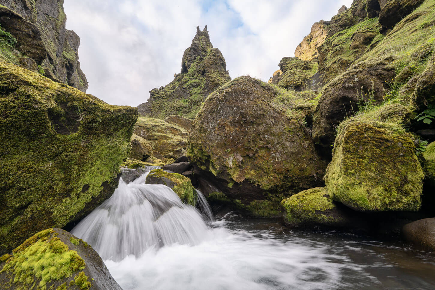
Table of Contents
How to Get to Þakgil
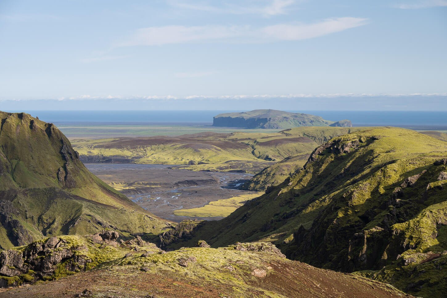
Þakgil is located in South Iceland, a short drive from Vik. It takes about 40 minutes to drive from Vik to Þakgil. You can get there with any car, but the road is a dirt, rough track, difficult to drive in a 2WD car with low clearance. Still, you can make it there in any car.
It is, however, a scenic drive, and you would want to stop at a few places to view the landscape and take photos. Just make sure you stop at some of the small pull-out areas you’ll find on the way.
One place you should definitely stop at is this – a rest area with great views of the whole landscape, which is worth the drive in itself.
You can also do day hikes in Þakgil without having to stop there for the night. But no excuses for skipping it!
The scenic Mýrdalssandur viewpoint on the road to Thakgil – drone photo.
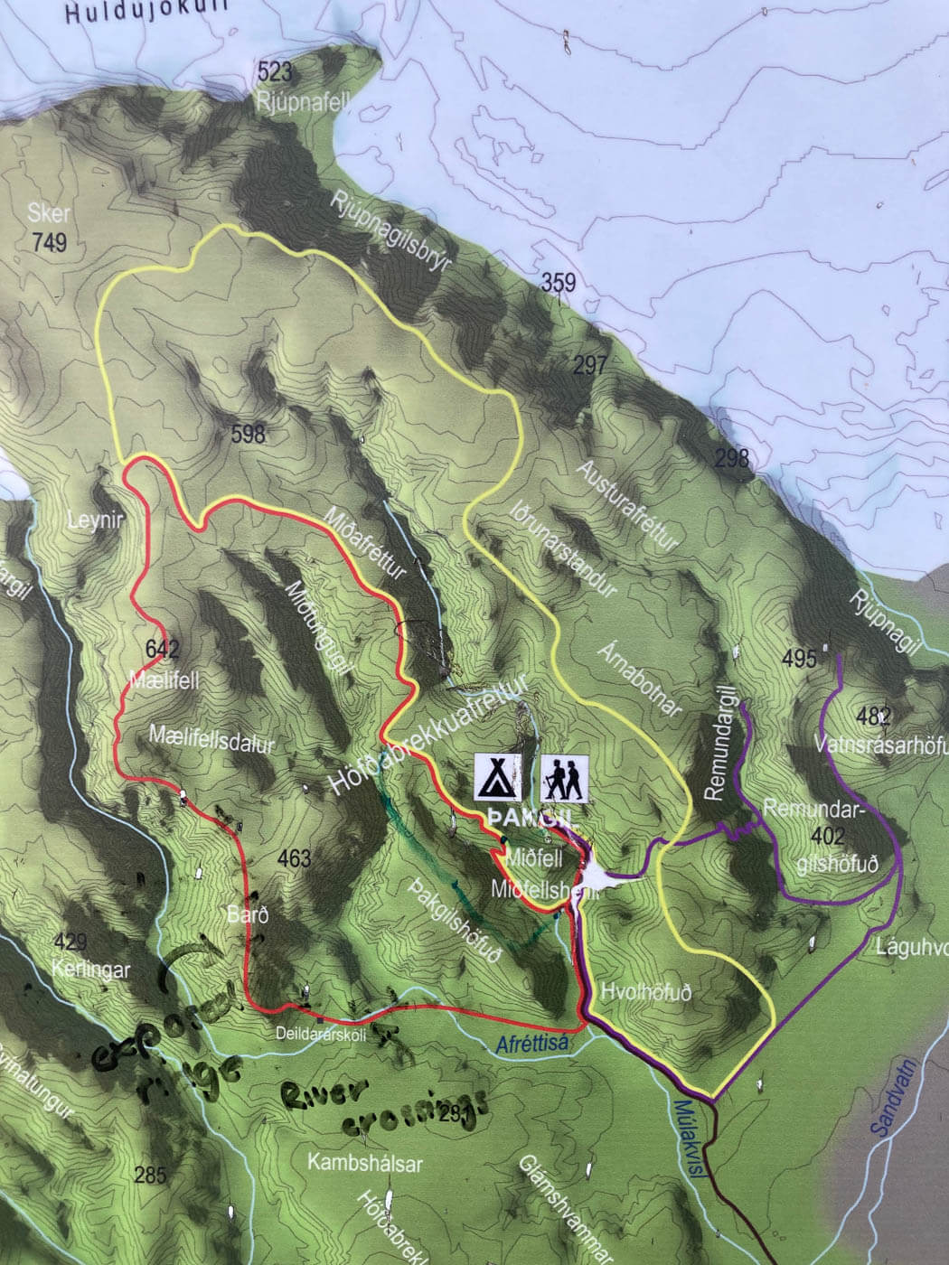
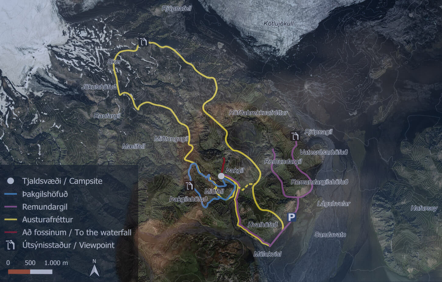
Þakgil Hiking Map
There are more than 50 kilometers of hiking trails in Þakgil, across five different hiking trails. While there are some official maps of hiking trails in Þakgil, they are good for illustration purposes only, rather than navigation. So here is my own map of the hiking trails in Þakgil. This is a map of all my hikes over the years.
Keep in mind that rangers typically change trails and their availability each year. Sometimes, parts of a trail may be closed or diverted. This is often done to help vegetation recover from heavy hiking traffic, for example. Therefore, always follow the signposts. recover from he
All the trails are marked in Þakgil and are quite easy to follow. However, if you want to, you can download all the GPX files of each hike for free from the activities linked within the map. Here’s the map of all the hiking trails in Þakgil:
Detailed Overview of the Hiking Trails in Þakgil
Now, let’s get into an overview of each of the hiking trails. I’ll link an in-depth hiking page for each one of these, too, as I have individual hike reports with the best photo spots for each one of these trails.
All the hiking trails in Þakgil start directly at the camping site, and initially, except for the Purple trail, all follow the same road until they split in different directions. One common recommendation applies to all trails except the Blue one: bring your hiking poles; you will cross some steep, slippery sections of soft/crumbling terrain at some point.
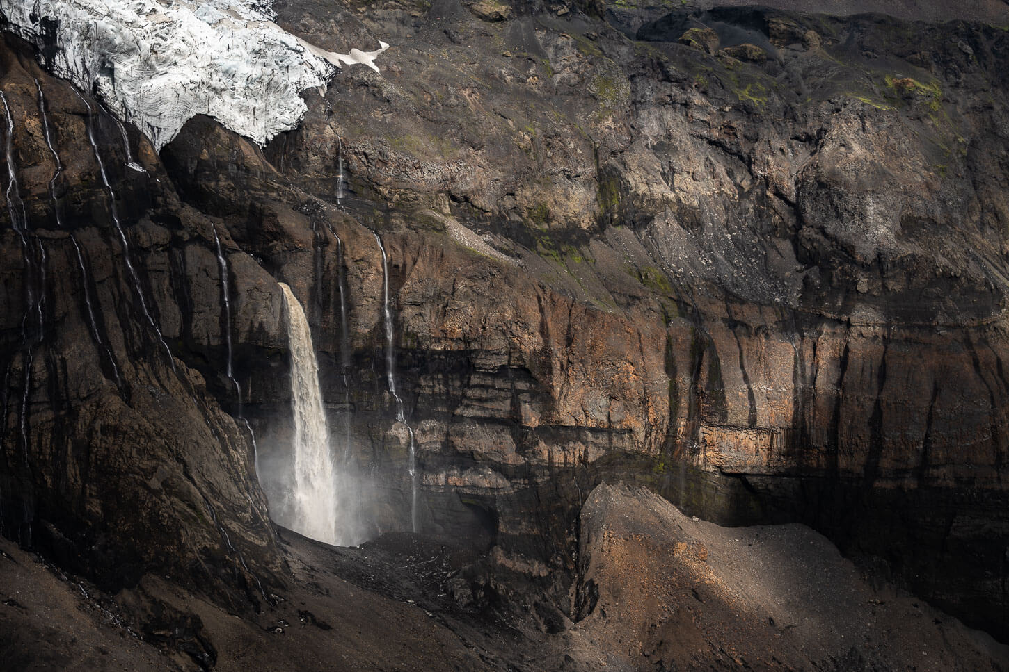
Also, an essential note: trails and hiking trail maps have been changing yearly in Þakgil. This is likely done to allow some areas and their vegetation to recover from pedestrian traffic. For instance, what was known as the Þakgil Red Trail (Mælifell Trail), described below, in 2025, that trail was no longer on the campsite’s map. It was replaced by another, “Red” trail (Waterfall Trail), which is a short walk to the end of a narrow gorge where you’ll find a waterfall.
In the same way, the “Blue Trail” wasn’t open until 2024. Each year, there’s no way to know for sure which trails are open or which sections are closed until you get there. As you can see, the map at the campsite will change accordingly. These are examples from different, consecutive years:
View of an older map.
View of a recent map.
So always follow the on-side trailmarks and open trails when visiting Thakgil. Now, without further ado, here is the list of trails.
Þakgil Yellow Trail (Austurafréttur Trail) – Best Glacier views
| 18.2 KM | Time: 5:30/6:30 Hours | Difficulty: Hard |
|---|
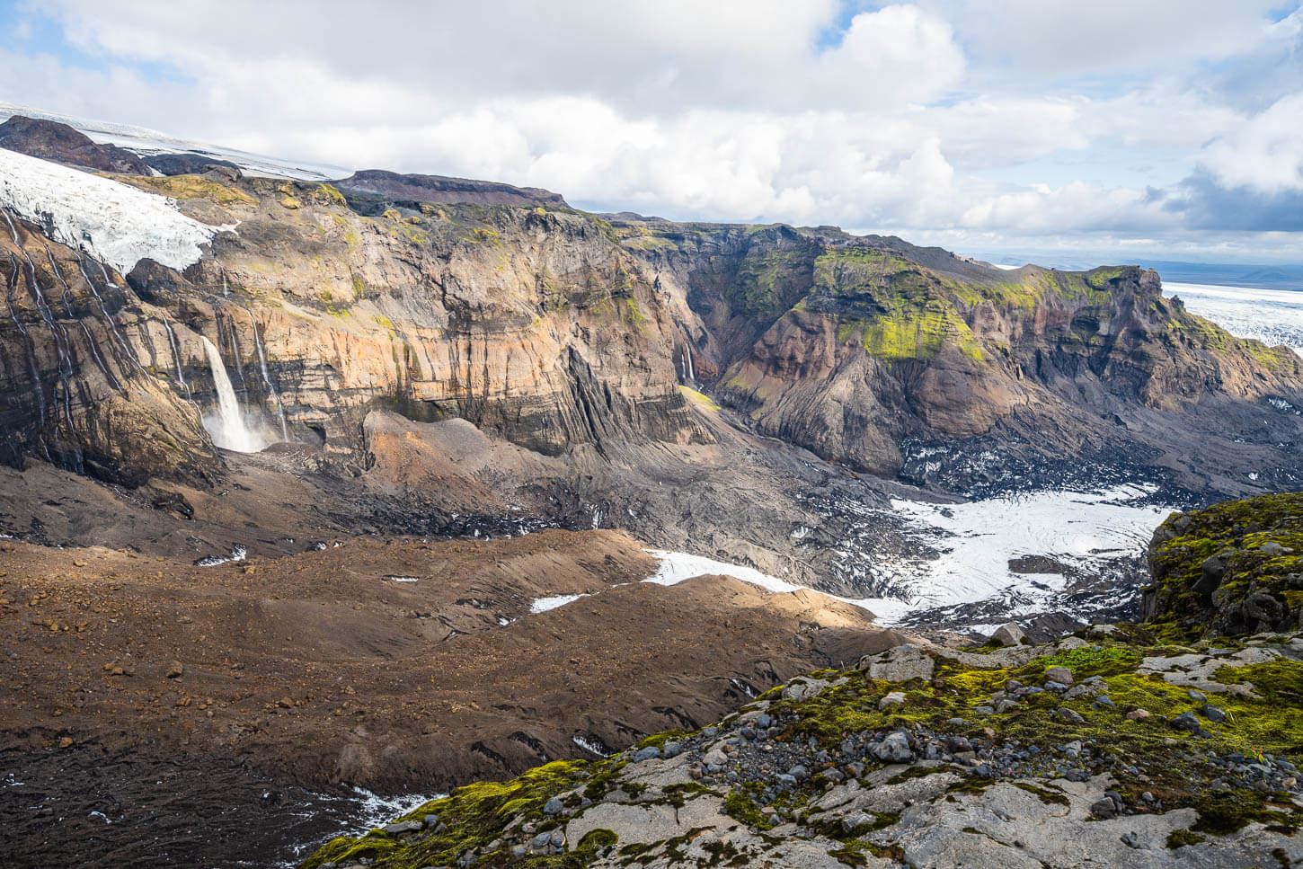
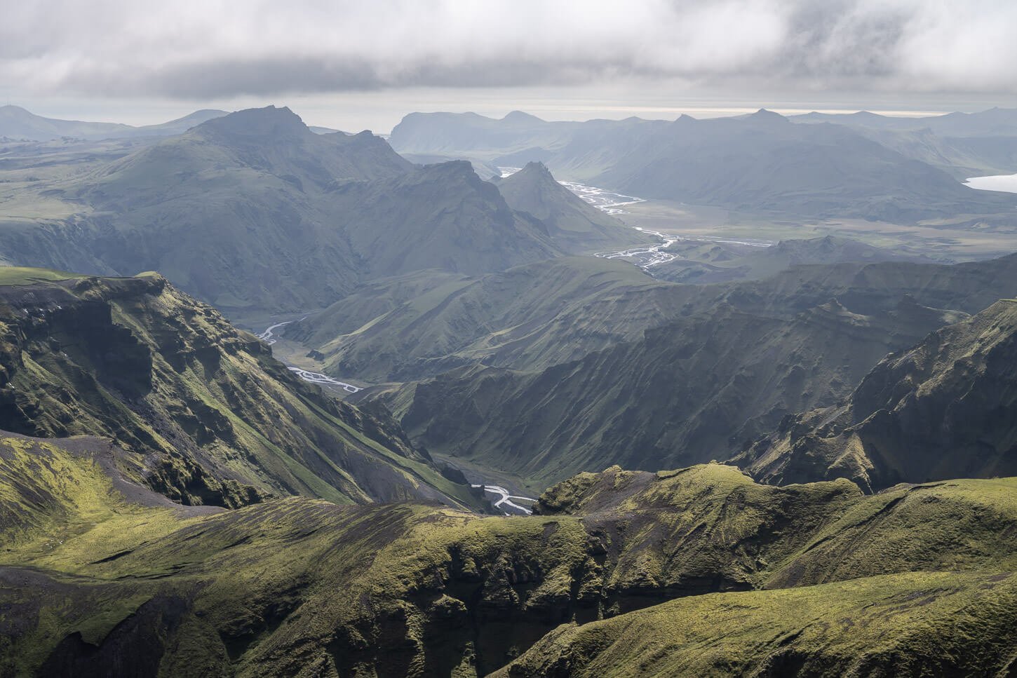
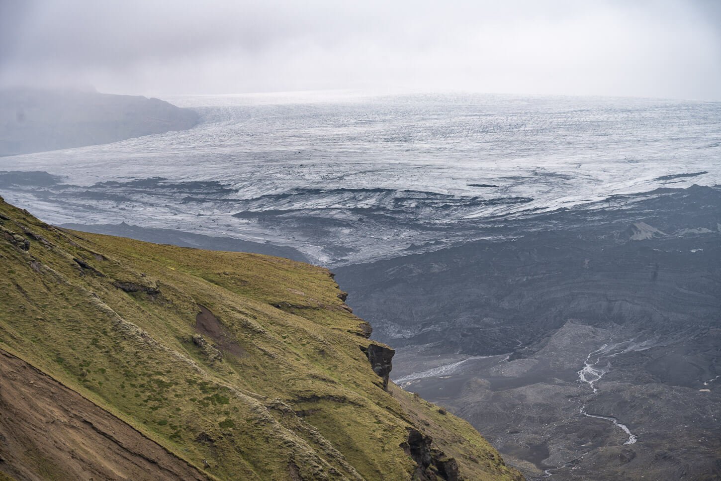
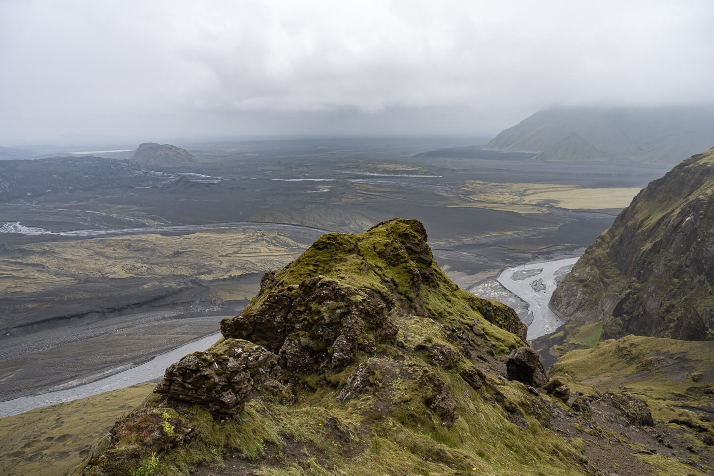
If you are looking for a long, challenging hike with spectacular views, this is the one. Also, if you can only choose one hike, this is the one. The Yellow trail, or Austurafréttur Trail, offers some of the best landscapes in the south of Iceland, and beautiful views of the eastern tongues of the Mýrdalsjökull glacier.
This is the longest hike in Thakgil, with a total of 18.2KM km, including the detour to the Huldujökull viewpoint – which you can’t really miss if you are hiking this trail.
Huldujökull viewpoint.
Huldufoss.
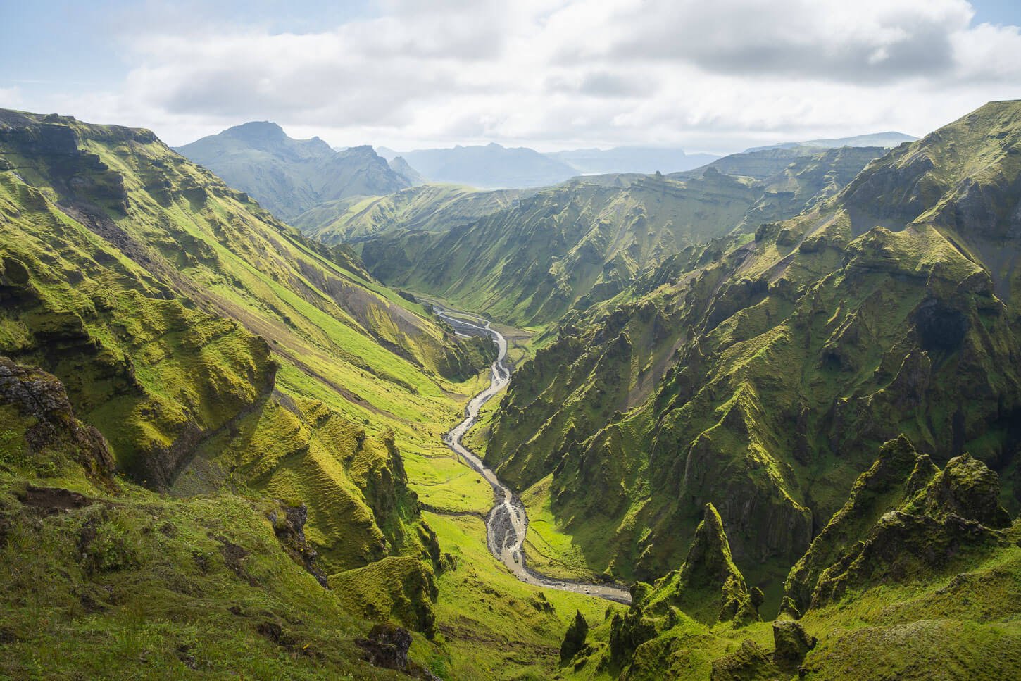
This is my favorite and easily one of the best hikes in South Iceland. It’s a loop hike that offers spectacular views of glaciers, waterfalls, ravines, and the outwash plains that stretch all the way to the coast.
I’d recommend hiking this trail counterclockwise. That way, you will have the best glacier views in front of you all the time. Here is the full hike report of the yellow trail and Huldujökull viewpoint.
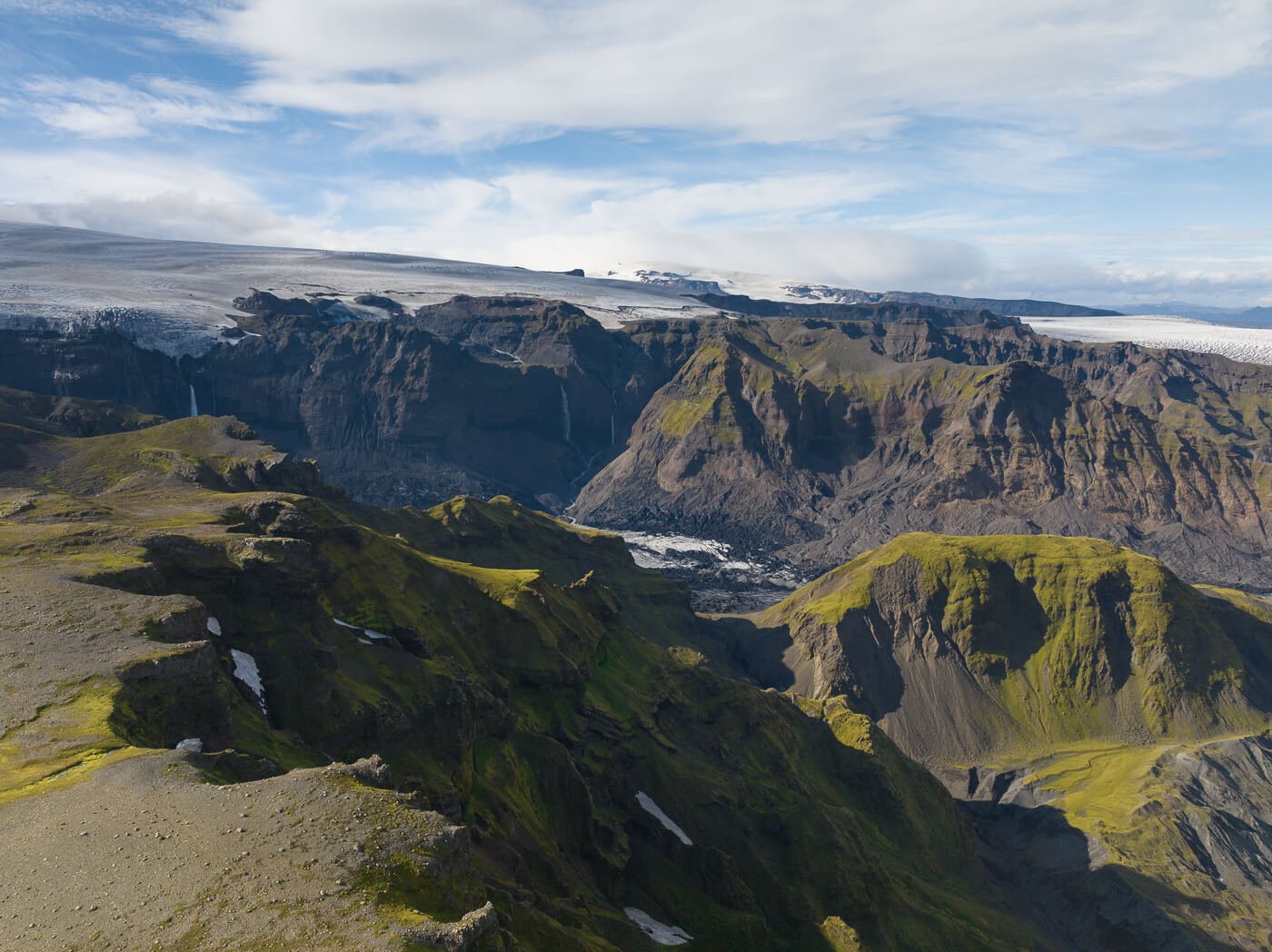
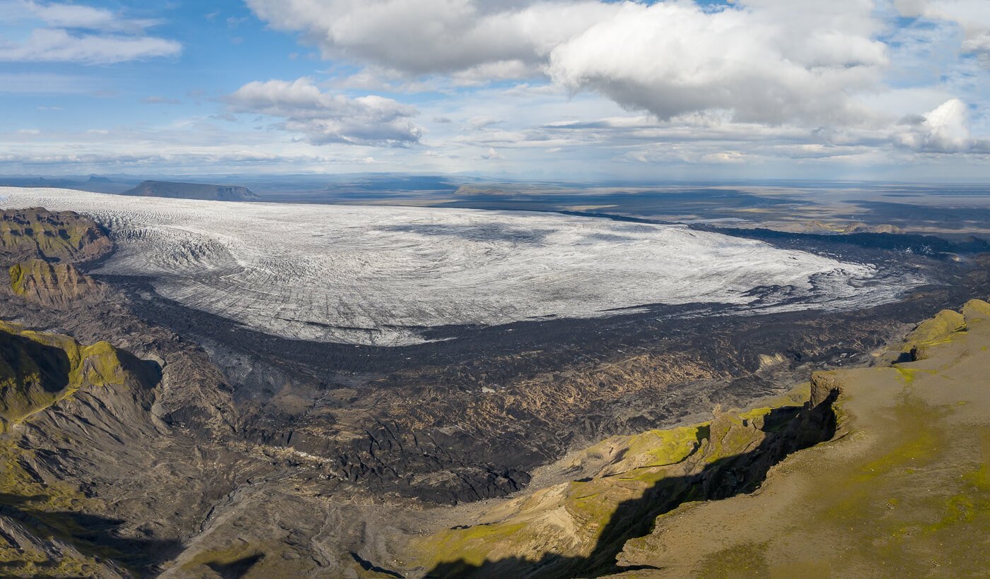
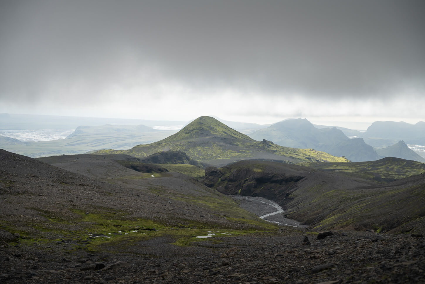
View of Kötlujökull.
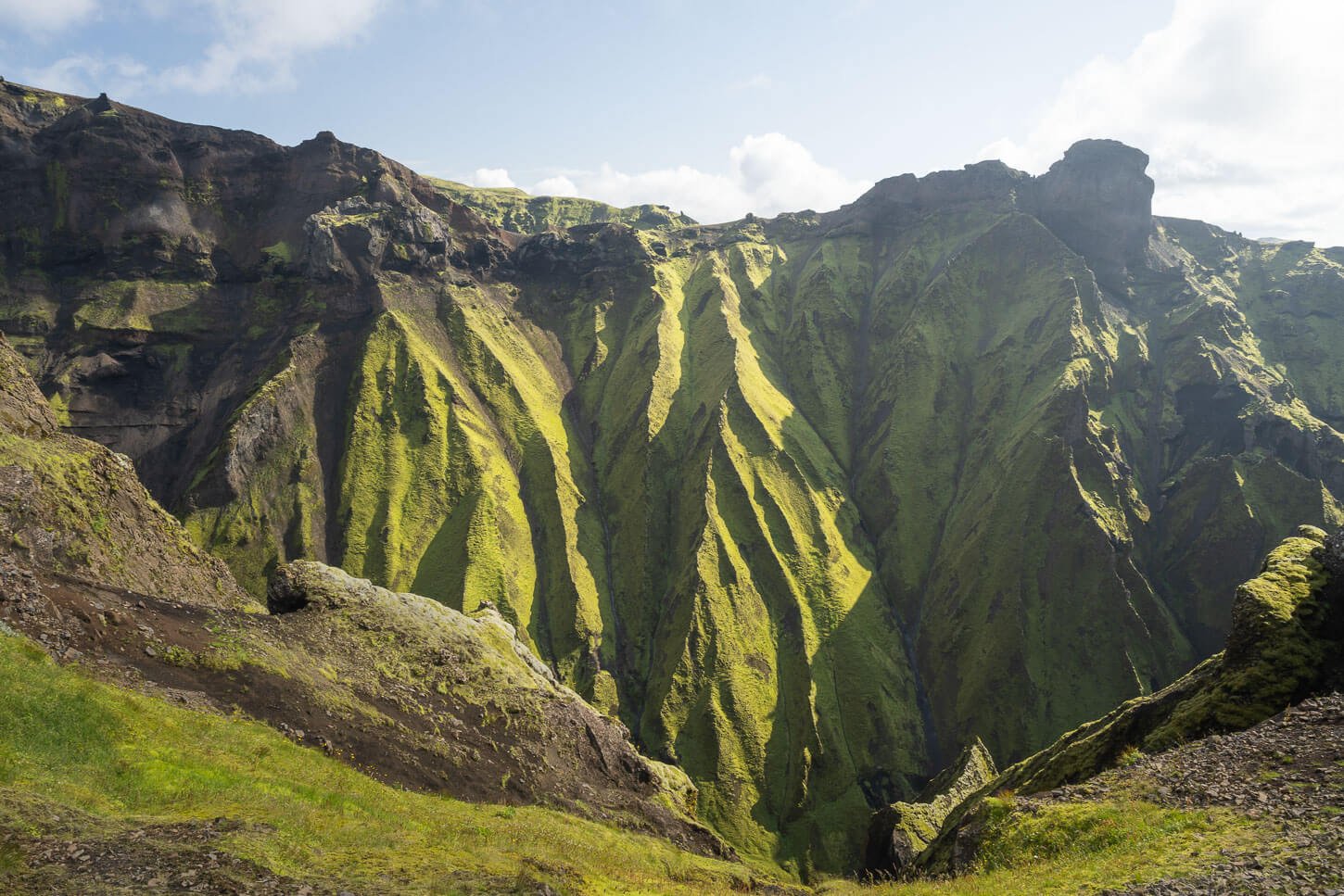
Þakgil Red Trail (Mælifell Trail) – Best views of mossy, green-lush ravines
| 12 KM | Time 4:00/5:00 Hours | Difficulty: Hard/Some exposed sections, possible rivers to cross |
|---|
The Red Trail is another rather long and quite challenging trail. While there are some exposed and difficult ridges, the views of the glaciers, ravines, mountains, and green-lush valleys are extremely beautiful. I did this trail clockwise, but I’d recommend doing it counterclockwise. This is because if you do it clockwise, the last bit will be the most challenging in terms of exposure, and there may be a river you’d need to cross on foot, too. So if you find that part too challenging, you’ll know that outright at the beginning of the hike.
However, I’ll describe it in the same sense of travel I did it, which is clockwise. The trail initially follows the same path as the Yellow and Blue trails. It then takes a detour through green, lush valleys and Canyons, on the higher plateaus above them.
After a detour to the top of Mælifell, the trail continues on a plateau before reaching a moderately exposed ridge trail. Past this section, the trail descends steeply on soft and crumbly terrain, where it is rather easy to slip and fall. Hiking sticks are highly recommended for this trail. At the bottom of this steep descent, you may have to wade a river. Nothing major, but water shoes will help with the rocky bottom.
Also, you can include the glacier viewpoint as an out-and-back detour from the red trail, too. However, that would add at least an hour and about 4KM in total. Here is my full Red Trail hike report.
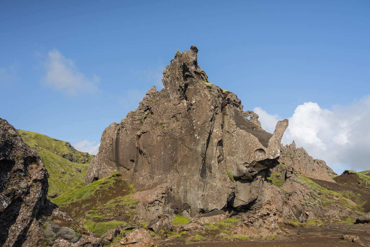
The “Rhino Rock”. This rock formation owes its name to its vague resemblance to the shape of a rhino.
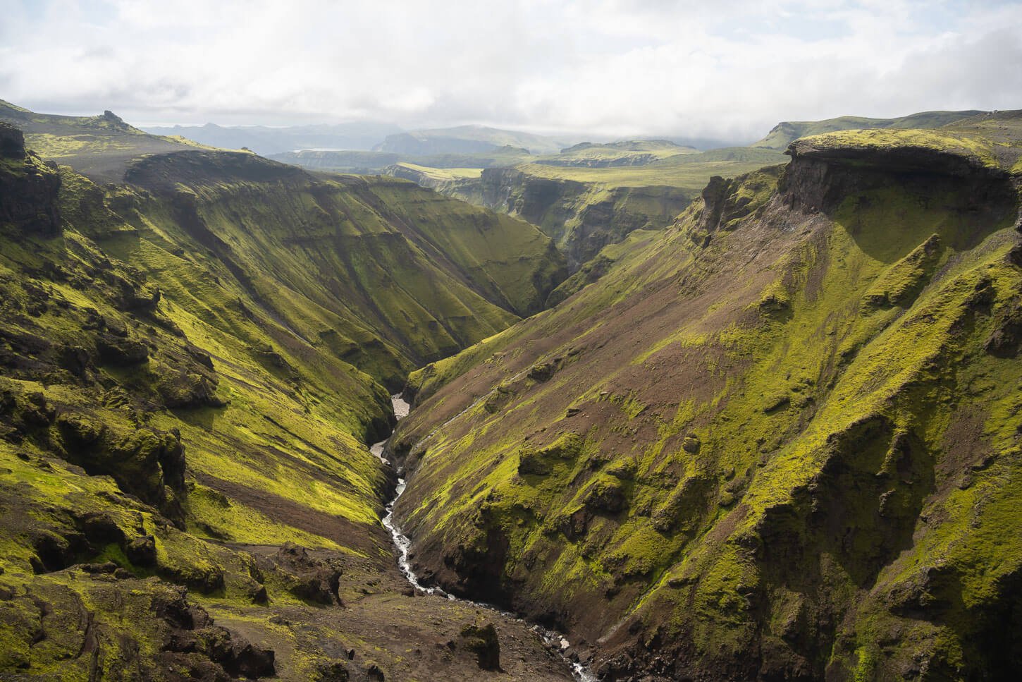
One of the many beautiful canyons along the Red Trail.
Mælifell, the mountain in the middle.
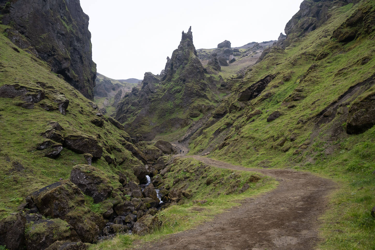
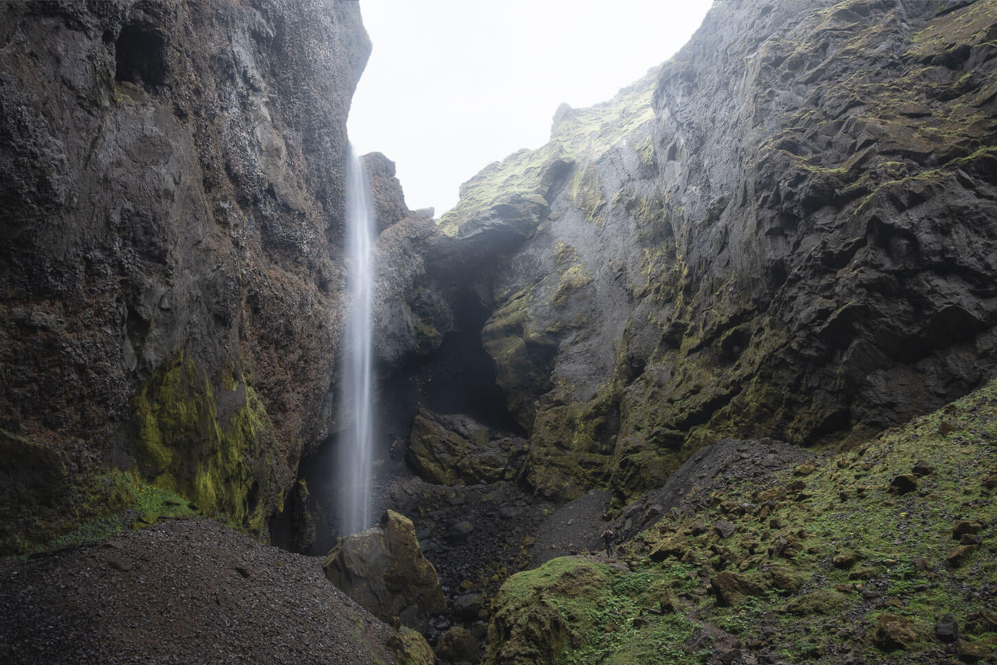
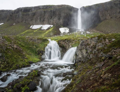
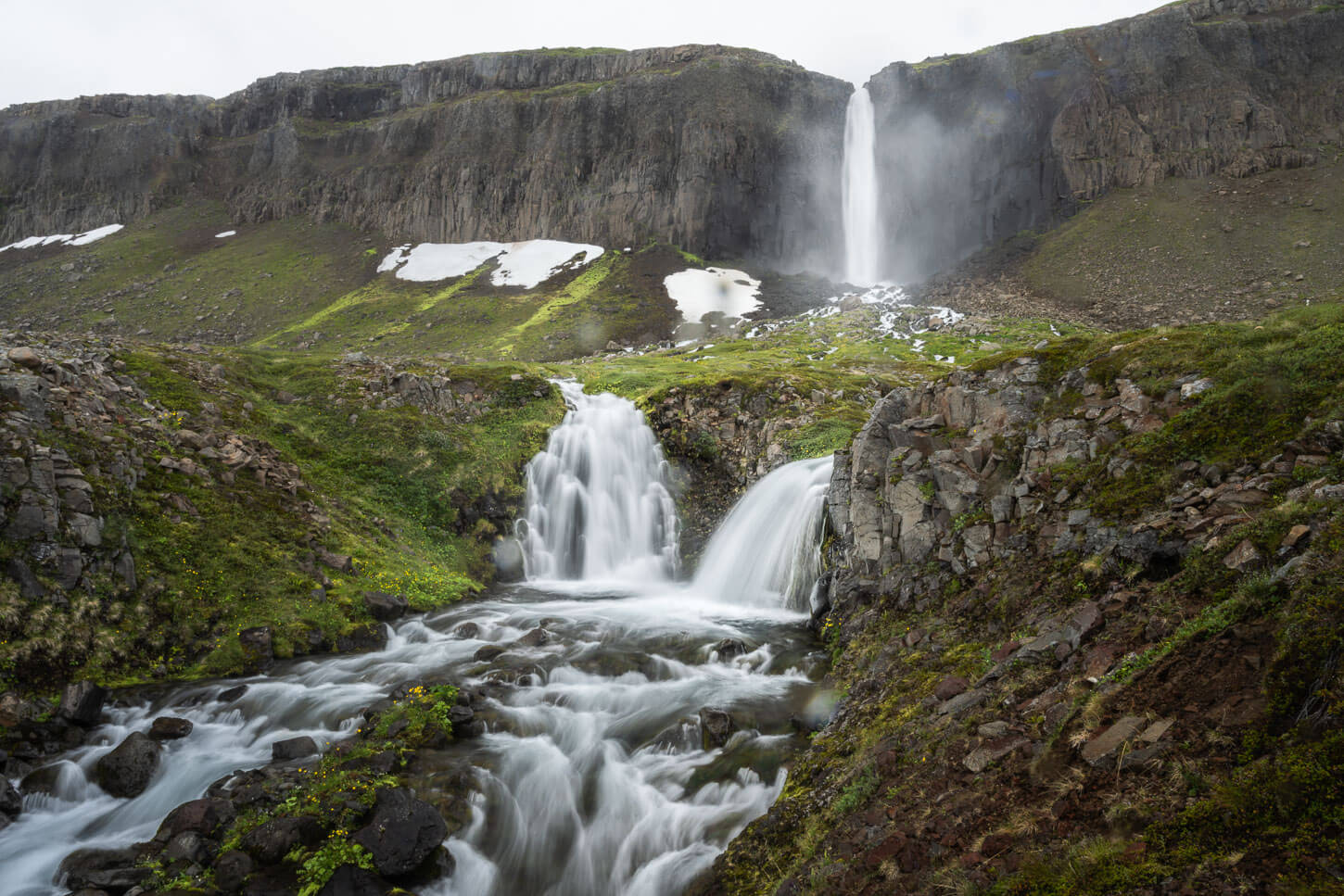
Þakgil Red Trail (Waterfall Trail) – Easy walk from the campsite
| 1.31 KM | Time: 20-30 minutes | Difficulty: Easy |
|---|
This second red trail appeared on the map by the campsite in 2025, and it “replaced” the other, longer red trail mentioned above. This is essentially a short hike in one of the most scenic ravines in Þakgil.
I am sure you may have already seen this landmark, which you can find on this trail:
This is just a short walk from the campsite in Thakgil, it literally takes less them five minutes. It’s a landscape photography landmark. The trail ends at the far end of the ravine, where there is a little lake where sometimes people bathe, too. I never dared, but if you like to take a regenerating cold-water dip after a long hike, this is the spot.
It’s a short walk, and I usually do it after a longer hike before setting up for the night at the campsite.

Þakgil Purple Trail (Remundargil Trail) – Glacier views and Ravines
| 12.3 KM | Time: 3:00/4:00 Hours | Difficulty: Moderate |
|---|
The Purple Trail, also known as the Remundargil hiking trail, offers a mix of glacier and canyon views, with Remundargil being the ravine next to Þakgil. The trail initially follows the river at the Þakgil campsite downstream. Then, it climbs up a steep hill on soft/crumbly terrain, for which I’d recommend hiking sticks, to descends on the other side into an equally steep ravine.
From there, the trail heads into another narrow canyon where you’ll find the waterfall of the Remundargil Canyon.
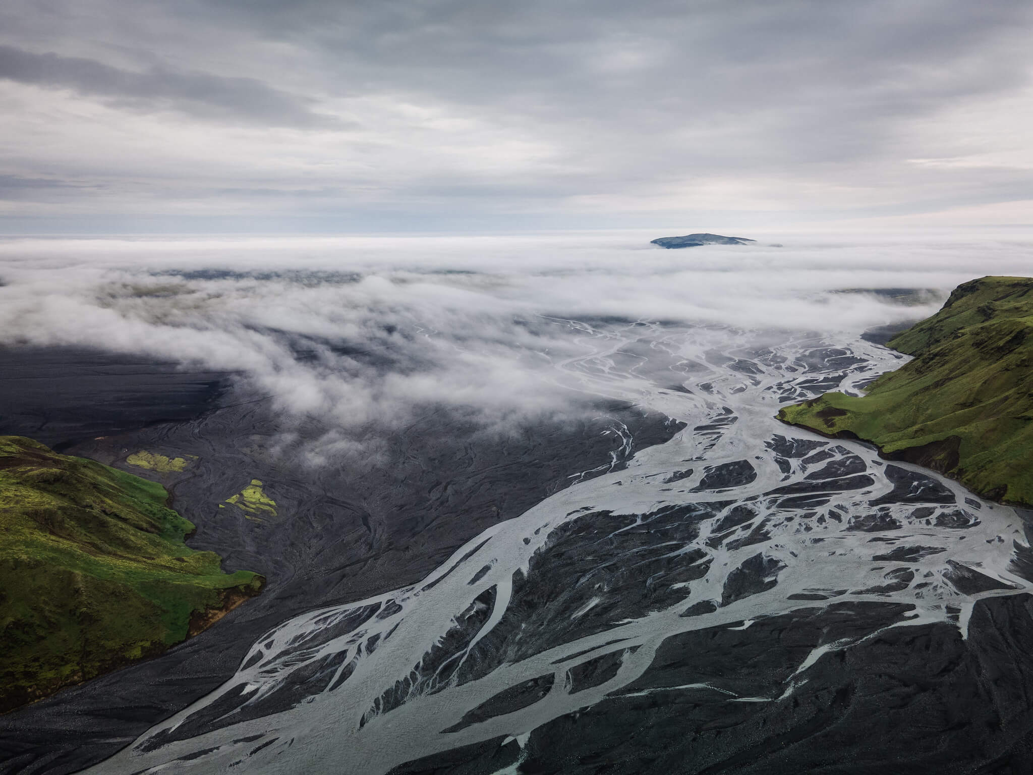
The last bit of the trail leads to a viewpoint above the Kötlujökull glacier. Here is my full Purple Trail hike report.
Remundargilsfoss.
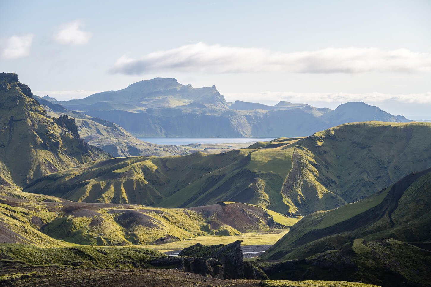
Þakgil Blue Trail – Easy Hike with panoramic views
| 4.16 KM | Time: 1:15/1:30 Hours | Difficulty: Easy |
|---|
This is the shortest and easiest hike in Þakgil, and was recently opened or reopened. The Blue trail in Þakgil is an easy trail that offers both great views of some of the ravines and landscape in the area, as well as a view of the farther-away landscape toward the coast.
The trail initially follows the yellow/red trails, to then turn around in the opposite direction and on a high plateau that offers great views of the green-lush valleys, their rivers, and of the coast further south.
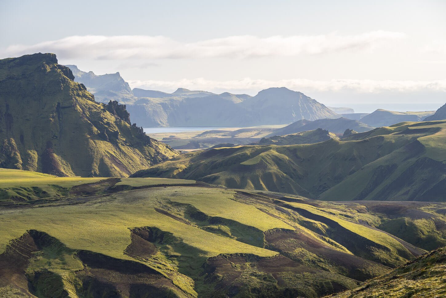
It’s neither a long nor a difficult hike, but a good introduction to hiking in Þakgil if you want to get the idea of the landscape without committing to much longer hikes. And, after this, you’d probably want to discover more of Þakgil.
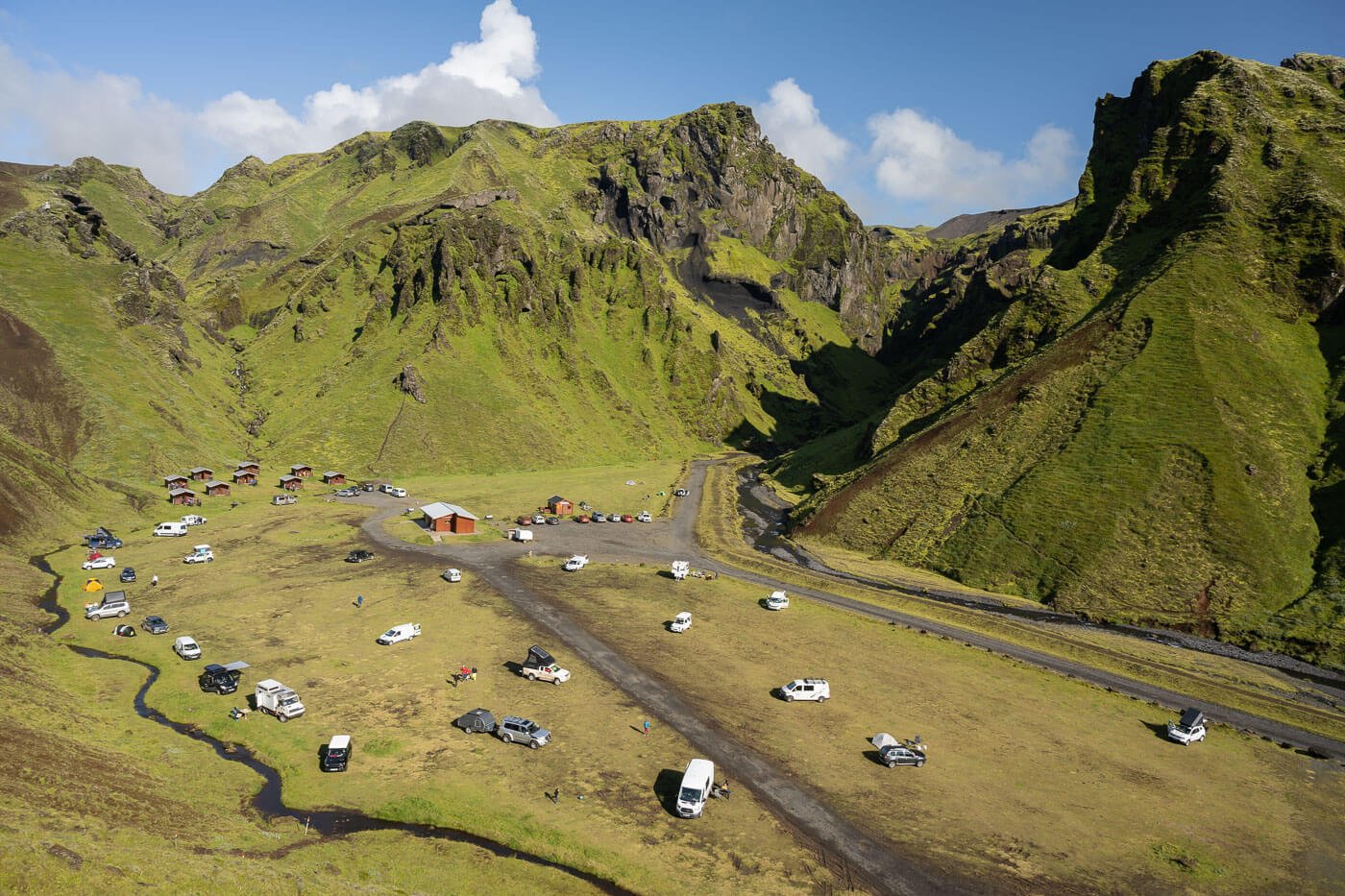
Camping in Þakgil – and Camping Tips
After a long day hiking on the trails in Þakgil, camping there comes as a special threat to me. It’s quiet, beautiful settings are the near-perfect place to relax and unwind after a long hike.
Þakgil also has its own website, which already provides basic information and prices about the location, so I won’t go into pricing details. Rather, I’d add my tips and recommendations.
The campsite is nestled deep in a ravine; the “-gil” in “Þakgil” actually means ravine or canyon, too. This location has pros and cons:
- On the plus side, Þakgil is quite shielded from winds compared to nearby areas. If you’ve never been to Iceland, you should know it’s a windy country, so that’s a big plus.
- On the other hand, that partly causes the ground to be relatively wet, which means heaps of condensation if you are staying in a tent. So you’d have to use your best condensation-management skills when camping in a tent.
Apart from camping in a tent, there are Cabins for rent, which are best to book in advance. And, of course, you can camp with a van or a camper. The facilities are basic but have all the needed amenities. They are well-maintained, with heated bathrooms, showers, and an outdoor kitchen sink area with a couple of tables. There are also wooden tables with benches around the campsite. However, there are a few, and they usually get occupied pretty fast in the early afternoon.
However, technically, there is no communal room to cook or eat in. I said “Technically” because there is a cave equipped with tables and a stove. It’s next to a water stream, at the far end of the campsite, opposite the reception.
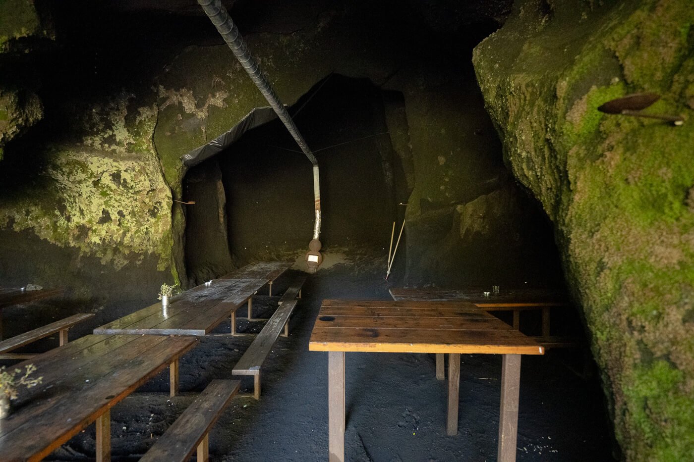
The “commmunal cave” at the campsite

View from inside the cave.
The cave is quite convenient if you are camping in a tent, but it may be a good idea not to camp next to it on weekends. It can happen that some people will spend the evening here to chat and drink, and the noise at the campsite can be quite noticeable. So if you are looking for a quiet night after a long hike, it’s probably a good idea to camp not too close to the cave.
Lastly, if you are looking for the spots that get the sun the earliest in the morning, I’d recommend setting up a cam in the area on the left-hand side of the picture below, near the little creek.
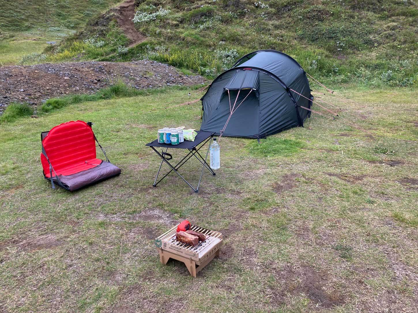
If you plan on leaving early in the morning, try to camp as far away from other campers as possible. At night, it’s so silent that you can literally hear almost every noise in a tent!
Lastly, if you see a guy with a green Hilleberg tent, a beer(s), and a disposable barbecue grilling Lamb fillet and peppers, looking as happy as a kid in a candy store, that is likely to be me, unless there’s another with the same habit around. Feel free to stop by and say hi!
Þakgil Hiking Videos
Last but not least, I made videos of each one of the main hiking trails in Þakgil – Yellow, Red, and Purple. Here’s the YouTube playlist, if you want to watch the best viewpoints on each one of the trails:
Additional Resources
- Discover more location-specific hiking and camping guides in Iceland, such as Landmannalaugar.
- Or, discover more Hikes in Iceland here.


Leave A Comment