Valnontey and Alpe Money Hike in the Gran Paradiso National Park, Italy
The Loop Hike to Valnontey and Alpe Money Hike in the Gran Paradiso National Park is a long and demanding hike that offers amazing views of the Gran Paradiso National Park landscape in Valle d’Aosta.

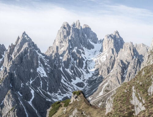
Alpe Money
This trail goes through a valley filled with trees, wildlife, 4,000m mountains, and glaciers. Some magnificent landscapes. The trail entirely lies within the national park, so apart from a few huts and other minor structures, it is a rather pristine environment.
Also, large parts of the loop trail have been destroyed by floods and landslides in 2024. It’s like some mountains have been ripped open by raging torrents turned into avalanches by raging water and debris.
In many areas the flood stripped the ground down to bedrock.
However, this makes for an interesting hike, one where you can see and feel the effect of such floods.
This also seems to have favoured wildlife in the valley. Likely due to fewer hikers in the area, wildlife roams free in this valley. Countless Chamois, and plenty of signs of wolves. No luck seeing one, traces were all over, including furry scat with bones and Ibex remains.
A unique hike, not only for its landscape, but as it stands, for its wildlife. After all, the Gran Paradiso is the oldest park in Europe, and the location from where all the Ibex have started repopulating the Alps after having been hunted almost to extinction.
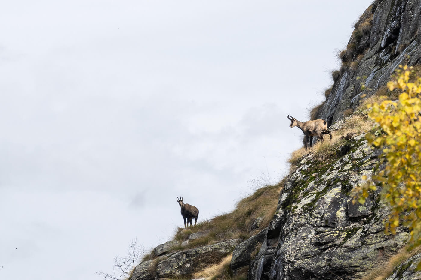
Chamois are everywhere in the valley.
Table of Contents
Overview of the Valnontey and Alpe Money Loop Hike & Map
As mentioned, this is a strenuous hike. This is also because, as of 2024, parts of the trail have been destroyed by landslides.
So the trail can only be followed for part of the hike, and you may have to take detours to circumvent the most damaged sections. You will need to use your best judgment to assess the safety of various passages.
This also means the GPX track you’ll find below may not be the best route, or even a viable one. So you’ll need to assess the best route each time.
| Max Altitude | 2,410 m |
|---|---|
| Distance | 17,2 KM |
| Elevation gain | 910m ↑ / 910m ↓ |
| Hike time | 06:30:00/ 07:30 Hours |
| Hike Difficulty | Hard, potentially hazardous terrain |
Here is the map of the hike. Again, you can use it but considering the current status of the area, you still need to carefully evaluate each passage as you go:
How to get to the trailhead and Parking
The hike can be accessed from Cogne, which is a village at the far end of a valley in Val d’Aosta.
- Driving Directions: From every direction, except Chamonix/Courmayeur, you’ll have to drive through the city of Aosta first. From North of the Alps, you can reach Aosta through various mountain passes, like the Great St Bernard or Gotthard, further to the East. Then, from Aosta, you can follow the signs to Cogne; it’s a 30-minute drive from there.
- Parking: The paid parking area closest to the trailhead is in Valnontey. You can park here. Otherwise, you can park in Cogne and walk for an additional 20 minutes. Alternatively, you can take the free shuttle from Cogne to Valnontey. More info is on Cogne’s website.
- Public Transport: You can get to Cogne with public transport from Aosta, by bus. You can get to Aosta by train. This is the timetable (Italian). You can also check the svap.it website.

Parking Area in Valnontey.
The Valnontey and Alpe Money Hiking Trail
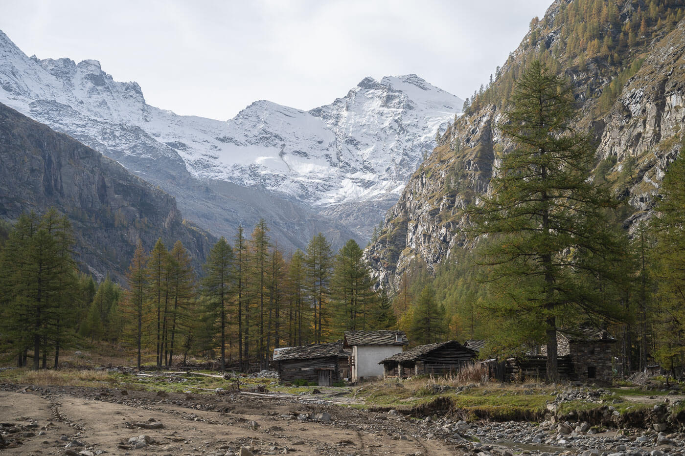
The trail starts as a flat walk on a paved road that quickly turns into a dirt road and then into a trail. It follows the Valnontey creek upstream. Signs of the recent devastation are clear right from the start, but the area around Valnontey, while still being fixed, is fully accessible.
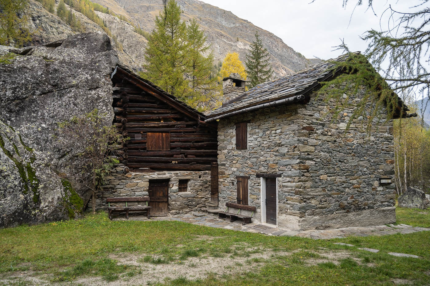
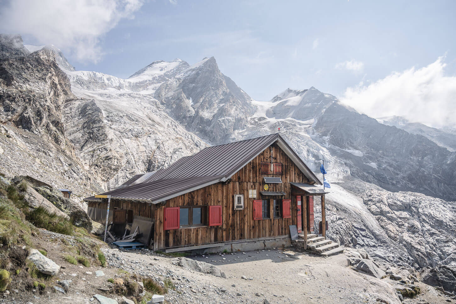
A typical hut, with a former barn partially built into a (possibly erratic) boulder.
Some areas around the river are partly covered in mud, due to the recent floods.
Hike into the Valnontey Valley
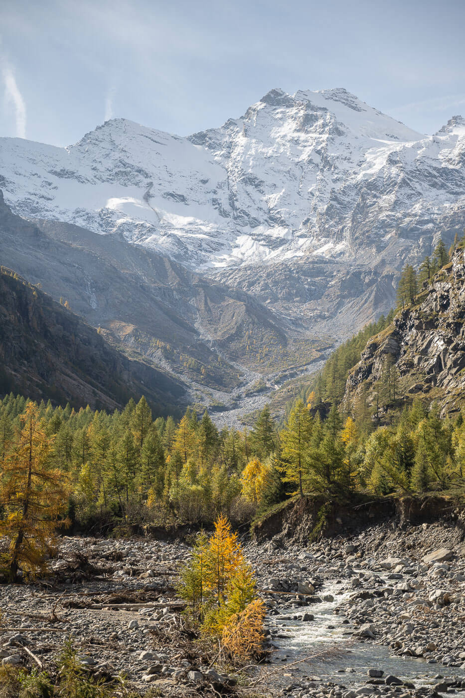
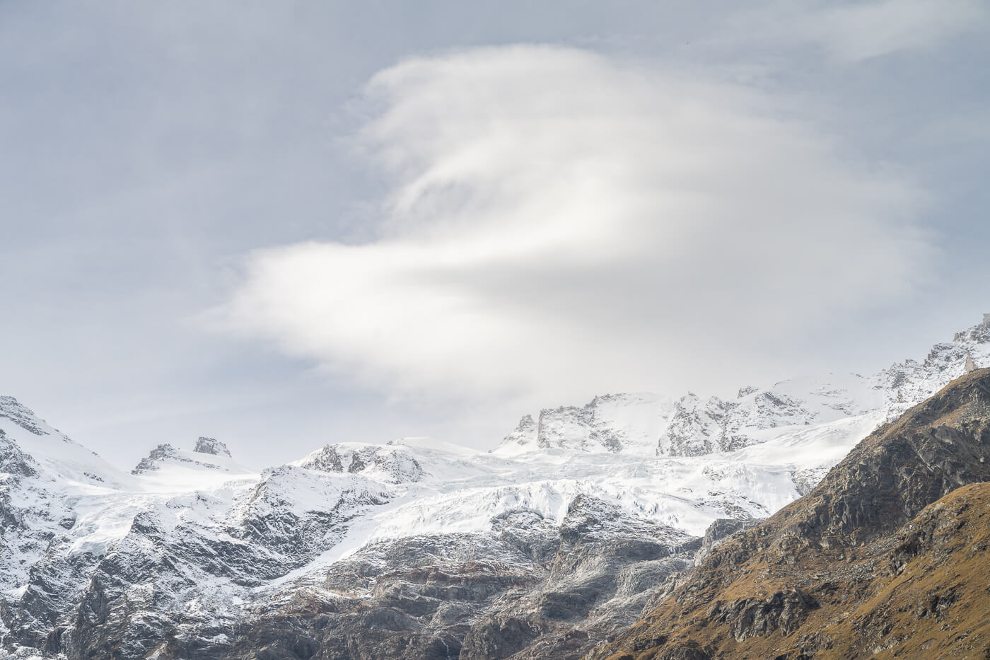
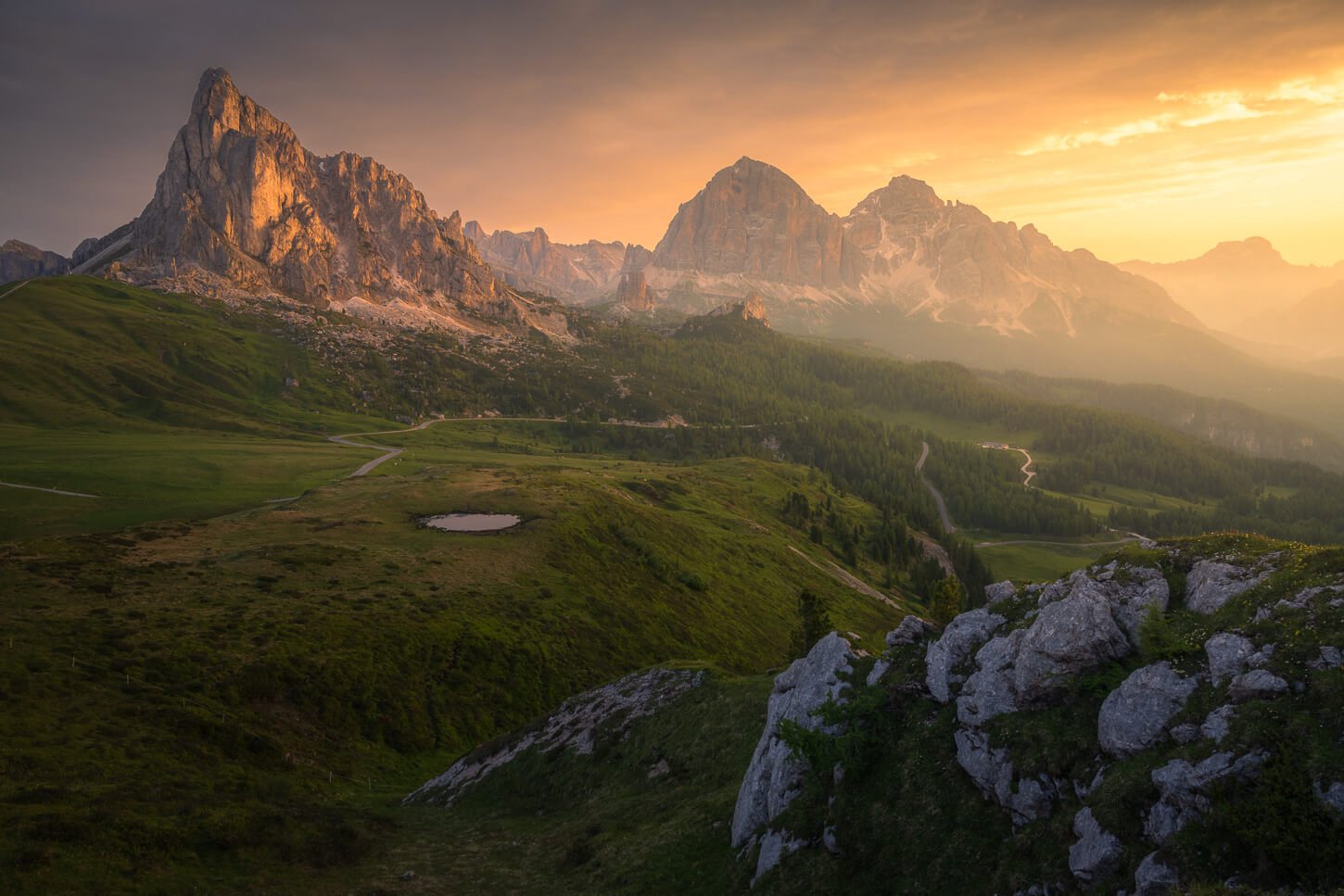
Between huts, larches and the Valnontey Creek, the first part of the trail makes for a nice and uncomplicated walk, which slowly reveals the group of the Gran Parasiso Massif, as well ans the beautiful Glaciers Grand Croux and Tribolazione in the distance – a glacier whose name means Tribulation.
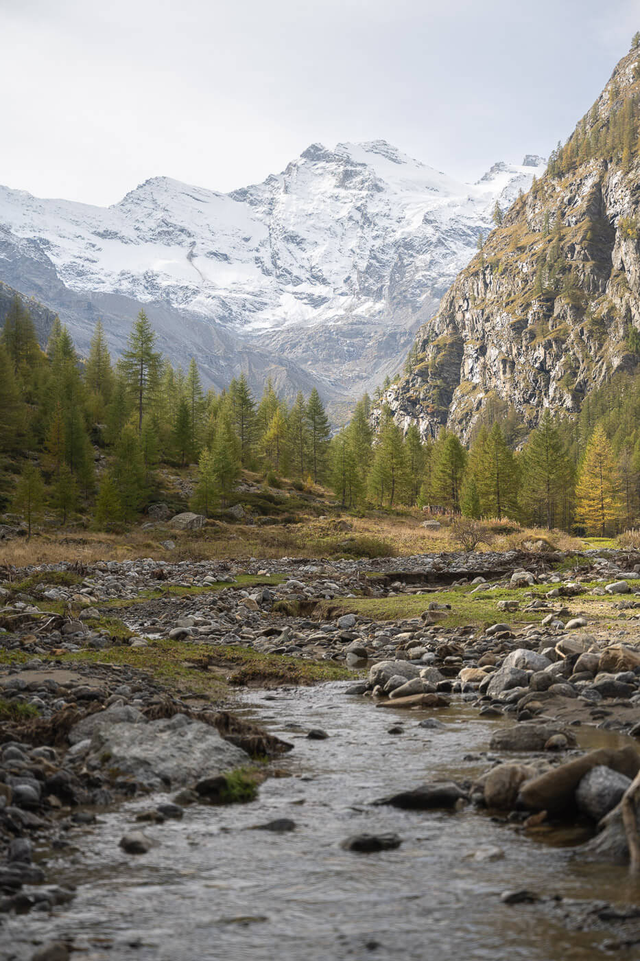
The trail follows the Valnontey creek upstream,

In the distance, you can spot the glaciers of the gran Paradiso Massif.
After about 30-40 minutes you enter the “hazard area”, where the recent flooding caused severe damage to the trails and infrastructure. This is also where wildlife started to appear everywhere.
The landscape is magnificent up to this point already. There’s some fantastic views of the whole valley as well as the background of the Gran Paradiso Massif. So if you are looking for a shorter hike or easy walk, you can still consider this trail, up to this point.


the last part of the trail before the steep ascent to Alpe Money offers again amazing views of the valley and mountains in the background.
Hike up to Alpe Money
From here the trail steadily winds up the mountain through vegetation and under looming rocks. Gradually the views open up to the valley and more of the mountains around the Gran Paradiso, revealing more peaks and more of the glacier. Some truly stunning views here!

As you hike up, more of the glaciers and mountains come into view

View of the whole valley from the trail
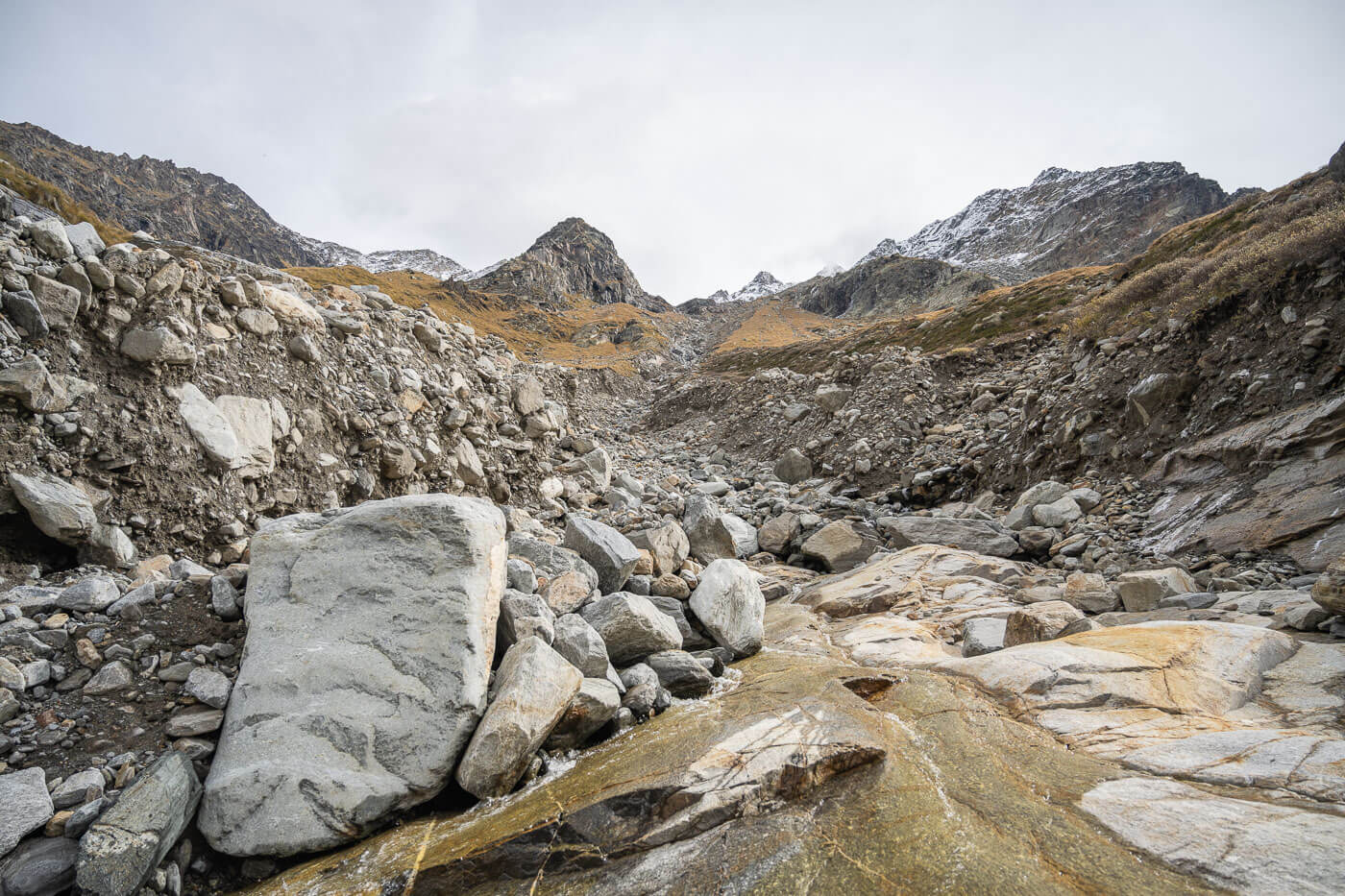
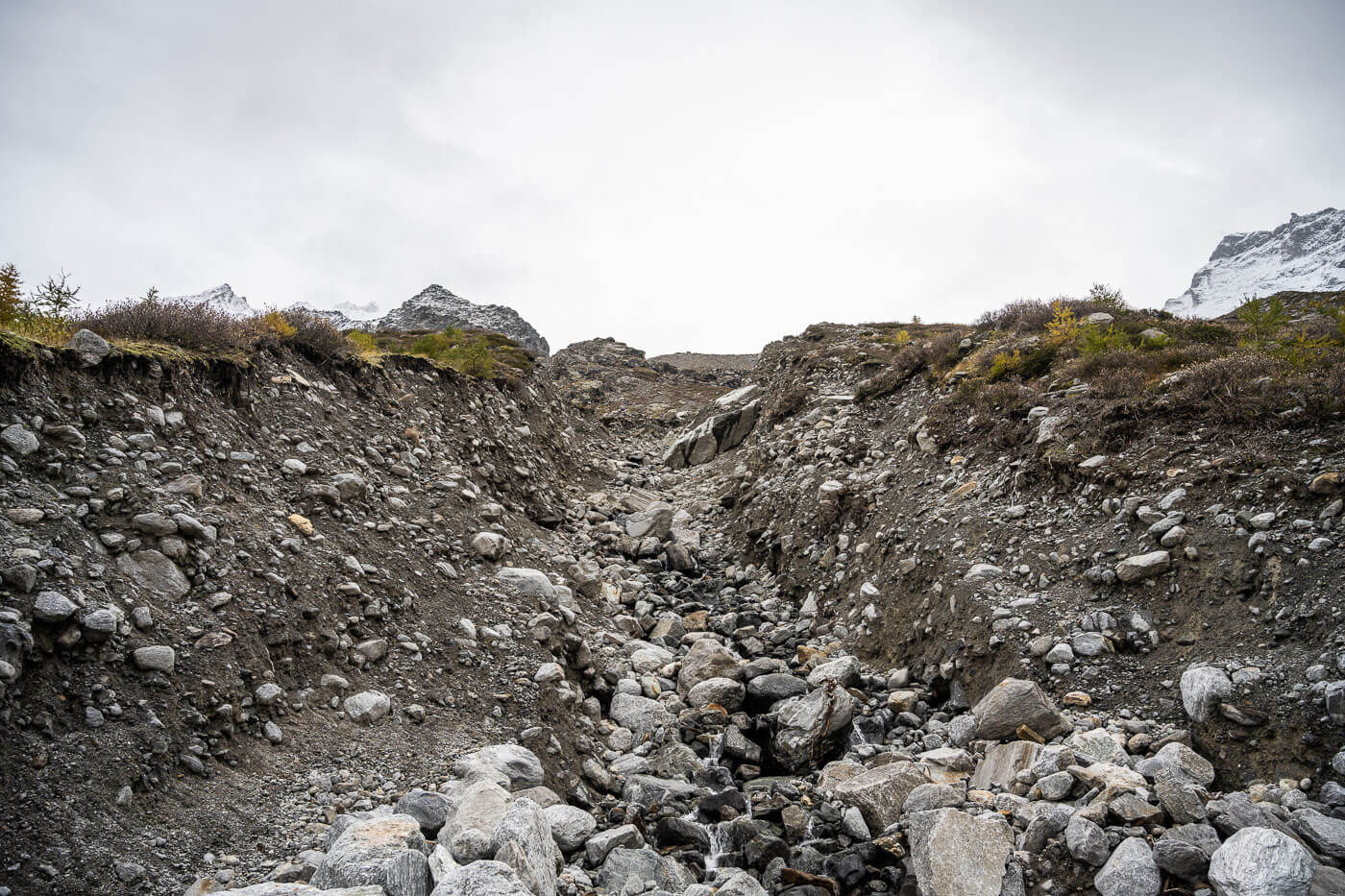
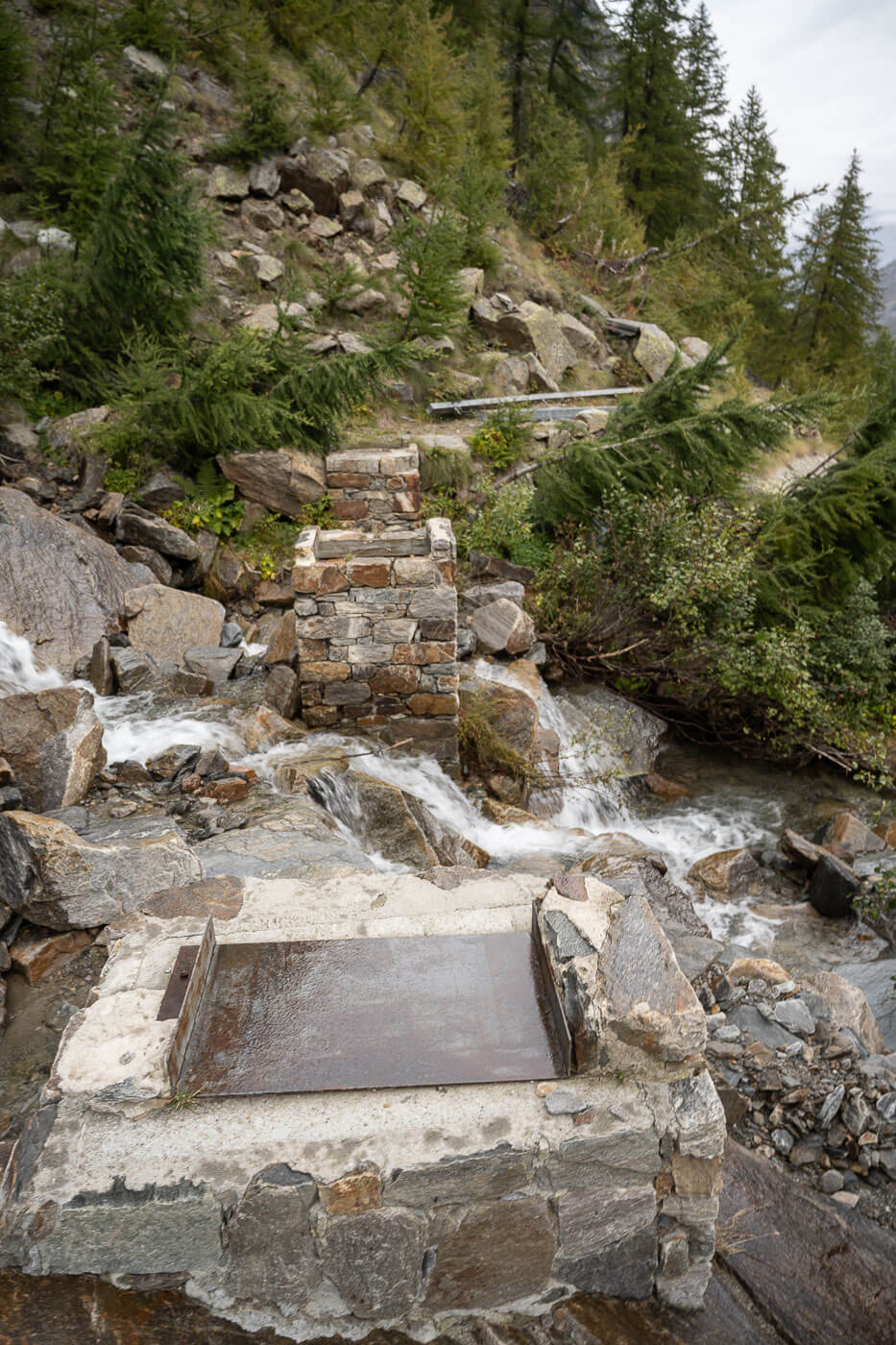
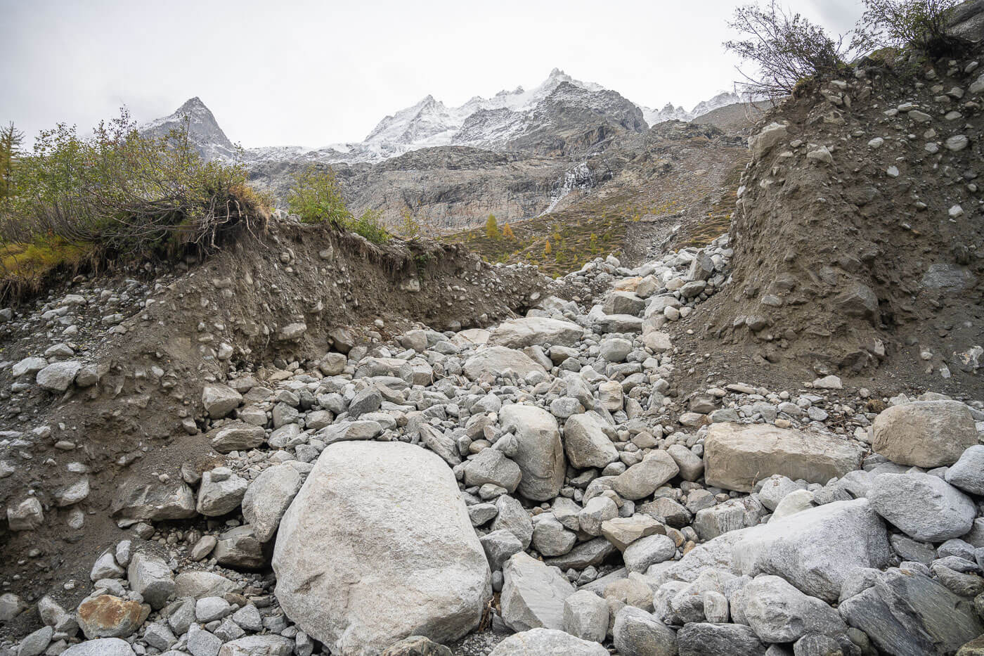
Gradually the trail flattens out. However, it’s not as easy as it may look at the beginning. This is where river beds turned into raging rivers of water and debris, opening the mountain wide open down to bedrock.
To the hike, this means you have to cross several areas of unstable terrain. There is no clear path forward, so you have to evaluate the best and safest way across these passages carefully.
A few sections cross channels dug down to bedrock by floods and Landslides – where there are still many unstable boulders.
Apart from that, the trail continues high up on the plateau above the valley until it reaches Alpe Montey. That is a good place for a break.
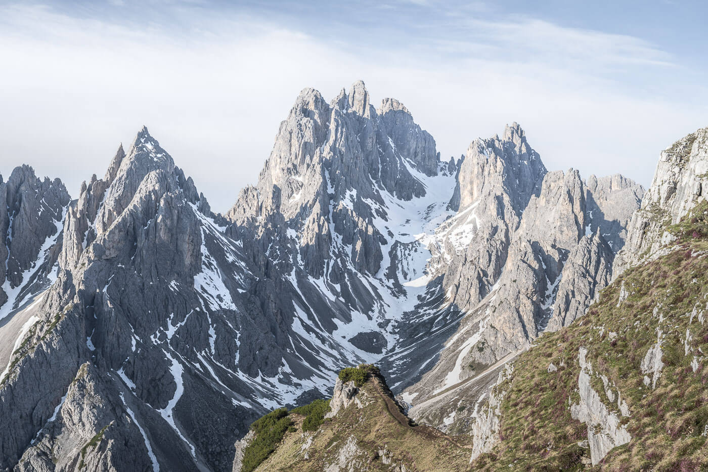
You can walk through the Alpeggio, which essentially means “alpine pasture”, looking at all the old, stone huts of times gone by. You also have fantastic views of the Tribolazione Glacier as well as several, beautiful peaks above it.

Alpe Money

One of the many, abandoned huts on Alpe Money

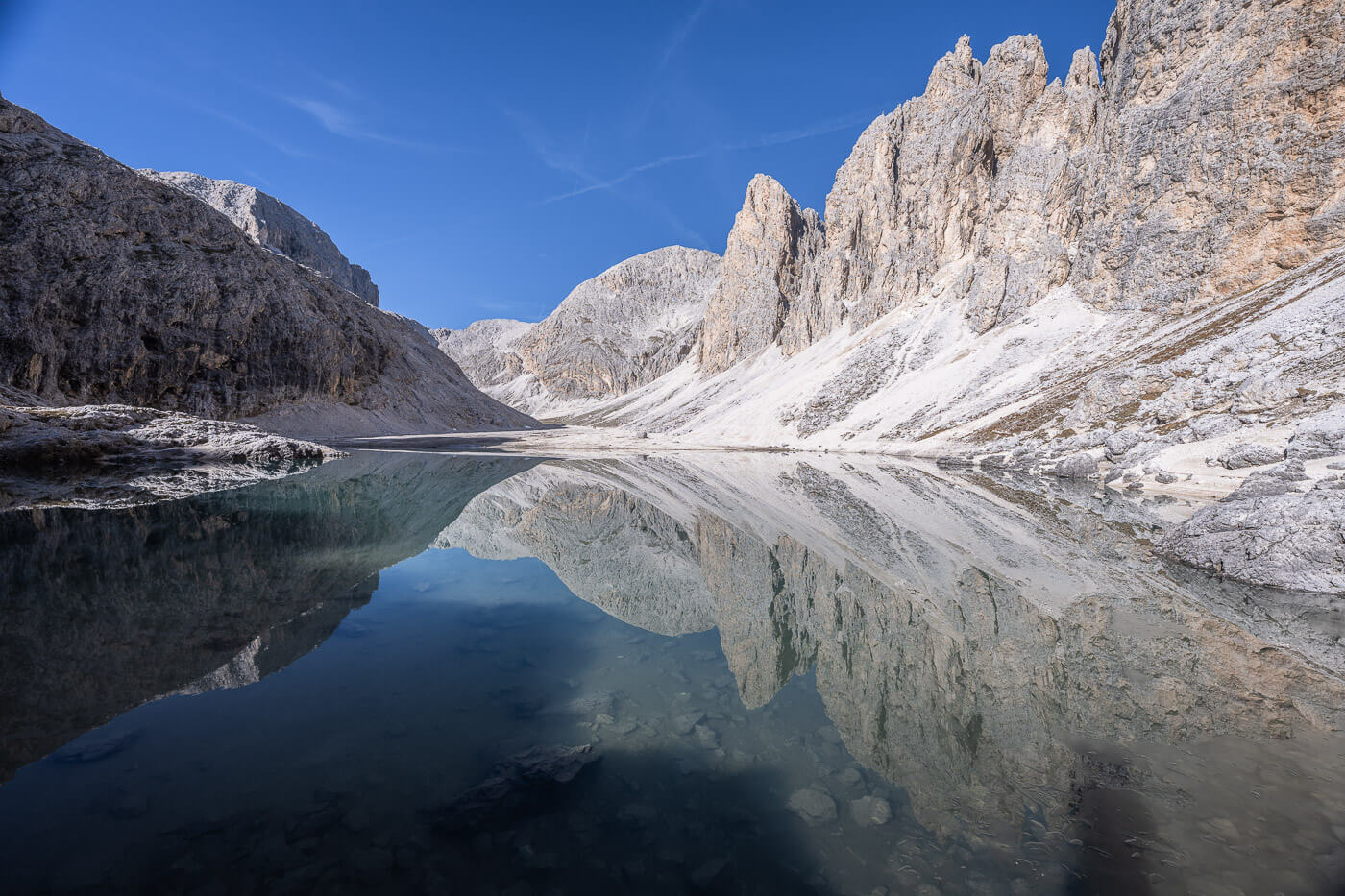
One of the glaciers in the Gran Paradiso Massif.

From Alpe Money back to Valnontey
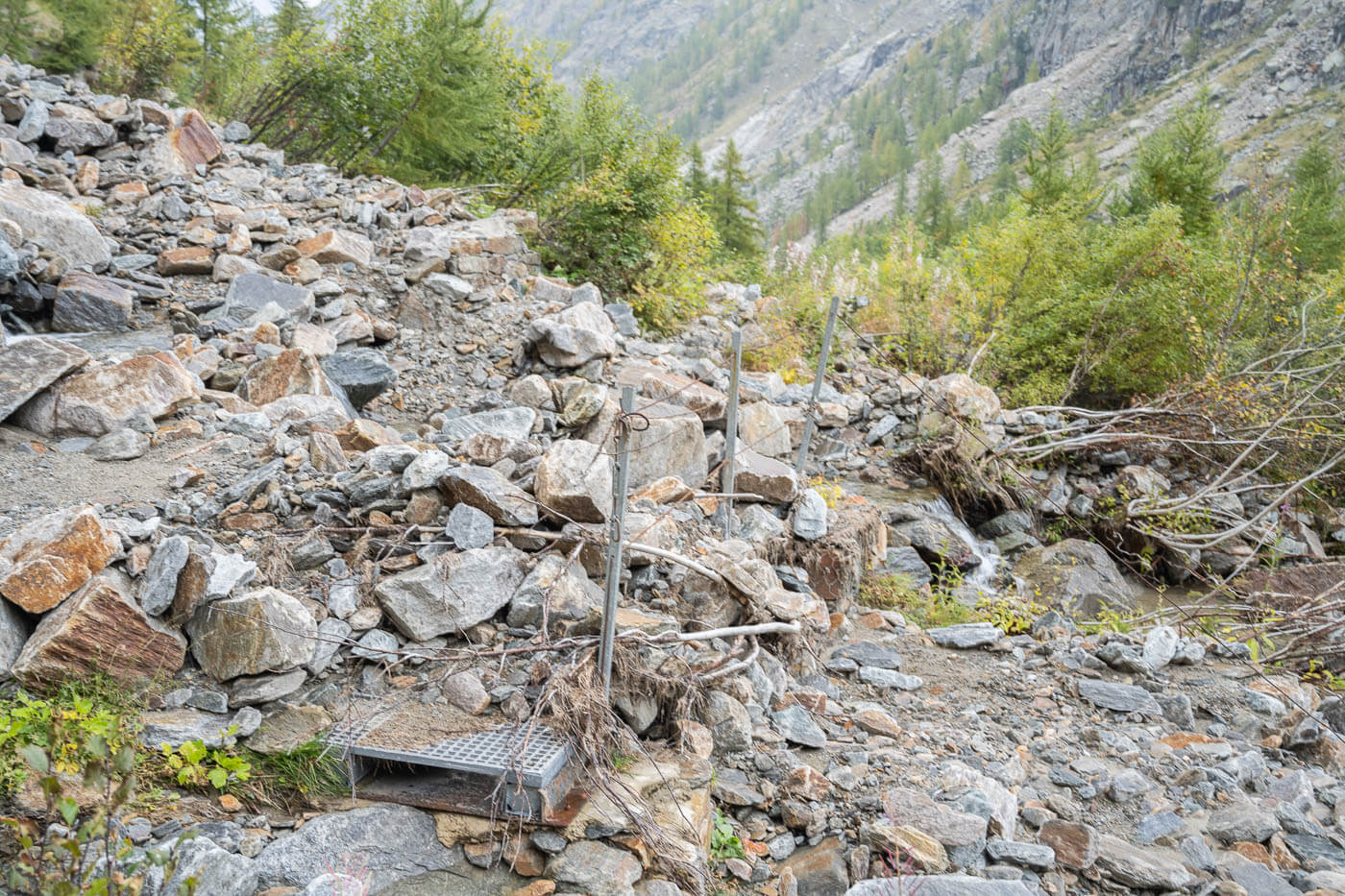
Alpe Money is also where the trail slowly starts to descend the mountain. First gently and progressively getting steeper. The trail continues like that until you reach the bottom of the valley. Here the trail is now non-existent for the most part. Again, you’ll have to evaluate the best way forward carefully in between all the debris left by the recent floods.
Again, sections of the trail cross channels left by landslides and floods.

The last part of the trail crosses the riverbed where the devastation left by floods is even more apparent.

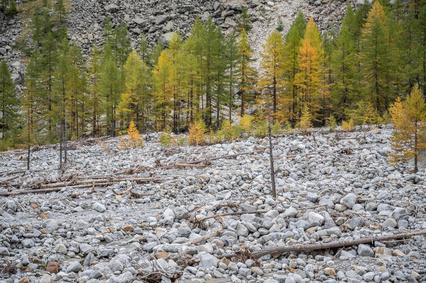
Floods left parts the forest covered in boulders.
It’s kind of hard to imagine what kind of forces opened those scars on the side of the mountains and created the mayhem that’s been left behind.
However, a walk around this debris will probably give you a good impression of what it was like, as well as will likely leave you wondering how it could have looked like.
A bridge destroyed by the recent floods.
Another bridge that suffered the same fate.
Anyway, the trail is mostly flat here, apart from areas where you have to circumnavigate obstacles or parts of the trail that have been destroyed. You may also have to cross some creeks and the river since there are no longer bridges—at least at the time of writing. When I was there, it was possible to cross them by hopping on boulders, but that may differ depending on water levels.
The trail then closes the loop back around the Valnontey Creek crossing. Again, once bridged, it has to be crossed on foot now. Once back on the first part of the trail, it’s just a walk back to the parking area – and onto some good mountain food back in Cogner or Lillaz! Or, perhaps, a nice Grolla/Coppa dell’amicizia; a typical coffee/liquor based warm drink sure to restore some energy into your body after the long hike.
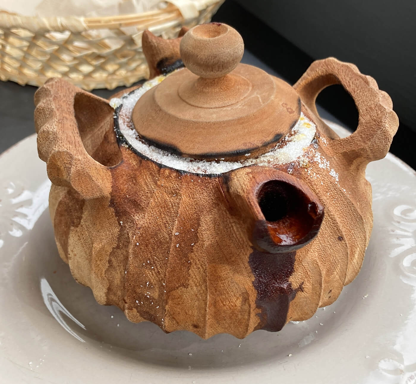
The “Coppa dell’Amicizia” also called Grolla, is an energetic, alcoholic warm drink.
Valnontey and Alpe Money Photos and Photography Tips
If you are into Wildlife, bring your longest lens. The Valnontey and Alpe Money Hike not only offers beautiful landscapes, but there’s also plenty of wildlife around. Chamois are everywhere. Plenty of signs of wolves and Ibex too. Not lucky enough to have seen a wolf even from afar, but there were plenty of signs.
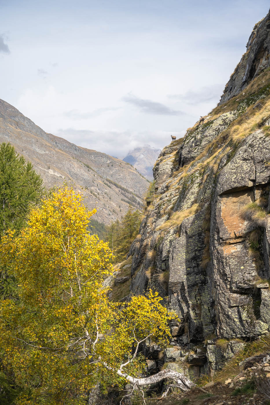
Can you see the Chamois on the cliffs.

A close look at the Chamois

In terms of Landscape, some of the best views are from the Valnontey creek bed, before starting the climb to Alpe Money. The view of the whole valley with the background of towering 4,00m mountains is incredible. Especially in autumn, when the larches turn golden. The view on the plateau around Alpe Money is also fantastic. The mountains at the end of the valley face the south, so they usually get good light through the day.

The views form the river bed are extremely scenic.


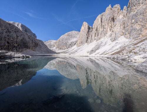
Alpe Money is another very scenic location.
However, seeing and documenting the widespread devastation of the valley was also quite interesting. Unusual and more documentary-style compared to the more classic landscape photography, but quite interesting. Especially trying to render how the landscape was devastated by floods and massive landslides, also considering it’s not something you see very often, luckily.

Rockpiles fallen from the mountainside.
Where to stay
Cogne is a popular mountain resort and offers plenty of accommodations, both in terms of hotels, guesthouses, or also campsites. It’s also the closest to the trailhead.
Food in the area is great, so it’s worth stopping here and visiting one of the restaurants for some Italian “mountain” food, with the occasional influence of French cuisine.
Vans and Campers: There is a relatively big parking lot you can spend the night at. Paid. There is a similar area in Lillaz too, just five minutes up the road from Cogne.
There are also two campsites in Lillaz: camping “al Sole” and camping “Les Salasses”.
However, Camping “Gran Paradiso” in Valnontey is the closest one to the trailhead. Probably the best choice if you are looking for something a little closer to nature.
Additional Resources
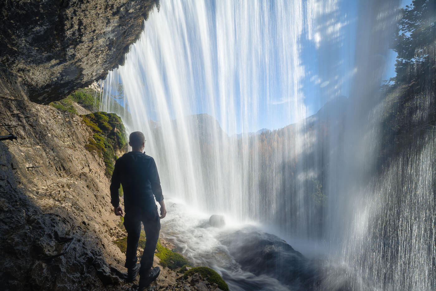
- If you are in Cogne, do not miss the short hike to Cascate di Lillaz.
- Here’s the main page on Hiking in Italy for more hikes and scenic spots in Italy.
- Gran Paradiso National Park Official Website.

Leave A Comment