Látrabjarg Cliffs Hike – See the Puffin Cliffs, Westfjords, Iceland
The Látrabjarg Cliffs are arguably one of the best places to see the puffins in Iceland; the hike up the cliffs can be as short or long as you want it to be, and the landscape is stunning. Getting there is quite an adventure too, as the place is rather remote, and it involves a lot of driving on the winding, gravel roads of the Westfjords.
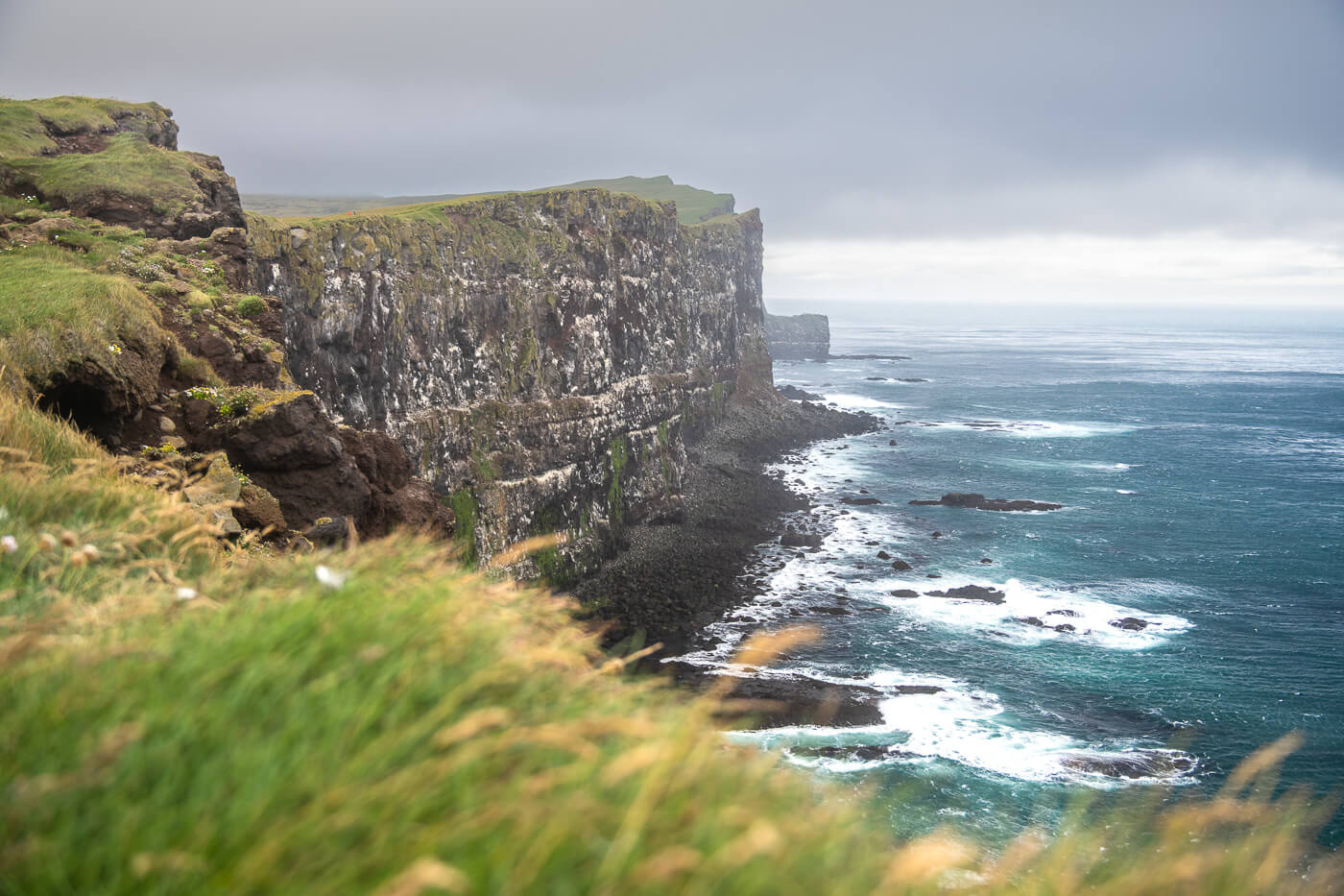
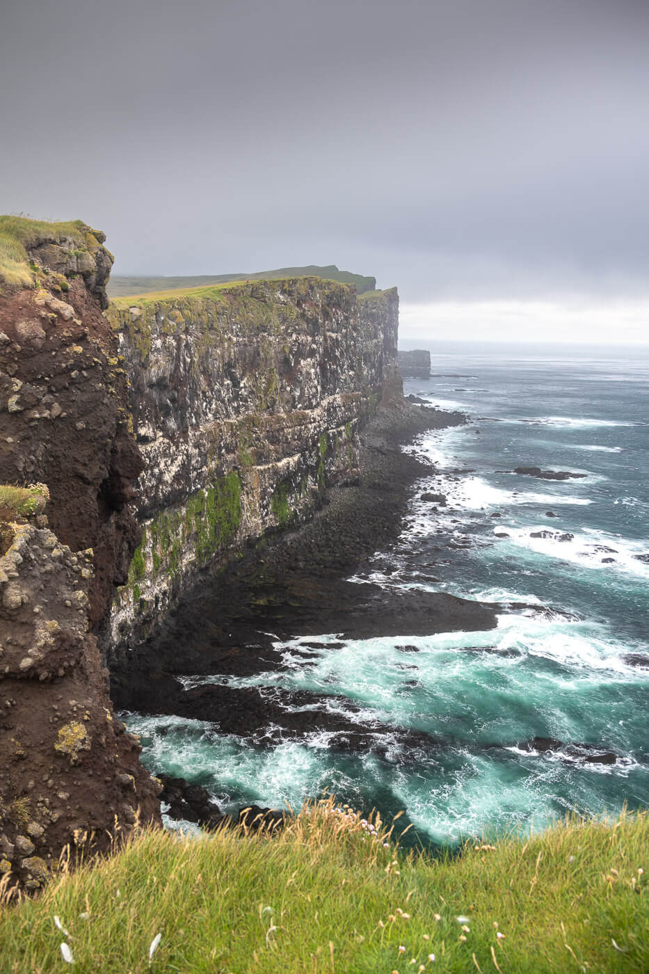
Látrabjarg Cliffs
However, he landscape is amazing. It is a scenic drive, where you’ll find plenty of locations worth a quick stop on the way to Látrabjarg.
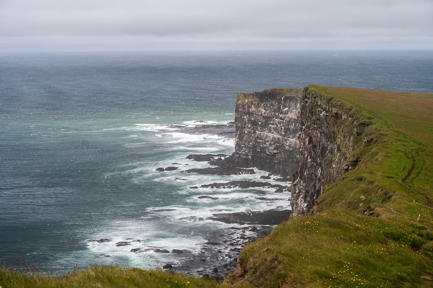
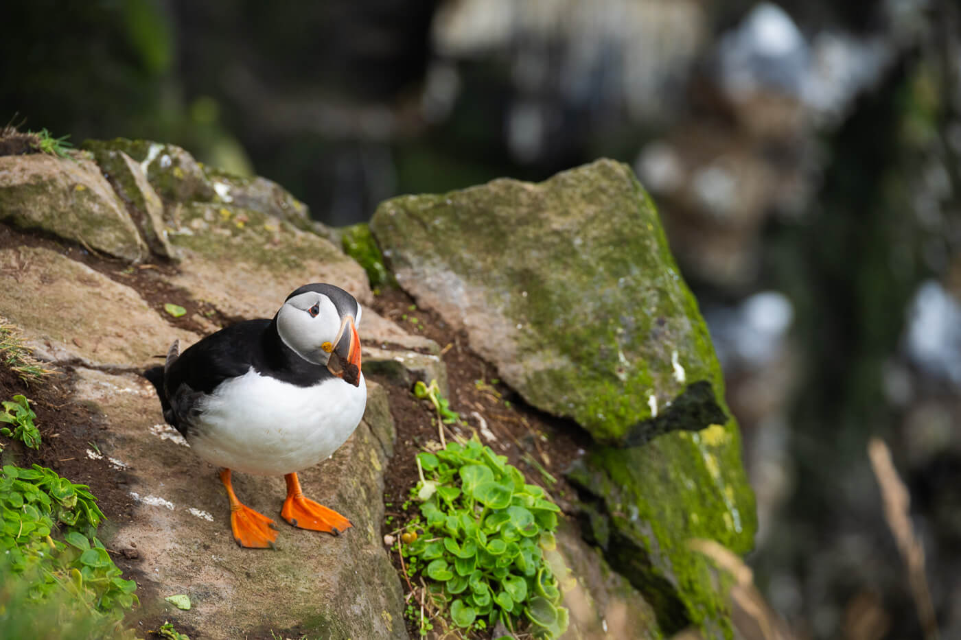
The cliffs, which are also known as the “Puffin Cliffs” or “Bird Cliffs,” offer stunning views of the coastline too. So it would be reductive to just call them the Puffin Cliffs. The cliffs are more than 14km long and more than 400m tall at their highest point. A mighty sight on their own – and during the season from to, they are full of Puffins

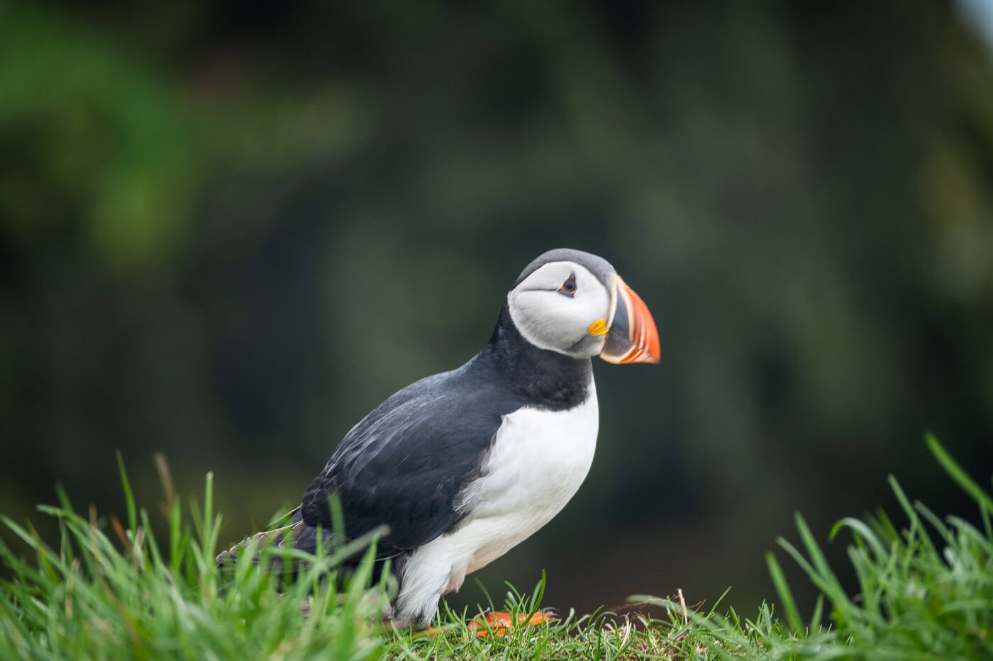
Puffin at Látrabjarg.
Table of Contents
Overview of the Látrabjarg Cliffs Hike & Map
The Hike up the Látrabjarg cliffs can be as long as or as short as you want it to be. I can be either a short walk, a few hundred meters up the cliffs to the first viewpoint, or it can be a few kilometers long, further up the cliffs.
The trail is part of a longer hiking route that also leads to Rauðasandur beach, so it covers quite a long distance. I hiked to the highest visible point, a little over 2km from the trailhead.
To see the puffins, you don’t need to get all the way there; you can just walk the first 2-300 meters up the cliffs. Also, a safety note: some of the cliffs are fenced, some aren’t. You are not supposed to walk or stand on the edge of the cliff, but to lie down on the grass if you want to look down at the birds and the cliffs. This is because the soil is eroded, and by lying down, you distribute the weight better and reduce the risk of causing a small cliff collapse.

Safety Tips from the infoboard at the trailhead.
Lastly, if you are doing this hike to see the Puffin, you should plan it between early/mid-May to mid/late August, in the morning or in the morning or afternoon, as most Puffins will be aout at sea during the day.
| Max Altitude | 230 m |
|---|---|
| Distance | 4,9 KM |
| Elevation gain | 200m ↑ / 200m ↓ |
| Hike time | 01:30/ 02:00 Hours |
| Hike Difficulty | Easy |
Here is the map of the hike. You can download the GXP file for free from the activity linked below. Do note that, for some reason, my GPS tracker went awry, and the track shows an excessive elevation gain. My guess is the GPS position pinged on and off the cliffs, but who knows.
How to get to the Látrabjarg Cliffs trailhead and Parking
As mentioned above, Látrabjarg is very remote, and if you are not already staying in the Westfjords area, you should plan for a full-day trip, at least.
The drive is long and tiring if you are doing it as a day trip. Almost all of it is on gravel roads from Road 60. Most of the road is ok, though some sections are quite narrow, and there are plenty of potholes. It’s a bumpy ride, but entirely doable in a 2WD car.
However, make sure you fuel up at the Flókalundur gas station before heading deep into the Westfjords. There aren’t many gas stations in this remote corner of Iceland, so it’s best to have a full tank just in case. The only other gas station is in Patreksfjörður, which is not directly on the road to Látrabjarg and requires a detour.
- Driving Directions: If you are coming from the south (Reykjavik), take road 60 after Bifröst. Keep following the same road until Flókalundur. Then take road 62 until the junction with road 612. Follow road 612 until its very end, which is your final destination, Látrabjarg. If you are coming from the opposite direction, the North of Iceland, the road is the same, except you’ll have to turn onto road 59 when you reach the far end of Hrútafjörður. The drive to Látrabjarg takes about 6 hours from Reykjavik and more than 7 from Akureyri in good weather conditions and without accounting for stops, which you’ll want to take.
- Parking: There is a large parking area available at the trailhead.
- Public Transport: none. One option would be to join a guided tour.
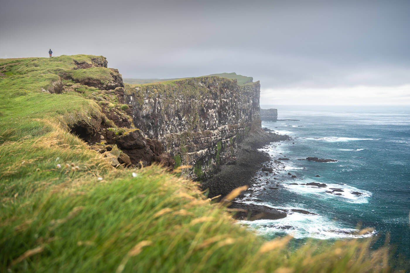
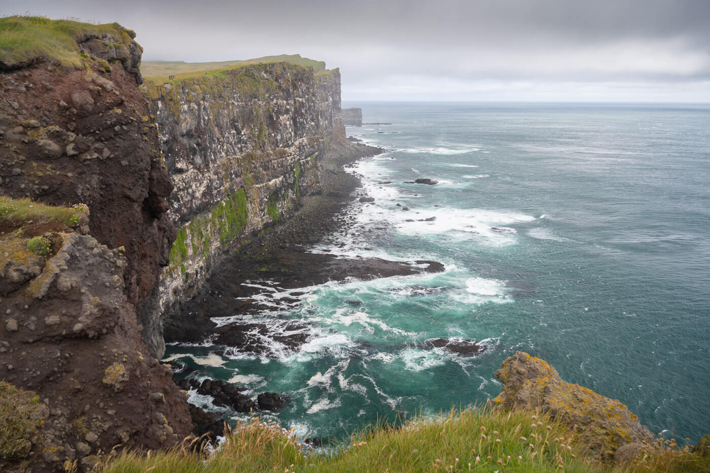
Hiker on the Cliffs at Látrabjarg.
The Látrabjarg Cliffs Hiking Trail
From the parking area, there is a nicely maintained trail that leads uphill. Along the trail, you will find some info boards that describe the different types of birds you could see on the cliffs.
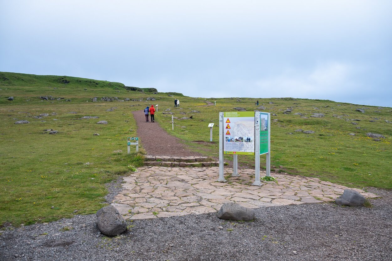
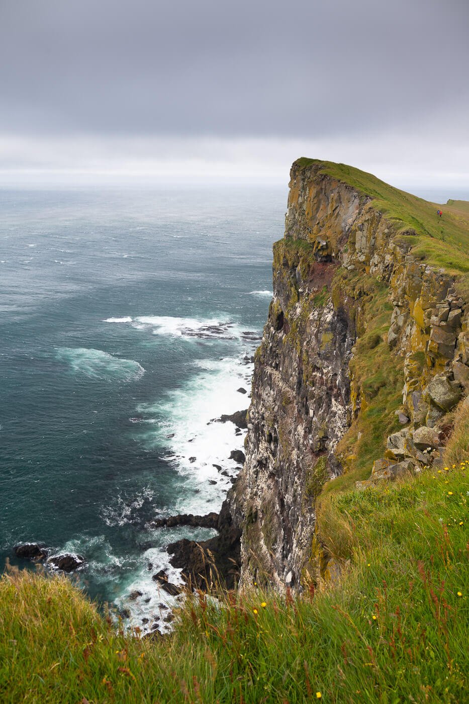
Látrabjarg Cliffs Trailhead.
At the beginning, it’s an easy trail and an easy walk uphill on a gentle gradient. The first stop is a cordoned-off viewpoint along the cliffs. The viewpoint is just about 300 meters from the main parking area, and provides a good view of the cliffs’ faces – and birds resting on them.
Most people stopped there when I visited, without venturing further up the cliffs. If it’s just the Puffin and other wildlife you want to see, this is a great spot. There are plenty of Puffins and other birds around to watch.
For those who want to explore the area further, the trail becomes a proper hiking trail that follows the ridge uphill. I also wanted to see the cliffs from a higher viewpoint, so I continued the hike uphill for a little over 2km. I hiked to the highest visible viewpoint, after which there did not seem to be many better viewpoints than those I already passed – if not, perhaps a few kilometers further down the cliffs.

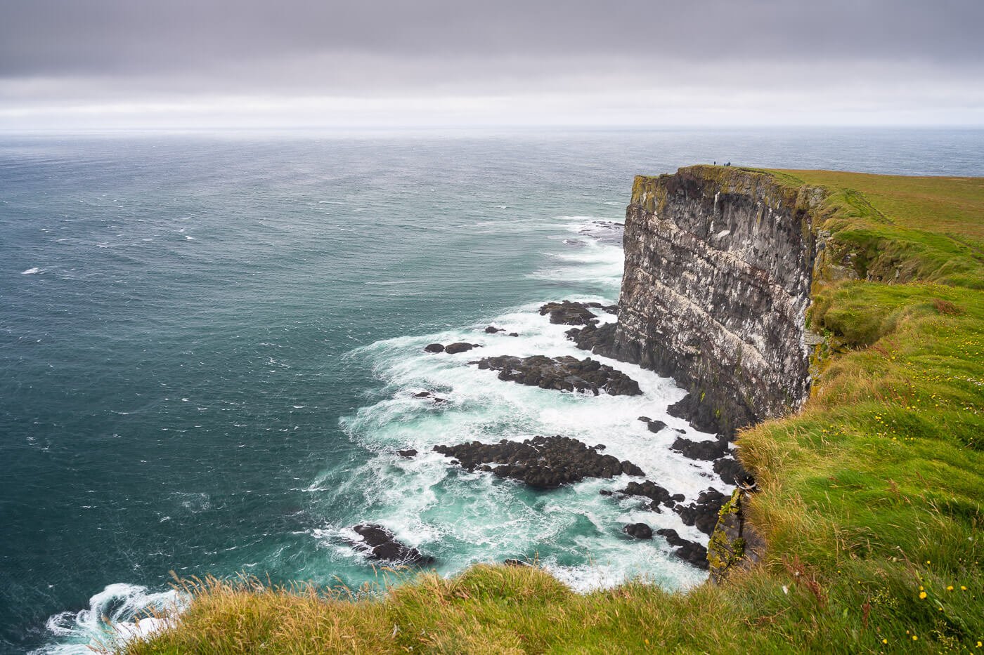
The trail is visible from a distance. Also, can you sport the two hikers lying down to watch the Puffins?

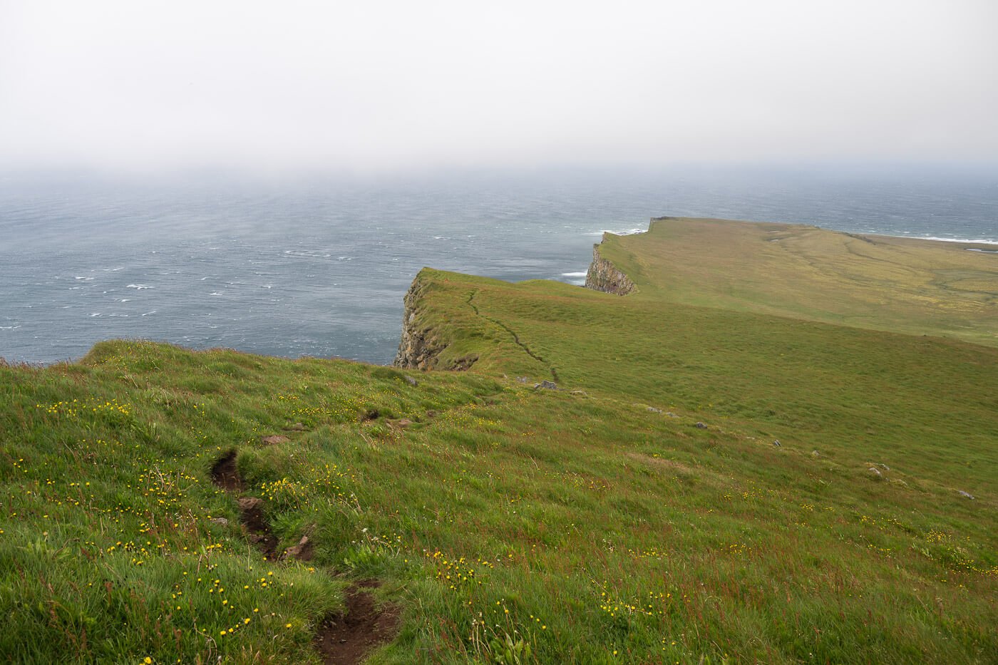
The trail uphill follows the ridge for the most part, but some sections have been closed due to the risk of collapse, and the trail deviates slightly, further down the hill and away from the cliffs. Apart from the additional views of the cliffs, you’ll also find more openings above the cliffs to watch more Puffins and other species of birds.
Just remember to lie down on the grass each time you approach the Cliffs to take a peek at the birds.

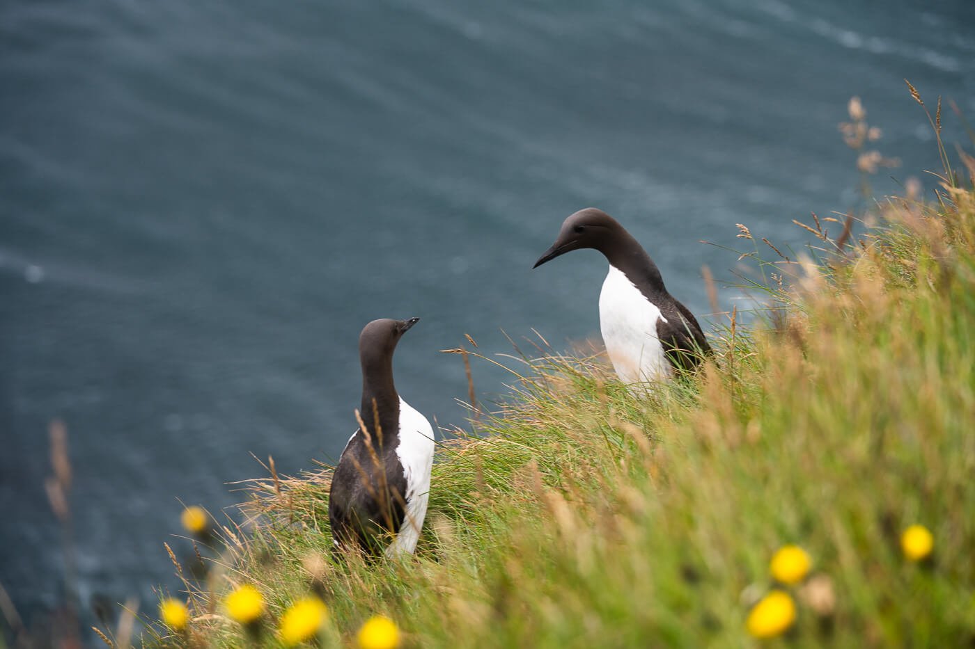
Common Guillemots
There is no way to do it as a loop hike, so you’ll have to hike back the same way you came. This, though, will offer more opportunities to sport even more birds. On your way down, you can stop by the lighthouse, which is the Westernmost point in all of Iceland – and Europe if you exclude the Azores Islands and Greenland.
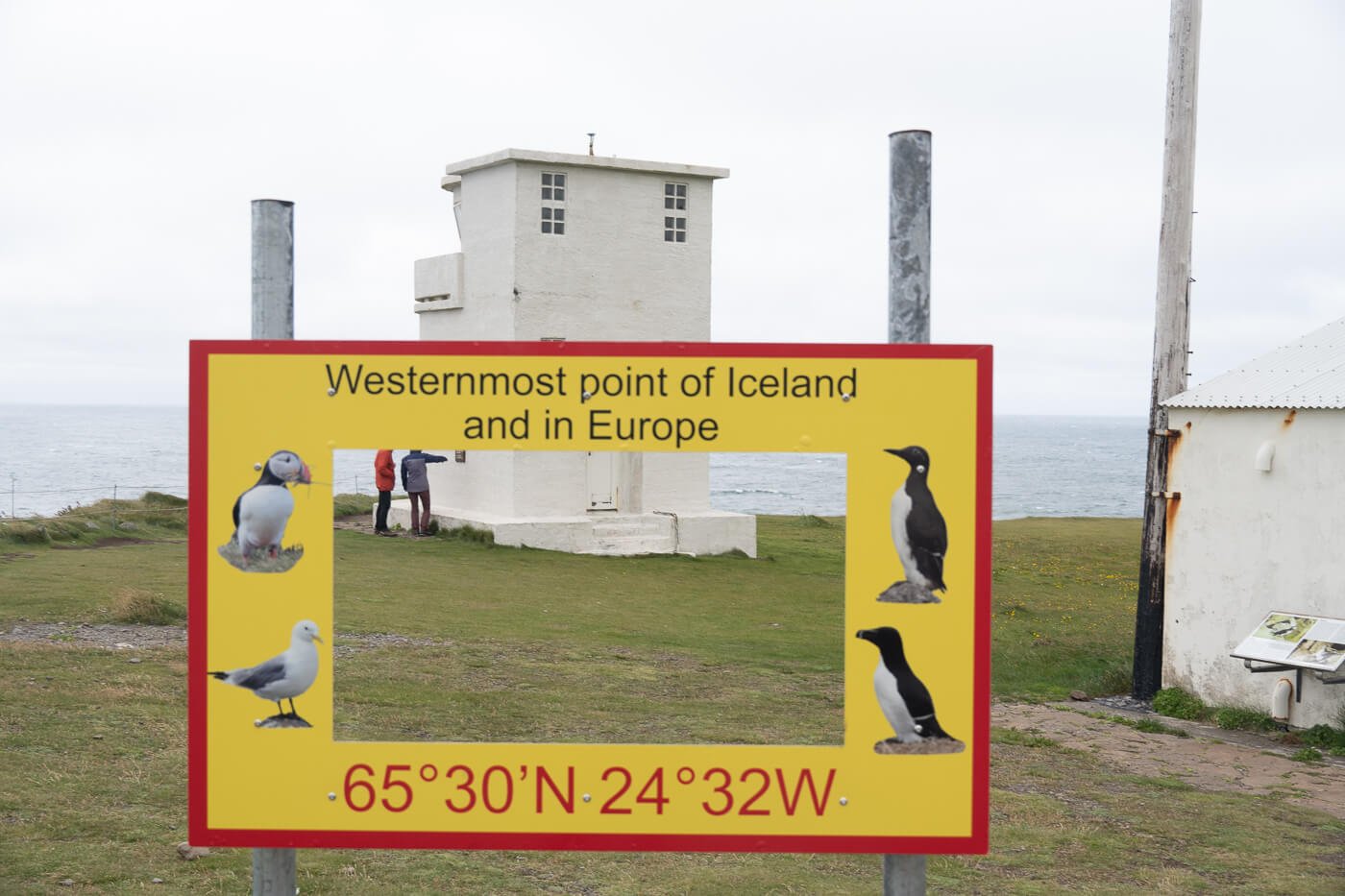
..excluding Greenland and the Azores.
Látrabjarg Photos and Photography Tips
The landscape at Látrabjarg is truly majestic. The Cliffs offer a huge variety of viewpoints from which it’s possible to take stunning photos of the landscape. Just walking uphill, you’ll find several spots from which you can look at the landscape below. If that matches with your schedule, try to visit at high tide. It’s much nicer when the waves are close r to the cliffs. The same rules as the Puffins apply though; approach the cliffs with caution and lie down. And beware of wind gusts.
On the way back, you’ll also also have great views of the cliffs from the side opposite to the trailhead.
I’d see this as a good sunset location, though I found surprisingly few shots. That makes sense, considering how remote it is. It’s not a place you can just hop to if conditions look good, and there are not many places to stay in the area.
When to Photograph the Puffins – and the best time of the day to do so
The best time to photograph the Puffin would usually be in the morning or later in the afternoon. They are out at sea trying to catch fish during the day. They aren’t particularly shy with humans and seem to be rather curious. They can move quite close, but as usual with wildlife, do not attempt to interact with them. They are slow-moving birds on their feet, so they are also quite easy to photograph when they are on the ground.
The photos you see were all taken within the 200m and 400m focal lengths, on a full-frame camera. The longer the focal length, the better, as this offers more flexibility in photographing the birds. However, a 70-200 would be enough in most cases.
Where to stay
There isn’t much in the area; it’s rather remote, and accommodations are sparse. There is, however, one popular place to stay nearby: Hotel Breidavik. Located next to the beautiful Breiðavík beach, there is also a campsite where you can camp. More accommodations can be found on the way back toward Patreksfjörður.


Leave A Comment