The Murgsee Hike, Switzerland
The hike to Murgsee is a bit of a hidden gem. An isolated valley filled with pristine nature, rivers, alpine lakes, rugged mountains and a protected forest reserve with beautiful trees, pines especially. All the perfect ingredients for a beautiful day out on the trails.

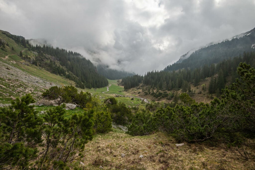
A beautiful, silvery light peaking through the clouds in the beautiful forest around the trail to Murgsee.
This is a relatively long hike at 14km, but it does not offer any particular challenges. The trail is easy to follow, never too steep, and has no exposed or dangerous sections. Best done from mid-late spring, there can still be snow in places along the trail. I did it in mid-May, and I’ve hiked across a fair amount of snow. So beware of that if you are planning to go early in the season.
This is a beautiful location, and you will enjoy spending time there. It is also a good example of how many hidden treasures there still are in Switzerland, away from all the major tourist locations.
Table of Content
Overview of the Murgsee Hike & Map
The hike is relatively long at just about 14km or 8.6 miles, with a moderate elevation gain of 720 m ↓ (2,362 ft.). The trail is well-marked with the usual pint trail posts and is always easy to follow.
| Max Altitude | 2,023 m (6,637 ft.) |
|---|---|
| Distance | 14 km (8.6 miles) |
| Elevation gain | 720 m ↑ / 720 m ↓ (2,362 ft.) |
| Hike time | 03:15-03:45 Hours |
| Hike Difficulty | Moderate |
Here is the map of the hike. You don’t need a GPS track here, but the map below can give you a good idea of the elevation profile and what to expect on the trail. and you can download the GPX fil for free, should you need to have it.
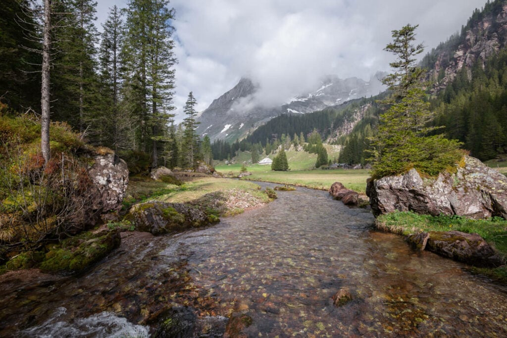
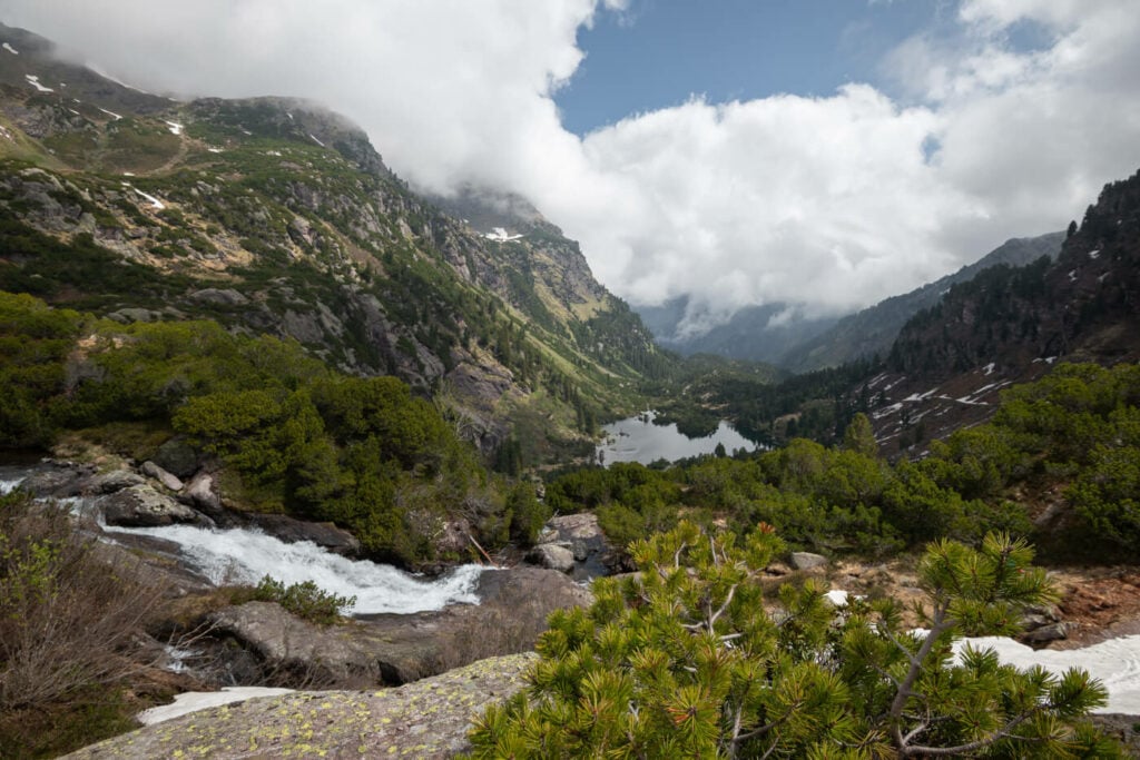
Panoramic view of the beautiful plateau after the first part of the climb through the forest. Quite a view coming out of the forest!
How to Get to Murgsee and Parking
Despite this being quite an isolated location, it is a relatively easy one to get to, as it’s a short drive away from the highway exit.
- Driving Directions: The trailhead can only be accessed via Highway A3, by reaching the Bachlaui parking area. From either direction, you can take exit 47-Murg; from here it is a drive on a narrow mountain road with many blind corners
- Parking: Ample, paid parking is available at the trailhead. Note you will have to pay to access the area. You can either buy the access ticket by the machine next to the last farm before the parking area, or you can buy it at the Parkuhr Murgtal.
- Public Transport: there is, unfortunately, no good public transport option to get to the trailhead.
Tip: best to be here early in the morning. While the parking area is rather big, it will fill up during the day so it pays off to be there with the early birds
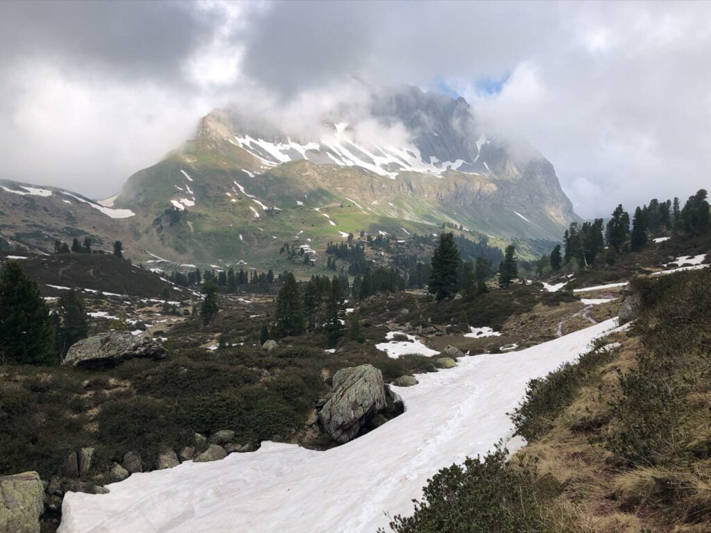
Snow on the trail in early spring
The Murgsee Trail
This is a loop hike, so you can do it either way. I did it counterclockwise and I’d recommend it the same way. I think the landscape can be enjoyed better, as you will have most of the scenic views ahead of you.
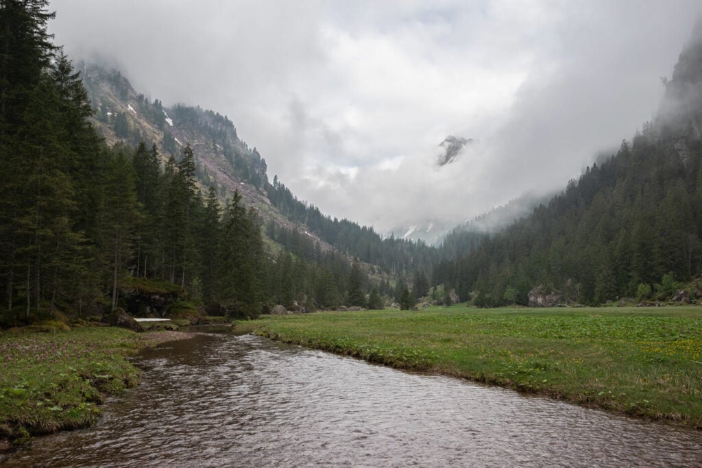
The first part of the trail is all in the forest. The trail here isn’t very well maintained but it is in good condition nonetheless. Also, regardless of which direction you take, the first part of the trail will be the steepest until you reach the plateau-like flattish area above the valley.
The rugged mountains around the trail are stunning and the forested area is beautiful. You’ll see several trees growing on or around rocks shaped by glaciers; it’s pretty amazing to see the combination of the two.
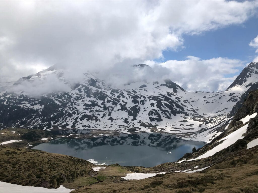
The lakes, the Oberer, Mittler and Unterer Murgess ad at the far end of the trail, where the hut and restaurant are also located. More trails go further up the mountains from here, so the hut can be a good overnight base to explore the mountains further.

A tree seemingly sliding down the rock it grows on.
The Murgsee Hike Photos and Photography Tips
Photographically speaking I think the most photogenic landscapes are to be found in the first part of the trail if you are hiking it counterclockwise.
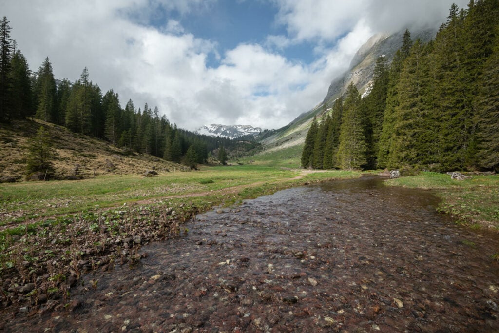
You’ll come across a river that makes for a great foreground in several different locations. It also serves well in providing leading lines to add depth to the image and drive the eye to the mountains in the background.
On this side of the trail, the light will also be better in the morning, with the sun rising to your left and casting light onto the mountains in from of you.
Also, you will probably come across some wildlife. I did see some Ibex it’s a fairly common sight, especially in late spring. Unfortunately, I did not have a long enough lens when I saw them, so no photos this time.
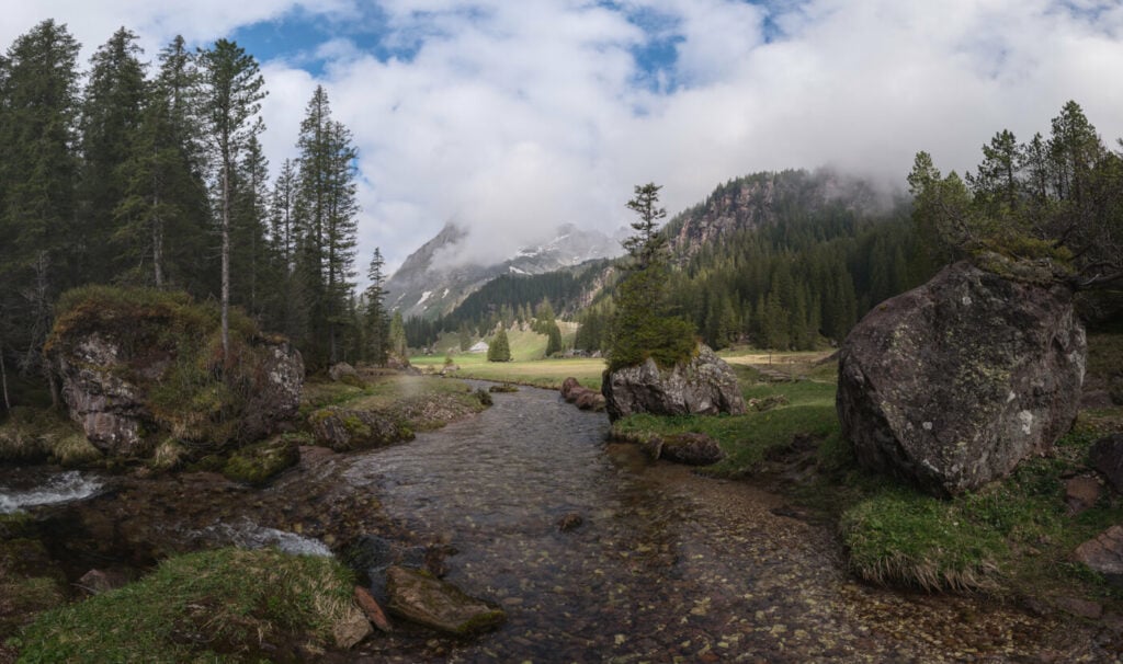
The beautiful river crossing the plateau in the first part of the hike

Panoramic image, 4 vertical frames taken at 16mm
Same scene as above, shot at 16mm
The beautiful, Pristina landscape on the trail to Murgsee
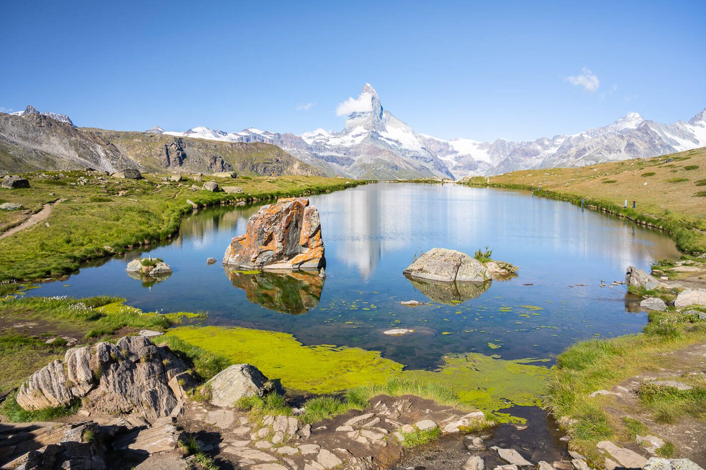
Murgsee
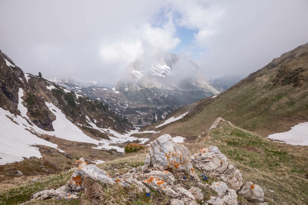
The view at the highest and farthest point of the hike
The Unterer Murgsee, the small lake in the middle.
Where to stay
Staying at the Murgseehütte is an option, and bookings must be made at least two days in advance. There are some rooms but mostly bunk beds. The Murgseehütte usually opens for the season in late spring. You can check availability directly on their website.
Additional Resources
- Check out the main Switzerland page for more hikes and an overview of hiking in Switzerland.
- Here’s the Murgseehütte Website


Thanks so much for sharing all these hiking recommendations and inspiration! We recently did one of the hikes you suggested online, and it turned out to be an absolutely beautiful experience. We really enjoyed it and would definitely recommend it to others.
Just a small note regarding the time estimate: unless I’m mistaken, the time you mentioned seems realistic either for a trail run (which is how we did it, and it was both feasible and fantastic) or for reaching Murgsee clockwise only. If I remember correctly, the signs along the counterclockwise route indicated something closer to around 3.5 hours. Of course, I may be remembering incorrectly, but I thought it might be useful to point that out for anyone planning the hike.
Thanks Claudia, for taking the time and to point that out! I think you are right. I just double-checked my original activity, and it took me 2 hours and 55 in total. That is almost 5km/h on average, so quite fast indeed. The 3.5 hours is a more realistic estimate for a standard pace. I will adjust it accordingly. Thanks!