Tre Cime di Lavaredo Hike and Photography Tips, Dolomites, Italy
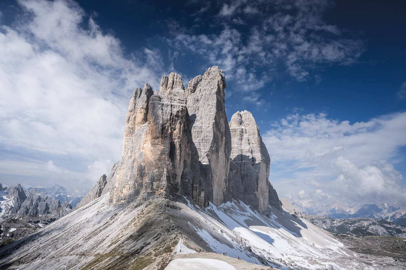
Le Tre Cime di Lavaredo are probably the most recognizable landmark in terms of mountain hiking and landscape in Italy, a landmark that, of course, makes for a great, scenic hike.
If you will, Le Tre Cime di Lavaredo are a bit like the Colosseum of the natural world in Italy, an absolute marvel. As an Italian, at least, these beautiful peaks instill the same sort of reverence and sense of wonder that the most famous Roman Arena does.
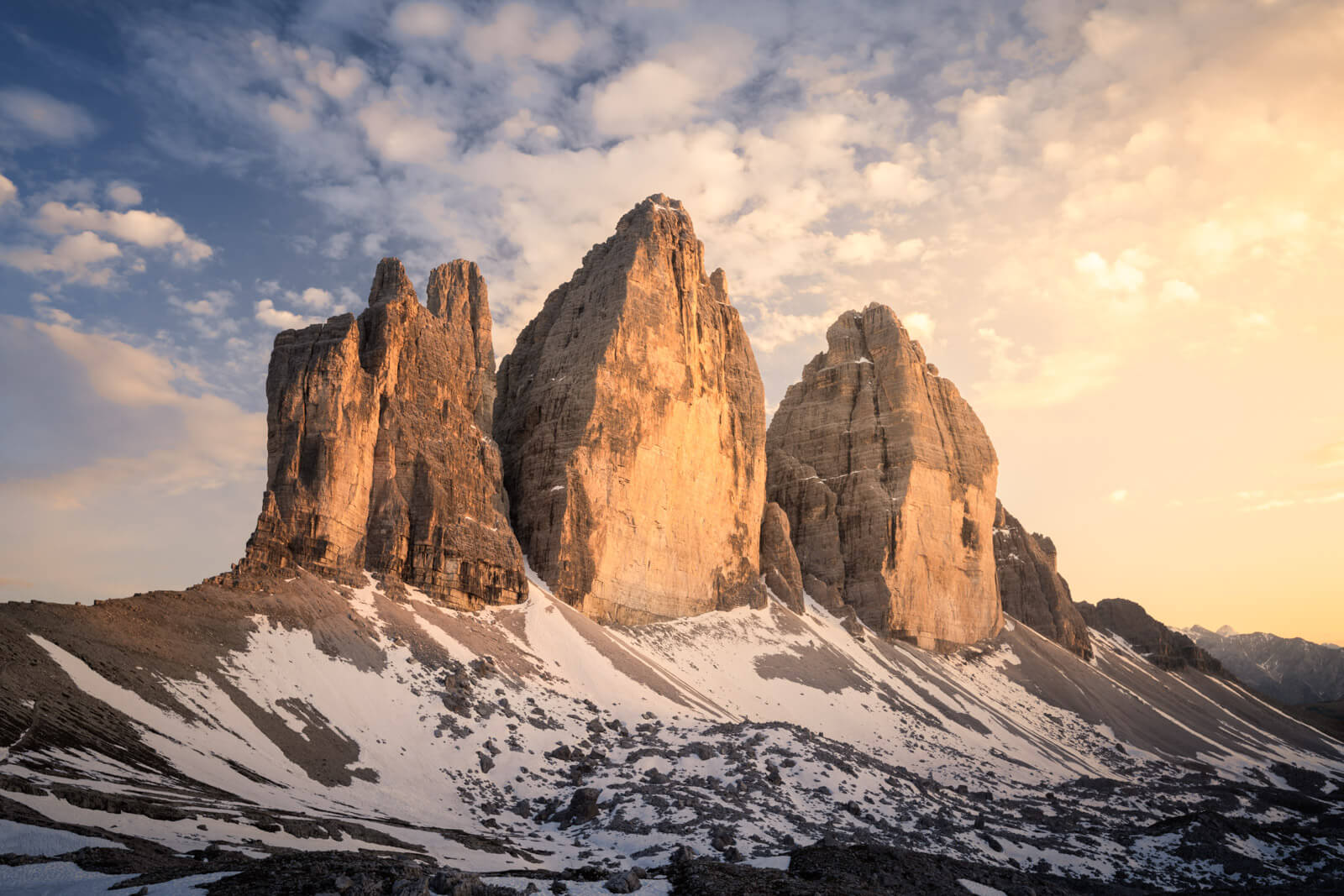
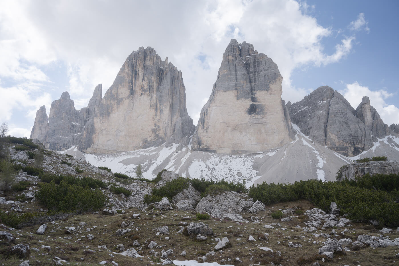
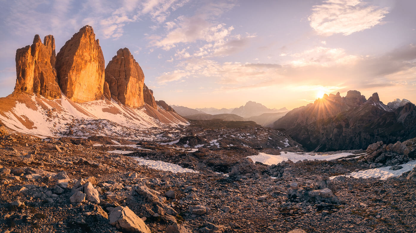
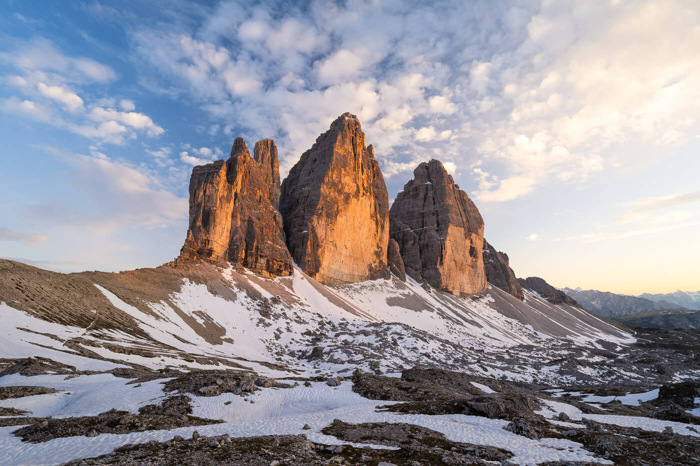
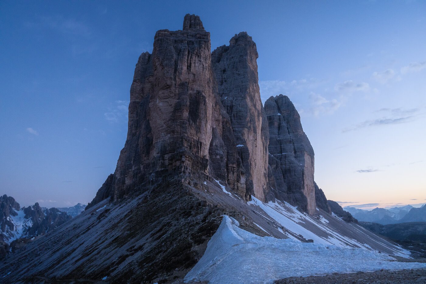
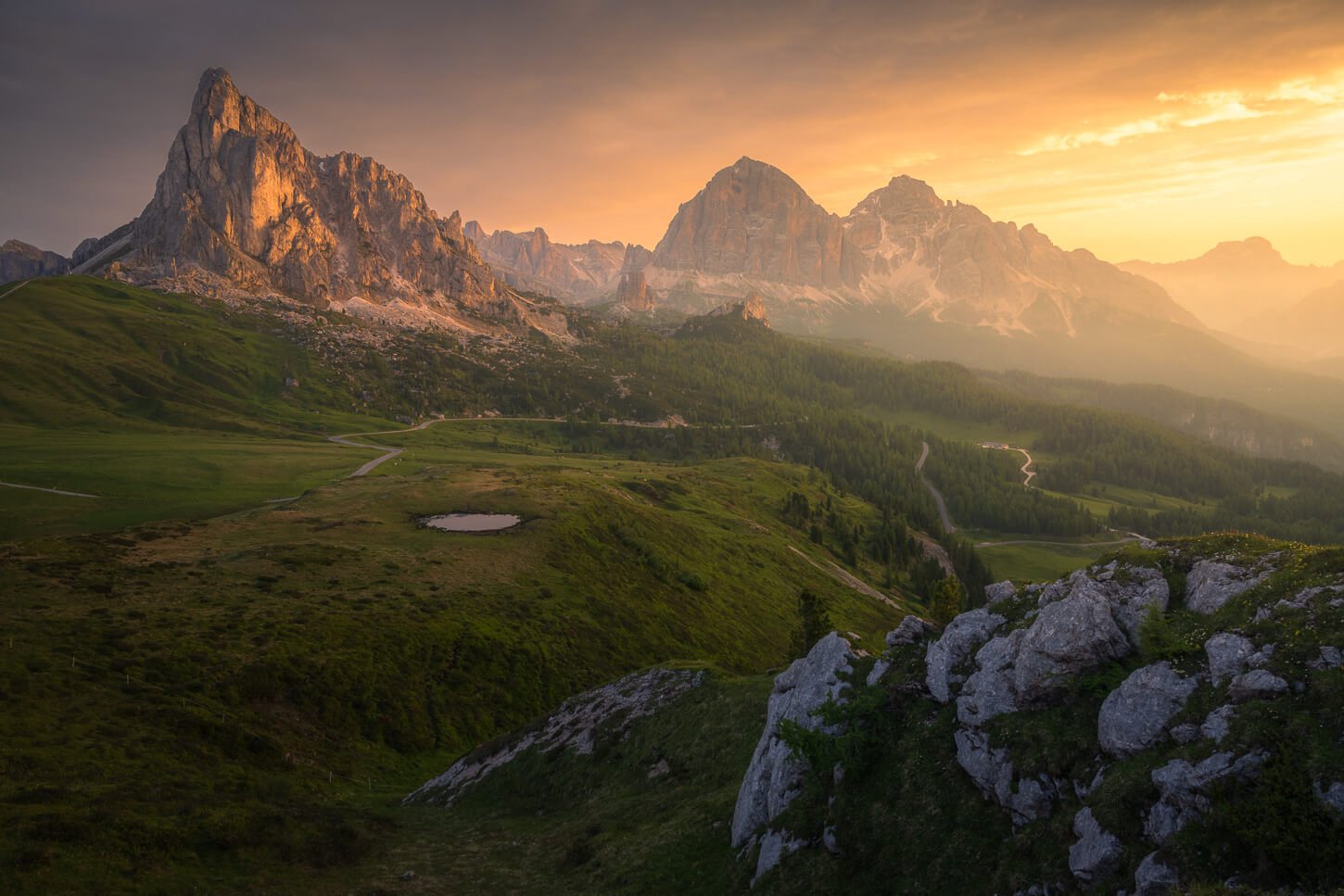
Le Tre Cime di Lavaredo at sunset, Dolomites.
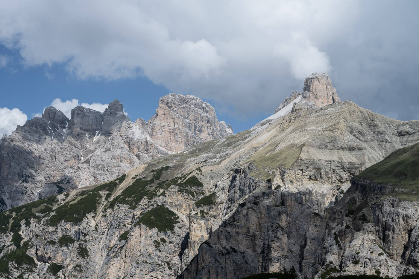
Also called Drei Zinnen in German, the Tre Cime di Lavaredo are of the Dolomiti di Sesto Mountain Range, within the “Parco Naturale delle Dolomiti di Sesto”. The three peaks of the dolomites are the Cima Grande (2.999 m s.l.m.), the Cima Ovest (2.973 m), and the Cima Piccola (2.857 m). Respectively, the Great Peak, the West Peak, and the Little Peak.
The Hike around them is quite easy and mostly flat on well-maintained trails. In my view, this is the only spot you should not miss if you are planning to visit the Dolomites. The whole area with its Rifugi and Jagged mountains is just insanely beautiful.
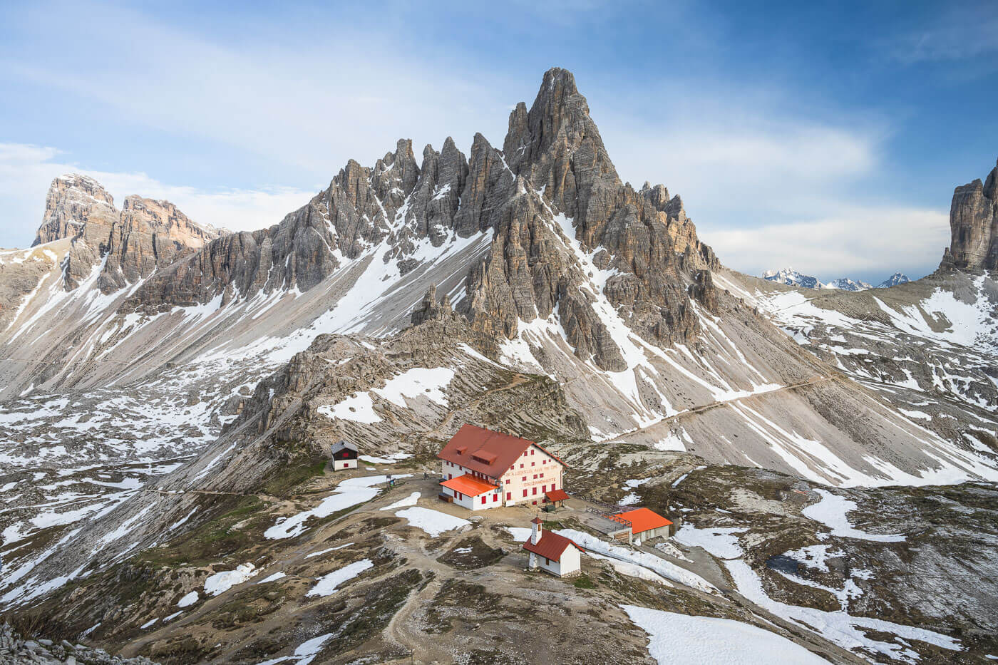
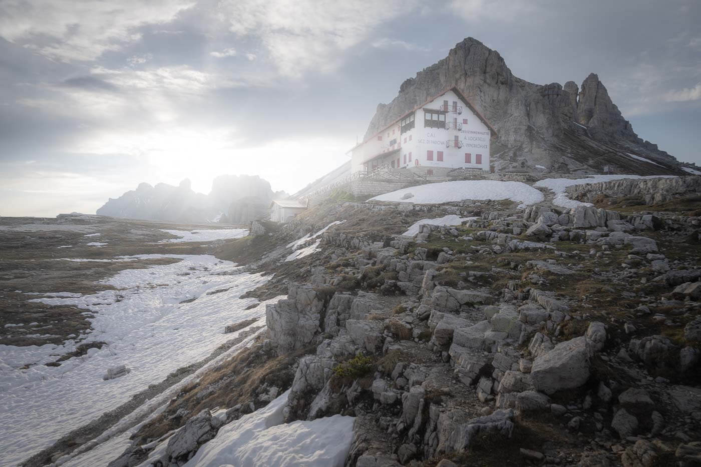
Rifugio Locatell, with Monte Paterno in the background
Table of Contents
Overview of the Tre Cime di Lavaredo Loop Hike & Map
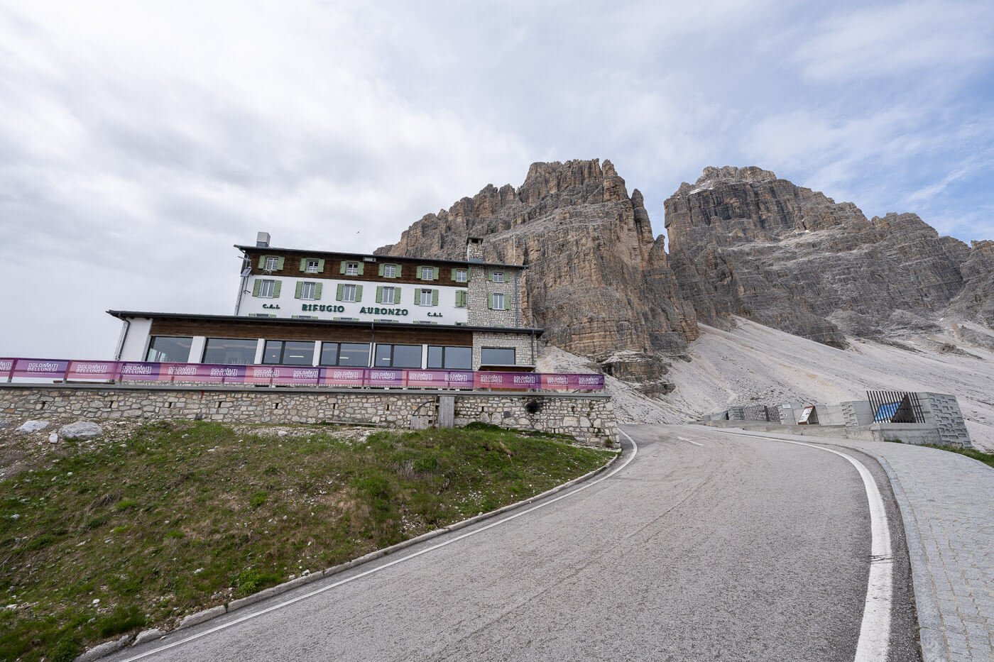
There are a few different variations of this hike. The most common is the loop hike around Le Tre Cime via Rifugio Locatelli, starting from Rifugio Auronzo. Parking there is expensive—unless you take the bus. I’ll describe this hike here.
You can also hike directly from Lago d’Antorno, and in that case, it’s a much longer hike (17.7 km, with 820m elevation gain).
You can also just hike to Rifugio Locatelli and back, which is also a very common hike, especially if you are doing it for landscape photography, as that essentially covers most of the best Tre Cime viewpoints (more on those later).
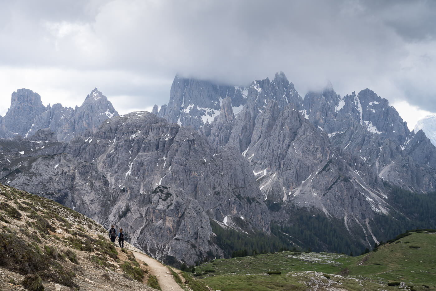
Hike walking toward Forcella Lavaredo, with Le The Cime in the background.
The hike around the Tre Cime di Lavaredo is relatively easy, there are no exposed or steep sections. It can be a very crowded location, especially in July and August. For this reason, my favorite time to visit Le Tre Cime is usually around mid-June or later in the season, from late September and until the first storms hit.
| Max Altitude | 2,460 m |
|---|---|
| Distance | 10KM |
| Elevation gain | 350m ↑ / 350m ↓ |
| Hike time | 03:00/ 04:00 Hours |
| Hike Difficulty | Moderate |
Here is the map of the hike to Le tre cime di Lavaredo. You can download the GPX file from the activity below for free.
Here you can also download the GPX file of the hike from Lago d’Antorno.
How to get to the Tre Cime di Lavaredo and Parking
Le Tre Cime isn’t a place you’d just pass by, and it is not on the way from one place to another, you’d have to drive there to the end of the road, where Rifugio Auroinzo is Located.
- Driving Directions: From Cortina, follow directions to Passo delle Tre Croci and then to Misurina. From Misurina, continue. toward Lago d’Antorno until you reach the Toll Booth, which gives you access to the road that leads to Rifugio Auronzo. Likewise, from Dobbiaco, follow directions to Misurina, then again to Lago d’Antorno.
- Parking: To park around Rifugio Auronzo, you’d have to pay to access the road that leads there. Note that as of spring 2025, you have to book parking in advance, and the ticket is valid for 12 hours. More details here. Otherwise, you can park by Lago D’Antorno (mostly paid, too) or in that area and start the hike from there.
- Public Transport: A bus service stops in the parking area near Rifugio Auronzo. More info here. The shuttle service is only available from the end of May until the end of October.
The Tre Cime di Lavaredo Hiking Trail
From Rifugio Auronzo you can do this hike either Clockwise or Counterclockwise. I usually do it counterclockwise, no particular reason for that. However, that is the shortest hike if you just want to get to Rifugio Locatelli.
From Rifugio Auronzo To Forcella Lavaredo.
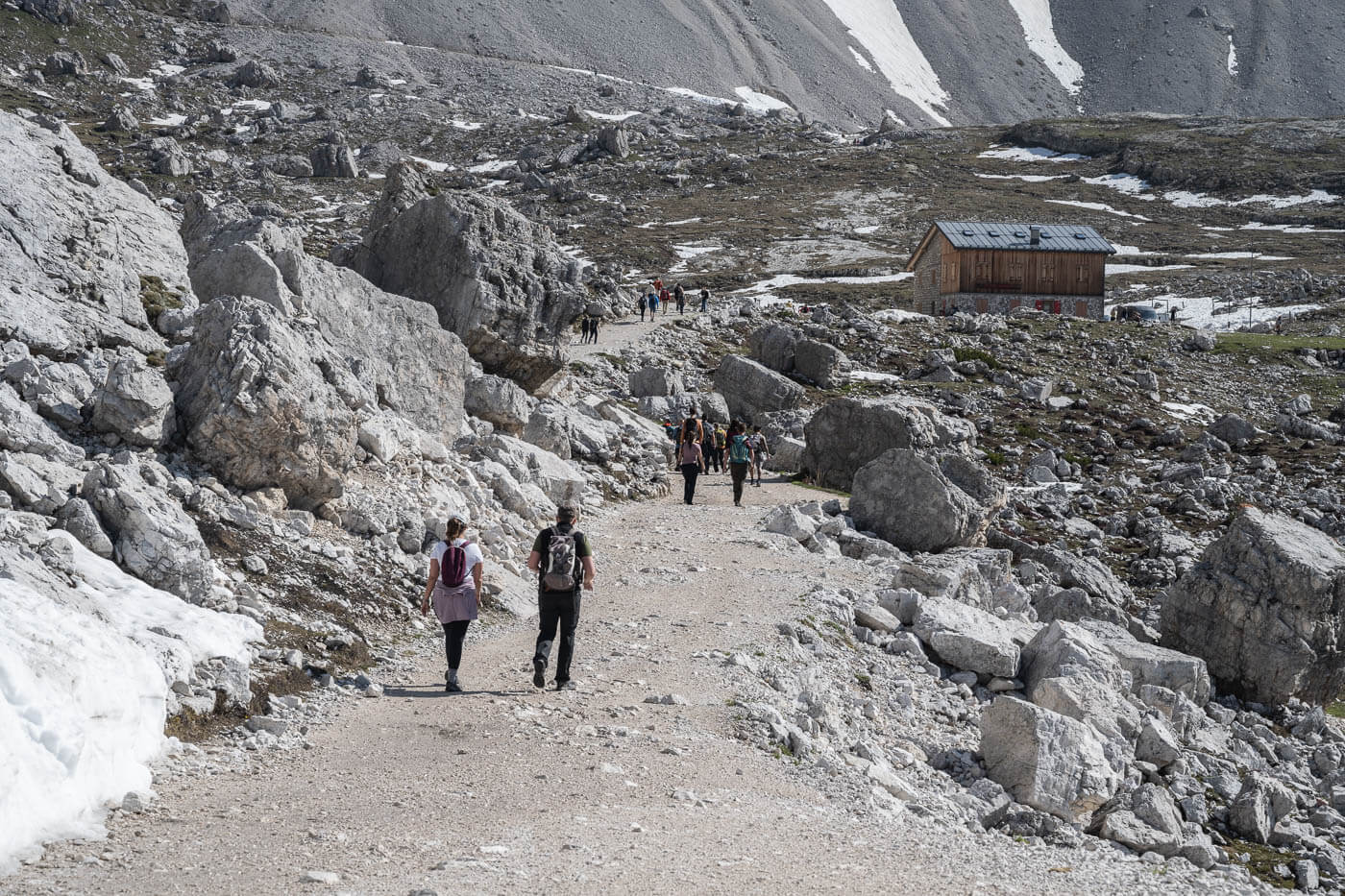
From the parking area by Rifugio Auronzo, follow the paved road until the trail turns into a gravel road. This is also used as service roads for huts in the area, so you may see cars with permission diving by.
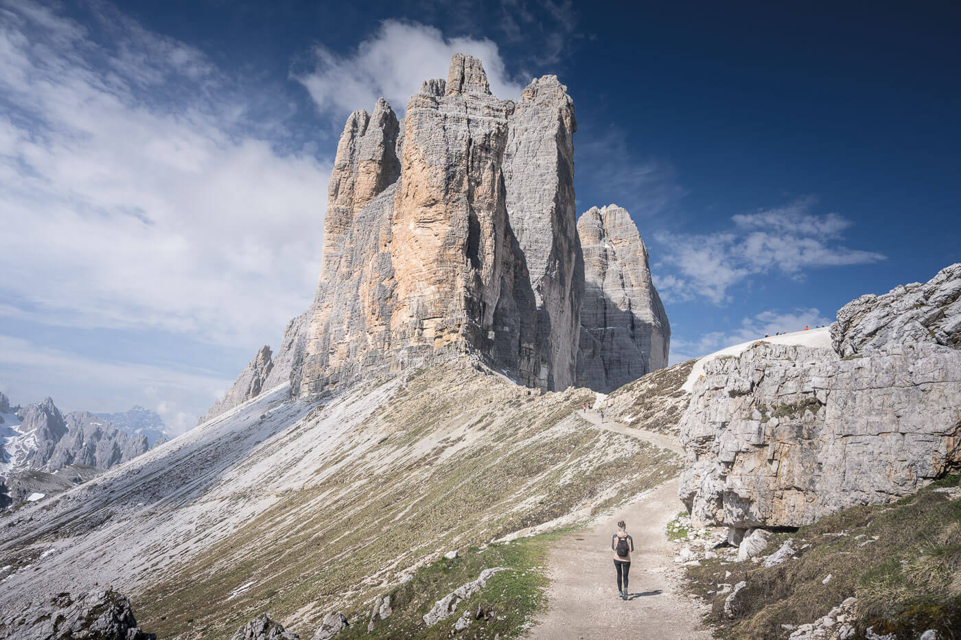
The trail is essentially mostly flat up to the short uphill section that leads to the Forcella di Lavaredo. In this section of the trail, you walk directly below the Tre Cime, where you have some nice views of its vertical wall, that give you a real sense of its true size.
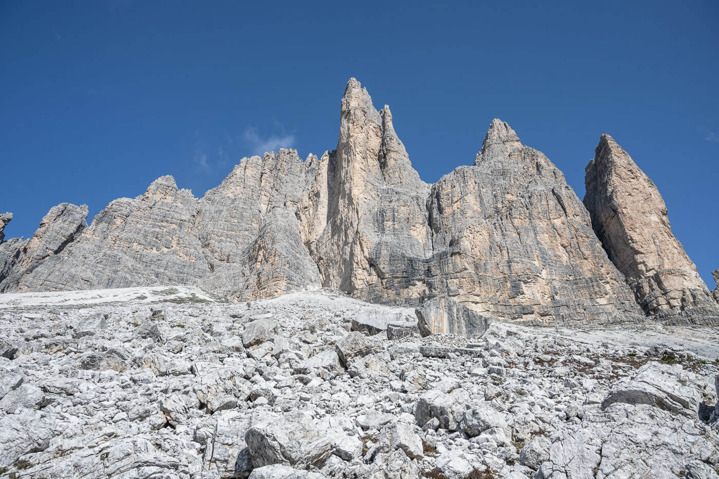
The rock face of the Tre Cime seen from below.
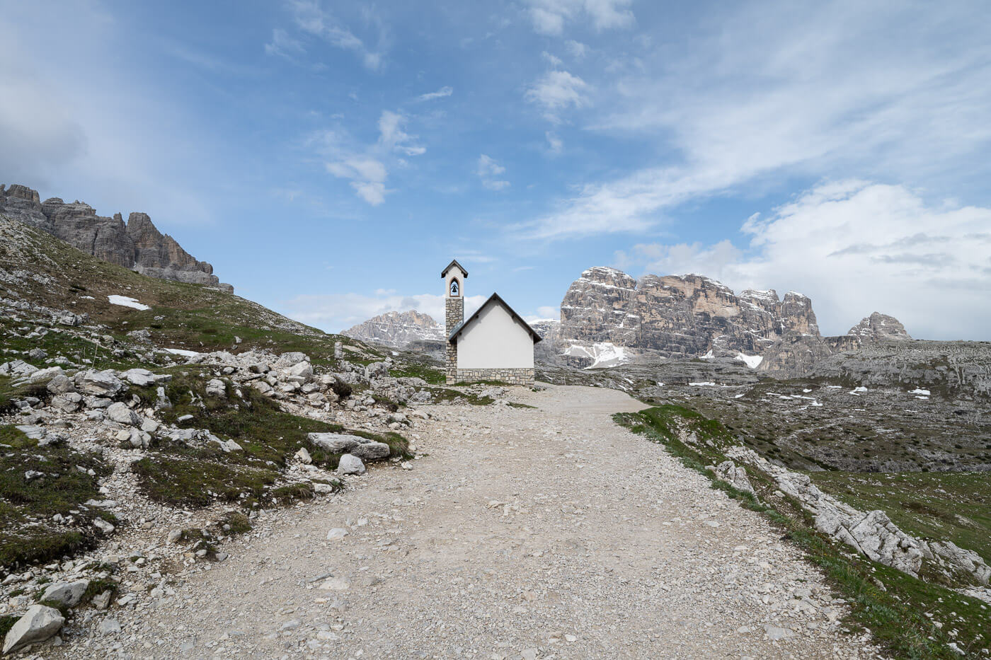
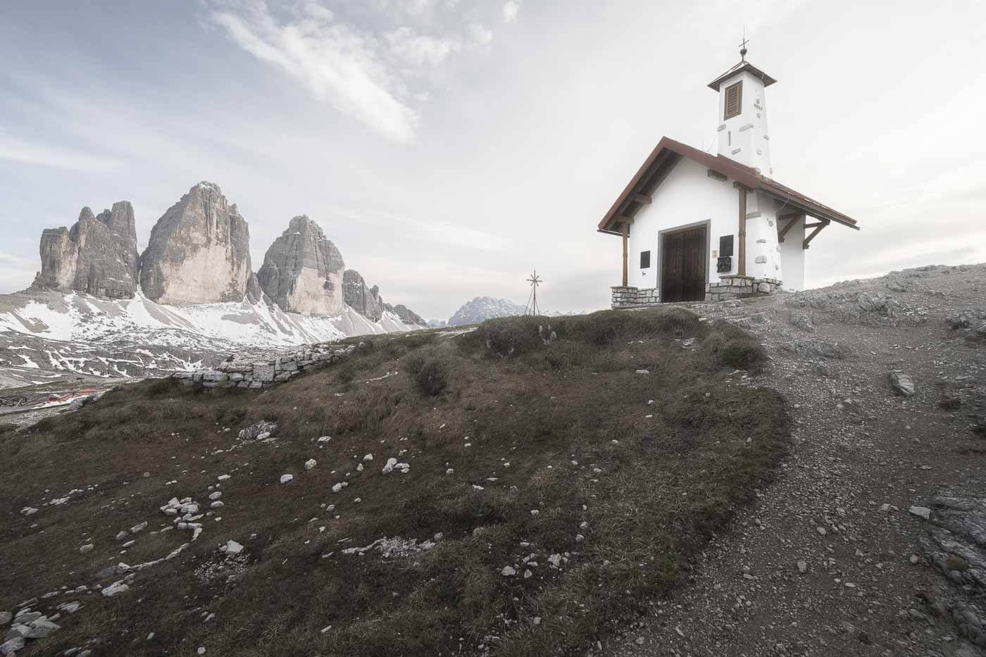
A little chapel on the road to Rifugio Locatelli
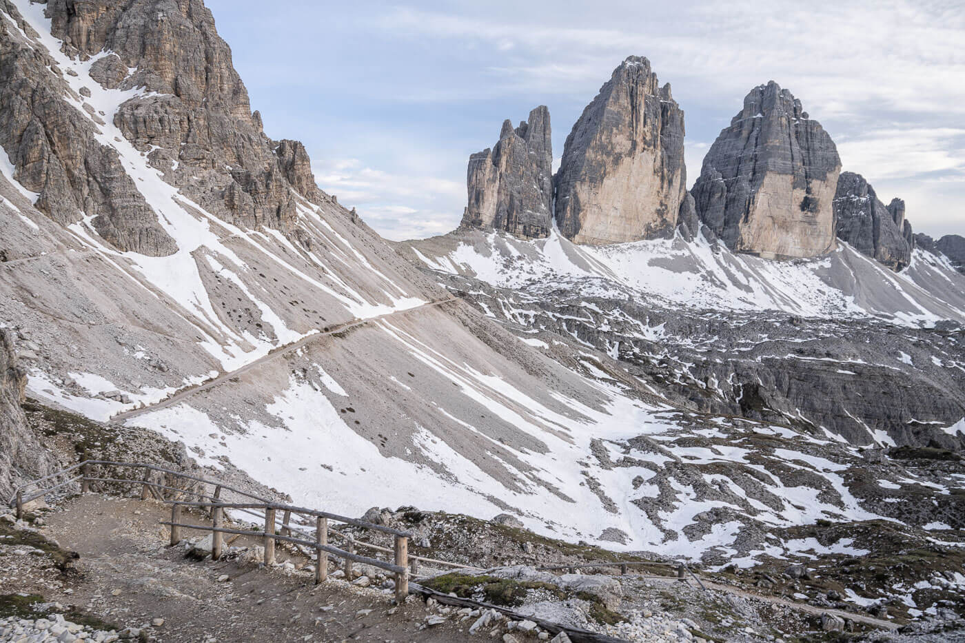
Here you’ll pass by another smaller hut, the Rifugio Lavaredo. From here your trail goes uphill until you finally reach the Forcella Lavaredo. It is likely to be a crowder area because it offers some of the most scenic views of Le tre Cime and the landscape around it, as well as being the starting point of a Vai Ferrata.
From Forcella Lavaredo the trail continues toward Rifugio Locatelli. you also have the option to skip it if you want to and continue on the loop trail without passing by the Locatelli Refuge.
View from Forcella Lavaredo.
From Forcella Lavaredo to Rifugio Locatelli (AKA Drei Zinnen Hütte).
From The Forcella Lavaredo to Rifugio Locatelli, the trail continues on a gravel road for about 20/30 minutes. Again, the trail is essentially flat up to the Locatelli hut, which, in German, is called Drei Zinnen Hütte.
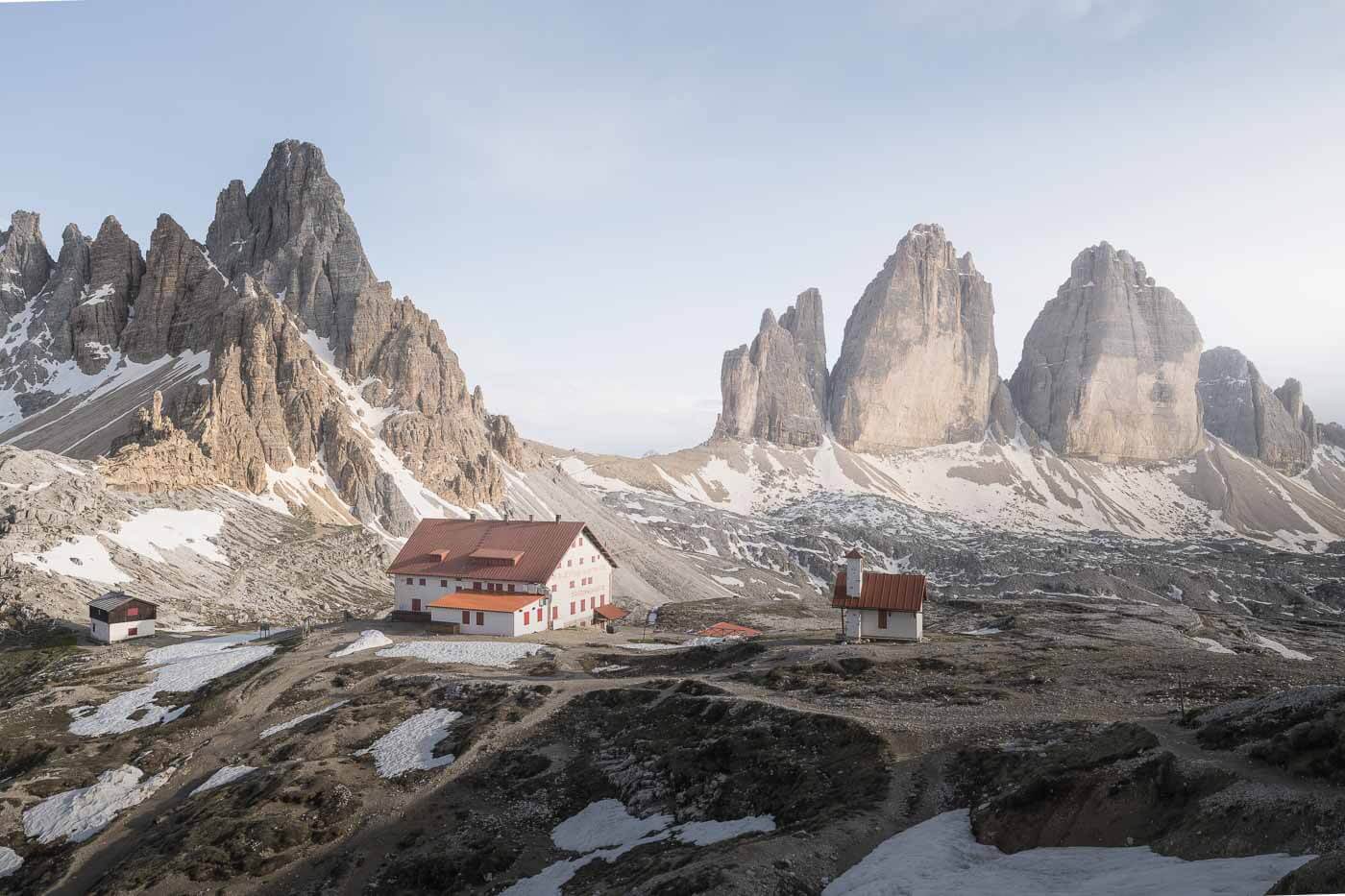
Rifugio Locatelli.
There, there’s a short uphill section that will lead to the hut. This is one of the trail’s most scenic sections, as you are surrounded by jagged peaks and rock faces everywhere you look.
You can also skip Rifugio Locatelli and continue on the loop trail without passing by the hut. However, it is a short detour and more than worth it. The Hut offers amazing views of Le Tre Cime and the surrounding landscape.
You also have some great views of the beautiful Monte Paterno from the Rifugio and the area around it.
The trail up to Rifugio Locatelli
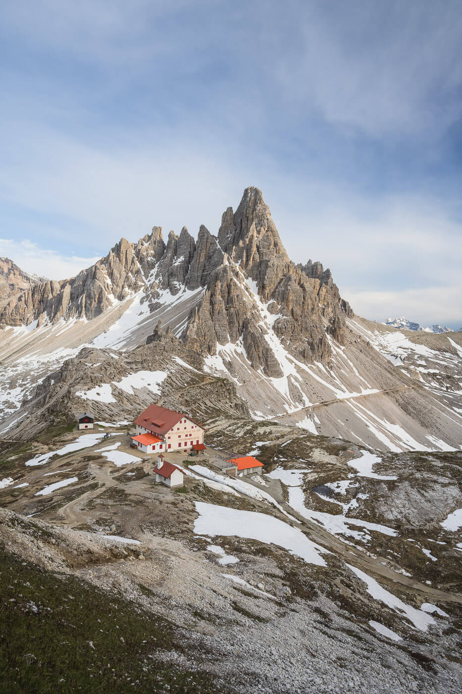
Monte Paterno, Towering above Rifugio Locatelli.
I think the Tre Cime’s fame somehow overshadows Monte Paterno’s beauty. With its many jagged peaks and ridges, it almost looks like a sculpture. And, as I compared the Tre Cime to the Colosseum in terms of natural vs. architectural landmarks in Italy, I might just as well compare Monte Paterno to Milan’s Duomo; in this case, though, more for its shape and jagged ridges that, to me, resemble the many statues that ornate the Duomo.
Also, there’s plenty to walk around and explore the area around the Drei Zinnen Hütte. It’s actually one of the areas with the best viewpoints.
From Rifugio Locatelli to Malga Langalm and Back
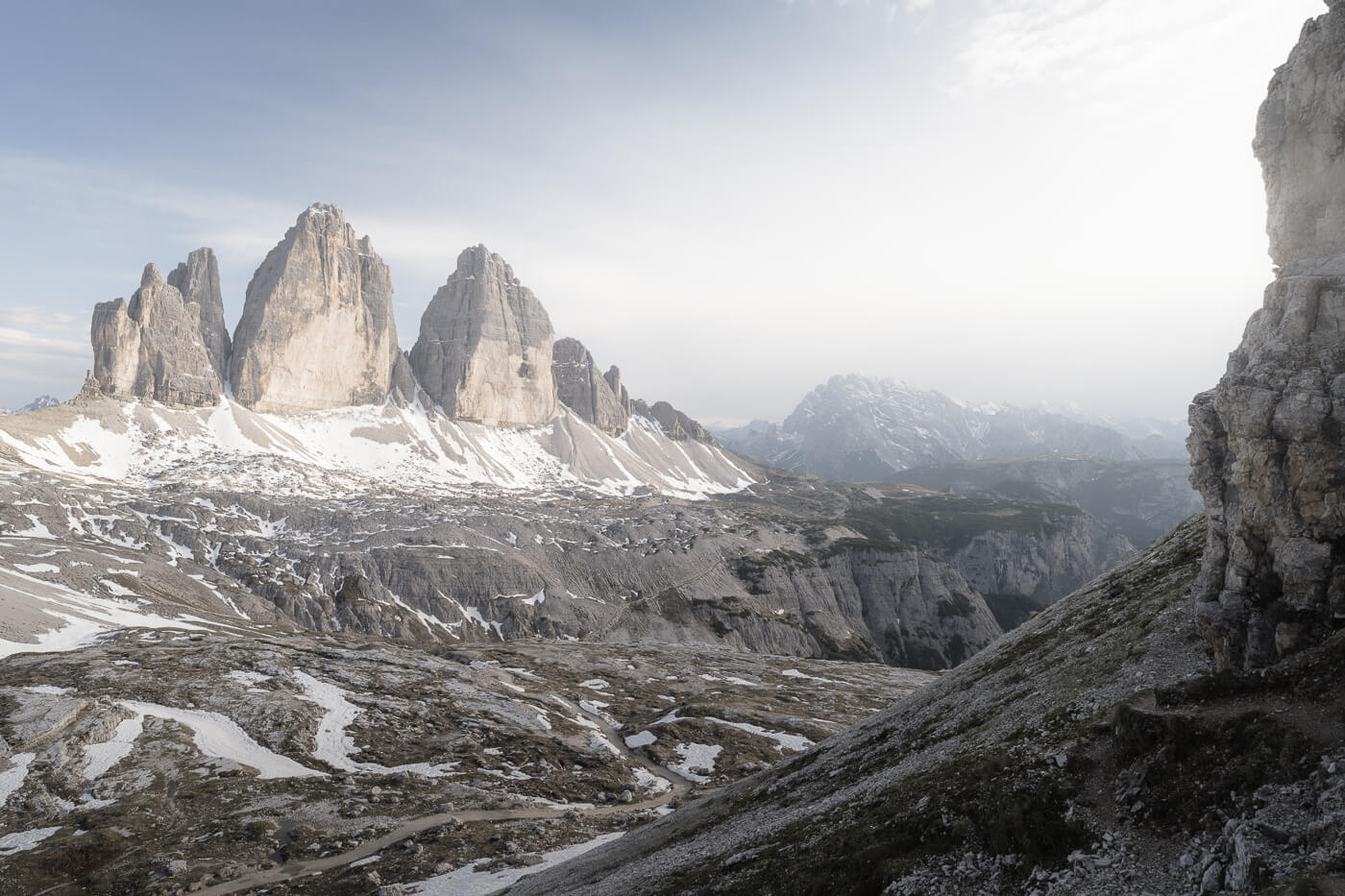
From the Rifugio, then onto the next stretch. This is the longest leg of the trail. Initially the trail heads downhill for quite a bit. That’s all elevation loss that you’ll have to recover shortly after. You also lose sight of the Tre Cime on this part of the trail, but you gain the views of several other mountain peaks around them.
The trail then continues on a more or less flattish stretch to the Malga Langalm, a hut that serves great food. However, if you are planning to have a bit of a drink there, bring cash. Not sure if this will change, but when I was there it was not possible to pay by card.
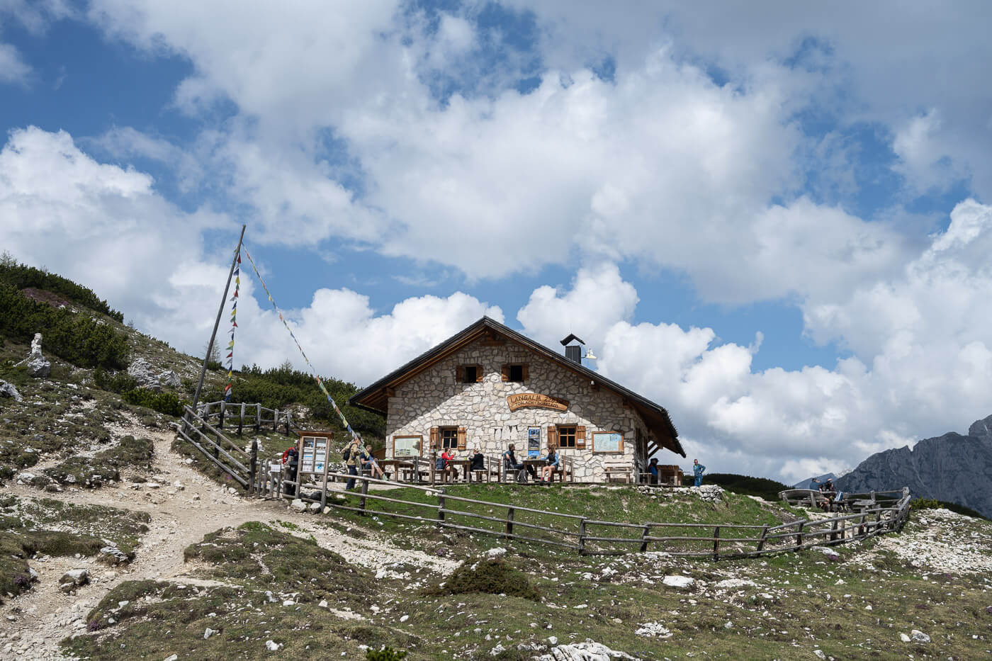
Malga Langalm.
View of Le Tre Cime approaching Forcella del Col de Mezzo
After the Malga Langalm, you’ll reach the other Forcella, Forcella del Col de Mezzo. From here the trail is mostly downhill again., and the views will open up toward the Lago d’Antorno and Lago di Misurina. Both will look like some sort of miniature from that distance.
Then it’s just a short walk downhill to return to the parking by Rifugio Auronzo.
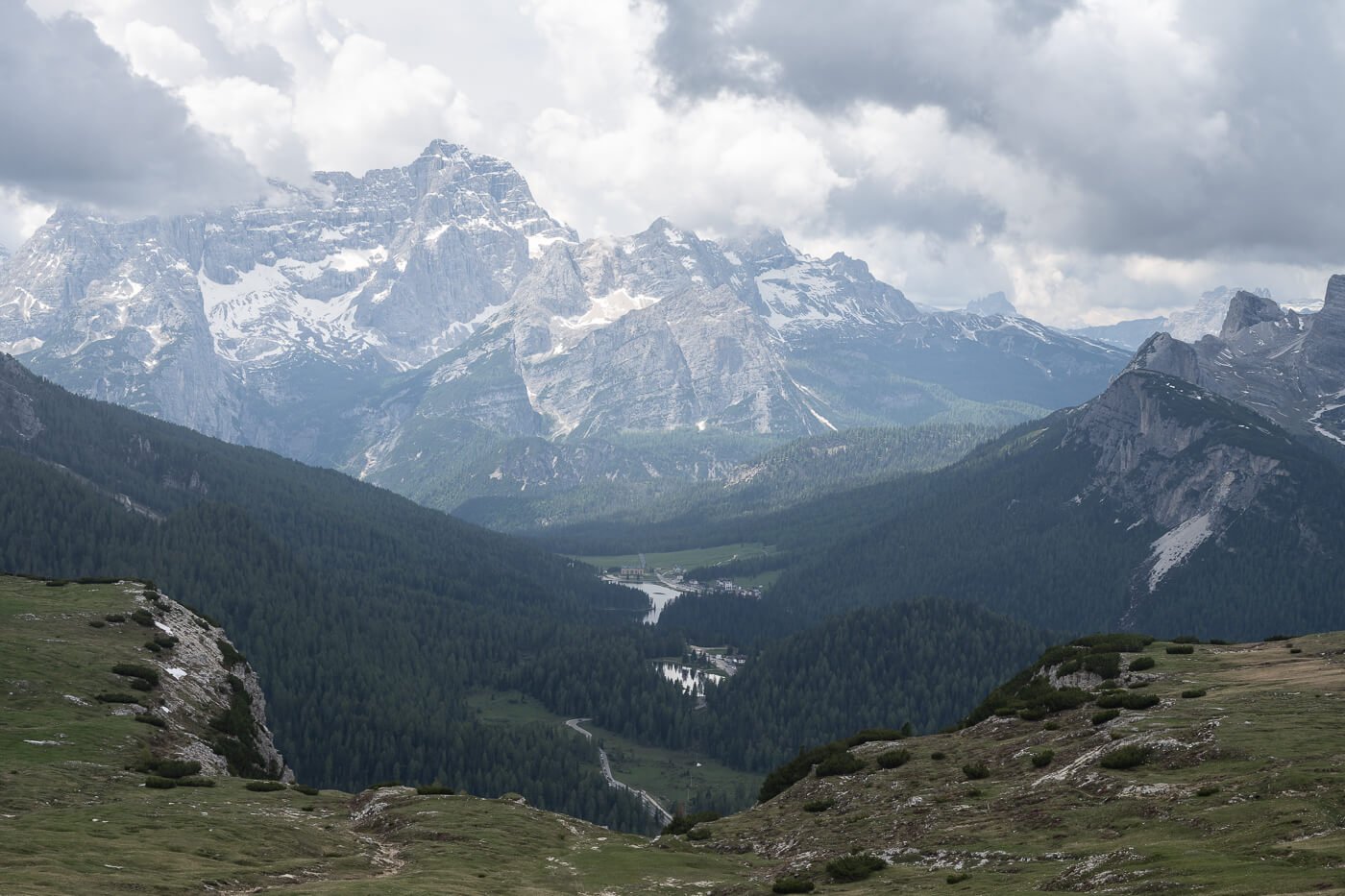
View of Lago d’Auronzo and Lago di Misurina way down in the valley below.
Tre Cime di Lavaredo Photography Tips
Typically the tre cime is good for Sunrise and Sunset. My personal preference is the sunset because that’s when the most scenic side of the Tre Cimes catches the last light of the day better.
But really, it’s a landscape photography paradise any time of the day, in any weather, except for the thick fog. In that case, it’s just like any other place immersed in thick fog, as you probably imagined.
Here is the list of the best viewpoints along this trail.
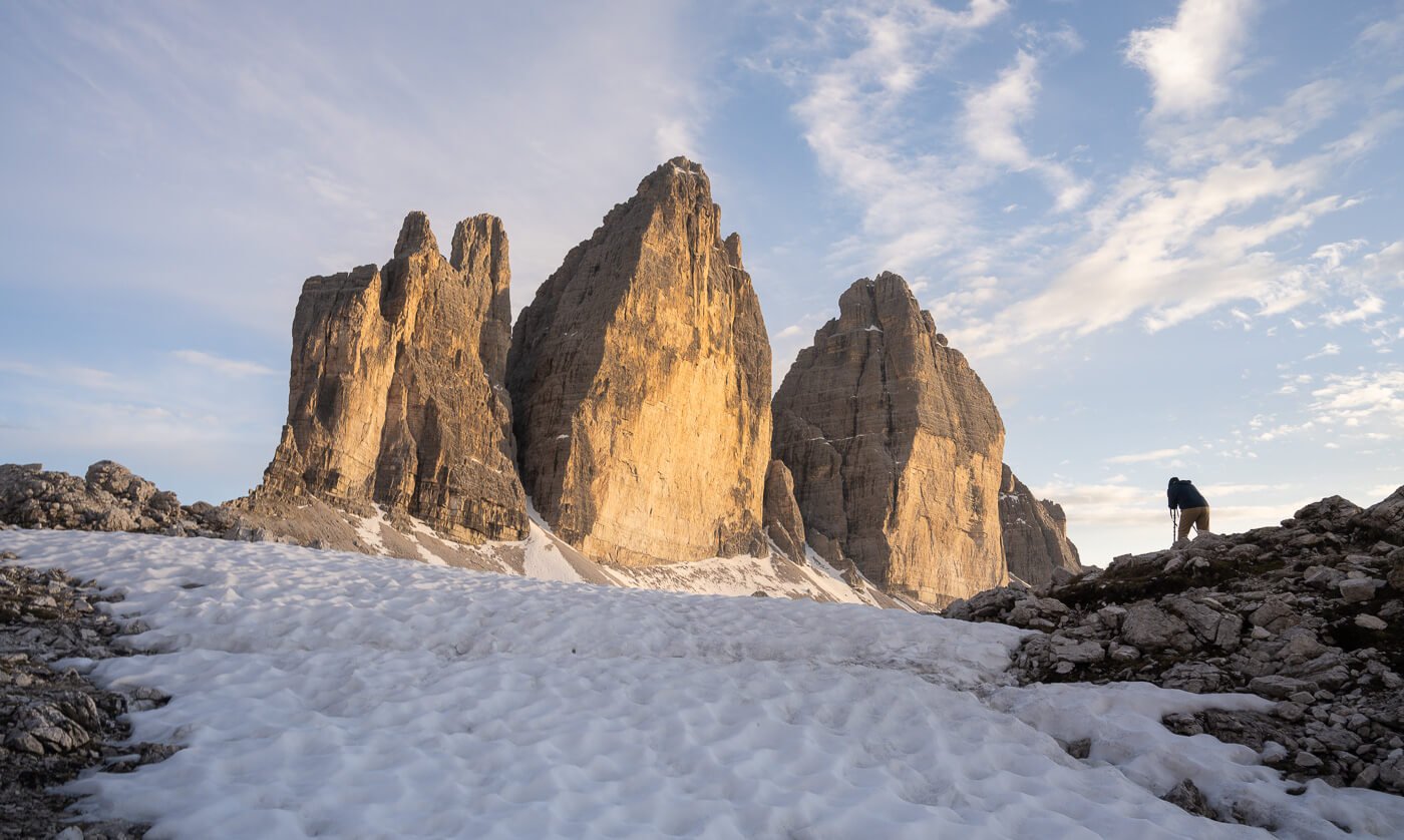
A photographer taking Photos of Le Tre Cime
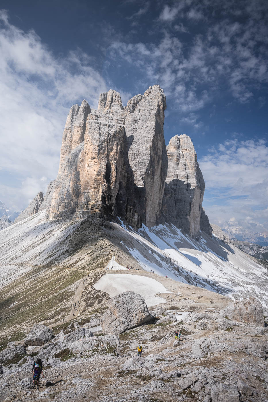
Forcella di Lavaredo
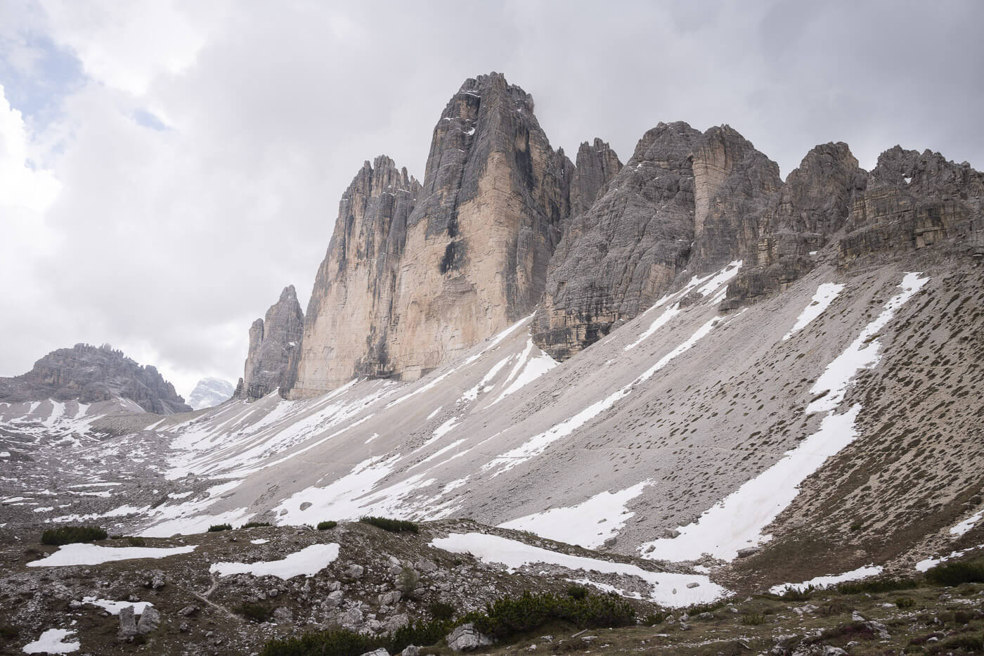
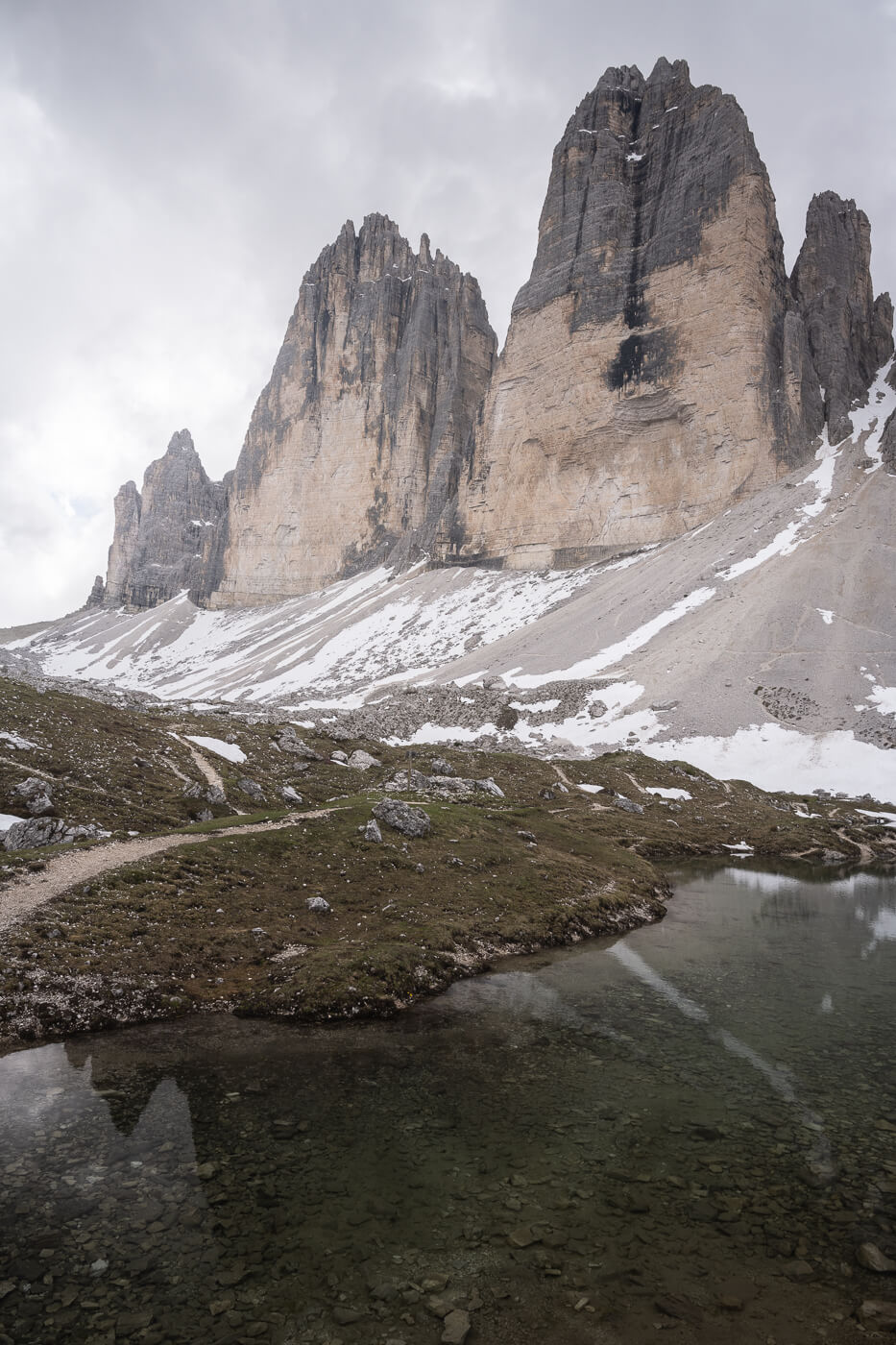
Forcella Lavaredo is the first viewpoint you would reach while hiking from Rifugio Auronzo. and one of The best. While the view of the Three Peaks is from their side, you can watch them emerging from the ground again a seemingly endless background of countless mountains.
Right below it toward Rifugio Locatelli, there is a vast expanse of scree. This is one of my favorite sports to view Le Tre Cime. the Cime are in stark contrast with the wide-open views around them, and this adds to their imposing size. Furthermore, this is one of the few places with a minimal view of the infrastructure in the area, and this makes this spot feel as if it’s an almost untouched environment.
Generally, The area around the Forcella Lavaredo and Rifugio Locatelli is the best to catch the sunset light and Alpenglow lighting the Tre Cime di Lavaredo.
When that happens, it’s as if the Cime shine their own light. You can almost feel their warmth, an experience that goes well beyond the purely photographic aspect.
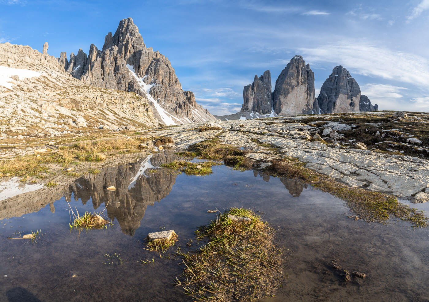
Rifugio Locatelli
Rifugio Locatelli is next in the same sense of travel. There are several great viewpoints and arguably the area around this Rifugio is the one that offers the most possibilities in terms of views, compositions, and Landmarks.

The Rifugio, of course, but also Monte Paterno, the small chapel, and the various ponds from where you can catch reflections are all great locations to catch the
Of all the spots around Le Tre Cime, this is the one that feels more like a “photographic playground”. You’ll likely find yourself running around wanting to shoot from all the best spots at the same time. You’ll notice other photographers doing the same.
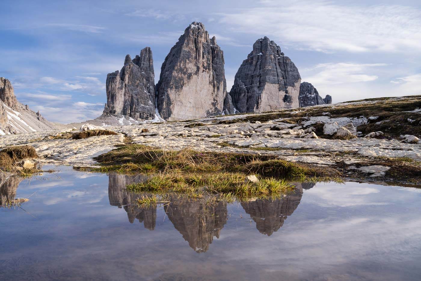
The pond, when filled with water, is located just below the Rifugio.
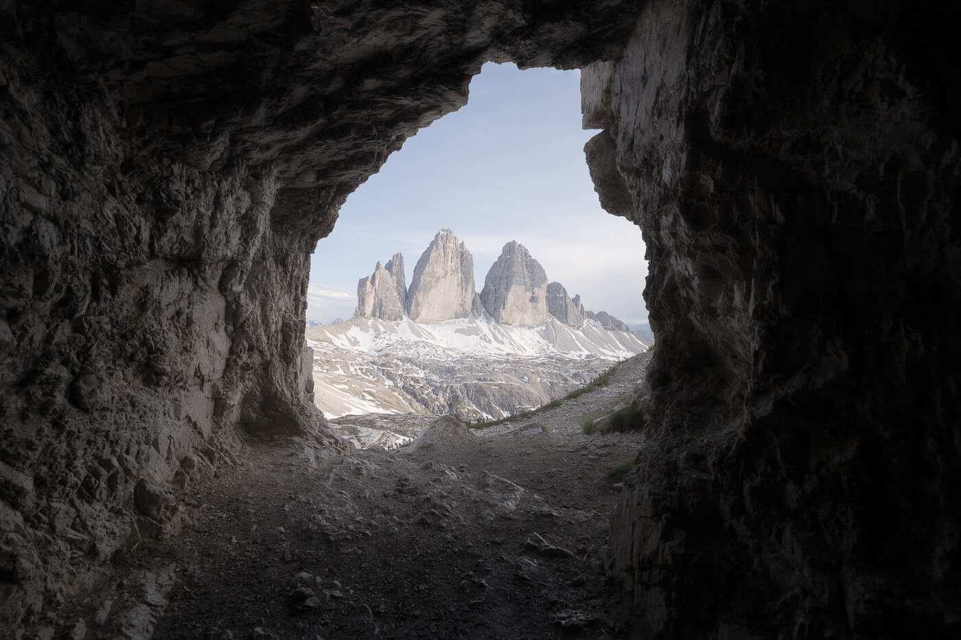
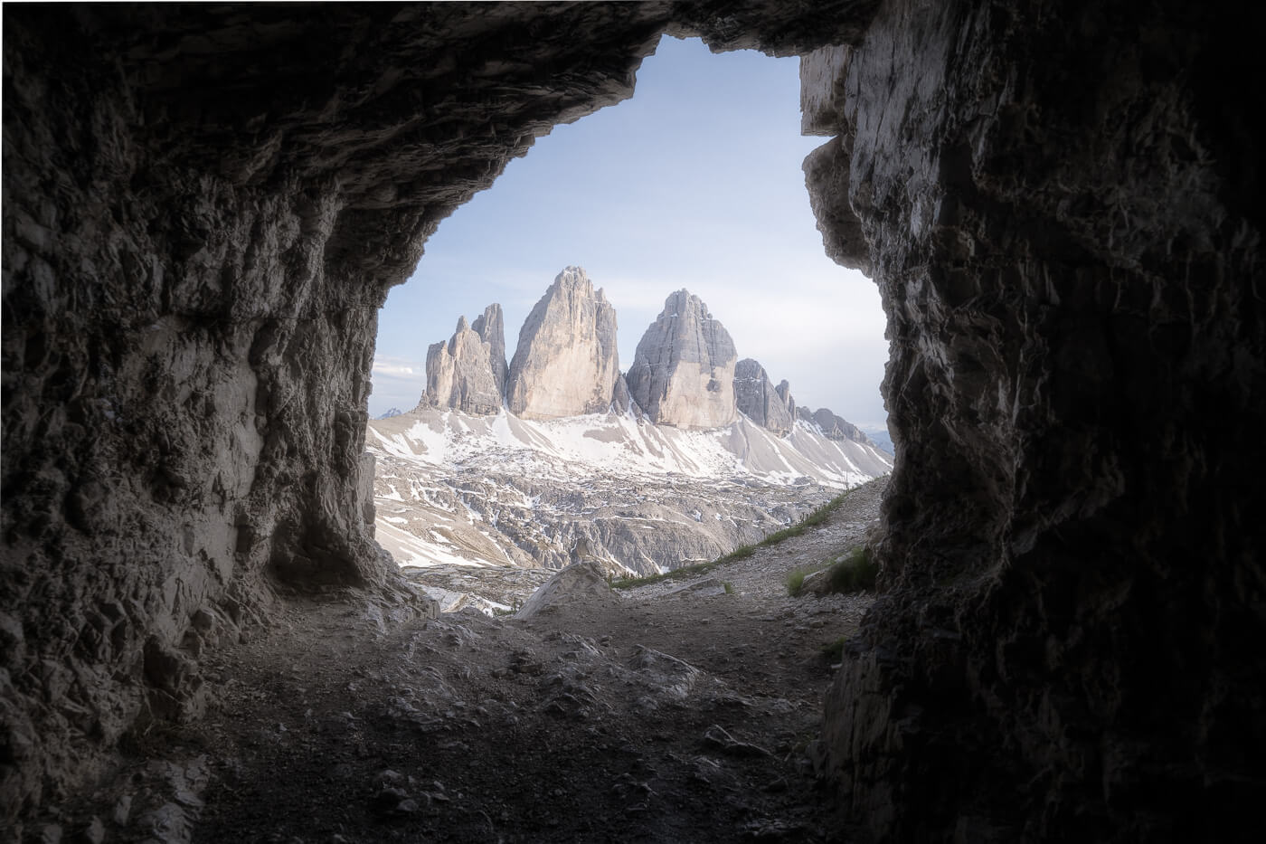
Tre Cime Caves
The caves are located just above Rifugio Locatelli. Very easy to find, ans you’ll sport them already after passing Forcella Lavaredo,
They are like small black holes on the side of the mountain from a distance. They stand out sorely, to be honest. War remnants, sadly.
However, nowadays the caves provide a unique compositional opportunity, where their entrance frames the Tre Cime. the view would be especially good at sunset when the Cime catch the last light of the day.
Other viewpoints
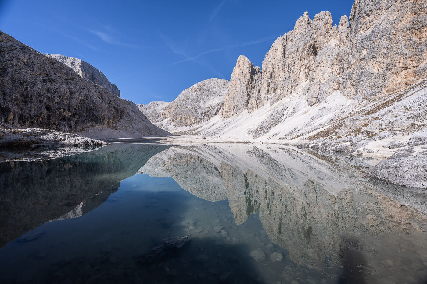
If you want a different point of view, try to hike up Sasso di Sesto, the mountain behind the Rifugio and above the cave. Also, there are some great views of the Tre Cime close to the Malga Langalm. At the Sorgenti Fiume Rienza or Rienzquelle, you can catch the Tre Cime reflecting in the small pond of the spring.
View of Le Tre Cime next to the Sorgenti del Fiume Rienza (Rienzquelle)
Where to stay
If you want to stay close to Le Tre Cime, you can choose Rifugio Auronzo, Rifugio Locatelli/Drei Zinnen Hutte, or Rifugio Lavaredo. Keep in mind that each is open only in the summer months. That usually means from the 20/21 of June. If you want to stay there, you’d need to book well in advance.
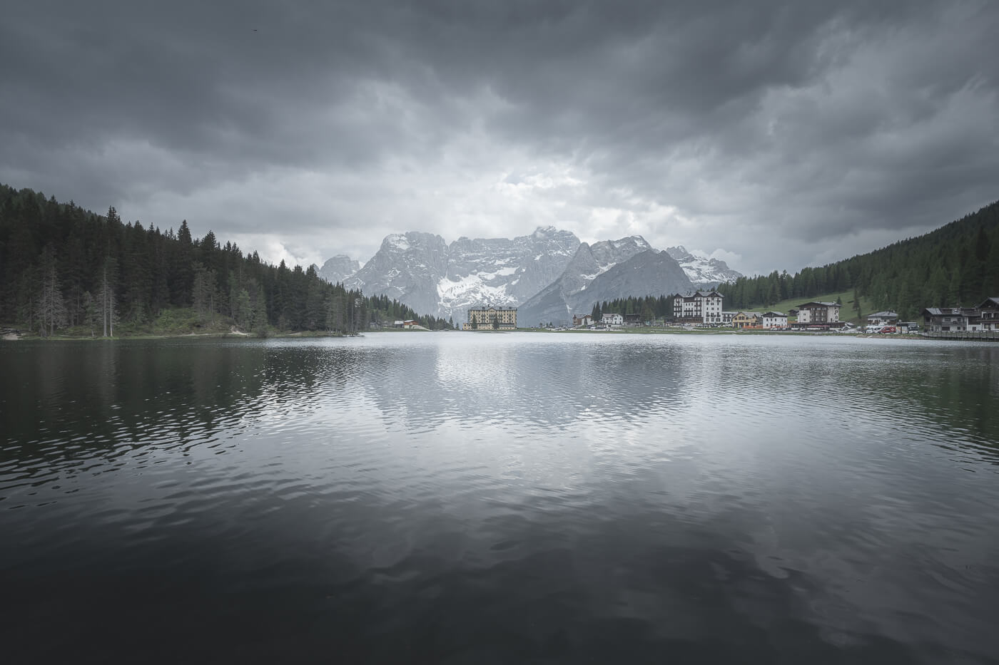
Other options include staying at Lago d’Antorno, another great spot for some photos, or Misurina.
If you are looking for a base to explore more of this area of the Dolomites, I’d recommend staying in Cortina d’Ampezzo.
Camping isn’t allowed because Le Tre Cime are in a national park.
Additional Resources
- Here’s my full guide to the best hikes and photo spots in the Dolomites, with tips on where to stay and when to go.
- Here’s the main page on Hiking in Italy for more hikes and scenic spots in Italy.
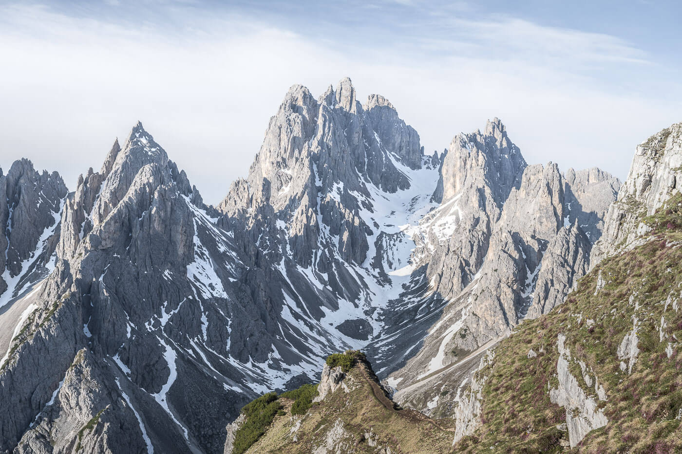
- If you are driving from Cortina, you may want to plan a stop at Lago d’Antorno and Lago di Misurina to view these two famous sports too. You can also visit the Cadini di Misurina viewpoint from there.

Very nice website, great pictures as well as descriptions. Thank’s👍🏻
Are travelling to Ortisei in the summer, looking forward to it.
Thanks, Hege. I’m glad you enjoyed the content. Enjoy Ortisei and the Dolomites!
Marco, you have provided Lots of GREAT information. I’m a San Francisco-based photographer planning a 10-day photo trip to various areas. Your information is invaluable in planning my trip. What does your crystal ball tell you if there will be water in the Baita Segantini reflection pond in late September? I’m planning to visit Tre Cime, Cadini di Misurina, Cinque Torri, Lago di Limedes, Baita Segatini, Paso Gia reflection, Alpe di Siusi, and Seceda. I will likely have to shorten the list. Thoughts?
Thanks Nick! The little Segantini Lake will be there. Limides may be the problematic one, but it’s easy to reach, so it is always worth a try. Nice list! I think it’s better to have a long one so you can add/swap places on your itinerary on the go.
You can do Le tre cime and Cadini on the same day. With Passo Giau, Le Cinque Torri, and Lago di Limides, you could hang around Cortina for 2-3 days as they’re all quite close. Same with Ortisei for Alpe di Siusi and Seceda. Baita Segantini is a bit farther away but reachable in about two hours from either Ortisei or Cortina.
Hi! Do you think it’s possible to hike tre cime around mid may?
It really depends on how much snow there is and on the weather. The road to Rifugio Auronzo usually opens around the second half of May, but if it’s closed you can still hike from Lago d’Antorno to Le tre cime.
Hello Marco. Yours us a very good website for the tre cime, full of information and advice.
We are two couples and shall be visiting the tre cime on 22nd September. My wife and I are 72 years old and not really in shape.
Can you suggest a short route where there isn’t a lot of uphill but still get hood views.
Thank you
Adrian.
HI Adrian,
Thanks, and of course! I’d recommend walking from Rifugio Auronzo to Forcella Lavaredo. You have some of the best views of Le Tre Cime from there. Also, good views of Cadini di Misurina on that trail. From The Parking lot next to Rifugio Auronzo, you can follow the loop trail counterclockwise, and you’ll reach Forcella Lavaredo in about 2.2km with a total elevation gain of 130m.
A quick note, since I am still updating the post; this year, they announced that parking at Rifugio Auronzo needs to be booked in advance: https://auronzo.info/en/parking-tre-cime-di-lavaredo/
Hello Marco, I’m planning a trip to Dolomites and your information is very helpful. I wonder if I want to take sunrise shot at Rifugio A.Locatelli, at what time should I start at trail head (Rifugio Auronzo). How long is the distance? Also, if is possible to take sunset photo at Rifugio A.Locatelli and walk back to Rifugio Auronzo safely? I stay at a hotel in Cortina d’Ampezzo. By the way, what photo spot do you think best for sunrise and what spot for sunset. Thank you!
Thanks! It’s almost five km from Rifugio Auronzo to Rifugio Locatelli, but it’s mostly on a gravel road, except for the last bit leading up to Rifugio Locatelli. No problem coming back after Sunset or doing it before Sunrise, just bring a headlamp and have a GPS track for safety. Both the area around Forcella Lavaredo (the saddle between the two Rifugi) and Rifugio Locatelli are great spots for Sunrise and Sunset.
Thank Marco! At what time should I start from Rifugio Auronzo to be in time for sunrise at Rifugio Locatelli? Best,
I’d start a couple of hours before sunrise, to be there before the sun rises.
Hi Marco, I was wondering when you did most of these Dolomites hikes? I am going to be there from June 17 to the 25th and was wondering if I will be encountering snow? Seems like you may have been there around the same time. Thanks!
Hi Justin,
Correct, it’s usually either mid June or late October for me. You will probably find patches of snow here and there on the highest trails, but it’s unlikely you’ll find anything that would prevent you from hiking.