Alta Canyon Hike – A Beautiful Canyon in the Arctic Tundra, Norway
If you are in Alta or its surroundings and are looking for hikes, the Alta Canyon hike should be high on your list. Also called Sautso, the Alta Canyon is likely the most scenic place you can hike to around Alta.
The dept of the canyon varies between 300 and 400 meters approximately – and it is more tha 12 KM long. Yes, it’s kind of huge.

Alta Canyon, view from the Rim
I’ll admit I did not know much about this location and it was a bit of an impromptu visit, due to bad weather in other areas of Norway. Though it’s a visit I’m really glad I did.
I didn’t know there could be such a stunning location in Finnmark. The Alta Cayon is one of Northern Europe’s biggest ravines. It’s kind of a hidden gem still, and I guess its remoteness may explain why. But to some – and surely to me – the relative remoteness is a plus.

View of the Altaelva River from the Canyon rim.
Anyway, the hike is through a flat arctic tundra, so it’s not a mountain hike. Still, the tundra and its open vastness do offer a unique experience.
Table of Contents
Overview of the Alta Canyon Hike & Map
As mentioned above the trail is mostly flat and actually the canyon is at a lower elevation point than the trailhead. The hike is mostly through the Arctic Tundra.

Infoboard by the Trailhead
There is an info board at the trailhead, and it’s worth stopping to read it to have some extra info about the Canyon and the trail, i.e., the two river crossings.
The trail is also marked, with pink-colored trail marks, mostly painted on stones along the way.
| Max Altitude | 472 m |
|---|---|
| Distance | 13.4 KM |
| Elevation gain | 370m ↑ / 370m ↓ |
| Hike time | 03:00/ 04:00 Hours |
| Hike Difficulty | Moderate |
Here is the map of the hike to the Alta Canyon. You can download
How to get to the Alta Canyon (Sautso) trailhead and Parking
The Alta Canyon trailhead is accessible on a short drive from Alta. It’s doable as a day hike from there. Or, if you are traveling along the E6, you can add this hike to your itinerary.
There is a paved, bigger parking area close to the Gargia Hut, but there also is a small parking area a few KM uphill. The road to the upper parking area is a rather narrow dirt road. It’s doable with a 2WD and, if you have experience with country-side dirt road driving, the road is not an issue.
Do note that Google Maps won’t get you to the upper parking area. Once you leave the paved road, it’s a leap of faith :)!
- Driving Directions: From Road E6, in Alta, whether you are coming from North or South, Turn onto Road 45, then turn into Gargiaveien and follow it until Gargia, at the end of the paved road. The drive from Alta to Gargia takes about 30 minutes.
- Parking: bigger vehicles, i.e. campers will have to park where the paved road ends in Gargia. I drove up the road with a Renault traffic van and, with due caution, the road was ok to drive. The upper parking area is here. Parking is free.
- Public Transport: there is a bus stop in Gargia, which is where the trailhead is. For the timetable check snelandia.no.

Upper parking area, at the end of the mountain road.
The Alta Canyon Hiking Trail
The canyon is at the lowest point of the trail and for the most part, the trail is rather flat with a few gentle uphill and downhill gradients here and there.
At the beginning part of the trail goes through some very boggy areas and, in the worst sections, there are boardwalks or just simply boards thrown there to help with the crossings.

The seemingly endless landscape around the trail.

Cairn with Trail Marker on the trail to the Canyon
There also are two small river crossings. when I did this hike in late September, both were doable, jumping from rock to rock. However, water levels will likely be higher early in the season or after rainfall, so wading may be required.
After about an hour and a half, you will reach the end of the trail, marked by a picnic table, a logbook, and a bonfire place. You can see the Canyon’s rim from there, though not the canyon itself. However, the viewpoints are just a short walk away now.

As you approach the Canyon, you can see both rims

Logbook at the end of the trail, close to the Canyon viewpoint.

From the board, you need to keep hiking downhill to reach the rim and the landscape will gradually open up.

The western part of the Canyon will soon come into view
The last part of the hike is a steep, short, downhill section leading to the canyon’s rim. So that you know, the canyon viewpoints are small and completely exposed. Approach with caution.
The viewpoints are somewhat limited, too, with one looking west and one looking east. The views are fantastic in both directions. with the upstream one providing a better view of the meandering Altaelva River down below.
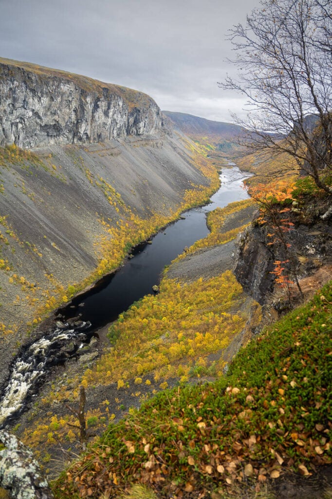
Main viewpoint toward the East.
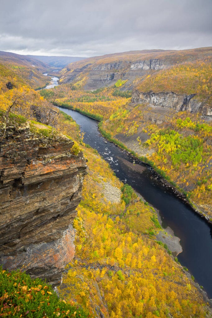
Viewpoint toward the West

Alta Canyon


Alta Canyon Photos and Photography Tips
The canyon does offer limited viewpoints, so that also means limited options for composition. There is just so much usable space without falling off the cliff. However, there is room to play around with different foregrounds safely. Plenty of trees, branches, or bushes to try and add depth or perspective to the image.
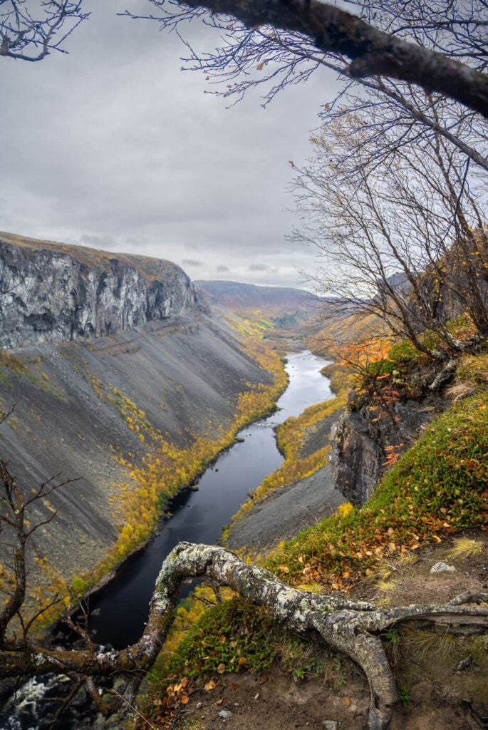


I was a rather gloomy day when I visited, which worked fine, especially because it was autumn and had good colors. Though If you can visit this with some good sidelight, I’d imagine the views would be pretty epic.
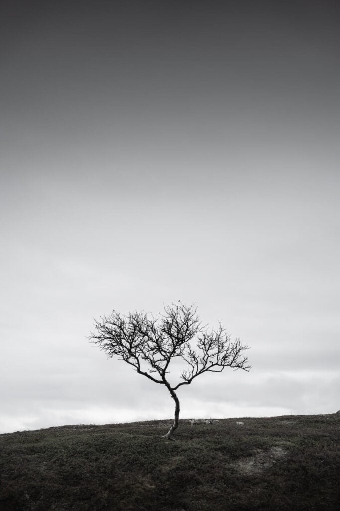
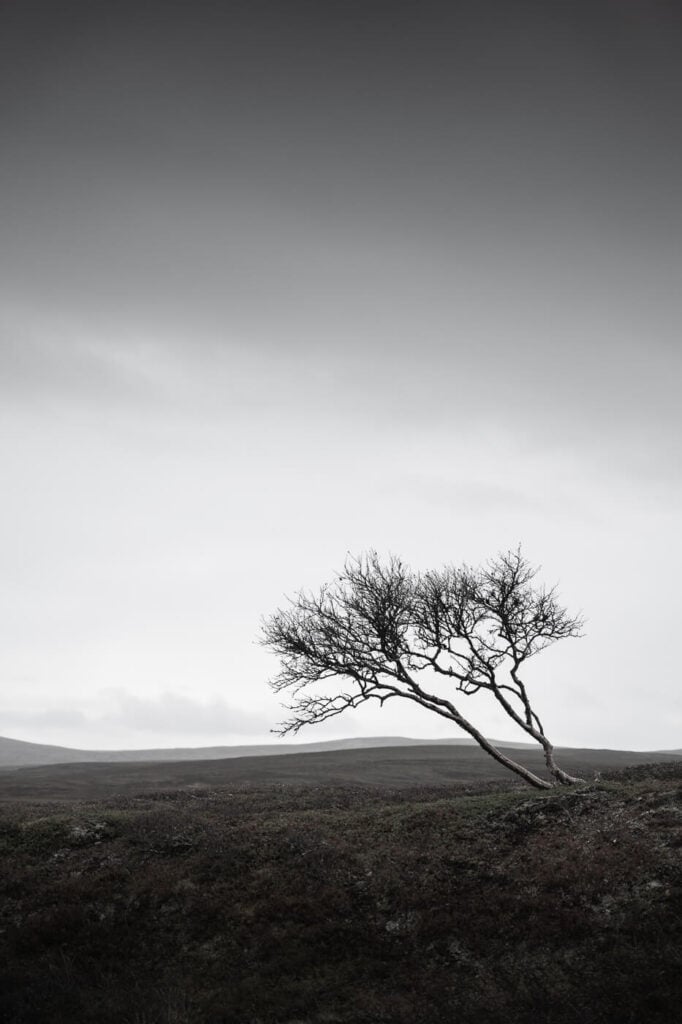
One other thing I really liked and enjoyed shooting on this trail is the dwarf birch trees you’ll come across on the trail. I probably spend more time taking photos of trees and trying to find the best angles in the vast tundra than at the Canyon.
I somewhat really enjoyed the minimalistic composition of those little, leafless trees emerging from the endless vastness of the tundra-like screams.

Where to stay
Although there are no places to stay in the immediate vicinities of the canyon, there are a few guesthouses where the paved road ends. Those are good places to stay if you are looking for a quiet place in nature. Especially the Gargia mountain lodge, which is right by the trailhead and close to another hiking trail I’d recommend, Orvvosfossen – a beautiful waterfall.
Otherwise, plenty of stays are available in and Around Alta.
Additional Resources
- This is also a popular bike trail so if you are traveling with one you can also ride your bike here.
- Check out the main page on Hiking in Norway (with Maps) to discover more beautiful hikes and locations.


Leave A Comment