Hiking to the 2023 Fagradalsfjall Volcano Eruption, Litli-Hrútur
Yet another eruption; the Fagradalsfjall Volcano is erupting again in 2023 for the third year in a row – this also means more hiking on the way, since the new location is even farther than the two previous eruptions.
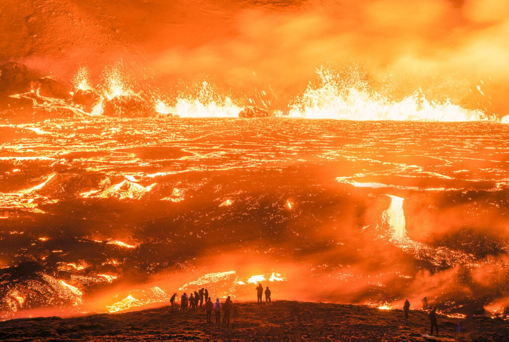
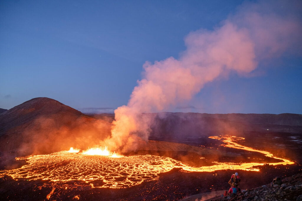
Archive image of the 2022 eruption.
If you could not make it to the previous two eruptions in the Reykjanes peninsula, this is maybe another chance to see an erupting volcano.
After the first 24 hours after the start of the eruption, the site was opened to the public; there is an official path to a new viewpoint, Path E (Meradalaleið, initially called Path D) to Hraunselsvatnsfell, which is a small mountain overlooking the site of the eruption.
Going to Iceland? Get a Car Rental Discount!
As a reader of The Photo Hikes, you get a 5% discount on your car rental when booking with Blue Car Rental through this website. The discount will be automatically applied to the booking through the following link
Many also hike Path A, but as we’ll see later, you cannot see the eruption from there without entering the hazard zone, which is technically prohibited.
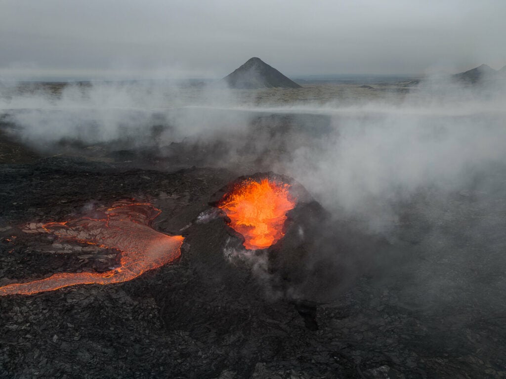
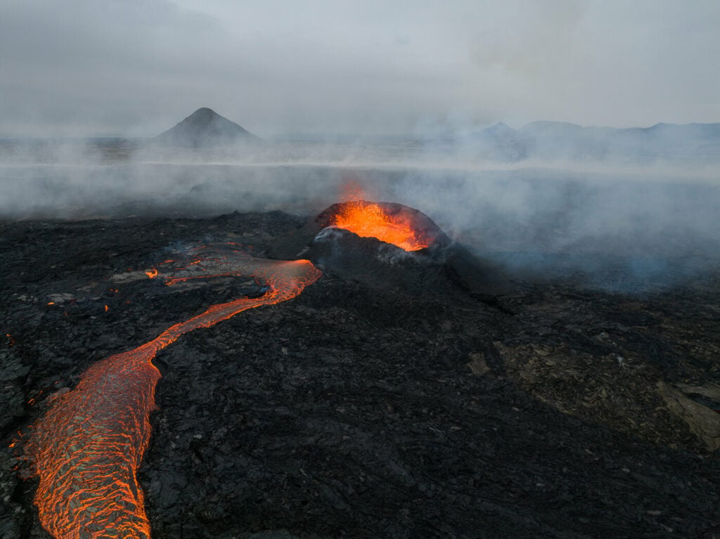
Drone Shot of the 2023 Litli-Hrútur Eruption
Keep in mind however that while the trail is now open, it could be closed with little to no notice if the conditions require it. For instance, it was closed again after a couple of days, only to reopen on Monday the 17th of August.
Also, from July 22nd, the trails will be open only until 6 pm, this usually means you can get in until 6 pm, but you may be asked to leave the area. It happened to me as I was asked to leave at 8 pm.
The site usually reopens at 9 am the following day and a police car will be guarding the entrance of the parking lots during closures.
Update: please note the eruption has ended. While there no longer are restrictions on the opening hours, the hazard zone is still in place.
Safety measures for the 2023 Fagradalsfjall eruption
If you are going to the eruption, safety comes first. Yes, it’s a once-in-a-lifetime opportunity, but it still is a natural disaster. Take great care out there. Hiking to the 2023 Fagradalsfjall Volcano Eruption is no walk in the park.
I saw quite a few people fall and get injured at both the 2021 and 2022 eruptions. The terrain there can be difficult, and do not enter the danger zone (you will see signs from the police).
Also, there are a few potentially hazardous things to be aware of:
- Toxic gasses, which can accumulate in lower areas, especially in low winds
- New fissures potentially opening
- The possibility of rockfalls due to the recent, strong earthquakes.
- Cool, hardened lava may suddenly break and release fast-flowing lava.
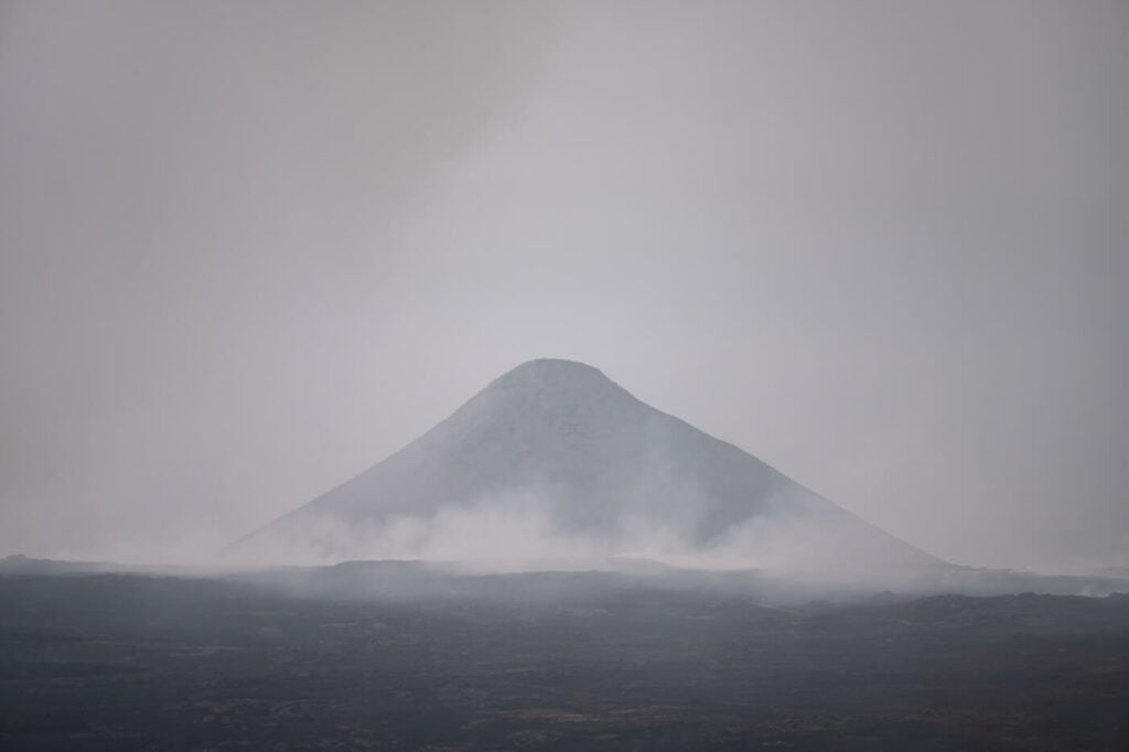
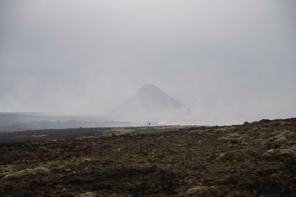
Smoke from Wildfires and Gases in the Hazard zone of the Eruption. The Mountain is Keilir.
Be sure to check the gas dispersion forecast. It goes without saying, hopefully, do not walk on fresh lava!
Also, since the eruption is in its very early stages, new fissures may open up, potentially trapping people in between. So although the eruption site is now open, it does not mean it is entirely safe to be there. So watch out and stay Safe.
Lastly, just use common sense and you will have a blast!
Path E and A: Hiking Trail and Map to the 2023 Fagradalsfjall Volcano Eruption by Litli-Hrútur
This time the eruption happened by Litli-Hrútur, a 312m high hill north of the previous eruption in Meradalir.
As mentioned above, an official path has now been opened, Path E leading to a viewpoint above the eruption, Hraunselsvatnsfell. The closest Parking is P2, and this is the only official and safest trail to view the eruption.
There are no trails to the new eruption from either the original Path A or Path B. You may have seen people standing on Litli-Hrútur on the webcam, but that is actually in the middle of the Hazard zone and not actually allowed to get there. Respect that, please :)
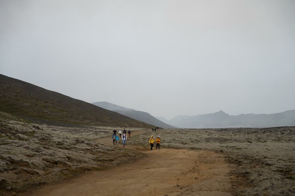
Back to the trail; Before setting out, remember this is a very long hike. At almost 18km for the roundtrip, it will take experienced hikers 5/6 hours to complete. Although the trail is mostly flat the ground is not the easiest to walk on. Lots of rocks, sandy and slippery terrain.
Make sure you can safely complete the hike before heading out. You should probably plan to stay out 6/7 hours in most cases.

Hikers checking the map of the eruption site
Litli-Hrútur: Path E Hike from Parking P2 to Hraunselsvatnsfell
The official option from P2 partly follows a dirt track that was used by the local authorities and SAR teams to get to the previous eruption site. Parking costs 1000 ISK per car. You can pay with the Parka App.
Here’s the full map to the Trail E viewpoint from P2. This is from my hike. It took me almost 5 hours but I did the hike at a rather sustained pace and only spent a little time there due to the smoke and gasses.
Feel free to download the GPX file from the activity below. Here you can also see where each photo was taken. Please note that some are drone shots.
The trail is a little longer than the previous one at almost 18km roundtrip. It is entirely flat, but you have the option to get to a small hill overlooking the eruption and the lava field. I also recorded a video of the hike, here it is if you prefer to see that
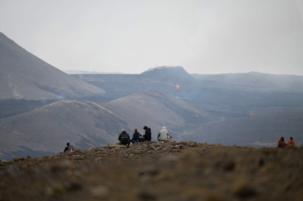
The viewpoint of the Litli-Hrútur eruption.
The trail then leaves the dirt road to go through a burn lava field and this is not the easiest going.
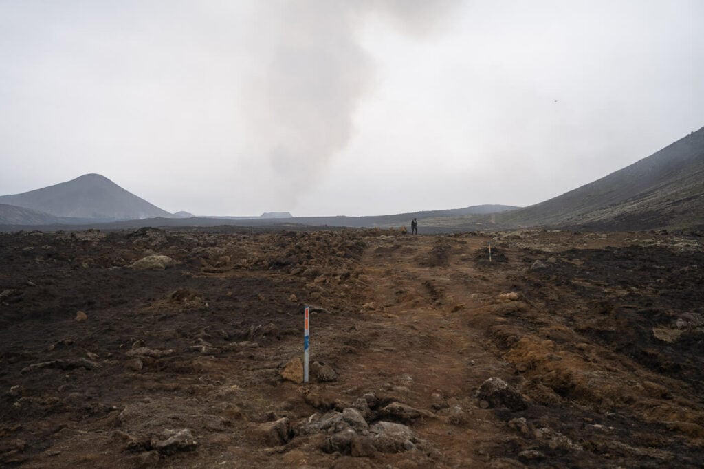
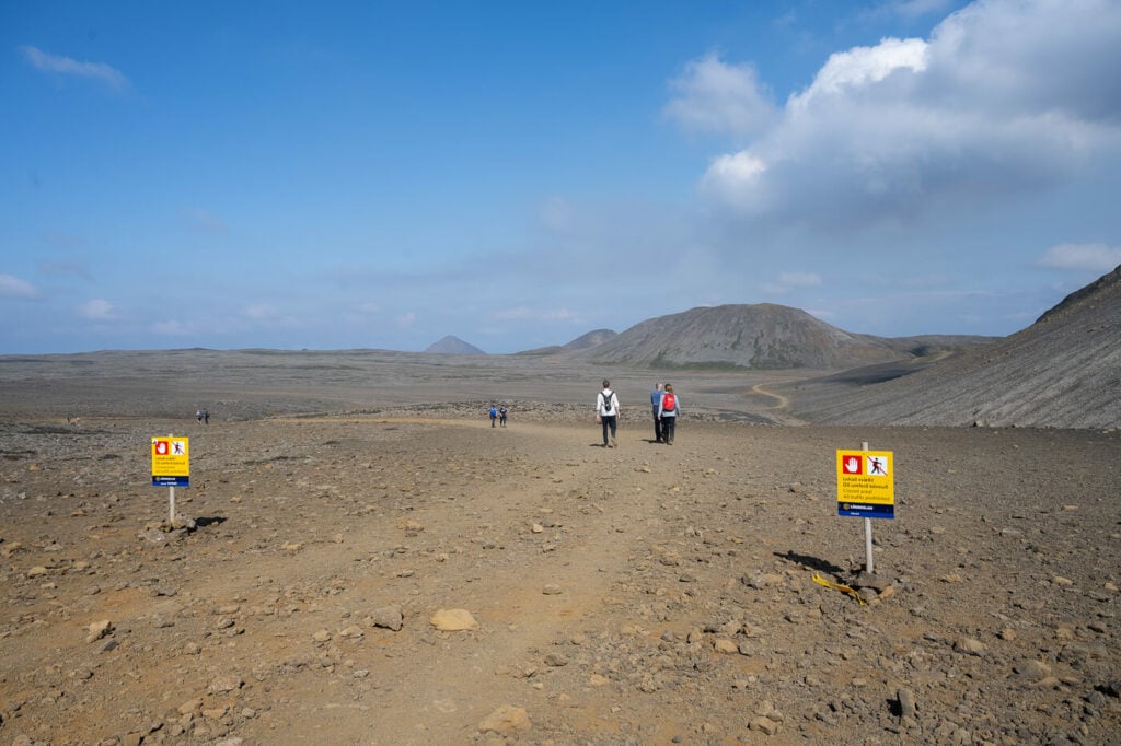
Trail E is marked with blue trail marks.
The Eruption Volcano from Trail E.
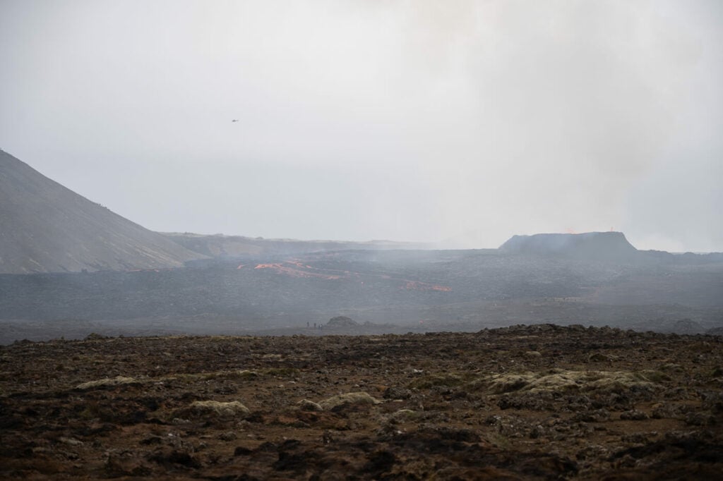
You will then reach a point marked by the No entry-hazard zone signs. the trail ends there, with a view of the current active vent of the eruption.

View of the erupting Volcano from the Trail E endpoint. 200mm shot.
Again, before setting out check the latest news and trail conditions on the Visit Reykjanes Website. and on safetravel.is. The trail may be closed or be changed with little to no notice and always follow ICE-SAR recommendations.
Litli-Hrútur: Path A Hike from Parking P1
As mentioned in the introduction, It is technically possible to reach the eruption site via Path A. The VisitReykjanes website also advertises this option, saying Path A can also be hiked to the eruption site. It is more difficult.
With this information, I also hike Path A, assuming that if the local tourist board advertises this path too, I would be able to get to the eruption site without entering the hazard zone. Wrong.
If you hike path A, you will enter the marked hazard zone at the 2022 eruption site, Meradalir. From there, it’s another 2.5 km to get a view of the Volcano.
Entering the hazard zone of the Fagradalsfjall 2023 eruption. no view of the volcano yet.
So the situation is a bit misleading, with the tourist board advertising Path A as a viable option for the eruption site, while you need to enter the Hazard zone to see the volcano. Which, again, is technically closed to all traffic. As you can see the Path is much longer and much more difficult compared to Path E. Please note: I am not recommending entering the Hazard zone, I am just reporting what I observed on the field after having read Path A was an option too.
Fagradalfjall Volcano Tours & Helicopter Tours
If you prefer to get a private guide, join a tour, or even book a flyover by helicopter, there are several activities available to choose from, on either Get Your Guide or Viator.
Given the opportunity, a volcano helicopter flyover would be a dream activity and a great occasion to take some unique photos.
Drone Shot.
Photos and Photography Tips of the 2023 Fagradalsfjall Volcano Eruption by Litli-Hrútur.
Since it is not possible to get too close to the volcano for obvious reasons, you will definitely need a telephoto lens. My focal range goes up to 200mm, 300mm would probably be ideal.
Drones help though. It is possible to fly drones here but make sure there are no helicopters or small planes around. In any case best to fly as low as possible, to be on the safe side. Most of my drone shots were taken at an altitude of 40 to 80 meters.
The ideal time of the day provided the trail is open, would be between the golden hour to the blue hour. So from one hour before sunset to one hour after. This is when the lava is the most visible and glows best. Unfortunately, this is no longer possible since will be closing at 6 pm. Later in the year perhaps, when the sun sets earlier, if the eruption will still be going on.
Also, there will be plenty of great subjects and scenes to photograph; it is as close to a post-apocalyptic location as it can get!
Drone Shot of the 2023 Litli-Hrútur Eruption
Drone Shot
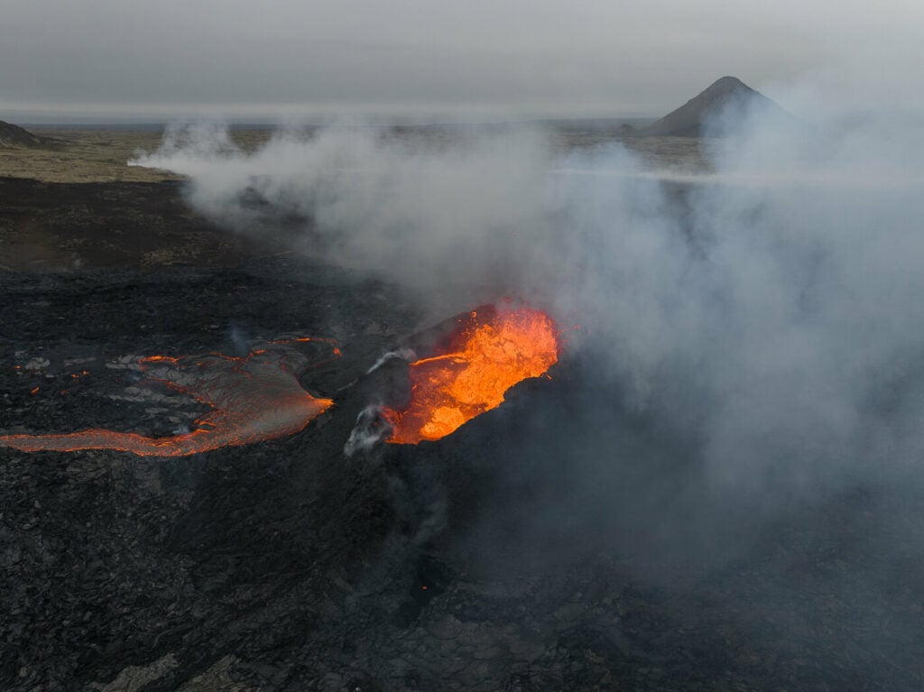
The Active vent with Keilir in the background
View of the erupting Volcano from the Trail E endpoint.
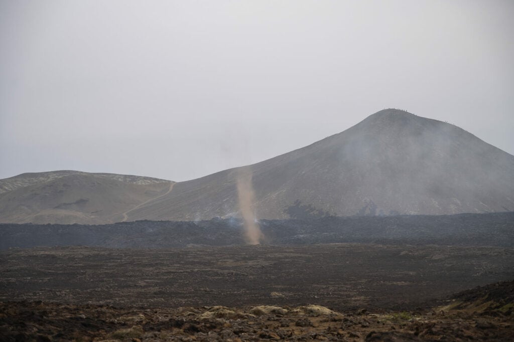
Dust Devil on the lava filed.
Hiker in the hazard zone. Don’t!
The beautiful Mt. Keilir.
Essentials Tips for the Hike to the Eruption by Litli-Hrútur
Last but not least, here are a few, essential additional safety tips:
- Always check whether the hiking trails are open to the public before heading there. Authorities will occasionally close the trails due to bad weather or maintenance/improvements to the existing trails.
- Listen to the local authorities and SAR’s advice. The SAR team has been doing an amazing job at keeping people safe and helping those who needed. Listen to them.
- Check the Gas dispersion forecast and the weather forecast before heading out. Avoid the area if the wind is blowing gases onto the trail or if bad weather is forecasted during the time you plan to visit. The Gas dispersion forecast can be checked here and the weather forecast here.
- Wear proper hiking gear, sturdy boots and use hiking poles. The trail goes over rugged terrain and is steep and slippery in places. Especially if it’s been raining.
- Bring a headlamp, especially if you go there late in the afternoon. Time will fly while watching the eruption and days are getting shorter and shorter. At this latitude, they also get shorter much faster.
- Bring a battery pack for your mobile. You will probably spend 6/7 hours out at the eruption, taking a lot of photos and videos and your battery is probably going to drain quickly. Always make sure to have a charged mobile and battery pack with you.
- Bring layers of warm clothes, gloves, and a beanie. While the fresh lava provides some heat from afar, it is cold, and with the Windchill, it’s even colder.
- Take more than enough water and food with you. You will want to refuel during the hike. Time will fly by watching the eruption.
- Do not walk or try to step on the Lava! This may sound obvious, but it is not, sadly. This also applies to the lava from the 2021 and 2022 Eruptions. the older Laval fields can still release toxic gasses and may collapse.
Lava flowing – the blue hour is the best time of the day to watch it. Archive shot from the 2022 Eruption.
Where to find updated information on the 2023 Fagradalsfjall Eruption
In any case, information on Hiking to the 2023 Fagradalsfjall Volcano Eruption is going to get outdated quickly. Make sure to check the latest updates on the following websites in case you are not familiar with them already:
- Safetravel.is
- Visit Reykjanes website here.
- The best webcam of the 202 Fagradalsfjall eruption. Litli-Hrútur towards the North.
Additional Resources
- Read my previous 2022 Fagradalsfjall eruption report.
- Check out my main page on Hiking and in Iceland for more hiking tips while you wait for the eruption site to open.
- If you want to say thanks to the amazing Björgunarsveitin Þorbjörn SAR team, you could consider donating to them too. They are all volunteers and are there to keep you safe.
Car rentals
- Cars: I can recommend Blue Car Rental, which is the largest Car rental company in Iceland, and for good reasons. The price includes Free Cancellation, Unlimited mileage, 24-hour breakdown assistance, SCDW, CDW, TP, and GP insurance, and more. Blue Car Rental is also located within walking distance of the Keflavik Airport, so you can be on your way to explore Iceland right away. I’ve always been happy with my rentals there, which is why I’m happy to recommend their services here on my blog. if you book through The Photo Hikes, you also get a 5% discount for all bookings made in July and August 2023!
- Camper Vans: CampEasy. With CampEasy, you can rent 2WD or 4×4 campers alike. If you prefer an off-the-grid vacation, they offer both 2wd and 4×4 campers suitable for most Highland roads.


Hello Marco.
Thank you for tour información. It is very good and very interesting.
I want to go there next Wednesday from Spain but it is possible that the official path is closed because the toxic fume.
I wonder if it is possible the access to the eruption zone from the north, using the KEILIR path.
I hope I can maintain a conversation with you, because you are an expert and I’m a volcano and hiking lover.
Regards
Thank you.
Hi Ramon,
Thanks! That would not be possible either; the road to Keilir has been closed as it is very narrow and in very bad conditions, unsuitable to take a large amount of traffic. There is also the risk of new fissures opening up from that side, since the magma tunnel extends all the way to Keilir.
So the only safe option would be Pat D from south when it reopens. They will reassess if it can be reopened tomorrow morning (July the 15th). I’ll be there soon too, so hopefully, it will be open again by next Wednesday!
Hi Marco.
Thanks for your quick response. As I am sure you know, the police have closed the area again until, at least, tomorrow, the 16th.
I have been analyzing the map of toxic gases as well as the weather forecast for the next few days, and it seems that the wind will continue from the north at least until the Thursday, from what I understand the secure area Will be closed several days.
I had planned to go to the volcano on Wednesday, but I think that the area is most likely closed.
What do you think about this topic?
Hi Ramon,
Yes, hard to tell exactly when it will be open again as it depends on a lot of factors. My gut feeling is sometime this week, maybe even today or tomorrow.
It seems the firefighters managed to contain the wildfires and burning moss, so if there aren’t strong winds blowing volcanic gasses directly on the trail, then I don’t see why it should not be opened again.
Hope you can make it there – while it is still a natural disaster, being able to enjoy this show safely really is an amazing experience.
P.d…. I come from Spain and It is not easy for me to travel (and expensive). This is the reason I should be sure that the possibility for visiting the volcano is high.
Hi Marco,
thank you för your wonderful work!
I’m a true vulcanofan and am planning a trip to Iceland and the new eruption. I have a question to which I can’t fina an answer. My wife is afraid of hights and is therefore not my ideal hikingpartner, yet, I’d like to experience the site with her. It seems like trial E is mainly on “flat ground ” following the valleys, can you confirm that?
Regards, Malin
Hi Malin,
Thanks! I just saw it too. From what I gather it’s the same path just renamed from D to E. Path D is now the one going to one of the viewpoints of the 2021 eruption, Stóri-Hrútur.
Also, Path E indeed appears to be mostly flat and ends below Hraunssels-Vatnsfell, while the trail I plotted goes up its slopes.
Anyway, I will be there on Saturday and I will then upload my own gps track and a short video of the trail too. If you check back on Sunday or Monday at the latest, I should have both up so you can check the altitude profile of the GPS track and some views from the video.
Hi Malin,
Just to confirm, the trail is pretty much flat. There are a couple of hills you can get up to, which I did, but that is not really needed to view the eruption. I have uploaded my own GPX track if you want to check the elevation profile. Cheers.
Hi Marco,
In terms of how close you get to the actual eruption in the end, is the hike worth it? If you are not going there with a sophisticated camera or a drone, but just to experience it first hand, is it worth the 2 hours hike (4 I supose, if you count return)? Of course we’re not going into the danger zone, but outside it, how close are you? Is any lava visible, any vents etc?
Thank you
Hi Maria,
The main vent is about 1/1.5 km away from the closest viewpoint on Path E. You can see it clearly, even if it is rather far. You cannot look into the main vent directly, but you can see the lava spewing out. Also some of the lava flowing in the distance.
This is essentially what you would see form there: https://thephotohikes.com/wp-content/uploads/2023/07/Fagradalsfjal-Volcano-hike-2023-8.jpg
And this is what I think was the best viewpoint: https://thephotohikes.com/wp-content/uploads/2023/07/Fagradalsfjal-Volcano-hike-2023-5.jpg (a little further back on the top of a small hill, marked on the linked Komoot activity.
However, I will say that it is not as good as the first two eruptions. Still, I personally think it’s still worth experiencing. I definitely enjoyed it and if I can I will hike there again. It’s a “living” landscape and may be totally different in a couple of weeks.
Hi Marco.
You mentioned there’s a spot up a hill where you can take some photos. How far away is that from the beginning of the trail? Thanks!
Hi Carlo,
Yes, it’s the spot in the photo where there are some people sitting and watching the eruption. That’s about 6.5km into the hike.
Hi Marco,
I would like to ask you, the official website announces that the opening time is 9:00 a.m.
Does that mean that the earliest boarding time is after 9:00 a.m.?
Thank you!
Hi Roy,
Before opening time there will be a police car blocking access to the parking lot. So you will not even be able to park the car before that time.
Hi
Can you confirm if the views are better from route A? I have seen most the pictures on google reviews are taken from Route A but the recommended route is route B? We are going tomorrow and want to make sure we see the best view as I believe the lava is a little less active now.
HI Maria
That’s because trail E is the only one officially open that does not enter the hazard zone, and is monitored by the SAR volunteers. Trail A offers better views but is in the hazard zone, which is technically closed for safety reasons.
Hi,
It says all hiking trails open until 6 PM. Does that mean you need to start by 6 PM or finish by 6 PM? thanks.
Hi Alissa,
Normally they won’t allow anyone to get into the parking lot after 6pm, so you can start the hike until that time usually. Though I was once asked to leave by the SAR team at 8pm. just a quick note, as you may have seen the eruption appears to have ended.
Trying to find a short and scenic hike, the paths that I see here is minimum 5 hours hike, where can I find all maps and paths?
Hi Co,
The Visit Reykjanes website has a great overview of all the hiking trails in the Fagradslafjall area. You’ll find a map of all the trails on this page.