The Roalden Hike, Senja, Norway
The hike to Roalden had been on my list for about three years before I finally managed to do it. Roalden’s summit promises some of the best views on the island of Senja but views you’d have to sweat for.
Boggy terrain and a steep climb all the way almost to the top make this a rather challenging hike. And while I was foggy when I got to the top, I still can’t say that the views were not worth it.
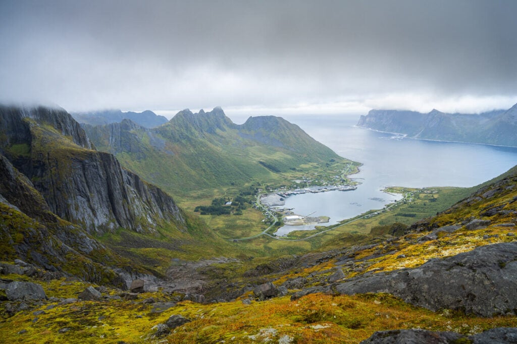
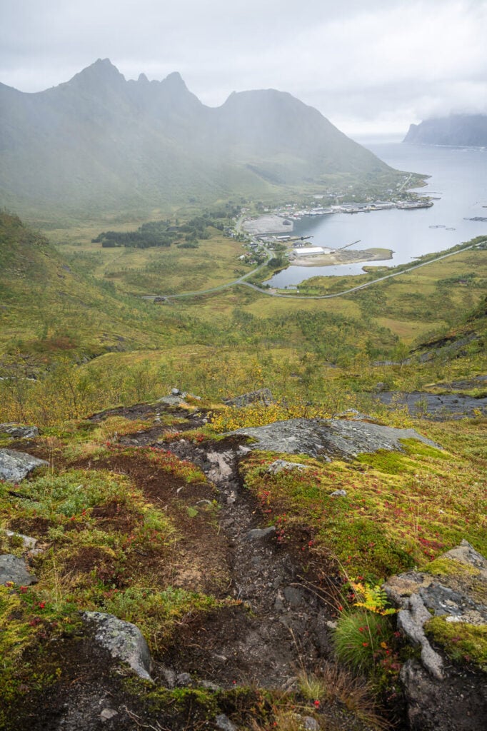
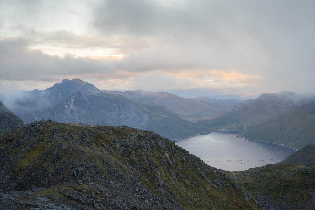
View from the trail, halfway up the mountain.
Roalden is probably a mountain you would visit if you have already been on all the other major peaks in the area, like Hesten, Segla, Keiper and Grytetippen, or Hustinden.
Roalden, although not as popular as other mountains in the area, offers fantastic views of the dramatic Senja’s coastline and its jagged peaks.
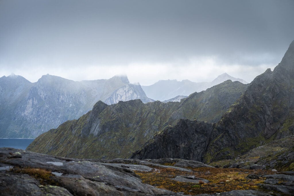
Table of Contents
Overview of the Roalden Hike & Map
The first part of the trail is likely one of the boggiest, muddiest, and most slippery trails on the island of Senja.
The trail is moderate to hard. At less than 6km, it is not a very long hike, but the elevation gain is almost 1,000m. Also, the first part is very slow going, with the constant risk of slipping and falling in a mud pool and sliding back down for a few meters, true story.
Other than that, the trail is steep almost throughout the entire hike, apart from a few short, flattish sections. The last part of the trail is the best, but it is exposed.
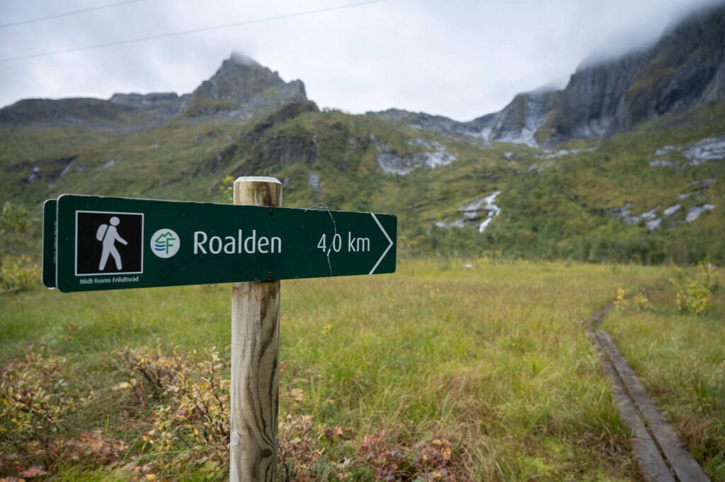
The trail is fully marked, and you can follow the blue dots painted on various rocks along the trail.
| Max Altitude | 855 m |
|---|---|
| Distance | 6.6 KM |
| Elevation gain | 910 m ↑ / 910m ↓ |
| Hike time | 02:30/ 03:30 Hours |
| Hike Difficulty | Moderate/Hard |
Here is the map of the Hike to Roalden. you can download the GPX file for free from the activity linked below.
How to get to the Roalden trailhead and Parking
The trailhead is located directly on the main coastal road, Road 862 – the Senja scenic route.
- Driving Directions: If you are coming from the Finnsnes direction, drive toward Gryllefjorden and then toward Senjahopen. You’ll find the trailhead on your left, right in front of the cemetery, and before the tunnel to Ersfjord. Likewise, if you are coming from the opposite direction, drive toward Sejahopen and you’ll find the trailhead right after the Ersfjord tunnel.
- Parking: The closest parking area is right in front of the cemetery, but I see it as a viable option only in the off-season. You do not want to keep this spot busy in the high season for anyone wanting to visit the cemetery. There are also a few spots available in a small pull-out area before the tunnel to Ersfjord.
- Public Transport: There are two bus stops a few hundred meters from the trailhead. Geitryggen and Senjahopen Steinneset. Busses 370 and 362 stop there. Check fylkestrafikk.no for the timetable.
Roalden Trailhead.
The Roalden Hiking Trail
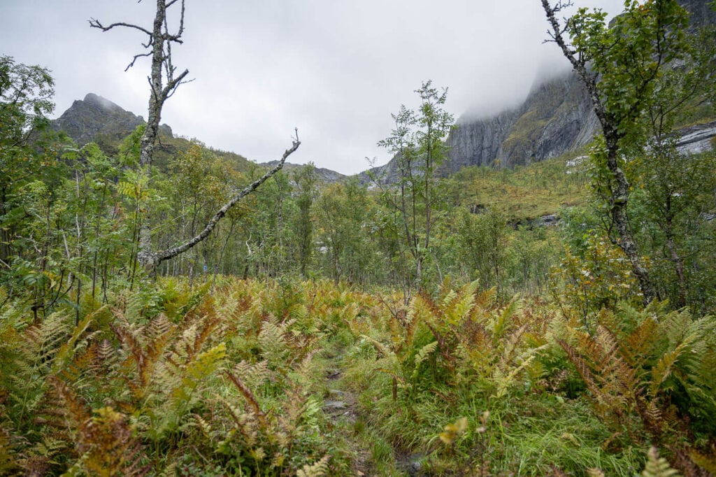
The trail initially crosses a boggy meadow, but there are wallboards to help with that. As soon as you enter the wooded area, no more walk boards. It’s not too bad at the beginning, but soon you will find yourself climbing on a moderately steep, but likely muddy and slippery gradient.
The mud situation may not always be that bad, especially in summer if it doesn’t rain for a few days. Otherwise, judging by the look of the trampled ground and footprint in the mud, it looks like it’s quite muddy, quite often.
But anyway, this is the worst part of the trail, and it is slow going. When I visited, it took me about an hour to cover a little over a KM. After that, you will reach a relatively flat area, and you’ll be out of the mud.
At this point of the hike you’ll be past the worst section of the trail.
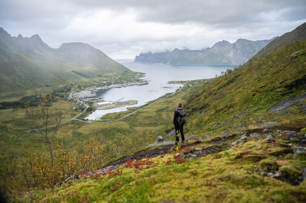
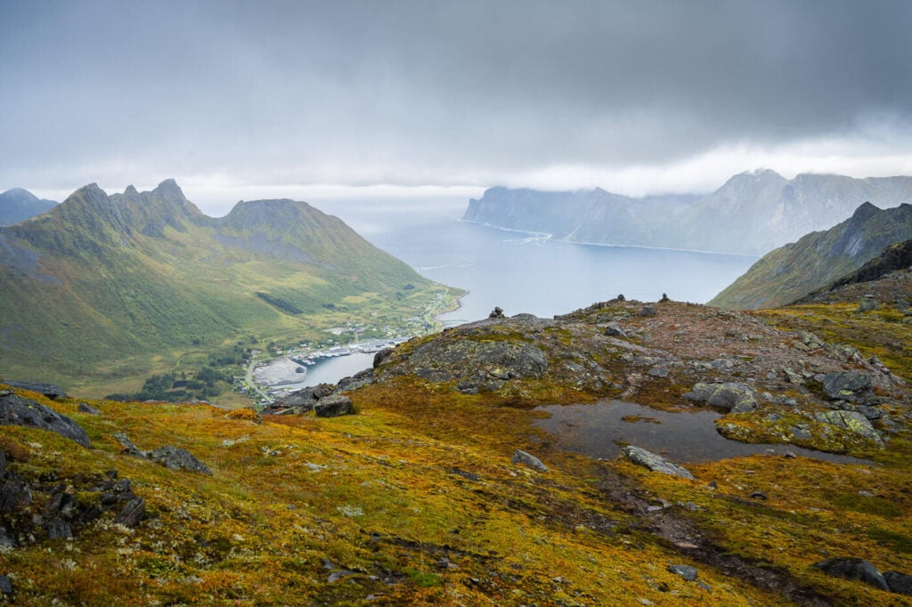
Here, the views also open up toward the magnificent coastline, revealing all the dramatic and steep mountains emerging from the sea.
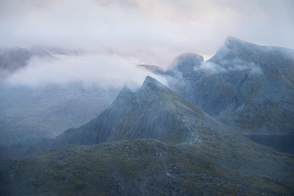
Soon enough, the trail climbs up again, and some minor scrambling is required. There are also some relatively exposed sections. Here you also have a good view of Roalden itself – a very beautiful mountain that almost looks entirely unaccessible.
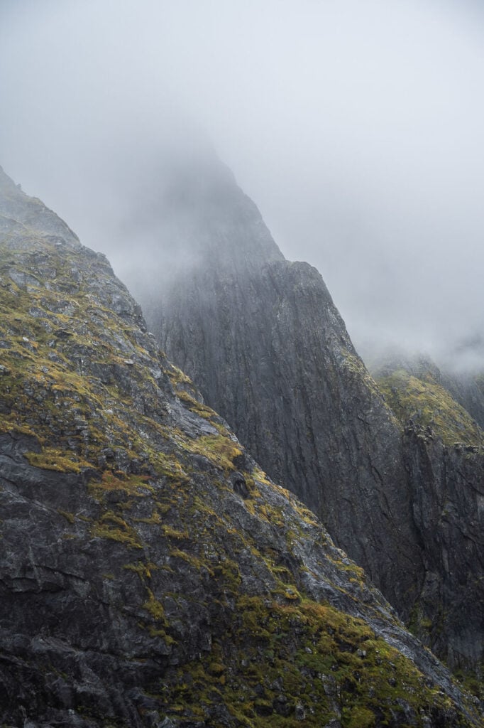
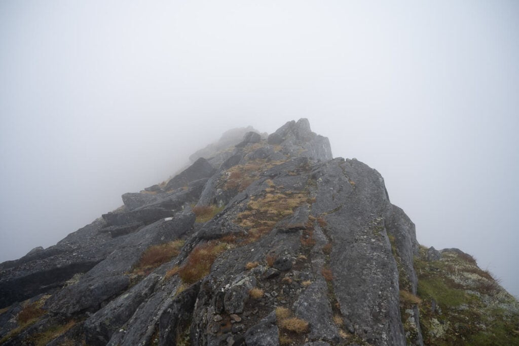
Roalden in the fog – a very beautiful-looking mountain on its own.
A moderately exposed section of the trail, just before the saddle that leads to the other side of the mountain.
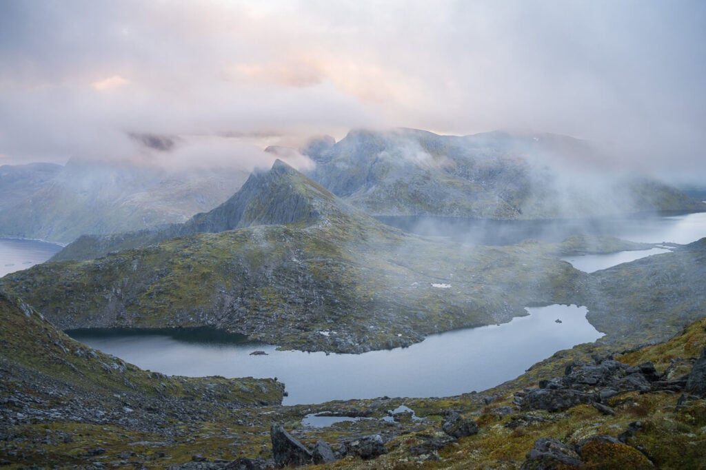
At the top of this climb, you’ll find yourself on the other side of the mountain. As you cross another relatively short but flat section full of big boulders, the views will gradually open to the lakes on the other side of the mountain.
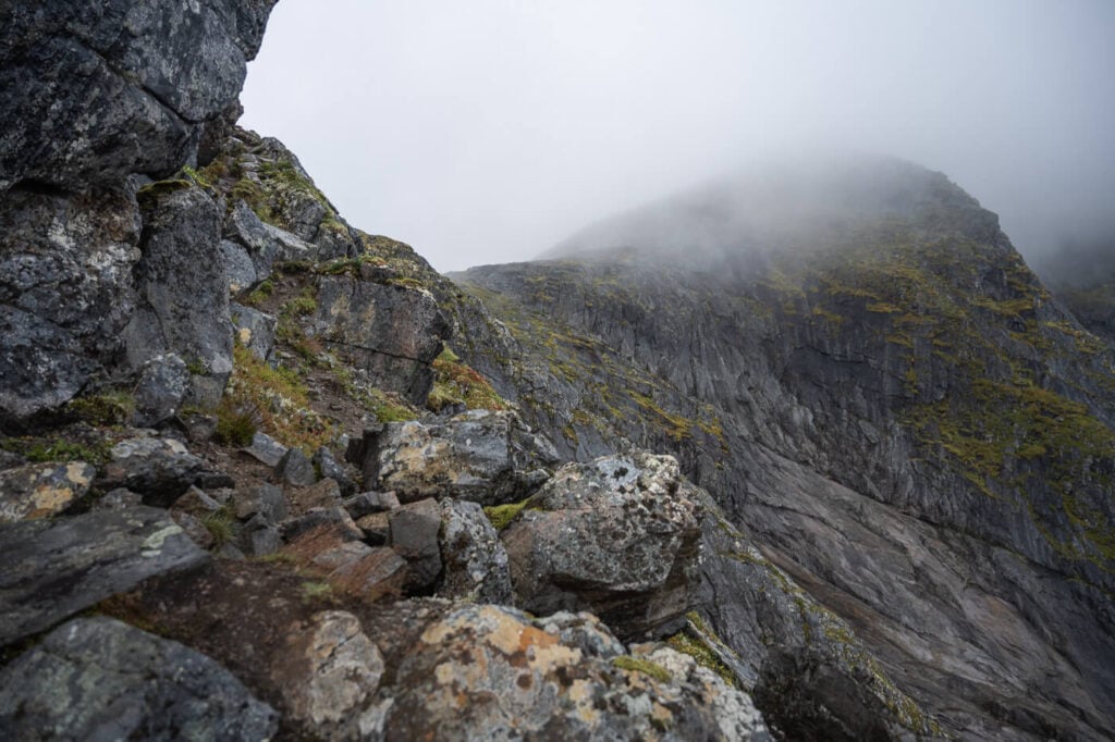
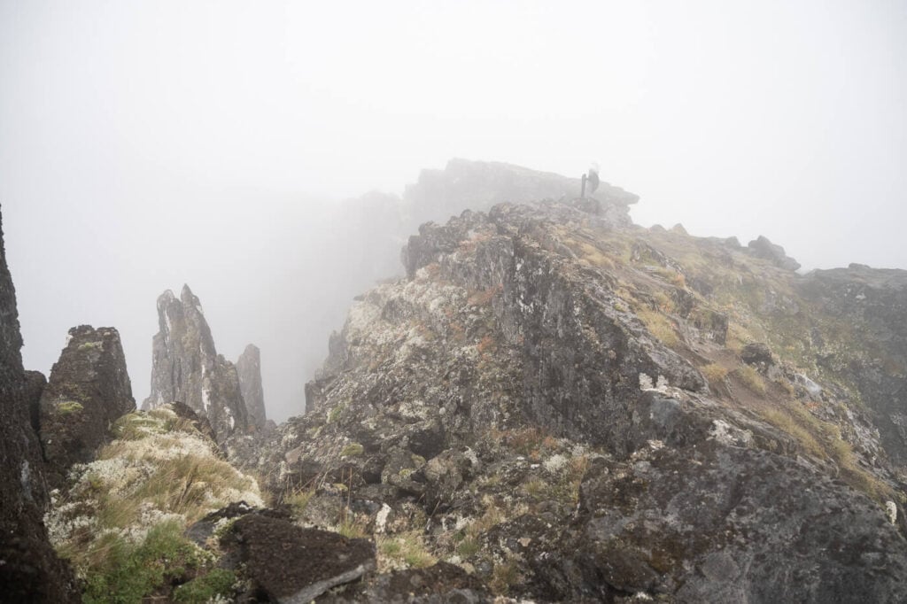
Here the trail picks up elevation again, for the last steep – and exposed – part of the hike. There’s a ridge walk before reaching the jagged summit.
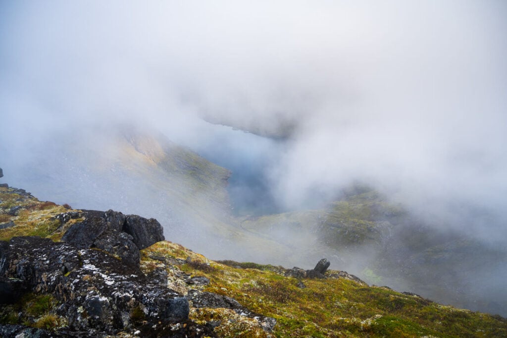
View from the saddle on the side of the mountain opposite to the trailhead
Part of the ridge walk that leads to Roalden’s Summit
Roalden’s summit.
Once you reach the top you’ll find a logbook, should you wish to sign it.
Unfortunately, I can’t speak of the views in the first person. As you can see, it was completely foggy when I got to the summit. However, you should have some rather amazing 360-degree views from up there. Still, this is a good excuse for me to return and hike to Roalden again in better weather.
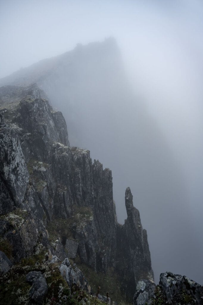
Roalden’s steep and exposed summit in the fog.
Roalden Photos and Photography Tips
The best part of this hike would be the 360-degree panoramic views of the summit, but especially the views on both sides of the mountain, toward Ersfjord on one side and Medfjord on the other. On a good day, the summit would offer spectacular 360-degree views of Senja’s jagged mountains and dramatic coastline.
Like most of the hikes on the Island of Senja, this one is good for sunset. This was my original plan, and I did this hike as a sunset hike. I stayed at the top until half an hour before sunset and then headed down, as the fog wasn’t going anywhere. I made it back to the trailhead as darkness fell, so if you plan on that outside of the midnight sun season, bring a headlamp.
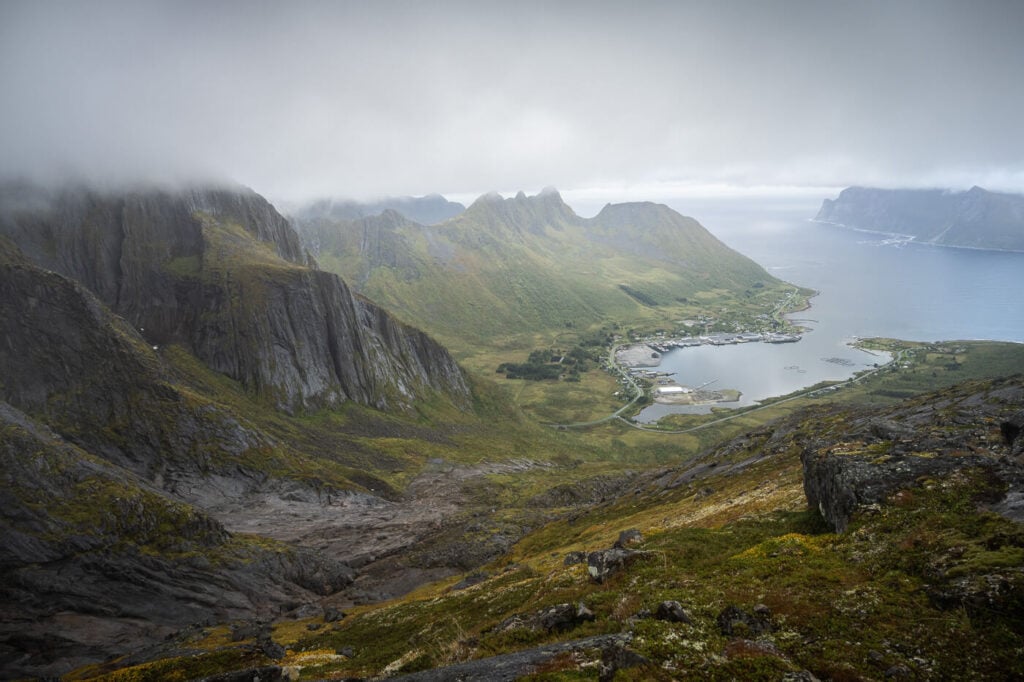
View of Medford, on the way up to Roalden
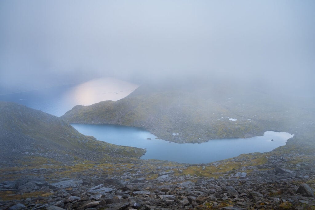
Lille Hestvatnet – a lake visible from the trail closer to the summit.
Where to stay
The closest villages that offer some accommodation are Senjahopen or Mefjordvær. They are located just a short drive away from the trailhead.
Depending on where you’re heading next, also consider Skaland (if you are planning to hike Hustinden, or Fjordgård for Hesten or Segla. Both can be reached in a little over 20 minutes by car.
If you are in a van, there is a rest area in Ersfkord (free) and another one in Steinfjord (paid).
Additional Resources
- Here’s my full Senja Hiking guide, with the best hikes in the region and trip-planning tips.
- Check out these other amazing hikes on the Island of Senja: Segla, Husfjellet, Keipen and Grytetippen, Inste Kongen and Kongeporten, or Hesten and Stavelitippen.
- You can check the main page on Hiking in Norway for more hikes (with maps).


Leave A Comment