Hike to Glæret, Senja, Norway – Scenic Sunset Views
The hike to Glæret on the island of Senja is a short but steep hike to a scenic viewpoint of the beautiful coastline and mountains above the small town of Gryllefjord.
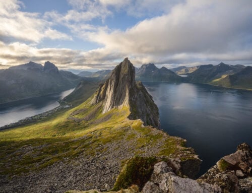
There’s something primordial about this view and the mountains around the fjord. Perhaps it’s the steep rock faces plunging into the sea, or their inaccessibility. Either way, this is one scenic sunset hike.

Sunset from Glæret.
You would typically do this hike if you were in the area waiting for the ferry to Andøya or had just arrived there. You would also do it if you just want to enjoy the sunset views from the top of this relatively small mountain (380 m.a.s.l.).
However, don’t underestimate this trail judging by how short it appears to be. It’s a proper mountain hike on steep, slippery, and rocky terrain that requires sure-footedness and balance right up to the summit.
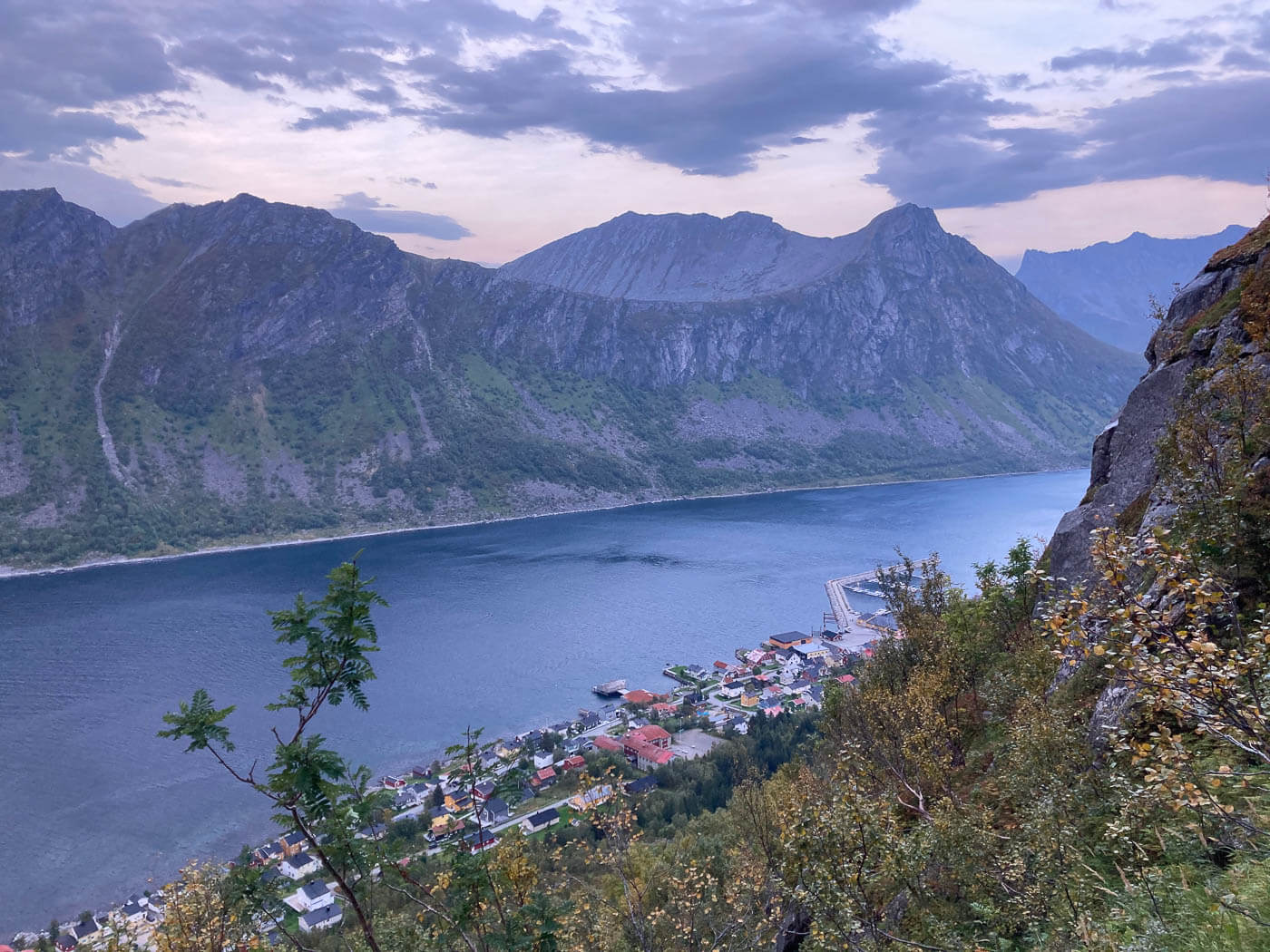
The trail is steep and rather demanding right from the start and all the way to the top.
Table of Contents
Overview of the Glæret Hike & Map
As mentioned above, the hike is quite short, but the gradient is steep. It is slow going. There are several stretches across boulder fields in a moderately dense birch forest.
There’s a section where you’ll need to use some ropes/rails to keep the balance and pull yourself up in the steepest stretches. Quite a long stretch of rope.
If you’re prepared for the effort, the hike is quite fun.
| Max Altitude | 392 m |
|---|---|
| Distance | 3.42 KM |
| Elevation gain | 420 m ↑ / 420 m ↓ |
| Hike time | 02:00/ 02:30 Hours |
| Hike Difficulty | Moderate |
Here is the map of the hike. You can download the GPX file for free from the activity linked below, should you wish to do so.
How to get to the Glæret trailhead and Parking
There is only one access point, Gryllefjord, at the end of Road 86. It is a very popular passage point due to the Andenes-Gryllefjord ferry, which saves 4-5 hours of driving between those two locations.
So it makes sense to plan this hike if you are following the same itinerary, either
- Driving Directions: if you are coming from the north (i.e. Skaland or Fjordgård), you can just follow the coastal road (86) south. It takes about 45/60 minutes under normal conditions. It takes a little over an hour if you are coming from the south (i.e. Finnsnes).
- Parking: Parking is somewhat limited, and even more so in summer. If you are queuing up several hours before the ferry departure, you can hike while you wait to board. Just make sure you have enough time to get back down. Otherwise, you’d need to park elsewhere. I parked here behind the local Matkroken mini-market, as I did the hike the evening before catching the ferry.
- Public Transport: There is a bus station at the Ferry terminal. It’s line 360 that connects Gryllefjord to Finnsnes and Torsken. More info on svipper.no.

The Gryllefjord ferry terminal.
The Glæret Hiking Trail
The hike begins with a stroll through Gryllefjord‘s typical houses and huts. You have to walk through half of the town’s length to the school, which is where the trailhead is.
There aren’t any trail markers here yet, but you’ll have to walk behind the school and across the playground in the backyard. You’ll then see the first sign pointing to the trail. That is the actual trailhead.

The trail begins behind Gryllefjord’s school.

Glæret’s trailhead.
Shortly after, you’ll begin a rather demanding and steep ascent. First, you’ll have to cross a moderately dense birch forest, then a small boulder field, and then climb up the last stretch of forest with the help of a very long rope.
This one was the longest stretch of rope I had seen in a while. Probably longer than 100m.

Part of the hike is roped, in the hardest part of the trail.
The roped part ends where the vegetation ends, too. From there onwards, there are again many big boulders, so it’s still slow going.
However, the views will start to open up toward the open sea, partly revealing the landscape that awaits on Glæret’s summit.

The trail continues on the steep side of the mountain.

The views gradually open up to the fiord and the open seas.
The last part of the trail flattens out, and you should see the trail signs in the distance, as well as the cairn that marks Glæret’s summit.
The summit is wide and there’s plenty of space to wander around, or sit and just enjoy the views.


To get the best view, you can walk a little further toward the coast, on an exposed ledge where you have a full view of the
Funny thing – you can see the ferry coming from Andenes too, from quite afar! Though if you see it you’d likely be too late to get back down and catch it if you were planning to get to Andenes.


The Andenes – Gryllefjord ferry arriving at Gryllefjord.
Glæret Photos and Photography Tips
The most scenic point of the hike to Glæret is by far the summit, which is also great for sunset or to catch the midnight sun. Up to that point the views are a bit hidden by the mountain, so it’s only at the very top where you have the most scenic views.
On the other hand, the summit provides plenty of foreground choices for different compositions.


Sunset from Glæret
Also, somehow, the views look much better in person than in photos. The panorama is so wide that it’s moderately hard to put a composition together and, in that sense, I found good old-fashioned panoramas to work much better.
If you are reading this on a mobile device, I recommend checking the photo below on a computer screen later too, to appreciate all the details and vastness of the landscape properly.

Where to stay
The nice village of Gryllefjord does offer some accommodation, mostly guest houses. Torksen, on the southern part of the same peninsular, is another option.
If you are looking for a Rorbu in the area, there are some in Hamn, a short drive away further north.
If you are in a van/camper, there’s a rest area nearby. That’s where I spent the night too, waiting for the first ferry in the morning.
Additional Resources
- Here’s my full Senja Hiking guide, with the best hikes in the region and trip-planning tips.
- You can check the main page on Hiking in Norway for more hikes (with maps).
- Here is a link to the Andenes – Gryllefjord ferry timetable.


Leave A Comment