Hike to Rifugio Mezzalama in Val d’Ayas, a Beautiful Hut at the Glacier’s Edge, Val d’Aosta, Italy
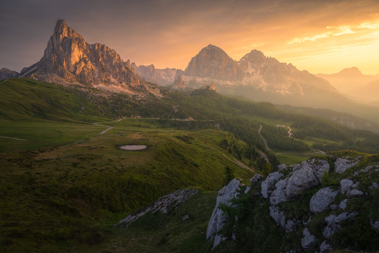
The Hike to Rifugio Mezzalama in Val d’Ayas is one of the finest high-altitude alpine hikes in Val d’Aosta. Spectacular landscape, a long but enjoyable all-day hike, and the beautiful Mezzalama hut to top it off.
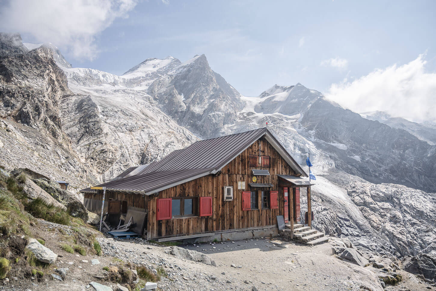
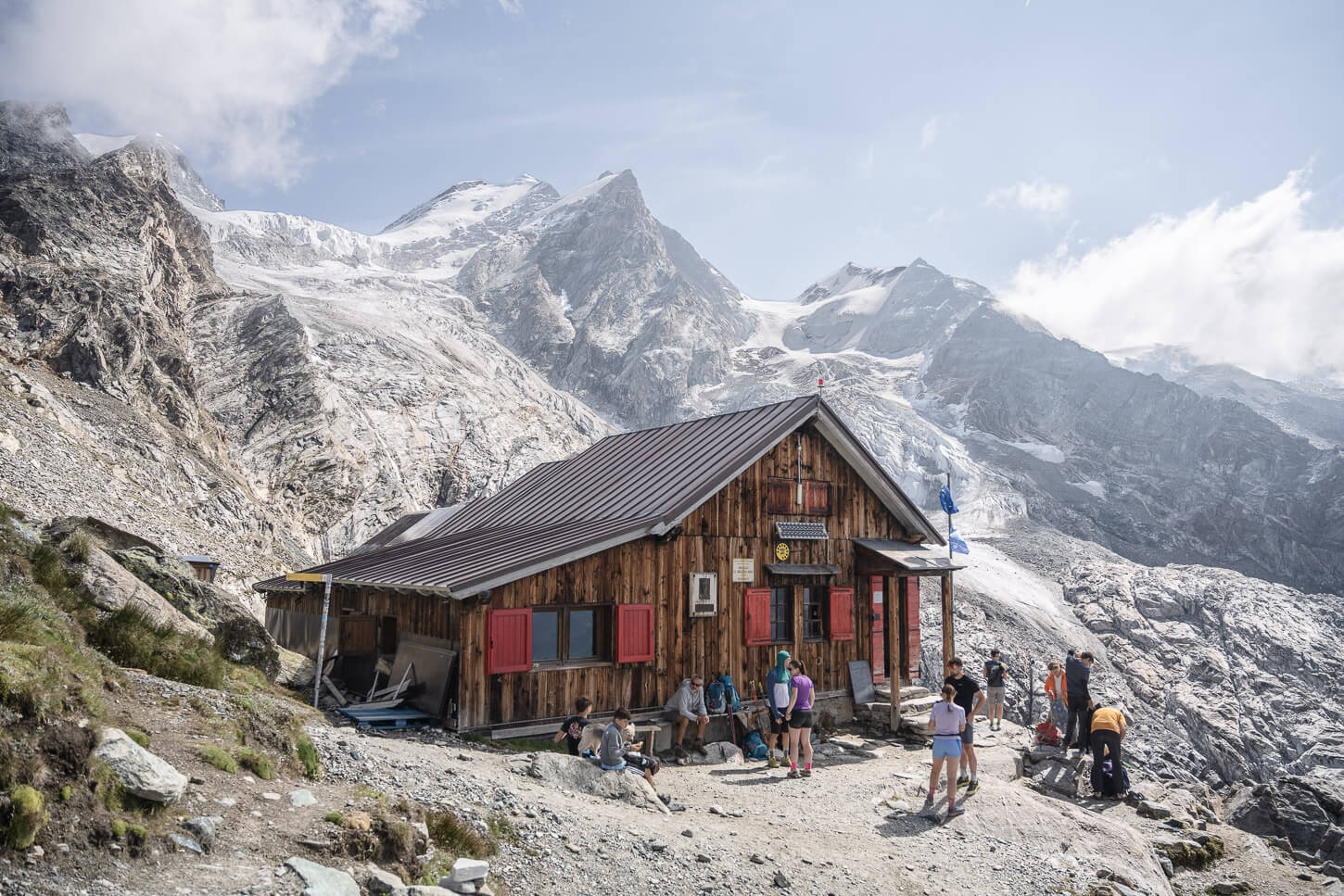
Located in the Monte Rosa Massif at about 3,000 meters of altitude, the Mezzalama hut offers fantastic views of some of the glaciers of the Massif’s southern face. The Mezzalama hut is a popular day-hike destination in Northern Italy. It’s also a historic mountain hut; it was built in 1934 and celebrated its 90th birthday in 2024.
However, the hut and the hike are less well-known outside Italy. Yet, the hike offers several highlights, from the green forests in Saint Jacques to the first views of the glacier at Piani di Verra Inferiore, to the rugged moraines and hanging glaciers, and the beautiful Lago Blu, destination-worthy in itself, as we’ll see.
And, while the glaciers have sadly retreated dramatically in the last few decades, they are still an extraordinary sight to see. If you are looking for a criminally underrated hike with all the ingredients that make an all-day alpine hike great, get the GPX file below, and hit the trails.
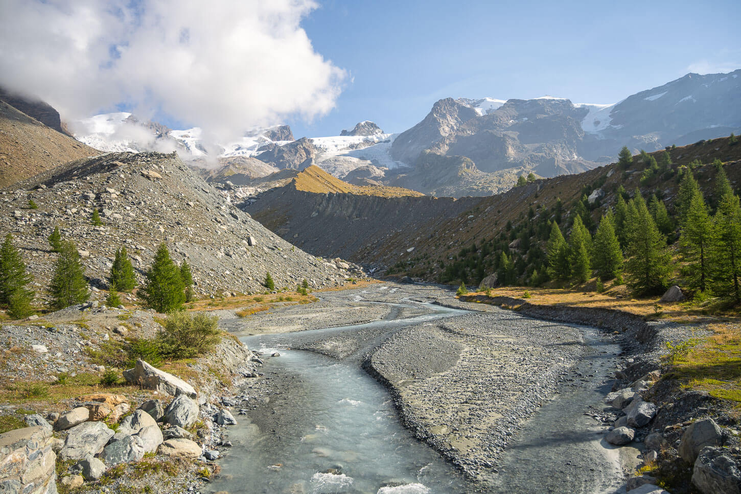
Table of Contents
Overview of Rifugio Mezzalama and Val d’Ayas Hike & Map
Overall, the hike isn’t technical or particularly difficult. It’s just relatively long (18km, or 11+ miles) and with a considerable elevation again, at 1,440 m. Considering the max altitude is above 3,000 meters, it can be more fatiguing than what the technical details of the hike suggest on paper. At that altitude, you can start to feel the lack of oxygen; I certainly did.
The trail is well-marked and easy to follow. It’s trail number 7, and it’s officially rated for a difficulty of “E”, meaning “Escursionistico.” That means moderate difficulty, but it refers more to the technical aspects than to how strenuous the trail is. So there are no exposed sections along the trail.
You can check if or when it’s open on the Rifugio Mezzalama Webpage on the CAI Torino website.
| Max Altitude | 3,036 m (9,960 ft.) |
|---|---|
| Distance | 18.3 km (11,4 miles) |
| Elevation gain | 1,440 m ↑ / 1,440 m ↓ (4,725 ft.) |
| Hike time | 6.5-7.5 Hours |
| Hike Difficulty | Moderate/Hard |
Here is the map of the hike. You can download the GPX file for free from the activity linked below.
How to get to the Rifugio Mezzalama Trailhead and Parking
The trailhead is located in Saint Jacques in Val d’Ayas, accessible via the A5/E25 highway that connects France and Turin Via Aosta/Ivrea. Getting there requires a longish drive up the mountain roads just off the main highway across Val d’Aosta.
While it is a winding mountain road and slow driving through mountain villages, it is not one of those scary one-lane narrow drives with a bottomless cliff on one side and hard rock on the other. It is a regular two-lane road, but you do have to drive to the far end of the valley.
- Driving Directions: On the A5 highway, take the Verrès exit. If you are driving from Switzerland/France, you’d have to drive through almost the entire Aosta Valley. From within Italy, Turin, Milan, or Genoa, it’s shortly after entering the Valley. Then follow road SR45 (Strada Regionale 45) toward Brusson and Champoluc, until you essentially reach the end of the road at the far end of the valley.
- Parking: Paid parking is available at Parcheggio Frachey by the cable car station. There are a few parking spots – a handful, actually – toward Saint Jacques, and in Saint Jacques too. However, it is an area with traffic restrictions, as it’s closed from 7 AM to 12 PM. If you arrive early, you can try your luck. For simplicity, I’d recommend parking at Parcheggio Frachey
- Public Transport: It’s also possible to reach Saint Jacques by “Corriera”, the Italian term for long-distance buses that connect towns and villages. The corriera runs between Verrès and Saint Jacques. More information here. You can reach Verrès by train, so from there you can catch the bus up the valley.
The Rifugio Mezzalama Hiking Trail in Val d’Ayas
The trail can roughly be divided into two main sections. From the small village of Saint Jacques to Piani di Verra Inferiore, and Lago Blu a little farther uphill, and from there to Rifugio Ottorino Mezzalama.
The first section is mainly a walk in the woods. The second section is a proper alpine trail. There are no exposed sections, but don’t get too close to the Moraine’s edge.
Hiking from Saint Jacques to Piani di Verra Inferiore and Lago Blu
If you parked at Parcheggio Frachey as I did, you’d have to walk the road up to the Village of Saint Jacques first. It’s about 1 km. So not much, and it’s easy walking. As you cross the small village, the trail will enter the forest and will start to climb up the mountain at a steady gradient.
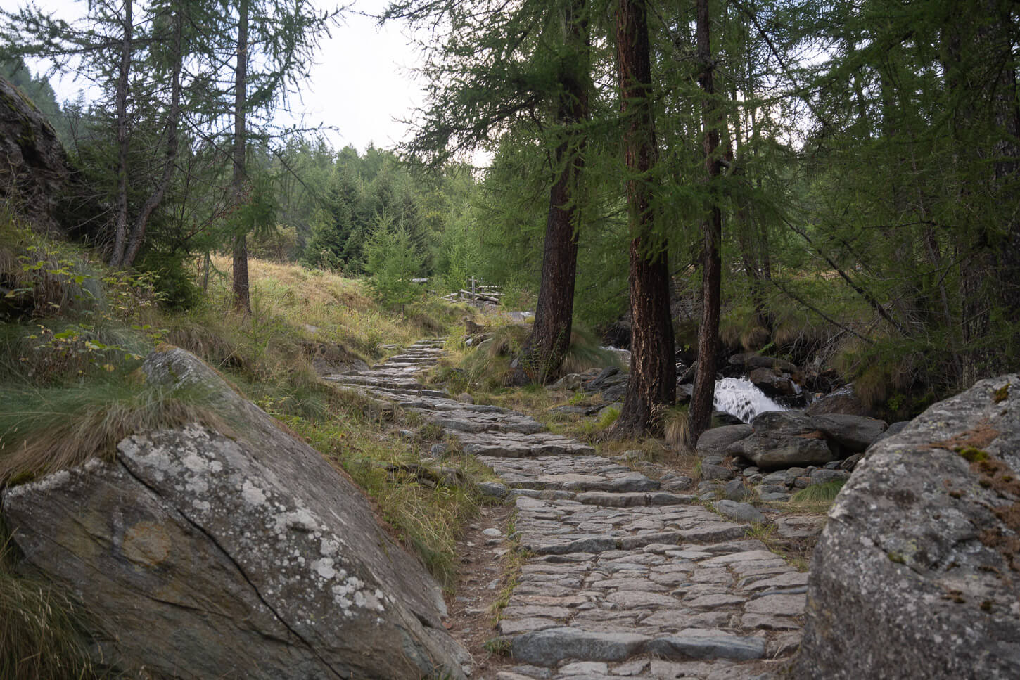
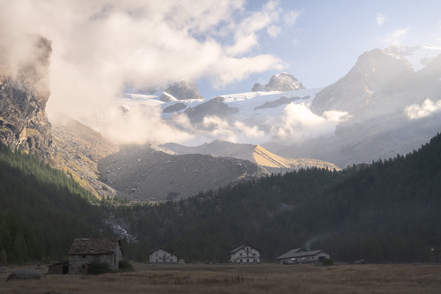
You will then pass by a few more houses and huts, where the views start to open up to the valley below. After another stretch through the forest, the trail gradually flattens out until reaching the Piani di Verra Inferiore, which literally means Lower Verra’s plains.
Here, you already have a view of the Majestic Peaks and glaciers farther up the valley. With the houses of Piani di Verra Inferiore just below them, the contrast in size between the mountains and the houses is striking. Overall, it is just a beautiful mountain scene in a beautiful mountain landscape.
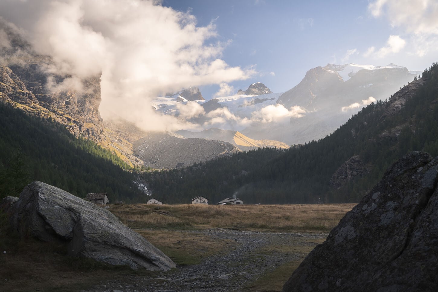
Piani di Verra iInferiore, and the glaciers of the Monte Rosa Massif in the early morning light.
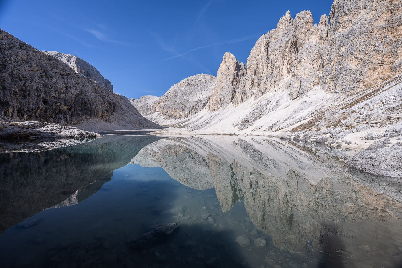
As you cross the Piani, the trail will gain elevation again on the side of the mountain through sparse trees and vegetation. Here, it’s not long before you come into view of the Lago Blu, the Blue Lake.
It will be easy to see why it’s called like that. Even more so on bright sunny days when the sun directly hits the waters of the lake. The lake is a destination in itself, and you can find people relaxing by the lake on hot summer days.
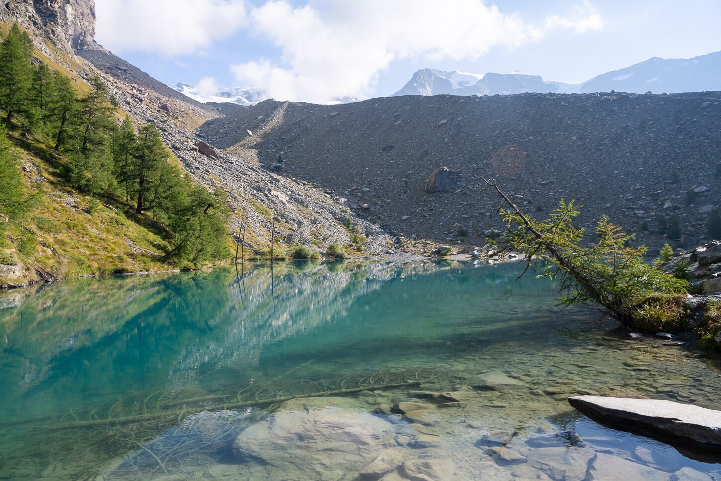
Lago Blu.
From Lago Blu to Rifugio Mezzalama
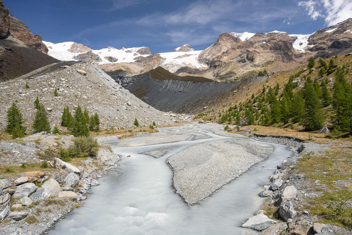
From Lago Blu, the trail starts climbing up on the morainic deposits that ultimately lead to Rifugio Mezzalama. After the first short climb, the trail crosses a small creek, the Évançon Creek, which originates from the glacier.
Here, the view is spectacular. As you cross the bridge to get to the other side, you have a full view of the creek with the Moraines, the glaciers, and the giant peaks of the Monte Rosa Massif in the background. I did spend some time taking photos here, as it is a truly beautiful alpine landscape.
From Lago BLu, the trail stats climbing again on the Moraine.
Torrente Évançon – the Évançon Creek.
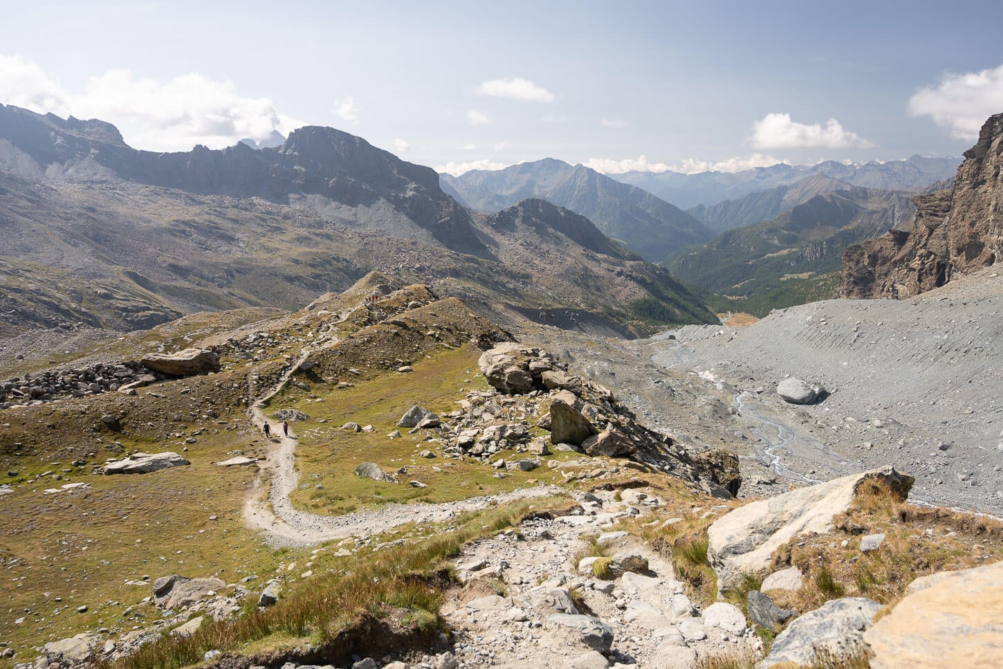
As you cross to the other side of the bridge, you have th option to climb up on the morainic deposit on the other side of the river, for better views, or take the dirt track just below it – easier to walk on.
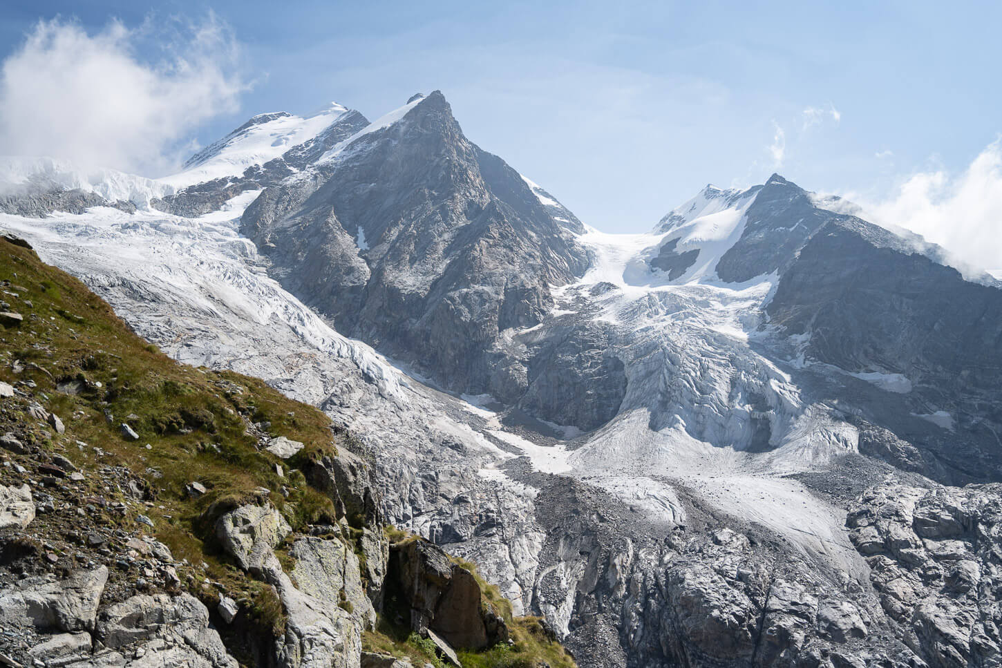
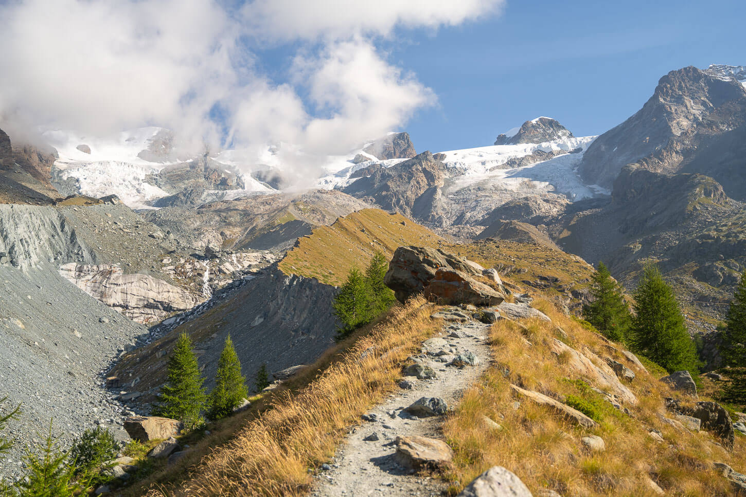
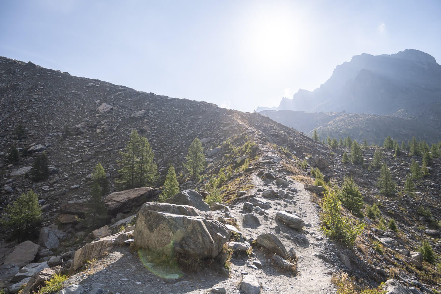
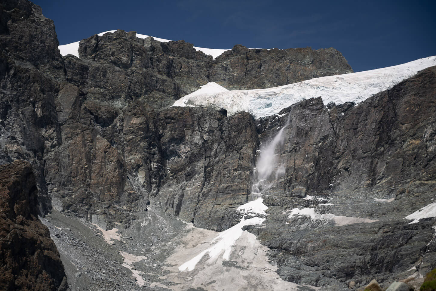
Ultimately, both will merge at the far end of the valley, which is where the last relentless climb starts. As you climb, the terrain progressively switches from grassy to the rockier terrain at the top of the moraine. As you approach the 3,000 meters of altitude. And, as you climb up, you already get better and better views of the glacier’s front.
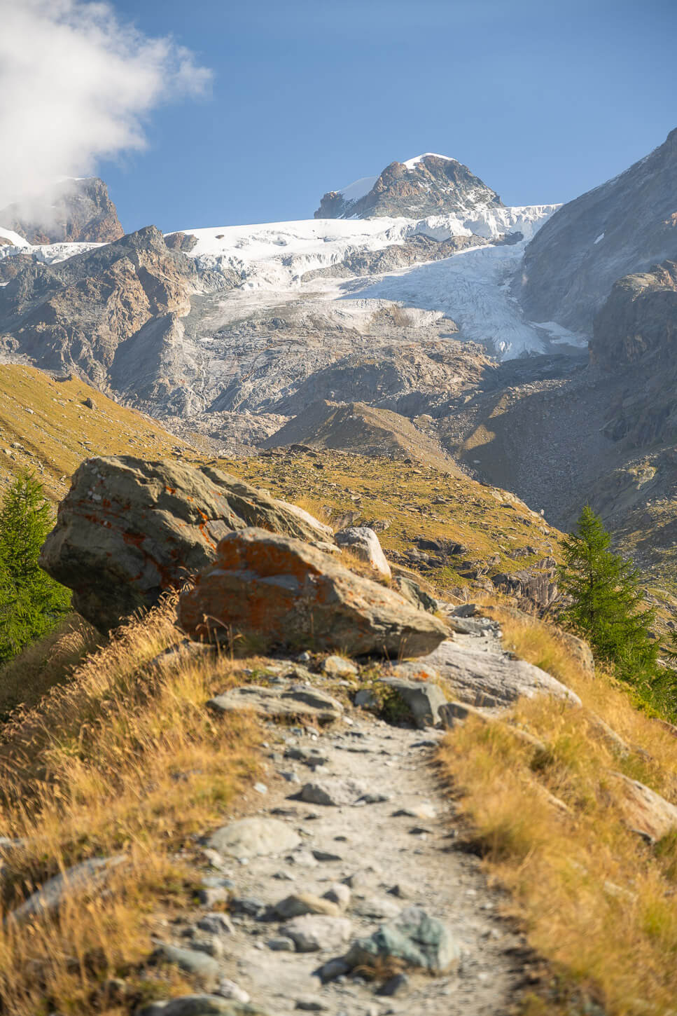
Some sections of the trial on the Moraine provide great views of the glaciers uphill.
The last section – and climb – is entirely on the crest of a Moraine.
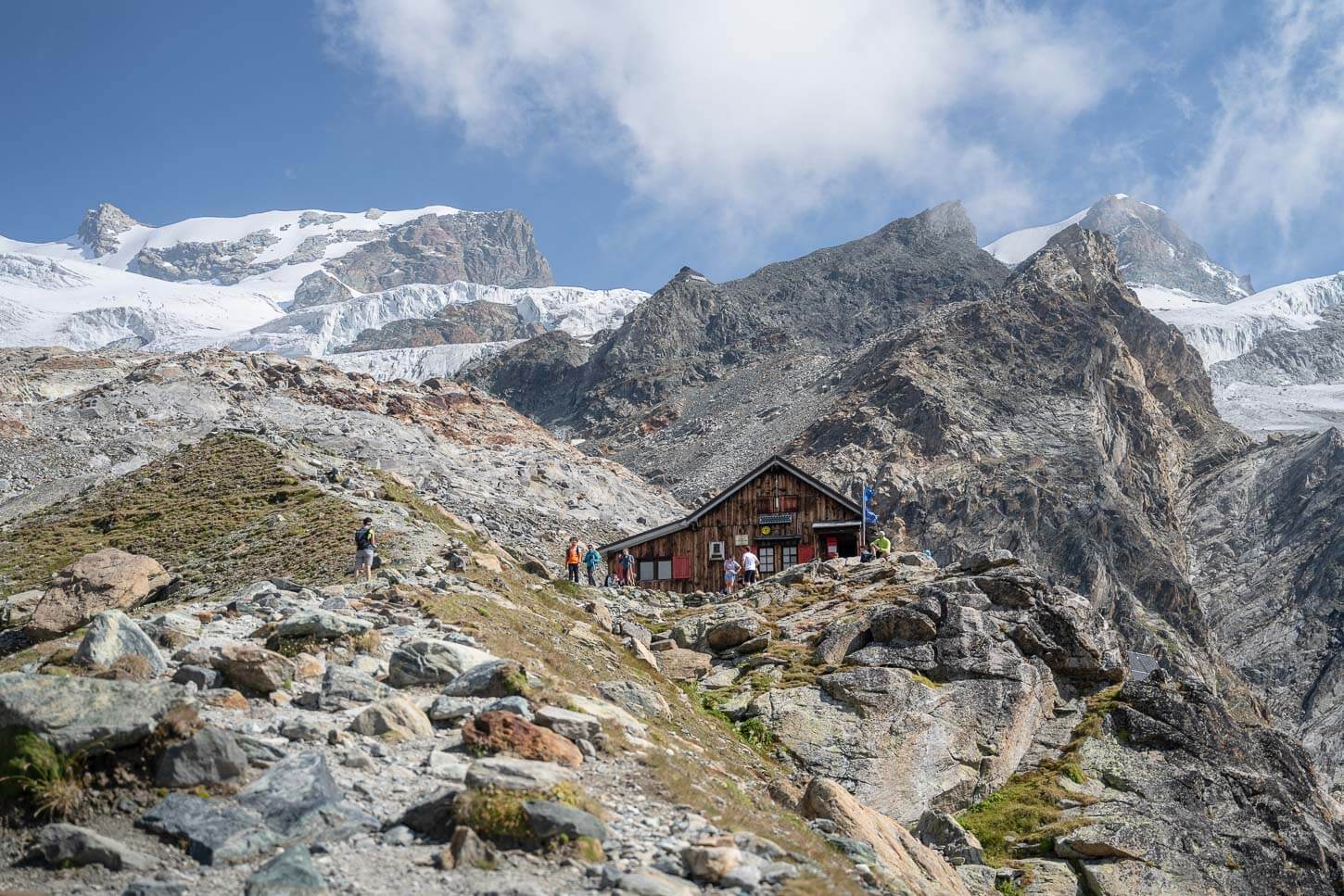
Approaching Rifugio Mezzalama.
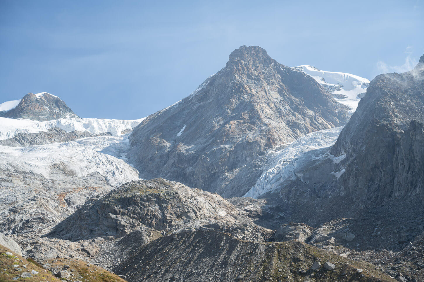
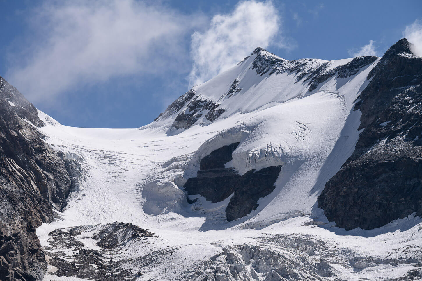
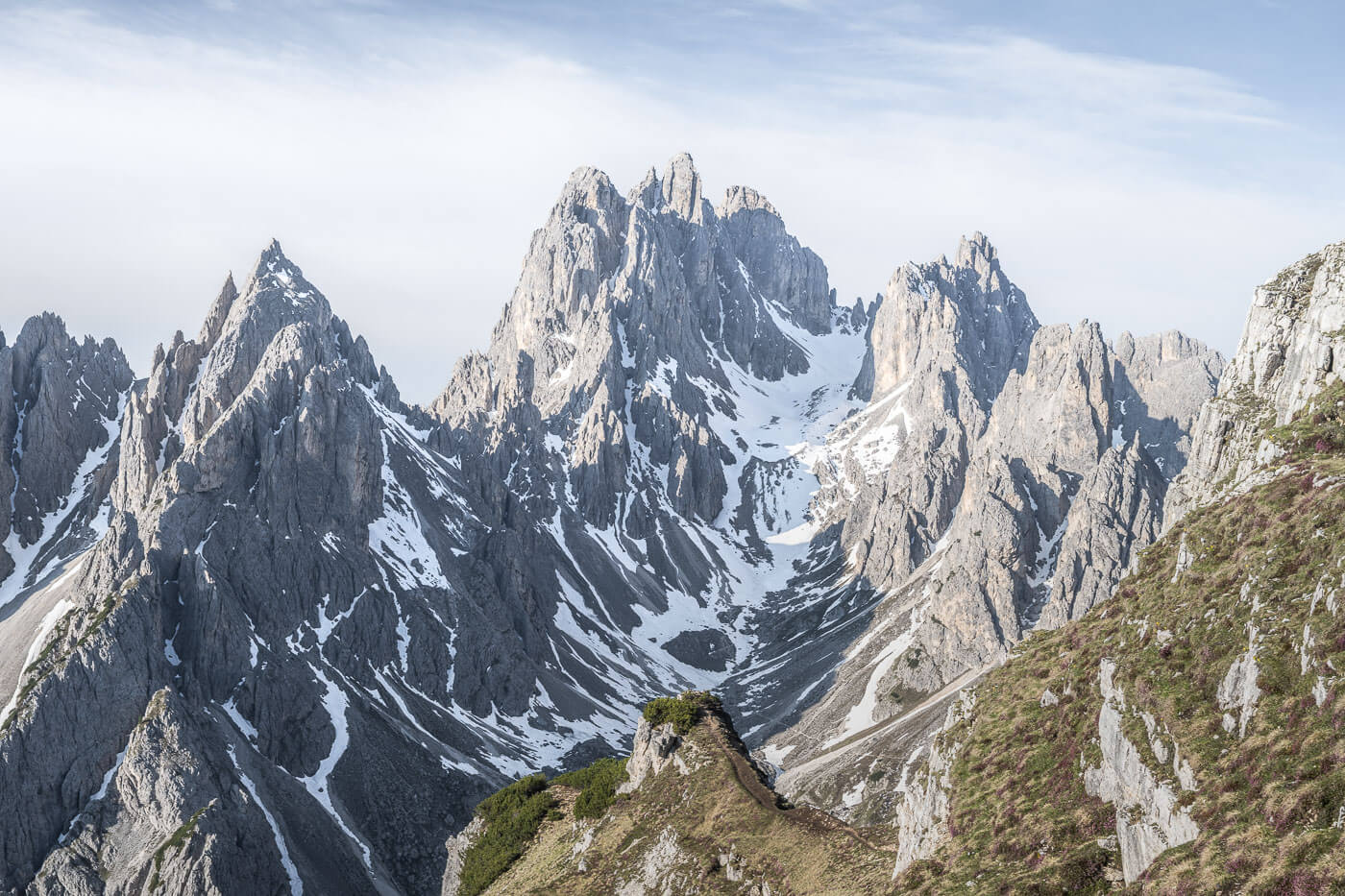
It’s not long before the hut comes into view, too. It basically sits at the top of the moraine and offers great views of the glaciers all around it. The “Grande Ghiacciaio di Verra”, or Great Verra Glacier. Then the “Piccolo Ghiacciaio di Verra”, or “Small Verra Glacier”, and the Felik Glacier.
You won’t have an issue in finding a good place to sit around the hut, to soak in the majestic views of the glacier and peaks of the upper Monte Rosa Massif.
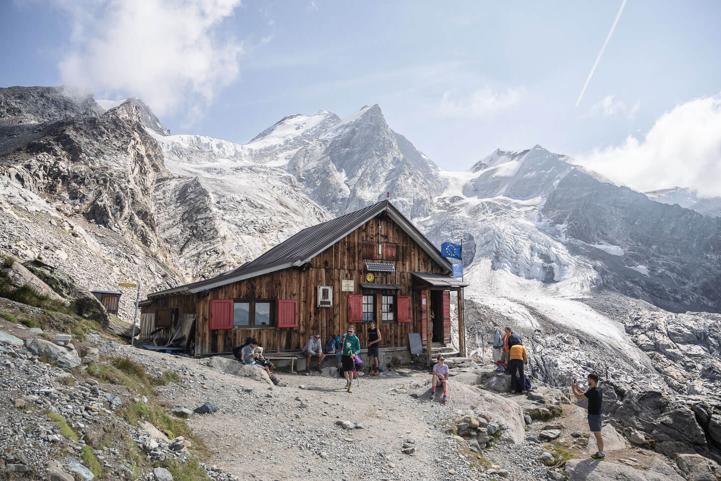
there’s plenty of space around the hut to sit and enjoy the views.
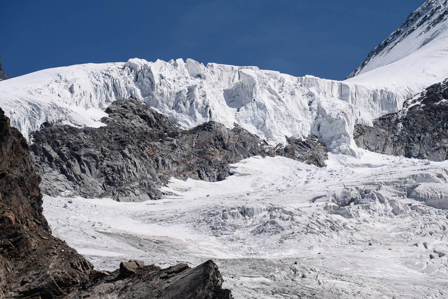
It’s not unlikely to also witness some smaller or bigger calving episodes. I actually saw several, at least 4/5, on my visit in mid-August. And, you can’t help but think about how the glacier would have looked in its former glory. Do look it up, it’s a jaw-dropping, spectacular view.
If you wish, you can also continue to the other hut farther up the mountain, Rifugio Guide della Val d’Ayas. That adds about another 200m of positive elevation gain. Or, when you head down, you may want to take a quick refreshing dip in the waters of Lago Blu.
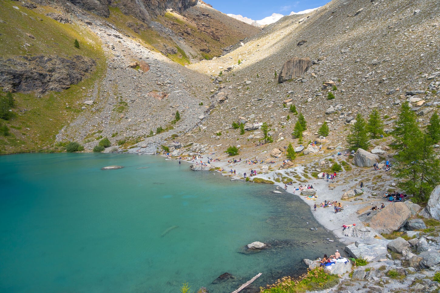
Lago Blue is a popular destination in itself in summer. And a good place to refresh.
Rifugio Mezzalama and Val d’Ayas Photos and Photography Tips
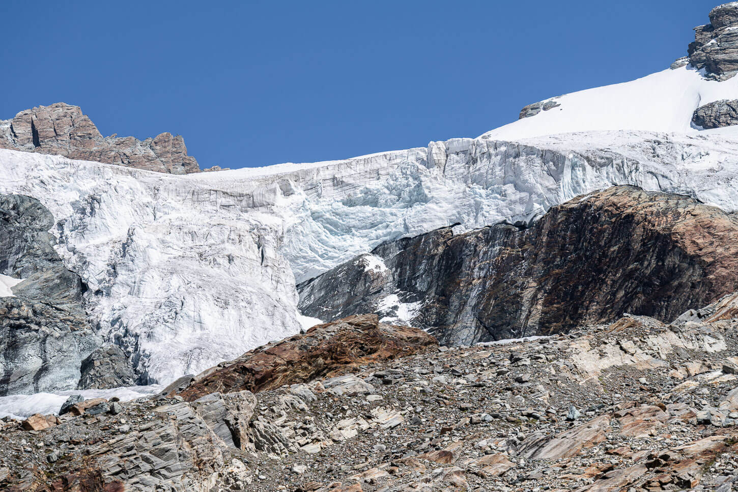
In terms of landscape photography, there are three main spots along this route. The Piani di Verra Inferiore, the view from the bridge across the river, and, of course, Rifugio Mezzalama and the spectacular views of the glaciers around it. I used a 24-70mm f/4 lens for most of the hike, and my 70-200 f2.8 at Rifugio Mezzalama. I also had my 14-24 with me, but I did not use it.
So a wide-medium telephoto lens will be more than enough, but if you can also bring your longest lens, to capture the finer details of the glacier. Or perhaps to capture smaller calving episodes. I did capture a few.
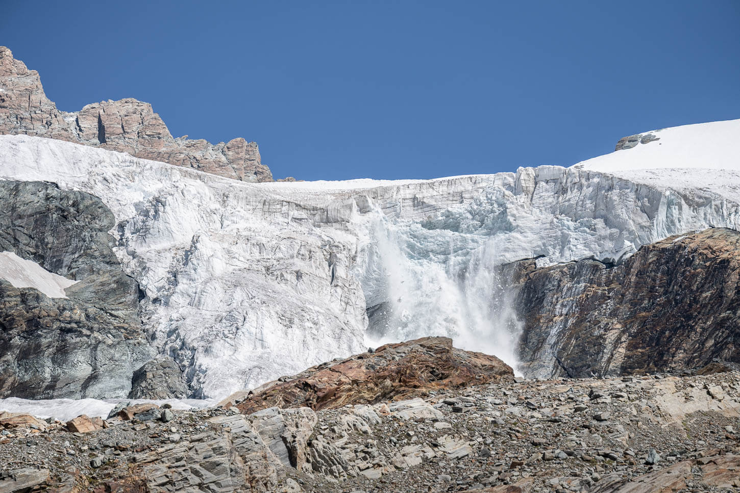
Small calving episodes are not uncommon on a hot summer day.
The morning golden hour is a great time to approach Piani di Verra. As the sun starts to peek above the mountains and light the glaciers, you also have some good sidelight that will gradually warm the valley up. It’s quite an evocative view, with the huts and houses at the Piani, and the towering peaks surrounded by glaciers in the background. With the early morning light hitting the valley, it’s almost a poetic view.
The other great view is from the bridge across the Évançon Creek. A spectacular view right from the bridge, with the creek that leads directly into the Moraines and the upper Monte Rosa Massif, its peaks and its glaciers.
If you plan to stay at the hut, your landscape photography options will multiply. Sunset, a starry night sky, assuming clear skies, and sunrise, with the first light of the day hitting the peaks. As for me, this is something I have on my list for the next time I’ll visit, whenever that will be.
Video of the Hike
Here is also a short video of the Hike to Rifugio Mezzalama, with all the main highlights from Piani di Verra Inferiore, the Évançon Creek, and, of course, the Rifugio with some close-up views of the glaciers.
Where to Stay
It’s possible to spend the night at Rifugio Mezzalama, or at the Guide Val d’Ayas hut higher up the mountain.
In terms of regular accommodations, Saint Jacques offers a few options too. However, if you are looking for an area with more dining and accommodation options, Champoluc would be the obvious choice. Alternatively, Brusson is a good option too, to stay in the same valley.
Additional Resources
- Here’s the main page on Hiking in Italy for more hikes and scenic spots in Italy.

Leave A Comment