Vøringsfossen Waterfall Hike, one of Norway’s most Epic Falls
Nowadays, the hike to the Vøringsfossen Waterfall is an easy walk on a pedestrian platform that leads to several different viewpoints above the waterfall. The view of the falls dropping into the Måbødalen is a truly epic sight.

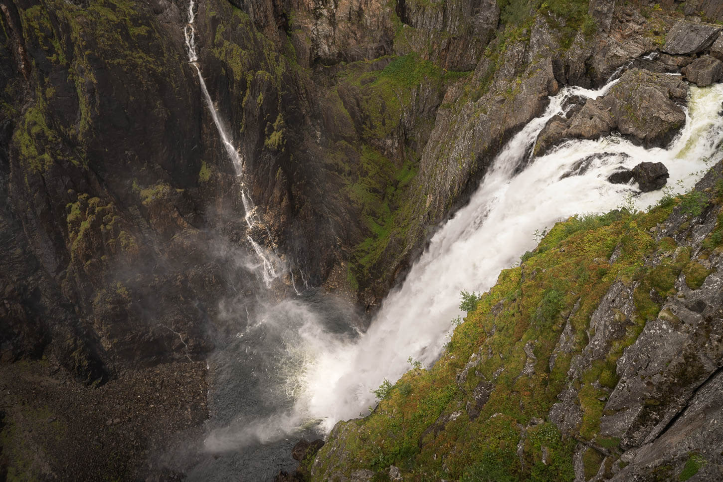
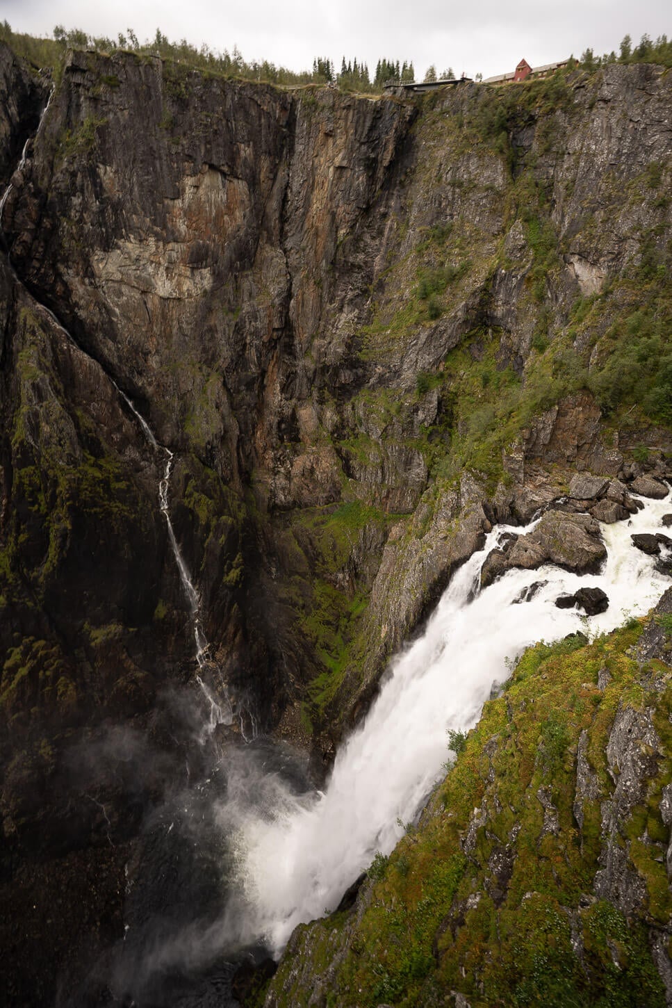
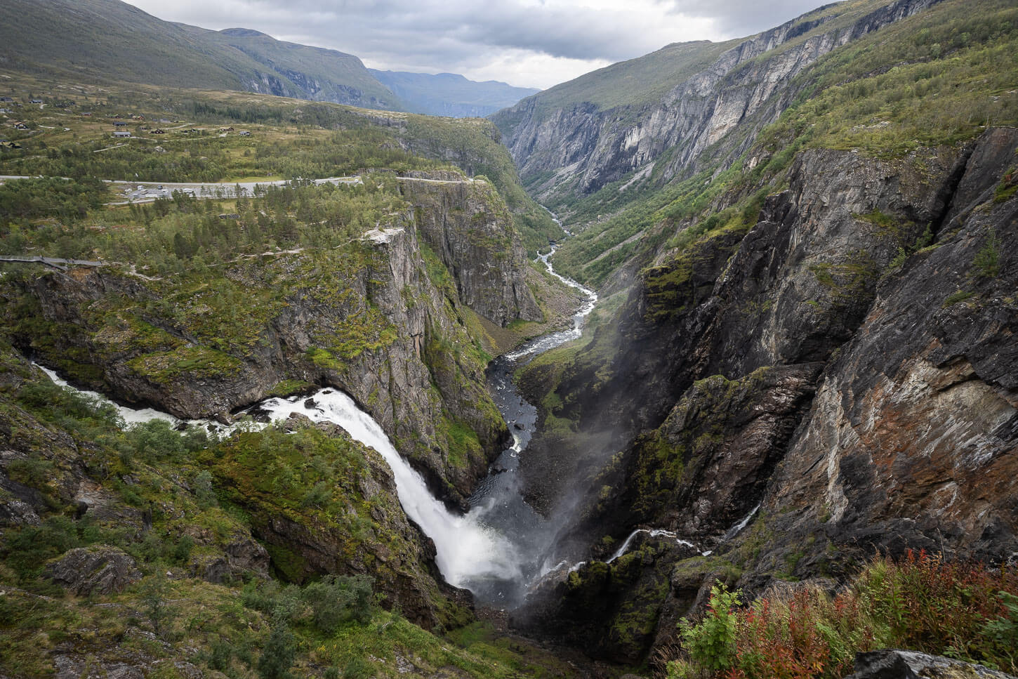
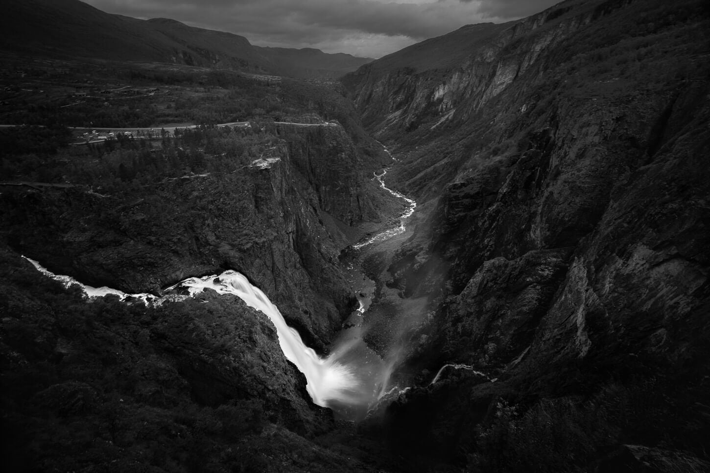
Vøringsfossen.
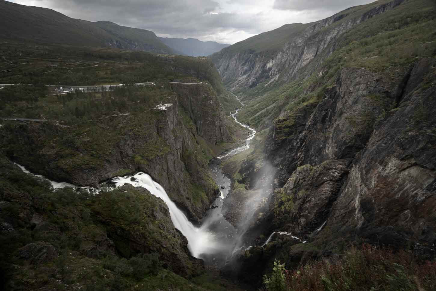
Vøringsfossen is part of the Bjoreio River in the Måbødalen Valley, and has an impressive total height of 182 m. Its main step alone is 163m. However, its flow is actually controlled at 12 m3/s (420 cu ft/s). Even then, in summer it’s a spectacular sight. It’s kind of hypnotic watching the water from the lower 163 m tall step plunging relentlessly into the narrow gorge below.
Or, given its height, crashing is perhaps a better word than plunging.
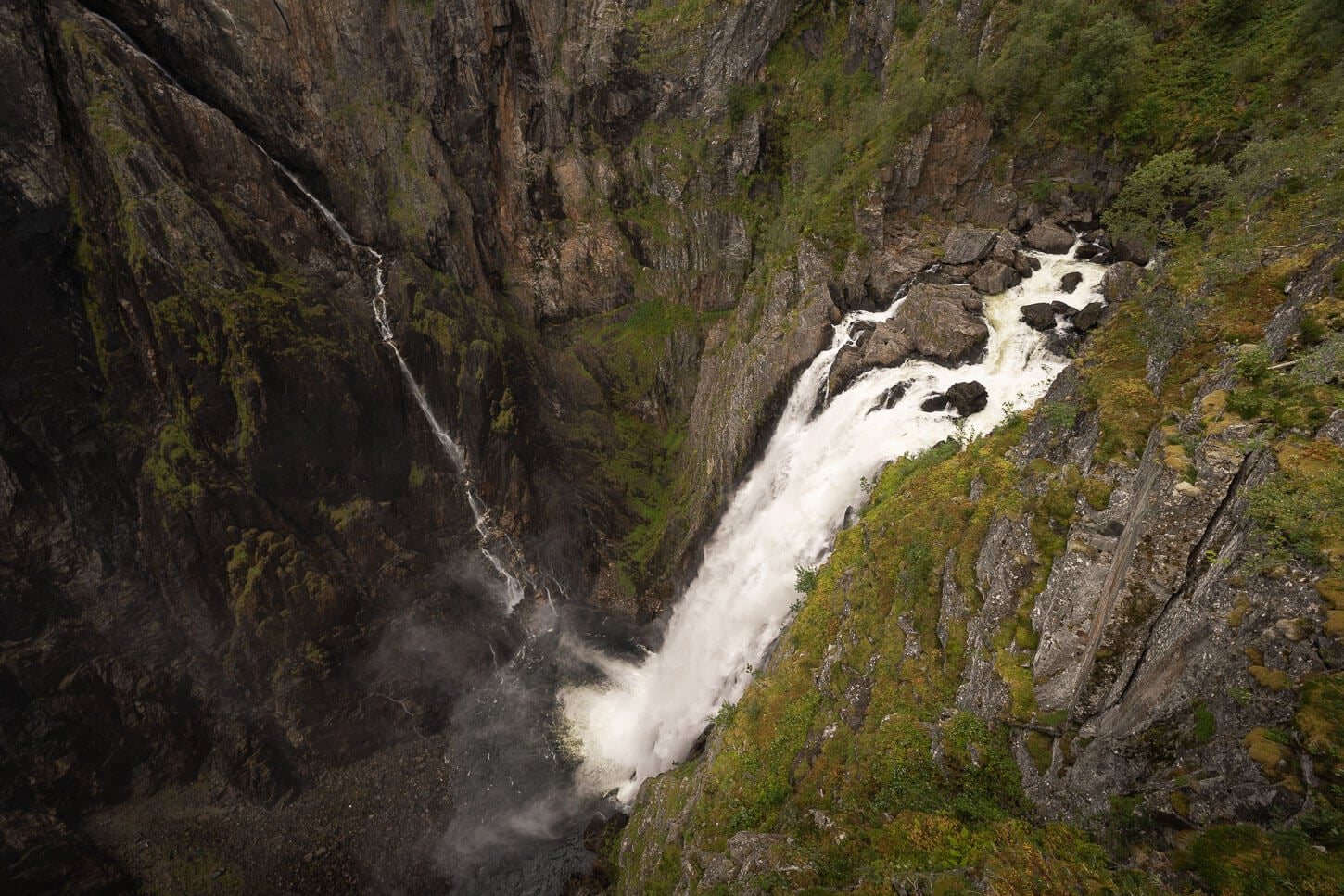
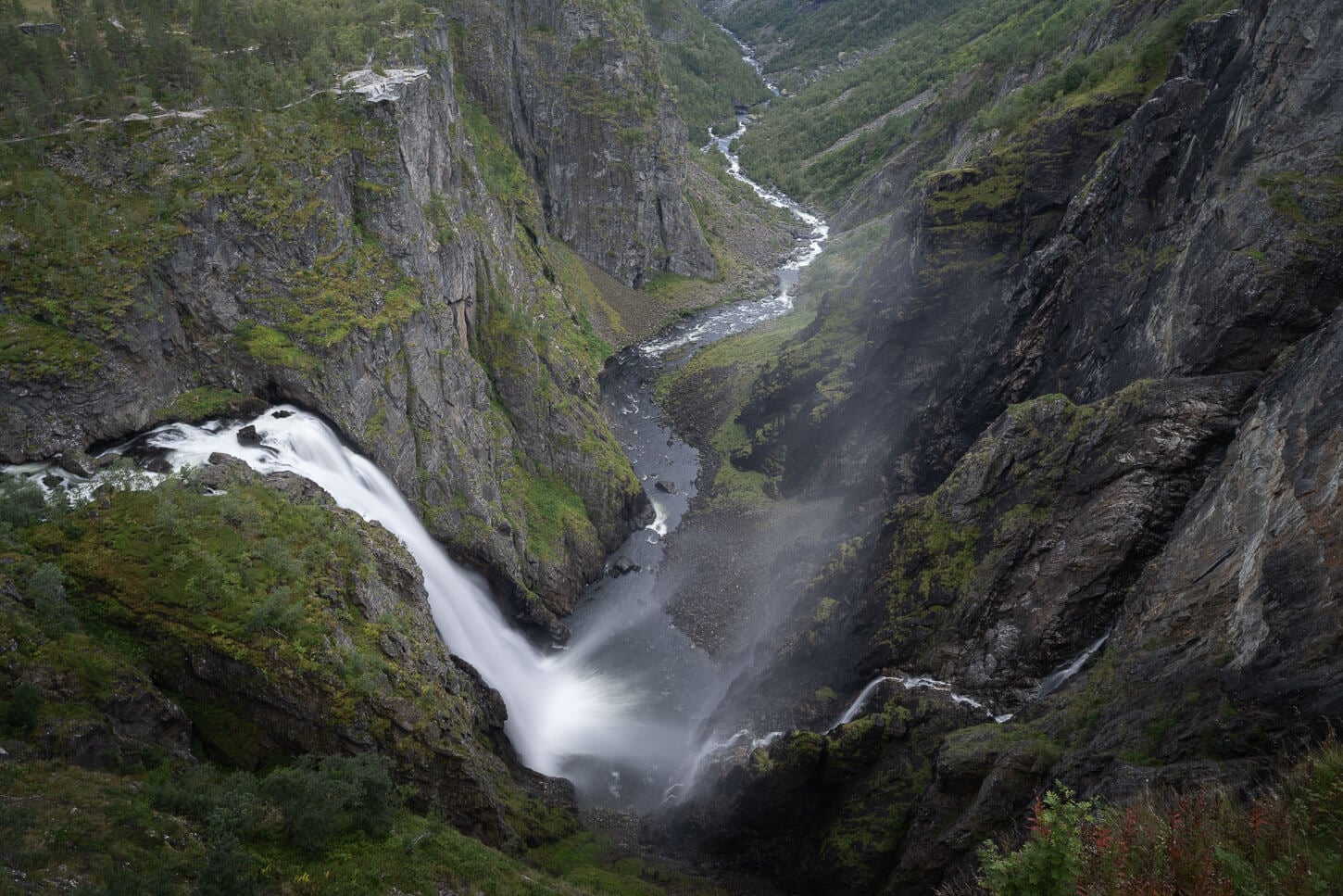
Viewpoint above Vøringsfossen.
The old suspension bridge at the bottom of the valley seems to have been closed indefinitely. Hiking to the bottom of the falls would have been my first choice. However, this leaves the upper observation deck and viewpoints as the best option to enjoy the waterfall. Still, it’s an absolutely epic sight, well worth the stop.
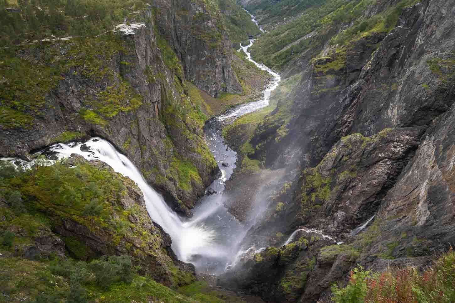
Table of Contents
Overview of the Vøringsfossen Waterfall Hike & Map
To visit Vøringsfossen, you have two main options.
You can park above the waterfall, by the Fossli hotel, or by the other Måbødalen parking/rest area downstream of the waterfall. The former is better if you just want to walk to the main viewpoint above the waterfall, the latter if you want to walk the whole path, from downstream to the main viewpoint and back.
Here is an overview of the hiking paths and viewpoints from the Visitors Center.

Map of the Vøringsfossen viewpoints and walking path, from the Visitors Center.
I opted to do the whole path, from the Måbødalen parking area to the Fossli Hotel viewpoint. It’s just a little over 2km out-and-back, and touches all the main viewpoints around the waterfall. Here are the details of the walk around the main viewpoints.
| Max Altitude | 721cm (2,365 ft.) |
|---|---|
| Distance | 2.37 km (1.47 miles) |
| Elevation gain | 120 m ↑ / 120 m ↓ (393 ft.) |
| Hike time | 00:45/ 01:00 Hours |
| Hike Difficulty | Easy Walk |
Here is the map of the hike. You can download the GXP file for free from the activity linked below.
How to get to the trailhead and Parking
Located at the top of the Hardangervidda plateau, Vøringsfossen is located on National Road 7, at about 18 km east of Eidfjord. That’s about 20 minutes by car. From Odda, it’s about 1.5 hours, or about 86km. From Bergen, you have different options, with or without a ferry, but generally speaking, it takes about three hours one way.
And, a bit of a random recommendation; if you happen to drive by Eidfjord, I can highly recommend stopping by the Vik Bakery and tasting some of their berry jam pastries.
- Driving Directions: The only way to access the waterfall is by driving on National Road 7. From Odd, you can drive north on Road 13, then take Road 7 before the Hardanger Bridge. From there, it’s a short drive to Eidfjord and then to Vøringsfossen. From Bergen, it’s a longer drive first on road E39, then on the E16 highway, before joining Road 13 from the North, where it joins Road 7 right after crossing the Hardanger Bridge.
- Parking: There are two big parking areas. Coming from the North/East on road 7, the Parking area by the Fossli Hotel is the first one you will pass by. It’s also the closest one to the main viewpoint. Coming from the South/West, you’ll come across the parking area at the top of the Måbødalen valley. This is also the one I used as the starting point of the hike. Park at the Fossli hotel if you just want to take a peek from the main viewpoint. Parking at Måbødalen is better if you want to pass by all the main viewpoints.
- Public Transport: Skyss bus 991 stops at the Måbødalen parking area. Check the Skyss Official Website for the official timetable.
Designed by Oslo-based architect Carl-Viggo Hølmebakk, the new Måbødalen parking area that opened in 2024 looks somewhat like a minimalist architectural installation.
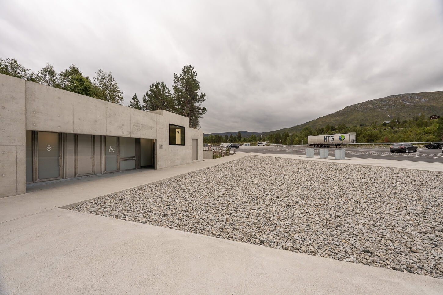
The Måbødalen rest area is a minimalist structure that somewhat makes for a soft transition from the giant paved parking lot to the path around the waterfall.
The Vøringsfossen Hiking Trail
The path around the waterfall connects four main viewpoints at the top of the Måbødalen valley, with the new bridge installation sitting in the middle of them. The names of the main areas are – from the west to the east: Vestre Utsiktspunkt, or simply “West Viewpoint”, Hovedutsiktspunkt Fossatromma, Hovedutsiktspunkt Fossli, and Nordre Utsiktspunkt.
The bridge in the middle of the four viewpoints also leads to the viewpoint of the upper, smaller step of Vøringsfossen.
Vestre Utsiktspunkt
From the Måbødalen parking/trailhead, you will have to first walk to the east to access the first viewpoint, the Vestre Utsiktspunkt. This is the viewpoint that offers limited views, with the waterfall only partly visible. Still, this viewpoint provides a good sense of the scale of how tall the cliffs really are.
Vøringsfossen Vestre Utsiktspunkt.
From this viewpoint, you’d first have to walk back to the visitors center, but following the path on the top of the ridge, to reach the next viewpoint. The views are limited until you reach the Hovedutsiktspunkt Fossatromma.
Hovedutsiktspunkt Fossatromma
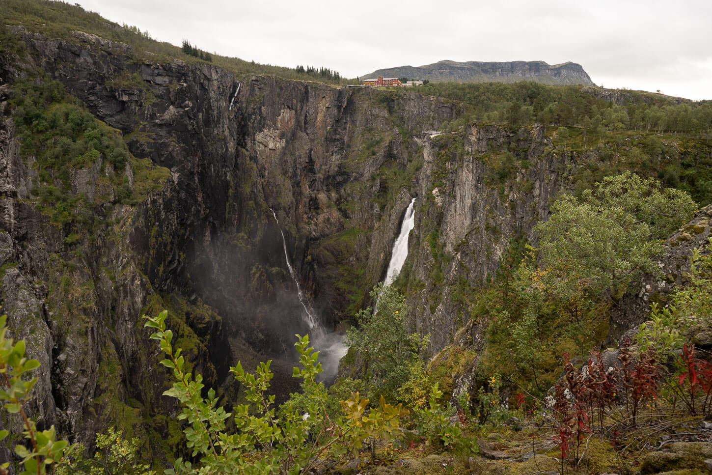
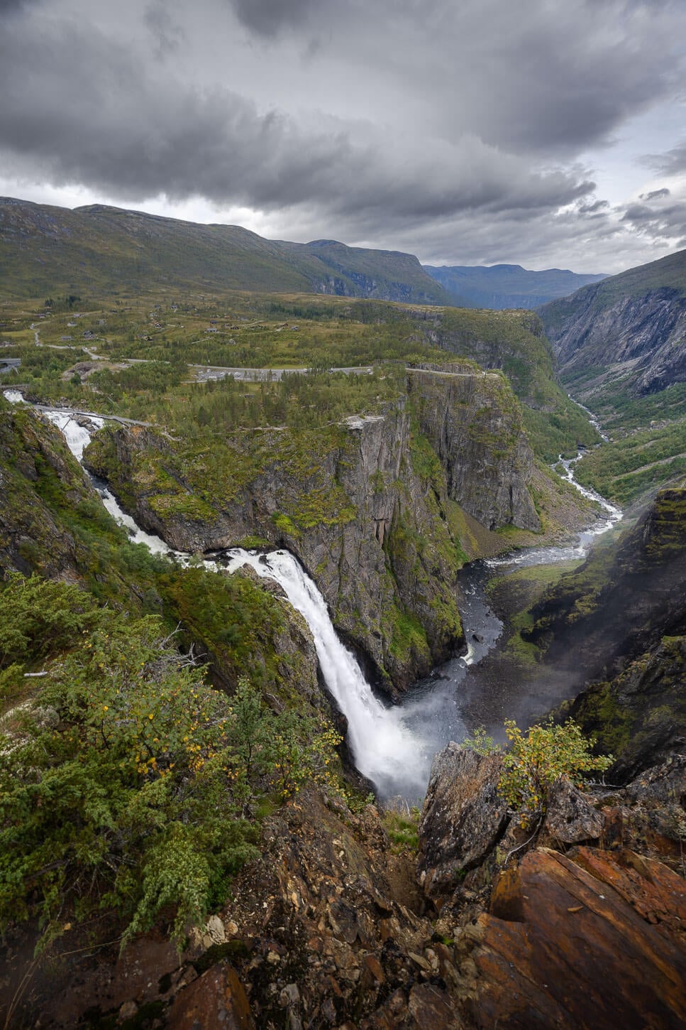
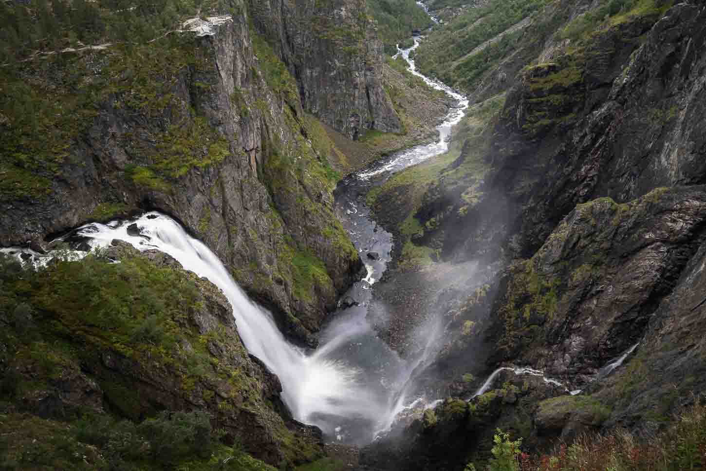
This is perhaps the second most spectacular viewpoint on the path. You are almost right on top of the lower step of the waterfall, which is also the main one. You can watch the water slowly dropping from the top of the fall, and dropping 163 meters to the bottom of the valley below.
With the view of the Fossli hotel in the background, you have a reference to really see how big this waterfall is. In that sense, Hovedutsiktspunkt Fossatromma is perhaps the viewpoint that offers the best sense of scale of Vøringsfossen.
Hovedutsiktspunkt Fossatromma viewpoint
From here, you can easily access the viewpoint of the upper step of Vøringsfossen. It looks like an entirely different waterfall, and it’s a bit farther upstream of its lower, main step. This is also where you can access the bridge across the two steps of the waterfall that was installed in 2020.
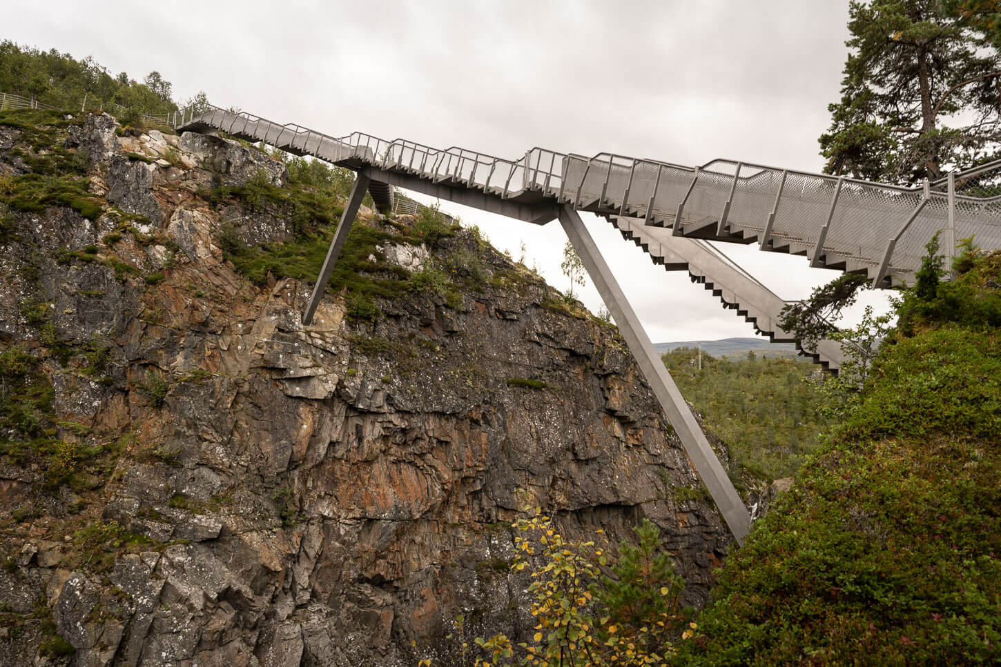
The set of bridge/stairs across the two steps of the waterfall.
Vøringsfossen upper step.
Once you cross the bridge, it’s a short walk, mostly on natural rocky terrain, uphill to the main viewpoint on this short hike.
Hovedutsiktspunkt Fossli
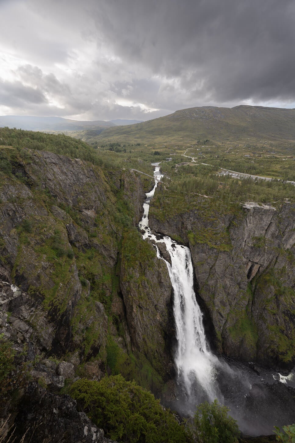
This is the main and most famous viewpoint of the observation deck around Vøringsfossen. It is also the largest and widest, right in front of the hotel. This is the “classic” photo spot too, where you have the view of the Vøringsfossen dropping into the valley below, with the meandering Bjoreio river disappearing in the distance.
View from Hovedutsiktspunkt Fossli, the classic viewpoint.
This is also the viewpoint you can access directly from the Fossli Parking area. from here. It’s a short walk to the last viewpoint, the last viewpoint, the Nordre Utsiktspunkt.
Nordre Utsiktspunkt
Lastly, the “northern viewpoint”. This is the one directly opposite the waterfall. From there, you face the waterfall directly. It’s one of the best viewpoints to really appreciate the scale of the waterfall. You have the reference to the pedestrian bridge above the waterfall.
You can see it in the photo below how small the pedestrian bridge looks compared to the waterfall.
View from the Nordre Utsiktspunkt. Notice how small the pedestrian bridge is compared to the waterfall.
This is the last viewpoint on this short hike around Vøringsfossen. So from here you can return back to your starting point, passing by the main viewpoint again.
Vøringsfossen Photos and Photography Tips
To be honest, Vøringsfossen was harder to photograph than I thought. It’s difficult to find a different angle or spot on the observation deck to photograph the waterfall from. The platform itself makes it quite difficult to find a proper shot where either the railings or the other part of the platform is not in the frame. And, with the railings, it’s also quite difficult to get close to an interesting foreground.
Foreground choices are somewhat limited by the protective railings around the platform
Vøringsfossen from the Classic Photo Spot.
All of this effectively limits compositions considerably. That’s not bad per se, as each viewpoint will easily allow you to take the classic photos and compositions. Just be aware that if you are thinking about trying to get creative with compositions, that’s going to be a challenge.
Also, with the main step of the waterfall located deep in the canyon, light could be quite harsh to manage. So in that sense, I feel it is a good spot for a moody/cloudy day. and, while the waterfall will get some light in the central parts of the day.
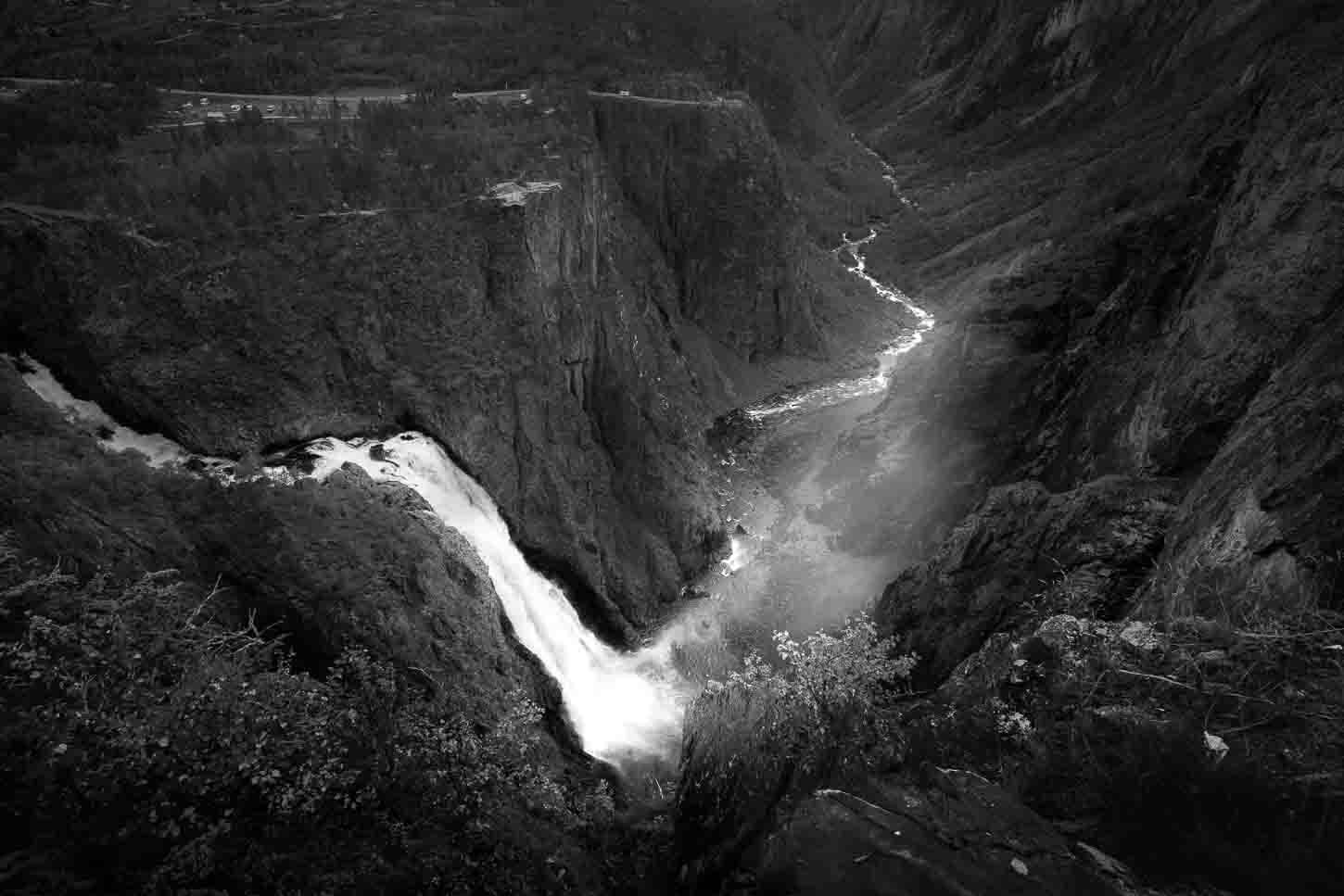
I also think this is a great waterfall for a black and white conversion, especially on moody/cloudy days, when you can push the contrast between the white waters of the waterfall and the river, and the surrounding shadowed areas. Here are my attempts to give you an idea. I am sure anyone with better black and white conversion skills can do a much better job, too.
Lastly, in terms of lenses, I mostly used my 24-70mm, which is flexible enough to capture the waterfall and the valley below, as well as to zoom in on the smaller details. Wider lenses work better to show the whole area around the waterfall.
Here are some examples at different focal lengths.
14mm.
24mm.
Where to stay
The Fossli Hotel is the closest option to Vøringsfossen, while Eidfjord is the closest town. Staying here makes sense if you want to try to capture the falls at sunset or sunrise. I can imagine how it would be early in the morning or late in the evening with just a few other people around.
Otherwise, it’s an easy stop to integrate into any itinerary when driving farther north or farther south.
Additional Resources
- If you are into epic waterfalls, check out the beautiful waterfall Låtefossen. It’s a couple of hours drive south of Vøringsfossen.
- Here is the official page of Vøringsfossen on the Visit Bergen website. Check it for possible updates.
- Check out (many) more Hikes in Norway, with Maps!


Leave A Comment