Bjarnafoss, an Easy Waterfall Hike in the Snæfellsnes Peninsula, Iceland
The Hike to Bjarnafoss is a short and easy one to a beautiful waterfall along Road 54, on the Snaefellsness peninsula in the West of Iceland. This is a location you would typically visit as a quick stop if you are driving to or from places like Grundarfjordur or Arnarstapi.
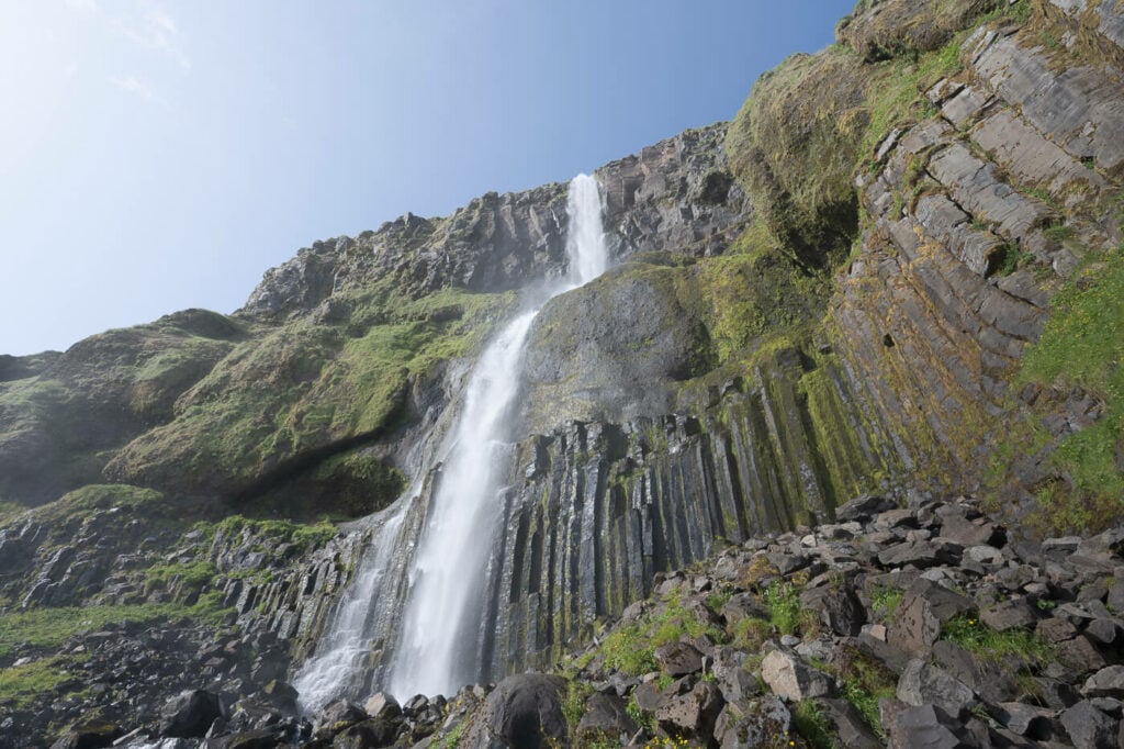
The impressive Bjarnafoss and its 80 meters of drop
Also called Bjarnarfoss, Bjarnafoss is quite an impressive waterfall too; at 80 meters high, it demands attention even from afar. It’s possible to hike up to its base to where you can watch it from up close
The trail is not immediately visible from the road, not even from the parking area, unless there are a few cars already parked there. Still, it is an easy location to visit, for a quick stop or a short hike alike.
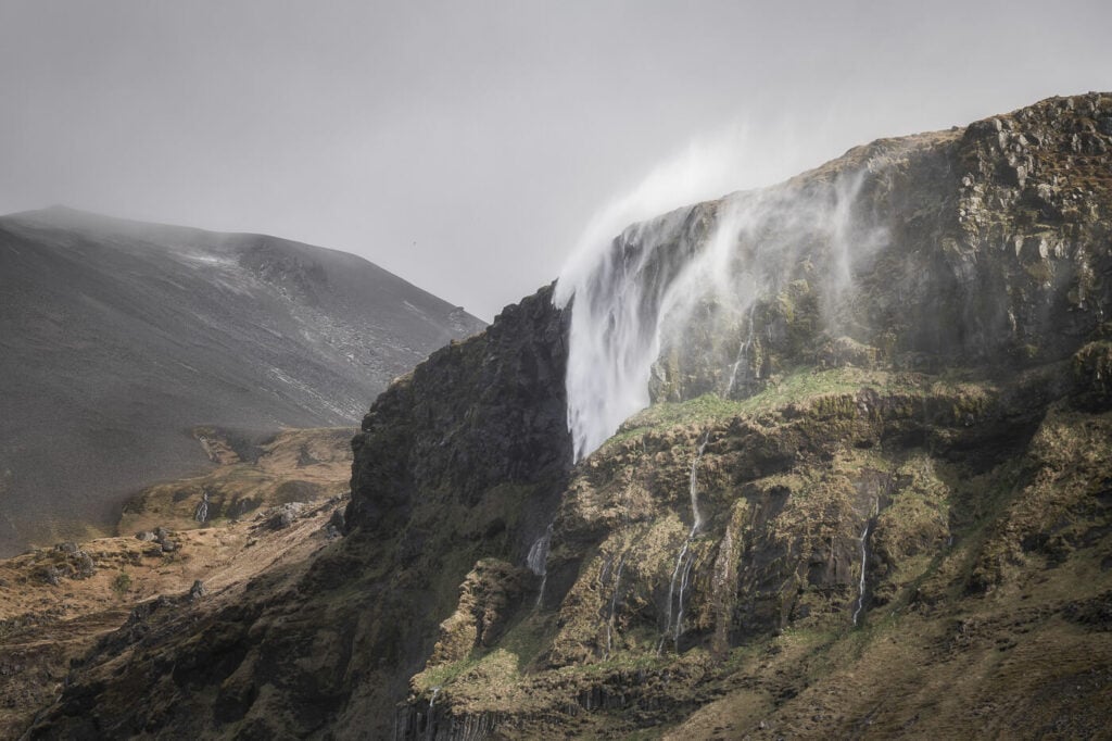
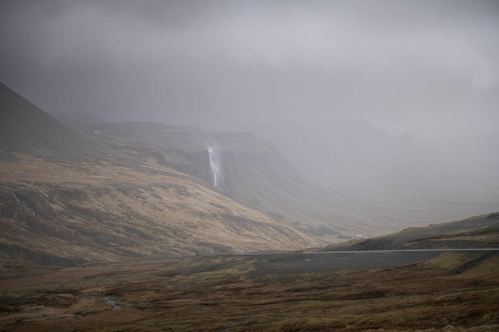
Bjarnafoss, going up and sideways during some typical strong Icelandic Winds
Going to Iceland? Blue Car Rental Discount!
As a reader of The Photo Hikes, you get a 5% discount on your car rental when booking with Blue Car Rental through this website. The discount will be automatically applied to the booking through the following link
Table of Contents
Overview of the Bjarnafoss Waterfall Hike & Map
Here is an overview of the hike. While it should be possible to visit all year round, the experience can vary depending on the season.
Spring and summer bring lush greenery and longer daylight hours, while autumn offers vibrant foliage. In winter, the landscape may be blanketed in snow, adding an extra layer of magic to the scenery – and ice, so be careful and wear appropriate footwear.
| Max Altitude | 143 m |
|---|---|
| Distance | 1:52 KM |
| Elevation gain | 140 m ↑ / 140 m ↓ |
| Hike time | 00:30/ 00:45 Hours |
| Hike Difficulty | Easy |
Here is also the map of the hike, from the parking area to the highest point I was able to reach:
How to get to Bjarnafoss and Parking
- Driving Directions: If you are coming from Reykjavik, keep driving toward Grundarfjordur, but do not turn right on Road 56. Instead, keep following Road 54 toward Arnarstapi for another 20 minutes or so. You’ll see the waterfall on your right. If you want to visit Grundarfjordur or Kirkjufell first, then turn onto Road 56. After Grundarfjordur, you can continue past Kirkjufell on Road 54 toward Olafsvik. You’ll see Bjarnarfoss on your left while driving down from the pass.
- Parking: It is easy to miss, as it feels a bit like you would be trespassing. However, there is a free, rather large, parking area. It’s not immediately visible from the road, but you’ll see it when turning onto the access road.
- Public Transport: No bus stops close by.

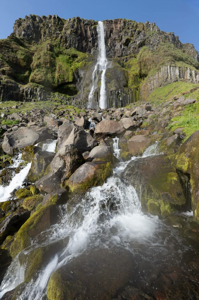
The Bjarnafoss Hiking Trail
The trailhead is right by the parking area. The first part is nicely maintained, and there’s a wide path leading to a bridge across the river. The hike is pretty much flat up to the bridge across the river, which is also a good viewpoint to admire the waterfall.
From there, the trail gets progressively steeper, though it’s never very demanding.

The first part of the trail up to the bridge across the river is nicely maintained.
The last part of the hike is relatively steep and can be muddy when wet.
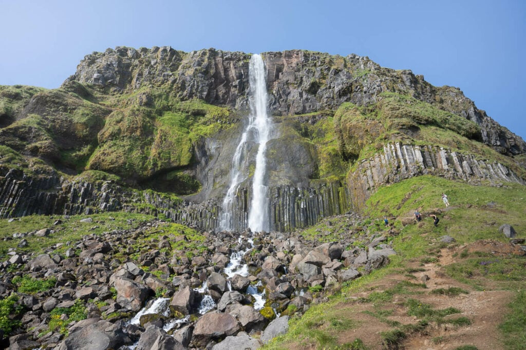
There isn’t a viewing platform or observation deck close to the waterfall, so you can walk around its side until you feel like it or until you can. Just be aware that the closer you get to the waterfall, the rockier and steeper the terrain gets.
From up there, you not only get a good look at the waterfall, but also at the vast, surrounding landscape.

Lastly, there may be a lot of vegetation in summer, covering holes in between rocks in the upper part of the trail. So pay particular attention to where you set your foot if you want to get close to the waterfall.
The Bjarnafoss Waterfall Hike Photos and Photography Tips
While the waterfall is a beautiful sight from wherever you look at it, I see Bjarnafoss as one of those waterfalls that are best photographed from a distance.
I think that’s for a couple of reasons. From up close, it’s hard to provide a sense of scale, and the waterfall is on a vertical drop, so there are not many good vantage points with a good foreground.

My favorite viewpoint is relatively far, on Road 54, on the mountain pass that connects to Grundarfjordur. There’s a large pullout area on the right if you drive up the mountain.
I wanted to link it, but it’s not visible on Google Maps. It was probably built quite recently, as I don’t remember it in past years. Anyway, you can’t miss it. You will need a lens like a 70-200 mm to capture it from up there, but the sight is worth the additional stop.
This viewpoint offers a much better sense of scale, with the waterfall standing out from the vast coastal landscape of the Snaefellsness peninsula.
Bjarnarfoss, from Road 54


The waterfall essentially faces south/south-west, so it is well-lit throughout the day. This creates great opportunities to capture it from the pass, with some nice sidelight.
Where to stay
The closest locations with some facilities would be Arnarstapi, Grundarfjordur, or Olafsvik. All of them offer additional attractions and points of interest, for instance:
- Arnarstapi: Budir’s Black Church, Londrangar, and the Cliffs/Rock Arches at Arnarstapi
- Grundarfjordur: Kirkjufell, Kirkjufellsfoss and Grundarfoss.
- Olafsvik: Bæjarfoss, Bugsfoss, and Svöðufoss
Additional Resources
- Discover more beautiful waterfalls or locations on the Snæfellsnes peninsula: other than Kirkjufellsfoss, I’d highly recommend a stop at Grundarfoss, Svöðufoss, and Selvallafoss.
- This stop was part of an eight-day campervan trip across Iceland – check it out for more travel inspiration.
- Check out more Hikes in Iceland here.


Leave A Comment