Munken Hike, Lofoten, Norway
The Munken Hike is one of the Lofoten’s Best. Of all the hikes I’ve been to, I’ve found the hike to Munken to be the one that consistently offered some of the finest landscapes and views.
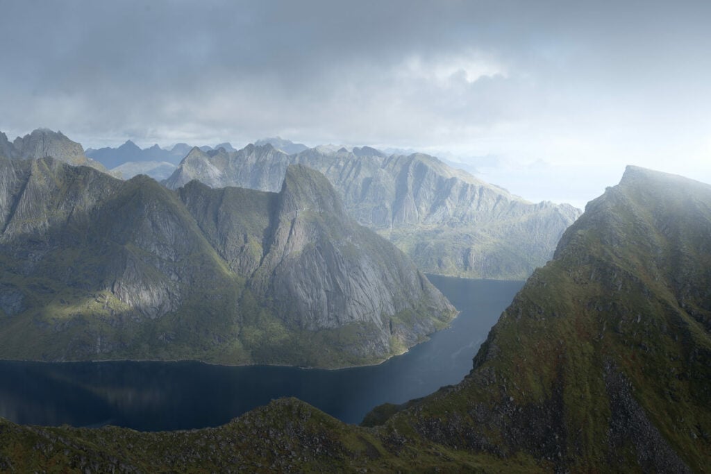
Mountains, Lakes, Cliffs, views of some of Lofoten’s most remote regions, and quite a few waterfalls – which are not that common on any hike in the Lofoten islands.
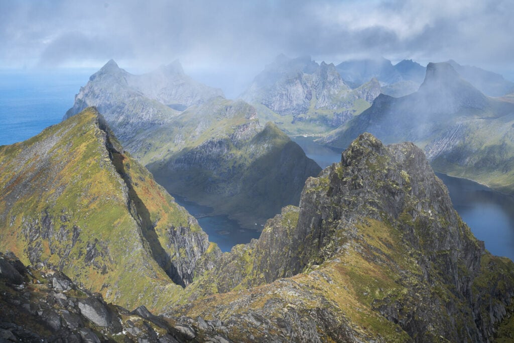
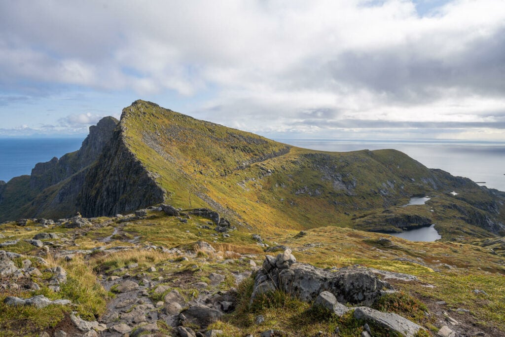
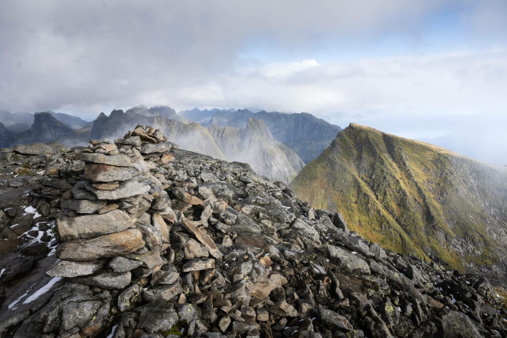
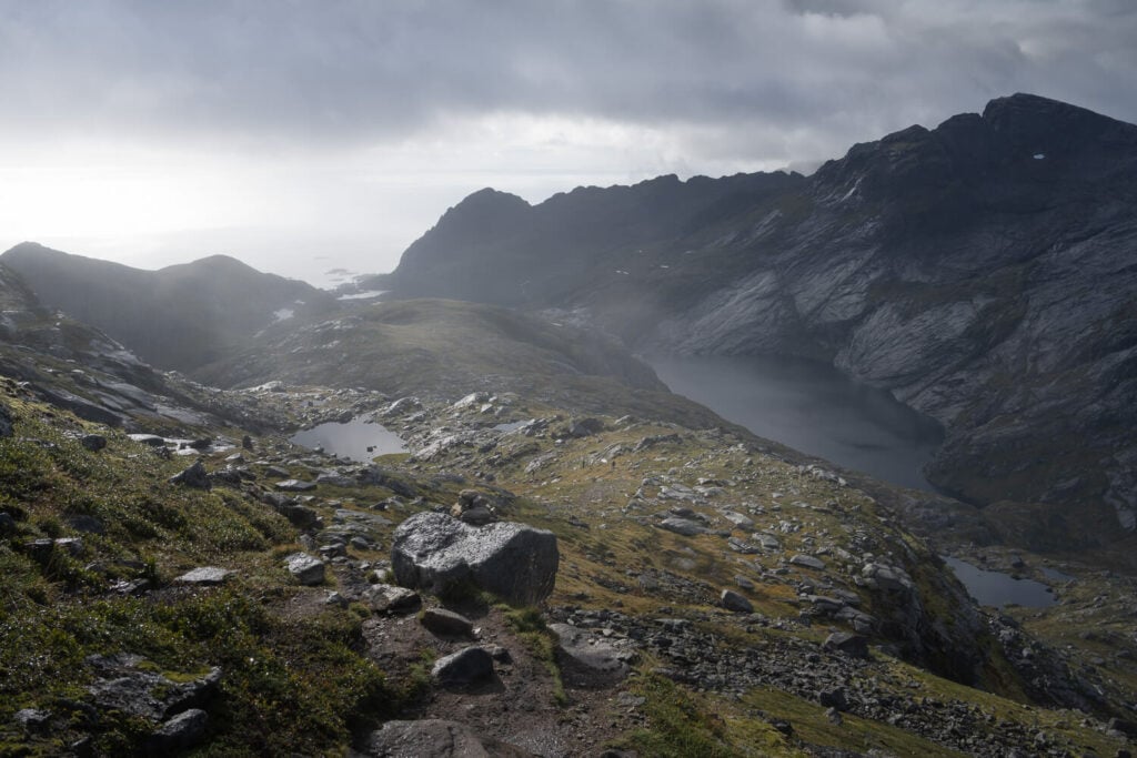
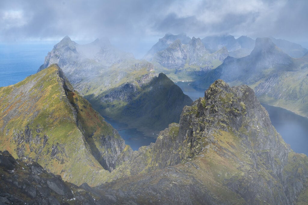
View from Munken’s North Summit
I almost regretted not having hiked this trail earlier in the 10+ years I’ve regularly visited the Lofoten.
Also, the trail is a rather enjoyable one. While it is not an easy hike, it also does not require any particular abilities or scrambling. Sure, there are some parts of the trails that are a little more technical or have chains to help with balance or slippery terrain
Anyway, if you are debating whether you should include this hike in your itinerary or not, I’d say go for it if you have time. Sure, do Reinebringen, Ryten, or all the beaches in the Lofoten, but try to include Munken too. You will not regret it!
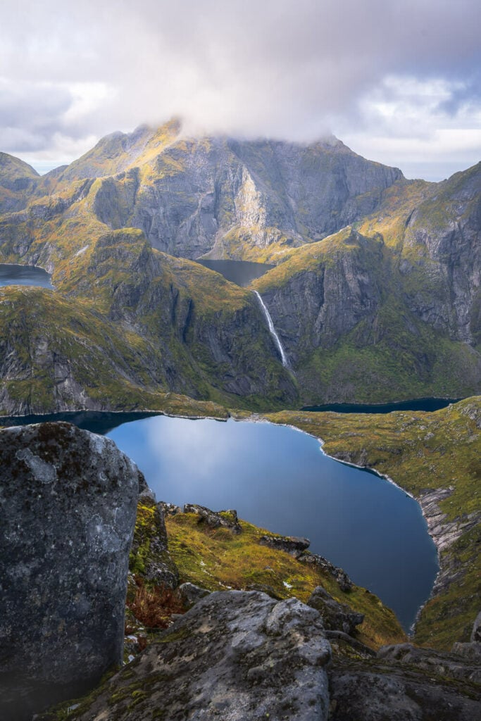
Table of Contents
Overview of the Hike & Map
This particular hike started in Sørvågen, which is the most popular trailhead. Even from there, you can take different routes to reach Munken – two of which will not pass by the hut – unless you intentionally include it – but we’ll get to that later.
| Max Altitude | 779 m |
|---|---|
| Distance | 12.6 KM |
| Elevation gain | 1,000 m ↑ / 1,000 m ↓ |
| Hike time | 06:00/ 07:00 Hours |
| Hike Difficulty | Hard |
Here is also the map of this hike. You can download the GPS file from the Komoot activity linked below:
How to get to Munken and Parking
The trailhead is easily accessible with all means of transport. Finding a parking spot may be a challenge in the summer months (July and August), though.
- Driving Directions: The trailhead is accessible by car. From a northerly direction (i.e. Leknes or Reine), keep driving
- Parking: Paid parking is available at the trailhead. However, it is quite a small area – more likely you’ll have to park further back in front of the Sørvågen School where more paid parking is available. I’ll save you some time, don’t look for free parking spots. There are none unless you are staying at some of the Rorbuer or guesthouses around that includes parking.
- Public Transport: Bu Stop Sørvågen Vest. Buses 300, 742, 772 to Å i Lofoten stop here.
An alternative but harder option is starting the hike at Djupfjordbrua, which I’ll describe in the next section.
The Munken Hiking Trail
As mentioned, there are several possible trails you can follow. Here I’ll provide a brief overview of the options you have.
Alternatively, you can start your hike by the Djupfjordbrua. From there, you can follow the trail to Veinestinden, and take the turn to the left at the opposite side of the fjord. You should see an old and worn-out sign pointing to that trail. You’ll connect to the main Munken trail at this “junction”:
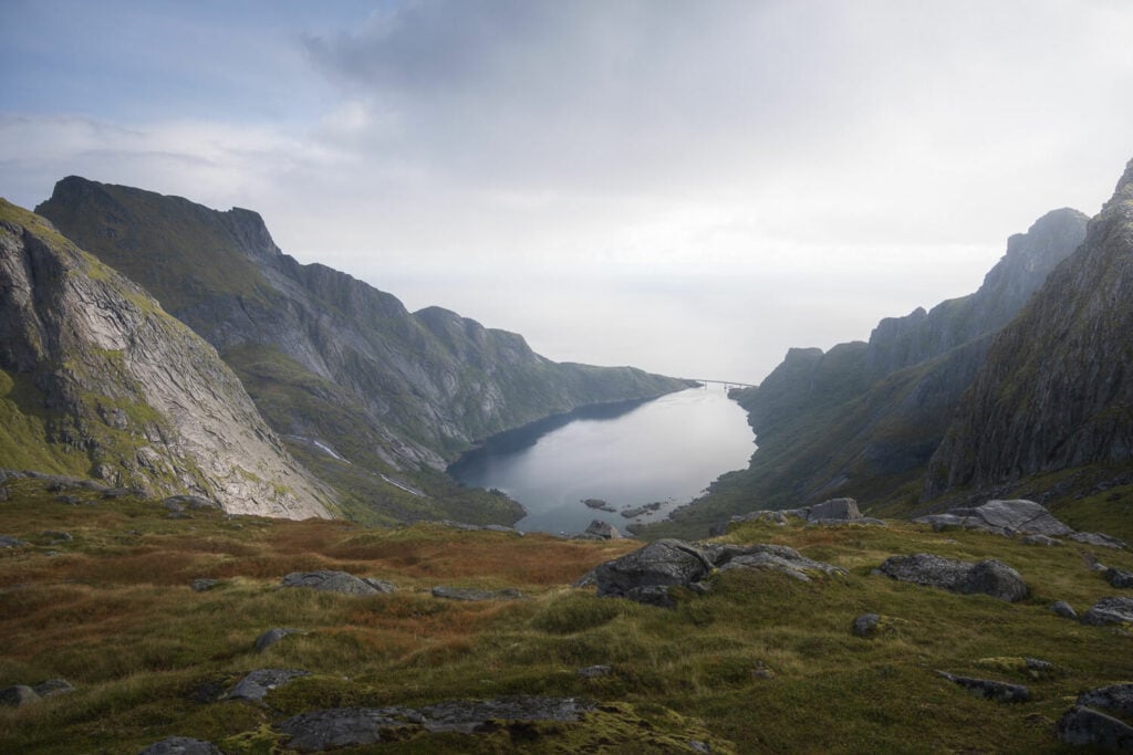
Here is where the trail from Djupfjordbrua connects to the main Munken trail.
While I hiked to Veinestinden, I have not done this particular stretch of connection trail myself. I have seen part is if and it appears to not be much traveled, and seems fairly steep. However, the first part is quite slow and hard because you will have to cross some thick birch woods and muddy trail sections. I’d recommend reading my Veinestinden Hike report for a description of that part of the trail.
One last quick note: the trail ends at Munken’s not summit. The real summit is a steep rock face only suitable for experienced climbers Now on to the trails to Munken and Munkebu from Sørvågen.
Hiking from Sørvågen to Munken
First of all, technically speaking the trail is not particularly difficult for experienced hikers. on the other hand, it is sometimes slow going and rather muddy in places. So it will likely take longer than anticipated to complete the out-and-back hike to the summit.
From the trailhead in Sørvågen you have several options to hike to Munken. So much so it seems to be in a maze of trails at the beginning with several deviations along the way.
In the beginning, you can follow the trail posts to Munkebu, and the cairns you will find along the way.
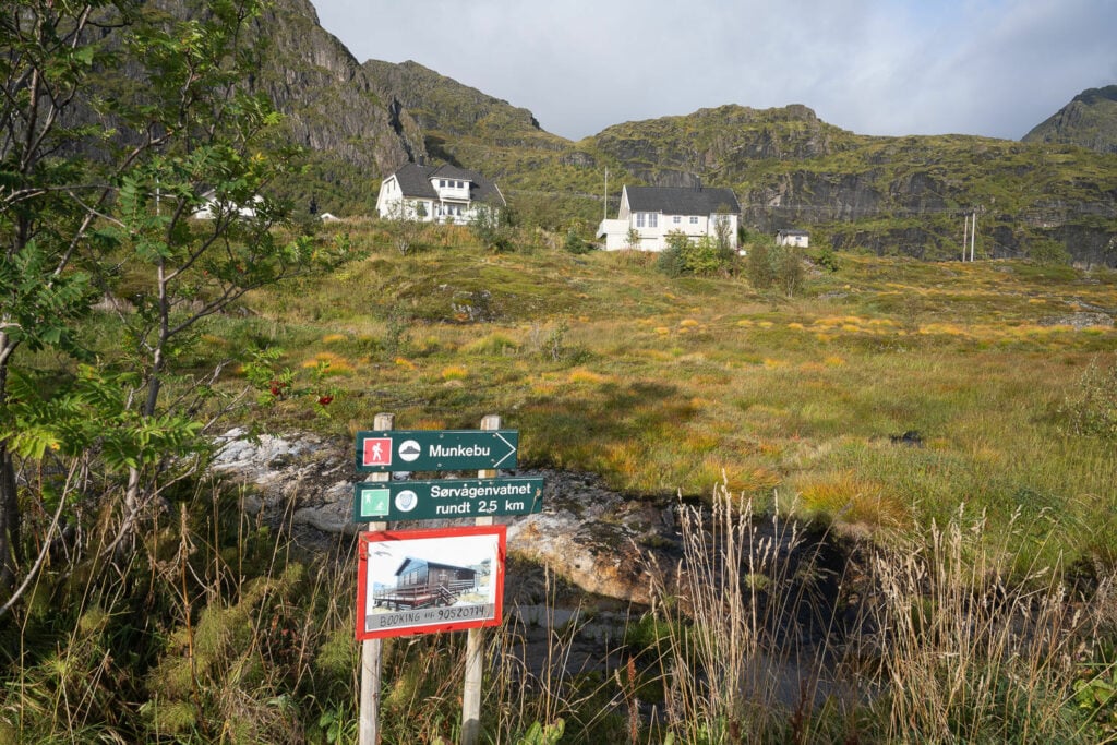
The trailehead
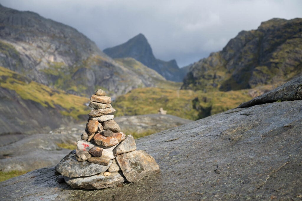
Cairns mark the way for most of the trail.
As you proceed further, you’ll discover several different rails heading in different directions. Generally speaking, as long as you follow the generally northerly direction, you will reach Munken or the Munkebu huts.
However as far as I can tell there are three main trails. I’ll call them the upper, the lower, and the middle ones.
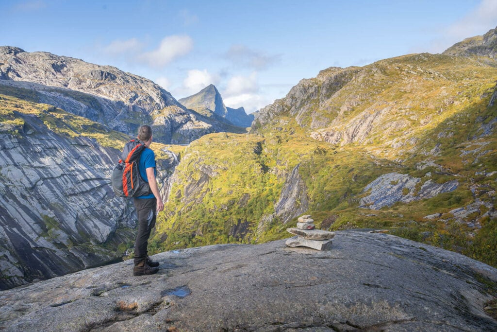
The upper one is the easternmost trail, which will allow you to summit Merraflestind (537m). This means more elevation gain though.
Merraflestinden, the peak on the left.
The lower trail is the westernmost trail and it’s not marked on all the hiking apps I’ve checked. This is the one that will pass by the Munkebu Huts.
The middle trail is the one I have hiked and I am reporting on in this post. This trail does not pass by the Munkebu huts, but you can make a detour and include them in your itinerary if you’d like to do so.
There are a couple of steep but not scrambling-steep stretches of the trail along the way with a couple of fairly large plateaus in the middle. The first plateau is dotted with small lakes. To reach it, you’d have to climb up some flat rocks, helping yourself with chains for balance.
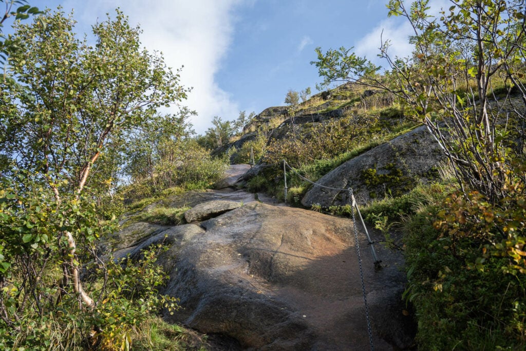
Even if not steep, these rocks can be slippery. Do use the chains.
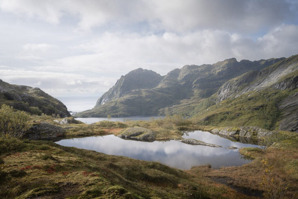
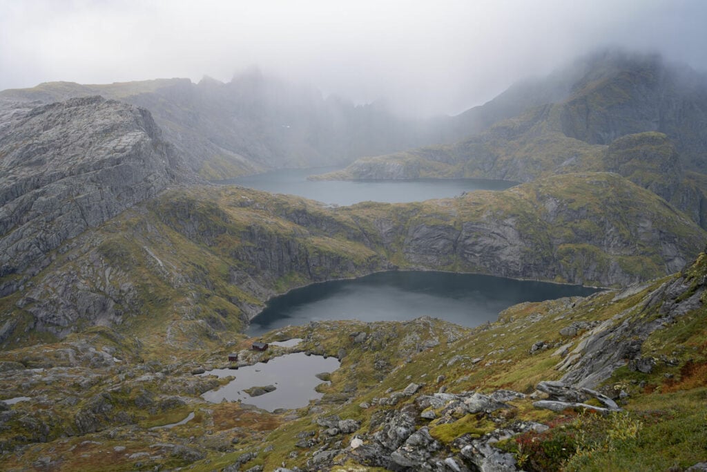
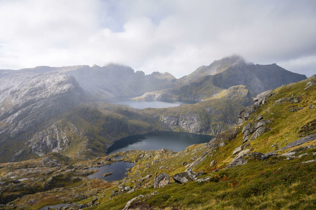
Once past the previous section, you will reach the first plateau, where you’ll find several small lakes (or large ponds, whichever you prefer).
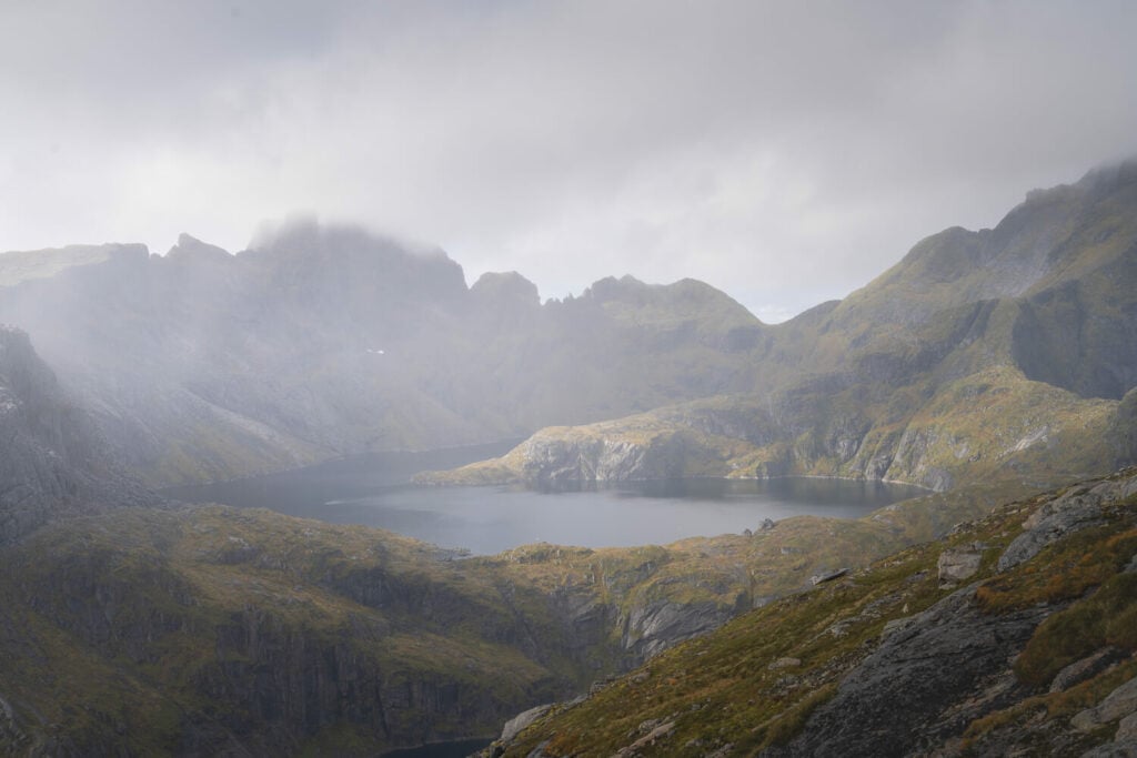
The second plateau is just below the final stretch to the summit. Here you can already see the Munkebu huts as well as Hermanndalstinden – the highest mountain in the Lofoten, hiding in the clouds in the photo below.
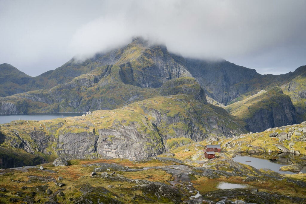
The Munkebu huts
As you continue the trail will get steeper and the terrain rockier. The views will gradually open up, revealing some of the stunning landscapes that await at the top. At some point, you will reach a small saddle and you’ll see a “giant “Rock Tooth” to your right. That would be Munken’s true summit – only fit for experienced climbers.
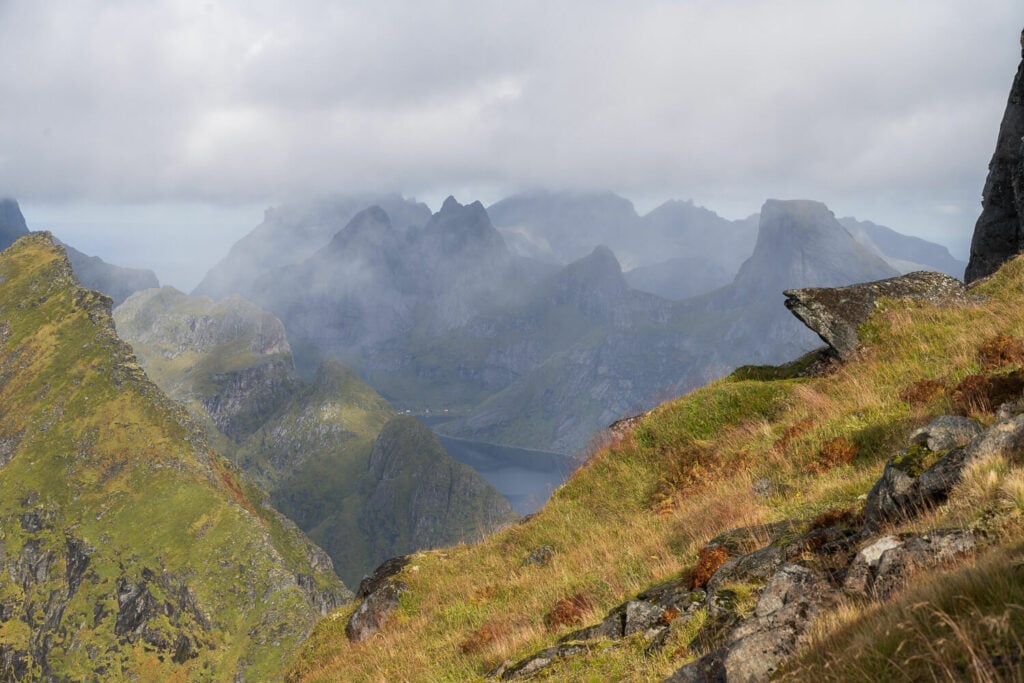
View from the last, steep part of the trail just below the summit.
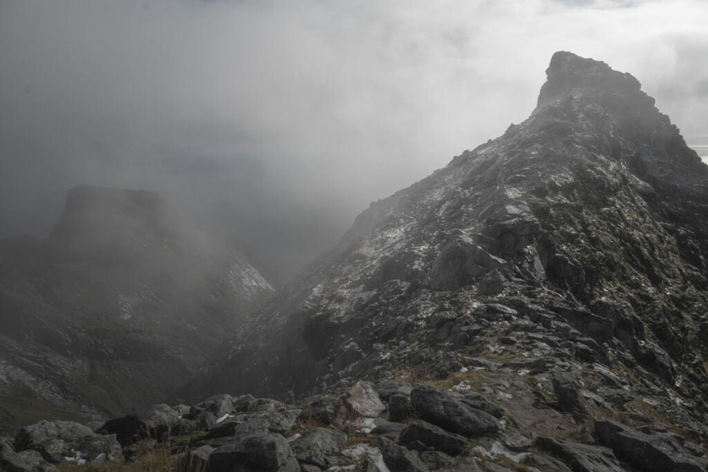
Munken’s real summit, to the right, a somewhat ominous but beautiful tooth of rock.
You’ll also see some rather big cairns ahead of you, marking the way to the flat and wide North Summit. There’s a lot of space to wander around and just soak in the views, rest a bit, and have a snack and a drink. Enjoy the views!
Cairns marking Munken’s North summit
View from Munken’s North Summit
The Munken Hike Photos and Photography Tips
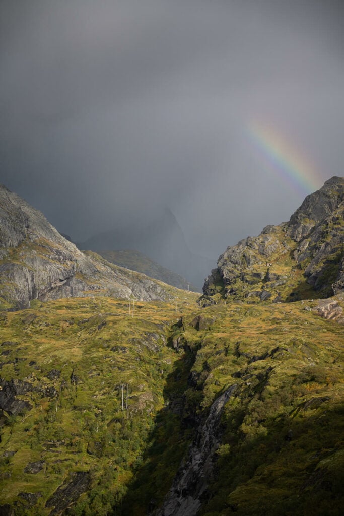
Well, what to say; you’ll be taking several stops to take pictures align the way. This holds whether it will rain or not. I had several rain showers along the way and that created even better conditions at several locations. This is a hike where I’d recommend to keep your camera ready at all times. For instance, I was lucky enough to catch a few rainbows along the way and they are not that uncommon at that time of the year I visited (September).
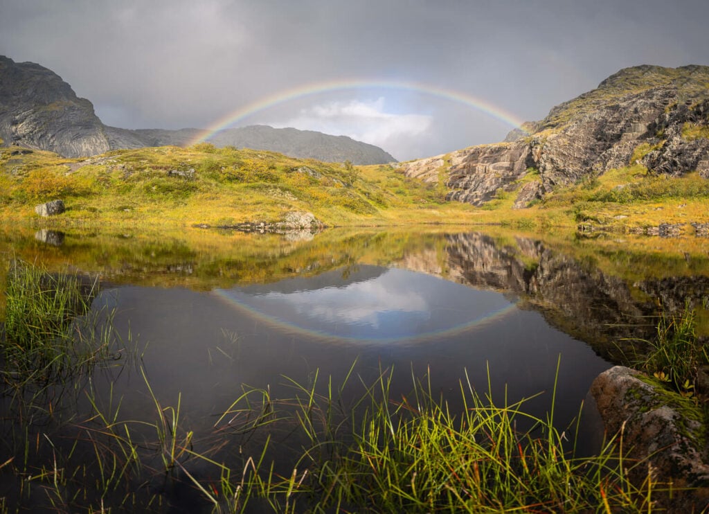
A rainbow reflecting in one of the several large ponds/ Small lakes along the way.
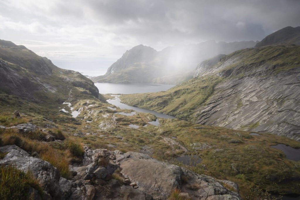
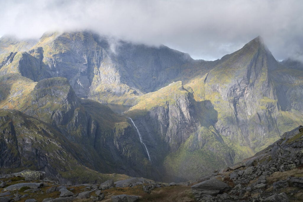
First of all, there are several waterfalls along the way. The first one is just a few minutes into the hike. You can get much closer to it than I did too, if you. You’ll pass by small lakes and the views will gradually open up to the magnificent landscapes around the trail. This goes for the whole trail, not just stretches of it. As you can probably tell by now, I am quite enthusiastic about the landscape around here :).
Hermanndalstinden and Litlforsvatnet, the small lake in the foreground. Photos take close to the summit.
Rain showers in the distance
Light peeking through the dark clouds
View from the summit
Light and rain
A light very faint rainbow. can you spot it?
View from the summit toward northwest
On top of all that beautiful landscape and considering how long this hike is, you’ll likely have very different lighting conditions on your way up and on your way down. Almost like being on the same hike on two different days. Here is an example of two photos of the same location on the way up and on the way down.
On what gear to bring: take with you all the lenses you have, from ultra-wide to telephoto. There will be an occasion to use all of them. You could technically fly a drone here to as the trail is outside of the Lofotodden National Park. However, I did not bring mine on this occasion, the views are plenty beautiful from the trail already :).
Video of the Munken Hike
Last but not least, you can also watch a short video of this hike, from the trailhead to the summit.
Where to stay
First, and a very common option, you could stay at the Munkebu huts, provided you booked your stay in advance. Alternatively, also a common option you could camp in the area. Check the camping restriction map first though.
If you’d rather do it as a day hike, there are plenty of options in the area. Sørvågen and Å i Lofoten are the closest small towns, but also Reine offers plenty of accommodations and is a very popular choice.
Additional Resources
- Planning a trip to the Lofoten? Here are my tips to plan a trip to the Lofoten Islands.
- Check out more amazing hikes nearby: Reinebringen and Veinestinden
- Check out more Hikes in Norway


Fabulous. I’d like to keep up
Thanks Markus – it is an amazing hike, so much so that I wish I had done it earlier in my years of visiting the Lofoten.