The Veinestinden Hike (Navaren) on the Lofoten Islands, Norway
The Veinestinden Hike on the Lofoten Islands supposedly provides some of the best views in the whole Lofoten Islands. Supposedly? Yes, with the scenery you can find on the Lofoten Island it’s hard to make a call on the best views. What I will say is the views from up there are glorious.
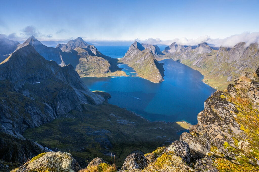
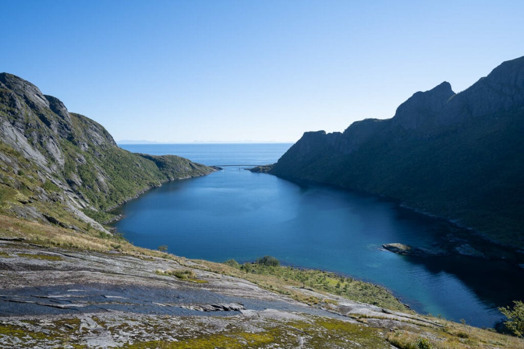
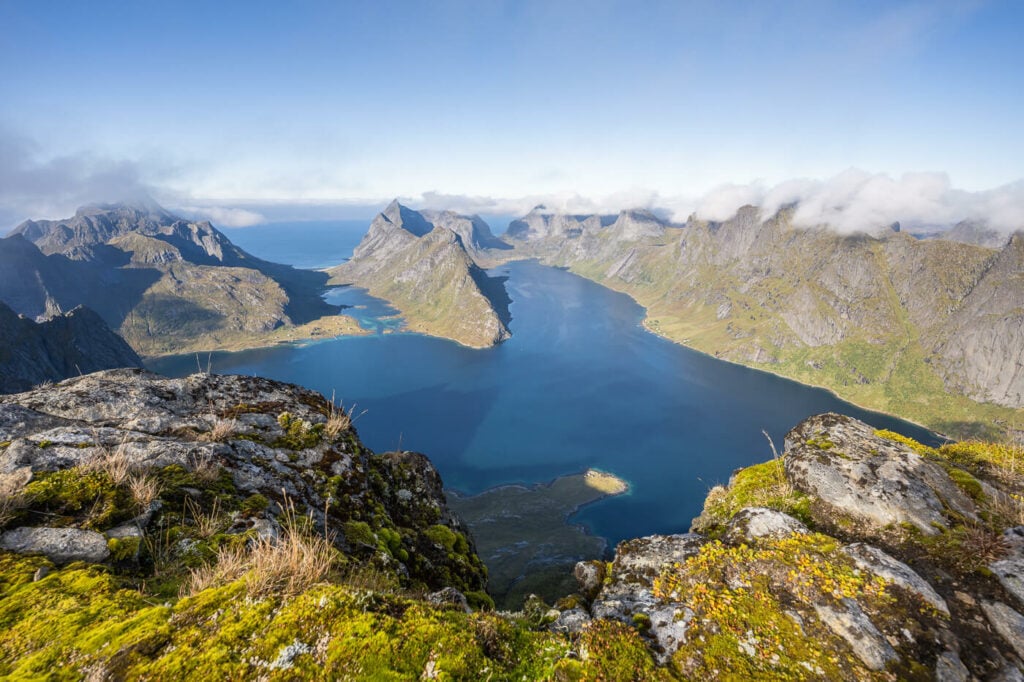
View from the top of Veinestinden toward Kjerkfjorden and Bunesfjorden
Truth be told, the first time I hiked up there, I was met by a wall of fog. And rain. Despite hiking all the way to the top clouds and rain completely obstructed the views.
I spent almost two hours up there waiting for the skies to clear, to no avail. So I decided to head back down, at least I had a good excuse to come back another time. And so I did.
View over Djupfjorden from the first part of the trail.
I was pretty excited while preparing for my first hike to Veinestinden. From the photos and the hike reports available online, everyone appeared to be rather enthusiastic about the views from the top.
Likewise, I was looking forward to this hike. I had planned it carefully for a couple of years, wondering what the view would be like from the top. I was ready to tackle the strenuous hike to get to the top and enjoy the views.
The second time around the weather was beautiful. I can safely say the views were more than worth the effort of getting back up there for a second time.
Note on Place Names: You might see this peak referred to as both Veinestinden and Navaren. While older print cartography and traditional routes often group this area under Veinestinden, modern digital maps have updated the specific peak name to Navaren. The GPX track is accurate to the trail described below.
How to get to Veinestinden & Overview of the Hike
- Getting there: From Reine, drive toward A. On the left, you will find the Steffenakken parking area right after the Djupfjordbrua (Djupfjord bridge). You can park the car there.
- Start of The Hike: From the parking area, cross the road, and head toward the bushes on the side of the fjord. You will see a few trails leading into the vegetation. For the next few Kilometers, it’s all going to be boulders, bushes, and probably mud too.
- Photography & Scenery value: Scenic views over the Reinefjorden and surrounding mountains. Glorious Landscapes, more suitable for Sunset than Sunrise.
- Difficulty: Hard, but kind of fun. The hike itself is not too hard in terms of distance or elevation. What makes this hike hard is mostly the first part through the bushes and the muddy parts of the climb. This demand a rather good core strength, so adequate fitness is required for this hike.
Tip: If you can, spend the night up there in a tent.
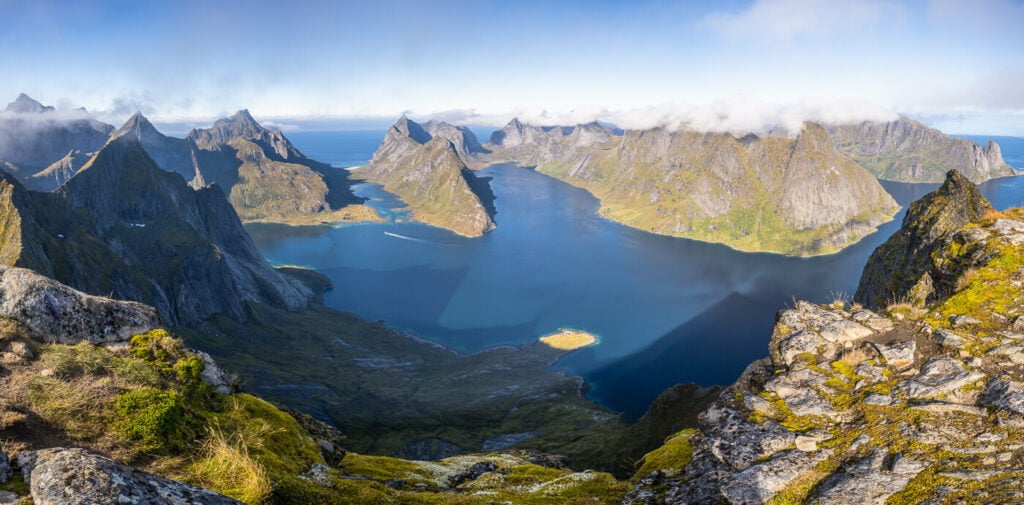
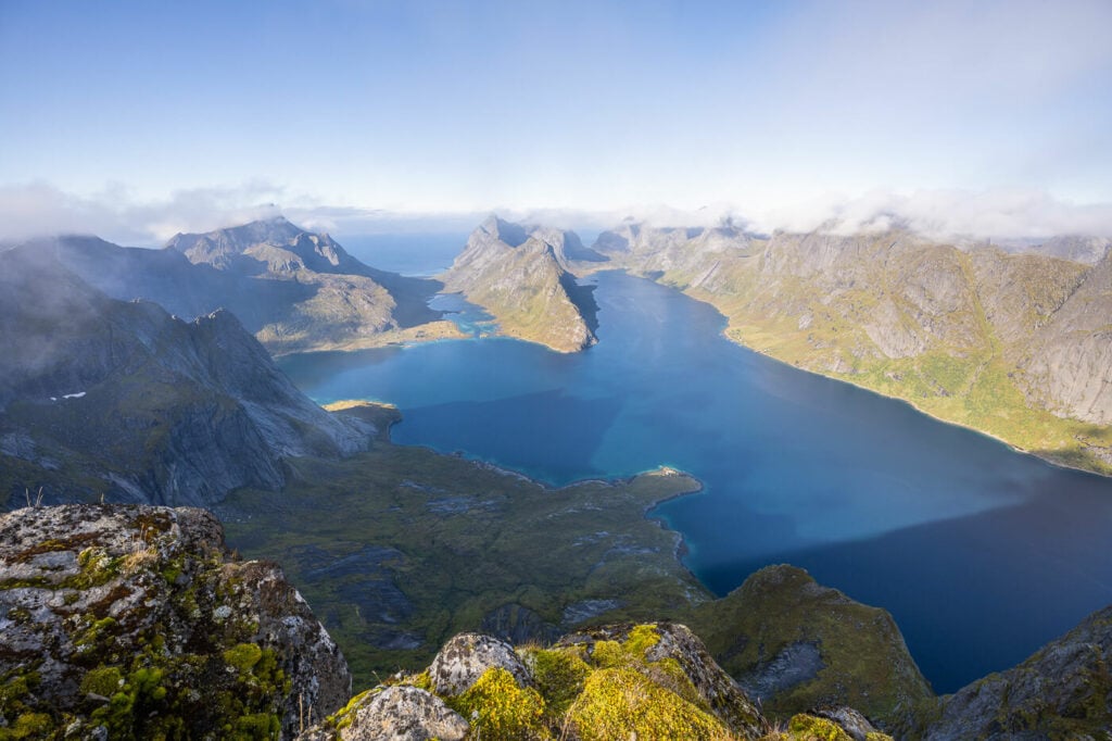
Panoramic image from the top of Veinestinden.
The Veinestinden Hike on the Lofoten Islands
| Distance | Ascent | Duration |
|---|---|---|
| 10 Km | 760 Mt | 6/7 Hrs |
Before you set off, you should be aware that this is one strenuous hike. There are no exposed areas, but the trail is challenging in places, especially the first part. With that out of the way, let’s keep going :)
As you leave the parking area by the Djupfjordbrua and carefully cross the road, you will already be able to see some of the dense vegetation on the side of the fjord. That’s where the trail starts. For the next 2 KM, you will need to hike through those bushes. It’s very slow going as you will have to negotiate your way through little by little. If it recently rained, the trail is going to be muddy, very muddy.
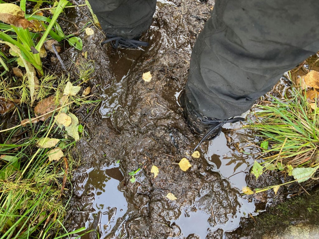
Muddy Veinestinden trails. Probably as muddy as it gets.
This part on the bushes is slow going but also fun in a way. I did enjoy finding my way through the bushes, scrambling up the boulders, and in the mud. After a couple of kilometers, you will reach a clearing, almost at the end of the fjord. There also seems to be an unmarked trail to Munken, so stick to the one on the right.
Next, you will pass behind the red hut. Here the trail may be difficult to follow as you will have to navigate across a boulders field. Once you’ve climbed up this section, you’ll pass by Austerdalsvatnet, before starting the second, steeper part of the climb. As you get closer to the top, I’d recommend getting up to the ridge first. You’ll get great views of the Reinefjord, in anticipation of reaching Veinestinden.
From there it is mostly an easy hike. A little deceiving, as it will look much closer than it is. Anyway, if you made it here, you’re a short hike away from some incredible views. Sit down there for a while and soak them in :)!
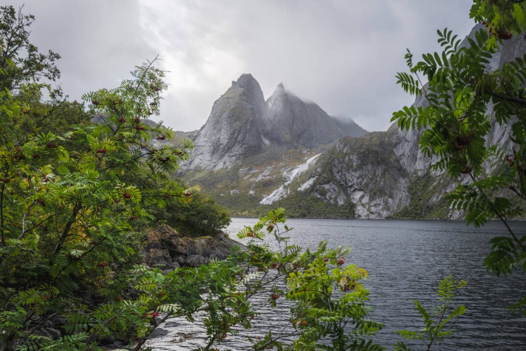
Djupfjorden, from the side opposite the start of the hike.
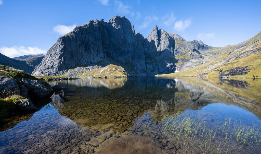
Austerdalsvatnet, the small lake halfway through the hike
The trail above Austerdalsvatnet
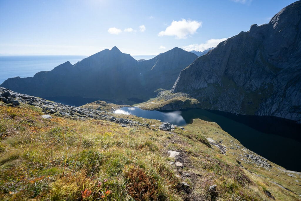
View from the ridge before Veinestinden, toward Reine
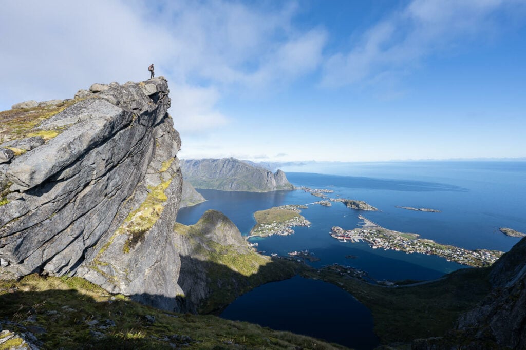
The Glorious view from the top of Veinestinden
Photos and Photography Tips for the Veinestinden Hike on the Lofoten Islands
Despite the views from the top being the absolute highlight of this hike, there are quite a few other scenic spots along the way. The first part of the trail, the one in the bushes, offers great views of the far end of the fjord and the impressive mountains around it.
The next scenic spot is Austerdalsvatnet, the small lake you’ll come across halfway through the hike. As you get closer to the top, I would recommend hiking on the ridge. The sights from there are fantastic. The summit speaks for itself.
I’d recommend bringing anything in the 14-200mm range. An ultra-wide angle will be useful to include a good foreground and the mountains on the other side of the fjord are quite far. and may appear too small. As mentioned this would be an epic location for a sunset. Lastly, there’s some wildlife up there. I’ve spotted rabbits twice and a sea eagle once.
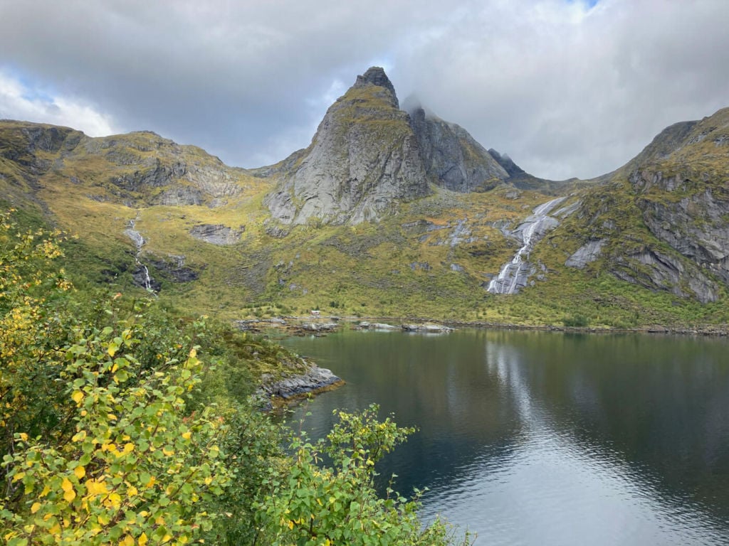
Another view from the trail. The waterfall on the right is the one that needs to be crossed.
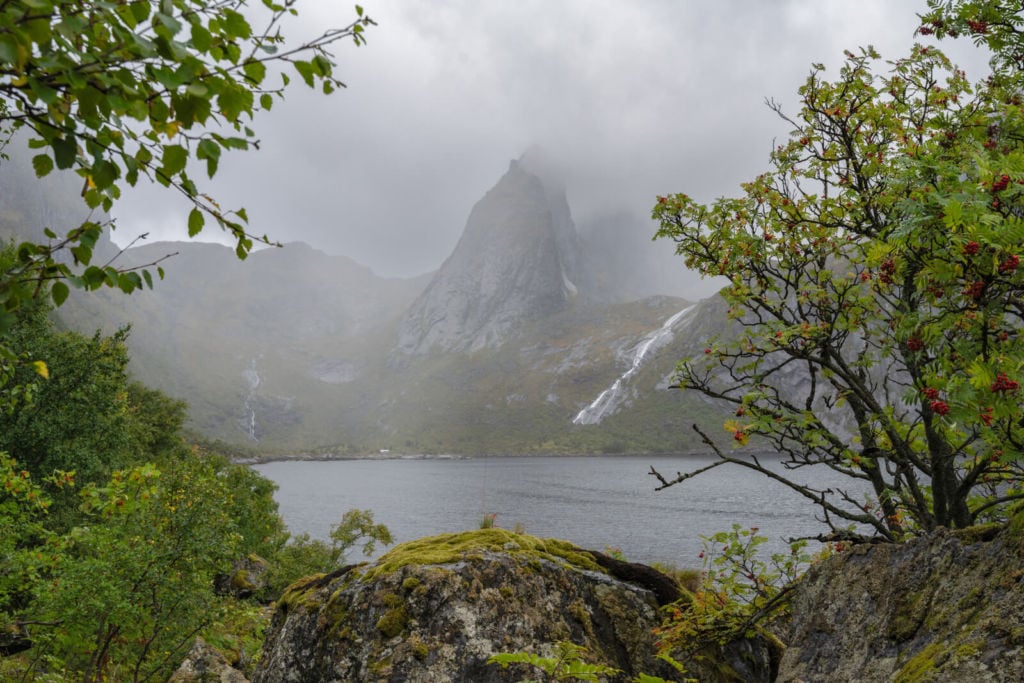
Rainshower during the first part of the Hike.
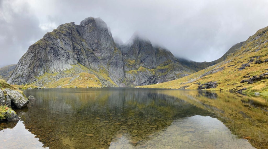
Austerdalsvatnet
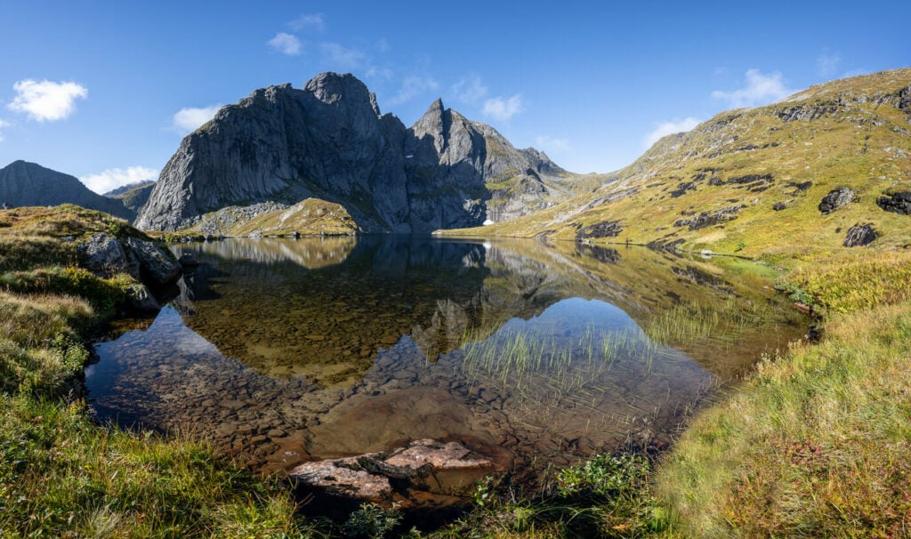
Austerdalsvatnet on a sunny day!
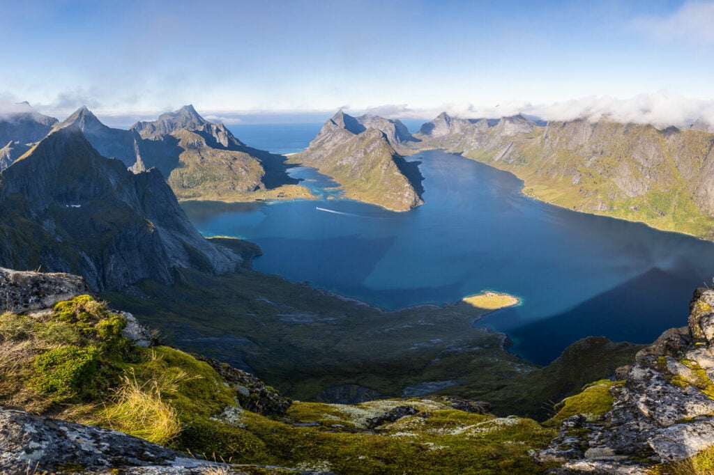
The Epic view from the summit
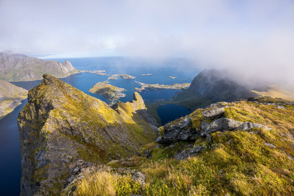
View from Veinestinden toward Reine

Beautiful light on the peaks around veinestinden
Again, the stunning view from the summit
Video of the Hike
Here’s a short 4K video I made on my list hike to Veinestinden. Check it out if you want to have a feel for the trail. Nothing fancy, just the trail, the views, and some music.
Map of the Veinestinden Hike on the Lofoten Islands
Here is the map of the hike. If you need a GPS track, you can download the .GPX file from the Komoot activity.
A quick note on a slight detour on the way up. I lost the trail before the hut at the end of the Fjord and had to cross a boulder field. If you decide to use this track, stay on the right one when approaching the cabin.
Where to Stay
Camping on top is definitely a great option. The area around the summit is relatively large, with several spots suitable for a tent. Otherwise, there also is a campsite in Moskenses. Several different types of accommodation are also available around the Reinefjorden.
Additional Resources
- You may also want to check out the Reinebringen Hike, and Munken, which are relatively close
- Planning a trip to the Lofoten? Here are my tips to plan a trip to the Lofoten Islands.
- Check out the main page on Hiking in Norway for more Photo Hikes and inspiration.
If you have any questions about this hike, let me know in the comments below.


This isnt Veinistinden. Veinistinden is the ridge over, even the gpx map you linked calls it something different. This hike is the hike to Navaren
Thanks for the clarification, Andrew. You’re completely right that modern maps now show this distinction. When I originally researched this route over a decade ago, Navaren wasn’t featured on the available cartography, and print references labeled the general area as Veinestinden. I still have paper maps and references calling it “Veinestinden”, but online sources all seem to have been updated since then to be more precise, which explains the discrepancy between the old references and the current GPX data.
I really appreciate you taking the time to point this out. I’ll update the post to reflect both names so it’s clear for others! Thanks!