The Strútsfoss Hike, East Iceland
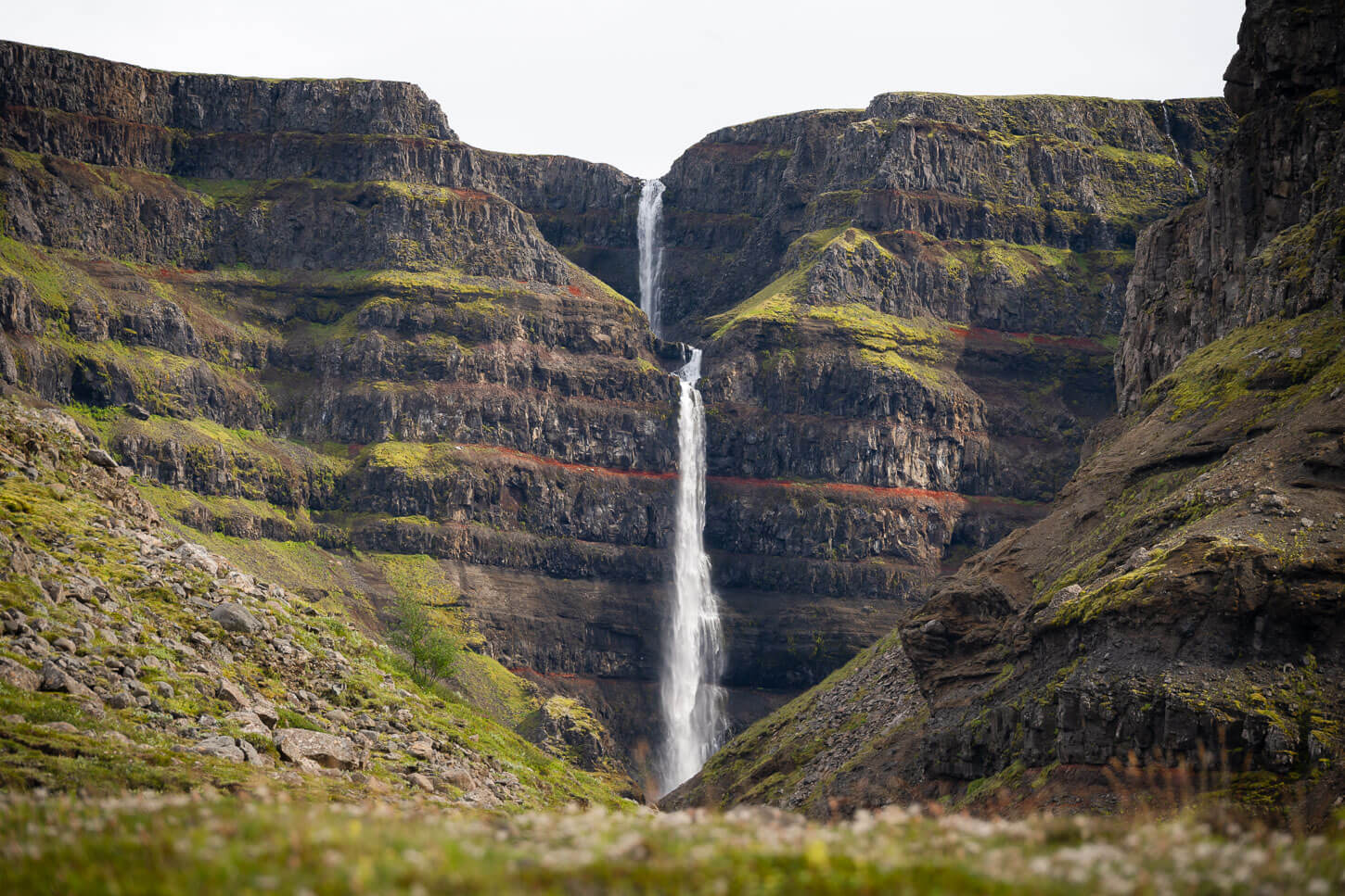
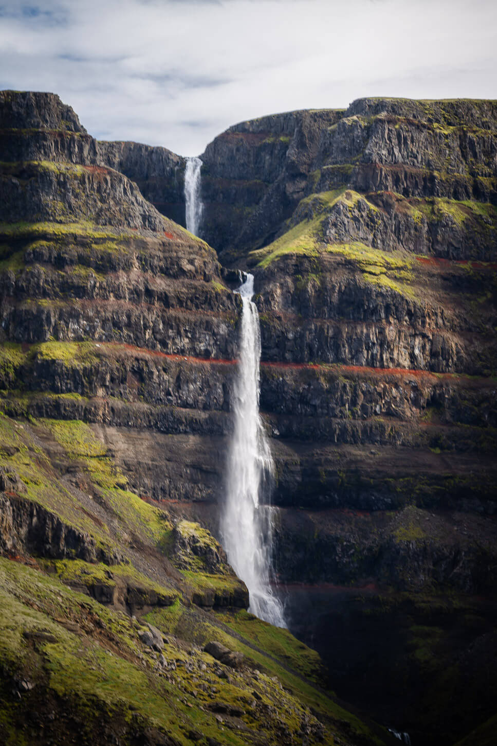
Strutsfoss (Strútsfoss) is a beautiful and hidden waterfall in the east of Iceland that can only be reached on a short hike. it is actually one of the tallest waterfalls in Iceland, actually the fourth-tallest one, at a total height of 120m split in two steps (20 and 100m).
Strútsfoss.
This beautiful waterfall is located in Suðurdalur near the Sturluflöt, in the East of Iceland. It is a relatively remote location, and the trailhead is at the bottom of a dead-end road. Still, it is easily accessible, and suitable for any 2WD passenger cars. So it is a good location for anyone to experience some of the magic Icelandic landscapes away from the crowds. It still boggles my mind how few people visit this beautiful location. I have been there four times, and never met anyone.
Strutsfoss is also similar to Hengifoss in some aspects, due to the red layers in the cliffs, and it’s actually not too far from it either. So if you are planning a hike to Hengifoss and are into waterfalls, you should add Strútsfoss to your itinerary. It should not be too challenging to combine both hikes in one day.
The waterfall and both of its steps, the upper (20m) and the lower (100m).
If you’d like to discover more similar waterfalls, you may also want to check out my eBook “Iceland – the Best Waterfall Hikes and Walks“; with 103 hikes or walks and a total of 172 waterfalls, 32 GPX files, it is one of the most complete and exhaustive resources available on the topic.
Table of Contents
How to get to Strútsfoss and Parking
As mentioned in the introduction, this is quite a remote location, despite being easily accessible.
- Driving Directions: in the past, there was no online map that would provide reliable or even correct directions, but as of 2025, it became possible to get to the trailhead even using Google Maps. Howeever, It’s a long detour from the Ring Road. You’d have to take first road 931, same as for Hengifoss, and drive until its end past the bridge until the road turns into toad 935. it’s a dead-end road. I’ve been there fours times, and the first teo I felt like I was on the wrong road. I was not. It takes about 30-40 minutes to drive from Hengifoss to the Strutsfoss trailhead.
- Parking: there is a relatively small parking area by the trailhead. It can probably fit 7-8 normal cars in total, but I doubt you’ll find it full. Parking is free at the time of writing. It’s here on Google Maps. But again, despite that, you won’t get directions from Google Maps.
- Public Transport: no public transportation options. Not even paid tours, as far as I am aware.

A very well marked trailhead.
Overview of the Strútsfoss Hike & Map
The Strútsfoss Hiking trail is an easy one, suitable for all skill levels. No steep, exposed, or difficult passages along the way.
| Max Altitude | 300 m |
|---|---|
| Distance | 7.53 KM |
| Elevation gain | 270 m ↑ / 270 m ↓ |
| Hike time | 01:30 / 02:00 Hours |
| Hike Difficulty | Easy |

The info point at the trailhead.
Here is the map of the hike. A GPS isn’t really needed since the trail is well-marked and easy to follow. However, you may find it useful to get to the trailhead.
The Strútsfoss Trail
The trail is well-marked and easy to follow. The first part is more of an old countryside road, almost all the way to the main lookout above the Canyon Strútsfoss falls into. As you follow the yellow trail marks, you will slowly gain elevation, following the course of the Strútsgil River upstream first.
Part of the trail actually appears to be an old dirt road rather than a hiking trail. Probably used by farmers to access the nearby fields. However, as you hike further into the canyon the trail will become a proper hiking trail.

First part of the trail; you can see the top of Strutsfoss in the center to the left.
Initially the trail will gently gain elevation. The waterfall will disappear from view at times, but the landscape around is nice enough by itself to make it an enjoyable hike.
Soon enough you should start seeing the top of the waterfall again. You will pass by a resting area where in recent years a picnic table has bee installed, and it;s a great place to sit, and have a snack and enjoy the views.
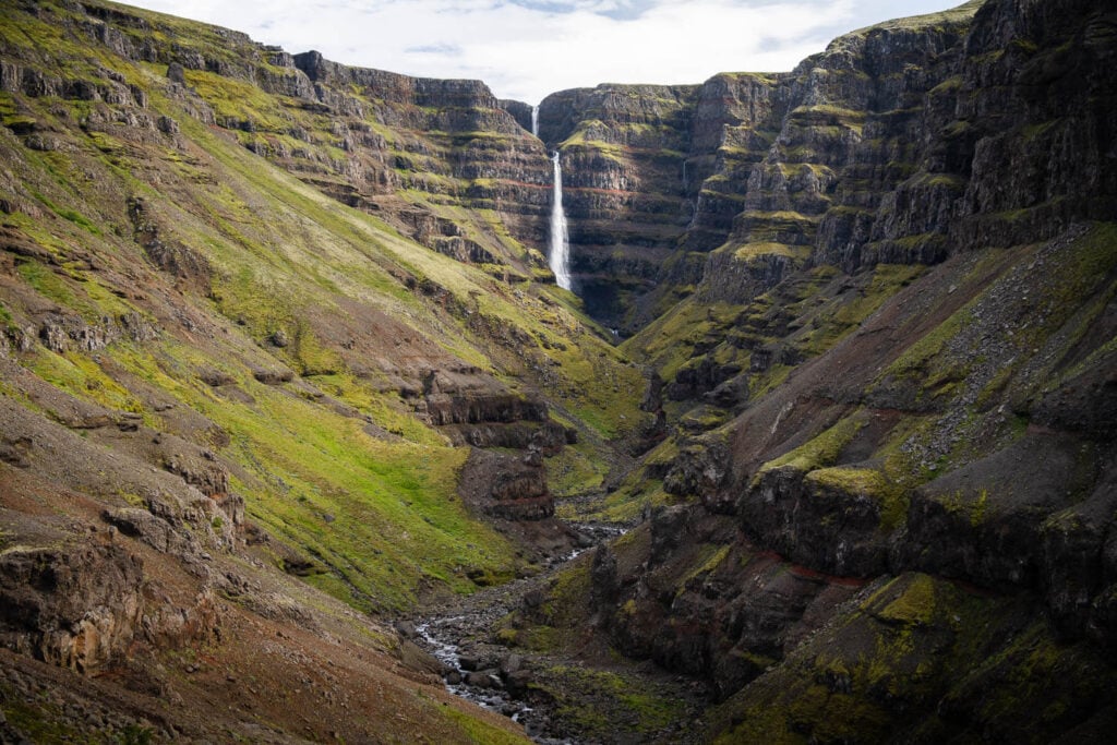
The trail the continues uphill, and the last part that leads to the viewpoint is relatively steep. The main viewpoint, which is also the end of the hike is a relatively wide flat area. Here you will be able to see this magnificent waterfall in all its glory. The Strutsgil canyon is also really beautiful.
For those who want to leave a mark here, there is also a tube with a logbook inside!

End of the trail, with the tube containing the logbook
I always spend one or two hours at this location just enjoying it, taking photos in the the silence and tranquility this location has to offer. Amazingly, haven’t seen a single soul each time I’ve visited. Definitely, I’d recommend taking your time to enjoy this location before hitting the road again.
One last note, there appears to be an unmarked trail that circles up above the waterfall and across the Strútsgil river, in a loop that allows you to see both sides of the waterfall. I had the intention to do it the second time I visited this location, but there was such a thick fog that it was pointless to even try. A good excuse to be back another time I guess :)!

View of Strutsfoos from the main lookout at the end of the trail. Photo taken at 24mm.
Strútsfoss Photos and Photography Tips
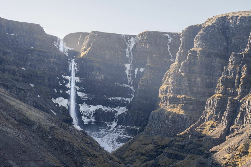
The waterfall and its canyon are impressive and definitely make for stunning landscape photography subjects. It took me four attempts before I could capture some photos i was happy with. That was mostly due to the weather conditions, and to the time of the day I visited at.

Strútsfoss.
Strutsfoss not catching the morning light :).
However, taking photos of this waterfall from the main lookout does have some limitations. The first one is the perspective and compositional options. These are quite limited because there is only one good lookout, but the waterfall is still very far. This does not allow for much room for compositional variance.
The second one is related to the light at this location. Due to its position, the waterfall gets relatively little light during the day. If you want to catch it in direct sunlight, best to plan it with some tools using SunCalc or Google Earth. Otherwise, it makes a good location for cloudy days, where the contrast won’t be so harsh if the waterfall is in the shadows.


I’d definitely recommend having a telephoto lens here, up to 200mm; as mentioned the waterfall is quite far. On the wide side of the focal length, 24mm FF equivalent should be more than enough. I’ve only used focal lengths between 24mm and 20omm here. I’ve found the 70-200mm to be the most useful, both to capture the waterfall as well as other features scattered around the valley.

Strutsfoss and the Strutsgil canyon

A nice little waterfall on the other side of the canyon (200mm)

Another smaller waterfall on the Strutsgil canyon

Details of the beautiful cliffs of the Strutsgil canyon
Lastly, It’s not possible to fly drones here. Strútsfoss is within the boundaries of the Vatnajökull National Park, where flying drones is prohibited (unless you have been granted special permission by the Park).
Where to stay
There isn’t anything in the immediate vicinities of the trailhead. The best options in the area are a few campsites, guesthouses, or Cabins further back in the Hengifoss area. If you are looking for more amenities, then it’s best to stop at Egilsstaðir.
Additional Resources
- Other hikes in the area: Hengifoss and the amazing Waterfall Circle Hike in Laugarfell.
- Check out even more Hikes in Iceland here.
- Discover the best hiking books and guides on Iceland.


Leave A Comment