Hike to Schilthorn, Epic views of the Jungfrau Trio, Switzerland
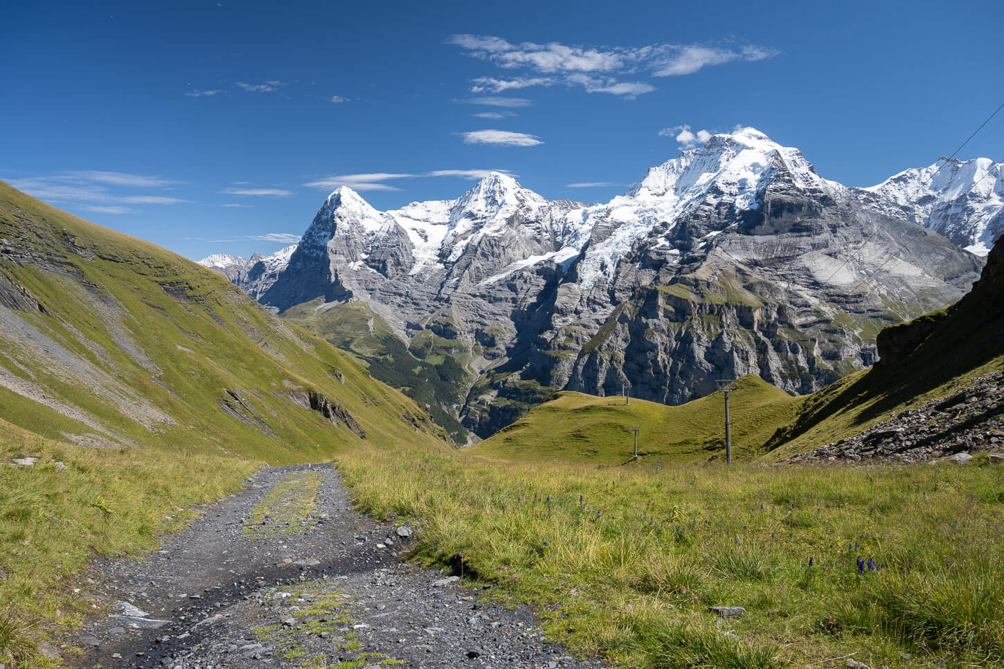
The Hike to Schilthorn, or Piz Gloria, is perhaps the one that offers the most epic views of the three iconic peaks in the Bernese Oberland: the Eiger (3,967 m / 13,015 ft.), the Mönch (4,110 m / 13,480 ft.), and the Jungfrau (4,158 m / 13,642 ft.).

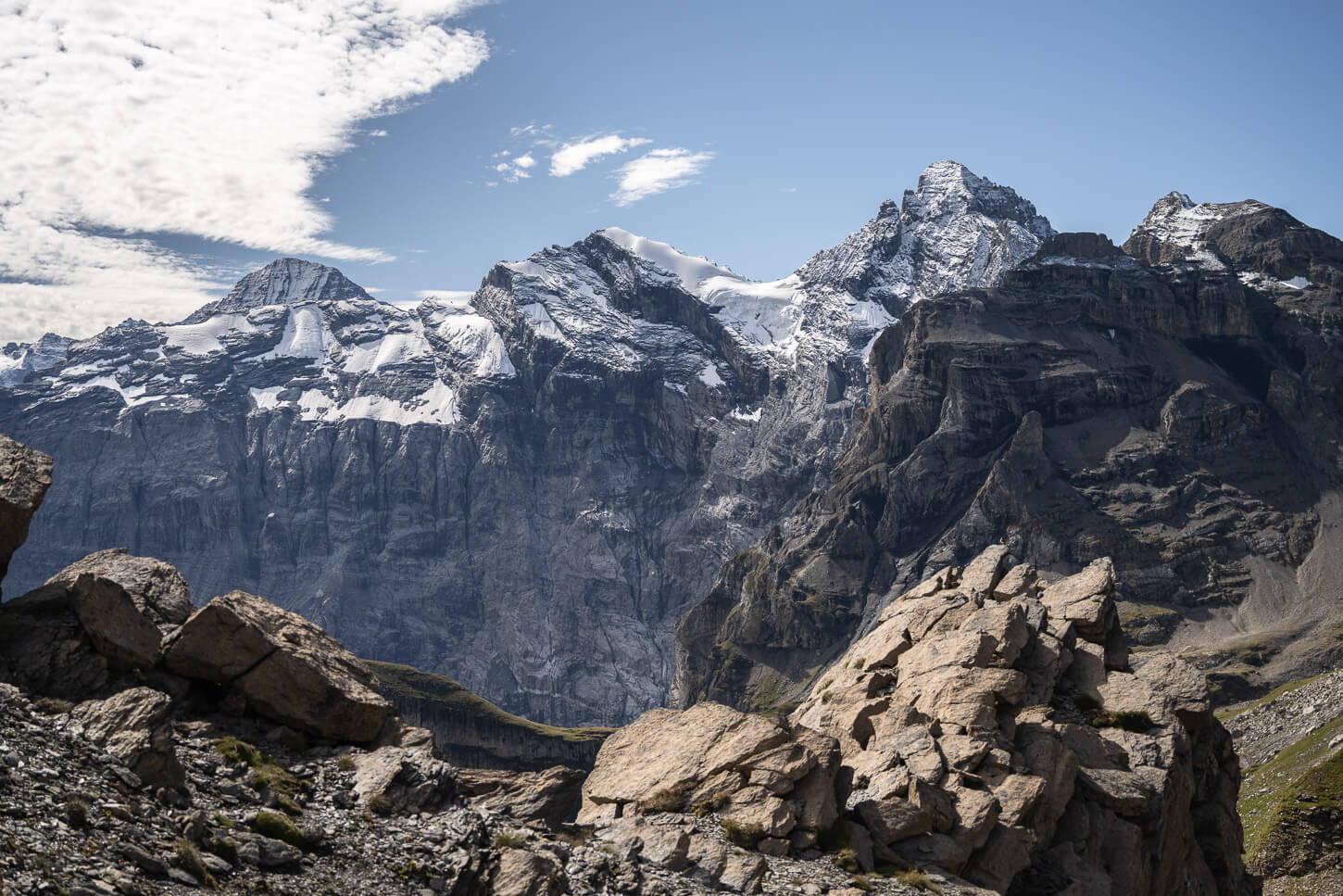
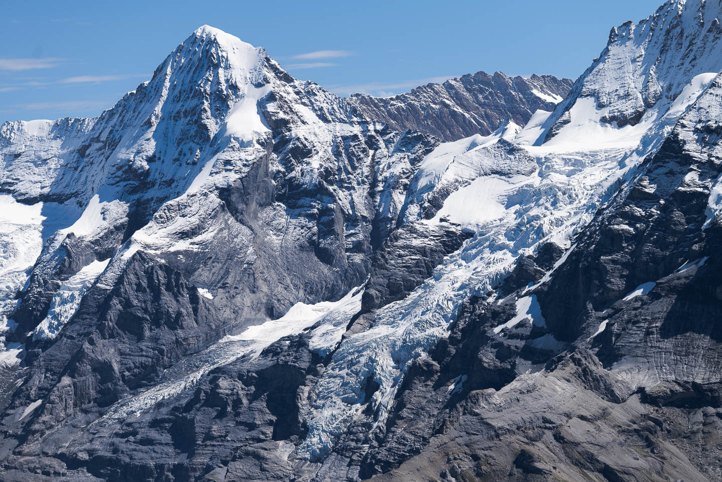
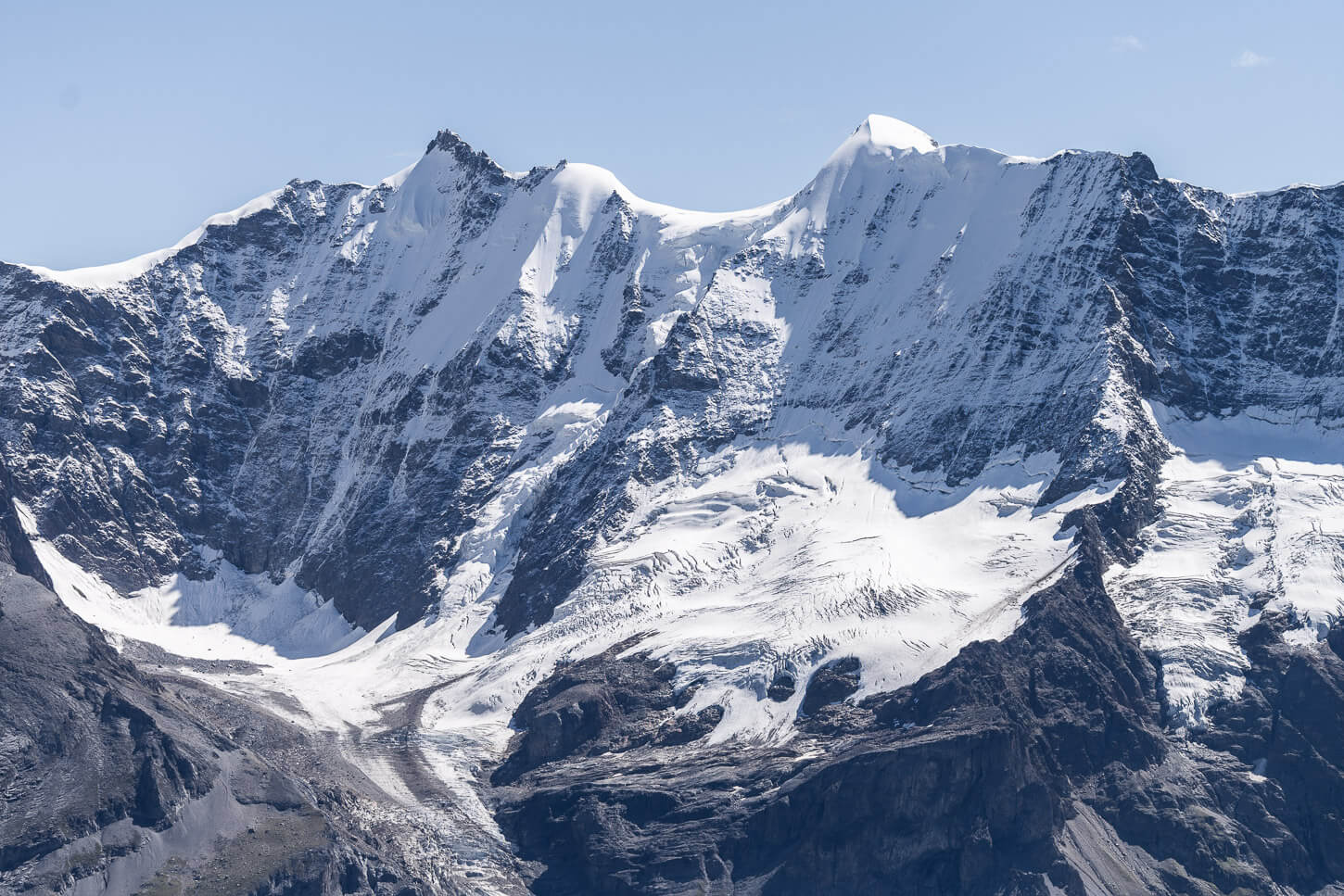
From the Center of the image to the right, the Eiger (3,967 m / 13,015 ft.), the Mönch (4,110 m / 13,480 ft.), and the Jungfrau (4,158 m / 13,642 ft.), with the lake Grauseeli below the Birg Station.
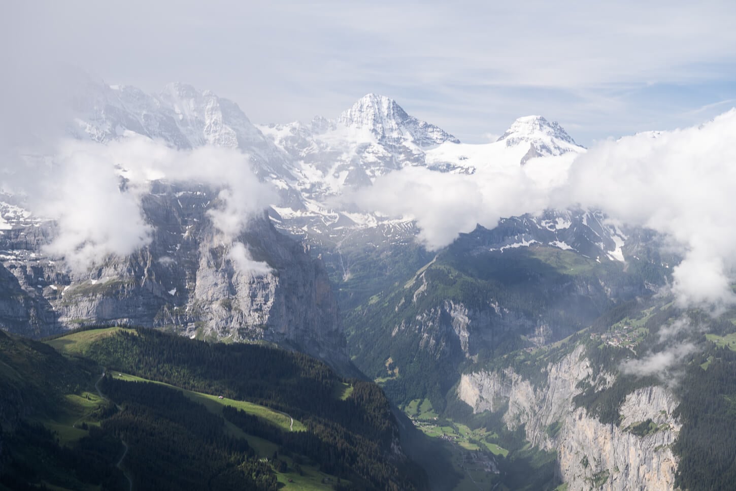
This famous trio of mountains is a UNESCO World Heritage site. From the trail, the views of the almost vertical rock faces of these three mountains and their glaciers are truly spectacular.
This clockwise loop hike starts in the car-free village of Mürren. Over a total distance of almost 20km with 1,450 m of elevation gain, you will experience the fairy-tale greenery of the Lauterbrunnen valley, the challenging, exposed, lunar-like terrain near the summit, and, of course, the epic views of the “Jungfrau Trio”.
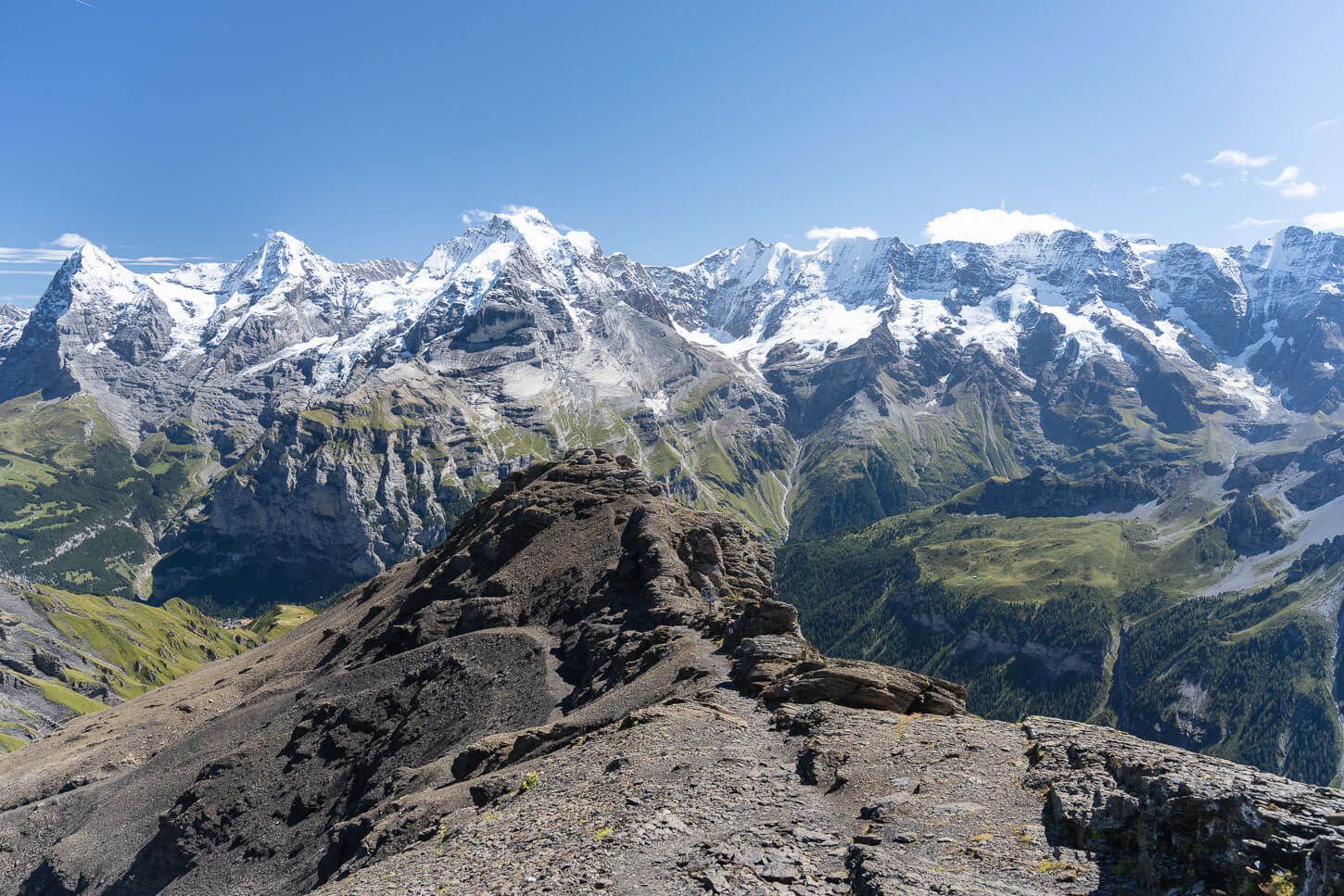
Facing the titans of the Jungfrau region.
However, the loop trail may not be for everyone: a couple of years ago, part of the trail near the summit collapsed, and while you can still complete it, there is a detour in place that is moderately exposed and requires some minor scrambling.
You can still hike part of the trail without doing the full loop, though, details below. But if you are looking for a challenging, all-day hike in the Lauterbrunnen valley, this loop and is scenic views is a great candidate.
The trail provides jaw-dropping views, also on the way back down toward Mürren.
Table of Contents
Overview of the Hike to Schilthorn & Map
Overall, the loop trail from Mürren to Schilthorn is a pretty tough all-day hike in the mountains. There are also some moderately exposed sections, especially near the summit. And part of the ridge trail near the summit trail collapsed a couple of years ago. The resulting trail detour is also more challenging and more exposed than the original trail.
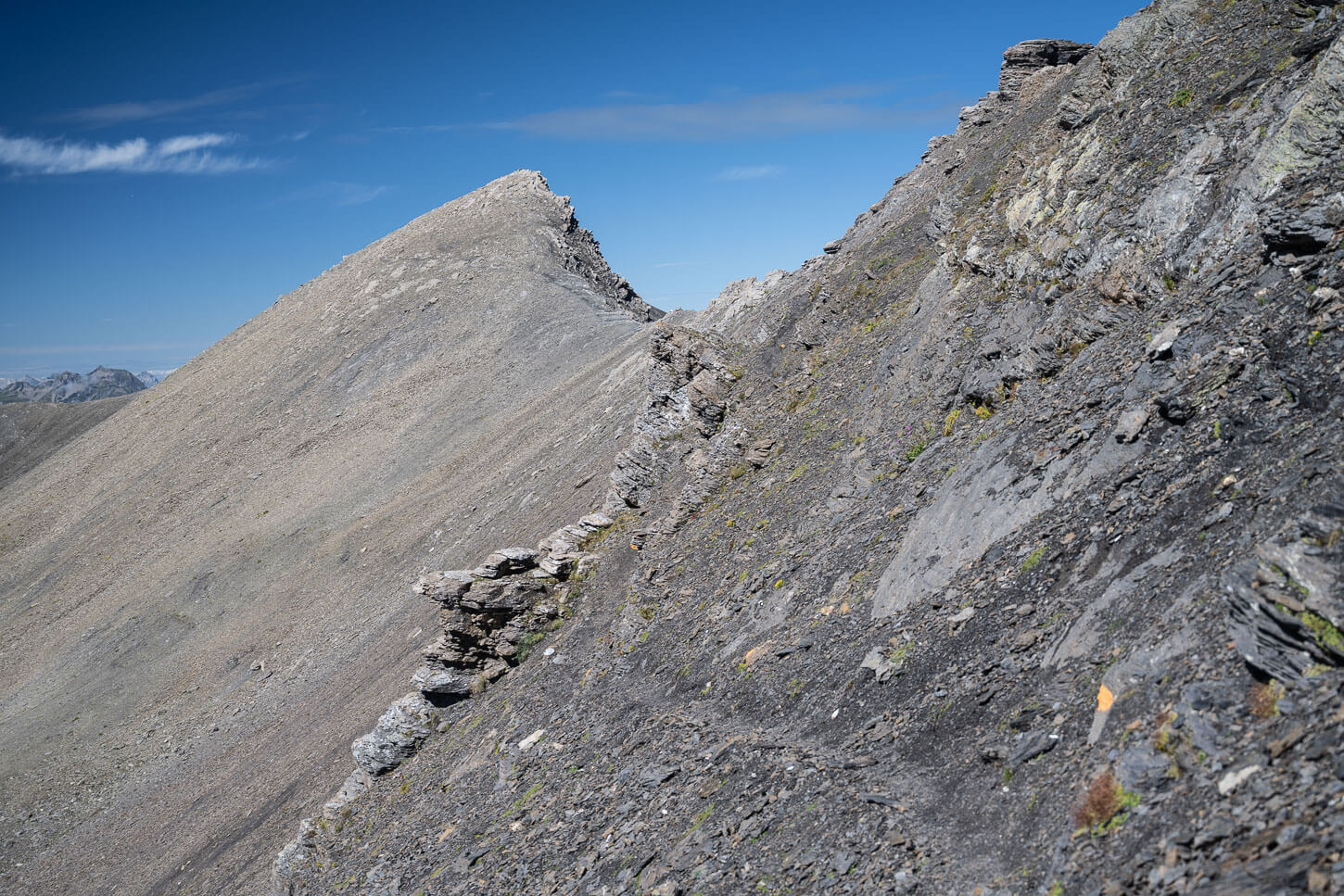
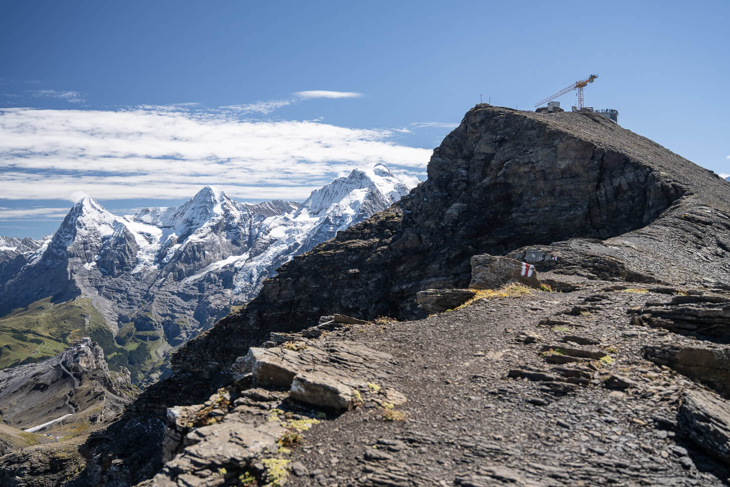
Exposed detour after part of the ridge section collapsed a couple of years ago.
For shorter or easier options that avoid that section, you could either:
- Hike out-and-back from Mürren via Birg. This is also a popular option of 7.5km (4.6 miles), one way.
- Take the cable car from Mürren to Birg, and hike up to Schilthorn from there, in which case it’s about 2.7 km (1.7 miles) one way.
A note on the section of the trail that collapsed: one of the reasons I did this hike was to check on the detour. At the time I did it, it wasn’t entirely clear how it was set up. It wasn’t even clear whether the detour was open, as the official Jungfrau Region site marked the trail as closed, but the Swiss mobility site marked only the collapsed section as closed and the detour open.
If you are planning the same hike and found the same discrepancies, there’s a detour, and it is fully marked.
| Max Altitude | 2,970 m (9,745 ft.) |
|---|---|
| Distance | 19.5 km (12.1 miles) |
| Elevation gain | 1,450 m ↑ / 1,450 m ↓ (4,757 ft.) |
| Hike time | 7-8 Hours |
| Hike Difficulty | Hard/Moderately exposed in places. |
Here is the map of the hike. You can download the GPX file for free from the activity linked below.
How to get to the Trailhead and Parking
Getting to Mürren, where the trailhead is, requires a bit of planning, as it is a car-free village. If you want to start very early, it’s best to stay in Mürren; you’d have to catch the gondola from Lauterbrunnen first, then the train to another train to Mürren.
Since I live in Switzerland, I drove there to catch the first Gondola up at about 6:30 AM. It is entirely feasible as a day hike if you are staying within a 1- 1.5 hours driving range too. I drove from Luzern, for instance.
- Driving Directions: The nearest highway is the A8, which you can easily reach from Bern via the A6 or from Luzern/Zurich via the A2. Then you’ll need to get off the highway at Interlaken to follow the signs to Lauterbrunnen.
- Parking: paid parking available in Lauterbrunnen. Best to leave the car in the main parking Silo, but you have to arrive early in the morning during high season. I never had a problem finding a parking space around 7-7:30 AM, even in the middle of August on a perfect, sunny, blue sky day.
- Public Transport: If you are travelling by public transport, the Lauterbrunnen train station can easily be reached from all the major cities in central Switzerland. Interlaken is just about 20 minutes by train. Lucerne to Lauterbrunnen is two and a half hours by train, each way. So it’s still doable as a day trip if you leave early. Basel is also about two and a half hours. Bern is one and a half hours. Check the SBB planner for more details.
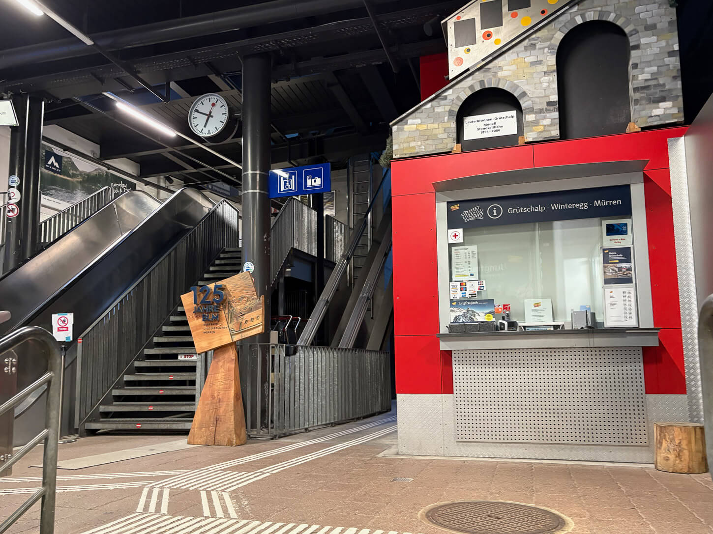
The Cable Car station to Mürren in Lauterbrunnen.
The Mürren to Schilthorn Loop Hiking Trail
Being a loop, you could do it either way. I did it clockwise. The reason for that is to enjoy the views of the “Jungfrau Trio” right in front of me when descending to get back to Mürren.
However, in this sense of travel, you have the last, moderately exposed trail detour right before the summit. And, overall, this section is also a little more technical in places.
So if you are not sure or do not feel safe tackling that section, you may want to do it the other way around to reach the summit first, or as an out-and-back hike from Mürren via Birg, which is steep in places but not technical or exposed as the other side.
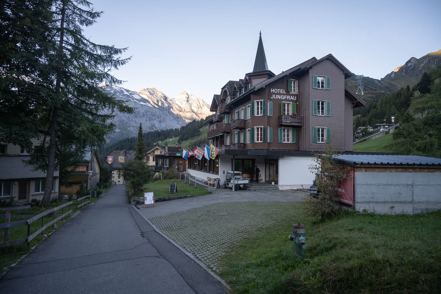
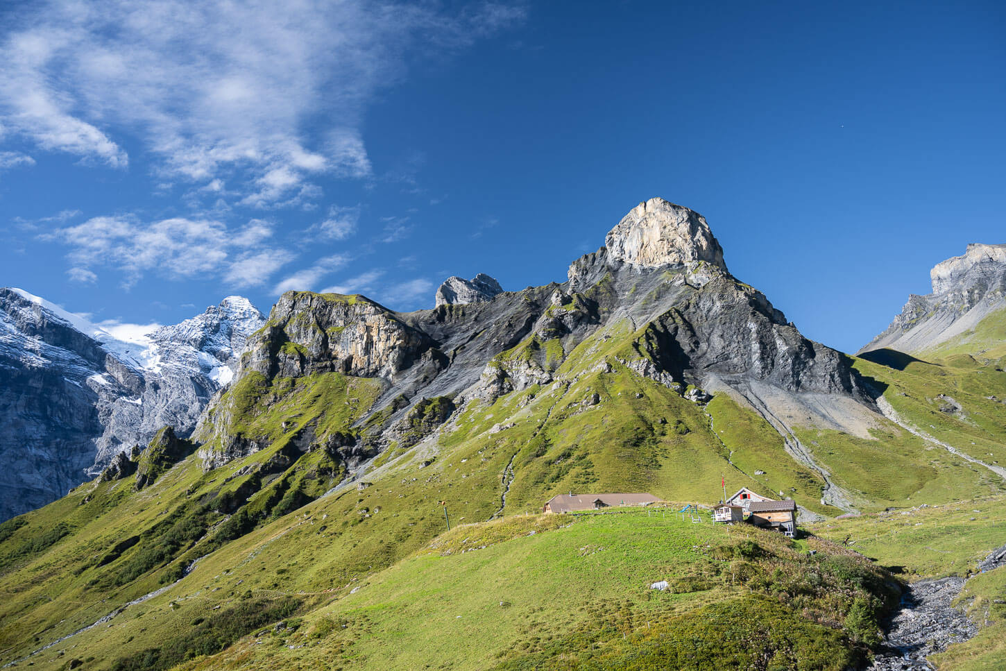
The trail starts in Mürren, a car-free village that offers fantastic views of the surrounding mountains
Hiking from Mürren to the Rotstockhütte
Once arrived in Mürren, you will have to cross the small car-free village on foot. The best option is to take the main road until you’re out of the village and the trail starts to climb.
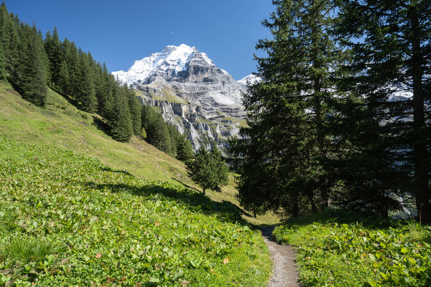
Partly through the forest and partly through an alpine pasture, this section is mostly on fairly easy mountain paths. There is the occasional steep section, but nothing technical. Then, views also gradually open up to the vast, deep valleys surrounded by the sheer, dramatic rock faces of the mountains.
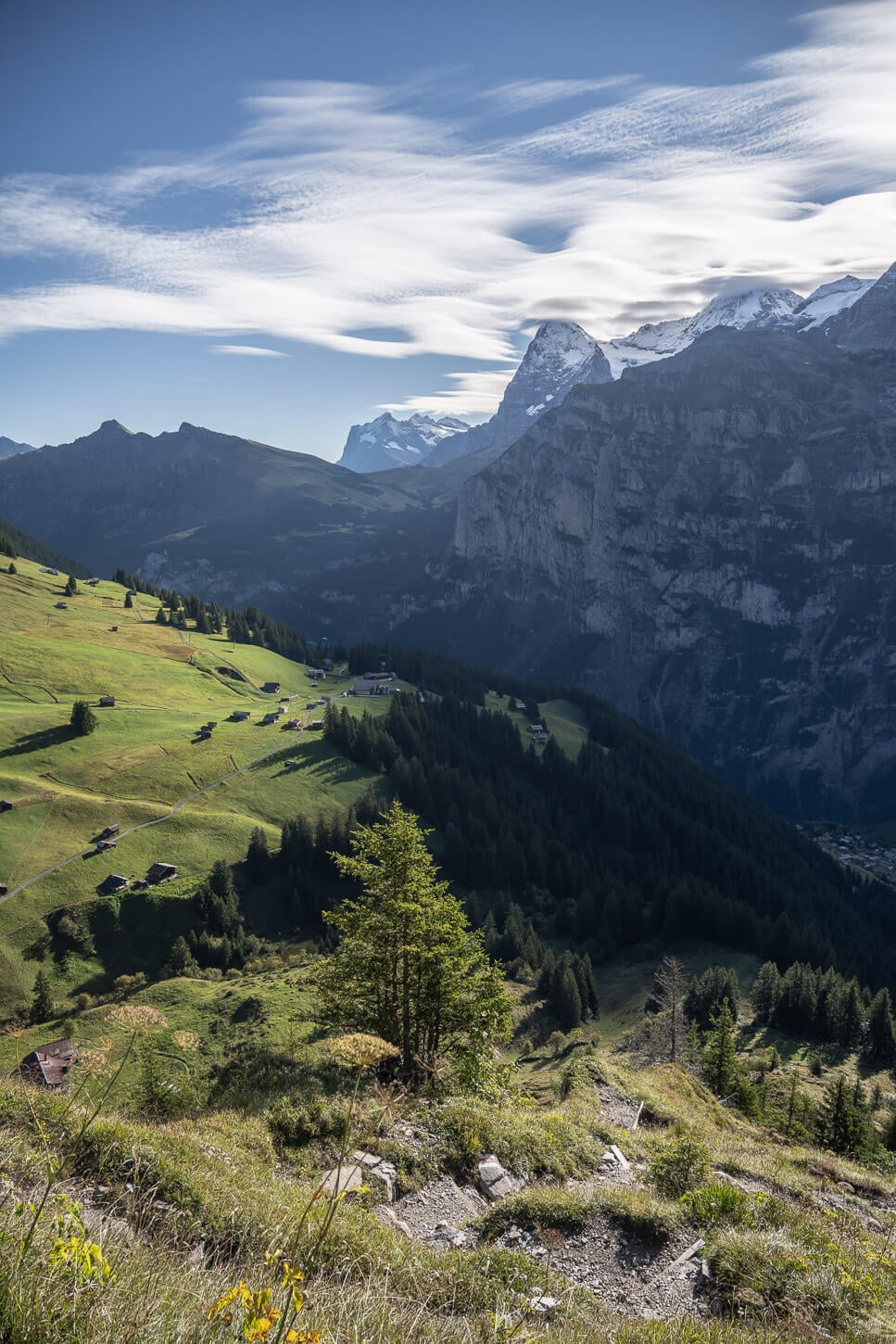
Right after Mürren, the trail starts to climb gradually, and the views open up to the mountains and the deep Lauterbrunnen Valley below.
As you continue further up the mountain, the landscape reveals more of the massive mountains of the Jungfrau region.
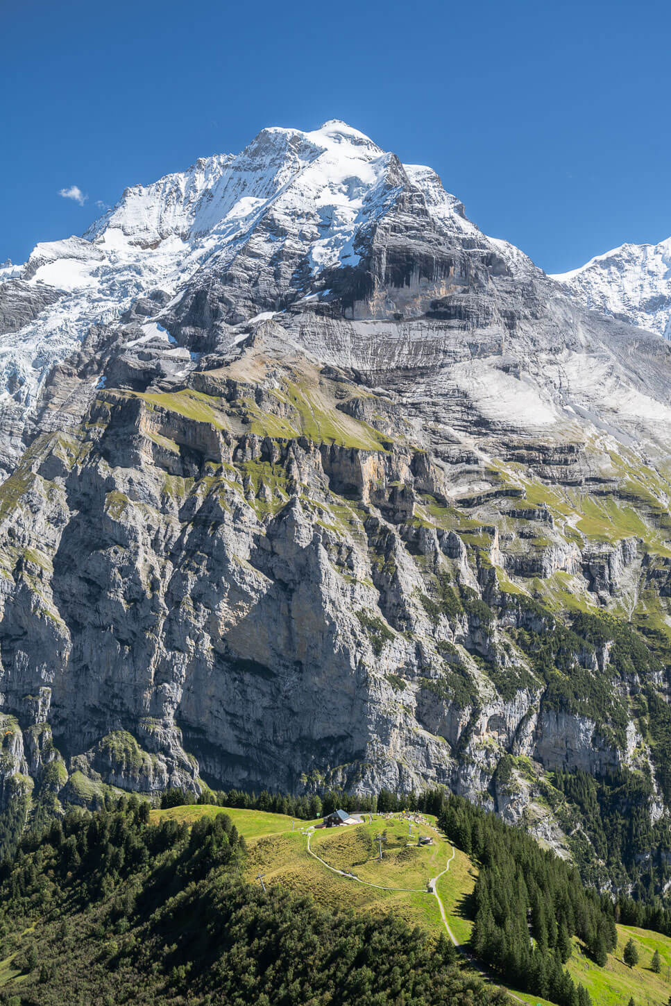
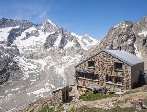
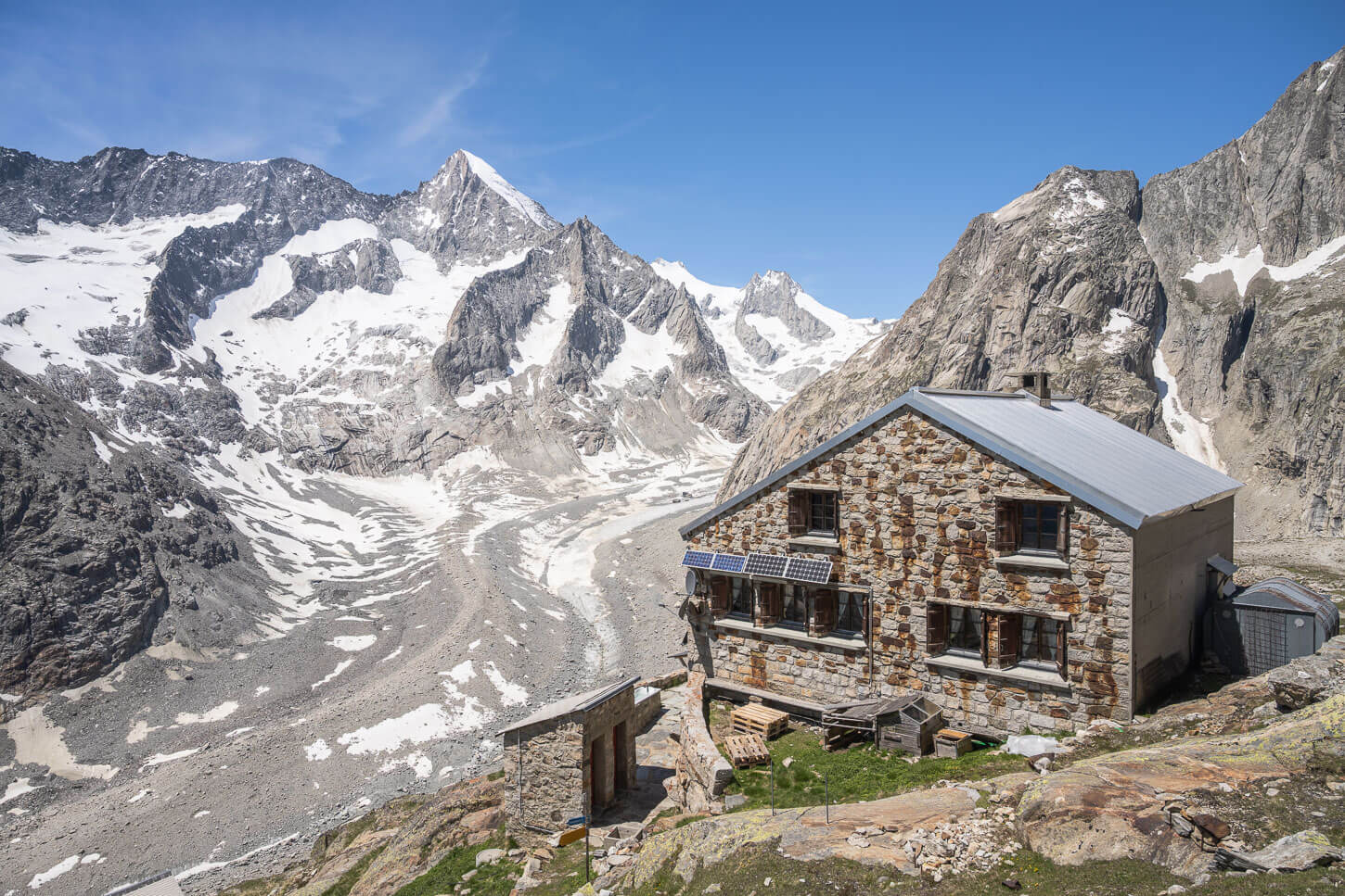
Then ..km into the hike, you will reach the Rotstockhütte. The hut is a good option for a short break, a coffee, or a piece of cake. From here, you can also see the Schilthorn’s summit and the Mountain Station on top of it. It looks deceivingly close.
You may be tricked into thinking you’ve almost arrived, but it’s actually still a good while away, both in terms of distance and elevation gain.
After a couple of hours, you should come in sight of the Rotstockhütte. An ideal location for a short break.

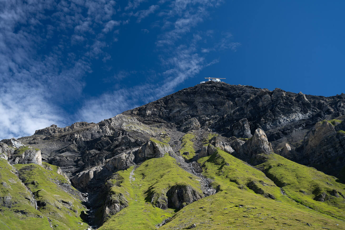
The Schilthor’s summer will look deceivingly close from there.
From Rotstockhütte to Schilthorn
The hardest and most technical part of the hike begins shortly after passing the Rotstockhütte. The trail gradually climbs through rocky terrain, big boulders, and scree fields up the steep side of the mountain.
The trail is very well marked here, with the T# white-red-white trail marks painted at short intervals on the rocks. That makes it much easier to navigate the chaotic boulder fields of this section.
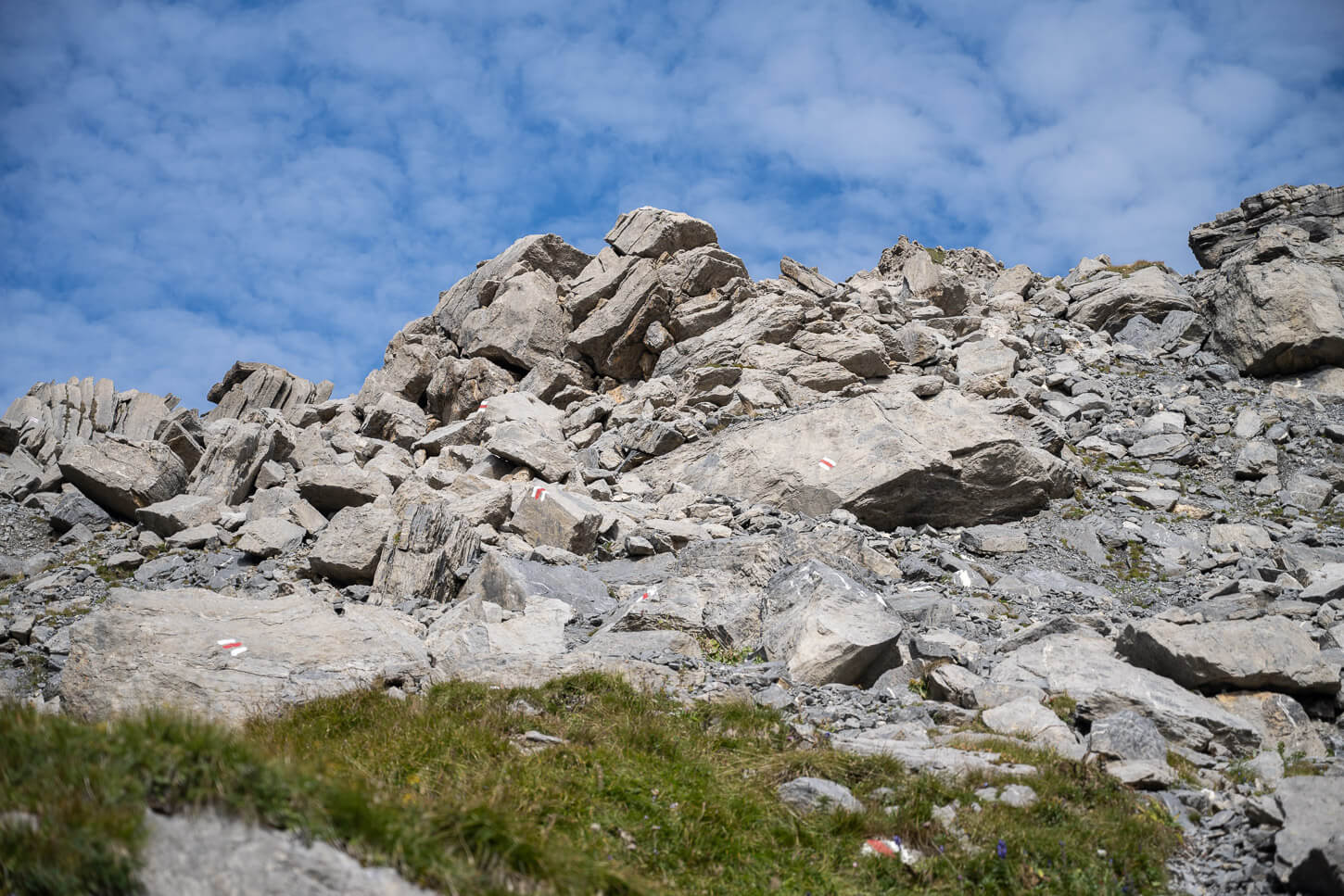
Past the Rotstockhütte, the trail becomes more technical, and you’d need to navigate through a large boulders field.
The trail, however, is well-marked with trail marks painted on the rocks at short intervals.
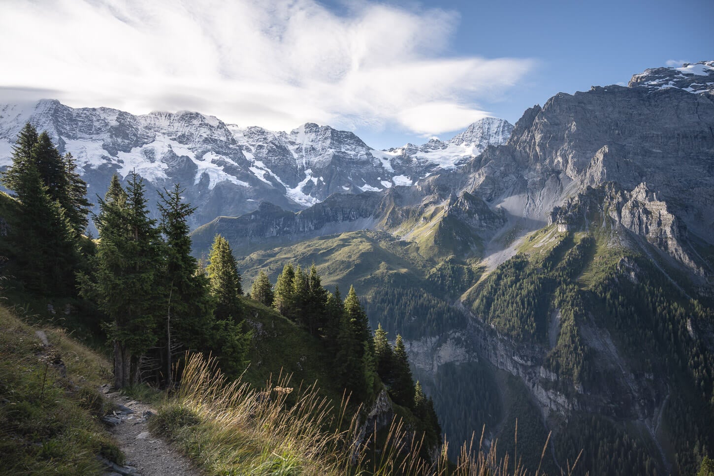
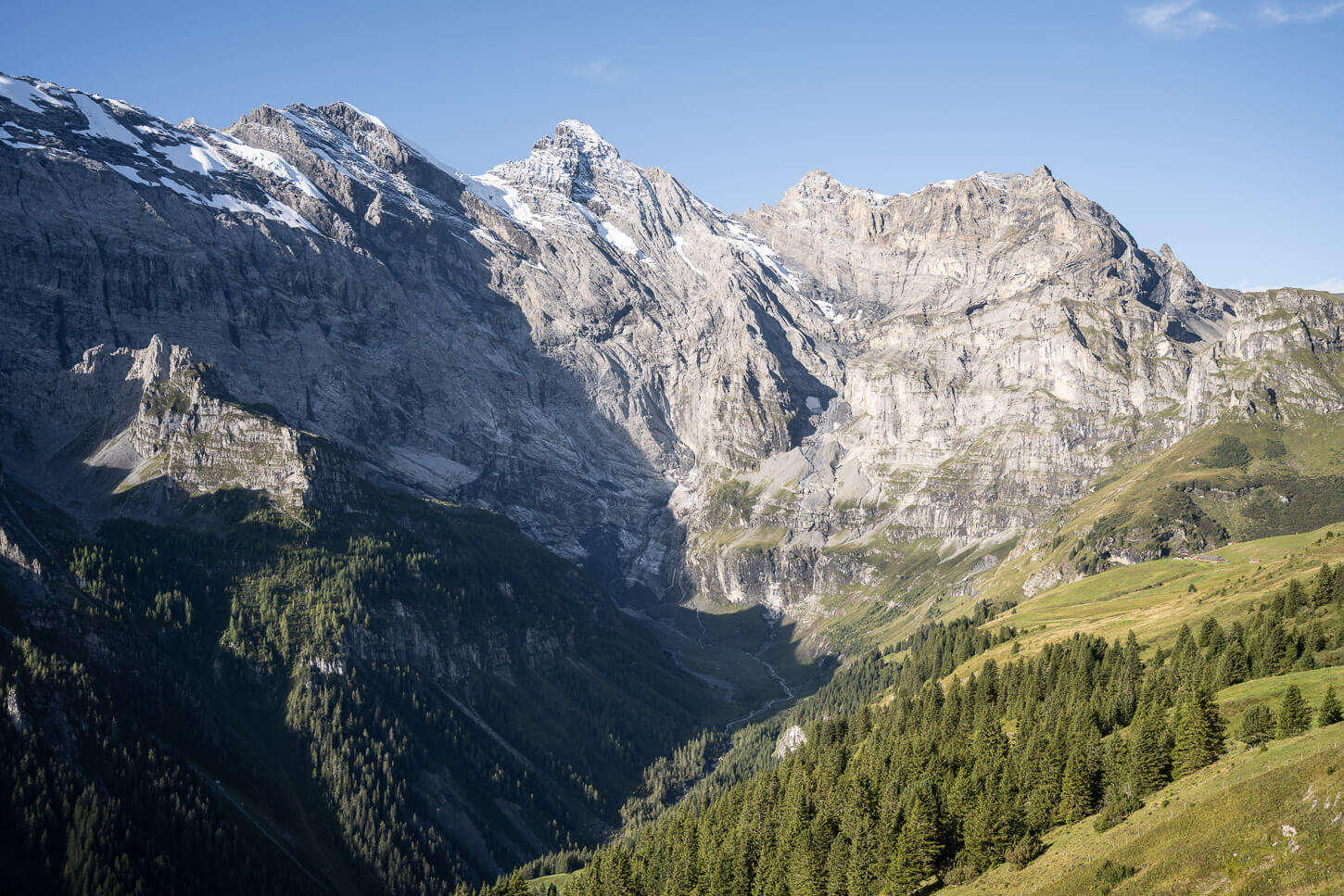
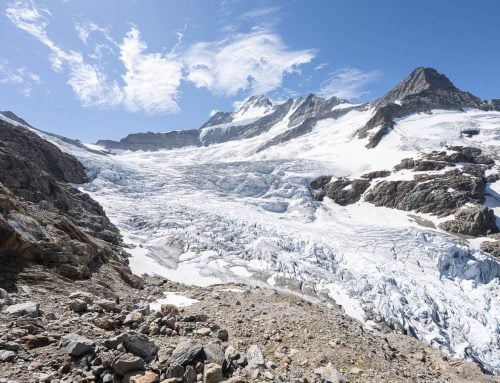
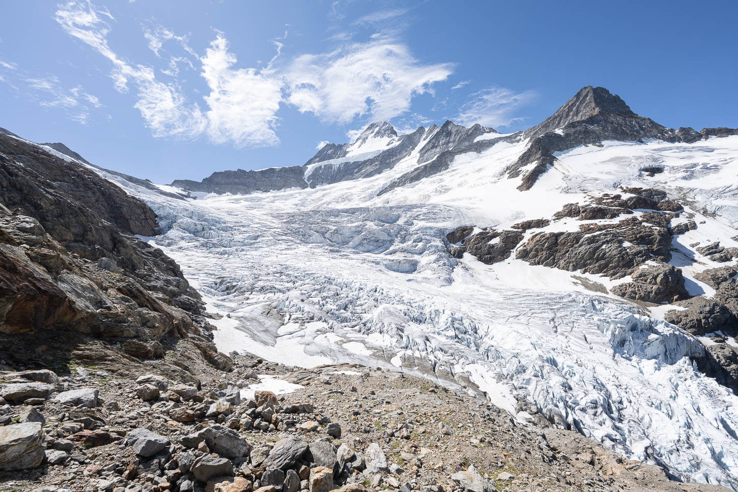
At the same time, the views open up to the sheer cliffs and mountains covered in glaciers to the west and to the North.
The trail is not particularly exposed here, but take particular care around potentially unstable rocks. It’s not a climb or a scramble, but you may need to help yourself with your hands for balance here and there.
There is also a very noticeable shift in the landscape. As you go from the greenery of the lower valley, the terrain gradually changes to a grey, lunar-like landscape filled with scree. There is no visible trail here, but the passage through the rocks is clearly marked.
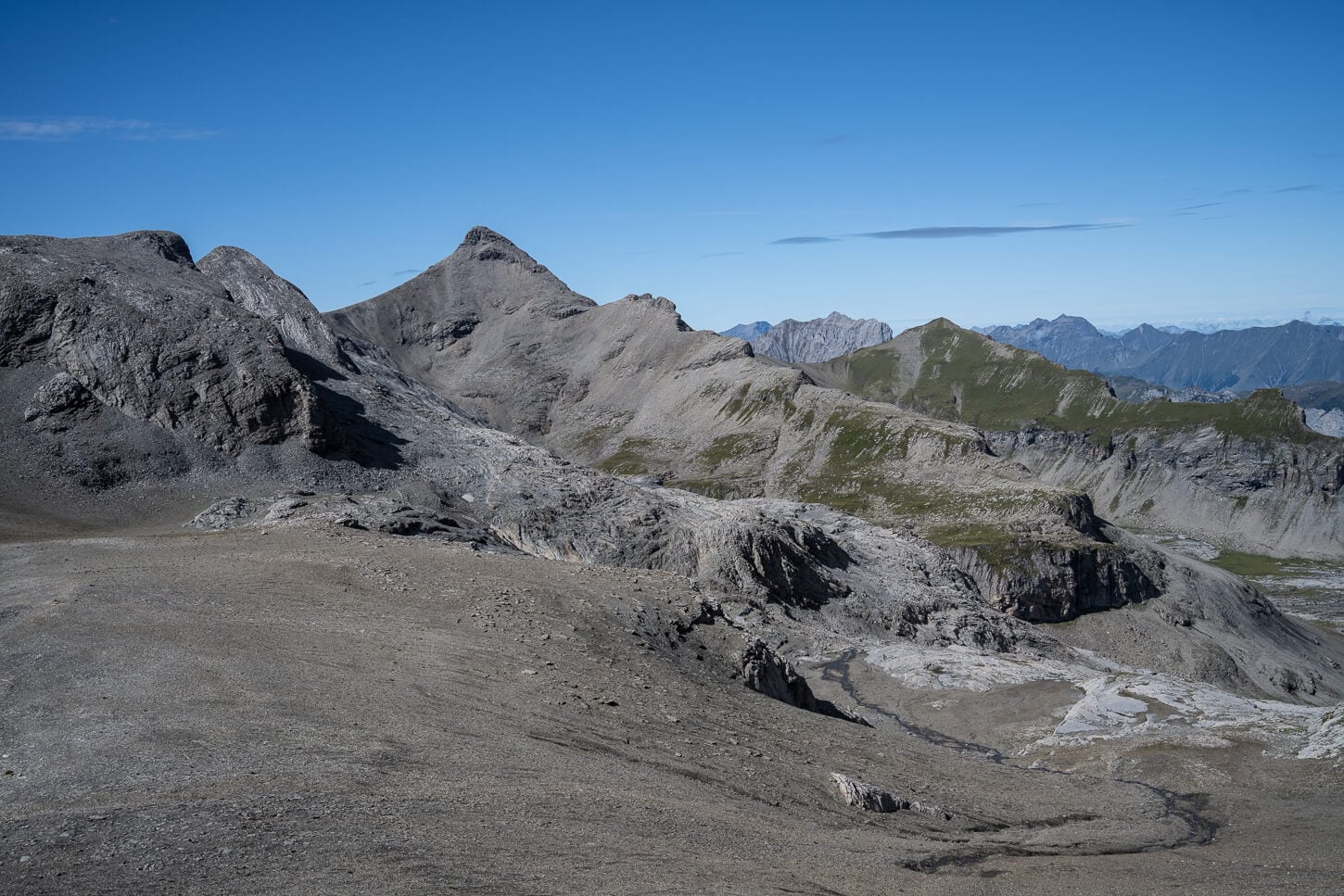
In the last section of the trail, the landscape is transformed into a lunar-like environment, mostly covered in scree.
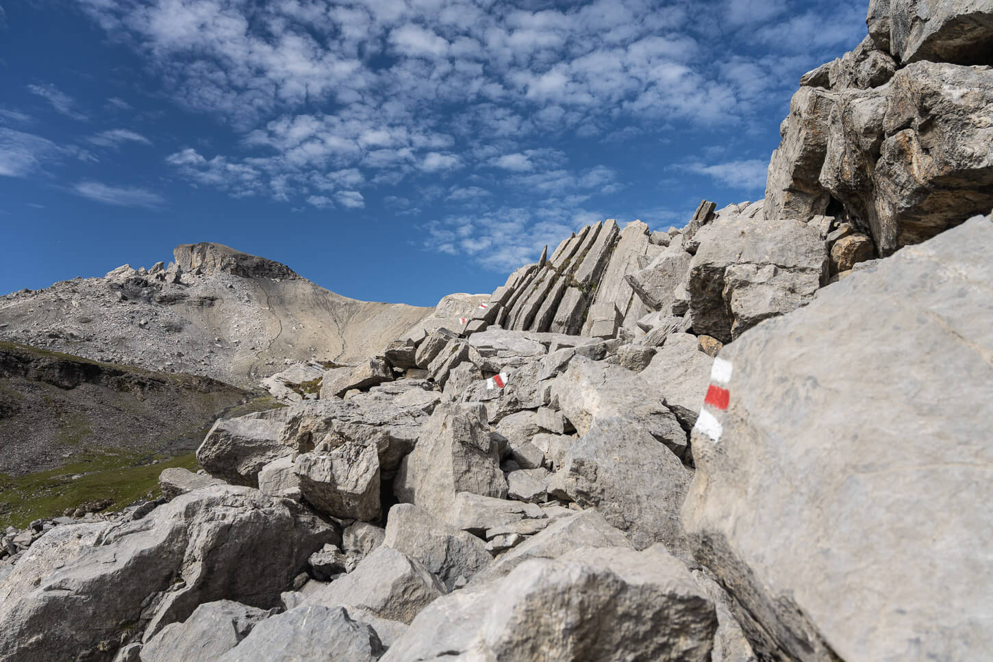
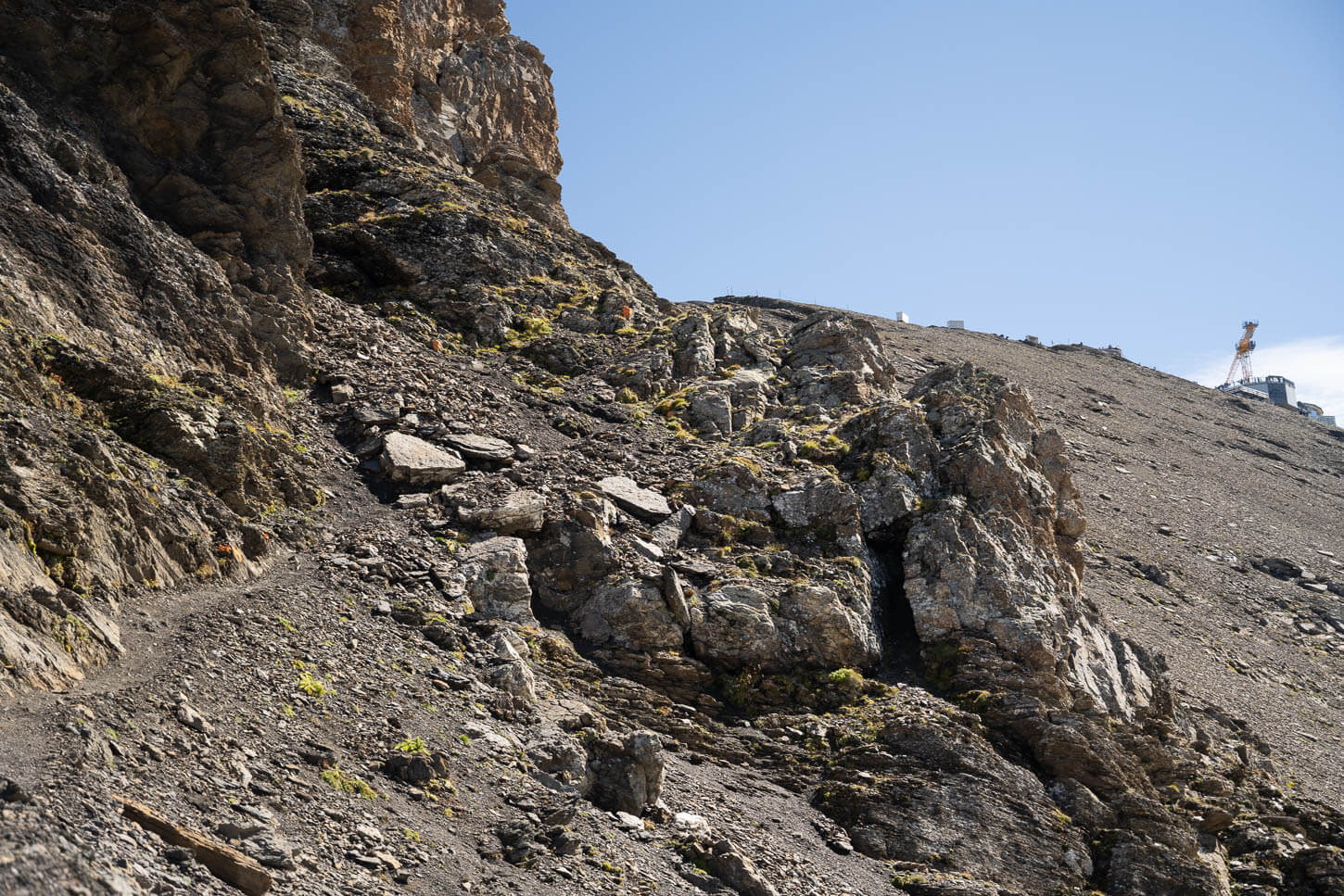
After about 10km, you will reach the junction with the trail coming from the valley on the other side of the mountain, Kiental. From here it’s mostly scree, following the crest of the mountain until the section where the old trail collapsed.
The detour is still in place, it’s nicely marked with orange trail marks. Still, it is partly exposed, and the terrain is crumbly. So you should definitely take your time to navigate the area, paying particular attention to the rocks you step on and the rocks you may need to scramble on.
The last part of the trail is a moderately exposed scree section on the side of the mountain.
The detour, however, is well marked with orange trail marks.
After this “thrilling” detour, you have essentially arrived.
The Schilthorn/Piz Gloria mountain station will be right in front of you. You’ll then have to cross the structure of the huge “mountain mall” that the station is, to get to the other side and enjoy the views of the epic rock faces of the Eiger, the Monch, and the Jungfrau.
The last part of the detour climbs back up to the main trail,
The last section is an easy walk to the mountain station at the top of the Schilthorn.
The summit offers spectacular, 360-degree panoramic views of the mountains and valleys around it.

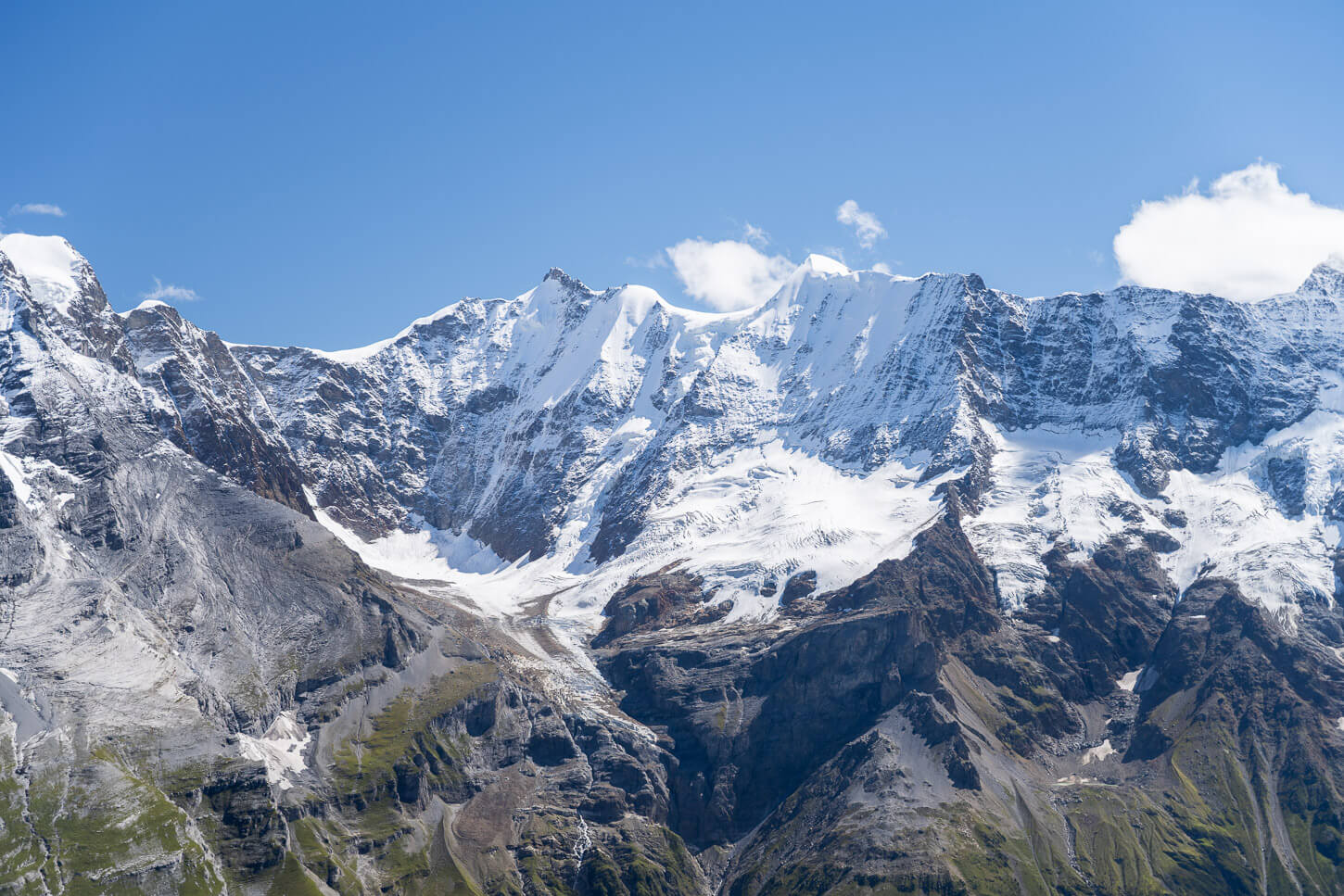
Glaciers on the Jungfrau.
Hiking from Schilthorn back to Mürren
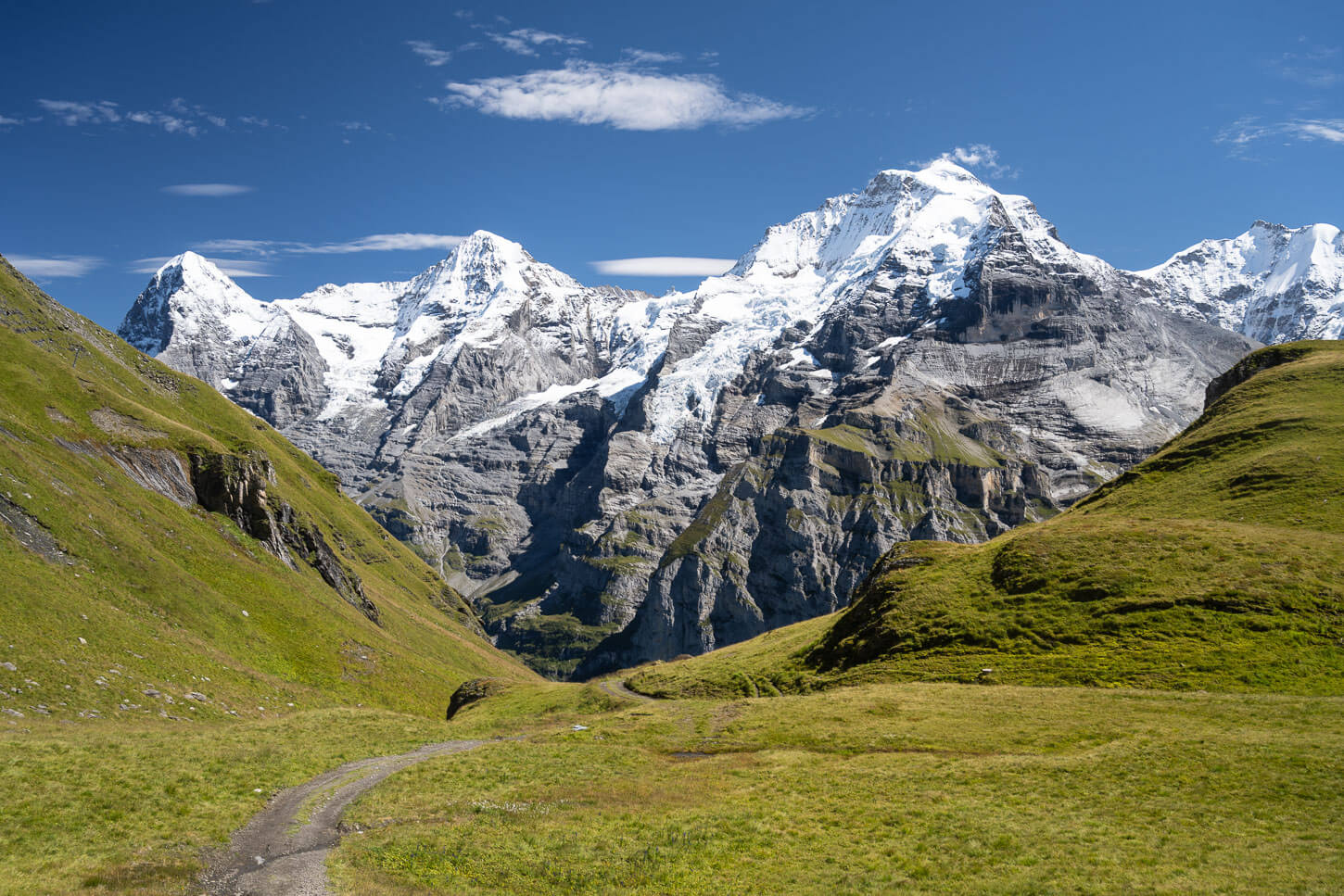
The descent toward Mürren starts as the approach to Schiltorn ended, which is on scree. It’s quite a steep descent, but you will have the epic views of the “Jungfrau Trio” right in front of you from the start of the descent.
Initially, it is quite a steep way down. Nothing that you need to use your hands for, but it is steep nonetheless. The trail loosely follows a ridge and passes by a couple of smaller peaks that offer more great panoramic views of the area.
The trail on the way down offers constant views of the massive mountains on the other side of the valley.
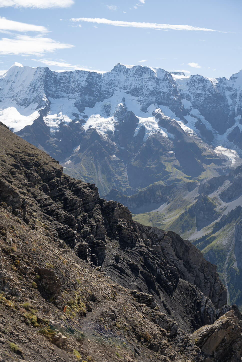
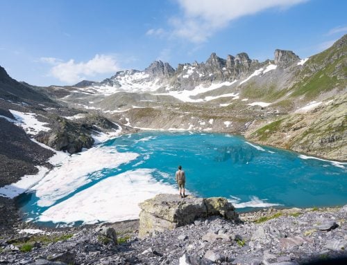
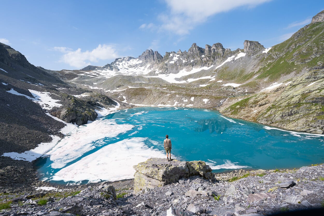
Grauseeli, bottom left, with the “Jungfrau Trio” on the right.

Grauseeli.
Progressively, the trail winds its way down through the rocky landscape until reaching the detour to the scenic Grauseewli Lake, not far from the Birg mountain station. Here, the trail essentially turns into a rough mountain road, alternating flatter sections with rather steep ones.
Again, the views will open up to the trio of mountains, looking even more impressive from a lower elevation, while you’re still halfway up the mountain on the opposite side of the valley.
To close the loop, the train enters Mürren again. Here you can enjoy a drink, a snack, or just more of the views at one of the many viewpoints around the village.
The last part of the trail keeps offering spectacular views of the mountais on the other side of the valley.
Schilthorn Photos and Photography Tips – Photographing the “Jungfrau Trio”
While you can easily manage most of the photography on the hike to Schilthorn with any standard zoom lens, what you’d really want to have on top of that is a telephoto lens too.
While I used my 24-70mm lens on the trail, I mostly used my 70-200 once on top. With such epic views of some of the most beautiful mountains of the Swiss Alps, you can really hone in on the smaller details and the peaks themselves with a longer tele lens.
And, to be fair, there’s a lack of foreground options at the top. Unless you find creative ways to include the railings of the various observation decks of the cable car station.
Jokes aside, there is really not much of a foreground up there, so with wider lenses and such, wider landscape compositions are limited. However, the telephoto lens will open up the landscape to all the smaller details.
Make sure you have a circular polarizer filter with you to cut through the glare and possible atmospheric haze. and to make the best of those colors on sunny days.
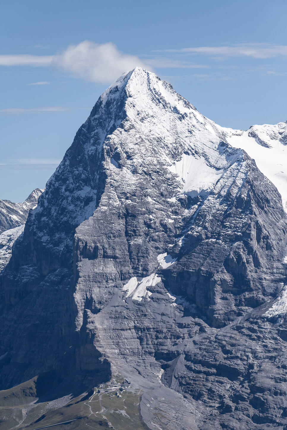
View of the Eiger, 200mm.
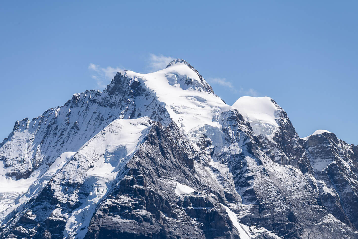
Jungfrau, 200mm

Where to Stay
Mürren would be the obvious choice to start the hike to Schilthorn early in the morning, before others arrive by train. Lauterbrunnen is another good choice, or Wengen on the other side of the valley. It’s all fairly easy to move around between these villages using trains/cable cars.
Interlaken is also another good option, if you want to visit more in that area, like for example, the Brienzer Rothorn, or the Augstmatthorn.
Additional Resources
- For a comprehensive overview of Hikes in Switzerland, check out my main Switzerland page.
- Since you have to be in Lauterbrunnen, do not miss the most iconic viewpoints and photo spots in town. Or for another long day hike on the opposite side of the valley, check out the Wengen to Mannlichen loop hike via Lauberhorn.
- Here is the official Schilthorn/Piz Gloria Website.


Leave A Comment