Oberaletsch Hut Hike: From Belalp to a Remote Glacier Valley, Valais, Switzerland
A hike to the Oberaletsch hut takes you to the head of a glacial valley, where you can enjoy the views of the Oberaletsch Glacier along the Oberaletsch Panoramic Trail. At the end of the trail, you’ll find this remote, historic hut.
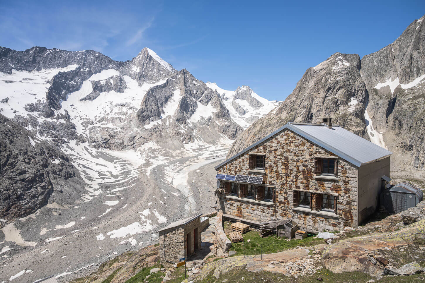
The Oberaletsch Hut, or Oberaletschhütte in German.
The hike isn’t easy, but it’s worth the effort. The Oberaletsch Panoramaweg is long, moderately exposed in places, and has enough up-and-downhill sections that you’ll probably feel it in your legs the next day.
The trail is also part of the Aletsch UNESCO World Heritage site, following the Oberaletsch Glacier up to where it meets the Beich Glacier. The area is a little underrated and offers a more relaxed experience compared to the nearby Aletsch Glacier.
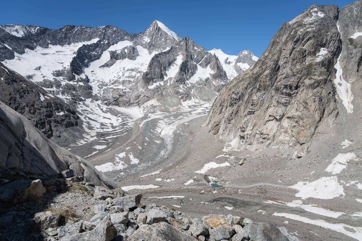
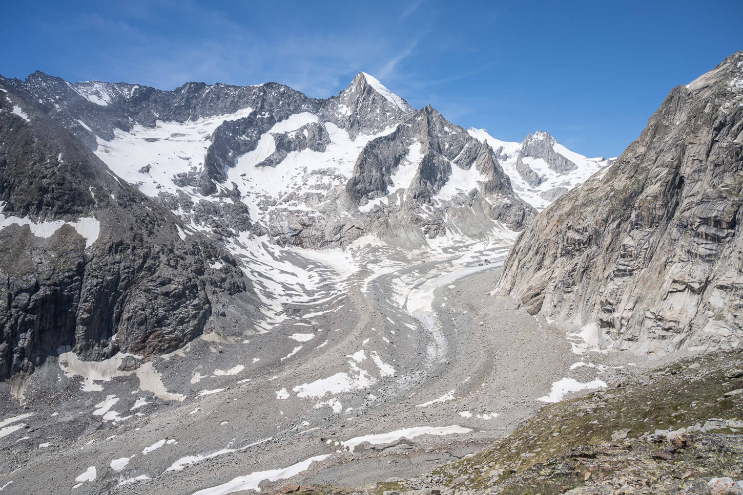
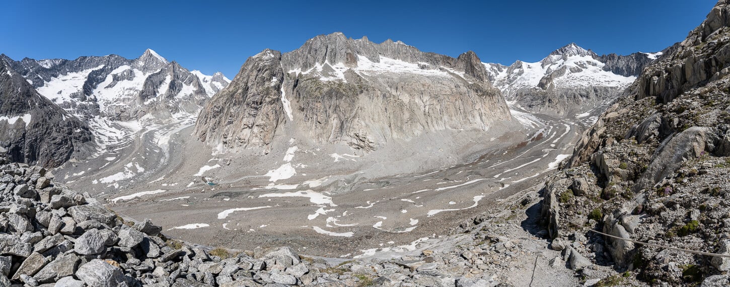
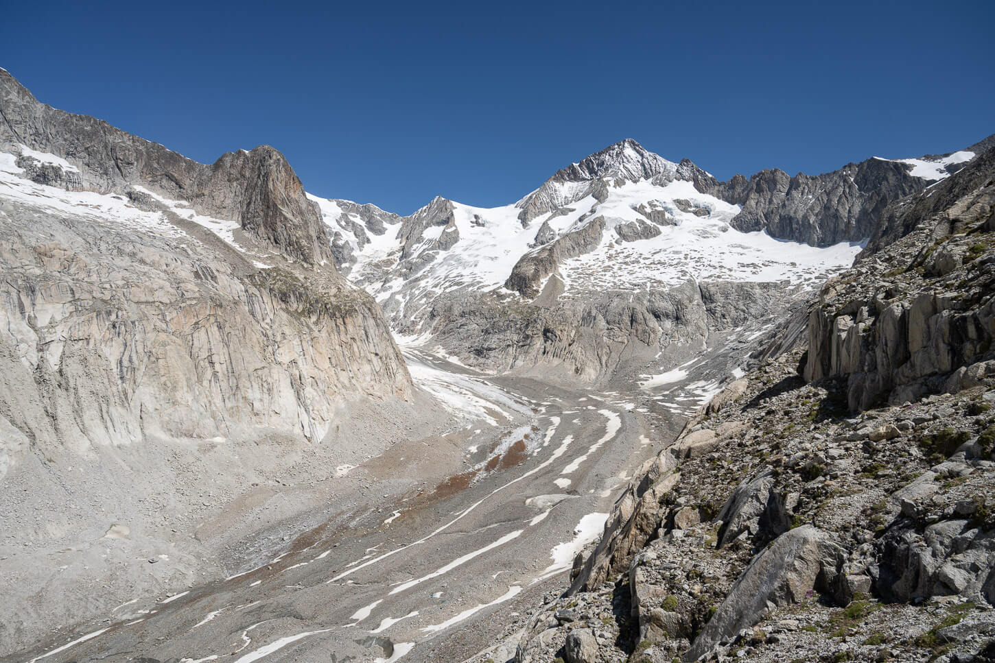
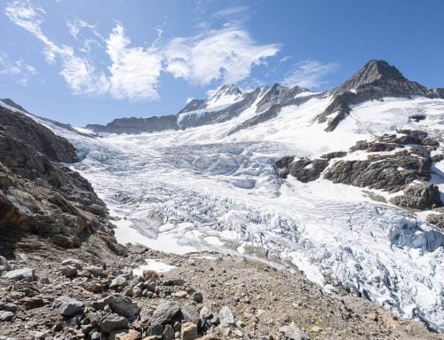
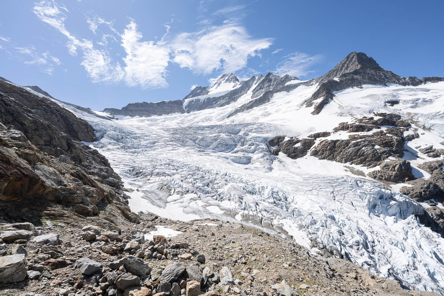
Oberaletsch glacier, to the right, and Beich Glacier, to the Left.
Once a thick river of ice, the Oberaletsch glacier is now largely buried under debris fallen from the surrounding slopes. It’s a very visible record of how much it has retreated in recent decades (link at the bottom of the page, for those who want the numbers).
And, at the end of the trail, the Oberaletschhütte finally appears, immersed in this beautiful, slow-moving landscape. It also has a kitchen that serves genuinely good mountain food, prepared by hosts who seem happy you made the effort to get there.
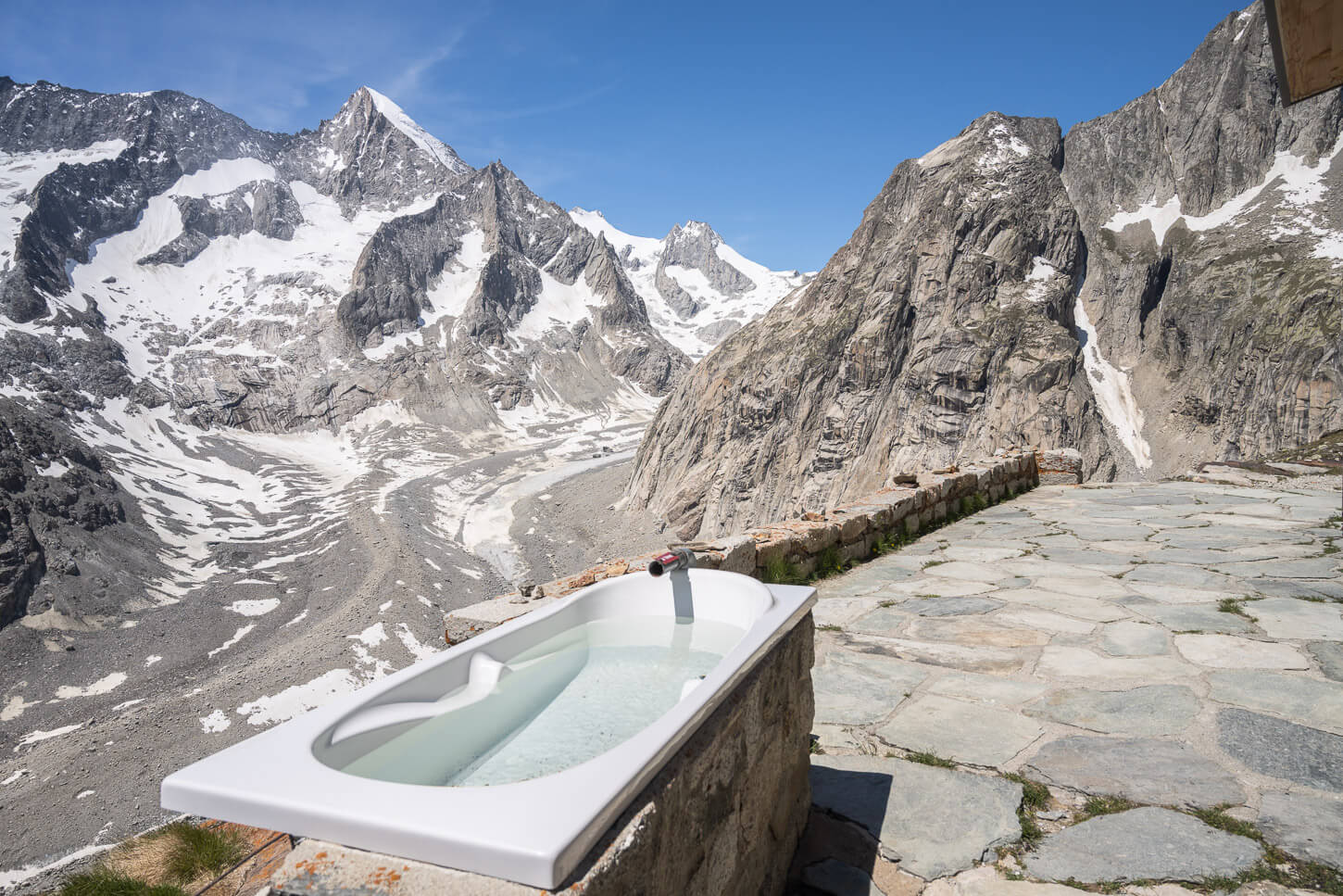
The hut offers a bathtub with a view too!
Table of Contents
Overview of the Oberaletsch Hut Hike & Map
The hike to the Oberaletsch Hut is rated as T3. That essentially means a demanding hike in an alpine environment, with some exposed sections, where no scrambling is required. The trail is also well-marked and visible at all times, with white-red-white trailmarks.
Overall, it isn’t a difficult hike. There are indeed some moderately exposed sections and a considerable elevation gain. The latter is mostly in the middle part of the hike, where the trail climbs toward the hut. However, there are also many short up and downhill sections that can feel strenuous after a while.
| Max Altitude | 2,648 m (8,687 ft.) |
|---|---|
| Distance | 21.6 KM (13.4 miles) |
| Elevation gain | 1,200 m ↑ / 1,200 m ↓ (3,937 ft.) |
| Hike time | 7.5-8.5 Hours |
| Hike Difficulty | Hard, sometimes moderately exposed. |
Here is the map of the hike. You can download the GPX file for free from the activity linked below. A quick note on the GPX file: unfortunately, the app somehow didn’t save the file from my own hike, so I had to recreate it manually.
The valley is rather big. More than 1km across in places, ans the glacier used to be about 1km wide too.
How to get to the Oberaletsch Hut Hike Trailhead and Parking
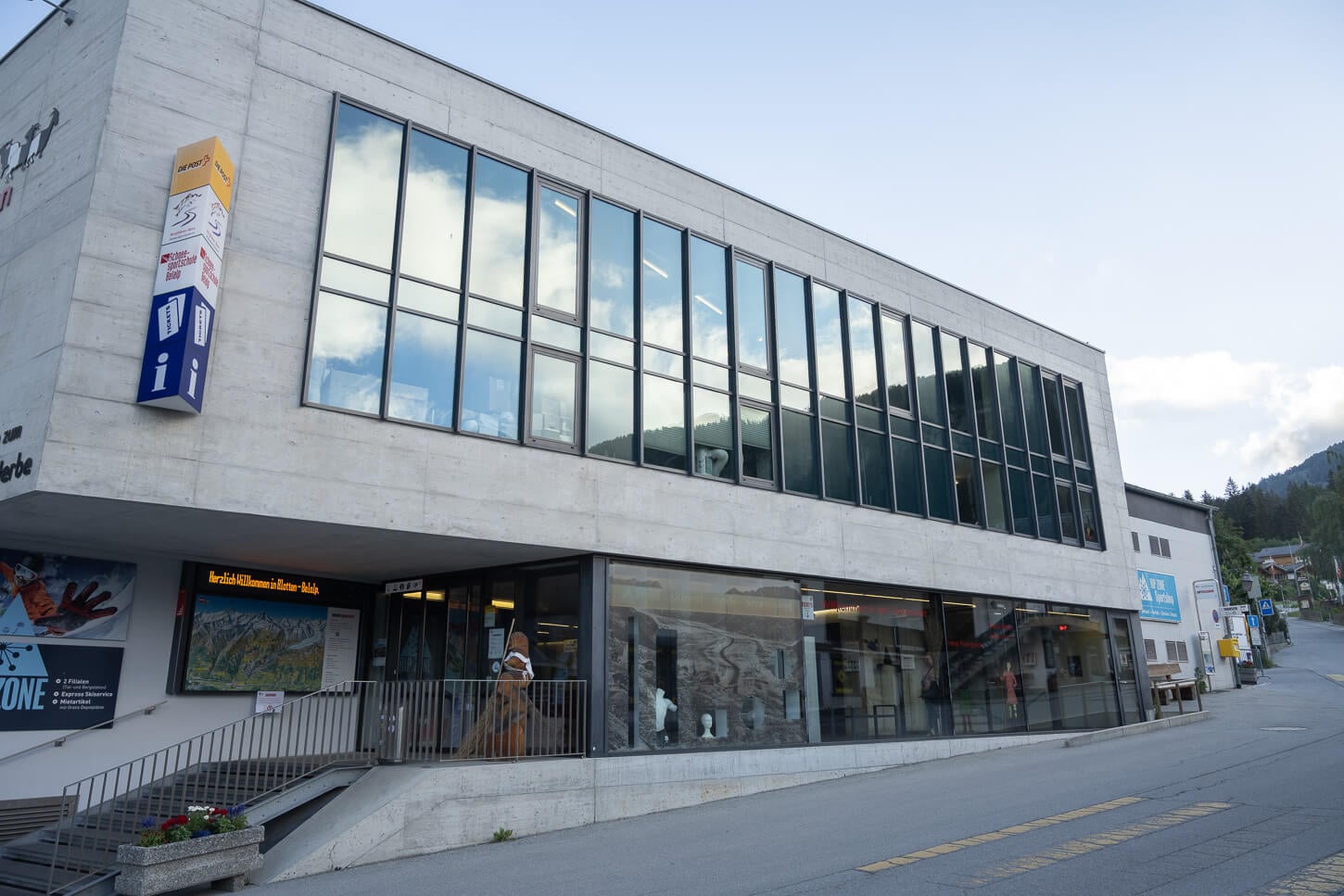
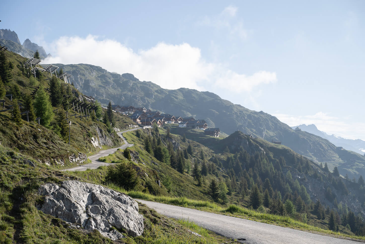
The Oberaletsch Glacier and the homonymous hut are located in the Swiss Canton of Valais. The trailhead is accessible from the small car-free village of Belalp, where you can only get to using the cable car.
Getting to the trailhead in Belalp isn’t particularly difficult. However, if you do not already live in Valais, it will likely require a few hours to get there. You essentially have to drive to Brig first, then to Blatten bei Naters. Make sure you look for Blatten bei Naters, not Blatten; Blatten is a homonymous town that was tragically destroyed in the collapse of a glacier not too far from there.
- Driving Directions: If you are coming from the west (Geneva), you can just take the A9 motorway to Brig. Same from the North, but you can also take the Lötschberg car shuttle from Kandersteg. From the East (Lucerne/Zurich), you’d have to drive the Furka (with the option of the car shuttle) or Grimsel passes and continue to Brig. From the South (Italy), you’d be arriving in Brig via the Simplon pass (also with a car shuttle option). From Brig, it’s a 15-minute drive on a two-lane, twisty mountain road.
- Parking: Paid Parking is available in Blatten bei Naters. There are quite a lot of parking spaces at the main parking area on the left when entering Blatten. There is also a Parkhaus – a covered parking structure – which is also paid. Your plate is recorded at the entrance, and you’ll have to pay at a booth before exiting.
- Public Transport: You can get to Blatten bei Naters by public transport from Brig’s train station. Take Postauto Bus 624; you can check the timetable here, but there’s one every hour during the day. Then, you can take the Cable Car to Belalp.
Belalp Cable Car
In Summer, Cable Car rides depart every 30 minutes from Blatten to Belalp and vice versa. The schedule is, for example, 6:50 am and 7:20 am. You can buy them online here or in the SBB app if you have it. On-site, too, of course.
Blatten’s cable car station to Belalp.
The Oberaletsch Hut Hike Hiking Trail
From the cable car station in Belalp, the first 1.5 km is an easy walk along a gravel road that offers panoramic views of the upper Rhône Valley toward Brig. The open view of the valley gives you already a good sense of how high up you already are, that is about 2,090 m.a.s.l., or 6,856 ft.
At the end of this stretch, you’ll find the popular Hotel Belalp and the small church of the village. This is also where you’ll find the Aletsch Glacier viewpoint. The glacier has melted considerably in recent decades, and it still only hints at its current size, but it is still a nice view.
Belap’s cable car station offers great views of the upper Rhône Valley
From the Cable car station, it’s a short walk to Belalp – all on a gravel road.
The tongue of the Aletsch Glacier – as viewed from the Belalp Viewpoint.
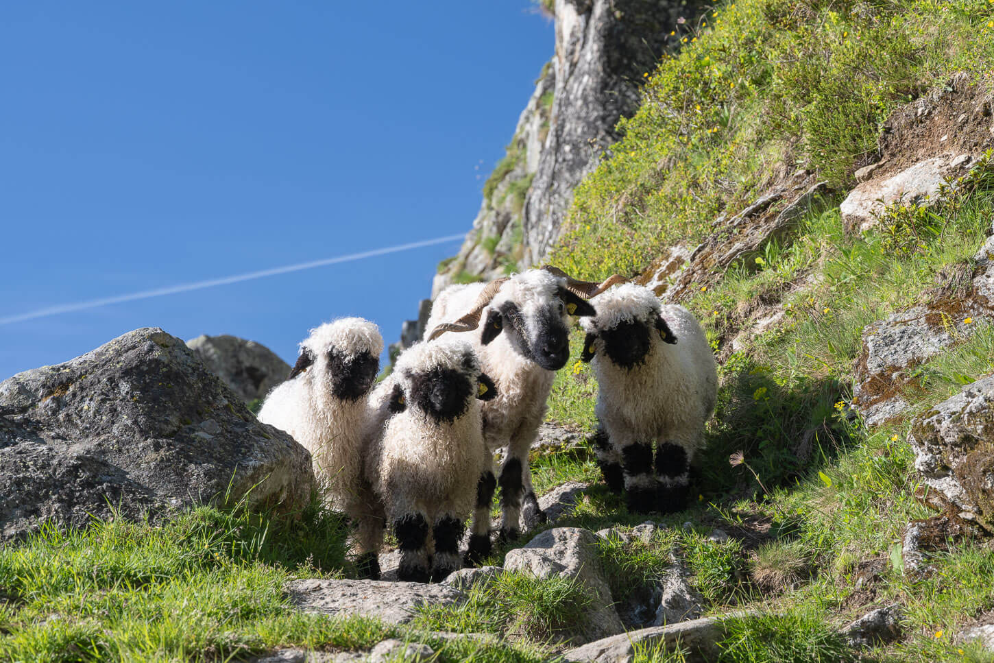
Valais Blacknose Sheep
From the Aletsch Glacier viewpoint, the trail descends steeply at times toward the valley and the pastures farther down the valley. Here, I had to negotiate my way through several small groups of sheep (..and their droppings).
Not long after, you’ll start to see the big morainic deposit that signals where the glacier once was. It has to be crossed to get to the top of the same valley where the glacier lies. There, you’ll see the trail carved into the rock on the opposite side of the valley. You’ll also be able to hear the echoing sound of the glacial river farther downhill.
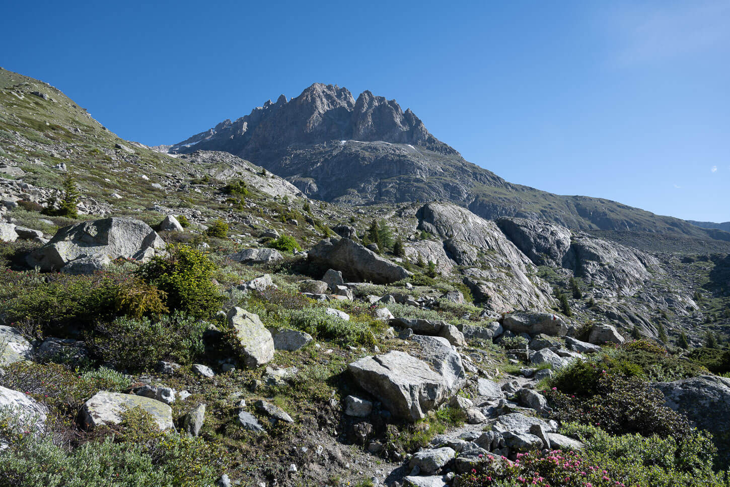
After the initial descent from Belalp, the trail climbs up to the Moraine, a sign of where the glacier once was.
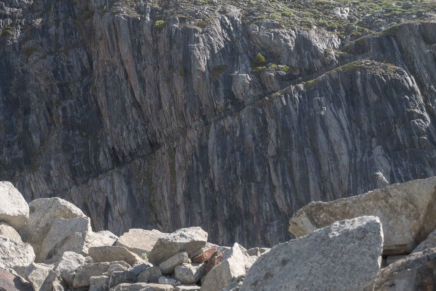
As you cross the moraine, you will see the trail carved in the mountan on the opposite side the valley
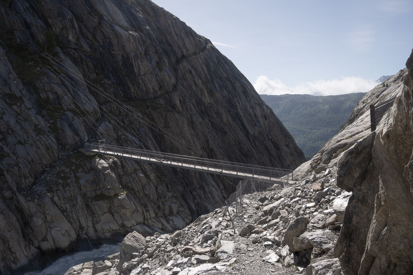
A bridge connects the two sides of the valley, above the glacial river from the Oberaletsch Glacier.
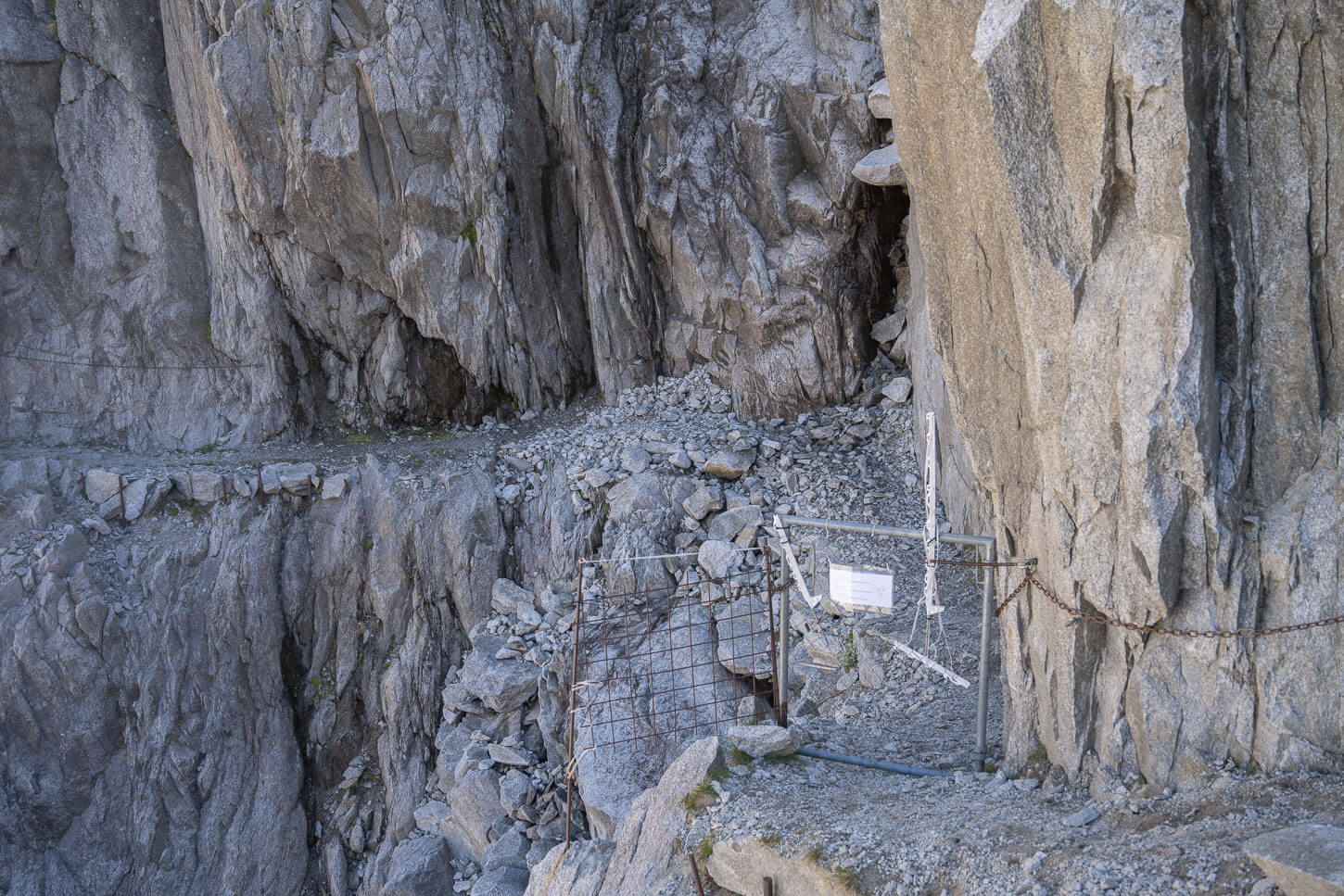
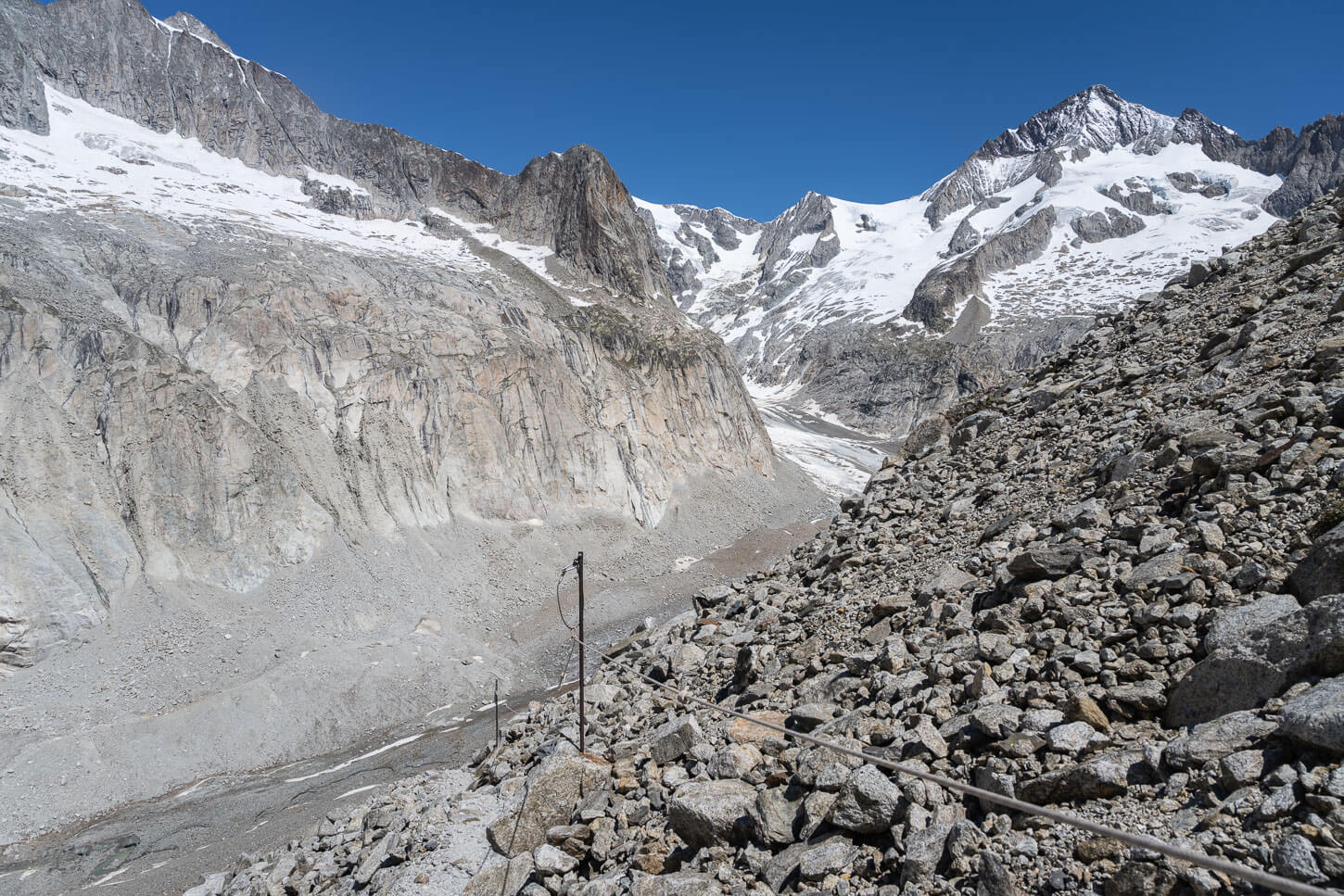
From this point, it’s a short descent on a rocky path to reach the bridge across the tumultuous glacier river. The bridge is very solid, and when I crossed it, it had monitoring equipment installed – for the glacier, I assumed.
Once across the bridge, the steepest uphill section begins, slowly but surely. This is where a good chunk of the elevation gain is. And while it’s demanding on the legs, the views already start to get better and better the higher you go.
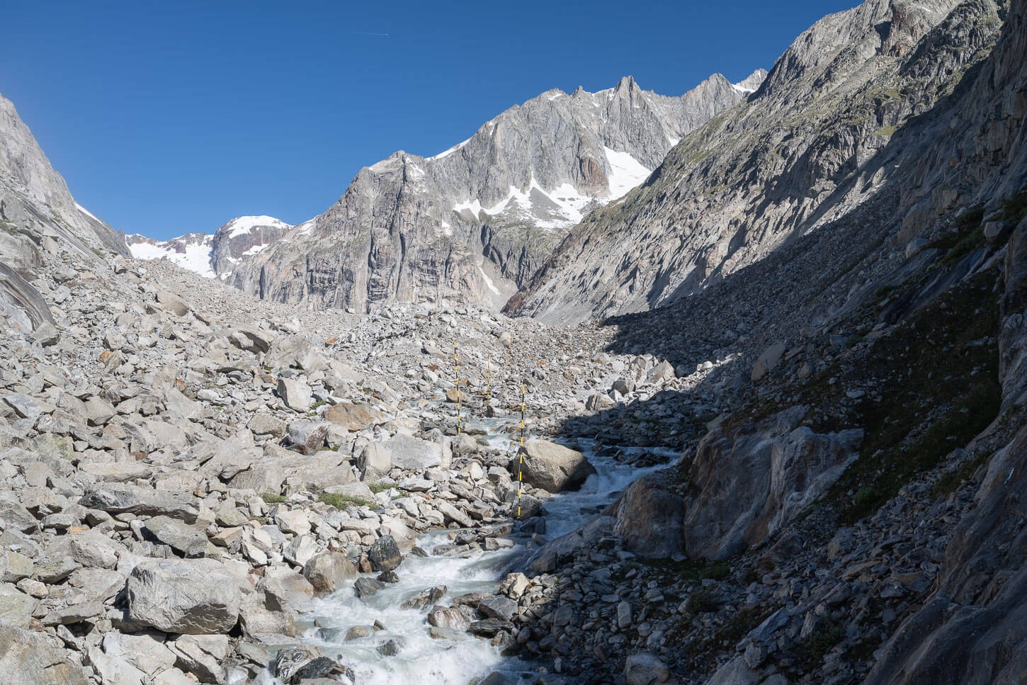
The river comes directly from the glacier.
Across the bridge, the trail starts climbing again, initially on the morainic deposit on the opposite side.
Oberaletsch Panoramaweg – And Oberaletsch Hut
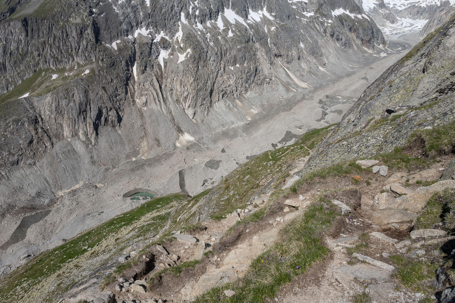
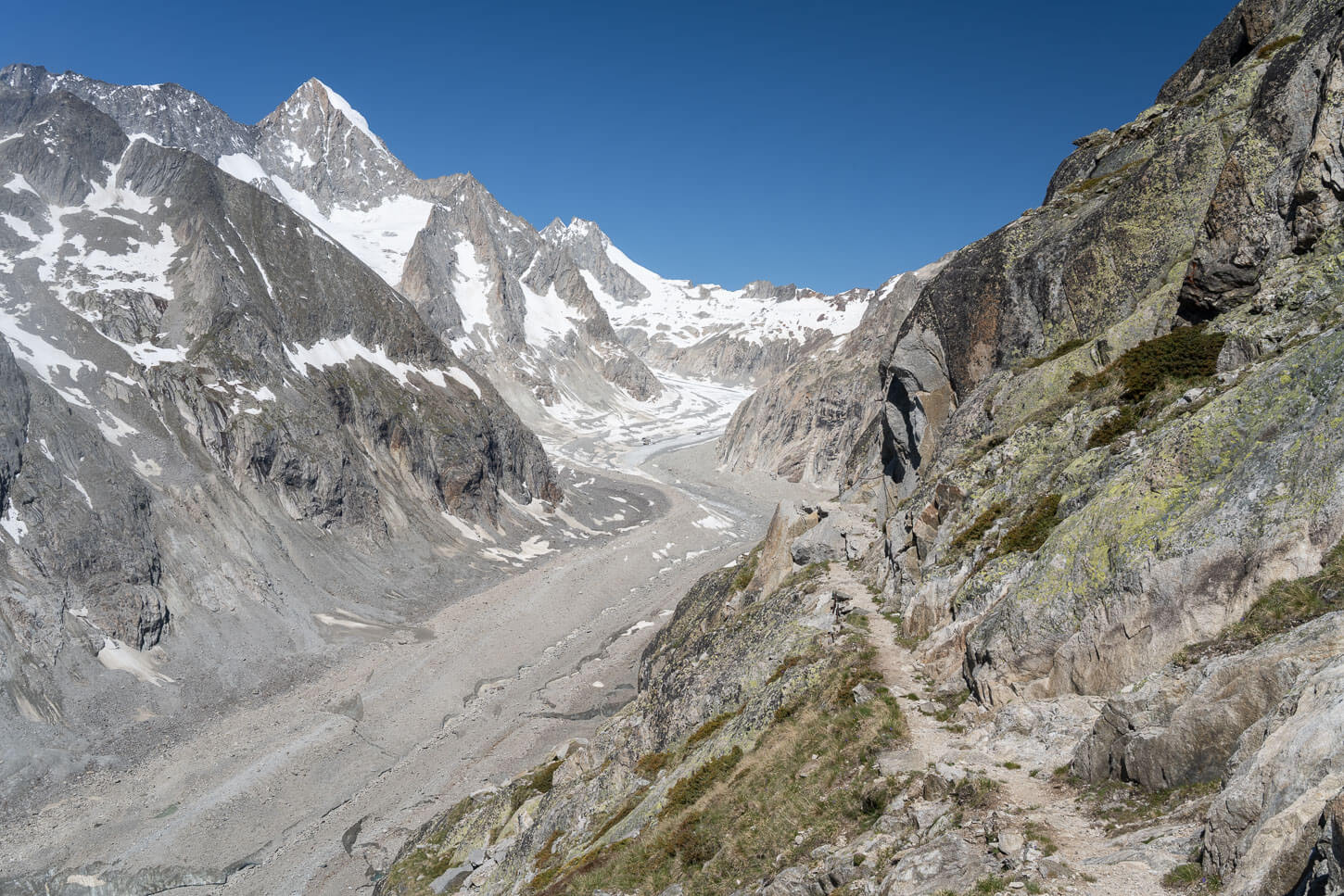
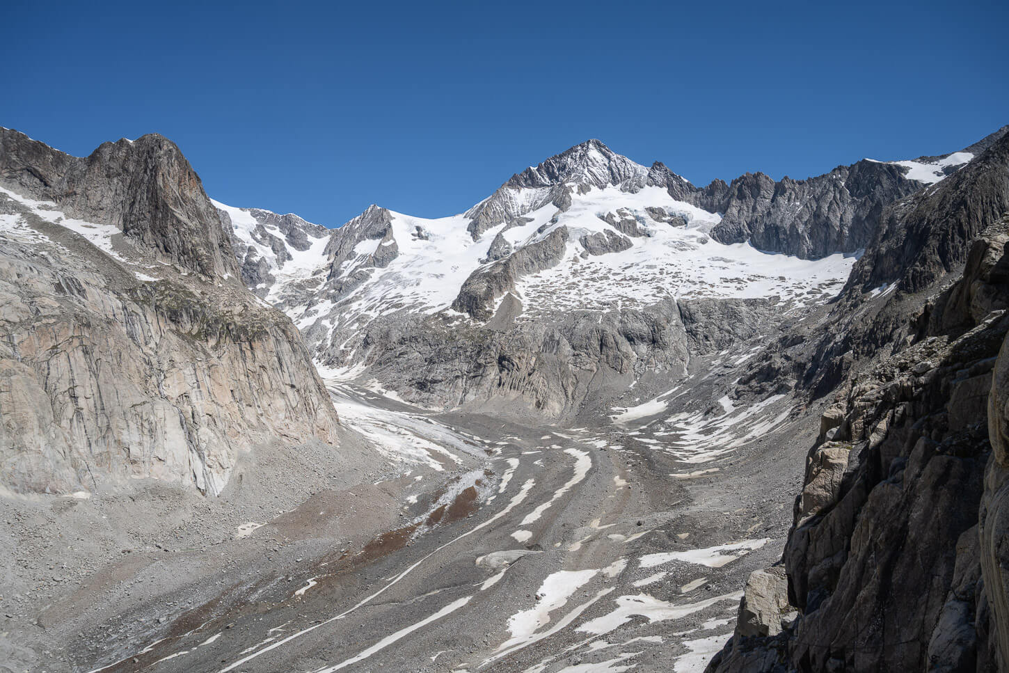
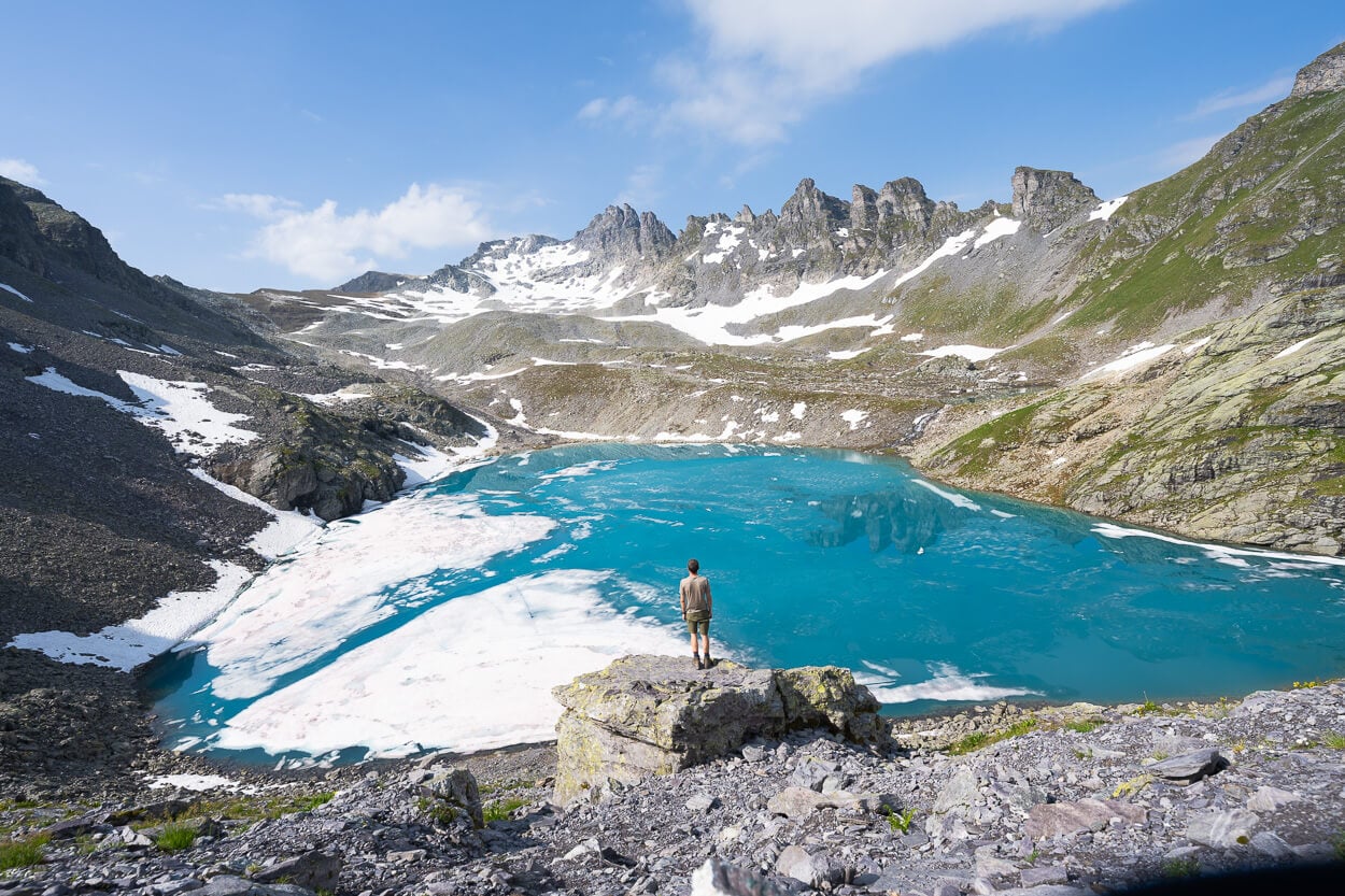
As you climb on the morainic deposit on that side of the valley, you’ll soon pass by the first viewpoint of the Glacier, at about 6.3 km into the hike. It’s a relatively large, grassy outcrop overlooking the entire glacier valley. While the glacier is almost entirely covered in debris, small ponds of glacial meltwater or cracks in the ice will reveal its presence.
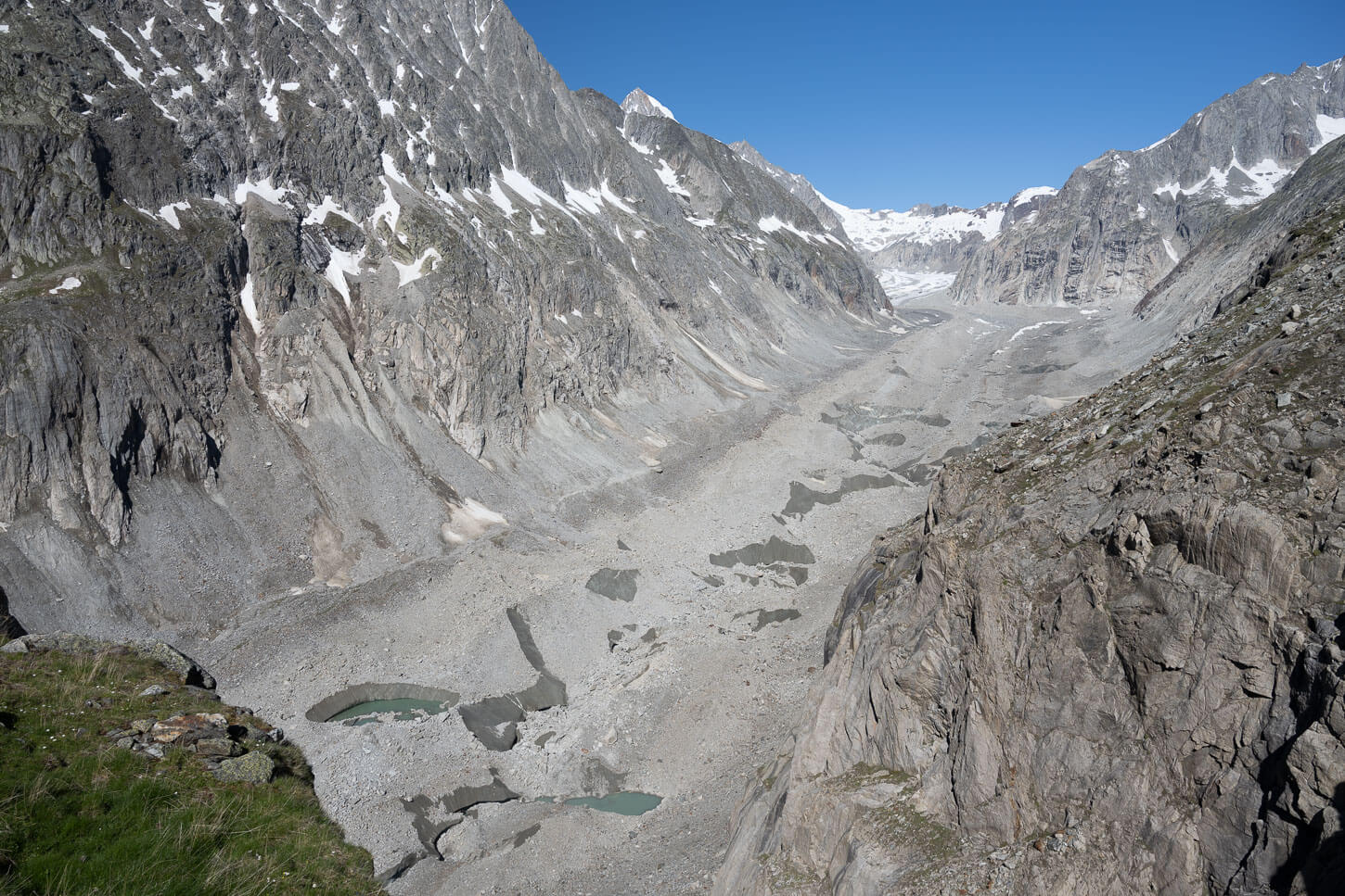
While the glacier is largely covered in debris, you can see pools of meltwater, as well as cracks in the ice.
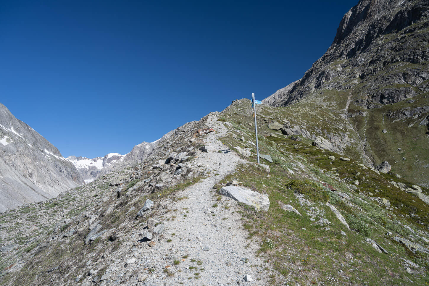
From this viewpoint, you can already see all the way to the opposite side of the valley, which is also where you have to go to reach the hut. As you continue, the trail winds its way up the mountainside for the last steep climb. nothing that requires scrambling, but it is a steep gradient.
This will be the last long uphill section. For the remaining distance, it’s mostly a succession of short climbs and descents, with relatively flat sections in between. Some are moderately exposed, some have chains installed, but the path is always fairly wide.
This is also the section where the steepest climb is.
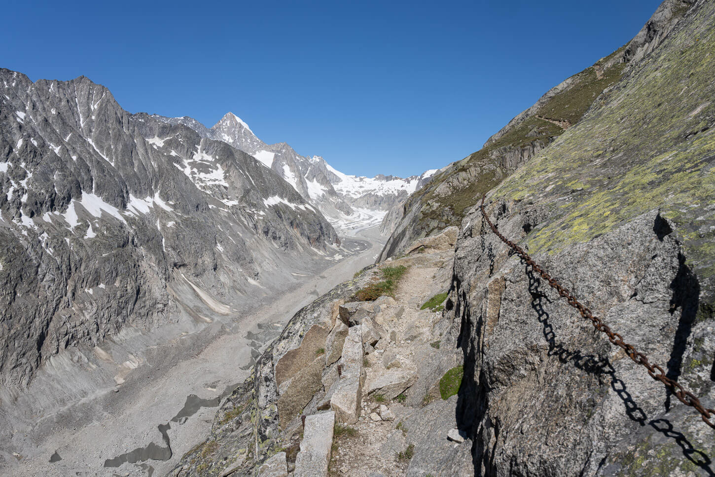
Moderately exposed sections often have chains installed.
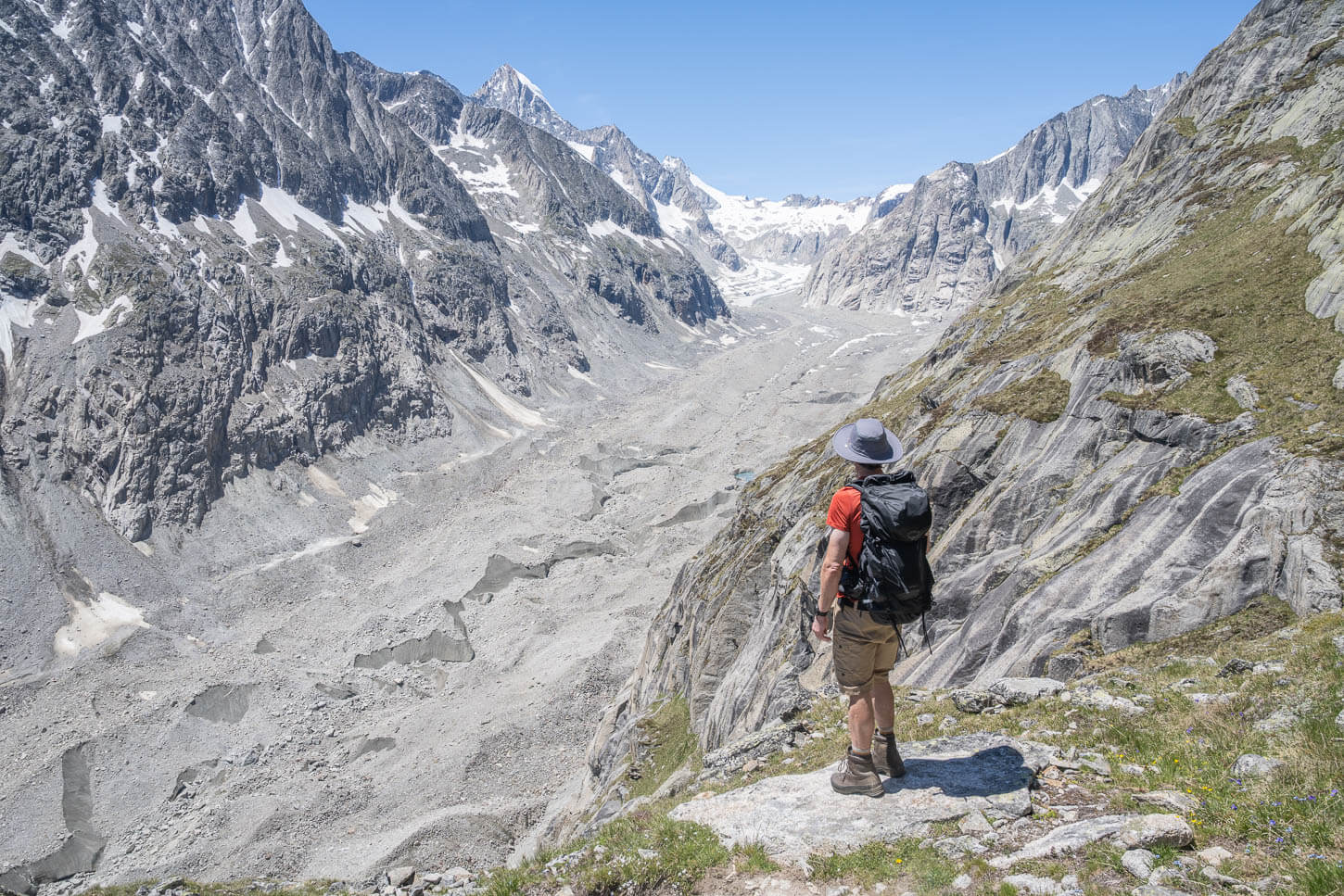
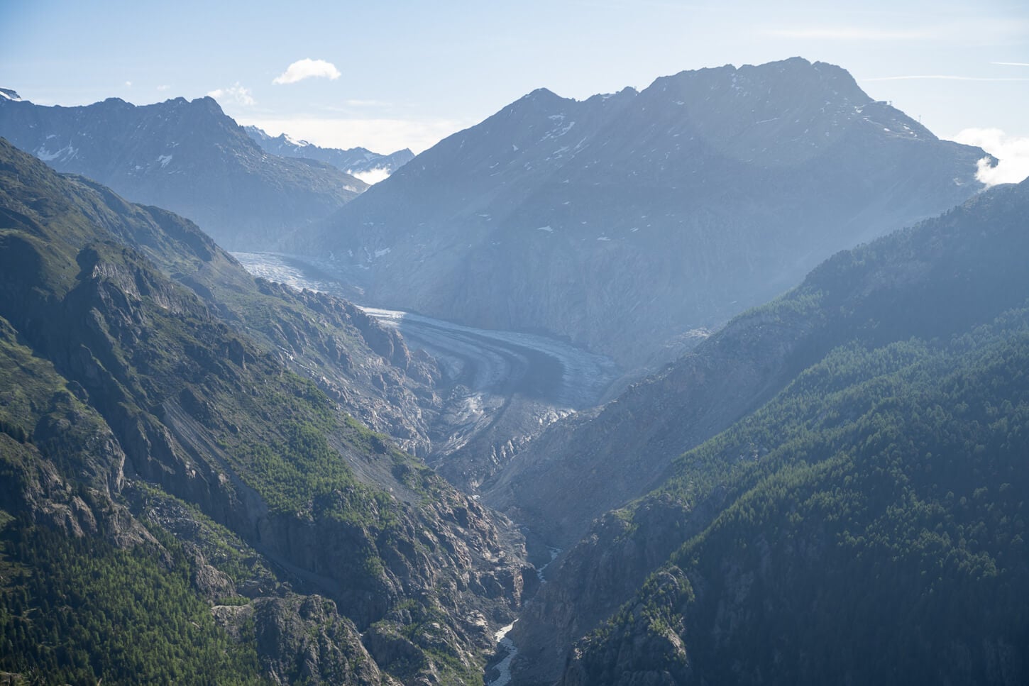
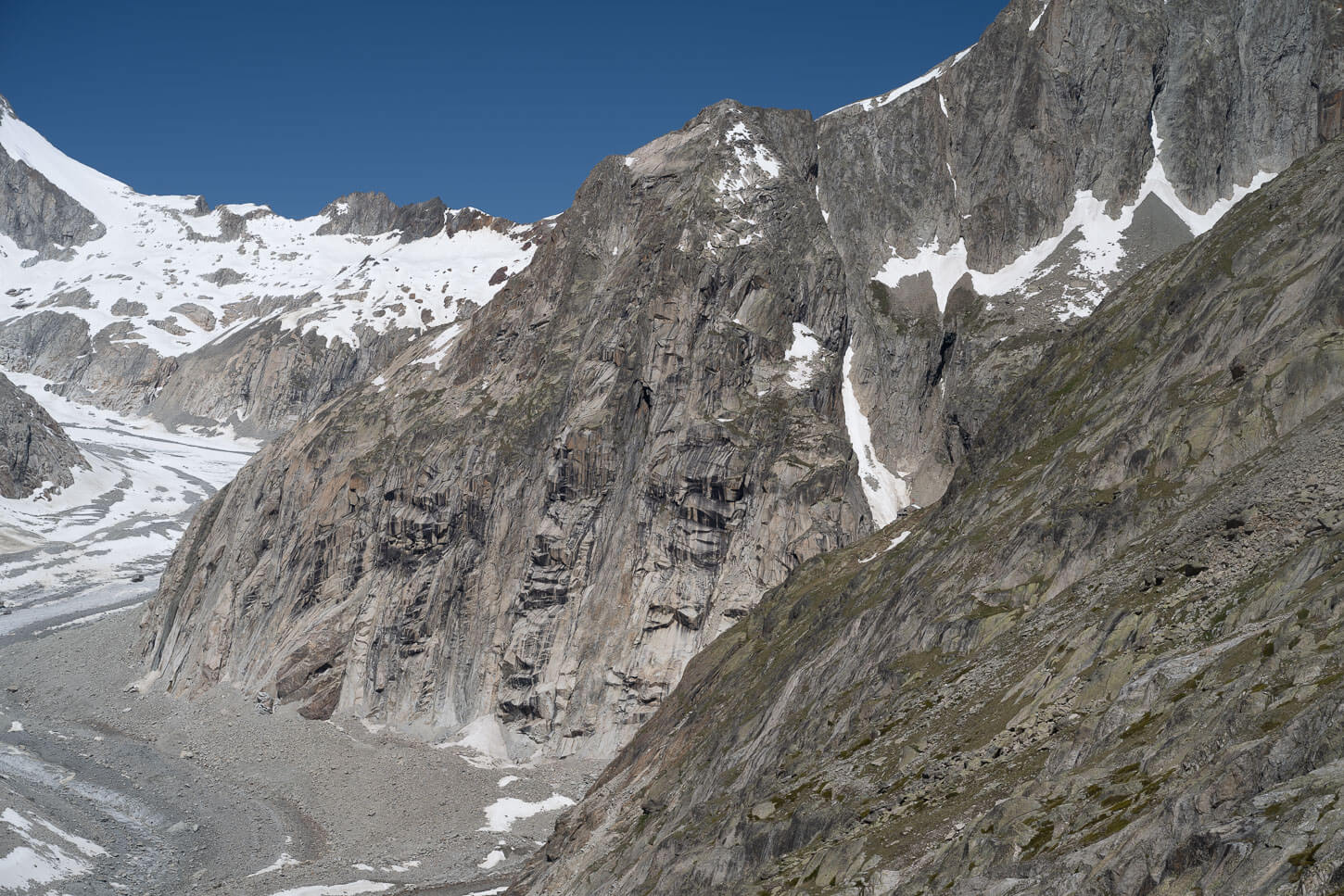
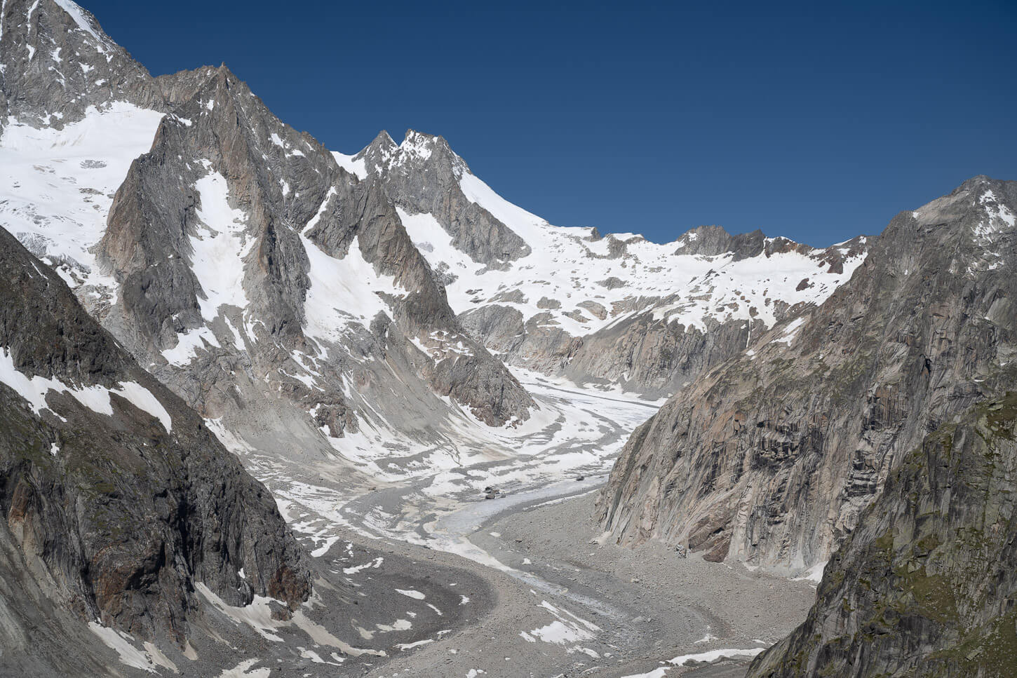
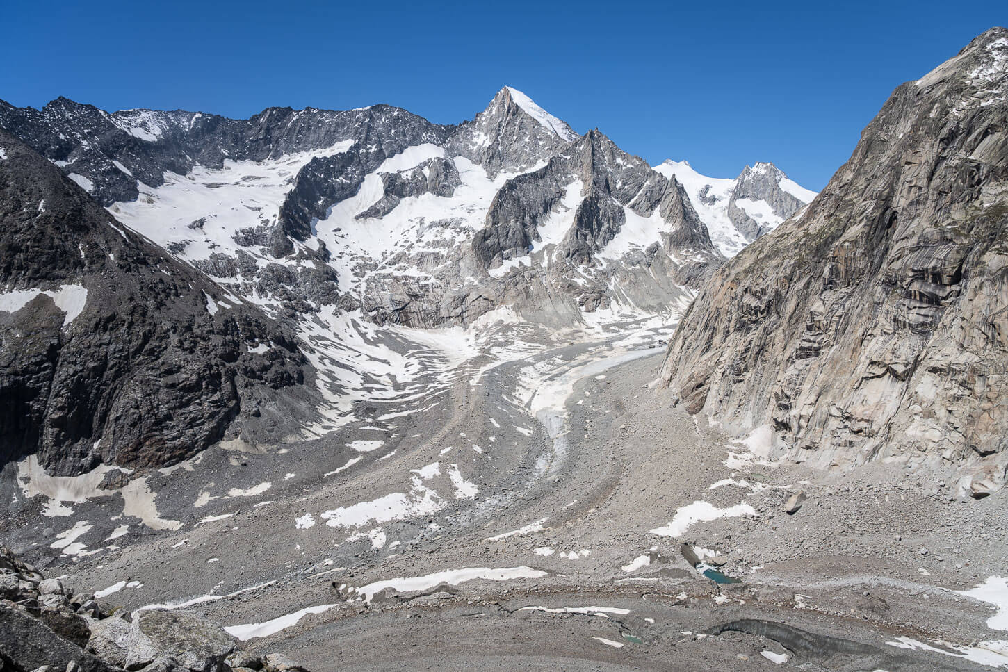
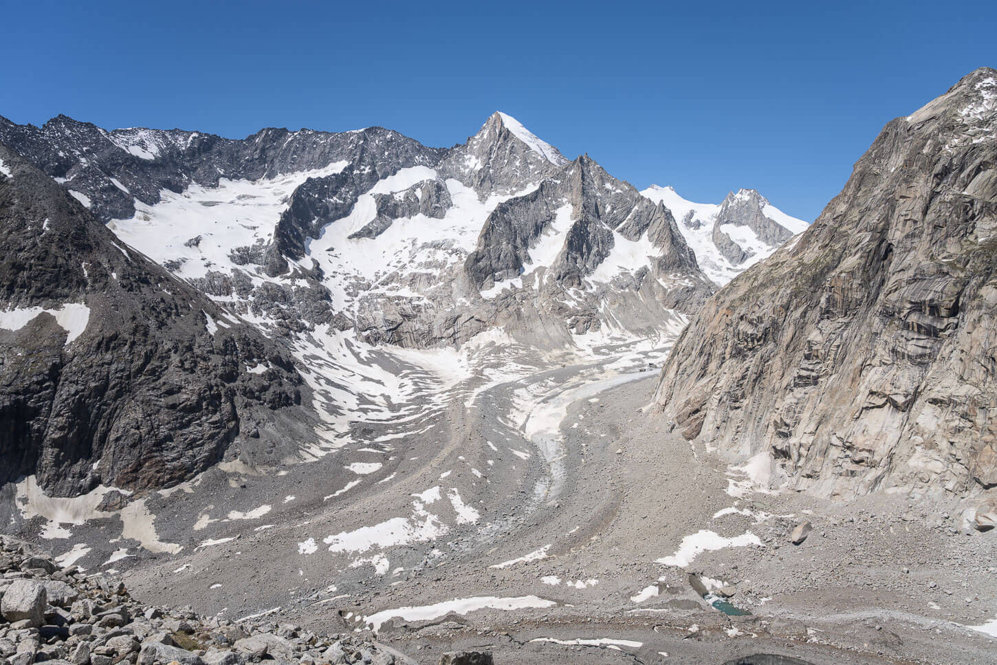
The Oberalets Panoramaweg keeps following the glacier on a trail carved on the side of the mountain. It almost feels as if you are not moving much, with the large scale of the landscape around you. The Oberaletsch glacier is the sixth biggest glacier in the Alps after all, and the landscape around it is a match for its size.
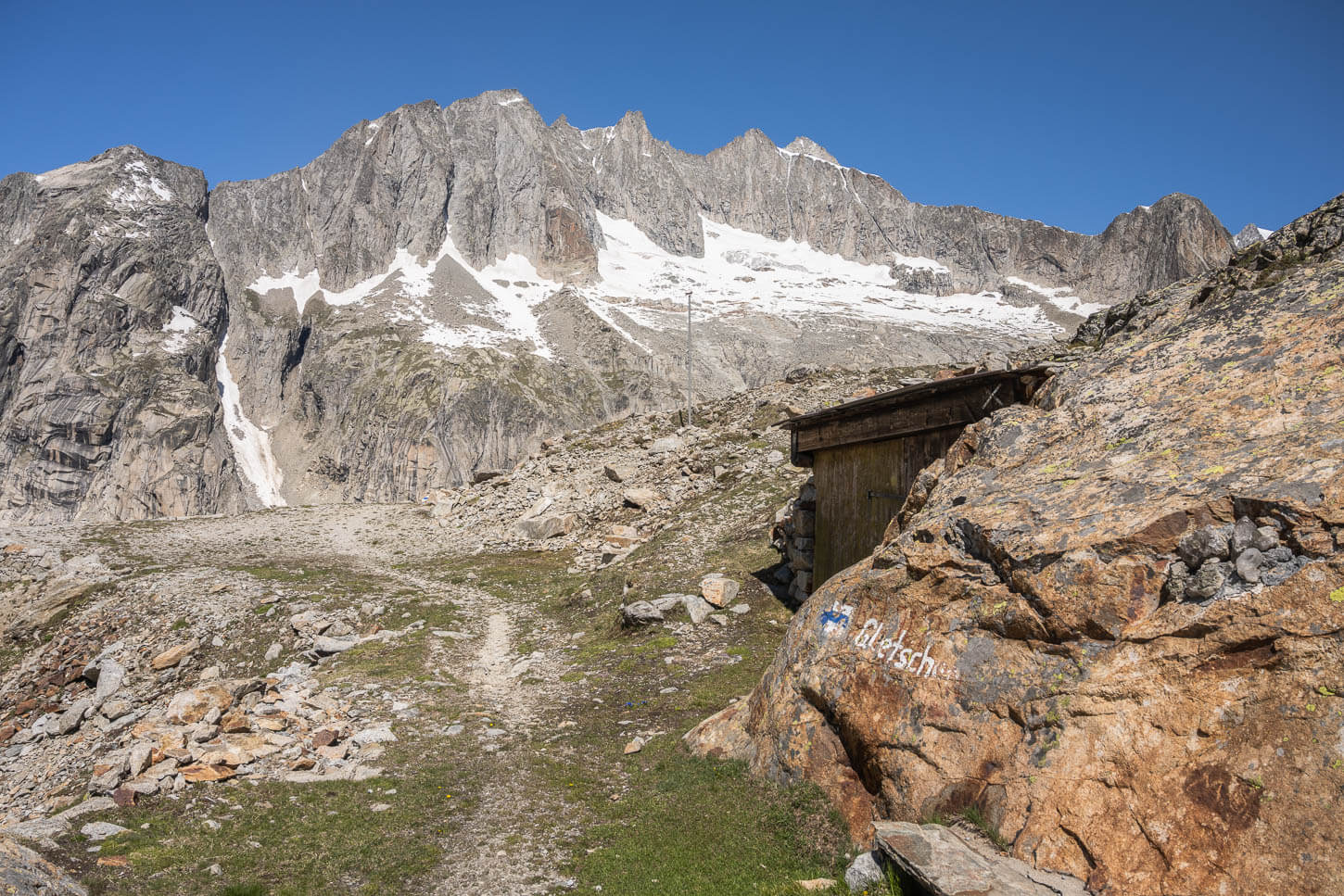
However, after about eight kilometers, you’ll catch the first view of the hut – or its upper floor at least. Perched on the mountainside, it is actually quite difficult to spot, as the stone it’s built with blends with the mountains quite nicely. Only the perfect geometry of its windows and roof visibly detach themselves from the surroundings.
Can you see the Hut? Hint: it’s in front of a snowbank on the mountain behind it.
Oberaletsch Hut – and beyond
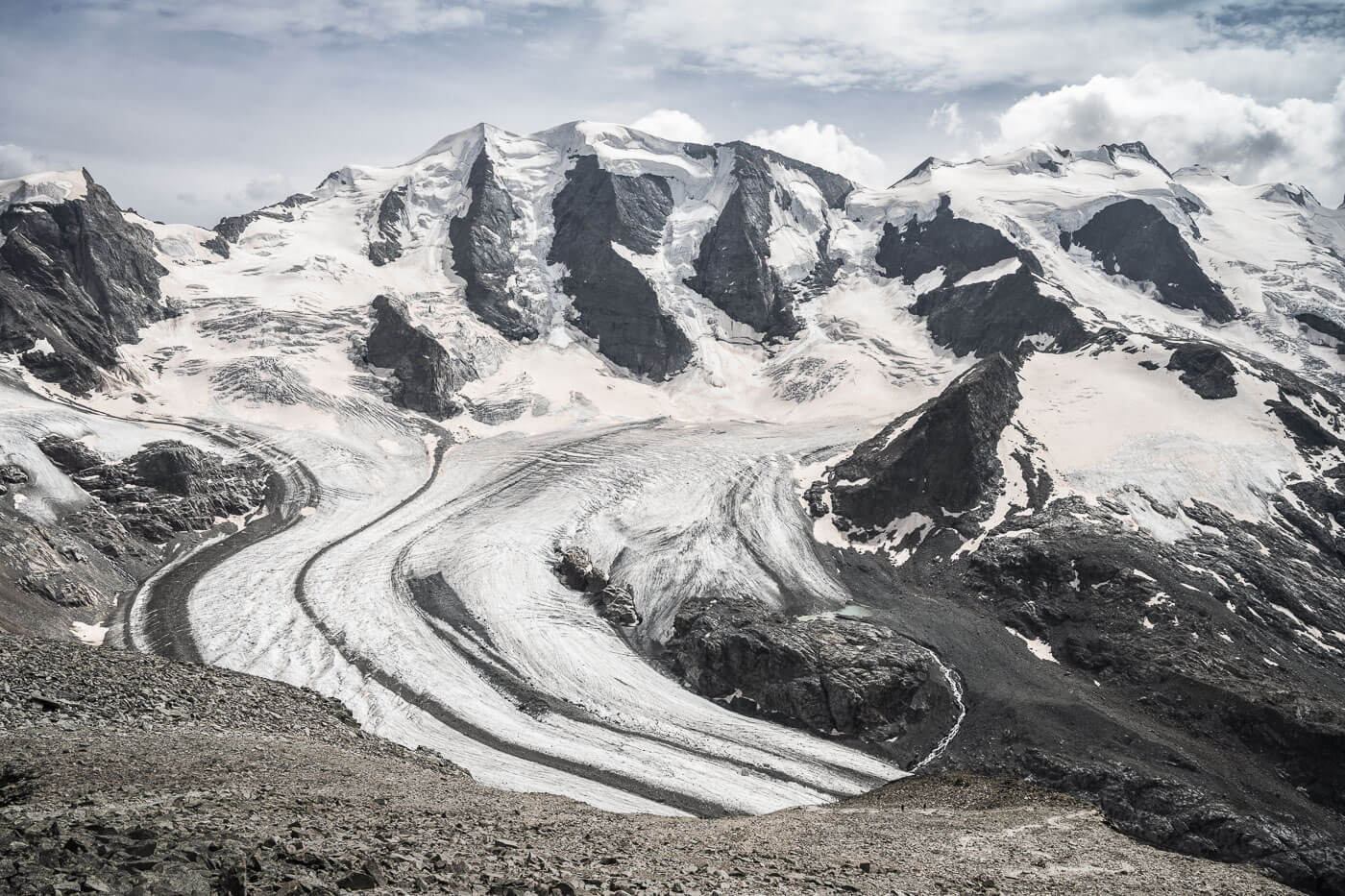
As you reach the hut, the views open up to the Junction between the Oberalets and Beich Glacier. It’s a spectacular view from the hut. You also have the option to continue a little farther, following the trail that leads down to the glacier.
It’s a T4 trail, which in this case essentially means more exposed and with risk of rockfall. And while you should not approach or go on a glacier without a guide or the proper experience, it’s worth taking a short walk down that trail for a bit to view the upper/northern part of the Oberaletsch glacier. The halfway point down that short trail offers great panoramic views of the whole area.
The Oberaletsch Hut, or Oberaletschhütte in German.
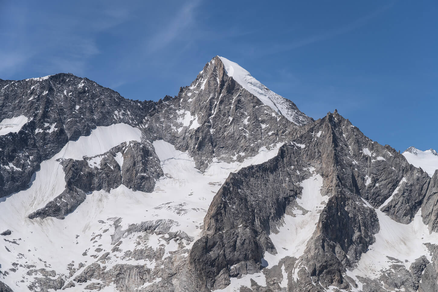
Beich Glacier, with the Nesthorn (3,820m) in the background.
Beyond the hut, another trail leads down to the upper Oberaletsch glacier.
That trail is categorized as T4 due to exposure and potential risk of rockfall.
This short trail offers great views of the upper Oberaltsch glacier and the Aletschhorn (4,193 m)
Beich Glacier (Left) and Oberaletsch Glacier (Right).
Panorama of the view behind the hut – two rows of eight frames each.
I’d highly recommend venturing inside the Hut, too, even if just for a cup of coffee or a slice of cake. Their food is great.
I had a delicious carrot soup with cream and an equally delicious apple tart for dessert. The inside is like any typical mountain hut, mostly made of wood, with a communal table and benches. You can also view photos of what both the hut and the glacier used to look like over the last few decades.

Soup for lunch at the hut.
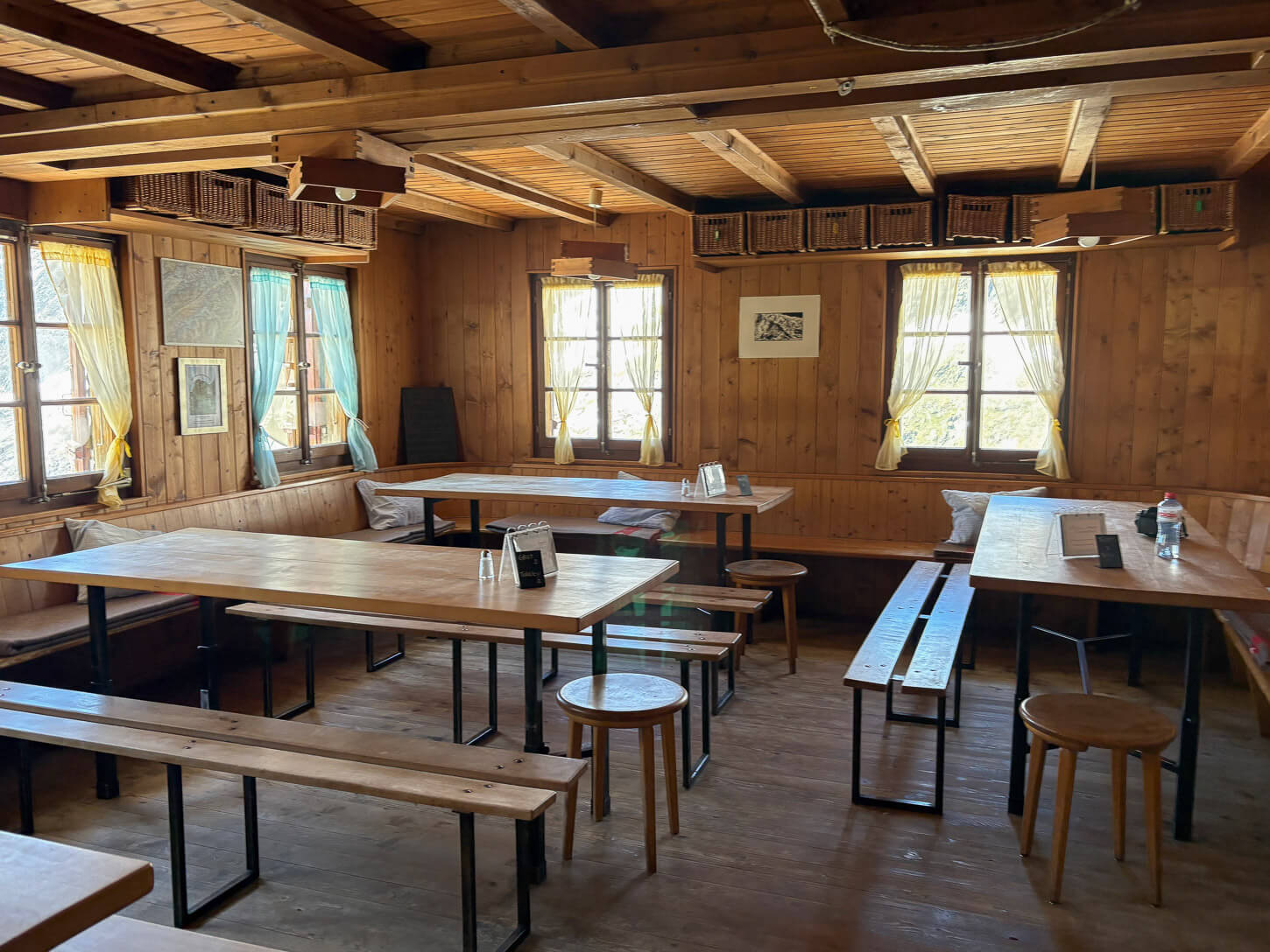
Inside the Oberaletschhütte.
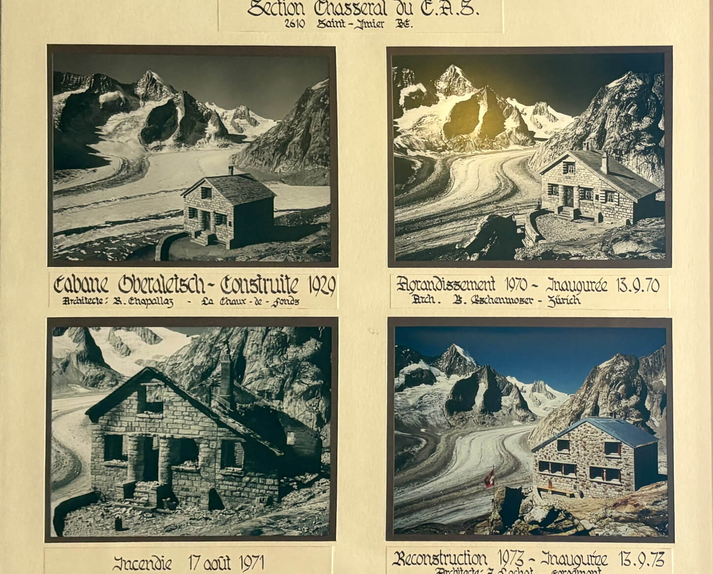
Old photos of the Oberaletschhütte and Oberaletschgletscher, and how they used to look over the decades.
Oberaletsch Hut Photos and Photography Tips
The hut for me was the “focal” point – pun intended -in terms of landscape photography. The hut overlooking the valley where two glaciers meet, surrounded by the jagged, towering mountains, is a scene hard to find elsewhere. Even if the glacier does not look like what it used to.
The viewpoint is slightly off-trail, right above the hut. It’s right next to the Anemometer, so you can’t miss it. If you are planning to stay for the night, that will allow you to capture the sunrise light hitting the mountain behind the hut. With sunset, and some luck, perhaps some colors in the same direction.
However, this is also a very rugged landscape that has beauty in itself. Especially the views behind the hut, where the hiking trail essentially ends, allow for capturing an area almost entirely devoid of signs of civilization, with meandering glaciers and jagged mountain peaks.
In terms of lenses, even though I had my 14-24 and the 100-400, I only used my 24-70mm. This is because while the valley is wide, it is also surrounded by giant, steep mountains up to 4,000m. That demand in most cases, even a 70mm lens is enough to capture a more detailed view of the mountain peaks around the valley.
Video of the Hike
Last but not least, here is a video of this hike. Just some musing and the wonderful views.
Where to Stay
The Oberaletschhütte offers the classic bunkbed accommodation, as most alpine huts do. You can reserve a bed on their website. Hotel Belalp in Belalp is also quite popular and offers fantastic views. You can both see the tongue of the Aletsch glacier and, on clear days, the Matterhorn’s summit.
Otherwise, father down the valley, Blatten bei Naters, or Brig. The latter is a good choice for the night, if you are travelling around and want to drive elsewhere the day after.
Additional Resources
- For a comprehensive overview of Hikes in Switzerland, check out my main Switzerland page.
- Here is a link showing how much the glacier has lost in recent decades.
- Official website of the Oberaletschhütte.


Leave A Comment