Laguna de Los Tres Sunrise Hike – Catch the Fitz Roy, Patagonia, Argentina
The sunrise hike to Laguna de Los Tres to catch the “Fitz Roy Fire” is one of the most spectacular and popular hikes in Patagonia.
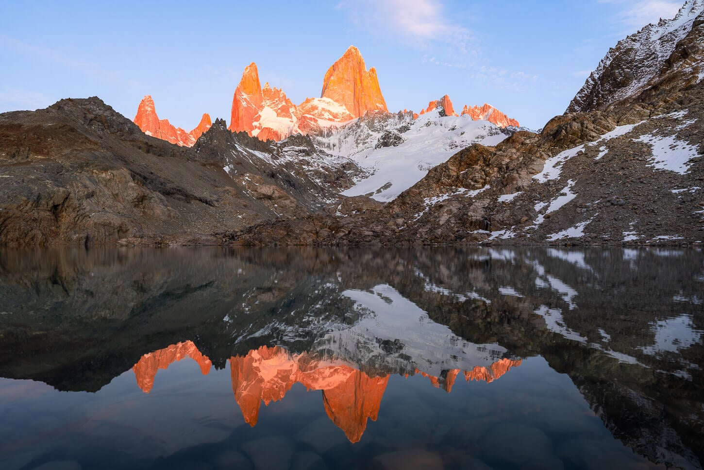
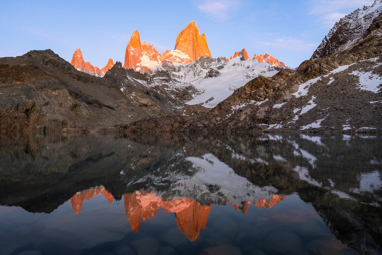
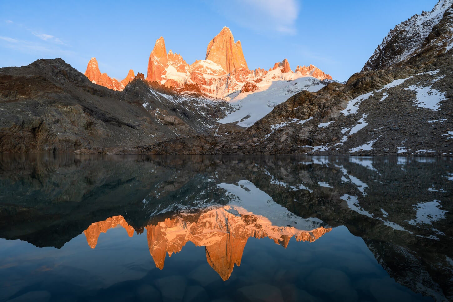
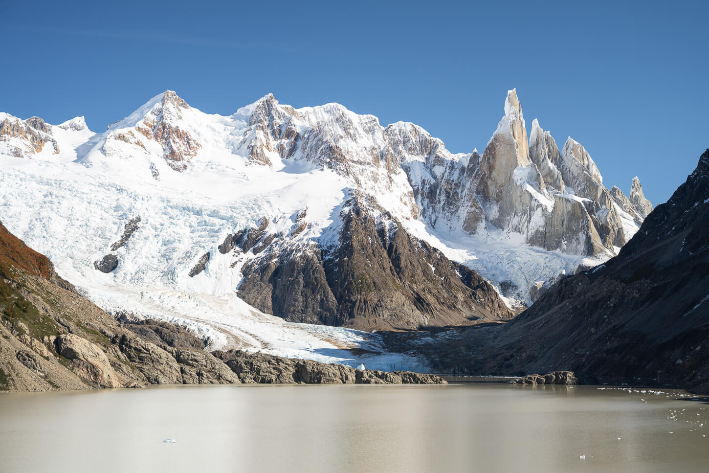
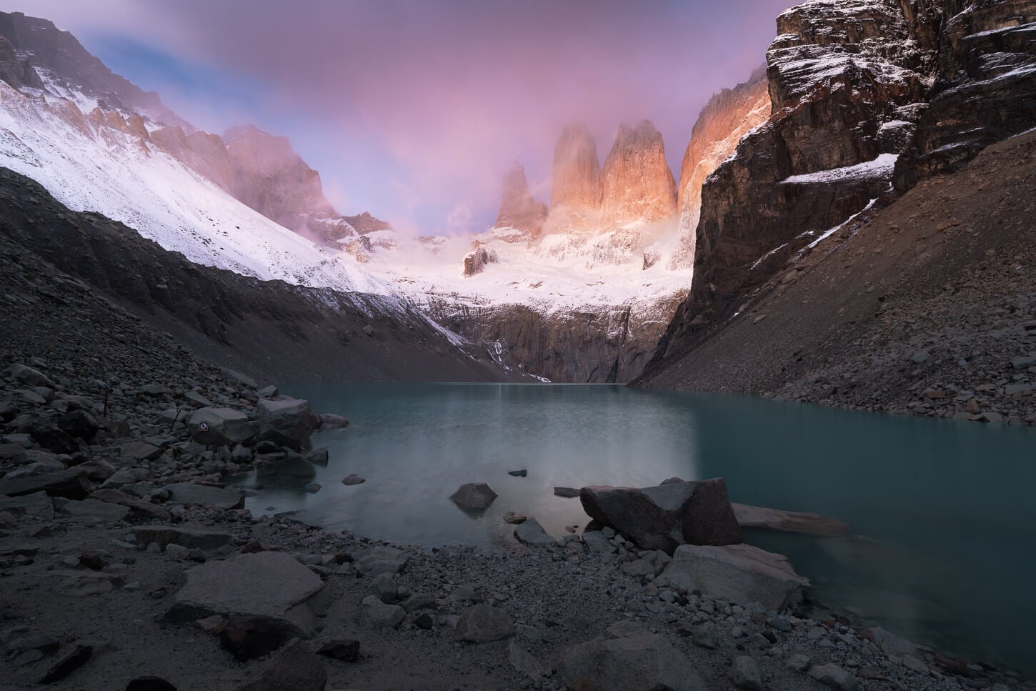
The “Fitz Roy Fire” at Laguna del Los Tres.
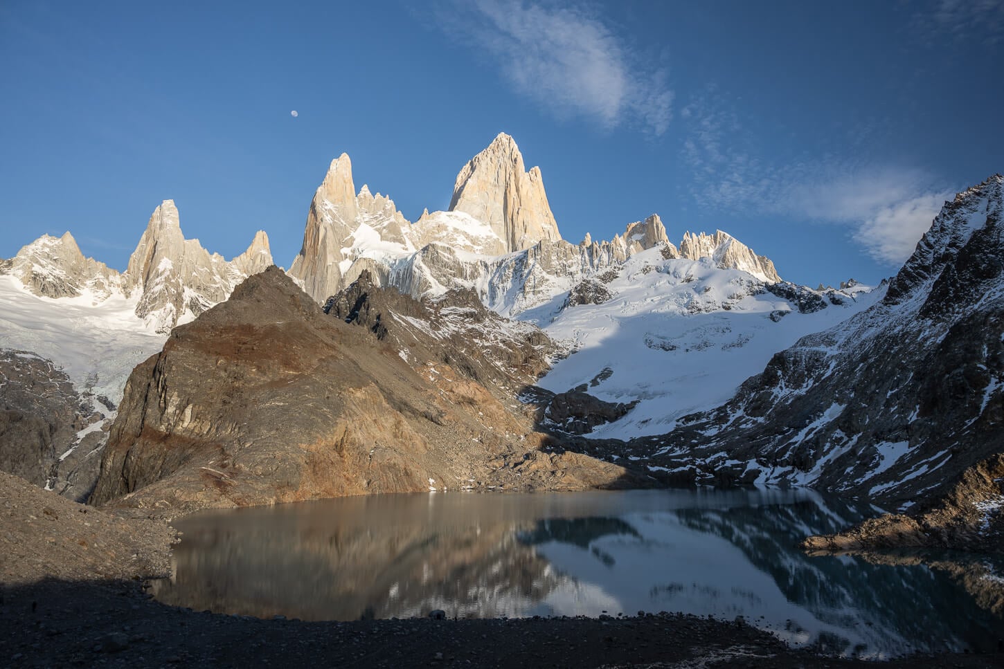
Seeing the 3,405 meters (11,171 feet) Fitz Roy or Cerro Chaltén catching the first warm light of the day above the Laguna is an absolutely jaw-dropping sight. It’s easy to see how this is a bucket list hike for many.
Located within Los Glaciares National Park in Argentine Patagonia, the hike is quite hard, at 22km or 14 miles, with about 900 meters (2,952 ft.) of elevation gain. And, if you are planning the Laguna de Los Tres hike specifically for sunrise, you should aim to leave from El Chaltén at least four hours before sunrise. But the views you get when you finally arrive at Laguna de Los Tres will be worth the early, grueling morning start.
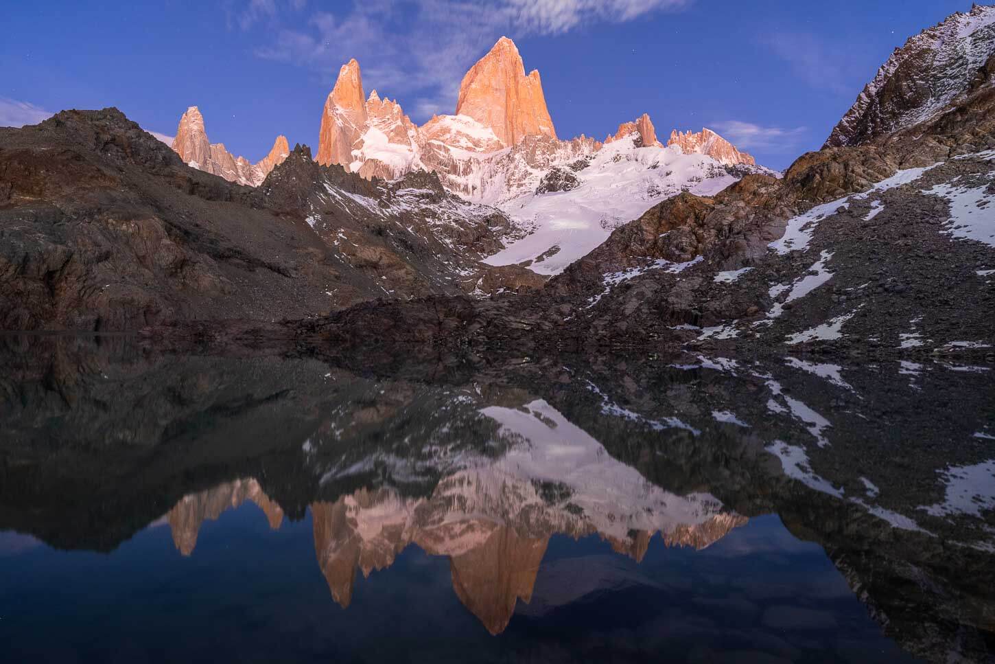
Fitz Roy at twilight, waiting for sunrise.
The most common way to hike to Laguna de los Tres is directly from El Chaltén, especially for sunrise. However, I will also share a quick overview of the other options, like Río Eléctrico and the various Campamentos too, and which one is best for which purpose. But essentially, the Río Eléctrico trailhead is best to see more of the park during the day, and the campamentos are better for a shorter sunrise hike.
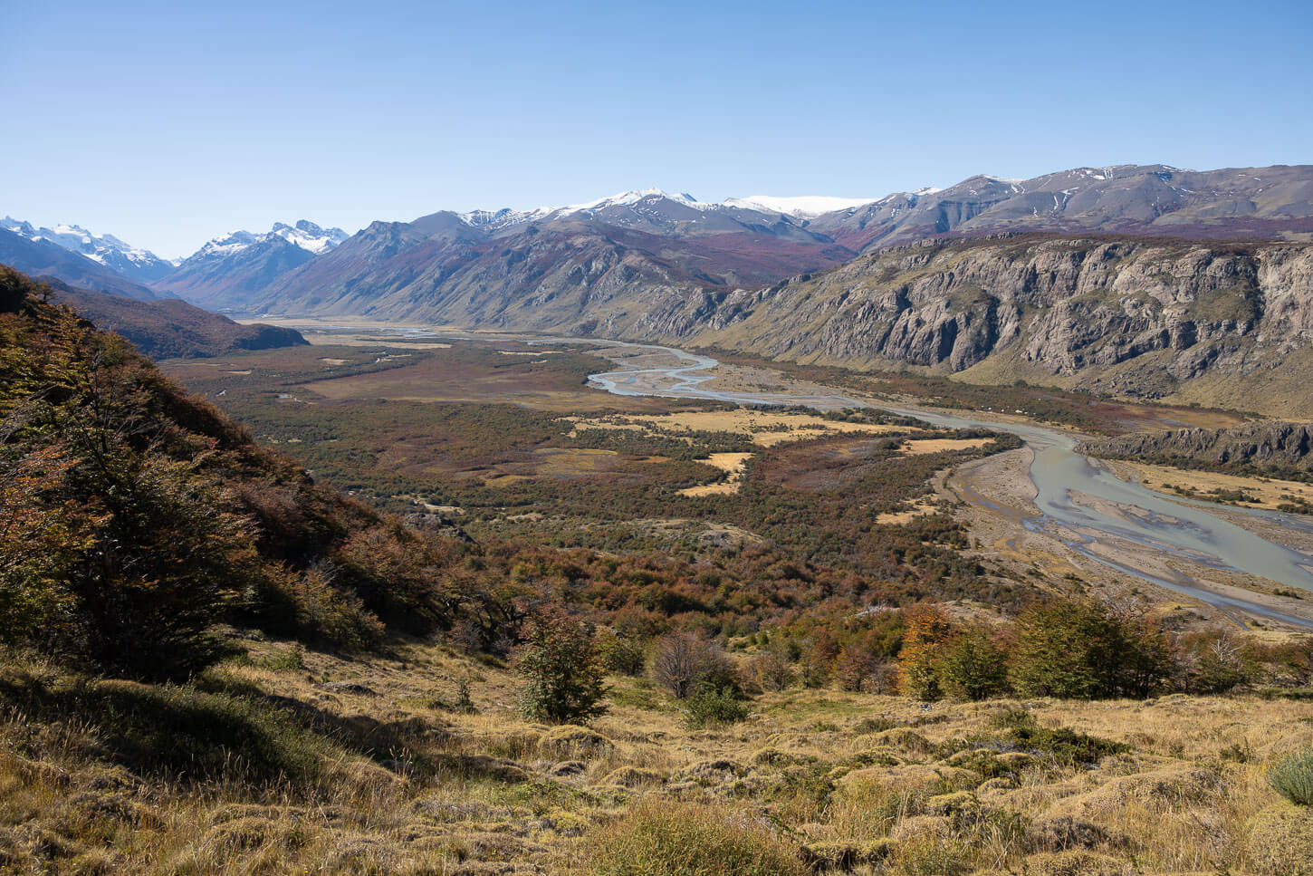
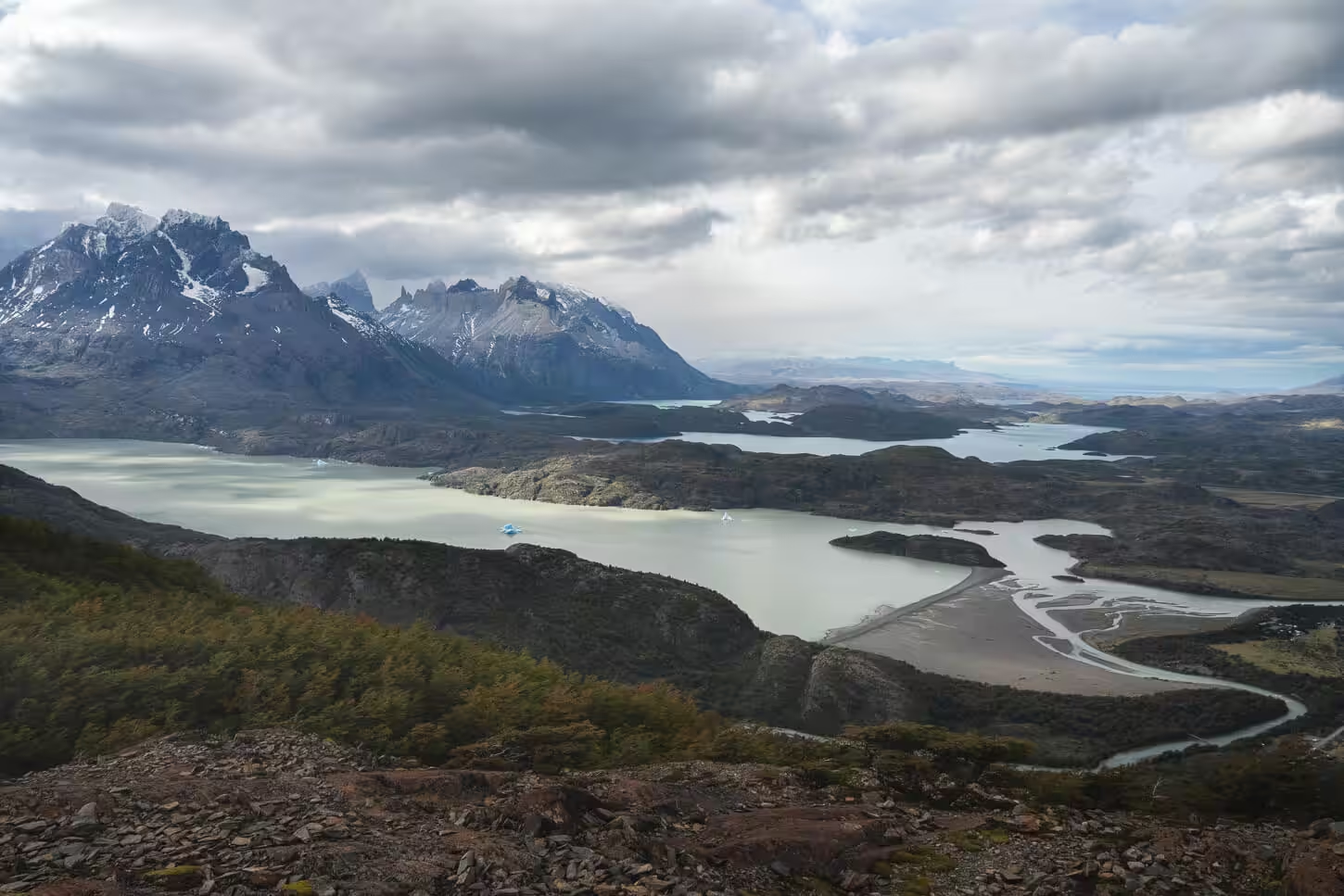
During the day, the hike to Laguna De Los Tres also provides breathtaking views of the Fitz Roy Massif.
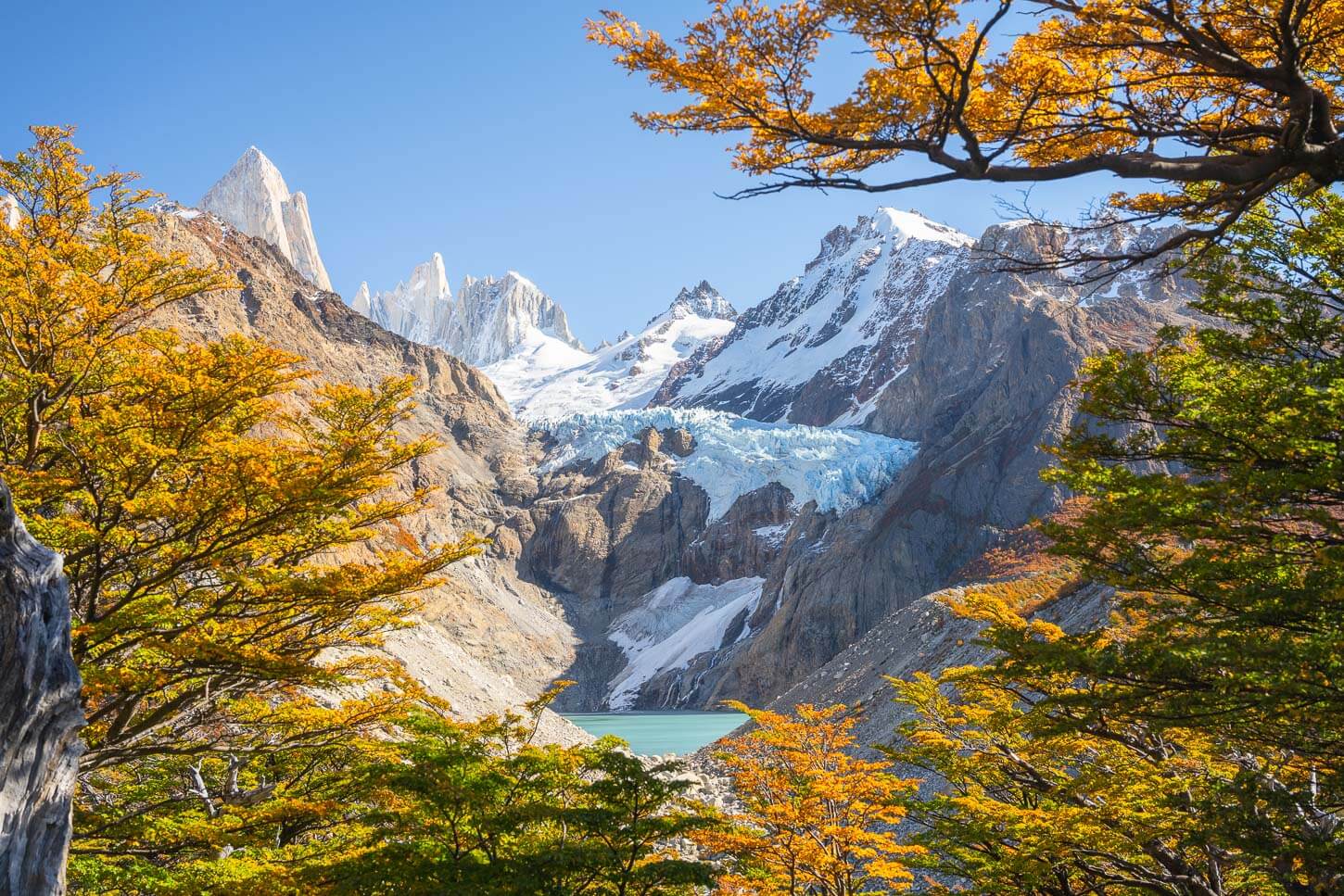
Part of what makes this hike interesting is also the geological history of the Fitz Roy massif. You can easily see how it stands out from the surrounding landscape, both in shape and material.
The granitic peaks of the Fitz Roy massif began deep underground around 17 million years ago, when magma intruded into the Earth’s crust due to the subduction of a tectonic plate. As tectonic forces further uplifted the region, the relentless Patagonian elements stripped away the softer surrounding rock layers, exposing those beautiful granite towers we see today.
Table of Contents
Overview of the Laguna de Los Tres Hike & Map
To hike to Laguna del Los Tres, you have three main options. First, you can hike directly from El Chaltén. Second, you can take one of the many shuttle services to the Río Eléctrico area, where you can be dropped off. And, as a third option, you could camp on the trail from El Chaltén either at Laguna Capri or Campamento Poincenot. In any case, the trail is well-marked and easy to follow.
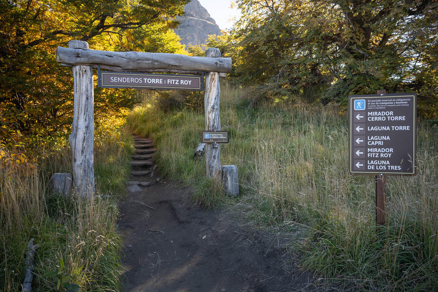
The Official trailhead is in El Chaltén, next to the main parking area along Road 41.
Also, regardless of the starting point, you will need to purchase a ticket/pass for Los Glaciares National Park. You can purchase the ticket online before entering the park for ease of access. I did that too. If you are planning to do the hike for sunrise, you would need to buy it online, as the booth later in the morning. If you buy the ticket online, it’s best to either print it or take a screenshot of it, as there may or may not be a reception when you need to show it.
A few additional notes:
- Keep in mind, there might be Pumas in the area. Something to be aware of, especially if you are doing the hike for sunrise.
- In winter, you need to have crampons and hiking poles. It’s mandatory. You can rent them in sports stores in El Chaltén if needed.
- A bit of a “trivia” clarification: sometimes the “Laguna de los Tres Hike” is also called “Fitz Roy Hike”; they’re the same hike.
Laguna de Los Tres Hiking Options
- From El Chaltén, the Hike to Mirador Laguna de Los tres is 11 km (6.83 miles), one way, with a positive elevation gain of 800 m (2,624 ft.). So a total of 22km from th park entrance. This is the best option for Sunrise if you are not going to camp inside the park. This is what I did.
- From Río Eléctrico, it’s 9.5 km (5.9 miles) to Laguna de Los Tres with 780 m (2,559 ft.) elevation gain, then again 11 km back to El Chaltén. This is a good option if you want to see more of the park on a day hike, so you can be dropped off at Río Eléctrico and hike to the Laguan via the Mirador Piedras Blancas.
- From inside the Park: From Campamento Laguna Capri is about 7 km (4.34 miles) with 480 m (1,574 ft.) elevation gain. From Campamento Poincenot, it’s about 2.5 km (1.55 miles) with an elevation gain of about 450 m (1,476 ft.). Camping is the best option to shorten the hike for sunrise, but also a great option to use as a base to view multiple landmarks. and, by far, the cheapest accommodation type. However, you do need to book in advance. This is what prevented me from camping, since I needed the flexibility to choose the day based on the weather.
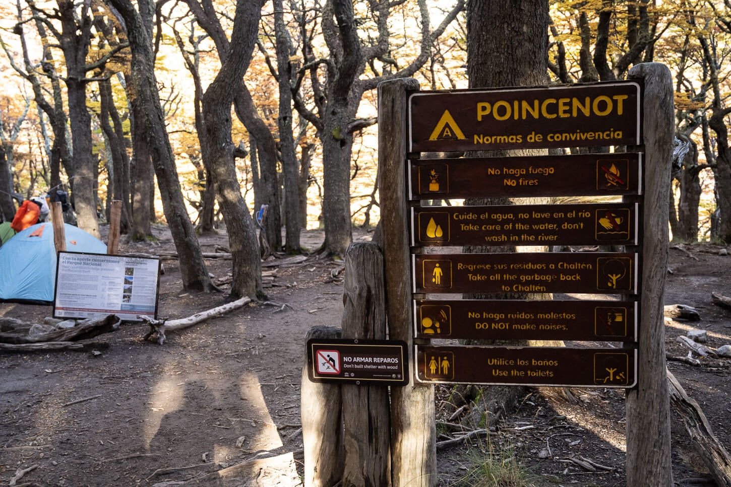
Campamento Poincenot Welcome sign, with house rules.
And without further ado, here are the details of the hike directly from El Chalten, with the map and GPX file.
| Max Altitude | 1,178 m (3,864 ft.) |
|---|---|
| Distance | 22 km (13.67 miles) |
| Elevation gain | 900 m ↑ / 900 m ↓ (2,952 ft.) |
| Hike Time | 07:30/ 08:30 Hours |
| Hike Difficulty | Hard/moderately exposed in places. |
Here is the map of the hike. You can download the GPX file for free from the activity linked below.
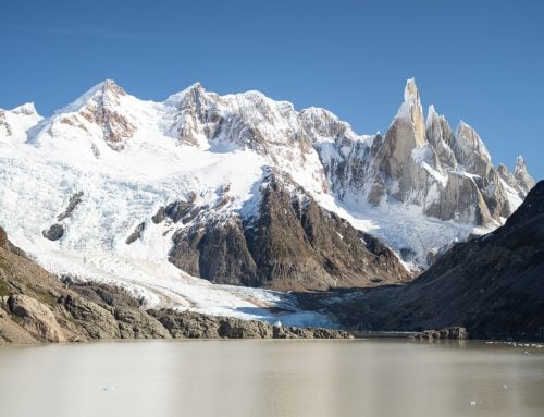
Combining Laguna del Los Tres and Laguna Sucia
As an additional tip, you could also add Laguna Sucia to the Laguna de Los Tres hike. That route would add about 4.5km (2.8 miles), and it’s a more technical trail that requires minor scrambling and crossing a potentially unstable morainic deposit.
However, if you have it in your legs, it’s worth it. Laguna Sucia is a completely different experience compared to the more crowded Laguna de Los Tres. I also did that, and here’s the file of the hike to Laguna de Los Tres and Laguna Sucia. if you get the file, do not I missed the turn at first and had to backtrack.
Laguna Sucia makes for a relatively short, lightly challenging detour (1.5-2 hours) to the trail.
Laguna de los Tres Sunrise Hike Timing
Specifically for Sunrise, I recommend starting the hike at least four and a half hours before sunrise if you are leaving from El Chaltén. For good measure, I actually left five hours before sunrise, though.
Here’s what I did. I hiked on April 5th, leaving my accommodation at about 3:15 AM. I arrived at the Laguna at about 7:15 am, with one hour to spare before Sunrise, which was at 8:16 am. That was intentional, to both find a suitable spot and to photograph the twilight glow.
Checking the Weather Forecast for the Laguna de Los Tres
Needless to say, this is a hike you want to do in the best possible weather, whether you are doing it for sunrise or during the day. So it’s worth spending some time on reading about the local weather patterns and familiarizing yourself with the main weather forecast tools for the region.
The most used weather forecast site for specific locations in Patagonia is Windguru. If you are not familiar with it, I’d recommend taking some time to familiarize yourself with it. It’s time well spent, both to make sure you identify the best possible weather conditions and are prepared for the weather you might encounter.
In short, you can search Windguru for each spot by name, i.e., “Laguna de Los tres”, and access the wealth of data the forecast provides. Below is a Windguru widget for the Base Torres forecast you can use to learn its ropes, or come back to check the forecast. It is easier than it looks.
The Laguna de los Tres forecast on WindGuru shows different weather models for the location. When I was there, of the Windguru models, GFS 13 seemed to be the most accurate/reliable. It’s the same one I have embedded above. Here is a short explanation on how to read this.
Wind
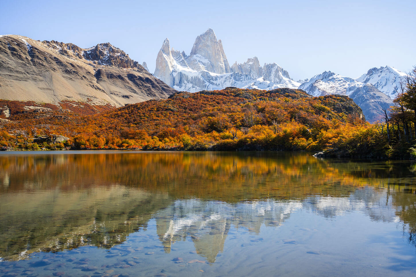
Wind, as little as possible, too. As you probably heard already, the wind in Patagonia can be extremely brutal. With wind speeds above 50km/h, you should think twice about doing the hike. And be aware that the trail will be closed for safety reasons in case of strong winds. With little to no wind, you’d also be able to catch the reflection as I did. That is exactly how I planned to capture that reflection, and as you can see, it worked in terms of weather.
The *0° isotherm (m)
This value tells you at which altitude you will encounter the freezing point. This means it’s the point where you can potentially get snow if rain is forecasted, and ice on the trail.
Last Weather Tip
However, given the unpredictable Patagonia weather, it is always useful to check multiple sources. My recommendation is Windy.app, where you can also check the ECMWF model. This model is often regarded as the most accurate/reliable for Patagonia. I compared it to the GSF13 at multiple locations, and the results were very similar.
How to get to the Mirador Laguna de Los Tres Trailhead and Parking
If you are starting the hike in El Chaltén at the official trailhead, you can walk right to the Parking area and start from there.
- Driving Directions: If you are coming from out of town, i.e., from El Calafate, you should drive right through El Chaltén on road 41, right to the opposite side of town, toward Río Eléctrico. You will find the parking area and the trailhead right at the end of town. Likewise, if you are arriving from the North on Road 41, you will find the parking area to your right, just before entering El Chaltén.
- Parking: There is a large Parking area by the Park’s entrance in El Chaltén, right next to the trailhead. If you are driving to Río Eléctrico to start the hike from there, there is also a large parking area right before the second bridge.
- Public Transport: If you are arriving by bus in El Chaltén, the terminal station is on the opposite end of town. It would take approximately 20-30 minutes to reach the Park’s entrance. There is no official Bus Service to Río Eléctrico, but you can book one of the transport services in town.
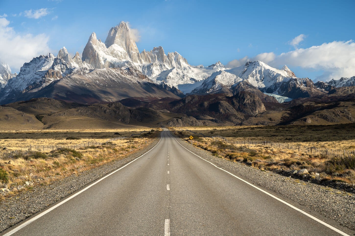
Arriving in El Chaltén by car already provides rather unique views of the Fitz Roy massif.
The Laguna de Los Tres Hiking Trail
Excluding the last 1 km-long steep climb, the hike isn’t particularly difficult. Most of the elevation gain is concentrated in the first section after the trailhead, and then again in the last climb that leads up to the lookout above Laguna de Los Tres. That means the first 3km (or about 2 miles) of the trail concentrates most of the elevation gain in the first section of the trail. The remaining elevation gain is pretty much all in the last, steep section before the Mirador at the Laguna de Los Tres..
The trail is also very well maintained and rather large before the last climb.
For most of the trail, the path is wide and easy to walk on. Which can make for a relatively fast-moving.
From El Chaltén to Campamento Poincenot
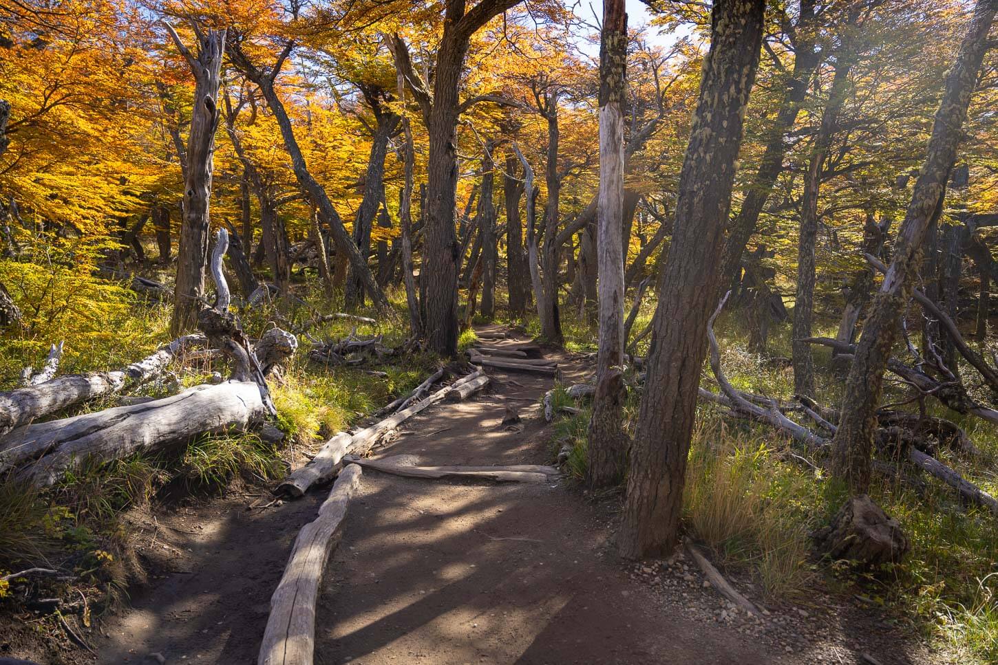
For the most part, it is quite easy going, as here the elevation gain is less than 400m in total. Then the trail is mostly in the forest, with views opening up here and there, with many short up and downhill sections.
The first part of the trail after El Chaltén gains some elevation, revealing the view of the landscape to the north, before entering the forest.
As you approach Laguna Capri, you will also come across a fork in the trail. This confuses most people, left or right? Officially, the trail is the one to the right, but both variants converge farther down the trail.
The one to the left is ever so slightly longer, but leads to the lookout at Laguna Capri, which is worth seeing. If you are doing the hike at night, it’s probably best to take the trail to the right, and the other one on your way back. This will allow you to see the Fitz Roy above Laguna Capri in the daylight.
View of Mount Fitz Roy from Laguna Capri.
Right after the two trails merge again, it’s also worth taking the short detour to the famous “hidden waterfall”. It’s a short, 10-minute detour to a very popular landscape photography spot, which is also another very popular sunrise hike in itself.
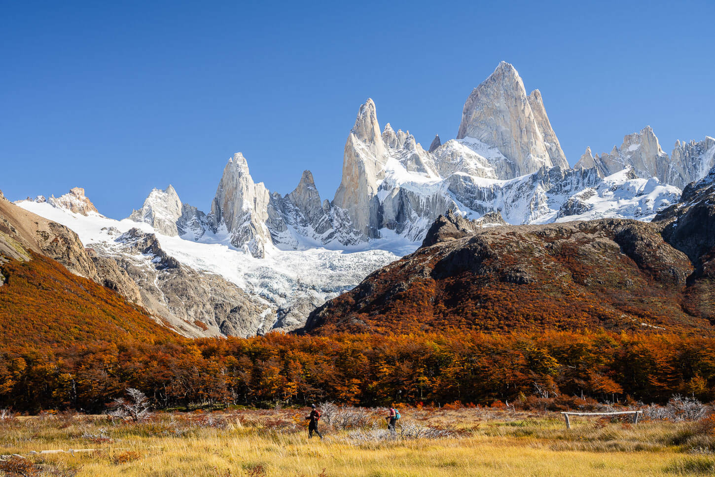
From there, it’s a short walk to Campamento Poincenot. Right before entering the forest, the views open up again to a glorious view of the Fitz Roy Massif. The last good view, before entering the forest and approaching the final climb.
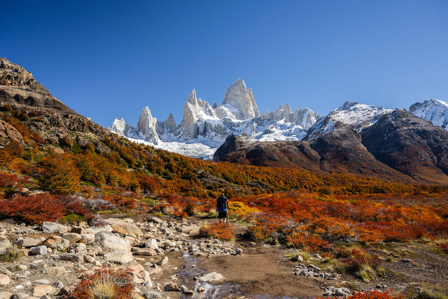
Hiker on the trail to Laguna de Los Tres.
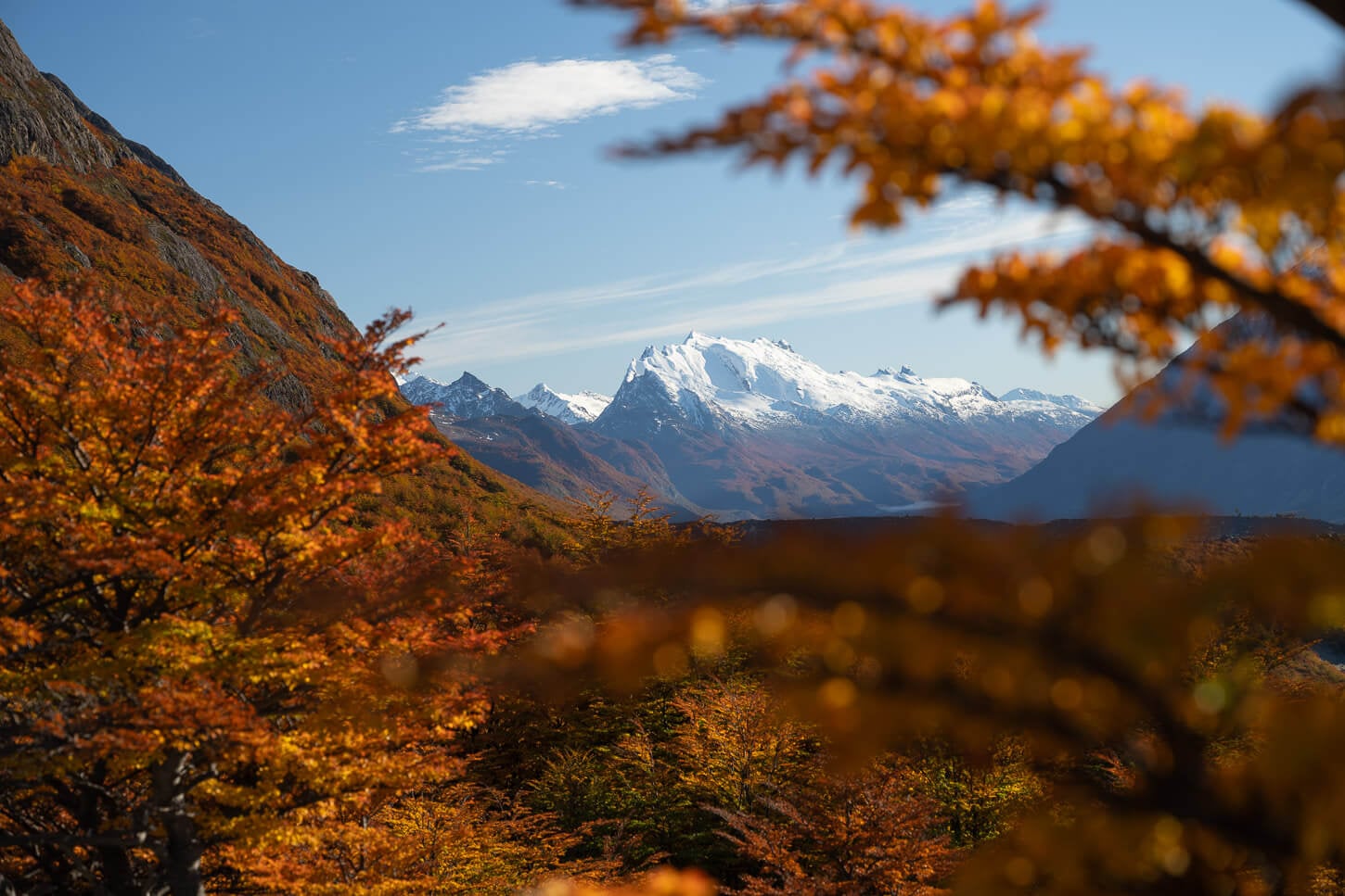
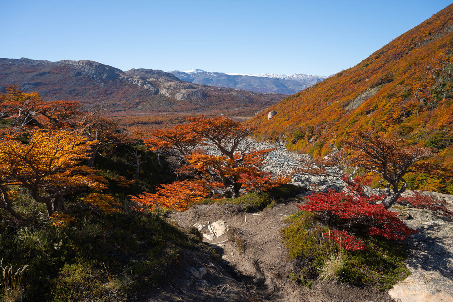
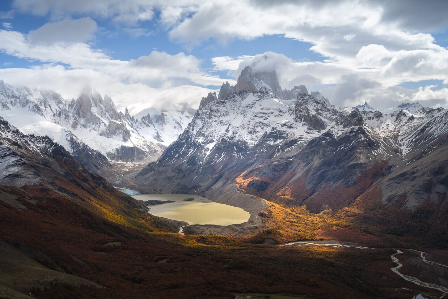
The impressive Fitz Roy peaks are constantly visible in the second part of the trail, before the last stretch. In Autumn, the contrast between the bright blue skies and the vibrant red leaves of the Lenga trees is breathtaking.
Lagunas de Los Tres – Final Climb and last part of the Trail
The last bit leading to the Mirador above Launa de los Tres is a steep, 1 km-long section that climbs a total of 400m in elevation again. So, a 40% steep gradient on average.
It is as challenging as they say. It is steep, filled with scree, and on erosion-prone terrain. This means there’s a high risk of slipping and falling.
It’s very slow going as you want to carefully measure your steps against the crumbling terrain and the loose rocks. You’ll also see a sign asking you not to stray from the marked path to prevent further damage to the area around the trail and to let vegetation recover in other areas.
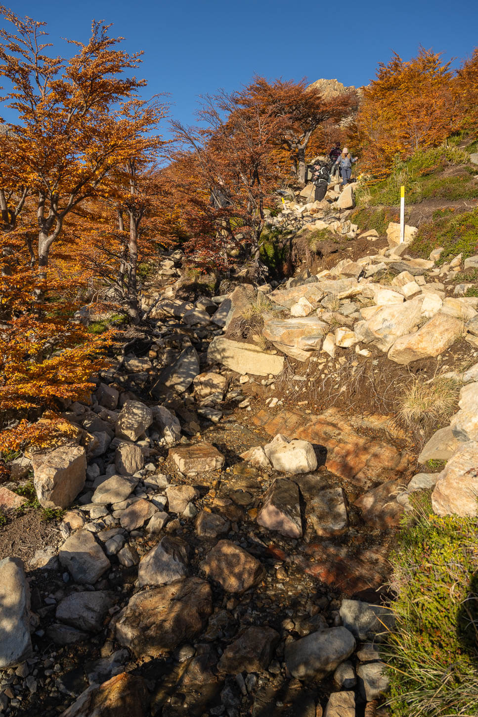
For the last km, the trail winds its way up through erosion-prone terrain, loose rocks, and exposed roots.
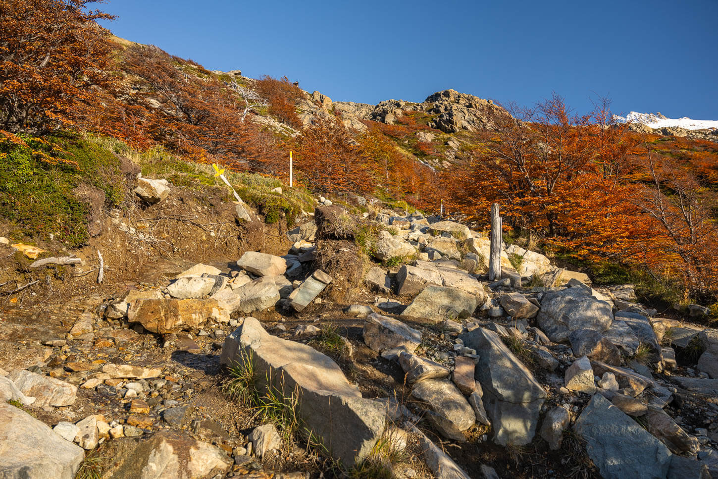
This section is, however, well-marked too.
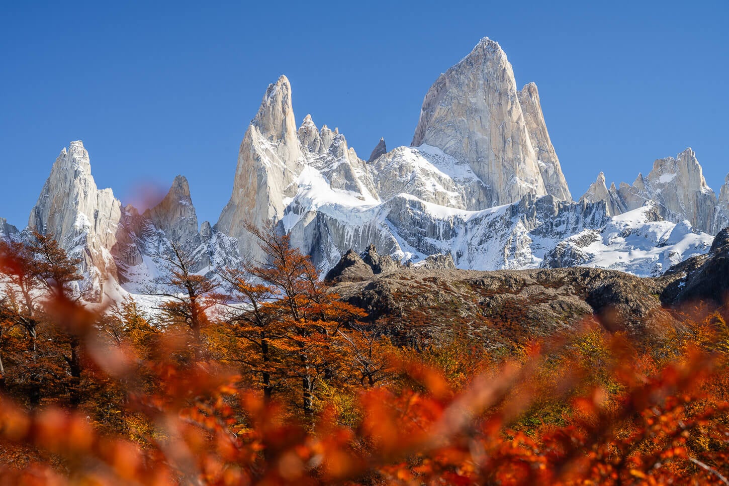
Despite how challenging this section is, and despite the Fitz Roy being out of view, during the day, you can take your time on your way up to enjoy beautiful views such as these.
It can easily take an hour to complete this last kilometer, as you really need to take your time assessing the best path and avoiding unstable rock. Hiking poles are highly recommended for this section.
Then after a long, grueling while, you’ll arrive at the top of the morainic deposit where the Laguna is. The trail flattens out, and you’ll see the peaks of the Fitz Roy massif again, with the last short climb in front of you to get to the Mirador.
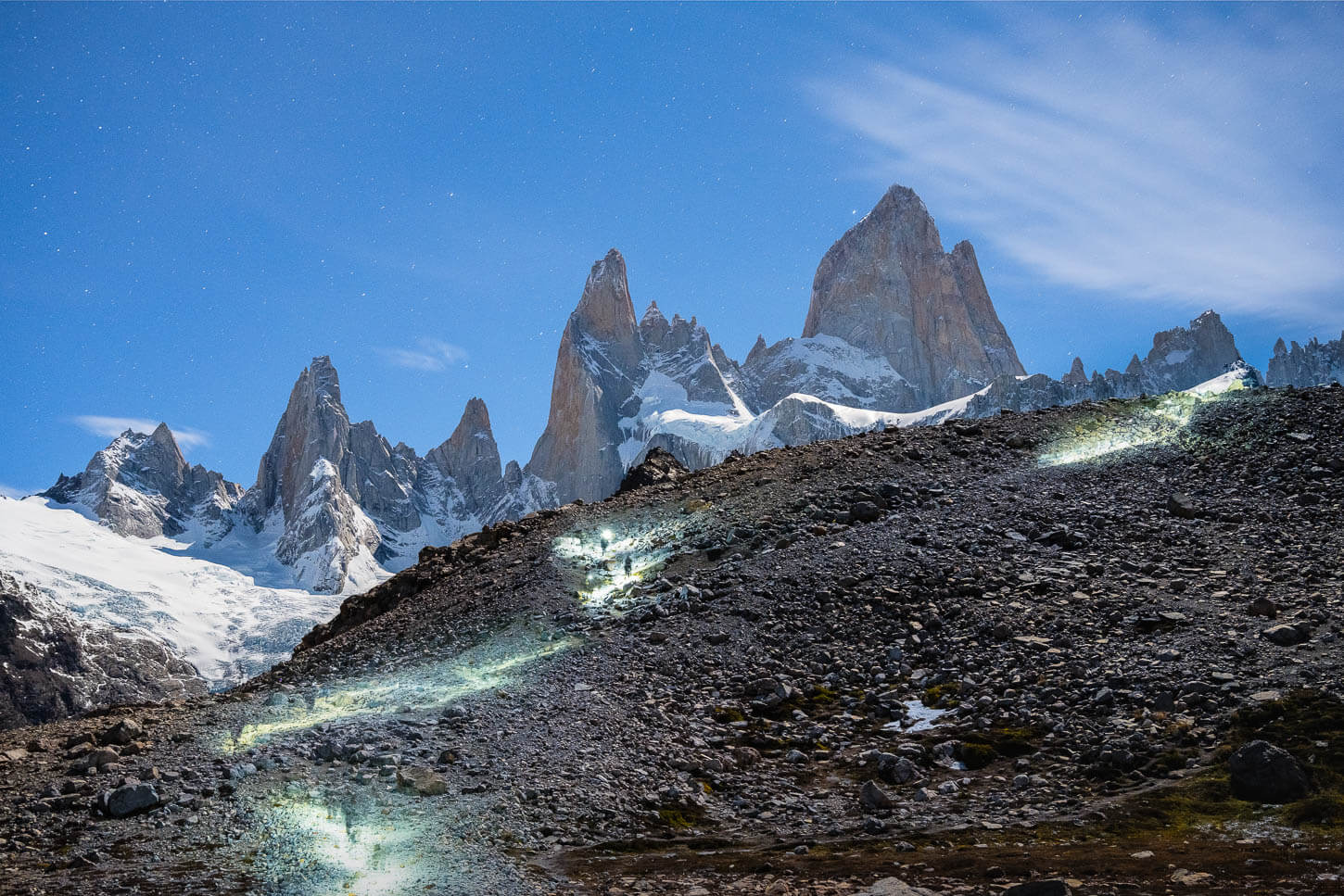
Long exposure photos of hikers with headlamps completing the last stretch of the trail to Laguna de Los Tres.
Mirador Laguna De Los Tres
The top of the morainic deposit is a relatively large flat area. Down below lies the Laguna. The whole area looks like a natural amphitheater. And it looks like one even more, when it’s filled with people. For sunrise, it was amazing to see how many people were there to watch a natural event that would last less than 20 minutes. Literally, there were at least two hundred people up there.
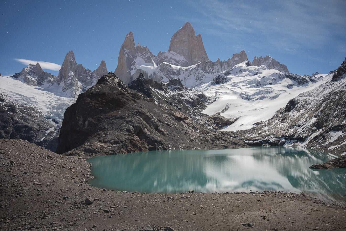
Fitz Roy and Laguna de Los Tres under the Moonlight.
Probably more than two hundred people had hiked into the night to watch the sunrise. And, even for someone like me who enjoys hiking solo and uncrowded places the most, that actually was beautiful to see.
But back to the Laguna, the top of the morainic deposit is where almost everyone finds a spot to watch the sun rise. From there, you have the clearest view of the Fitz Roy Massif. However, it’s also possible to walk down to the laguna itself. That is what I did. I did it because I wanted to capture the Fitz Roy reflecting in the waters of the Laguna at sunrise.
And stayed there to catch all the shades of colors that the Fitz Roy reflected from the sunrise.
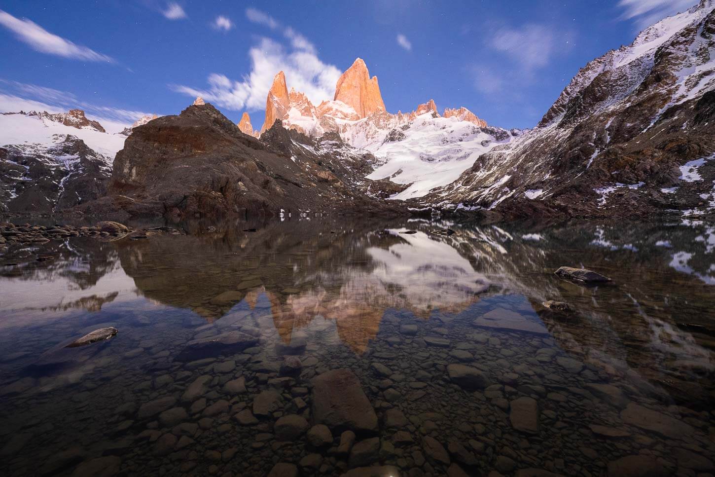
The Fitz Roy catches the warm colors of the twilight glow, with stars still shining in the sky.
The path to descend to the laguna isn’t marked, but it is visible. However, it’s a morainic deposit, so special attention should be paid to possibly unstable rocks. Once down, you can hike around most of the laguna on this side of the lake before getting back up.
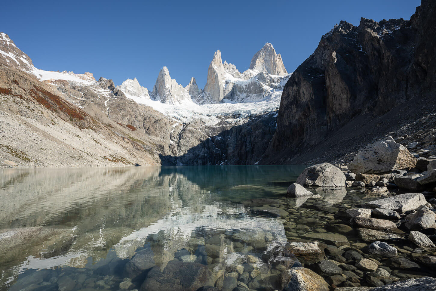
Once there, don’t miss the viewpoint above Laguna Sucia. It’s worth the short 10-minute detours from the Mirador Laguna de Los Tres.
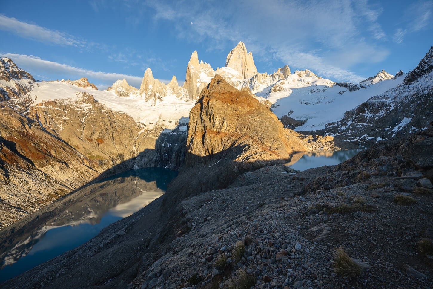
Laguna Sucia viewpoint next to mirador Laguna de Los Tres.
Laguna de Los Tres Sunrise Photos and Photography Tips
To get the classic shot of the Fitz Roy Massif towering above Laguna de Los Tres, you can find plenty of space to align the top of the morainic deposit above the lake. From there, you have the classic bird-eye view of the Laguna and a great view of the peaks.
Most people tend to hang around the southern part of the moraine, and there’s plenty of space there, whether on top of a boulder or behind it. Plan to be there before sunrise. I planned to be there well ahead of time, more than one hour, for a very specific reason. This brings me to my top two tips to photograph the Fitz Roy and Laguna de Los Tres for Sunrise.
Fitz Roy and Laguna de Los Tres under the Moonlight. View from the main lookout.
Be at Laguna de Los Tres before Twilight starts
This will allow you to catch the warm twilight glow on the Fitz Roy massif. Generally speaking, this is a good mountain photography approach whenever planning to catch the first light of the day hitting any peaks. That kind of like, combined with the dark skies of the night, creates a great effect, which, in combination with a long exposure, also creates a natural, saturated effect on the peaks. Plus, the contrasting cold color of the night and the twilight glow of the peaks create a great, natural complementary combination.
Don’t just stay up on the Moraine, get to the lake
If it is a day on the less-windy side or there is no wind, this will give you the chance to catch the Fitz Roy reflecting into the waters of Laguna de Los Tres. I’m at a loss as to why this is not a more common approach, especially in landscape photography.
The best way to catch it is to move toward the northern side of the Laguna until you have a clear view of the three main peaks reflecting in the water.
Lenses and camera gear for Laguna de Los Tres/Fitz Roy
I had three lenses with me for this hike. The “default” 24-70mm and the 14-24mm. For most of the trail, I used the 24-70mm lens. Flexible enough to capture all the highlights comfortably, and for the main viewpoint at the Laguna.
The 24-70 was enough to take photos from the main viewpoint from the top of the morainic deposit. However, down by the laguna, to capture the reflection, the 14-24mm was a more suitable choice. So the 14-24mm got the most use on the shores of Laguna de los Tres.
Last but not least, a sturdy tripod, possibly with a bottom hook to add weight. The Patagonia winds are an experience on their own!
Where to Stay
El Chaltén, of course! It’s a lovely small town. Accommodations vary from Hostels to high-end hotels and private houses or “Tiny Houses”, which are quite a popular accommodation type. I stayed in one of those, too, and would not change it for a hotel. Personally, I just loved the feeling of getting out the door after breakfast and walking directly to one of the many trails for a day out.
Then come back to a snack, a meal, or a beer at one of the many bars, restaurants, takeaways, or bakeries – but this applies to every type of accommodation.
However, if you want a more “remote” experience, there are a few accommodations available in the Río Eléctrico area, too.
As mentioned earlier, you can also camp inside the park. Either Laguna Capri or Campamento Poincenot. Advanced booking is required.
Additional Resources
- If you are planning a trip to Patagonia, you may also want to check out my Base Torres Sunrise hike guide for the other epic sunrise hike in Chile.
- If you are planning a trip to El Chaltén, you may want to check the guides on Loma del Pliegue Tumbado and Laguna Torre.
- Here is an overview of the hike on the official website of El Chaltén.


Leave A Comment