
Laguna Torre Hike where Cerro Torre Meets the Earth, Patagonia, Argentina
The hike to Laguna Torre is perhaps the best way to take in the legendary Cerro Torre, a needle-like spire of granite that stands 3,128 meters (10,262 feet) tall and reaches for the sky like almost no other mountain on earth.
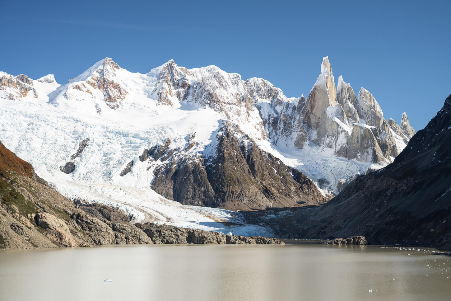
Laguna Torre, Cerro Torre, and Glaciar Torre.
| Laguna Torre Hike: Quick Overview |
| • Distance: 17.8 km / 11.1 mi (Out & Back) | Time: 5h 00m–6h 30m | Difficulty: Moderate | Trail: Laguna Torre Trail |
| • Start & Parking: El Chaltén Laguna Torre Trailhead (West side of town) |
| • Best Season & Light: December through early April. Sunrise at Mirador Cerro Torre or Laguna Torre, until mid-afternoon |
From the Laguna, you can see all the way up to Cerro Torre’s summit, and its iconic “ice mushroom”, with the beautiful, jagged Cerro Glacier at its base. It’s as if Cerro Torre connects the earth and the sky, as few mountains do.
It is a might sight to witness, not only from Laguna Torre. Indeed, for most of the trail, this gigantic, monolithic rock will emerge in front of you, commanding the views.

The trail offers many interesting views of Cerro Torre for most of its length.
Of El Chaltén’s three “epic” hikes, alongside Laguna de los Tres and Loma del Pliegue Tumbado, Laguna Torre is the most approachable. At about 18km out-and-back, it’s no walk in the park, but the elevation gain of under 500m makes it the gentlest of the three.
Like Fitz Roy, Cerro Torre began as magma injected into the Earth’s crust. The magma then solidified in that shape underground. Then millions of years of land uplift and Patagonia’s relentlessly hard erosion did the rest, leaving this beautiful mountain for us to enjoy.
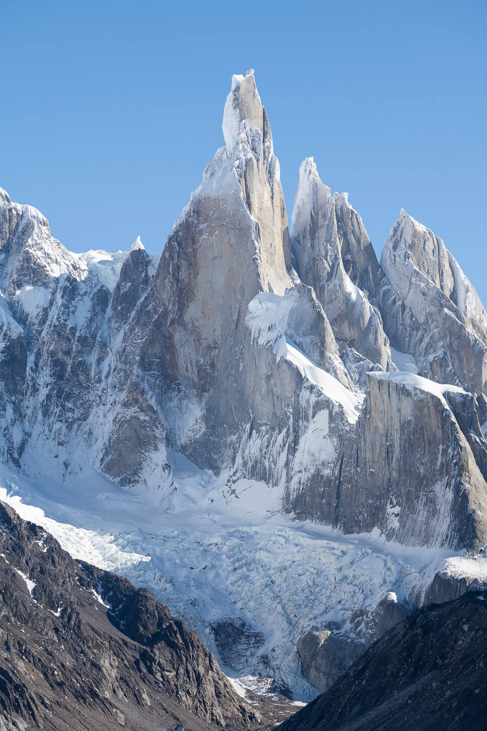
Cerro Torre and Cerro Glacier.
Table of Contents
Overview of the Laguna Torre Hike, Map & GPS File
As mentioned in the intro, while long, the hike to Laguna Torre isn’t a difficult one. It’s just long, and at about 20km/11 miles, out-and-back, so it does require a certain level of fitness. The path is well-marked and easy to follow.
Most of the elevation gain is in the first 3km/1.8 miles that lead to Mirador Cerro Torre, then again at the end to reach the top of the moraine around Laguna Torre. Some sections on the trail are on the rockier side. Also, bring all the water and food you need for the hike.
Hiking this trail requires a pass, like all the trails in Los Glaciares National Park. You can purchase the ticket online before entering the park for ease of access.
Sunrise tip: If you are planning this hike and are looking for an alternative, easy option for sunrise, you can plan to be at Mirador Cerro Torre for Sunrise. It’s about 3km from El Chaltén.

Sunrise on Cerro Torre
Lastly, a safety note: the whole area is potentially subject to Glof hazard, that is Glacial Lake Outburst Flood. You can think of it as a Tsunami caused by a “mechanical” failure of a specific system. It’s a remote eventuality, but worth being aware of it.

You will find Glof warning boards a couple of times along the trail.
Now here are the technical details of the trail. You can download the GPX file for free from the activity linked below. You don’t really need one as the trail is well marked, but it is helpful to have it to see the data while on the trail.
Here is the map of the hike.
How to get to the Laguna Torre Trailhead and Parking
You can walk to the trailhead from pretty much anywhere in El Chaltén, within 15 minutes or so. So it does not require taking a car to get to the trailhead. Unless, of course, you are not staying in El Chaltén, or are arriving from out of town.
- Driving Directions: If you are coming from out of town, i.e., from El Calafate, you should drive right through El Chaltén on road 41, right to the opposite side of town, and drive to the “upper” part of town, a part of town built on a higher plateau, to the dirt road where the small parking area is. But really, you could park almost anywhere you find in El Chaltén and walk.
- Parking: There is an “unofficial” parking area right by the trailhead. Space is somewhat limited, probably good for 15-20 cars.
- Public Transport: If you are arriving by bus in El Chaltén, the terminal station is on the opposite end of town. It would take approximately 20 minutes to reach the trailhead on foot.
Do note that as you leave El Chaltén, you will have no mobile signal on the trail, like on all the other major trails.
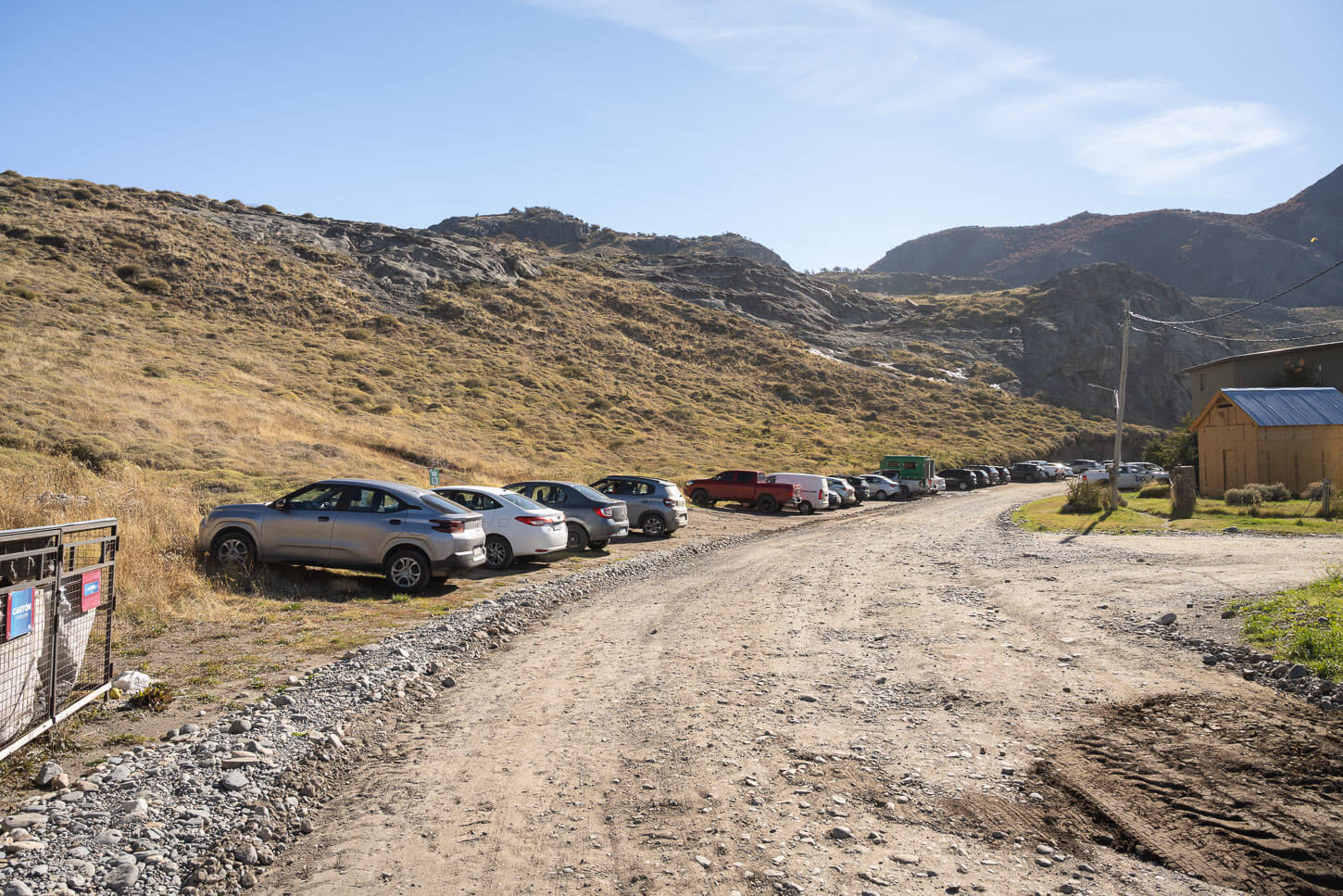
The trailhead/Parking area.

The Laguna Torre Hiking Trail
From the parking area, there are 2-3 different trails that climb up the side of the hill; you can take any of those as they later converge back into the same trail. It’s mostly packed dirt with the occasional rocky section, and the trail alternates between open stretches and stretches in the woods.
This first part of the Cerro Torre Trail is also where a good chunk of the elevation gain is. It’s never very steep, but once you complete it, it gets easier until the last climb up to the moraine where the trail ends.

The trail initially climbs uphill for the first three kilometres.

There is not much of a view yet, except for the very top of the mountains.
There isn’t much of a view in this first stretch, if not for Cerro Torre’s and Fitz Roy’s summits appearing above the tree line. Those summits are just hinting at what lies ahead.
In total, it’s about 3km until the first major viewpoint, Mirador Cerro Torre.
Mirador Cerro Torre
As you arrive at Mirador Cerro Torre, you can take a bit of a break. It’s a good place to have a rest and enjoy the beautiful Views of Cerro Torre. The Mirador is a rather wide area, and there are lots of trees around, but there are also plenty of clearings to watch the landscape.
It’s hard to describe and render such vast, raw landscapes. It’s something you have to see for yourself. Apart from its sheer beauty, it’s that type of landscape that really makes you feel how strong the quiet forces of nature are. That’s also hard to explain, but if you have seen such landscapes, you might have an idea of what I’m blabbing about.

Mirador Cerro Torre.

The Views of Cerro Torre are already jaw-dropping.
View of Cerro Torre from the mirador at Sunrise.
Past Mirador Cerro Torre, the trail continues on flat ground through a large plateau that provides fantastic views of Cerro Torre. Initially, the trail goes downhill for a short stretch. It then reaches a flat area – slightly uphill, actually.
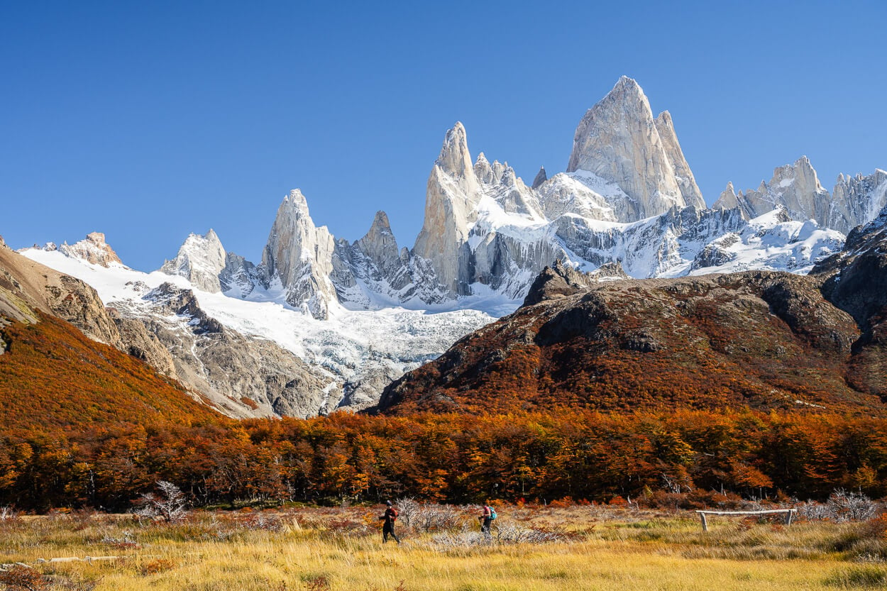
This part of the trail, although relatively flat, can be rocky at times. It’s almost like a dry riverbed in places. However, here it is also a feast for the eyes. Cerro Torre will tower above the area for most of the hike, almost all the way to the laguna.

Cerro Torre above the beautiful colors of the Lenga Trees in Autumn.

The trail in this section, although flat, can be rocky. But the views make it almost effortless.

This section is approximately 4km in total, and for the most part, you can enjoy such views. However, for the last stretch before the laguna, the trail enters the forest again. Here again, the gradient is still quite gentle, up until the very last short climb. It’s not long before you reach Campamento d’Agostini.
From the campsite, it’s just a short walk, about 5-10 minutes, on a steep, rocky moraine. That’s the last push, before the views open up again to Laguna Torre.

The last part is a short, steep hike up a rocky moraine.


Laguna Torre.
Laguna Torre
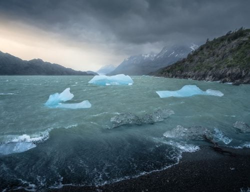
As you reach the top of the moraine, the whole lagoon, the glacier, and Cerro Torre will be right in front of you in all their glory. If you are lucky, you may see some small icebergs in the Lagoon. As you can see, there was only a small one when I was there. Plus some chunks of ice.
The area at the top of the moraine is quite narrow. However, you can walk almost the entire length of the moraine, up to where the trail is closed – at least it was when I visited. You can also walk up the northern side to Mirador Maestri if you want to have a better view of the Cerro Torre glacier and Glaciar Grande.

Lagun Torre


With some luck, you could catch smaller or bigger icebergs floating in the Laguna.
Laguna Torre Photos and Photography Tips
From the viewpoint atop the moraine, the compositions are somewhat limited. The landscape is vast, the area is relatively narrow, and there is a lack of foreground, photographically speaking. The better views are towards the bottom of the Laguna, close to where the trail is closed. However, they may vary if you find icebergs in the area.


Panorama of three frames.
Here I mostly used my 24-70mm lens, full-frame, which was actually enough for the entire hike. I only used the 100-400 to capture closer views of the beautiful Cerro Torre and the glaciers around it. In that sense, if you want to isolate the mountain, bring your longest telephoto lens too. Also, for the occasional wildlife.
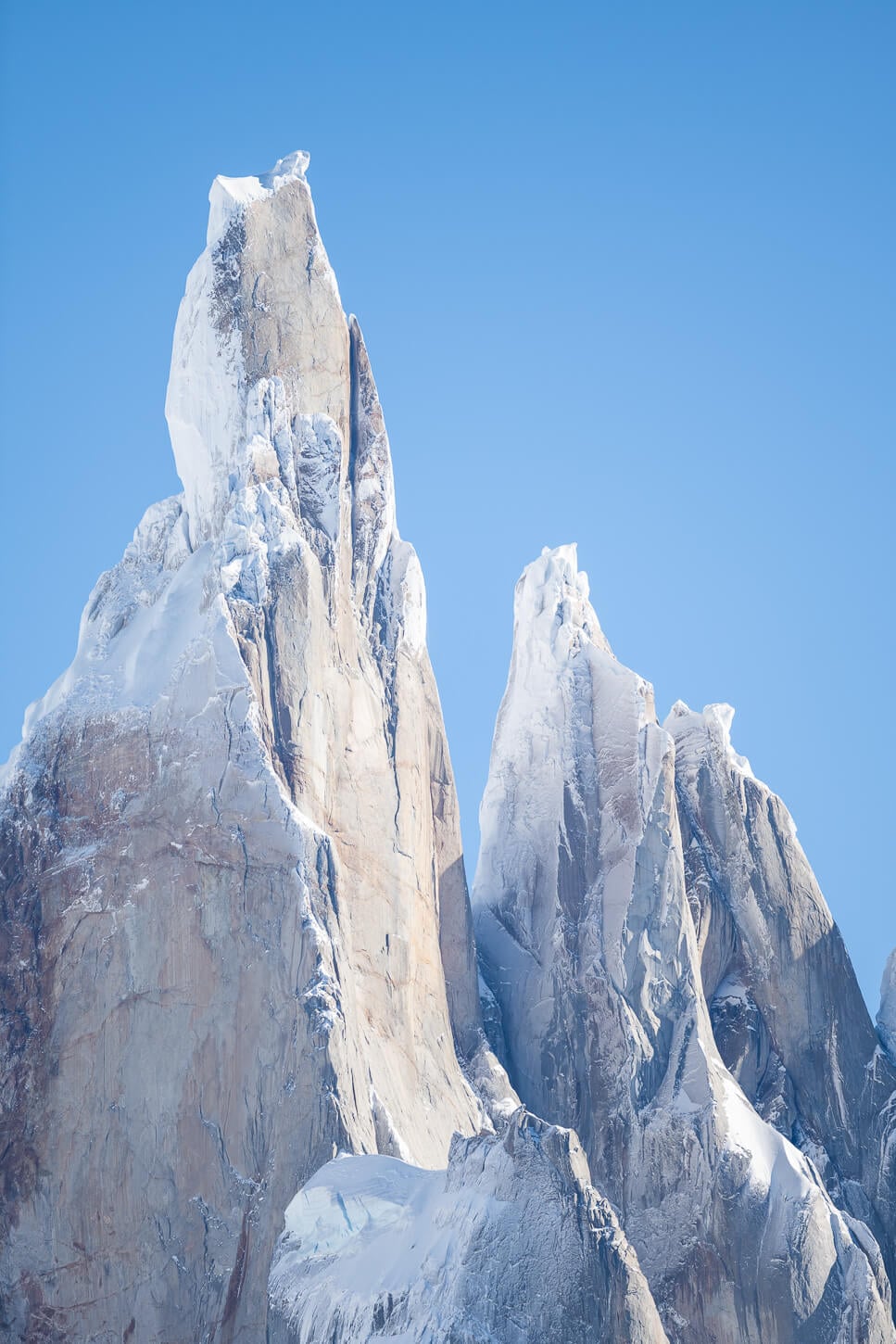
Cerro Torre, photo taken at 340mm, full frame.

Glaciar Torre, 400 mm.

Glaciar Grande, 400 mm.

Chimango Caracara, a bird of prey of the Falcon family, keeps an eye out for snacks left unattended!
However, more than the Laguna itself, I found all the various scenes and impressions I found along the trail from Mirador Cerro Torre onwards. While the mountains do not change, the views on the trail did so consistently.
Either between some leaves, or with trees in the foreground, or even the trail, I kept stopping to see interesting compositions all the way to the Laguna; it never got boring, somehow.

Lastly, the same tip as the hike; if you are looking for an easy, short hike for sunrise, you can also consider the Mirador Cerro Torre, 3km into the trail. It’s quite a sight watching the Cerro Torre lit up as the sun rises.
If you are doing this hike in autumn, let’s say from early April, you’re in for a treat. Patagonia’s Autumn colors are legendary, and the hype is real. Do bring your laptop to make the best out of those colors.

Where to Stay
El Chaltén, of course! It’s a lovely small town. Accommodations vary from Hostels to high-end hotels and private houses or “Tiny Houses”, which are quite a popular accommodation type. I stayed in one of those, too, and would not change it for a hotel. Personally, I just loved the feeling of getting out the door after breakfast and walking directly to one of the many trails for a day out.
Then come back to a snack, a meal, or a beer at one of the many bars, restaurants, takeaways, or bakeries – but this applies to every type of accommodation.
If you want to camp on the trail, Campamento D’Agostini needs to be booked in advance (no longer free). It’s the only campsite in the area. However, Campamento Poincenot could also be an option if you are planning this hike before or after the Laguna de los Tres Hike. It’s just about 10km from there to Laguna Torre.
Additional Resources
- You may also want to read my full El Chaltén Hiking and Landscape Photography guide if you are planning a trip to the area.
- For a general overview of hiking and landscape Photography locations in Argentina, check out my main Argentina page.
- If you are planning a trip to this beautiful corner of Patagonia, you may also want to check out my Laguna de Los Tres and Loma del Pliegue Tumbado hiking guides.

Leave A Comment