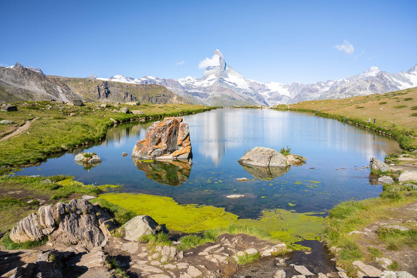
The Göscheneralpsee Hike – Canton Uri, Switzerland
The hike around Göscheneralpsee is a beautiful walk around the alpine lake (a reservoir, actually) in the Swiss canton of Uri. The location is close to several other points of interest, such as Andermatt, The Gotthardpass and the Sustenpass. However, this is not a point of passage like the locations mentioned above since the road ends at the lake.
Still, it is easy to include it in an itinerary for anyone passing nearby. Well worth the detour, if you ask me. The lake, like most Swiss alpine lakes, is beautiful, and a magnificent alpine landscape surrounds it.
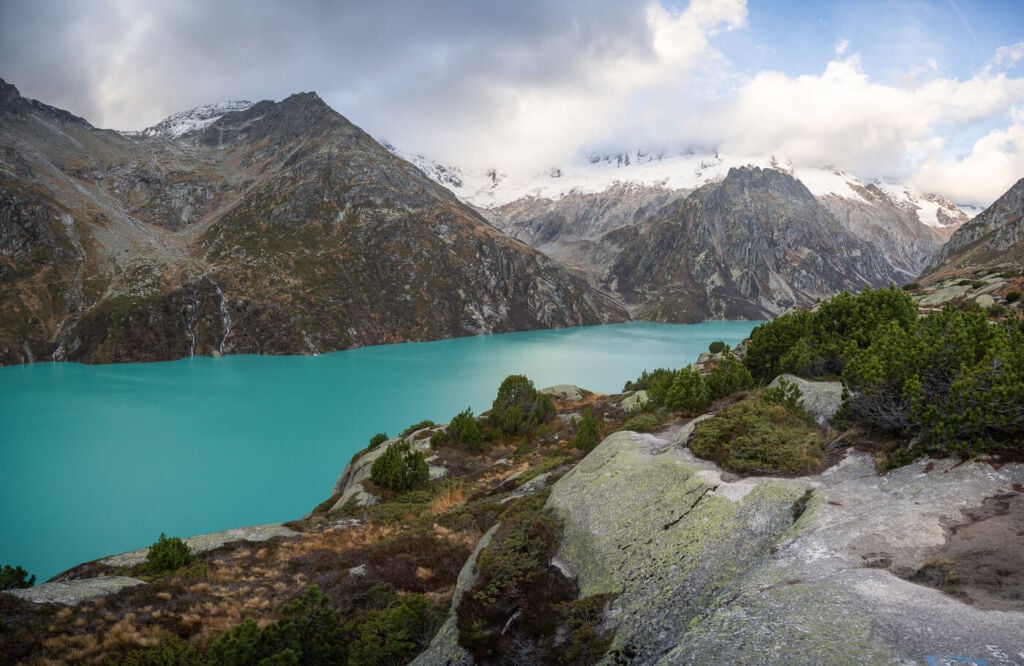
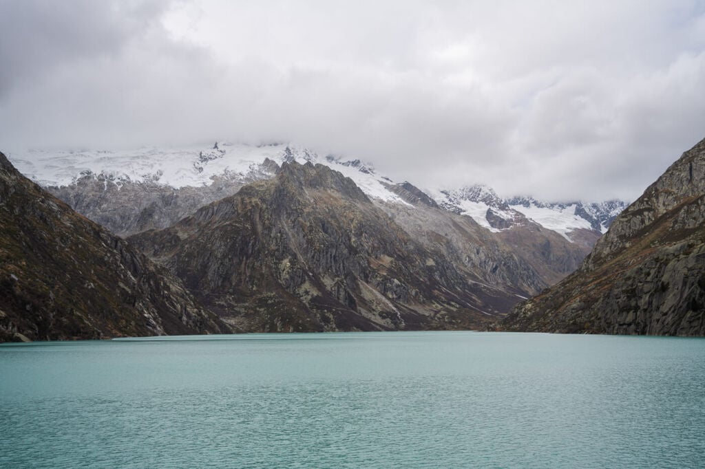
Panoramic view of the lake, surrounded by snow-capped mountains. Early Autumn.
Although not particularly short, the hike isn’t overly demanding, and it offers several spectacular vantage points and stunning views of the surrounding landscape.
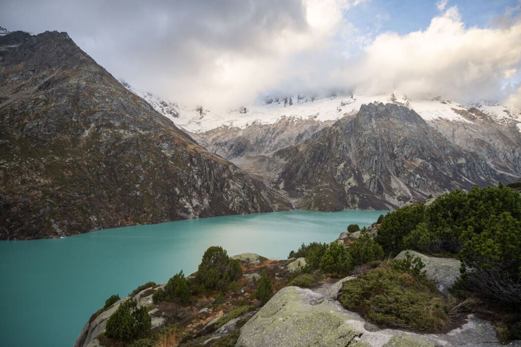
Still, if you are not a hiker, you could pass by and enjoy the scenery and the view of the lake’s deep blue waters from the Dam. Even from there, you get a good view of the glaciers beyond the far side of the lake.
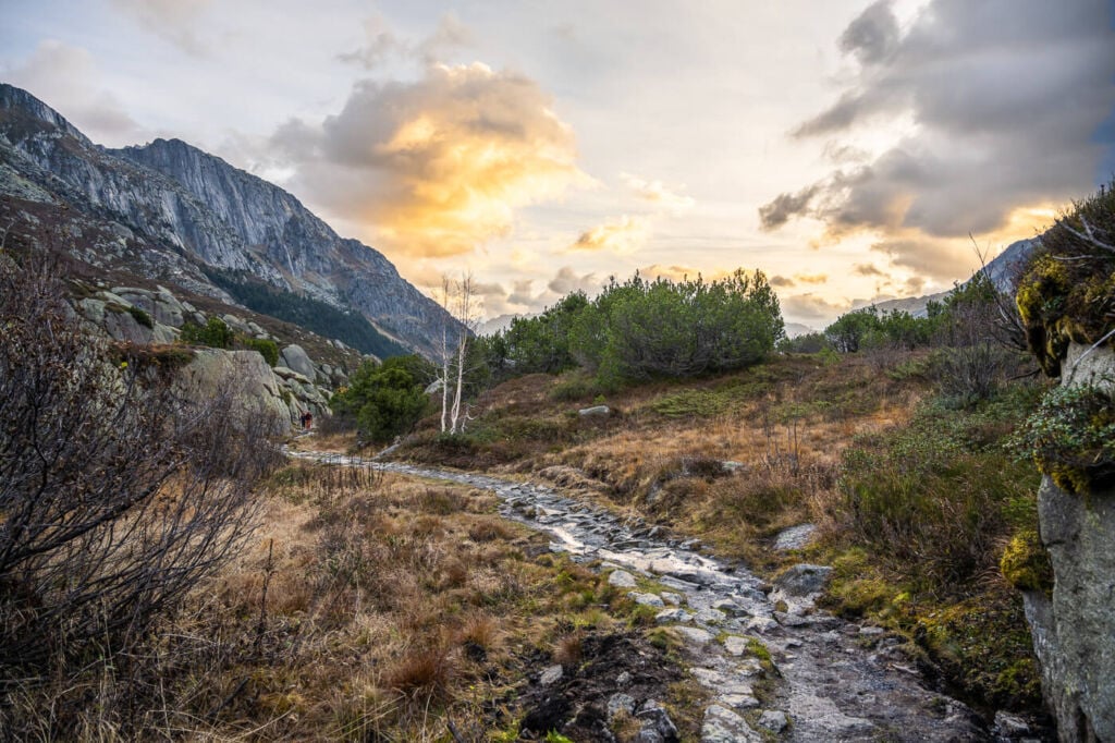
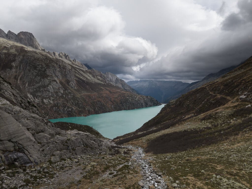
The stone-paved first part of the trail.
How to get to Göscheneralpsee and Overview of the Hike
- Getting there and Parking: You will first have to drive to the small town of Göschener, whether coming from the A2 Highway, Luzern, or Andermatt. Once there, the drive to Göscheneralpsee is on a narrow, winding road with a few blind corners. Drive carefully and honk as needed. You can park at the end of the road, 0 km later or so, where you will find a camping area and an ample parking lot.
- Start of The Hike: directly from the parking area. If you plan to hike the trail counterclockwise, you will need to turn right on the first signed trail before reaching the dam. Otherwise, you will need to cross the dam and follow the trail on the other side.
- Photography & Scenery value: Alpine landscape, glaciers and a stunning dammed surrounded by mountains.
- Hike Difficulty: Moderate
- Tip: there are several other trails in the area, so if you feel like it, you could add a detour to your itinerary, like the Bergeseehutte, for a coffee or a break.
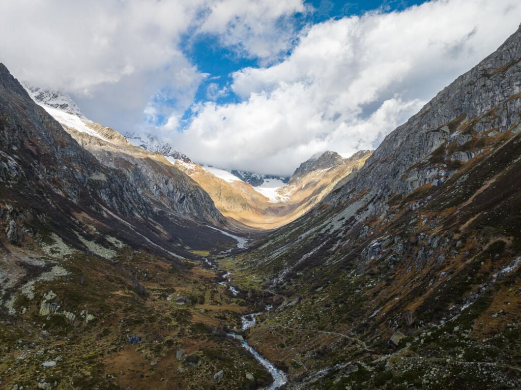
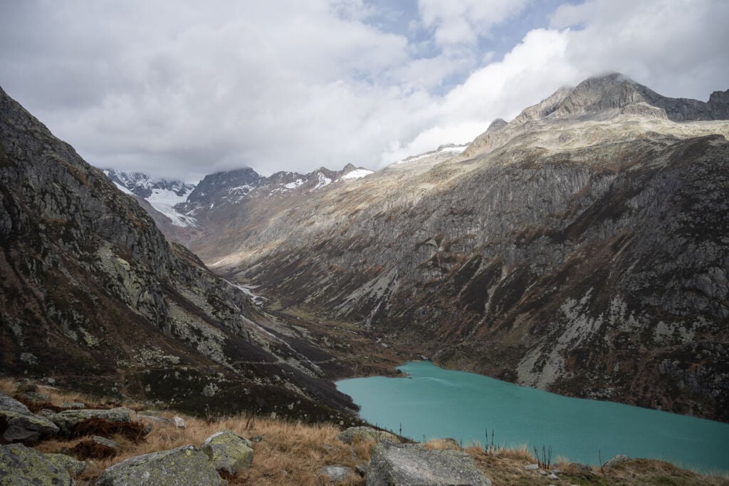
Done shot of the glacial valley on the far side of the lake.
The Göscheneraplsee Trail
| Distance | Elevation Gain | Hike Time |
|---|---|---|
| 11.9 Km | 590 m. | 4:30 / 5:00 Hrs |
The best time to go will be from late spring to late autumn. I was there in early autumn, and there was a fair number of hikers around the lake. When I returned to my car, the parking lot was full. I suspect this location may be crowded during summer weekends, so I recommend a weekday if you can – this will be true, especially in summer.
Also, this is a circular hike. I did it counterclockwise, but I would recommend doing it clockwise. This is, of course, a personal preference, but I would say the counterclockwise hike offers better views for most of the hike, both of the lake and the glaciers on the far side.
Still, I hiked this trail early in the morning in early autumn, and for that time of the day, the light was better on the side I chose. That is the main reason why I went for that option. So the hike I am reporting on in this post goes counterclockwise around the lake.

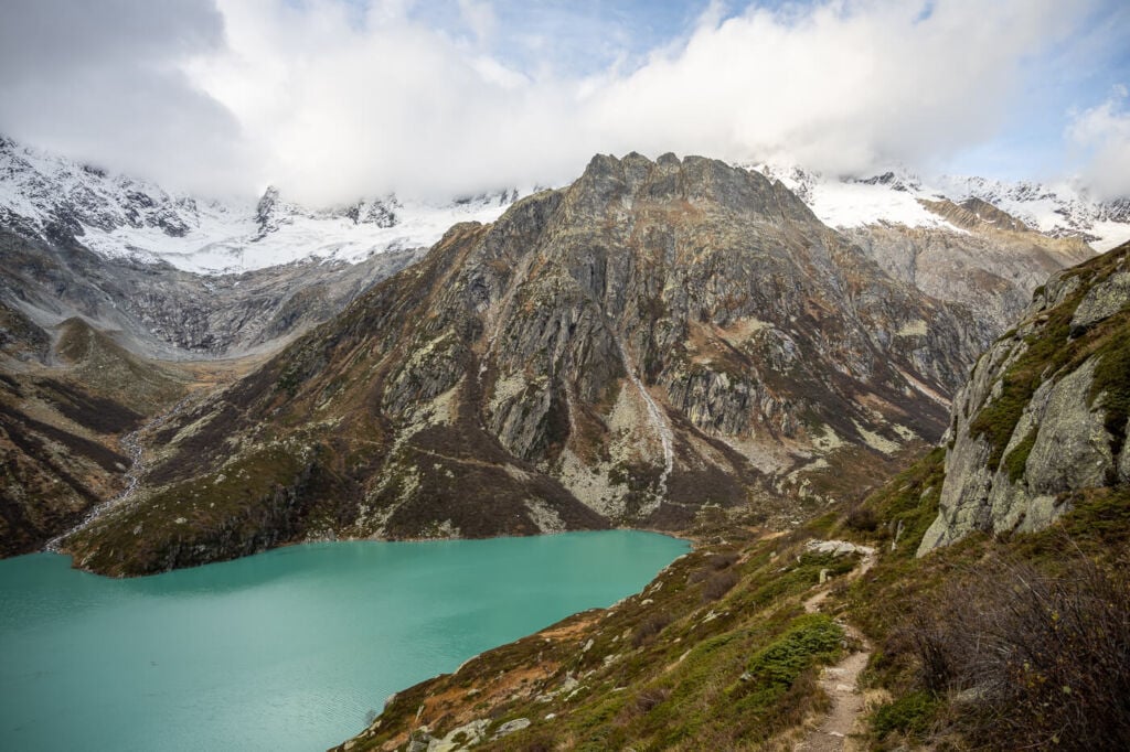
The winding trail on the side of the mountain
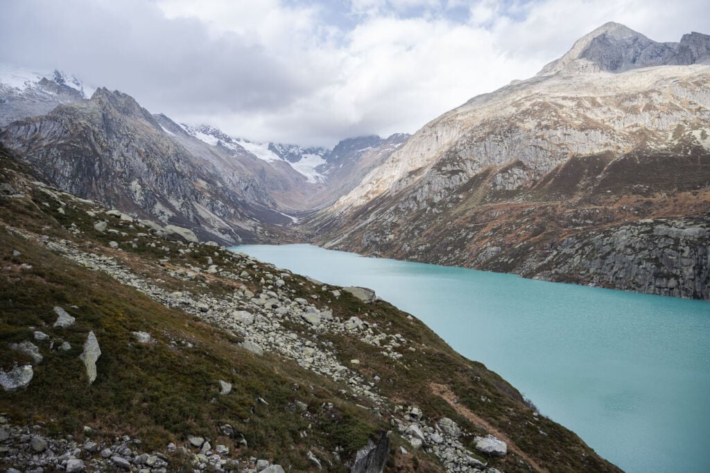
View of the lake from the opposite side.
The Göscheneralpsee Hike – Hiking to the other side of the Lake
As you leave the parking area, you will see a narrow trail and the white-red-white sign Göscheneralpsee pointing up to the side of the mountain. Follow that trail up. The trail here is nicely maintained and partially paved in stone. As you hike up, It will gradually widen, and there’s the first panoramic point not even 10 minutes into the hike.
There’s a sign pointing to that vantage point and a boardwalk, so that can’t be missed. Indeed it is a great spot that offers fantastic views of the lake. So good, I almost wanted to turn back and call it a day :)! Both the panorama point and the boardwalk are pretty scenic and worth a photo stop.
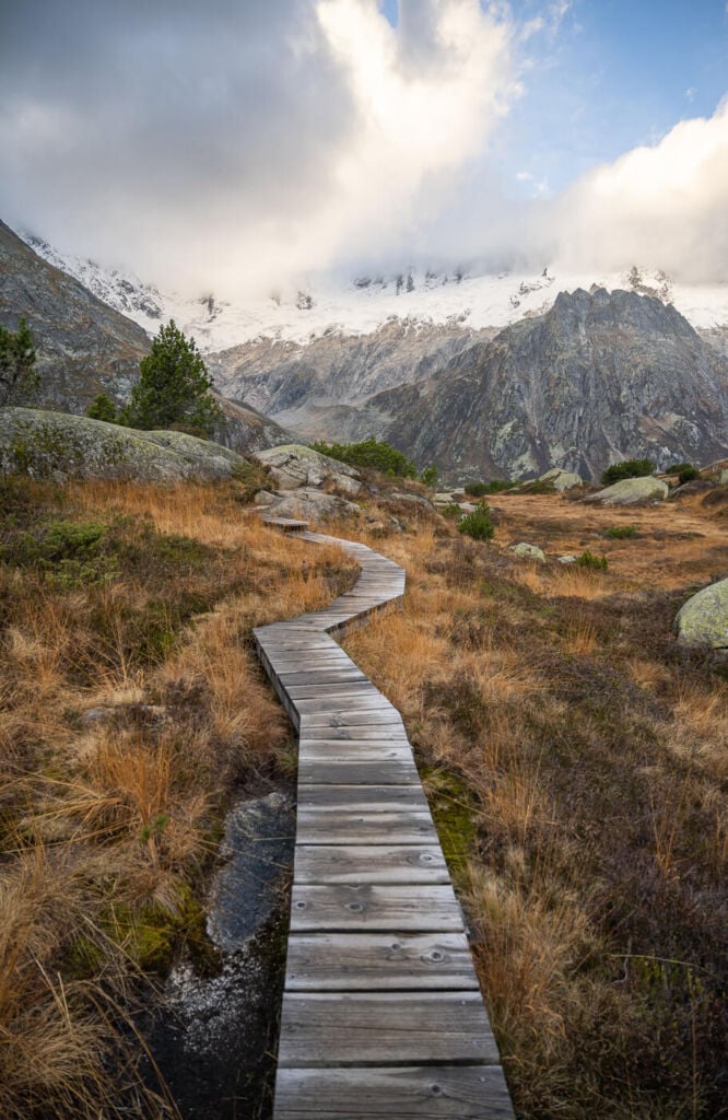
The boardwalk that leads to the first panoramic point when hiking the trail counterclockwise.

Another section of the same beautiful boardwalk.
View from the first panoramic point.
Back to the main trail, you’ll soon pass by another scenic spot, a marshy area where the surrounding mountains reflect nicely. I stopped to take a few photos here too. This time I thought I would never finish the hike if I kept stopping that much for photos!

The Marshy area in the first part of the trail
The trail as it descends to the other side of the lake
On the other side of Göscheneralpsee
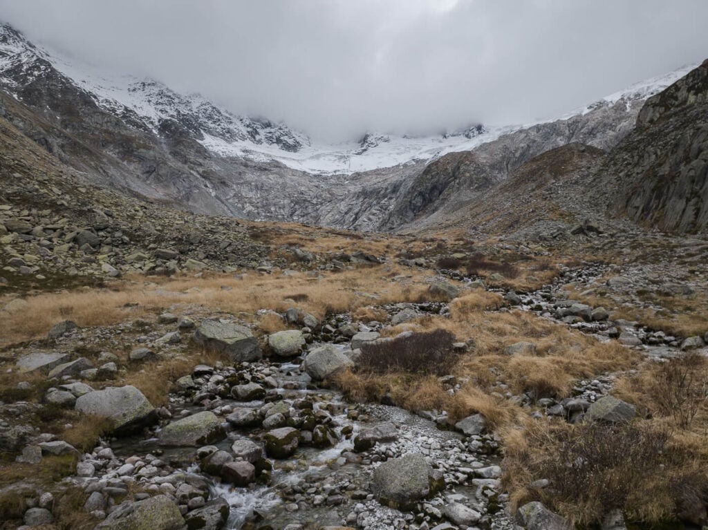
I kept hiking nonetheless, continuing to the side of the mountain. The trail here follows the lake along its longer side, all the way to its other tip. Once you get there, the trail will slowly descend to the bottom of a glacial valley. This is where the trail turns to the other side of the lake and where more trails continue in different directions. One heads to the Chelenalp hut, while another takes a detour up the side of the mountain.
I explored this area a bit, especially around the river, as there are some nicely shaped rocks, which are rather tricky to photograph since they are pretty deep in the river. A nice sight nonetheless. Also, there are quite good views of the glacier on the other side of the glacial valley. I took a short break here; I drank some coffee, had a chocolate snack and took some drone photos before continuing to the other side of the lake.

The river at the far side of the lake – vertical Panorama.

The Beautiful turquoise waters of the lake – drone shot.

View of the lake from the trail.

The river feeding the lake.

The other side of the river, with a view of the glacier.
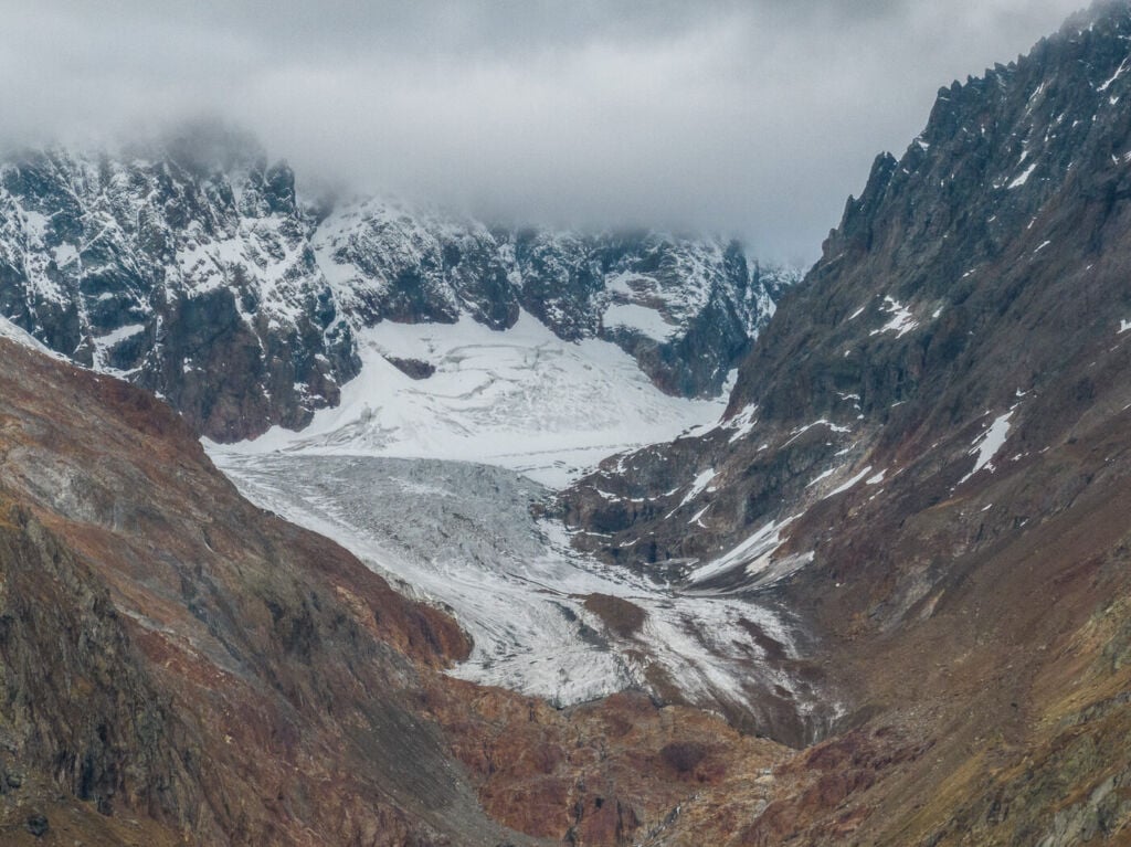
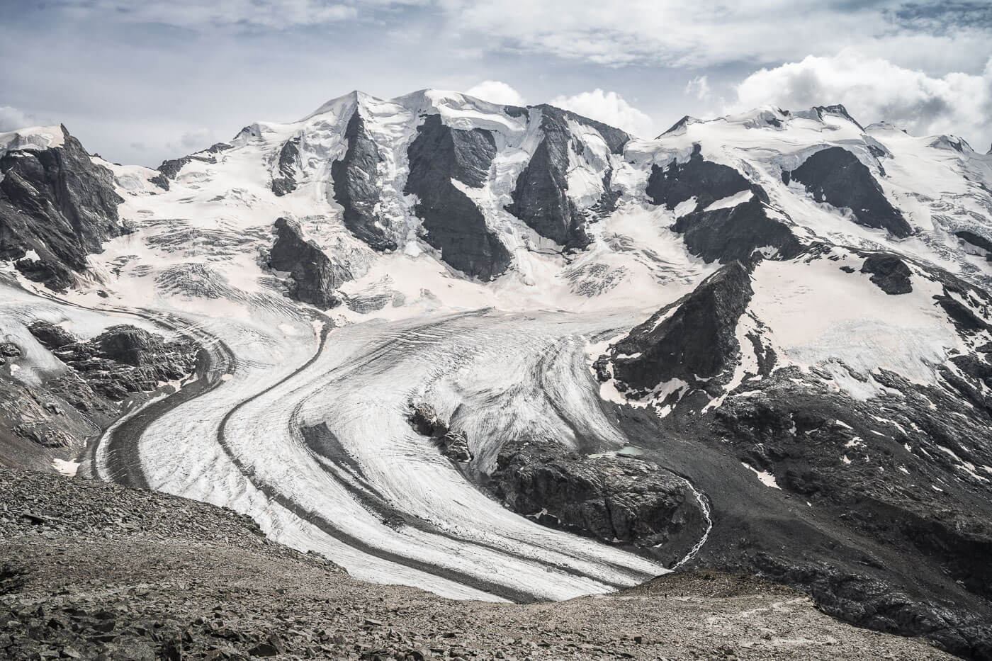
Detail of the glacier and source of the river that feeds into Göscheneralpsee. Zoom shot taken with the Mavic 3.
The Göscheneralpsee Hike – Getting back to the Dam
Here the trail climbs up a boulders field, and there are a couple of narrow passages on potentially slippery rocks, especially if wet. The passage is easy enough, and there are chains to help with the balance, but one must always practice caution in similar routes.
Next, the trail steers into the next glacial valley that offers excellent views over the surrounding mountains. There’s a bridged river to cross, which is also a nice area to explore. From here, the trail continues along the other side of the lake. Not much of an elevation difference here, as the trail will only descend to the dam near the end of the hike. Once you reach the dam, it’s a short walk away from the parking lot. Still, the view of the lake and the mountains surrounding it are pretty great even from there.
In conclusion, I was surprised to see how many scenic points this trail offers. There are several different good vantage points around the lake and views of the glaciers higher up on the surrounding mountains. I’d totally recommend this hike if you are looking for scenic alpine panoramas that are not to difficult to get too.

Göscheneralpsee from the side opposite the dam.

Panoramic Image from the trail
The other glacial valley on the side opposite the dam.
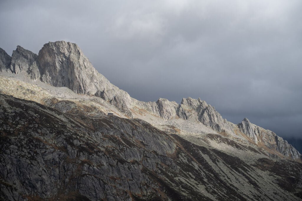
Detail of the peaks surrounding the lake. The barely visible “tiny” building is the Bergseehutte.
View of the lake toward the end of the hike.
Göscheneralpse, view from the Dam
Map of the Göscheneralpsee Hike
Here is the map of the Göscheneralpsee hike. If you need a GPS track, you can download the .GPX file from the Komoot activity.
Where to stay
It is possible to stay around the lake only from late spring to early autumn.
- There are a few huts around the lake: The Bergeseehutte, Chelenalp and the Dammahütte. However, the last two are on a T4 alpine route, only for expert hikers/mountaineers.
- The Berggasthaus Dammagletscher, a guesthouse by the dam, also offers accommodation.
- Camping: several camping sports are available on the road to the lake; all have basic facilities.
Additional Resources
- Check out my main Switzerland page for more info and hikes in Switzerland.
- Discover more awesome lake hikes in Switzerland: Limmerensee, Oeschinensee, Gelmersee, Bannalpsee, Glattalpsee, Triftsee or Mattenalpsee and Gaulisee.
Have you been to this lake or on this hike? Let us know your experience and tips in the comments!


Leave A Comment