The Triftsee and the Trift Glacier – Switzerland
The Triftsee and the Trift Glacier; discover a green emerald lake and traverse a suspension bridge over the two sides of the lake.
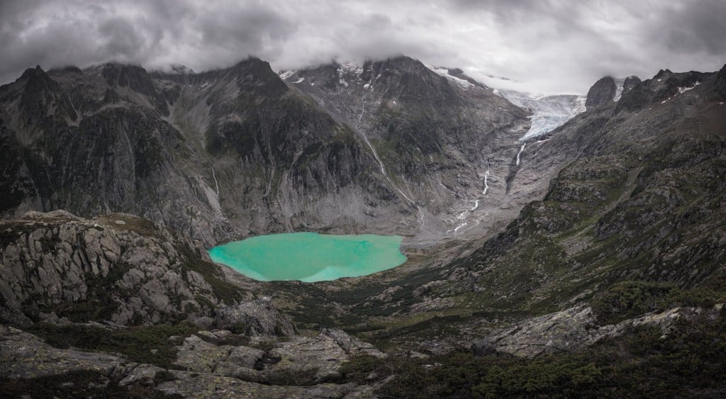
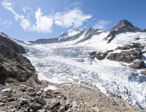
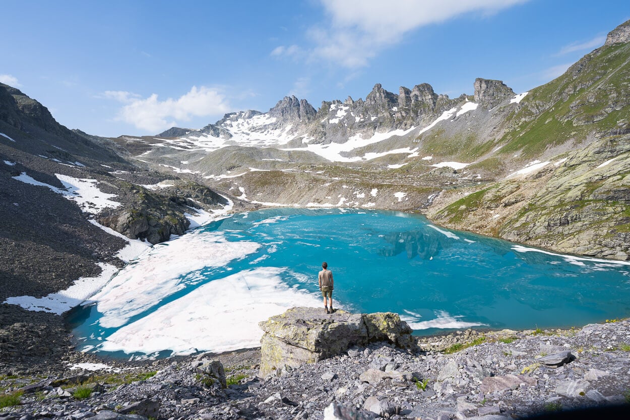
The Triftsee and the Trift Glacier are located in a gorge of primordial beauty. Despite that, the Triftsee is a lake that only formed in 2001 due to the melting of the glacier. If you search for old photos of the glacier online, you’ll be surprised to see how much of the glacier has melted in just over 20 years.
The Triftsee and the Trift Glacier
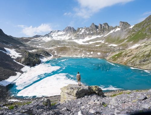
Still, the lake displays beautiful emerald green waters, and from the receding glacier, majestic waterfalls drop their waters onto the lake below. It is one of those locations where you can still feel the raw forces of nature at play.
Several trails lead to the Triftsee from the parking spot. Cable car rides are available for part of the hike but require advanced booking.
How to get to Triftsee and the Trift Glacier and Overview of the Hike
- Getting there: You can drive directly to the Tirftbahn valley station and leave the car there by car. If you prefer to start the hike from the Triftbahn valley station, you should buy your ticket in advance. You can buy a return ticket for 26.00 CHF, an ascent or a descent for 13.00 CHF.
- Start of the Hike: If you’re up to it, you can start the hike from the Triftbahn valley station. Be aware, though, that it is a physically demanding hike. If you are unsure whether you can make it or not, you should not attempt it. Also, Photographically speaking, the first part of the hike does not have much to offer.
- Photography & Scenery value: Scenic panorama vies from the surrounding cliffs. The suspension bridge also offers excellent photographic opportunities.
- Difficulty: Difficult/Hard from the valley station. Medium/Hard from the Triftbahn mountain station if you hike the same loop to the Panoramic viewpoint and the Windegghuette.
- Tip: the Sustenpass is nearby and definitely worth a visit. The views around the pass are spectacular, and The Steinsee area is another good location for hiking and photography.
The Triftsee and the Trift Glacier Trail
| Distance | Ascent | Duration |
|---|---|---|
| 17.1 KM | 1,100 MT | 7/8 Hrs |
I only hiked the trail on the right side of the Triftbahn valley station, so my report applies to that. However, from what I’ve read, the trail on the left side of the station may be a little easier, but it is still a long hike nonetheless. Therefore, excellent fitness conditions are required, especially for a roundtrip.
You will first have to take a paved road that initially descends a bit to take the trail. After that, it will turn into a gravel road and then a trail as you proceed further.
The first part of the trail will lead you through a forested area. You may see some Chamois (I did!) or other wildlife if you are lucky.
Once you exit the forest, the trail will turn rocky, and there will be a few exposed sections, but nothing too bad. However, rockfall danger is real here, and you will see warning signs. Proceed with caution.
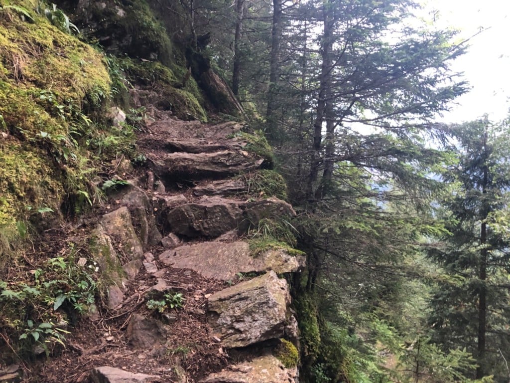
Exposed and unstable sections of stone stairway in the first part of the hike
As you hike your way up, you’ll see the Triftbahn mountain station on the other side of the valley. Shortly after, the trail will merge with the one coming from the mountain station.
At some point, the trail will fork in two. If you take the one on the left, you’ll reach the bridge. You’ll first get to the Windegghuette and a panoramic point overlooking the lake if you take the one on the right. After that, you can make it as a roundtrip in both directions, whichever you take. Be aware that there are some pretty steep sections with chains.
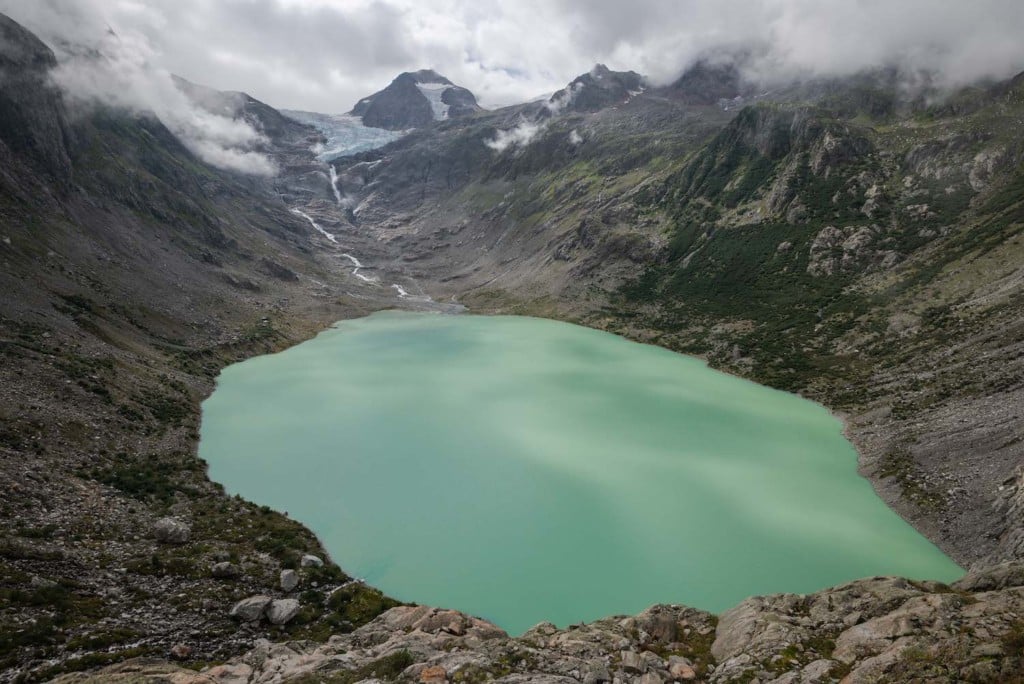
Panoramic View from the trail leading to the Windeghuette. The starting point of the hike is behind the mountain on the left.
Photos and Photography tips for the Triftsee and the Trift Glacier Hike
Honestly, the first part of the trail does not have much to offer in terms of photography. For this reason, you may prefer to book the cable car in advance and spend more time exploring the area around the lake. Still, it is a strenuous but nice hike if you want to hike up.
One of the best panoramic views is a 10-15 minutes walk above the Windeghuette. Once you pass the hut, make sure you take the right trail there as one leads down to the lake (left) while the other to the lookout above it (right).
When I visited, I had only my 16-35 f4 Nikkor lens and the drone. I would recommend bringing a wide-angle as the view is vast. You will need more frames to create a panorama to make it all o fit.
The Triftsee and the Trift Glacier. View from the vantage point above the Windegehuette
Also, I wish I had a bit more reach. At least up to 70mm, to capture the waterfalls better. Of course, anything above 70mm may be a bit overkill in terms of the landscape here, but it may be worth bringing something beyond that if you are a wildlife shooter.
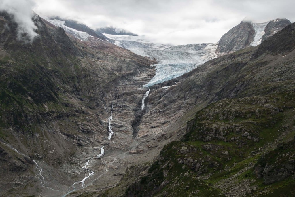
35mm shot of the waterfalls. I wish I had a bit more reach here. Good excuse to be back, I guess :).
Once you get down to the bridge, you will have great views over the lake from both sides and the bridge. The bridge itself is a photographic attraction, so you’ll have fun looking for different compositions and perspectives with and without people on it.
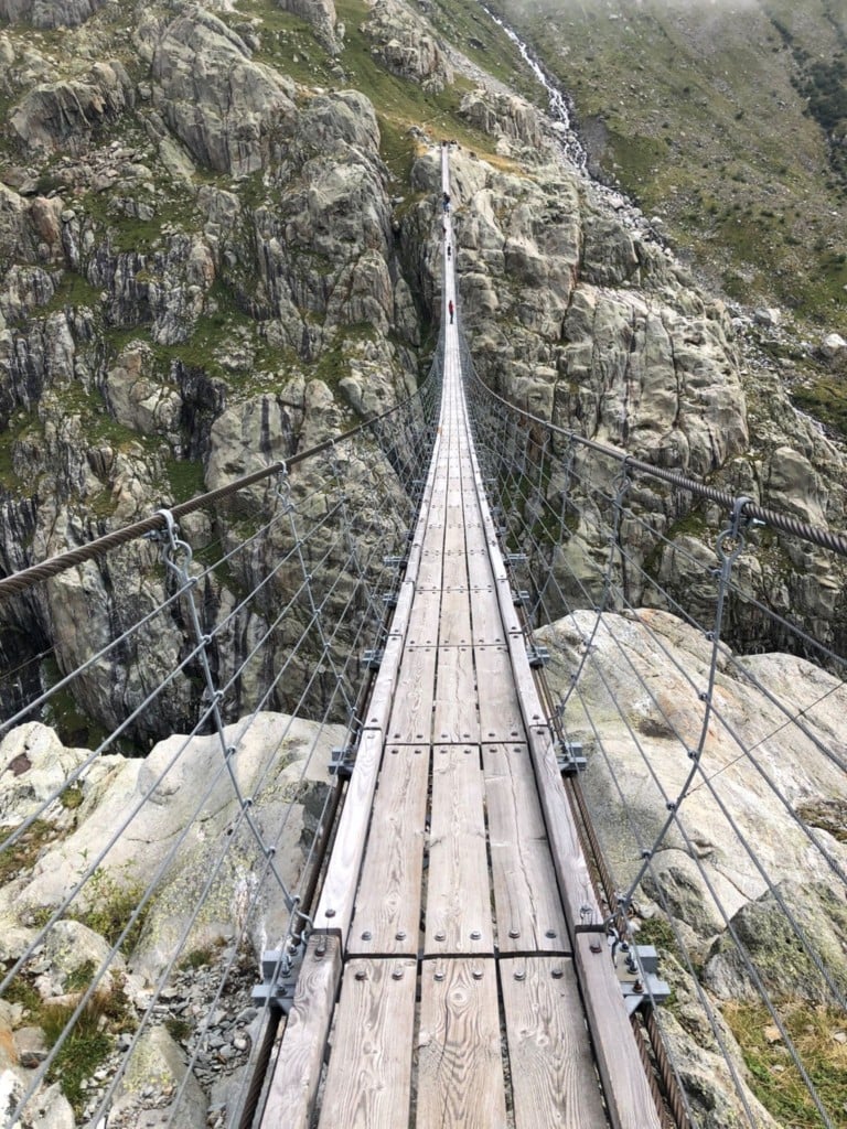
The Suspension bridge
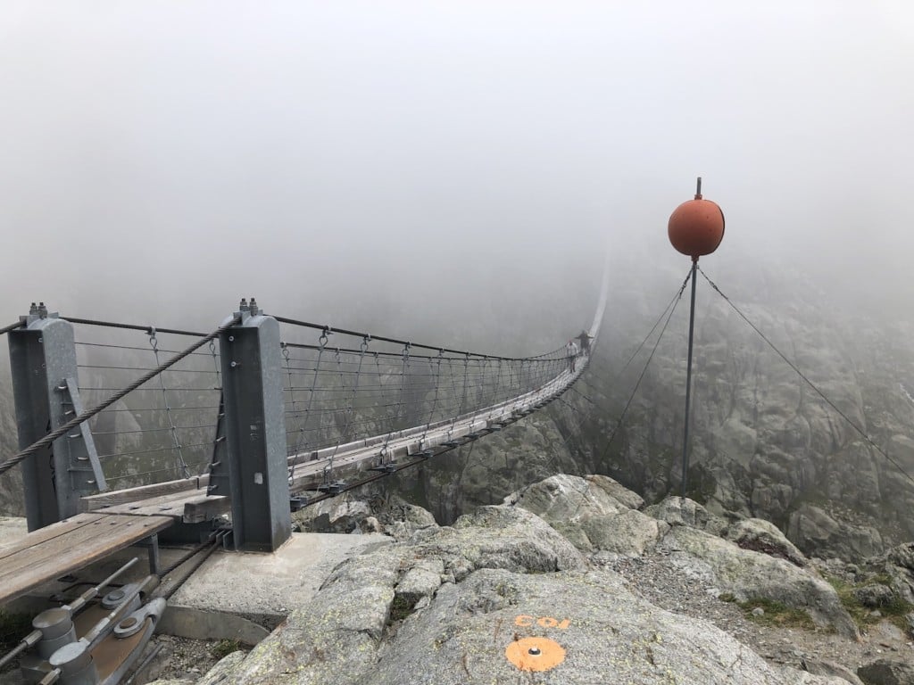
The suspension bridge in the fog
You will have fun shooting the bridge with a drone if not too many people are around. Nevertheless, Early in the morning or late afternoon should be ok if you stay in the hut nearby.
Also, from the other side of the bridge, the views over the lake are fantastic. But, on the other hand, this area will be more crowded with many people basking in the sun if the weather is good.
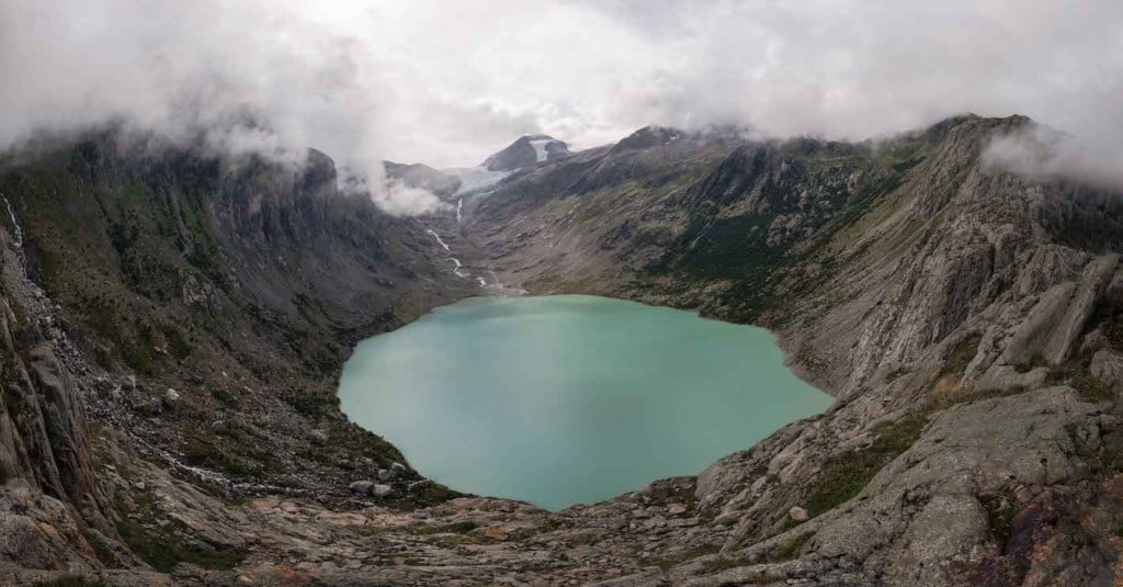
The Triftsee and the Trift Glacier. View of the lake from the other side of the bridge. Panoramic photo.
Map of the Triftsee and Trift Glacier Hike
Here is the map of the hike from the parking area. If you need a GPS track, you can download the .GPX file from the Komoot activity.
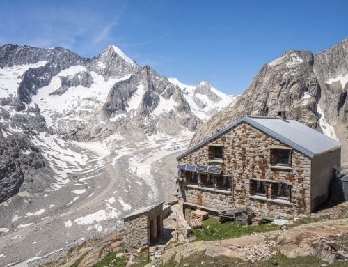
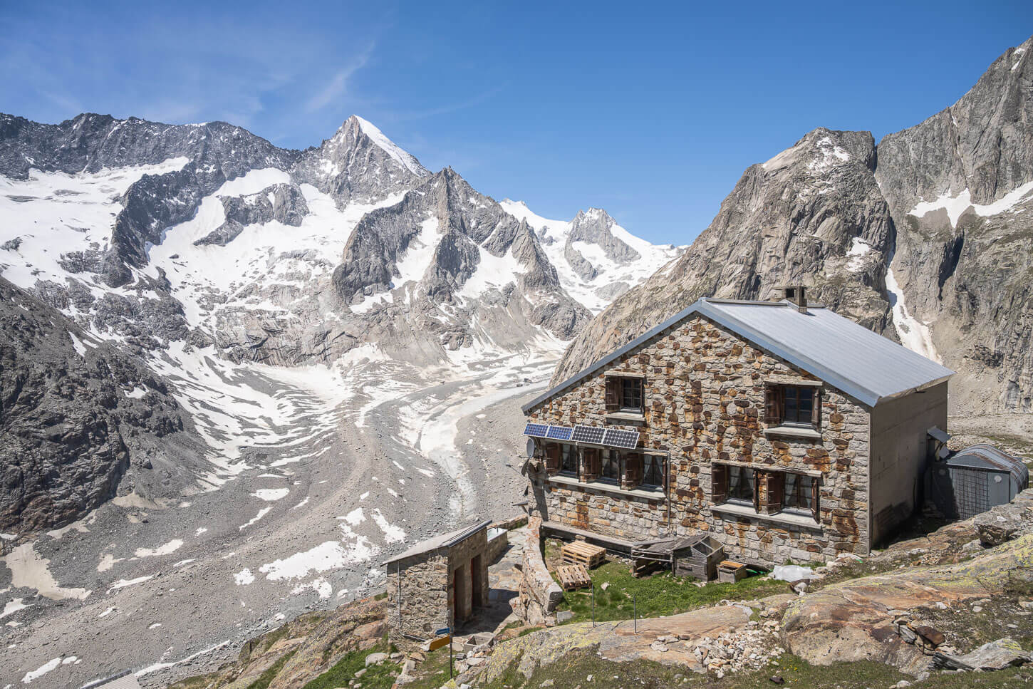
Where to Stay near the Triftsee and the Trift Glacier
Two options are available in the mountains around Triftsee; the Trifthutte and the Windegghuette. Both would require advanced booking:
However, the Trifthutte is further up the mountain next to the glacier. This adds considerable length to the hike. The Hut is also on a white-blue-white alpine hike, with exposed sections and ladders to climb over. Alpine experience is required. Thus plan accordingly.
Additional resources
- Discover more awesome lake hikes in Switzerland: Limmerensee, Oeschinensee, Gelmersee, Bannalpsee, Glattalpsee, Göscheneralpsee, or Mattenalpsee and Gaulisee. For something a little bit out of the ordinary, check out the Chüebodengletscher and Gerenpass Hike.
- Another nearby glacier hike: Steingletscher.
- Check out my main Switzerland page for more info and PhotoHikes in Switzerland.
- Link on the Triftsee Hike from the local Tourism agency


Vielen herzlichen Dank für den tollen Bericht und die wunderschönen Bilder. Sehr hilfreich und wunderschön.
Danke Amy!