The Limmerensee Hike – Switzerland
Welcome to Limmerensee, one of the most beautiful mountain lakes in Switzerland and the strangest hike at the same time!
The hike to Limmerensee starts with a 3km walk in what looks like the entrance to the Bat Cave. In fact, to access the lake, you will have to walk through the service tunnel of the Limmerensee dam. It will take about 30 minutes to cross it, and indeed, there’s light at the end of the tunnel. Actually, more than that, there’s the beautiful Limmerensee!
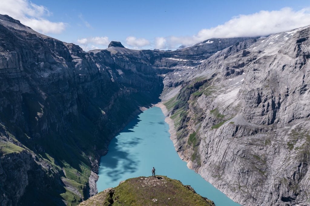
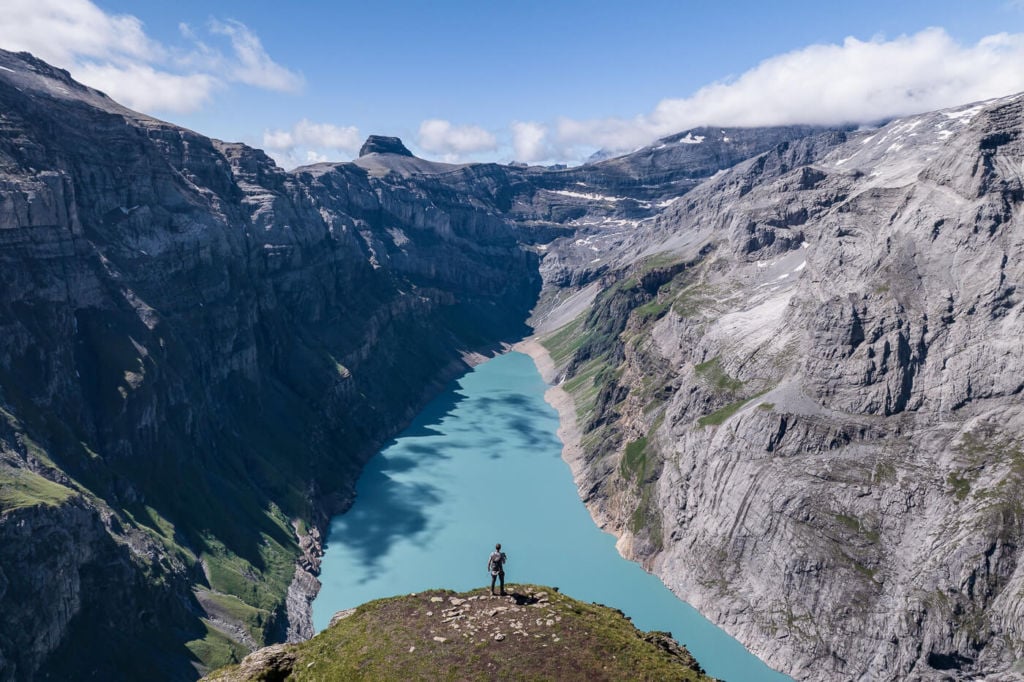
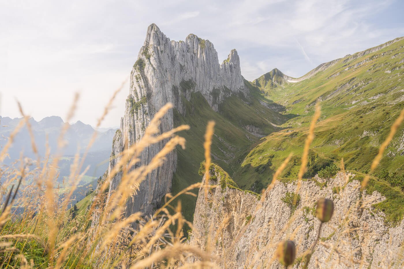
View from the top of the Muttenchopf.
To get to this lookout, however, there’s still a bit of a hike – details below.
Also, if you do not want to hike through the tunnel, it’s possible to hike to the Muttseehütte directly from the cable car mountain station. It will take approximately one hour longer than walking through the tunnel, and you can follow the trail marks to the Muttseehütte.
How to get to Limmerensee & Outline of the Hike
- Getting there: There is free parking at the Luftseilbahn Tierfehd – Kalktrittli, where the cable car’s valley station is located. This is where you would need to drive to. By public transport, you would need to take the train to Linthal and then walk to the cable car station from there. The walk is almost 6km, so not a great option, but still feasible if you are ok with that distance.
- Start of The Hike: At the mountain station of the cable car. You will see a small box full go high-visibility jackets. Pick one, we are it and open the small door next to it to enter the Bat cave :)!
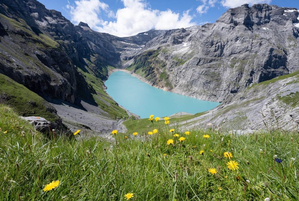
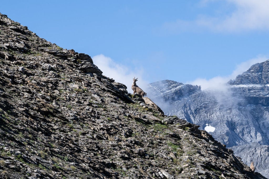
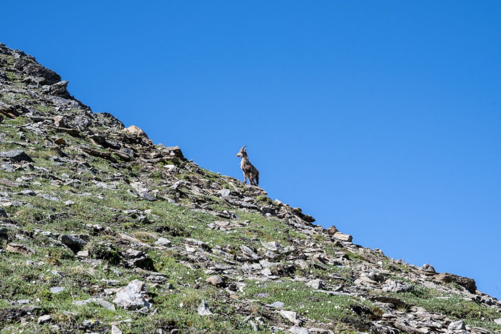
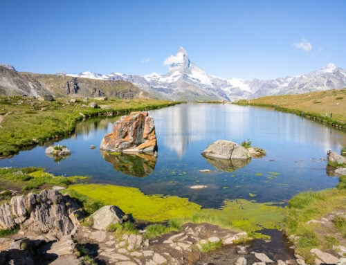
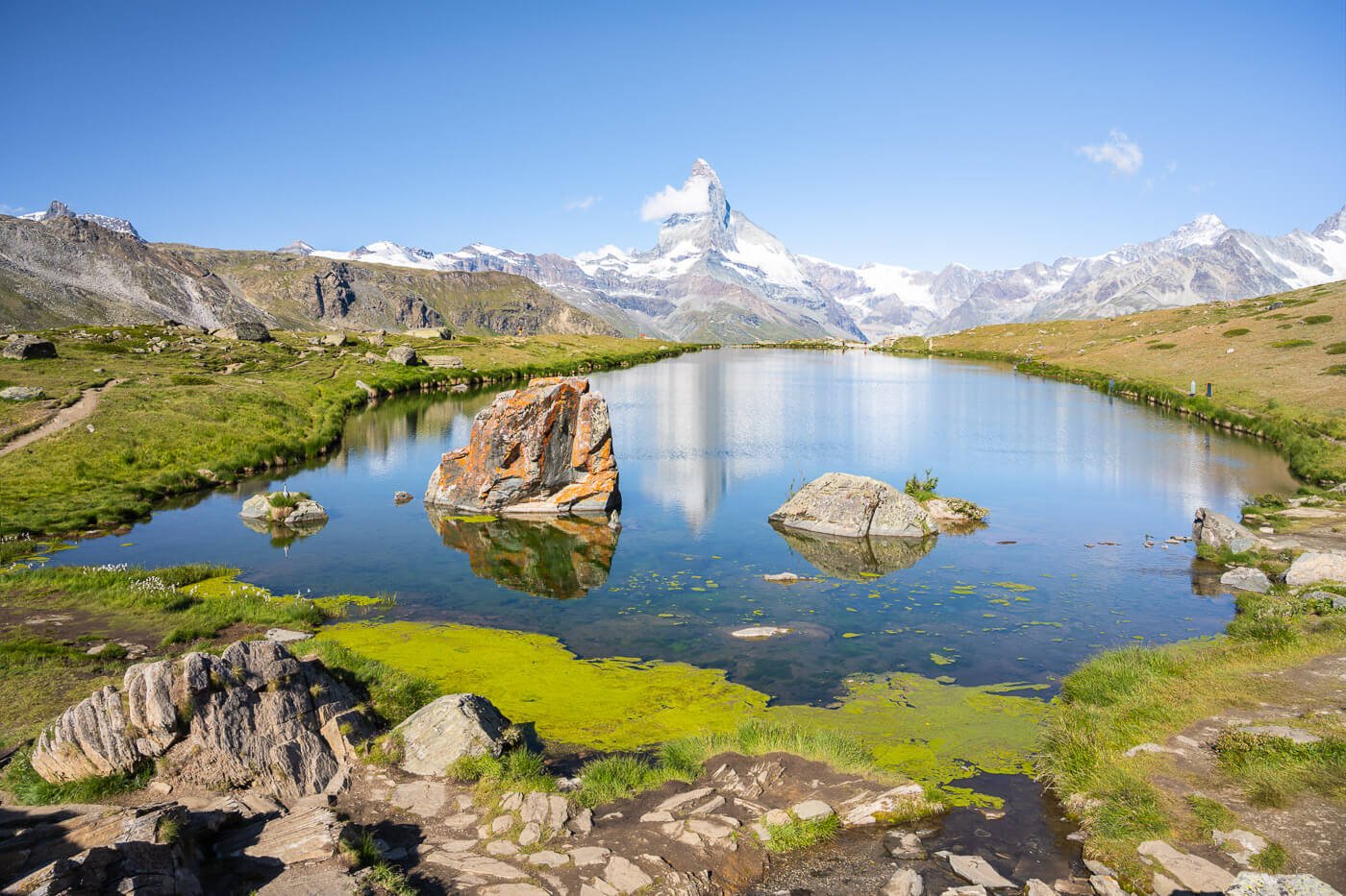
- Photography & Scenery value: beautiful alpine lake with turquoise waters surrounded by steep mountains. Like a jewel set in the mountains. Also, a bit of wildlife with Ibexes and Marmots.
- Difficulty: Medium to Hard, depending on fitness. The trail has no particular challenges, but the climb to the top is more or less relentless, and part of the trail is on loose rocks, making it more challenging.
- Tip: Bring a jacket for the walk through the tunnel, even in summer. It’s rather cold – and wet – in there.
Overview of the Muttenchopf Trail to Limmernsee and Map
The out-and-back trail is relatively long at 10km in total, but not overly difficult. Moderate if you are used to this type of distance, but could be considerably harder if you are not used to go hiking too often. Also, the trail is steep in places, it has a couple of moderately exposed sections where chains have been installed for safety.
| Distance | Ascent | Hike Time |
|---|---|---|
| 10.3 KM (6.4 miles | 640 Mt. (2,100 ft) | 4-5 Hours |
Here is the map of the hike. If you need a GPS track, you can download the .GPX file from the Komoot activity.
As mentioned above, the hike starts at the cable car’s mountain station. Walking through the tunnel is a rather strange experience. It’s cold and humid but well lit. “Funky” lit in places.
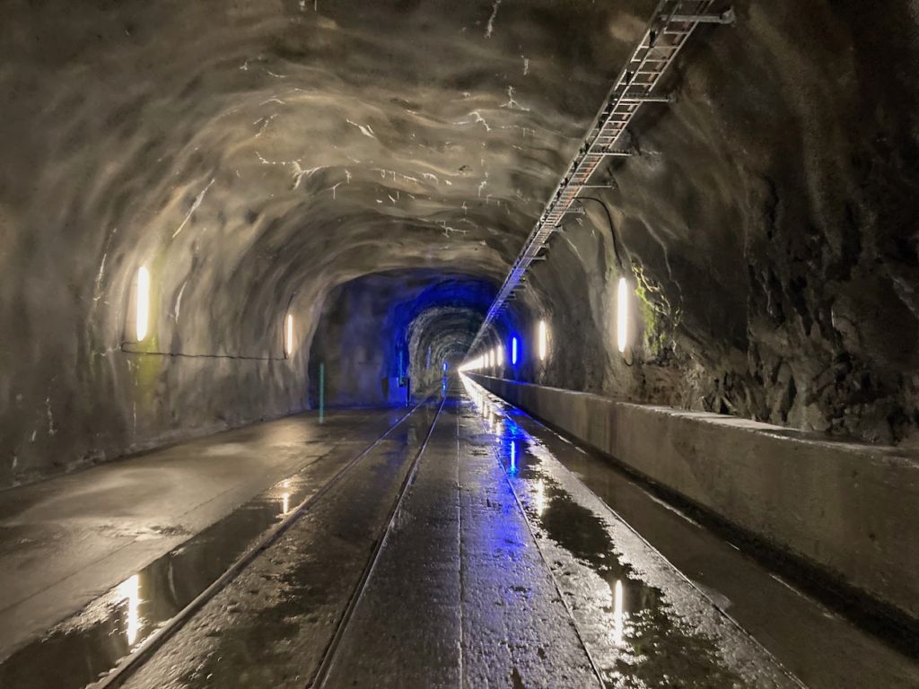
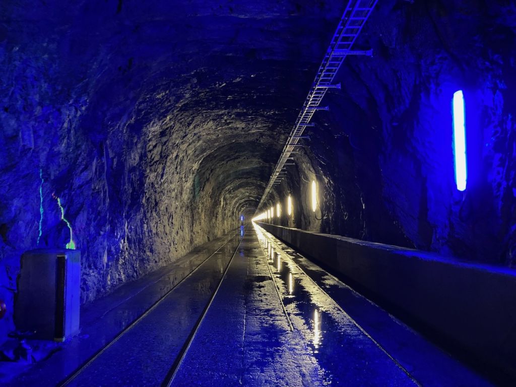
Wear the high-visibility jacket you can find at the entrance, as there may be workers driving around. You want to be spotted in there :). At the end of the tunnel, you will find another box where you can store the high-visibility jacket.
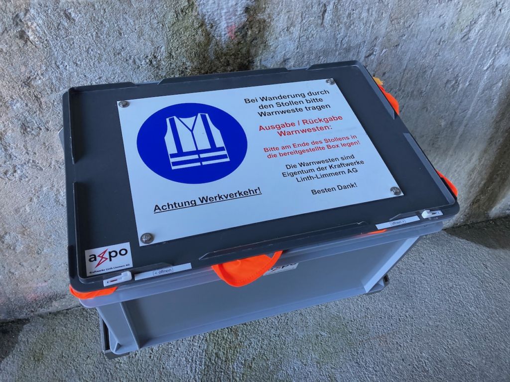
The box where you can pick and deposit the high-visibility jackets.
Once you cross the tunnel, the hike is relatively straightforward. There aren’t many other trails going up the mountain from there, so the navigation is easy.
The terrain is steep and rocky in places, with stretches of loose and sharp rocks, so pay attention to those. there also are some moderately exposed section, but chains have been installed to help with balance and safety.
And before reaching the Muttenchopf summit, however, there will be plenty of amazing views of the Limmerensee Lake. So despite the winding and steep trail, you can enjoy some amazing views.
As you approach the top of Muttenchopf, the trail will split in two. To the hut on the right and the top of Muttenchopf on the left. Follow the trail to the left, and you are about a 10-15 minutes hike from the top of Muttenchopf and the spectacular view over Limmerensee.
Photos Photography tips for Muttenchopf and the Limmerensee Hike
The main attraction here is the beautiful Limmerensee and its turquoise waters. The lake’s waters offer their best colour when fully lit by the sunlight. So if it is sunny, I recommend being there at around 10:30/11:00 AM or before 5:00 PM in summer. If it is overcast, that would not matter.
As of 2025 some restrictions to drone flying have been introduced in the area, east of Muttensee, in the Kärp Game Reserve . So you could technically still fly a drone around Limmernsee, make sure you comply with local regulations, temporary restrictions. Also, this is quite a popular location, so fly with discretion without disturbing other hikers or wildlife.
And, apart from the fantastic views along the trail, you may also be lucky enough to come across ibex when hiking to Limmernsee
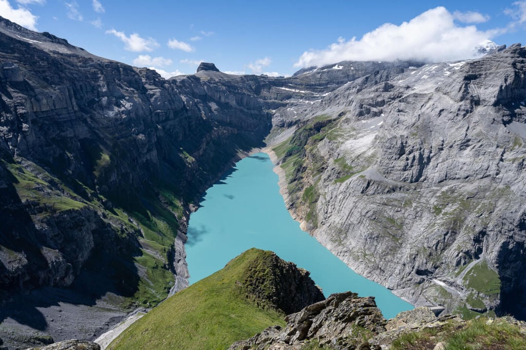
View from half-way up.
The best views are from the top of the Muttenchopf.
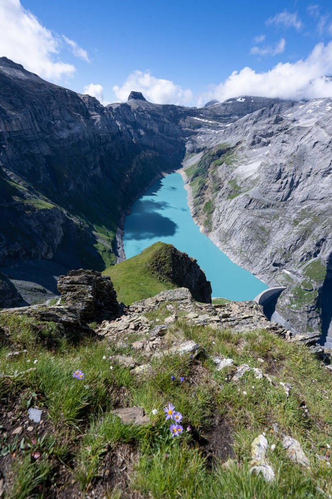
Classic view over the lake
If you are tempted to walk down to that other lookout you can see in the photo above. Don’t. The side of the mountain is steep and very exposed. The terrain is basically loose rock. Essentially, this is a combination for a disaster, so don’t go there.
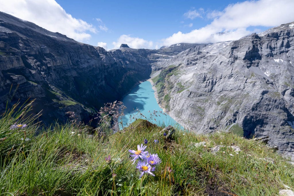
Late spring and early summer and you may be able to include some flowers in your shots!
Additionally, the top also works great for drone selfies :)
Selfies with a drone!
It’s easy to see Ibex here in this location, too, especially in the early morning. I did see a group of 4 on my hike there, so if you are into wildlife photography.
A surprised Ibex cub staring back at me
One of the four Ibexes I met on this hike.
Video of the Muttenchopf and Limmerense Hike
Lastly, here’s a short video of this hike. Check it out if you want to get a feel for the trail
Where to Stay
The Muttseehütte is just a 30/45 minutes walk from the summit of the Muttenchopf. Closer to the other side of the lake, the Kistenpasshutte also offers food and accommodation.
It should be noted that it is no longer allowed to camp in the area – which is something that used to be relatively popular. Understandably so, as would would not love to wake up to such an amazing view?
Additional resources
- Check out this other cool hike nearby, the Klausenpass-Griesslisee hike. Also, here are two awesome must-visit waterfalls on each side of the Klausenpass: Stäubifall and Berglistüber
- More awesome lake hikes in Switzerland: Oeschinensee, Gelmersee, Bannalpsee, Triftsee, Glattalpsee, Göscheneralpsee or Mattenalpsee and Gaulisee.
- Check out my main Switzerland page for more info and PhotoHikes in Switzerland.


Hi! Little remark from a local here: As from 2025 all camping, bivouacing and letting a drone fly is forbidden in a quite large region around the Muttenchopf and Limmernsee. But otherwise a great informative article!
Thanks Marti! I’ll update the post accordingly in the next few days.