The Niederbauen Hike, Switzerland
The hike to the Niederbauen is a bit of a hidden gem. Mostly popular with locals, it still does not get much attention like others nearby like Pilatus, Rigi or Fronalpstock. Still, this is one of my favorite hikes around Lake Lucerne.
This is a great but demanding hike from mid-late spring to late Autumn. To me, the views from the top are second only to Fronalpstock. Also, it’s quite a long hike with a decent elevation gain, ideal for training before the higher part of the alps becomes accessible in summer. Lastly, this is a fantastic place for a Sunrise hike.
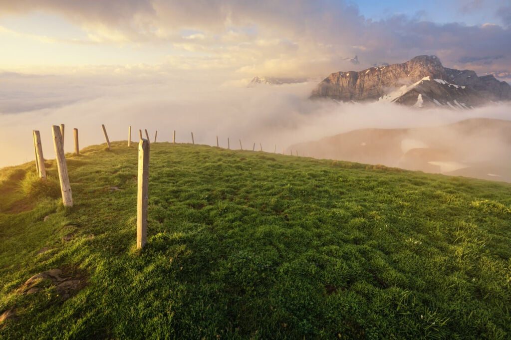
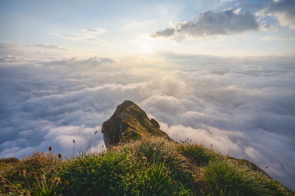
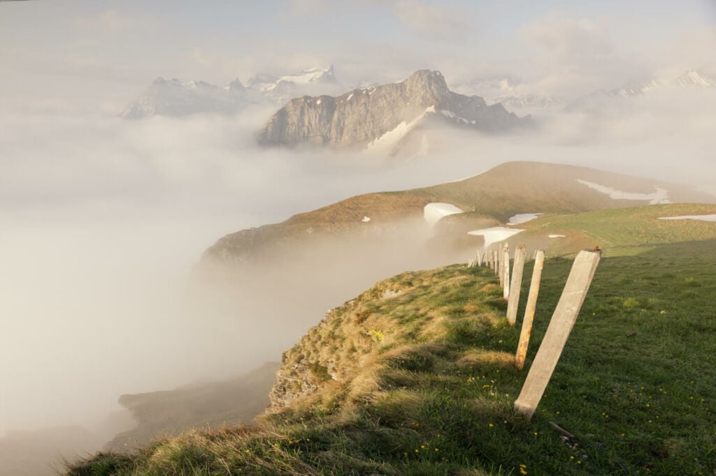
A magic sunrise on top of the Niederbauen, above the sea of clouds.
The reason why this location is not so popular may be because the summit is relatively small, and there is no space for much infrastructure. Or perhaps they wanted to preserve it. I’m happy it is the way it is. . In winter, it’s also possible to get to the top in snowshoes, although it is a difficult snowshoe hike with a couple of moderately dangerous passages.
There are two main hiking options to get to the top of this mountain. A longer one, directly from Emmetten, and the other one from the cable car’s mountain station. I’ll describe the longer hike in this post, but I will also provide directions for the second one. Also, this is a popular paragliding location if you are into that.
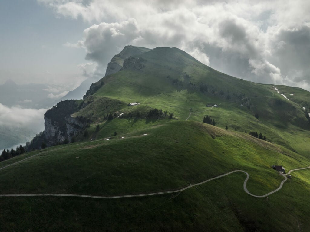
The top of the Niederbauen, the second summit in the background. Drone Shot.
Table of Content
Overview of the Niederbauen Hike
This refers to the longer hike. If you prefer to take the cable car to the mountain station, you will save about 8km from the roundtrip and a 700m elevation gain. The hike is challenging mostly due to the elevation gain and the constantly steep terrain. Otherwise, the trail is well-maintained; there are no exposed areas and no need to scramble up steep sections. If you start the hike from the mountain station, it would be an easy to moderate hike. Here you can find the timetable and prices of the cable car.
| Max Altitude | 1,923 m |
|---|---|
| Distance | 12.4 KM |
| Elevation gain | 1,140 ↑ / 1,140↓ |
| Hike time | 5:30 / 6:00 Hours |
| Hike Difficulty | Hard |
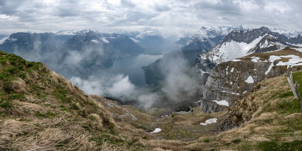
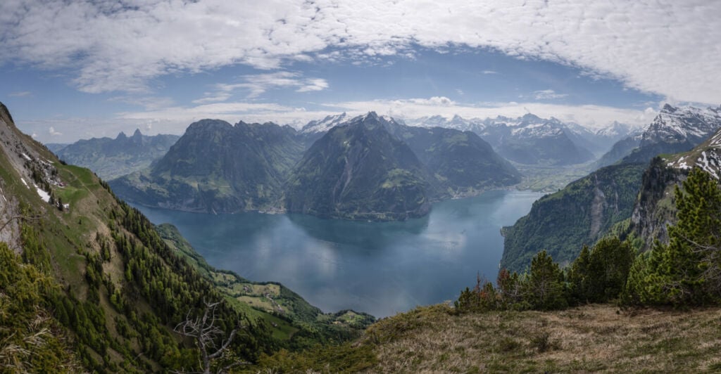
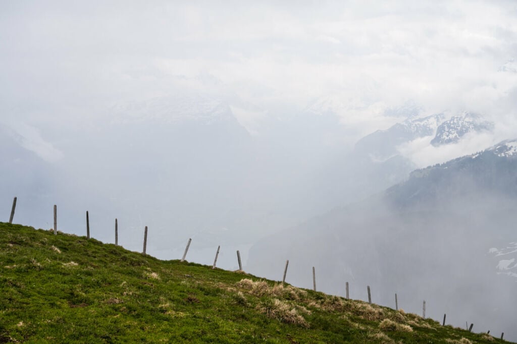
Panoramic Image from the top. Taken in mid-spring.
How to get to Niederbauen and Parking
The trailhead is in Emmetten, an easy-to-reach village near the A2 highway. Parking is available there and
- Driving Directions: on the A2 from either north or south, take the exit from Emmetten. Keep following the road uphill until you reach this small village. There are a few paid parking areas available in Emmetten, and I’d recommend arriving there early rather than later, as they can fill up quickly, especially at the weekends.
- Parking: if you plan to hike the whole trail, I recommend parking at the first ample parking you will find on your right, the Klewenalp Stockhütte Parkplatz. If you prefer to take the cable car, you can park here.
- Public Transport: you can get to Emmetten taking bus 311/N44 from Stans Bahnhof
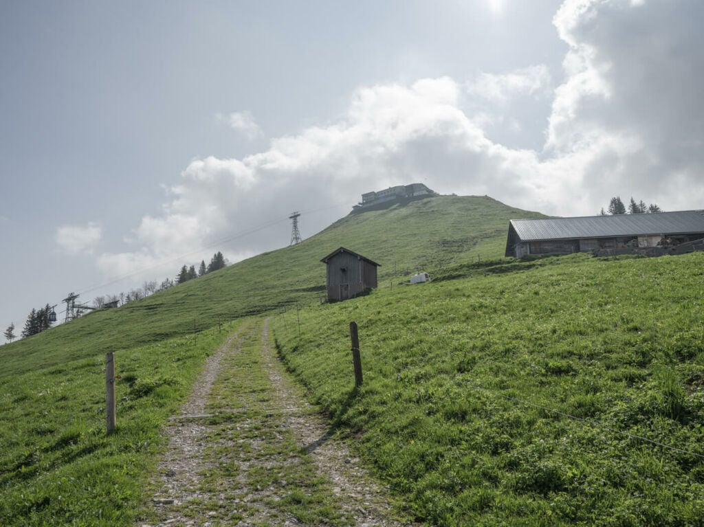
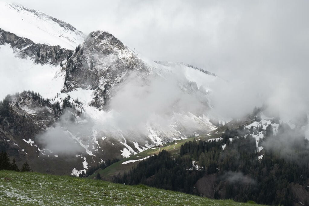
The mountain station of the cable car, in the background.
The Niederbauen Trail
The first part of the trail follows the road toward the valley station of the cable car until you will have to turn to your right down a smaller road. Keep going until you see the trail signs for Niederbauen-Kulm, next to a small house complex. Here the actual trail starts, and you will soon enter the steep train in the woods, only to reemerge close to the mountain station.
You do not need to pass by the mountain station as the trail will pass below it. This is a relatively flattish part of the hike and is where you would start the hike if you took the cable car. Soon you will approach the last part of the climb on the north side of the mountain. It will take about an hour at an average pace to reach the top, where there is a fence and a couple of benches. Sit, have a snack and a drink and enjoy the views!
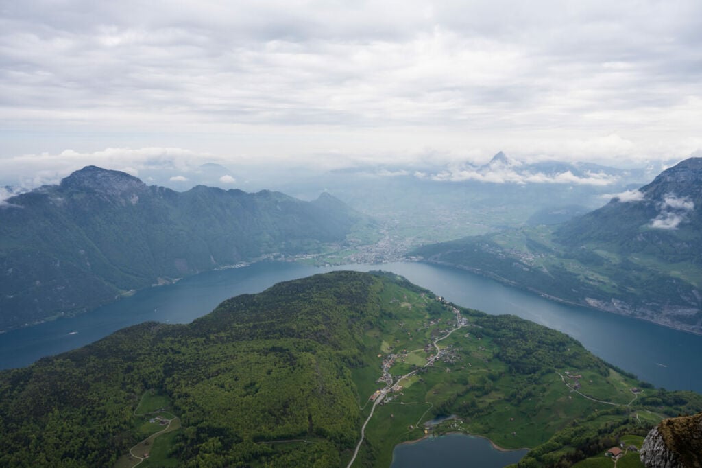
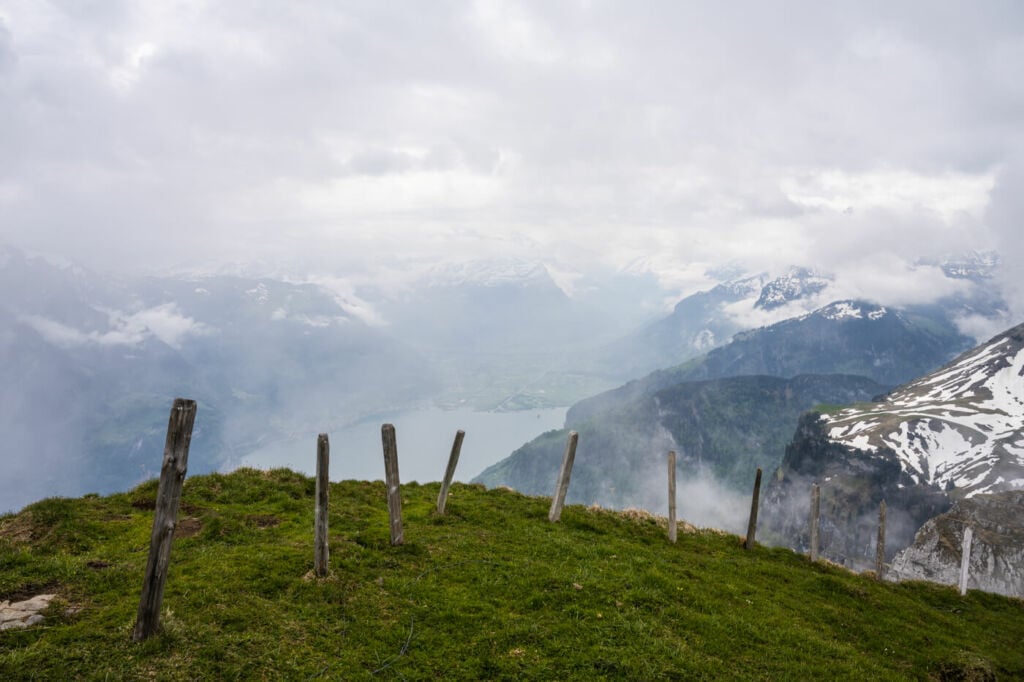
Lake Lucerne from the top of the Niederbauen.
The Niederbauen Hike Photos and Photography tips
This is a great sunrise hike. Especially in spring, when the sunrise is not too early in the A.M., the sun will rise directly in front of the top of the mountain. Also, at that time of the year, there could be the classic “sea of clouds” typical of this corner of Switzerland, which the sun usually clears after sunrise. This can create very scenic effects.
I found a use for anything between 14mm to 200mm. There is not much on the top, but you will have no trouble finding an interesting foreground, like fences or part of the cliffs, or some vegetation. A telephoto lens will be handy in isolating some of the beautiful mountains around Lake Lucerne. And the occasional wildlife, if you are into that.
Lastly, you could fly a drone here, assuming you comply with local regulations and registration requirements.
P.S.: this is a great location when there is snow for both minimal and landscape shots. Here are some of the photos I took on my hikes:
Panoramic Image from just below the summit, on the opposite side of the mountain.
Sunrise in mid-spring, the sun rises right in from of the mountain.
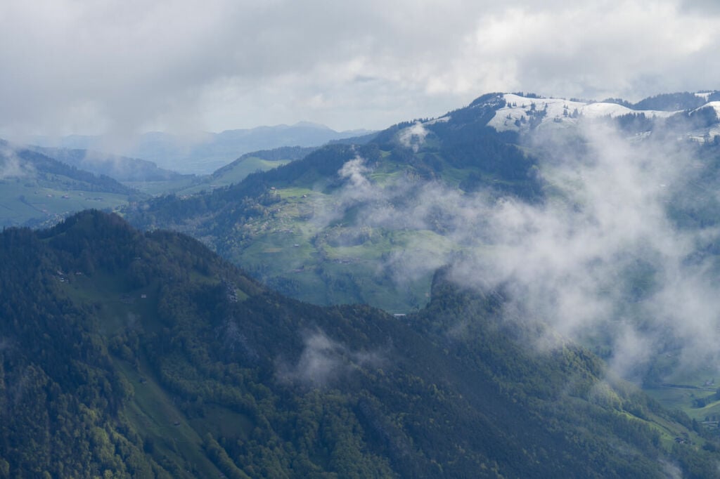
Detail of the mountains around the Niederbauen.
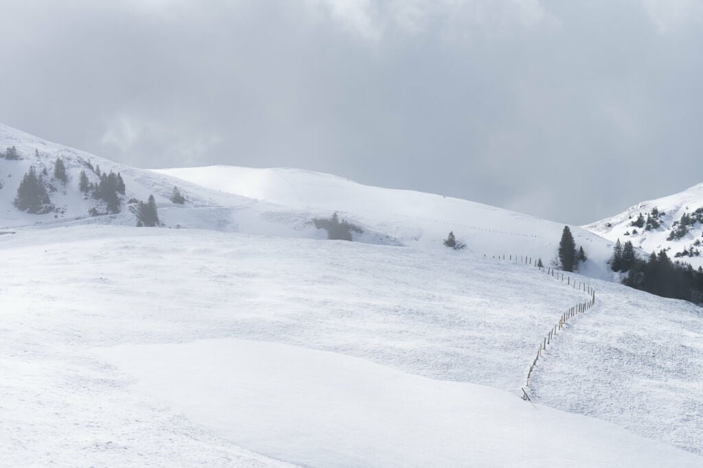
A snowy day in early spring.
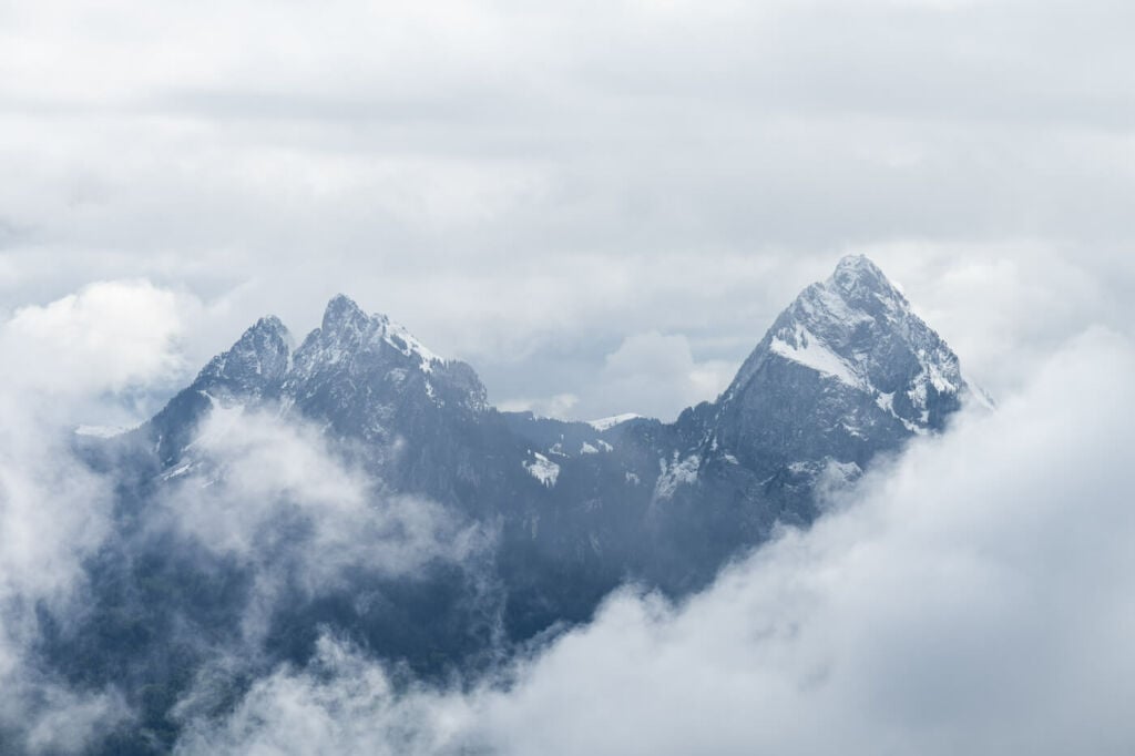
The Kleiner and Grosser Mythen, 200mm shot from the top of the Niederbauen.
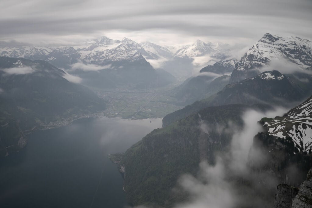
View from the summit toward south
3 minutes long exposure shot at 200mm
Sunrise on the Niederbauen.

Drone shot
The sun slowly clears the sea of fog after sunrise.
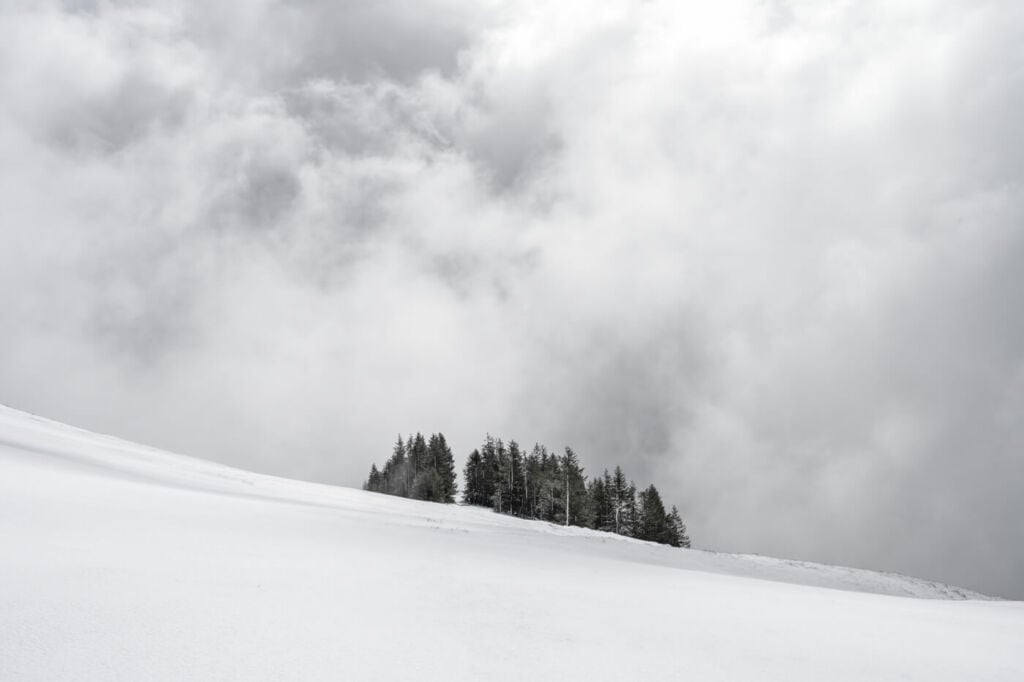
Early spring snow on the Niederbauen
Sort of minimal shot – the Niederbauen offers several similar possibilities when covered in snow due to the lack of major infrastructures. Note this is not a monochrome image.
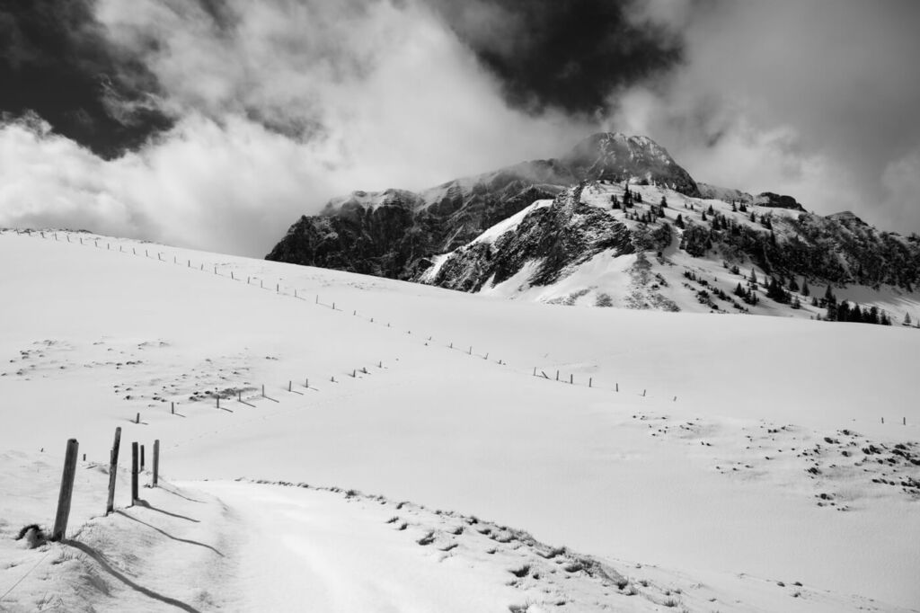
A monochrome image from the hiking trail leading to the summit.
Map of the Niederbauen Hike
The trail is well-marked with the usual pint trail posts and is always easy to follow. You don’t need a GPS track here, but the map below can give you a good idea of the elevation profile and what to expect on the trail.
Where to stay
If you want to spend the night on the mountain, it is possible to do so at the Niederbauen Berggasthaus. Otherwise, there are a few options in Emmetten too.
Additional Resources
- Check out my main Switzerland page for more hikes and an overview of hiking in Switzerland.
- Also, check out these other fantastic hikes above Lake Lucerne, Fronalpstock, Mount Rigi Hike, Stanserhorn, or the Buochserhorn
- A timetable of the Cable car to the mountain station.
- You may also want to check out the Best Hikes around Lake Lucerne.


Leave A Comment