The Mount Rigi Hike, Switzerland
The hike to the top of Mount Rigi is popular with locals and tourists. Mount Rigi, also called the Queen of Mountains, can be hiked from every possible direction. The views are fantastic in all directions and there is plenty to do from the bottom to the top of the mountain. Farms to purchase cheese or meat from, SPAs, Steam trains, restaurants, hotels and huts, all on top of the stunning views and beautiful environment.
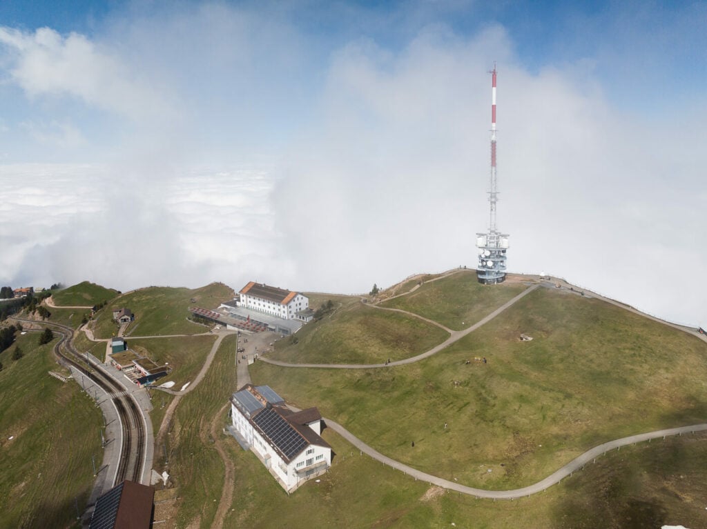
the top of Mt. Rigi. Taken with a Mavic 3
While the top of Mount Rigi may look inaccessible from some angles, there are several easy options to walk all the way to its summit. Not only that, but you could also take the cogwheel train or the gondola and hike some parts and take the transportation for the rest. This is really a mountain everyone can enjoy in several different ways.
The hike can also easily be done as a day trip from either Lucerne or Zurich and also one that’s easy to do by public transport, since Mount Rigi is a sort of “standalone” mountain surrounded by lakes and flat ground. The hike I did and the one I will describe here starts in Küssnacht and ends at the top, but as I mentioned there are several different options to get to the top. More details on that later.
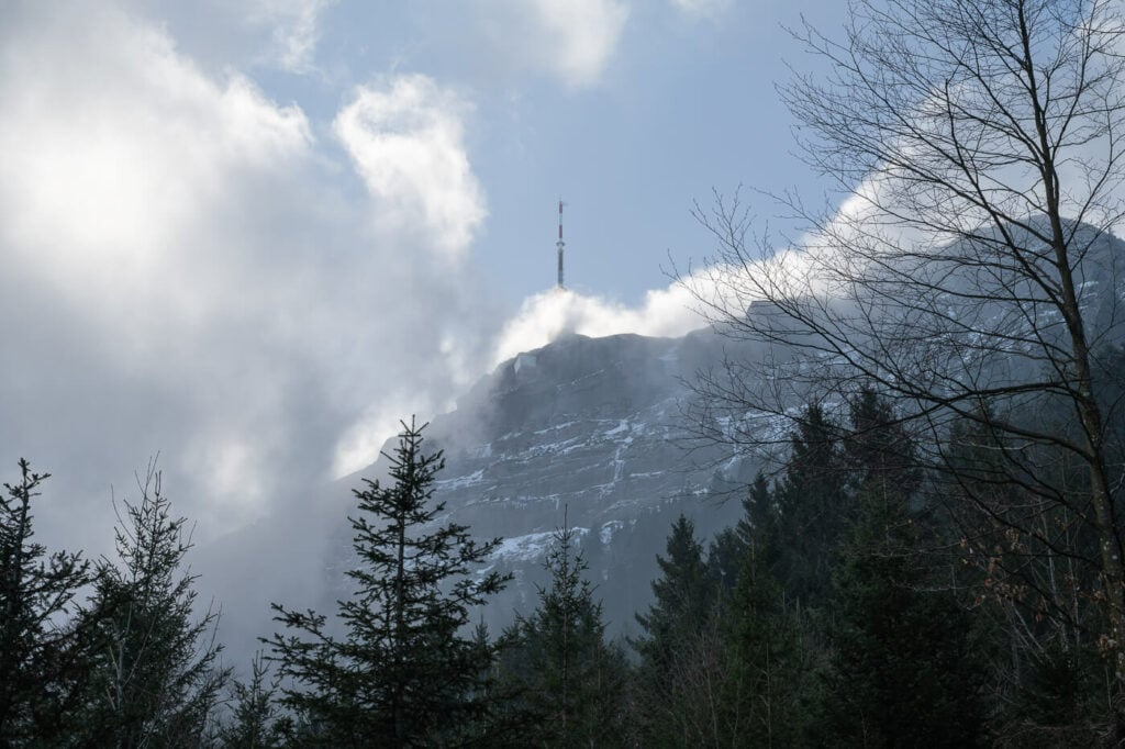
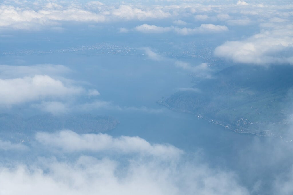
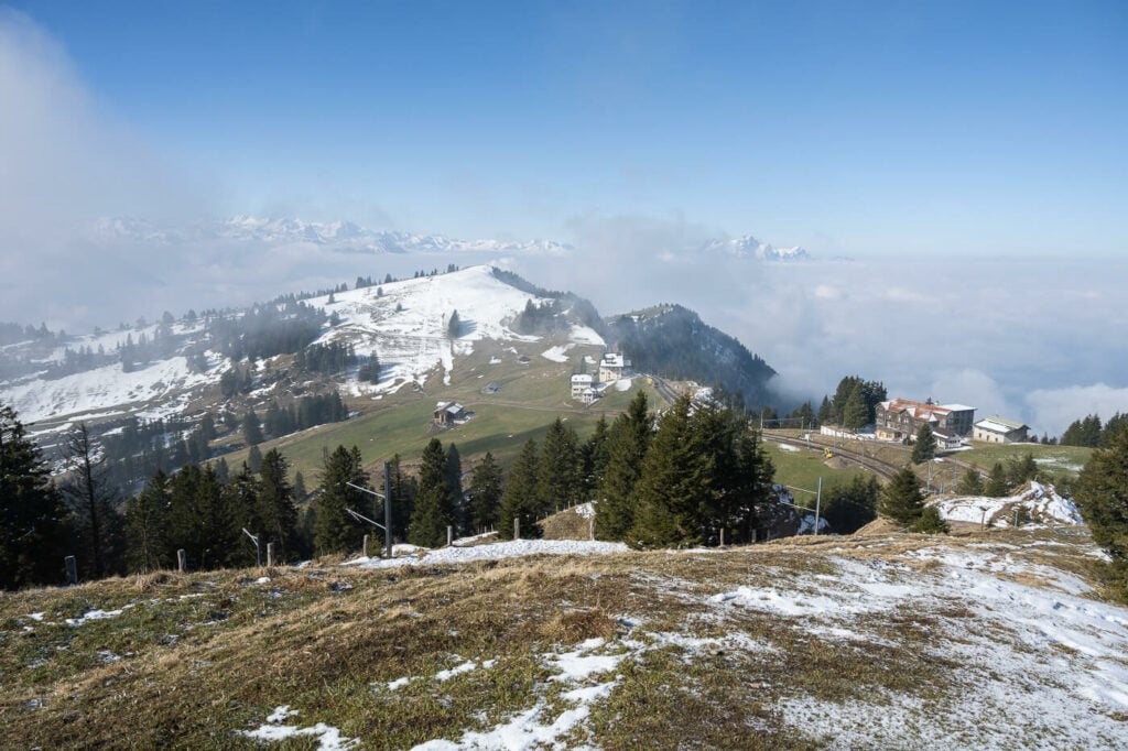
The seemingly inaccessible summit of Mt. Rigi in the clouds
Table of Contents
Overview of the Mount Rigi Hike
The hike to the top of Mount Rigi is long and the elevation gain is considerable. However, other than that the trail presents no real challenges. So depending on fitness, it could be considered either moderate or hard. You can plan to hike a part of this trail or a different hike using the official map of the trails on this page. There are more than 120 KM hor Hiking trails on Mount Rigi, so there’s plenty to choose from for every kind of hike.
The hike I will take you on in this post is a loop hike from Küssnacht. This is the most accessible one from either Luzern or Zurich. It’s also possible to shorten the hike by one hour in each direction by taking the gondola ride to Seebodenalp. If you want to take the train to the top, you should head to either Arth-Goldau or Viznau and take beautiful the cogwheel train to the top of Mount Rigi.
| Max Altitude | 1,798 m |
|---|---|
| Distance | 18.1 KM |
| Elevation gain | 1,370 ↑ / 1,370↓ |
| Hike time | 06:00/ 07:00 Hours |
| Hike Difficulty | Moderate to Hard |

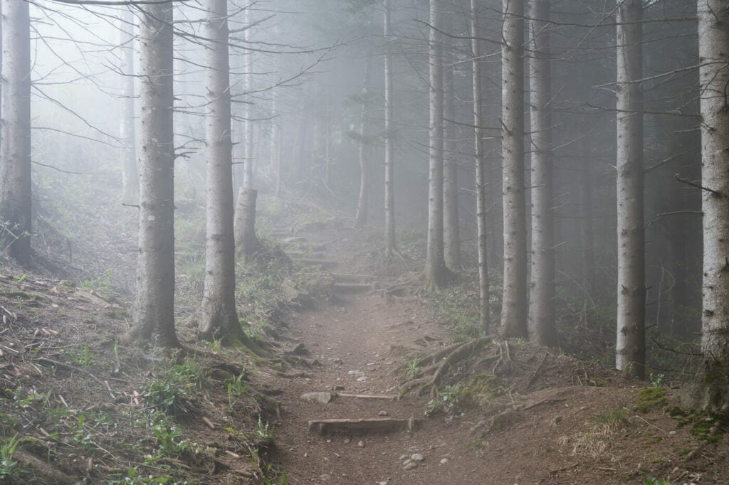
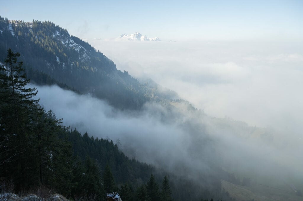
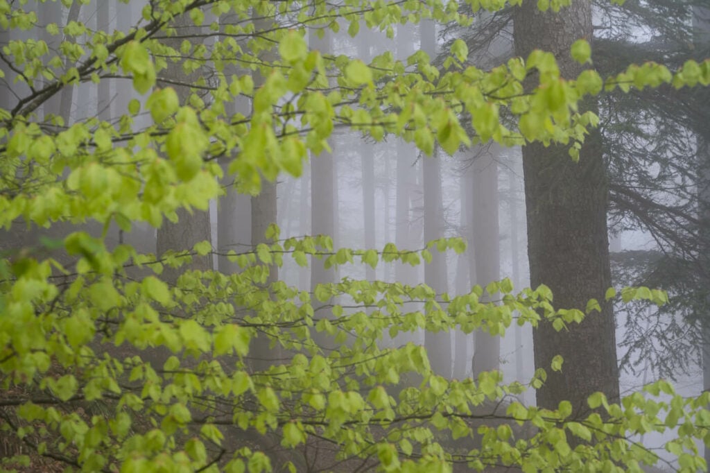
Fog along the beautiful trail up to Mount Rigi
How to Get to Mount Rigi and Parking
If you are driving, you also have the option to either park in Küssnacht at the valley station of the cable car or drive to the Seebodensalp parking and start the hike from there.
- Driving Directions: to get to the trailhead you would have to drive to the town of Küssnacht. If you are coming from Zurich or from the south you can usually reach it via the A4 highway. From Lucerne, you can just drive through Meggen to the valley station of the gondola lift.
- Parking: paid parking is available at the cable car station in Küssnacht and at the cable car station in Seebodenalp. Not particularly expensive by Swiss standards, around 1 CHF per hour.
- Public Transport: the best way to reach the trailhead is to first get to the Küssnacht train station. From there it’s a ten minutes bus ride (line 502) to the stop “Küssnacht am Rigi, Seilbahn”. If you are staying around Lake Luzern, you can also take a boat ride!
Tip: if you purchased the Swiss Travel Pass, you have free access to transportation on Mount Rigi.
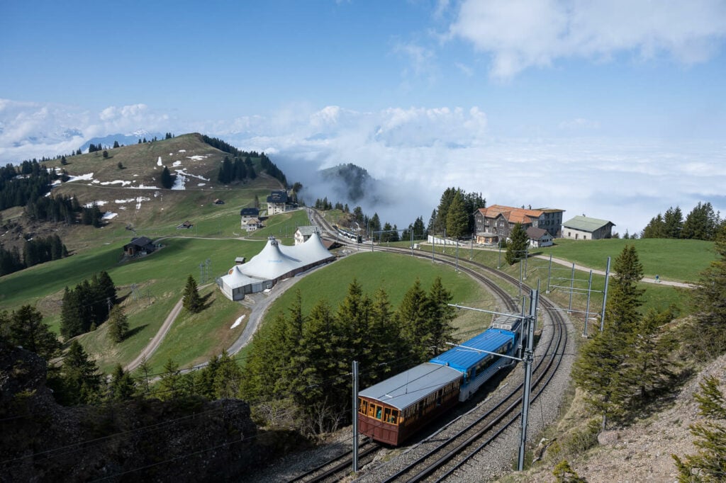
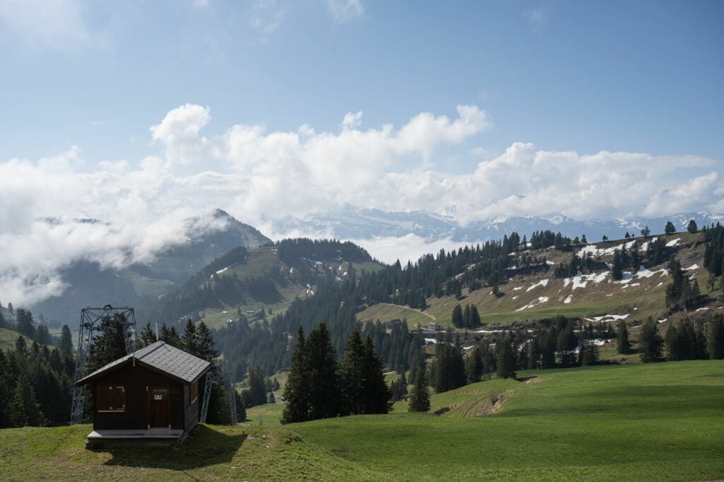
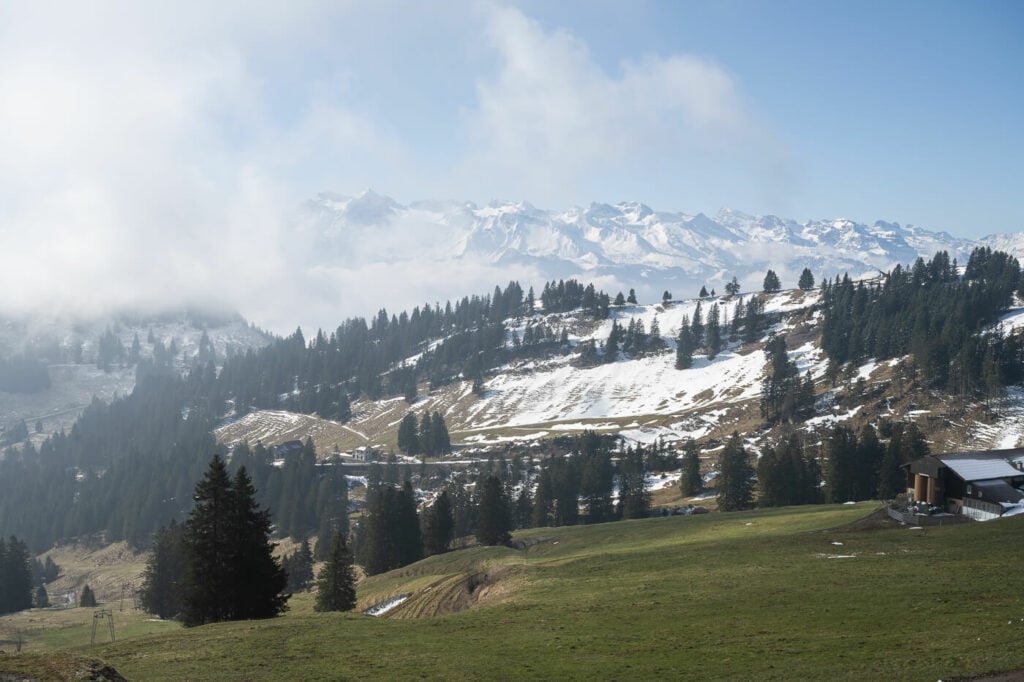
Seebodenalp with Mount Rigi in the background.
How to Hike the Mount Rigi Trail
The trail will initially pass through a residential area and some typical old-style Swiss farms, some barns and cow or sheep pastures. As you gradually and gently gain elevation, the trail will first pass through the woods. Then it will reach the Seebodenalp mountain station of the cable car. It will take about an hour to get there. Here the trail will cross a small plateau before starting to gain elevation again into the forest.
The rest of the trail will be through the forest almost all the way to the top. The trail will only emerge from the forest at the station Rigi Staffel, which is about a 15-20 minutes hike to the summit. From the Staffel station, the trail is essentially paved and follows the cogwheel train track to the top.
Rigi Staffel Station, in the middle of the picture.
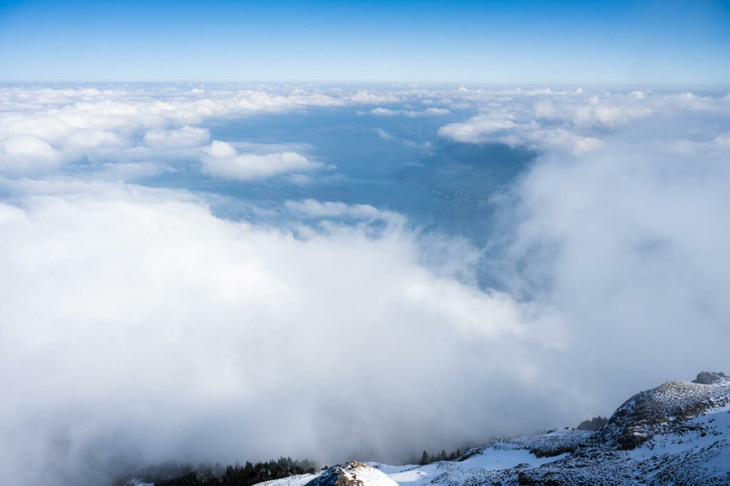
Up there you will find a fenced lookout since there is a very steep drop on the other side. From there you will get amazing views of Lake Zug, Mount Pilatus and a good chunk of the Alps to the south/south-west. there is a bar/restaurant on top so you can also enjoy a drink or a warm beverage or a full meal before heading back down.
To go back you could either take the same trail or the one that goes down along the cogwheel train tracks. Whenever I can I do a loop hike to enjoy more of the environment, so this would be my personal recommendation. This is also a great walk in the forest, with some additional panoramic lookouts on the way down.
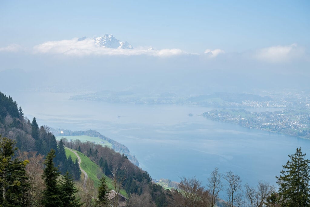
The view toward lake Zug (Zugersee)
The Mount Rigi Hike Photos and Photography Tips
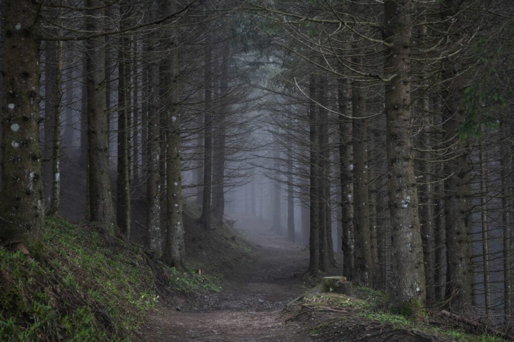
If you are into forest and tree photography, you may want to do this hike when the clouds are low around the slopes of Mount Rigi. It’s a beautiful forest and there will be several occasions to shoot moody and some sort of dark or abstract images. Sure, the views from the top are great, but the landscape is too. Though in my personal view, the walk through the forest is one of the nicest around Lake Lucerne.
Also, this is one of my favourite places to shoot when it’s foggy. It’s a completely different atmosphere and in combination with the beautiful trees in this area, I always get back home happy after a day out shooting. If you either want to catch it or avoid it, you are more likely to encounter the classic “sea of fog” from late autumn to early spring.
Also due to its position, Mount Rigi also makes for a great sunrise hike. The sun rises directly in front of the main lookout on the summit, so the view is sure to be spectacular. Your photos too, if the sky catches fire for a colorful sunrise!
Final note; assuming you are in compliance with local regulations, it is possible to fly a drone on the top of Mount Rigi. Actually, you may find several people flying one, so fly with care. This can be a crowded location.

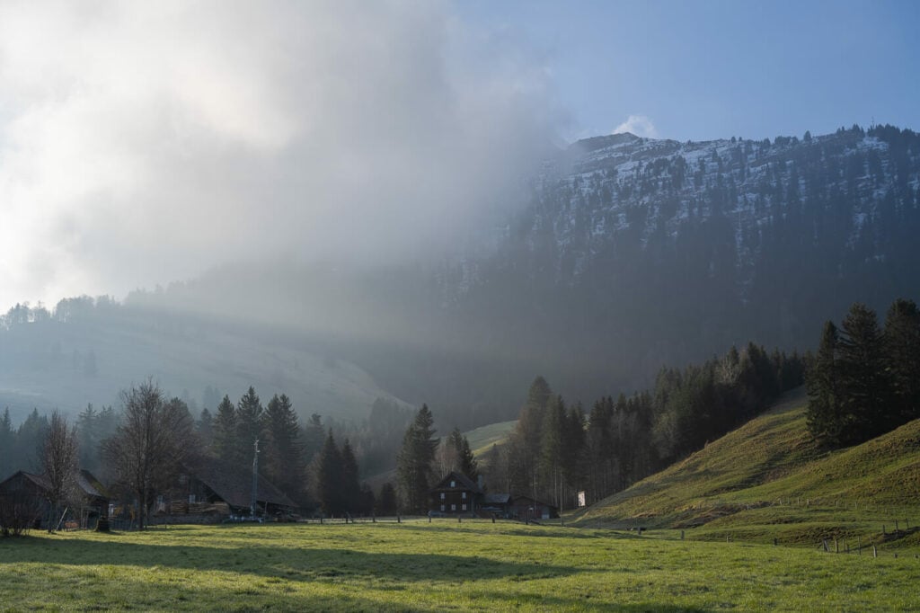
Early morning Light on Seebodenalp
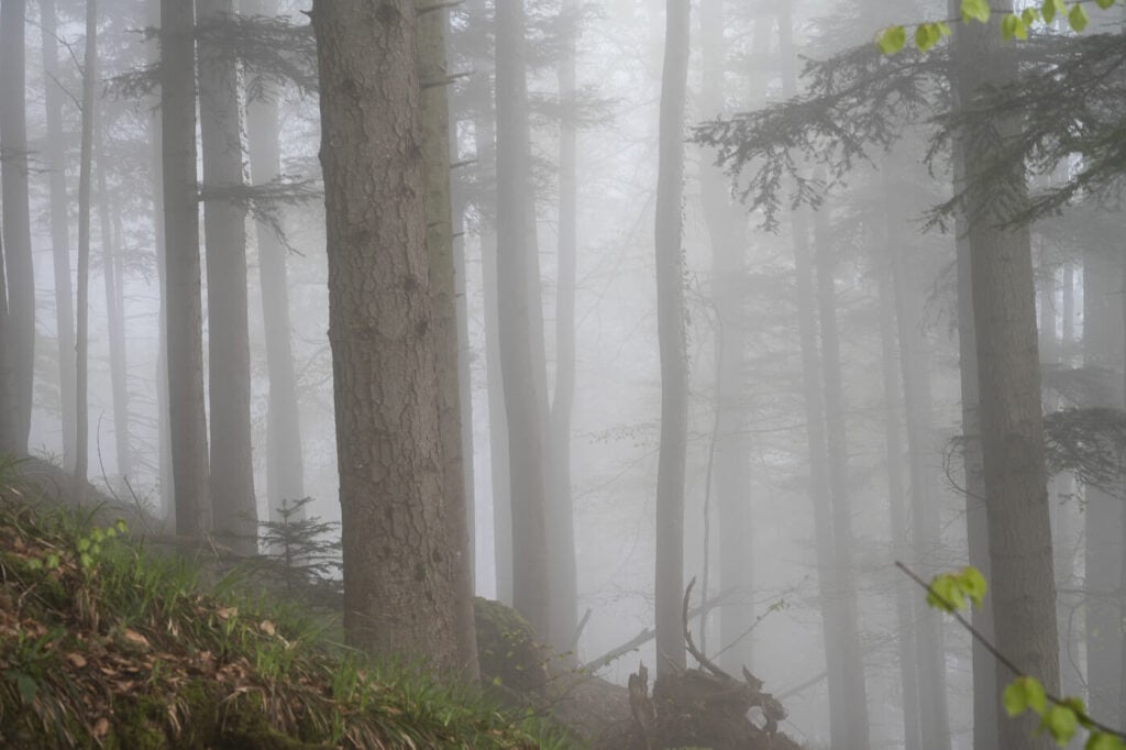
Trees and fog on the trail
More trees and fog
View from the top of Mount Rigi toward Zug and the Zugersee
View toward Mount Pilatus and the Alps from just below the summit of Mt. Rigi
View from the Staffel station toward the Alps
Mount Pilatus, in the background, emerging from the clouds

A tree in the fog on the way down the other side of Mt. Rigi.
a section of the beautiful forest along the trail
Springtime and foggy ambiance
The snowy alpine arch.
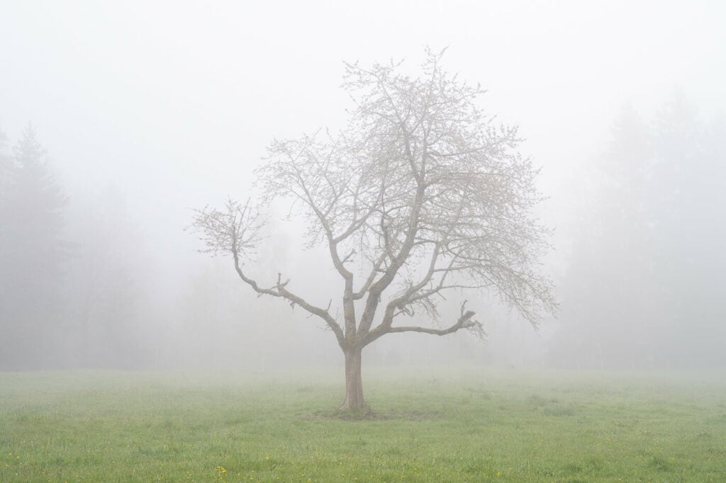
Another beautiful, lone tree in Seebodenalp

Sunbeams peeking through the fog.

Curiously shaped trees for an “almost” monochrome
View of Mount Pilatus from Mount Rigi

One of the few, beautiful old buildings around the summit of Mount Rigi
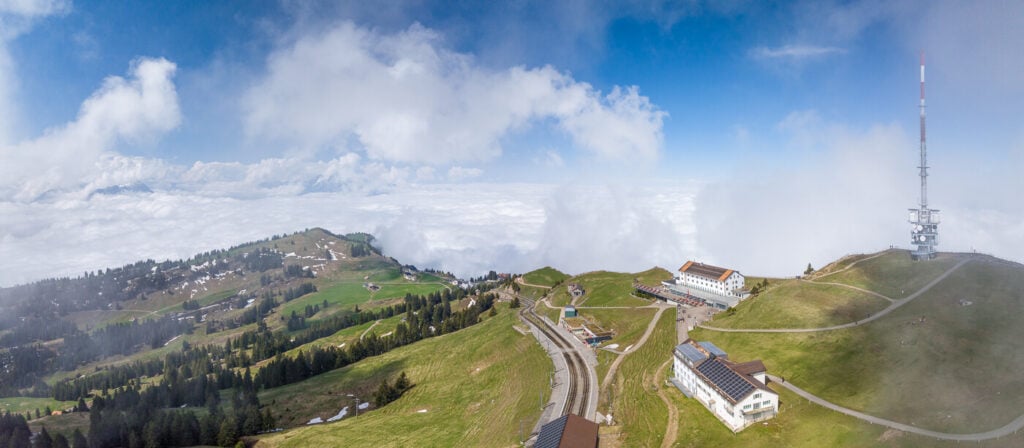
Drone Panoramic View of the Rigi’s Summit
Map of the Mount Rigi Hike
The trail is well-marked with the usual pint trail posts and is always easy to follow. You may want to download the GPS track, as there are several trails crossings along the way.
Where to stay
It’s actually possible to spend the night at the hotel at the top of the Rigi. This may be a good idea if you want to catch the Sunrise from there. Otherwise, the hike can easily be done as a day trip from either Luzern or Zurich. Or any other small town around the Rigi.
Additional Resources
- Mount Rigi actually has a few summits. For more challenging ones, check out the Rigi Stockflue and the Rigi Hochflue Hikes.
- Discover more hikes around Lake Luzern: the Hike to Mount Pilatus, Fronalpstock, Niederbauen, Stanserhorn. or the Buochserhorn.
- Check out the main Switzerland page for more hikes and an overview of hiking in Switzerland.
- You may also want to check out the Best Hikes around Lake Lucerne.


Great details. I’d rather hike up and down because I don’t like the heights on the cable cars. I’m here in Lucerne for a month and am also looking for some easier hikes between “hard” hikes. Have you ever walked around the entire lake? I was thinking it must be possible using boat rides and possibly breaking these into three or four day hikes. What do you think? I’m actually staying in Horwerstrasse and walk into Lucern when needed. Any other local recommendations would be greatly appreciated.
-Terri
Hi Terri – thanks, happy you found it useful!
On hiking around the lake: I have never do it but it is technically possible to hike around the lake using a mixture of hiking trails/roads/sidewalks. No exactly all round the perimeter of the lake, as you cannot walk around Burgenstock for instance, but it is doable in a few days. If you go for it I’d recommend planning it using a mixture of hiking apps and the Switzerland Mobility app (the latter to double check the path/trails and possible closures).
Easier hikes: good options in the area are Kriens to Frakmuntegg and back, or Alpnach to Frakmuntegg. There also are nice, easier trails in the Eigenthal area. The Seeliberg area below the Niederbauen also has some easy trails with greet views over the lake like this: https://maps.app.goo.gl/kwx89HSeQM3gKezq5.
I’d also recommend hiking up the Niederbauen from Emmetten. It’s similar to the Rigi in terms of distance but perhaps with a steeper overall gradient, but I think it’s one of the most underrated views of the lake. This is the one I am referring to: https://thephotohikes.com/the-niederbauen-hike/. there probably are still patches of snow but should be doable in the next weeks.