The Stanserhorn Hike, Switzerland
The Stanserhorn Hike offers some of the best views of the Lake Lucerne area. Looking at the Stanserhorn from the ground, this mountain does not look particularly inspiring. I’ll admit it took me three years to get on top of it, and the trailhead is a twelve minutes drive from where I live. Today, I can safely say I regret not having hiked this mountain earlier.
The mountain station of the Stanserhornbahn.
I finally decided to take this hike on one snowless winter morning, with the Stanserhorn mostly cleared of snow. I’m happy I did because the views from the top and all around this mountain are some of the best and most varied around lake Lucerne.
This is a safe bet if you are looking for a hike around lake Luzern. The hike isn’t particularly challenging, but the elevation gain is considerable, at more than 1,400m. Still, you could hike part of it by taking the cable car up and hiking down or vice versa. Whichever you choose, you are sure to enjoy the fantastic 360 degrees from the top of the Stanserhorn.
Table of Content
Overview of the Stanserhorn Hike
This is a challenging hike, mainly in terms of length and elevation gain. The trail is quite steep, especially in the second part of the hike, but there are no exposed areas.
| Max Altitude | 1,898 m |
|---|---|
| Distance | 15,9 KM |
| Elevation gain | 1,410 ↑ / 1,410 ↓ |
| Hike time | 05:30/ 06:30 Hours |
| Hike Difficulty | Hard |
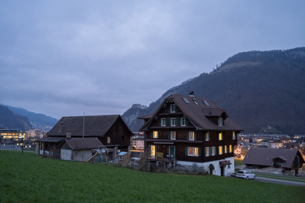
Typical Swiss houses on a cloudy winter morning.
How to Get to the Stanserhorn and Parking
Stanserhorn makes for an easy day hike from Lucerne and is easily accessible from anywhere in Central Switzerland. The trailhead is
- Driving Directions: The trailhead is pretty much the town centre of Stans. Not exactly, but right next to it. To get to stand, you would have to take the A2 Highway and exit at Stans. Keep driving to the parking area next to the Stanserhorn mountain railway (Stanserhornbahn).
- Parking: Paid parking is available at the trailhead by the old Stanserhorn train station. The parking is relatively small and fills up quickly, so it pays off to be there early.
- Public transport: the trailhead is easy to reach by public transport. You can easily get to the Stans railway station and walk to the Stanserhornbahn Parking. The walk will take about five minutes.
If you prefer to take the cable car (timetable here), there is a historical railway and the Cabriolet-Bahn, or a Cabriolet Cable Car, meaning you can actually ride the cable car on top of it.
It’s quite a fun concept. If you want to try it out, consider taking it on the way up or down. At the Kälti midway station, you must switch from the Cable Car to the Historical railway, which is also pretty cool.
Tip: the Stanserhorn cable car is included in the Swiss Travel Pass, This means if you purchased a Travel pass, your trip to Stanserhorn is already included in the price of the Travel Pass.
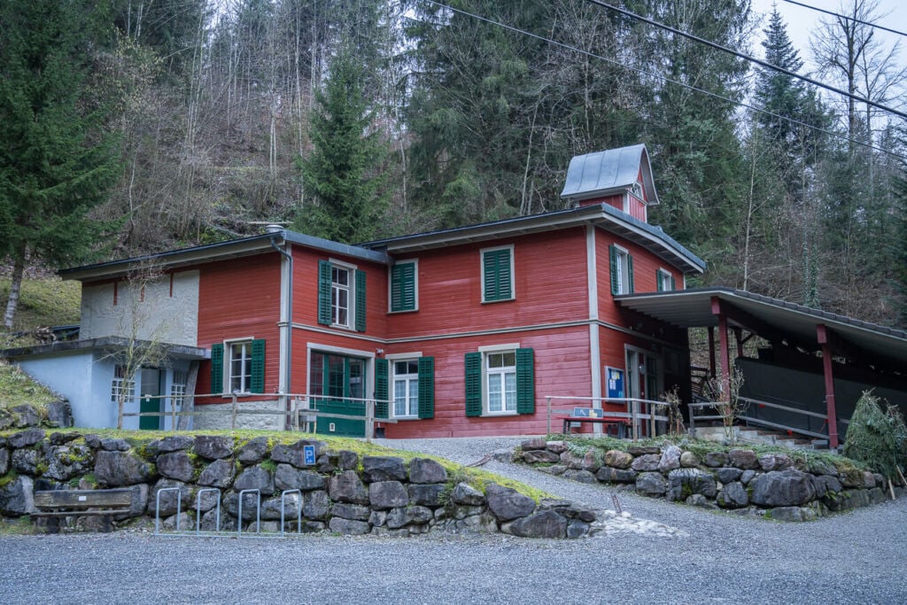
The Kälti midway station a beautiful, well-maintained historical building.
The Stanserhorn Trail
The trail starts by the parking lot and heads up the mountain next to the railway tracks. After that, it more or less follows the way up to the Kälti midway station. From there, the trail will cross a section in the woods and gradually become steeper.
Halfway through the hike, the vegetation will clear, and the steepest section begins. HThetrail also follows an old mountain railway track wthatis no longer in use. It’s also interesting to see how nature and the mountain are reclaiming that railway piece.
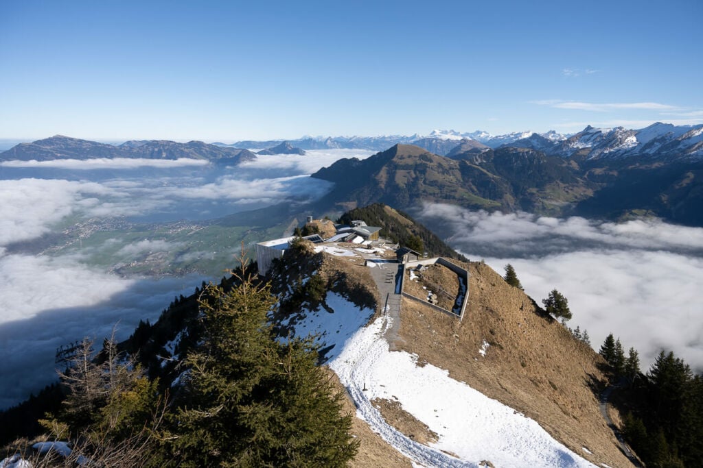
Once this steep section is over, the trail will turn around and head up the crest to the top. You’ll first pass by the Mountain station of the new Cabrio cable car. You must cross this structure to greach thesummit just behind it. You can follow the broad path that leads up to it to start soaking in the incredible views around this mountain.
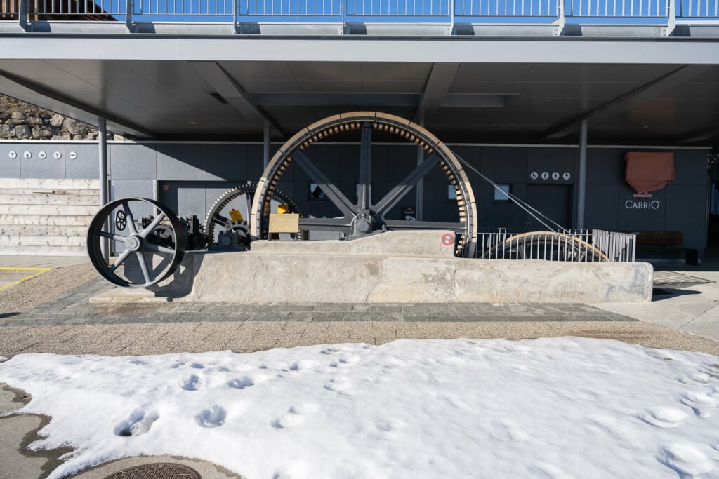
A Cogwheel by the mountain station of the Cabrio cable car.
The Stanserhorn Hike Photos and Photography tips
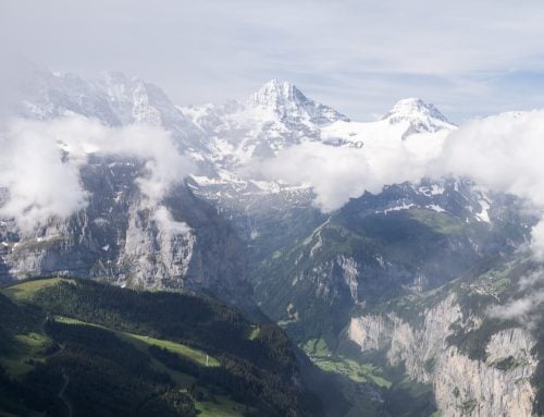
Photographically speaking, the hike’s first part does not offer much The good views start halfway up the mountain when the trail emerges from the woods. You’ll get the first views of Lake Lucerne. The views from the top are 360 degrees awesome and wide open in any direction. For this reason, there’s not much use here for a wide angle; everything will look too small. A 24-70mm lens is ideal and would allow capturing all the panoramic views around the top.
From autumn to early spring, it’s possible to capture the classic sea of fog that often appears in this corner of Switzerland. I did see it when I was there. Here are some photos from my hike.
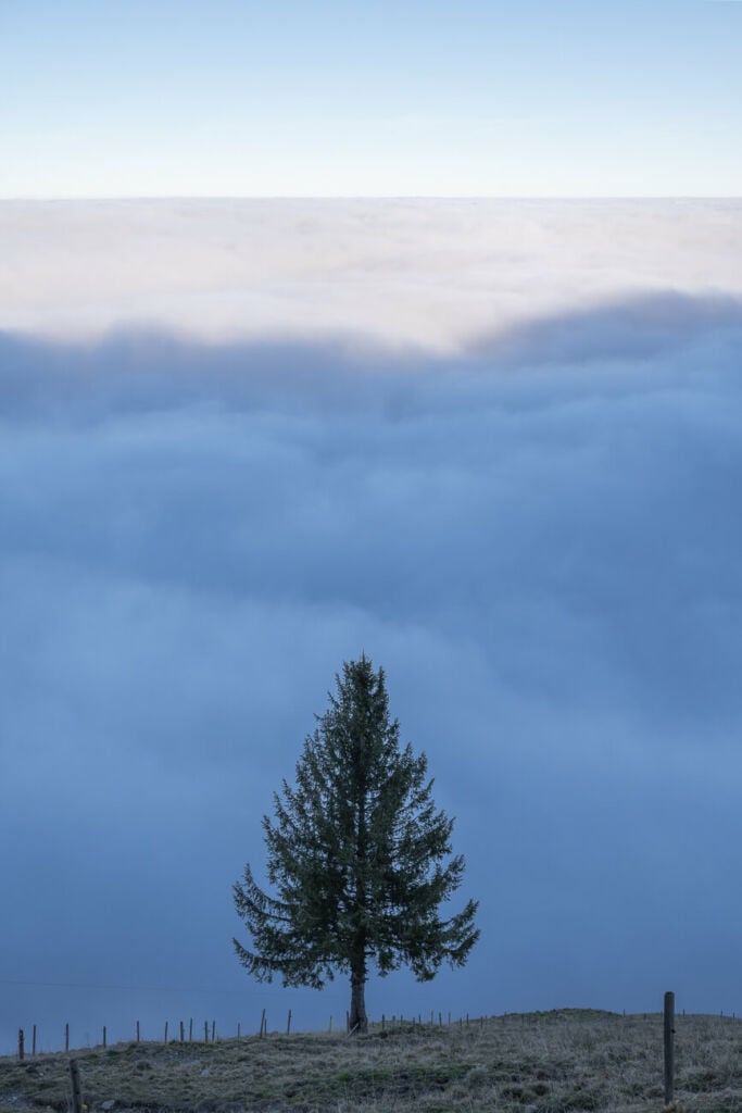
A tree emerges from the sea of fog
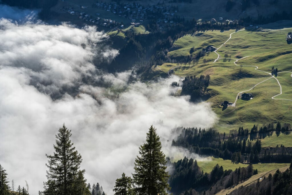
The sea of fog covering the town of Stans
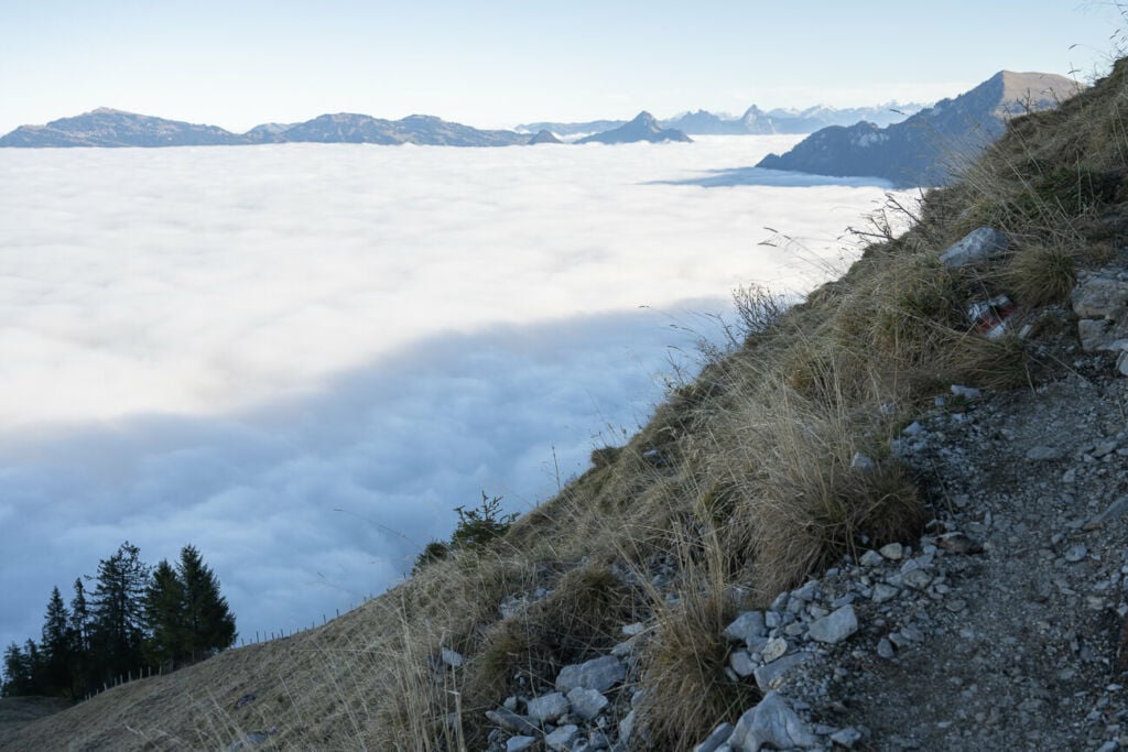
View from the trail toward the Engelbergtal, the side opposite to Stans.
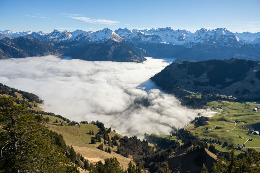
Same, but a wider view of the sea of fog above the Englelbergtal.
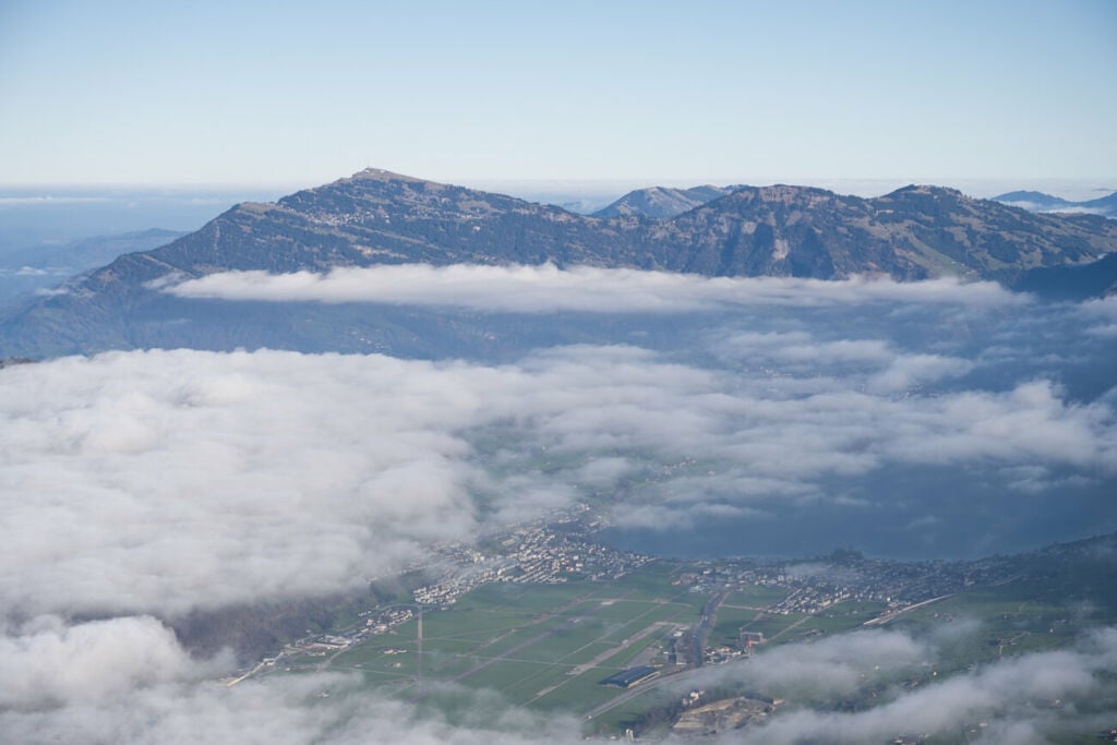
Mount Rigi
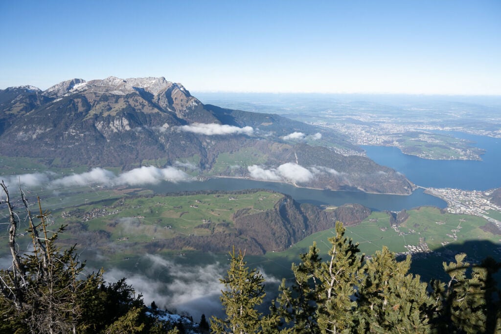
Mount Pilatus and Lucerne (on the right-hand side)
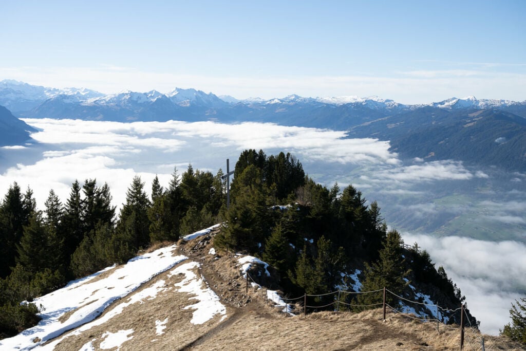
View from the top toward the west.
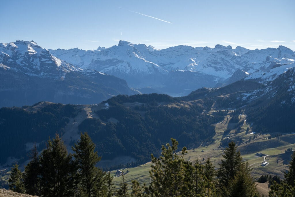
Mount Titlis in the middle
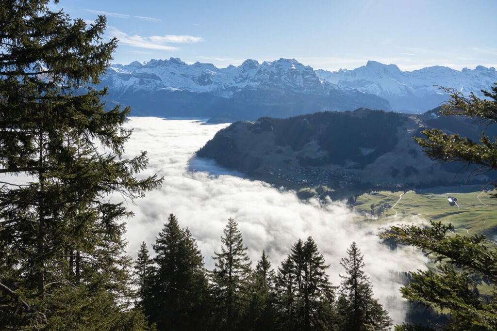
Another view from the trail of the beautiful sea of fog.
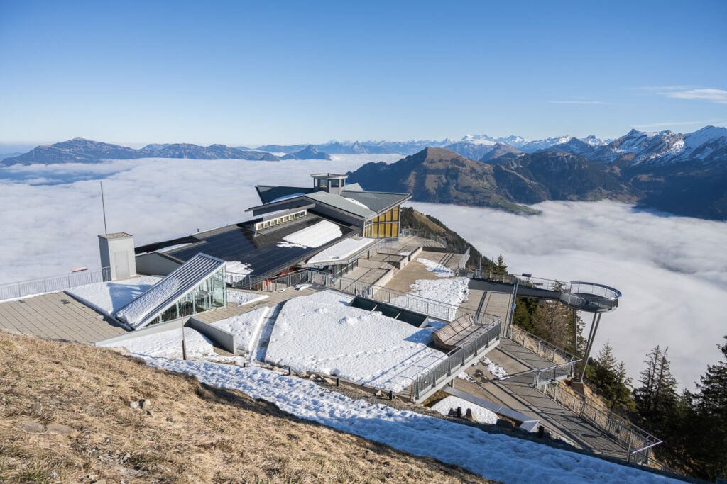
The Mountain Station of the Stanserhorn
Video of the Hike
Here is a short, silent hiking video of this hike, with a final timelapse:
Map of the Stanserhorn Hike
In typical Swiss style, the trail is well-marked and easy to follow. You don’t need a GPS track here, but the map below can give you a good idea of the elevation profile and what to expect on the trail.
Where to stay
There is a revolving restaurant on top of the Stanserhorn, but no accommodation is available there. Still, the revolving restaurant is open for dinner, and the Cable Car runs until late in Summer. Therefore if you want to experience the revolving restaurant after a day hike up the mountain and take the cable car down, you can stay overnight in the town of Stans, where plenty of accommodation is available. Otherwise, this can easily be done as a day hike.
Additional Resources
- If you are looking for other great hikes around Lake Lucerne, check out the Mount Pilatus Hike, Niederbauen Hike, Mount Rigi Hike, Fronalpstock, Buochserhorn or the Rigi Hochflue Hikes.
- Check out my main Switzerland page for more hikes and an overview of hiking in Switzerland.
- Timetable of the Stanserhorn Cabrio Cable Car
- You may also want to check out the Best Hikes around Lake Lucerne.


Excellent photography. Thank you, Jim Oregon State, USA
Thank you Jim!