The Buochserhorn Hike, Switzerland
The hike up the Buochserhorn is one of the best options around Lake Luzern. At 1,807m above sea level, it is not one of the tallest mountains in the area, but it is a rewarding and challenging hike to the top. I’d highly recommend the Buochserhorn if you are looking to spend a good day on the trail in the area around Lake Luzern away from the crowds of Mount Pilatus, Rigi, or Fronalpstock.
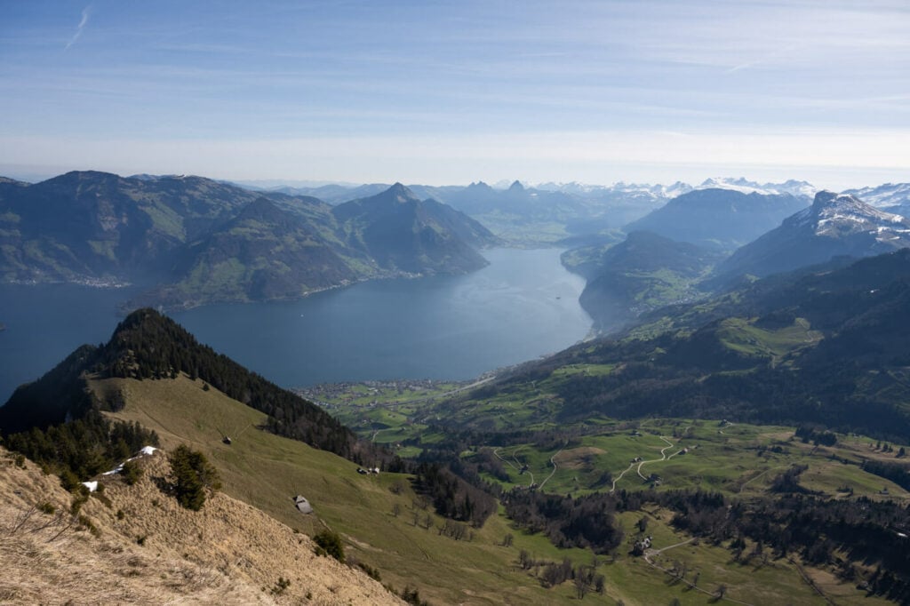
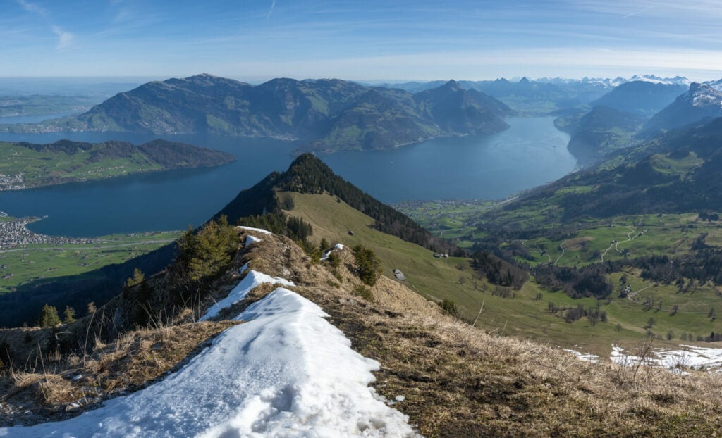
View from the Summit of the Buochserhorn toward the southern tip of Lake Luzern
A bit like the Niederbauen, this is one of the mountains with fewer infrastructures and therefore fewer people around. The whole mountain has more of a countryside feeling and there are several farms and huts along the trail to the relatively wide summit. Also, there actually are several trails leading to the top of the Buochserhorn. The option I’ll describe in this post is the one starting in the town of Buochs and going all the way up to its summit.
While this trail cannot be combined with other means of transportation, it is possible to take a cable car ride from Dallenwil to either Niederrickenbach or Musenalp and hike the rest from there. I’ll describe both options below.
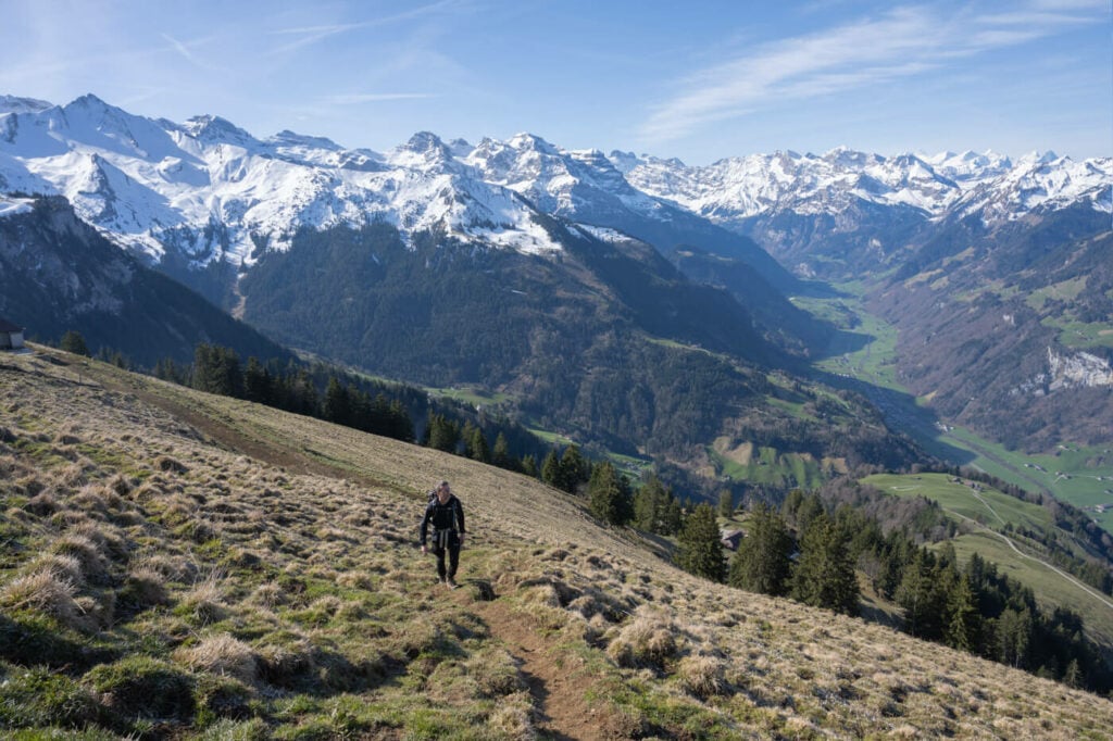
Hiking to the top of the Buochserhorn with the Engelbergtal in the Background.
Table of Contents
Overview of the Buochserhorn Hike
| Max Altitude | 1,807 m |
|---|---|
| Distance | 14,1 KM |
| Elevation gain | 1,350 m↑ / 1,350 m ↓ |
| Hike time | 5:00/ 6:00 Hours |
| Hike Difficulty | Hard |
How to Get to Buochserhorn and Parking
- Driving Directions: Buochs is easily accessible from the A2 Highway. You can take the Stans Süd exit and follow the direction to the parking areas close to the trailhead. If you want to take the cable car in Dallenwil you can take the same exit and follow the signs to Dallenwil stop at the train station.
- Parking: If you are parking in Buochs, you can leave the car either at the Turnhalle Parkplatz (paid) or at the few free spots on Obere Güterstrasse (free, but there are only a few spots). If you want to take the cable car you can park here, at the valley station of the cable car.
- Public Transport: by train, you would need to take a train to stans and from there bus 311 to Bouchs. Travel time is about 30 minutes. If you are going to Dallenwil you can get there by train. From Luzern, it takes about 20-25 minutes. Here is the site of the Cable Car in Dallenwil.
Typical Swiss landscape on the way up to the Buochserhorn.
The Buochserhorn Trail
The trail starts right after the A2 highway underpass if you park in Buochs. What I like about this and most of the trails around Lake Luzern is getting the experience of hiking from the town all the way up to the top of the mountain.
As part of this, cement and city buildings will progressively disappear as you hike up the mountain. As with most hikes you get farther away from civilization, here you can actually see the progressive change in the environment around you.
Also, shortly after the A2 underpass, you will pass by the Middle Point of central Switzerland. It’s a small building with a stone to mark the exact spot. From here the trail will alternate parts in the woods to parts on the road. In any case, it is a rather steep ascent all the way to the top. there are not many flat starches of trail on the way, so despite being shorter than other hikes, it is quite a hard one.
The trail will only become clear of vegetation high up the mountain, at an altitude of around 1,500 meters. From there you can guess the position of the summit by looking at the huge cross on top of it. The summit is rather flattish and there are also a couple of benches you can sit on to enjoy the panorama, have a snack and chill for a bit before heading back down.

Mount Pilatus, the tall mountain in the background.
The Buochserhorn Hike Photos and Photography Tips
The first part of the trail is mostly in the forest and there are not many open views. The first ones are halfway up the mountain when you get the first good views of Mount Pilatus and the Stanserhorn. From there the views will progressively get better and better. First, a view of the Engelbergtal Valley and its beautiful mountains will open up. This will make for great scenery, especially in spring or autumn when there is a little bit of snow on the top of the mountains.
The summit offers fantastic 360 degrees panoramic views of Lake Luzern and the mountains around it. This is great for Panos and also to use a telephoto lens to isolate the beautiful, farther-away mountains.
Sunny early summer days are when the turquoise waters of Lake Luzern shine at their best if you want to capture some of that color.
In terms of lenses, no real need for anything ultrawide. a 24-70 range will cover most of it. However, I’d recommend having something longer if you want to take photos of some of the beautiful peaks around the Buochserhorn. Lastly, it is not possible to fly a drone here, as there is a landing strip in Buochs.

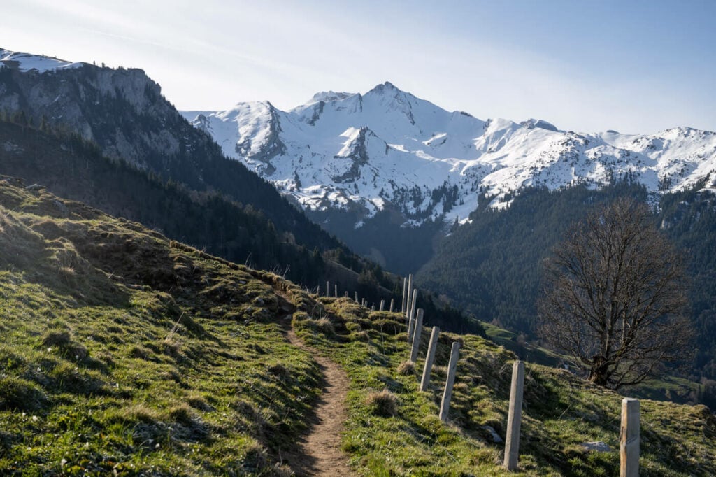
The Beautiful Engelbergtal Valley and its impressive mountains

One of the many, typical farms on the slopes of the Buochserorn
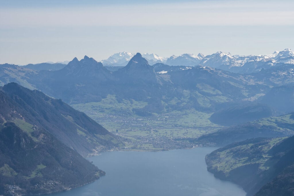
The Kleiner and Grosser Mythen, 200mm shot

Mount Rigi, in the background.
View from the Summit of the Buochserhorn toward the southern tip of Lake Luzern

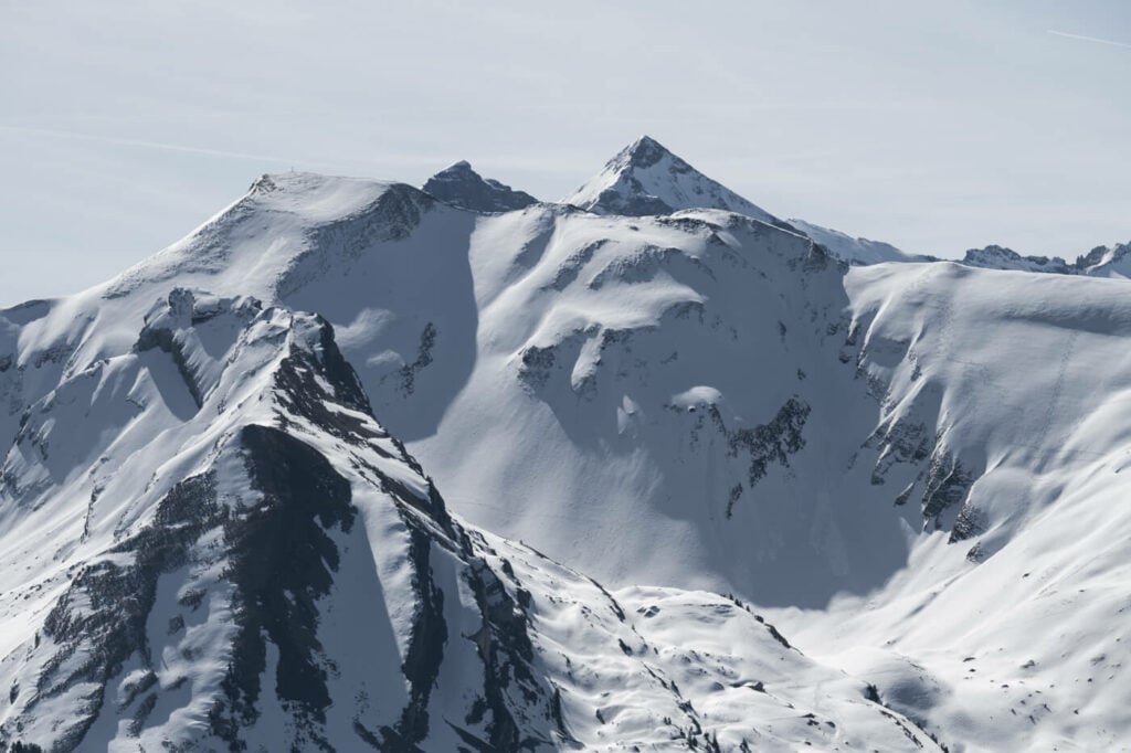
The Snow capped mountains around the Buochserhorn. Here you get great views of the 3,000+ meters tall mountains in the area.

Panoramic Imange of three vertical frames at 24mm
Map of the Buochserhorn Hike
Here is a map of the hike. You can download the GPS track from the Komoot activity.
Where to stay
There is only one accommodation available on the mountain; the Pilgerhaus Maria-Rickenbach guesthouse, on the Dallenwild side. Otherwise, apart from Buochs or Stans, I’d recommend staying in Luzern, since it is easier to reach other places from there.
Additional Resources
- Discover more hikes around Lake Luzern! The Hike to Mount Pilatus, Fronalpstock, Niederbauen, Stanserhorn or the Mount Rigi and Rigi Hochflue Hikes.
- Check out the main Switzerland page for more hikes and an overview of hiking in Switzerland.
- You may also want to check out the Best Hikes around Lake Lucerne.


Leave A Comment