The Mount Pilatus Hike, Lucerne, Switzerland
Mount Pilatus is, without a doubt, the most popular hike in Lucerne. From its height of 2,128.5m above sea level, this beautiful mountain dominates the landscape in Lucerne from almost everywhere in town.
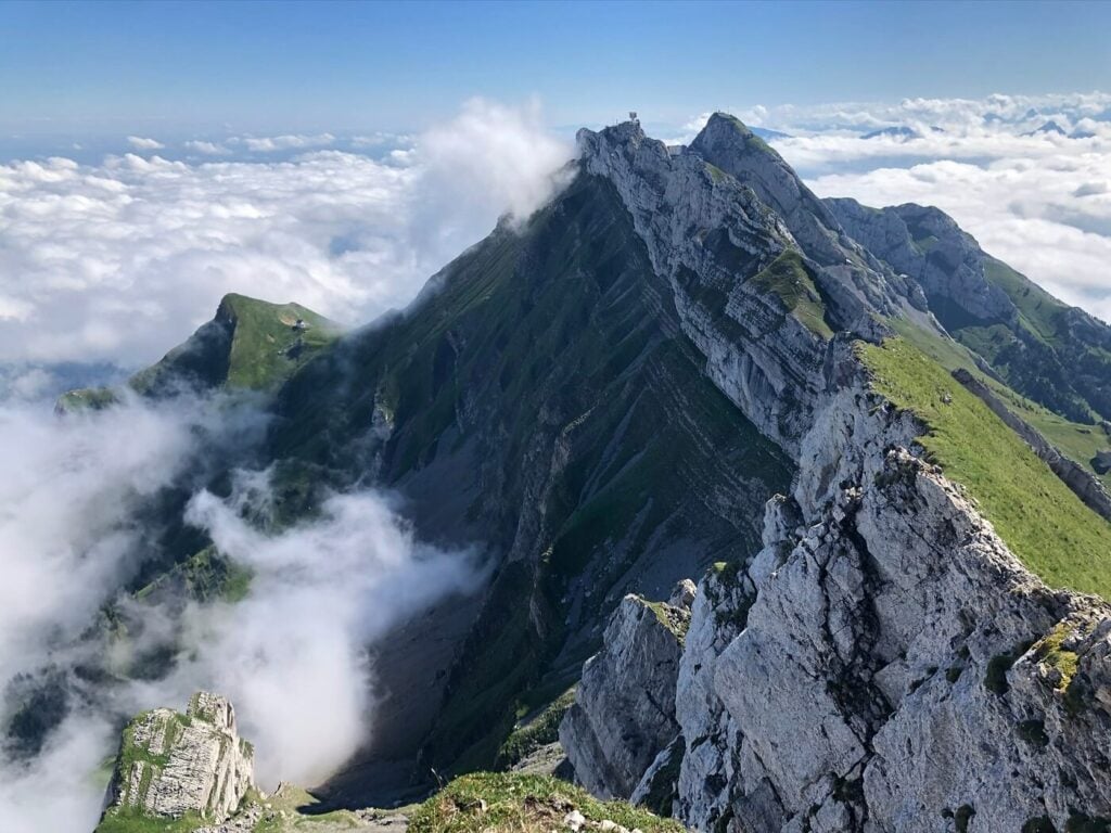
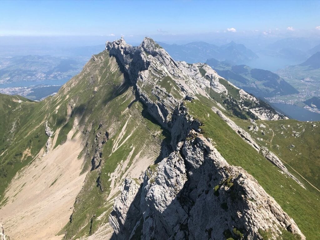
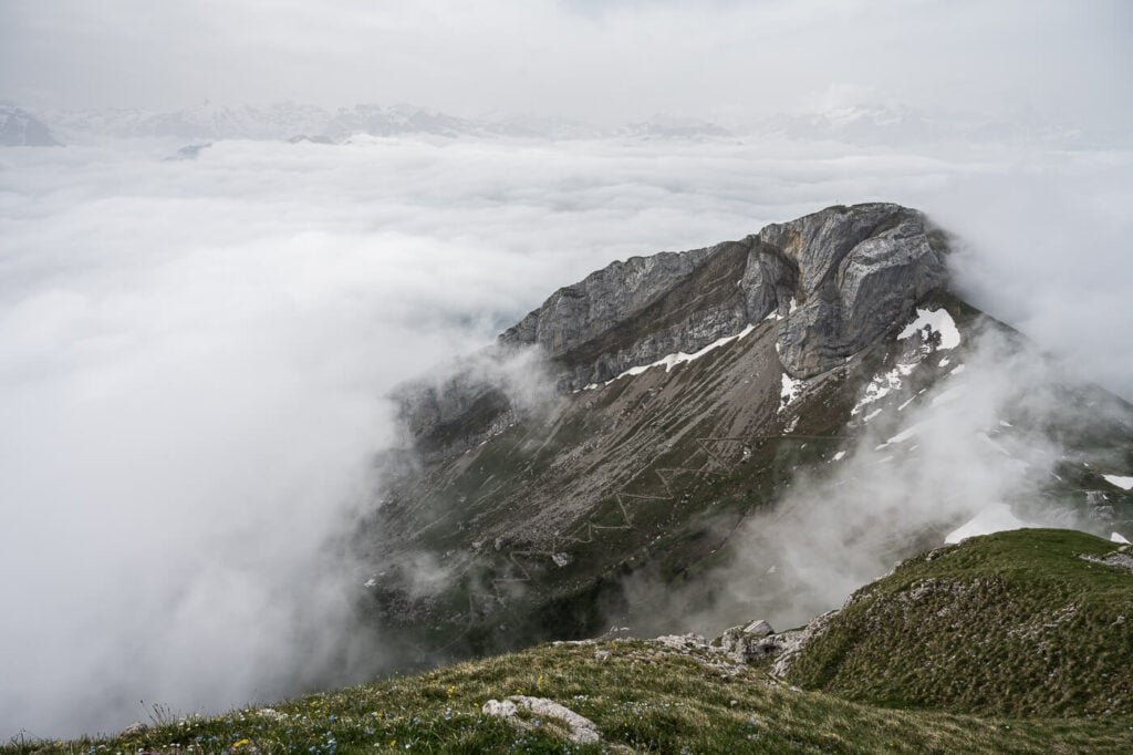
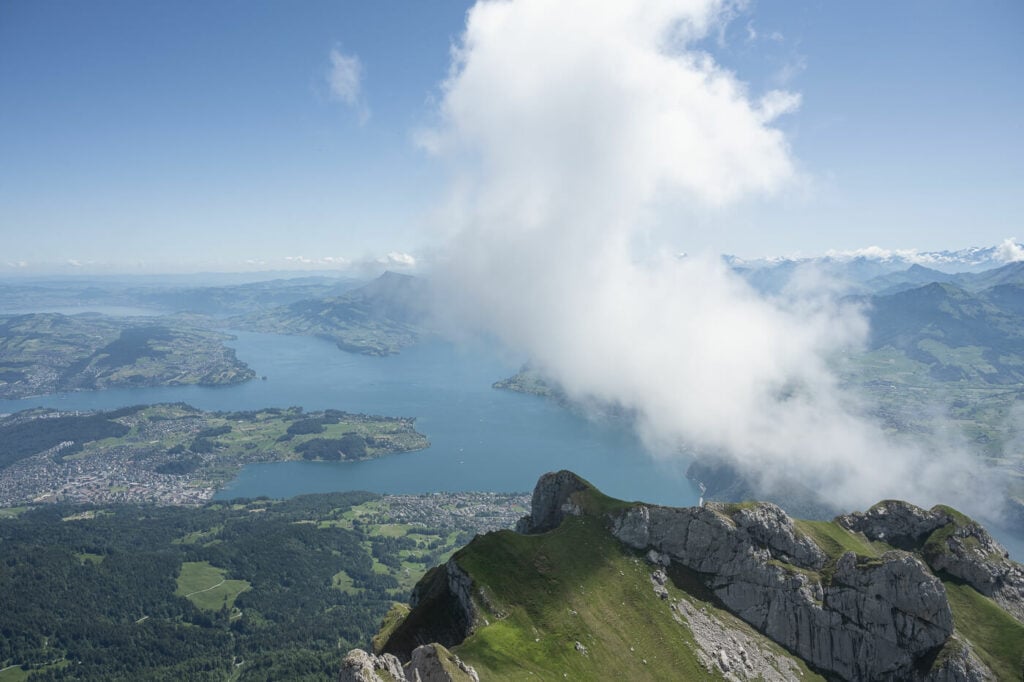
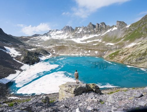
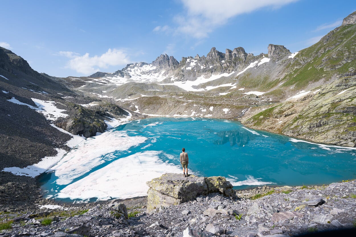
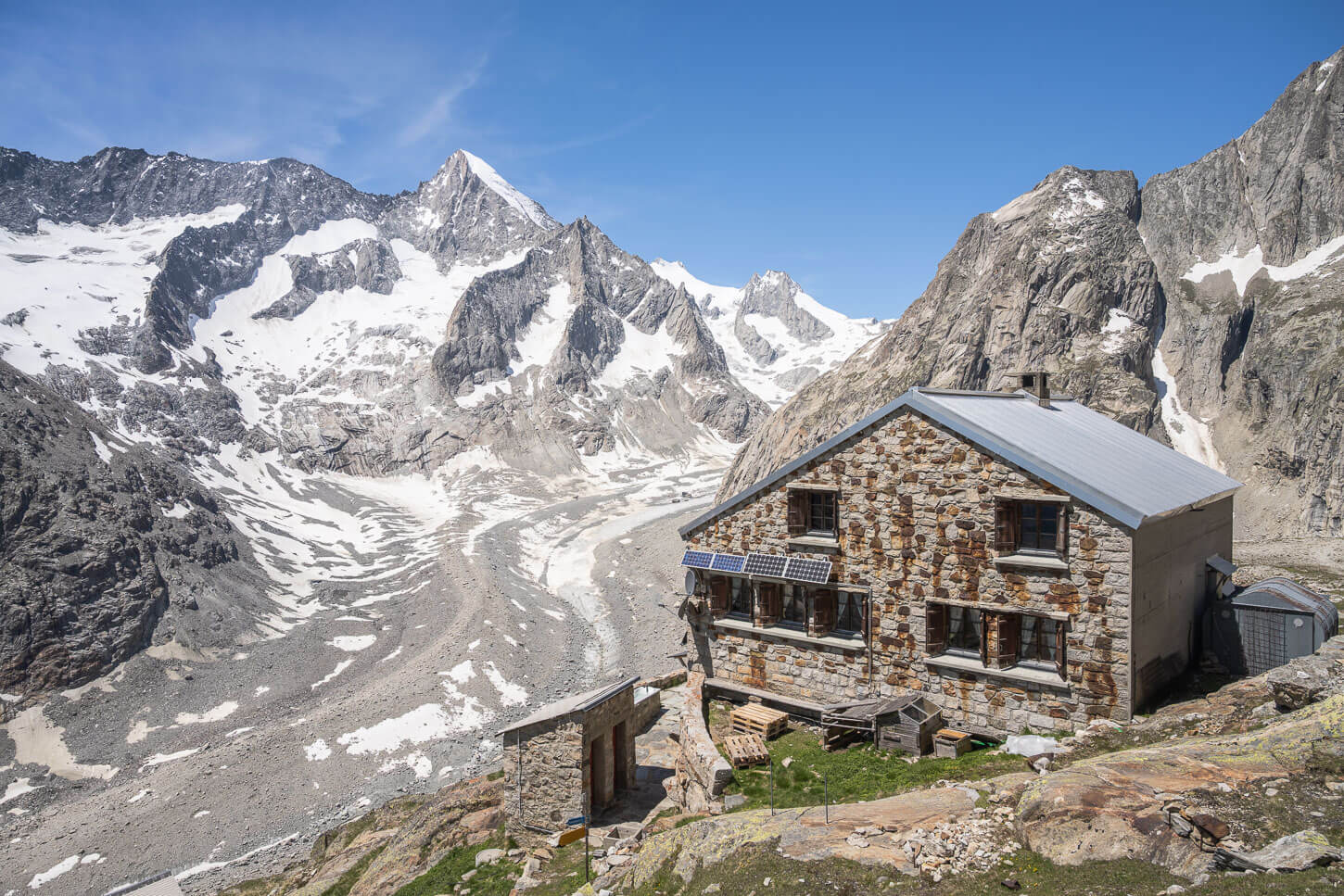
Mount Pilatus viewed from a nearby summit, the Tomlishorn.
This is a local’s favorite too. If you decide to do this hike, you’ll meet several other hikers, trail runners or just families enjoin the outdoors. It is easy to see why, mount Pilatus is a sort of “backyard” mountain here in Lucerne. This is also the city where I currently live and the Pilatus is a mountain I visit very often.
So how do you get to the top of Mount Pilatus? Apart from the Cogwheel train in Alpnach and the Cable Car in Kriens, you can also hike all the way to the top.
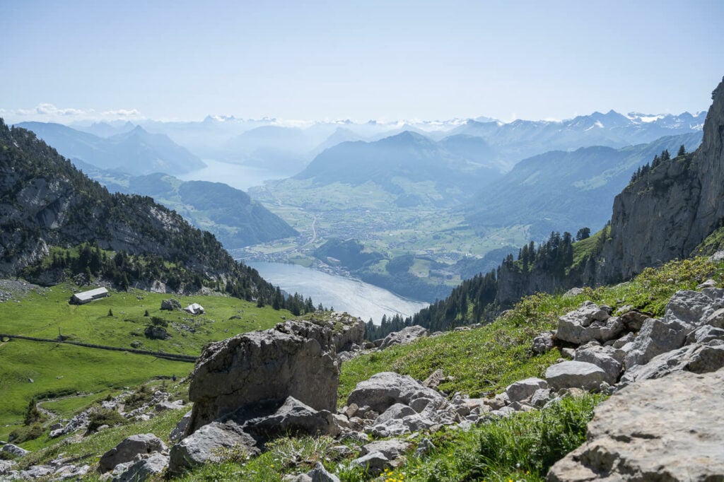
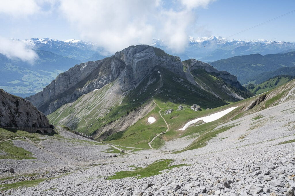
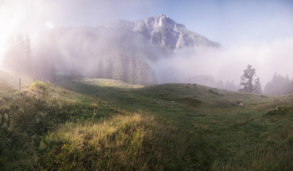
Panoramic view from the Alpnach-Pilatus hike
Actually, there are actually several different ways you can hike up Mount Pilatus, not just one. Some trails are more challenging and some a little easier, and we’ll take a look at the most popular ones. Whichever trail you end up taking, you should be prepared for a long day in the beautiful outdoors.
Table of Contents
The Mount Pilatus Hike(s) – Several trails to the top
As mentioned in the intro, there are several possible ways to hike up Mount Pilatus. Not only that but there also are connecting trails that will allow you to take any detour you want or take different routes for each. This will allow you to plan and tailor your hike to your preferences.
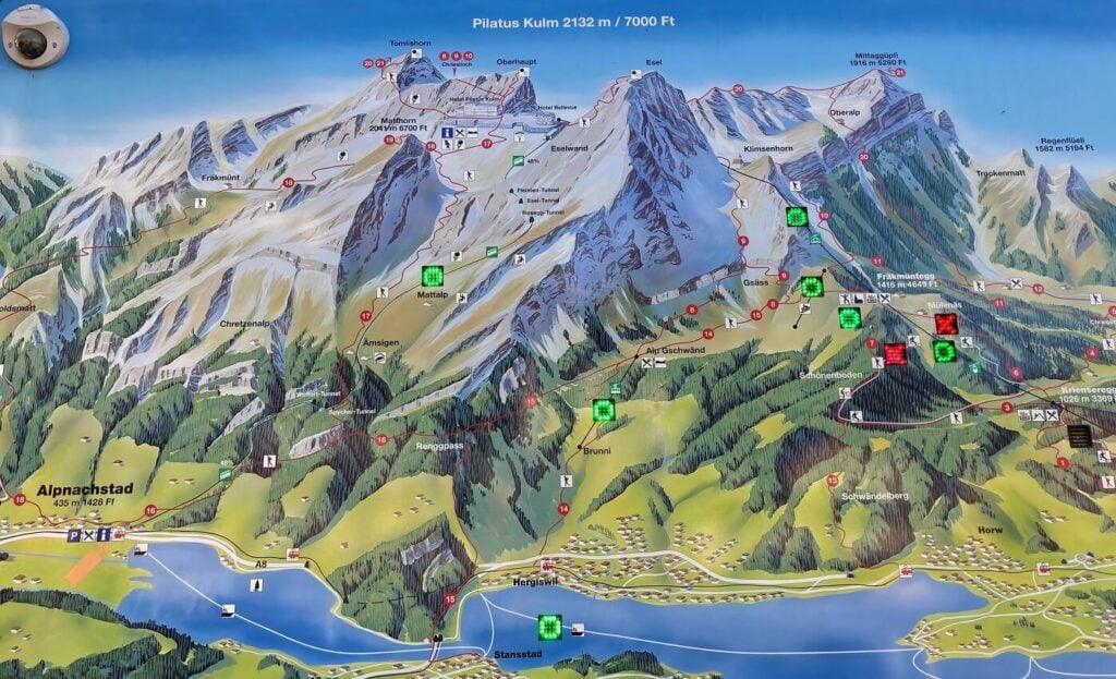
Map of the Mount Pilatus Trails, Alpnach/Hergiswil Side.
The hike is generally possible from late spring until mid-late autumn or when the first snow falls on the mountain. the best season is probably early summer when the grass is at its greenest
Please note, the hike to the top of Mount Pilatus is not possible in Winter, The snow and the ice makes it extremely dangerous to hike the last few steep slopes leading to the top.
Still, you should be able to hike (or even snowshoe!) to or around the middle stations, like Fräkmüntegg.
Now, without further ado, here are the best trails leading to the summit of Mount Pilatus.
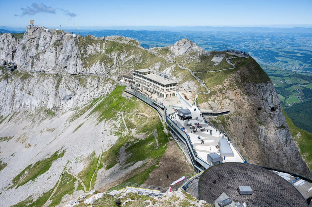
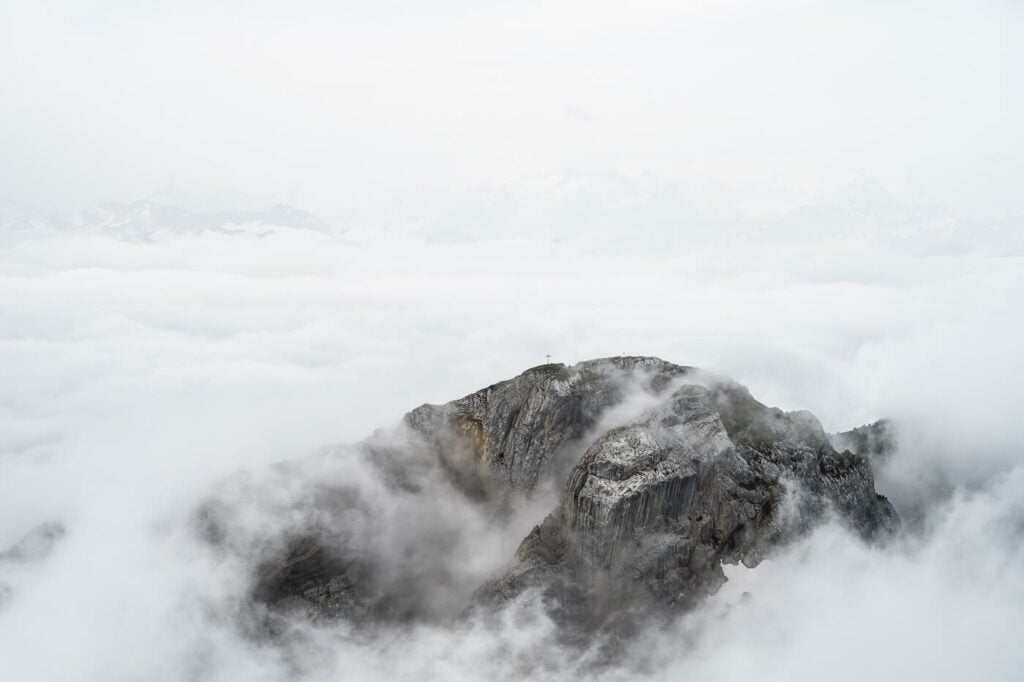
View from the top of Mount Pilatus
Alpnach – Ämsigen – Pilatus
This is probably the most popular option with tourists. Also, most of the reports from other blogs in English I have seen just report on this hike.
Probably also because Alpnach is very easy to reach by train from Lucerne, but also by boat in what is known as the Golden Round trip (Leaving Lucerne by boat, taking the cogwheel train to the top, and descending with the Kable car to Kriens, where you can take the bus back to Lucerne).
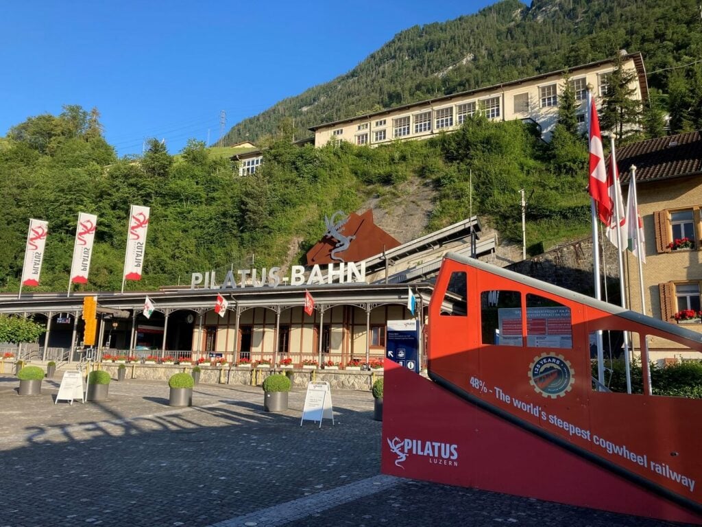
The Pilatus Train Station (Pilatus Bahn) in Alpnach
Back to the hike; it surely is a nice, long day hike and also the least technical. Still, the trail is relatively steep and the ascent is relentless, meaning you will not come across many flat stretches along the trail. The trail loosely follows the railway up the mountain, so you will see the trains a few times, which is a nice addition to the hike.
If you want to hike part of the trail, you also have the option to take the cogwheel train to the middle station Ämsigen and continue from there.
The last section of the trail coming up from Alpnach, with the Matthorn in the background.
This is the only trail that approaches the summit from the south, but like all other trails, you’ll have to cross a scree section just before getting to the summit.
How to Get to the Pilatus Hike Trailhead in Alpnach from Lucerne
The best and easiest way to reach The trailhead in Alpnachstad PB is by far the train connection. From Luzern Bahnhof, there’s a train every half an hour (.12 and .42, as of 2023). The trailhead is right next to the railway. Paid parking is also available.
Alpnachstad – Pilatus Hike time, Distance, Elevation gain, and Map
- Hike time: 7:00/ 8:00 hours
- Distance: 17.4 Km
- Elevation gain: 1,620m
Kriens – Krienseregg – Fräkmüntegg – Pilatus
This is a very popular route with locals, probably the most popular. Very easy to reach, it also allows you to break the hike into several different legs and combine it with cable car rides if you wish to do so. For instance, you can ride the cable car to either Krienseregg or Fräkmüntegg and continue on foot from there.
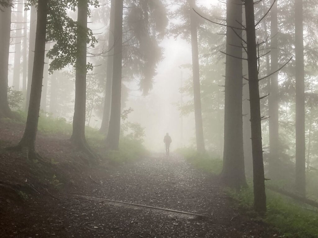
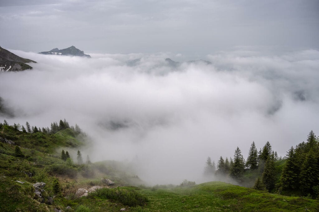
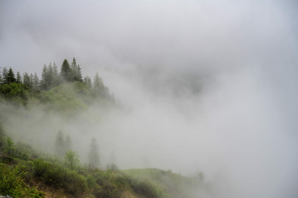
A hiker n the fog between Krienseregg and Fräkmüntegg
The first part of the trail is relatively “urban” as it passes through a residential area in Kriens. Soon though you will pass by a couple of farms and the trail will gradually turn into a proper mountain trail, passing the occasional gravel road until Fräkmüntegg.
Here the trail is well maintained but presents a few challenges between Fräkmüntegg and the summit. This is probably the most technical as there are a few moderately exposed sections and chains to pull yourself up in some steep sections. So it is a fit for the more experienced hikers.
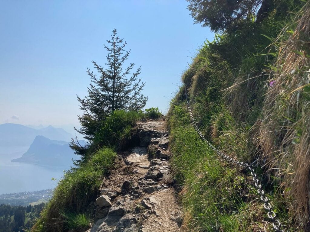
One of the exposed, steep sections of the trails after Fräkmüntegg
Once past this section, you’d have to tackle the last bit, which is mostly scree, before reaching the main arrival area bu the train/gondola station. From there it’s a short walk to the top.
How to Get to the Pilatus Hike Trailhead in Kriens
The trailhead, as well as the cable car station, is easily reachable with Bus 1 from Luzern Bahnhof’s train Station. Paid parking is also available.
Kriens Pilatus Hike time, Distance, Elevation gain, and Map
- Hike time: 7:30/ 8:30 hours
- Distance: 19.9 Km
- Elevation gain: 1,640m
Eigenthal – Pilatus (Heitertannliweg)
Also called Heitertannliweg, this trail starts in Eigenthal and it’s a little harder to reach. This is also the shortest and more “rural” option out of the four hikes mentioned in this post. Also, this route cannot be combined with any other form of transportation, meaning you cannot take a cable car ride back to the trailhead, you’d have to hike back down.
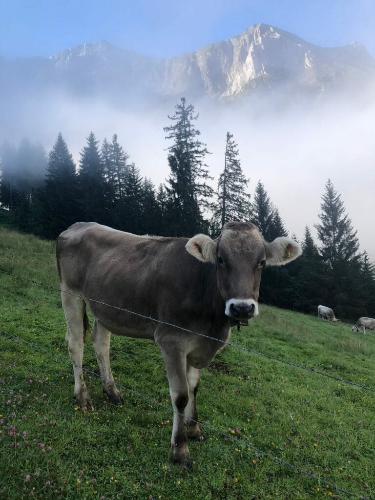
A cow in one of the pastures of the Eigenthal-Pilatus trail
The route is initially mostly on a dirt gravel road, and it turns into a proper mountain trail as it approaches a small farm around half of the trail.
From there, the trail gets steeper and there are a few passages you may need to help yourself with fixed chains. This part of the route is relatively technical but nothing too difficult.
View from the trail to Mount Pilatus on a foggy and moody day
The last bit of the trail joins the same scree section you’d have to cross when hiking up from Kriens or Alpnach, just below the Klimsenhorn by the Klimsenkapelle – a small chapel built under a smaller summit of Mount Pilatus.
How to Get to the Pilatus Hike Trailhead in Eigenthal
Paid parking is available in Eigenthal. You can also reach the trailhead by taking PostBus 71 (or 211 as an alternative). You can PostBus Pilatus line timetable here.
Eigenthal – Pilatus Hike time, Distance, Elevation gain, and Map
- Hike time: 5:30 / 6:30
- Distance: 12 Km
- Elevation gain: 1,080m
Hergiswil – Alpgschwänd – Pilatus
Out of the four options present here, the hike from Hergiswil is probably one that makes sense if you are either staying there or visiting Hergiswil.

View of Hergiswil, the town down below by the lake. Here you can see the Trail from Hergiswil (right-hand side) joining the one from Fräkmüntegg (left-hand side).
You can start his hike directly from the Hergiswil train station. You also have the option to combine it with a cable car ride up to about 1/3 of the way up Mount Pilatus.
The cable car in this case is the Seilbahn Brunni-Alpgschwänd, and there is also a restaurant. If you are driving you can also park the car at the valley station of the cable car, ride up and start the Hike from the Alpgschwänd.
From there, the trail goes through some woods and some meadows, before merging with the same trail you would take if hiking up from Kriens/Fräkmüntegg – the same scree section that begins by the Klimsenhorn/Klimsenkapelle.
The Klimsenhorn and Klimsenkapelle – the last small summit in the distance.
How to Get to the Pilatus Hike Trailhead in Hergiswil
You can either start the Hike directly from the Hergiswil train station and hike your way up. Paid parking is also available in Hergiswil.
Hergiswil – Pilatus Hike time, Distance, Elevation gain, and Map
- Hike time: 7:00/ 8:00 hours
- Distance: 17 km
- Elevation gain: 1,630 m
The Mount Pilatus to Tomlishorn Hike
One of the best things to do on Mount Pilatus is a hike to another nearby summit, the Tomlishorn. This is a short, mostly flat, two kilometers hike each way to a nearby summit. The Tomlishorn offers fantastic views of Mount Pilatus and the Emmental Alps, as well as of the surrounding area.
View of mount Pilatus from the summit of the Tomlishorn on a sunny day.
The trail is well-maintained and is actually more of an easy ridge walk. Whether you took the cable car or hiked all the way to the top, I’d highly recommend visiting the Tomlishorn too.
The Mount Pilatus Hike Photos and Photography Tips
Each one of the four trails offers different views but for the first part, all of them will offer fantastic views of Lakes Lucerne and its surroundings from different perspectives. The same applies to different seasons of the year. The photos in this post have been taken across three different years from Spring to Autumn, so hopefully that will give you a good idea of what to expect.

Lone tree on the trail from Kriens, late spring.
Sunrise on the trail to the summit from Eigenthal, Early Autumn.
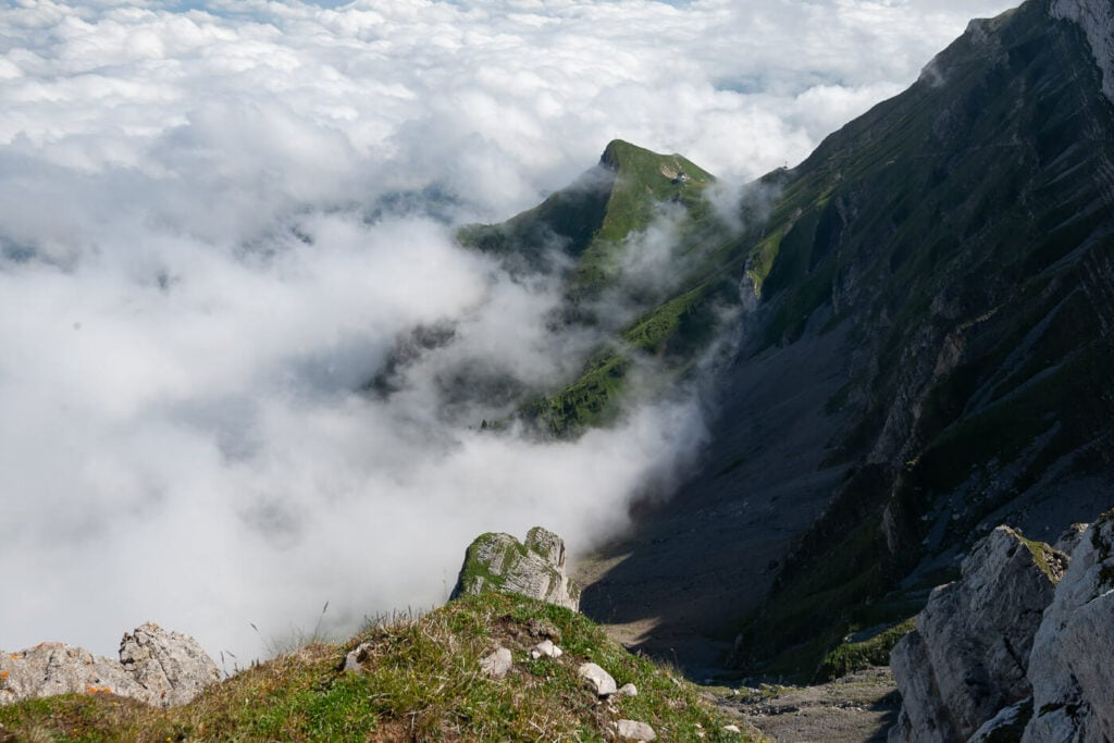
If you want to catch the “sea of fog”, the best time to catch it is usually late spring or early autumn. You’d be able to also catch the surrounding peaks like the Matthorn and Klimsenhorn emerging from it, like small, rocky islands.
Mount Matthorn emerging from the sea of clouds in late spring.
Another Detail of Mount Matthorn
Also, the Pilatus’ “stairs” shot, with a view of the city and the lake is a classic one.
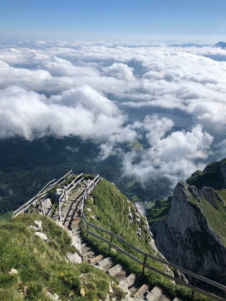
The last set of “stairs” leading to the Mount Piltus summit, summer.
If you made it to the Tomlishorn you will also have a bit of a better foreground and lines to photograph Mount Pilatus.
If you are staying at the hotel on Mount Pilatus, you should have no problems catching the sunset, sunrise and doing some astrophotography there as well, if the skies are clear.
Trees in the fog.
Mount Pilatus viewed from a nearby summit, the Tomlishorn.
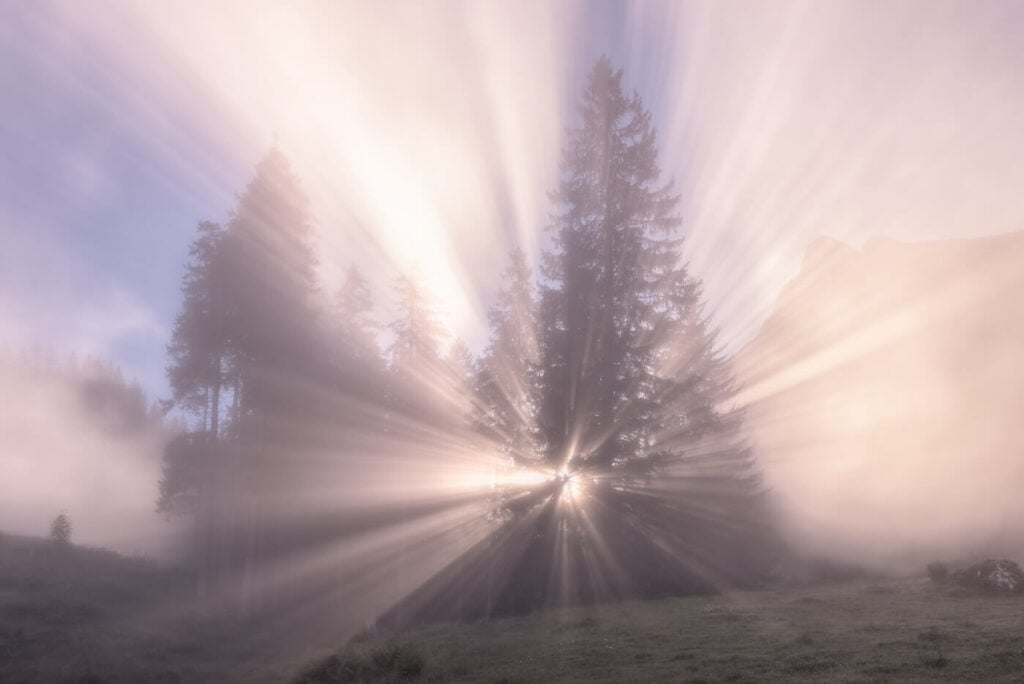
light peaking through the trees and the mist on a early morning hike.
Panoramic view from the Alpnach-Pilatus hike.
View from the summit of Mount Pilatus to the north-east.
Tips to Enjoy your Mount Pilatus Hike Day
Here are a few fun, additional tips to make your day on Mount Pilatus even more enjoyable.
Ibex and Alpenhorn on Mount Pilatus
It is sometimes possible to spot Ibex on Mount Pilatus. They do reside in the Emmental Alps, so that includes Mount Pilatus too. Based on my experience the best chances are in Late Spring and early summer. I have seen them a couple of times.
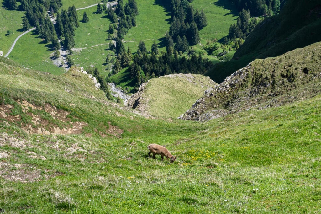
A young Ibex grazing on the green slopes of Mount Pilatus.
Also, especially on weekends, it may be worth hanging around to see if there is anyone playing the Alpenhorn. I’m not sure what the schedule is, but I’ve always seen them on weekends. It does not get more Swiss than this, apart from a yodeling competition perhaps!
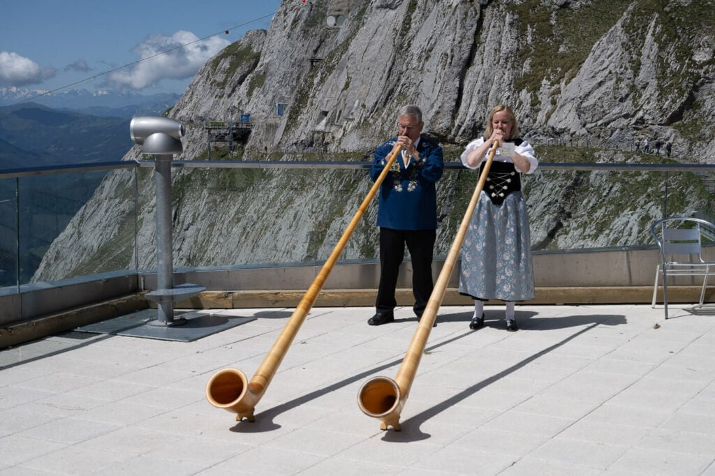
Alpenhorn Players on Mount Pilatus
Mount Pilatus Webcam Selfie
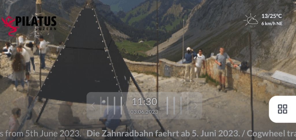
You may not know there is a Webcam on top of Mount Pilatus. This webcam takes a shot every ten minutes, on the clock. This is something I always do whenever I hike up there. Sort of a rite and have several “Pilatus Selfies” from the webcam.
Essentially you can position yourself in the field of view at 10:00 am for instance, wait for the camera to take the shot (it is a very visible and noisy device) and then take a screenshot once it is available on the website. Keep in mind, you have just ten minutes before the next shot is uploaded :)!
One of my own selfies on mount pilates – I’m the first on the right-hand side.
Swimming in Lake Lucerne – Ufschötti Park
If I can think of the possible best ways to end a hike, apart from a cold beer :), a refreshing dip into a lake would top the list. This is actually easier done than said in Lucerne, and a sort of rite after each hike for me.
My favorite spot is Ufschötti Park, which is a short 10 minutes walk from the train station. Easily reachable from everywhere in Lucerne, this park has a small beach and a nicely maintained lawn where you could also grill.
While it can get relatively crowded on hot summer days, you’ll always find a quiet spot. This is the perfect location for a refreshing swim in the lake, straight from the trails.
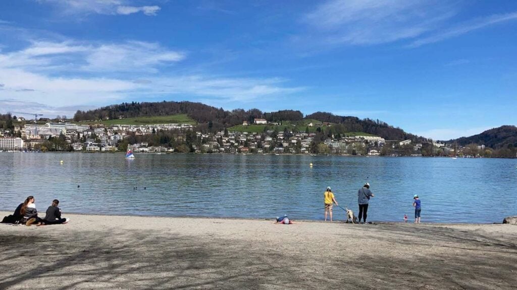
Ufschötti park in Luzern on a sunny spring day
Where to stay
Apart from the obvious choice of Luzern, you can also stay on Mount Pilatus. There actually are two Hotels on top of Mount Pilatus, the Pilatus-Kulm Hotel and the Hotel Bellevue. these are great options if you want to see Sunset, Sunrise or the high-altitude starry sky at night.
Lucerne is a very tourist town and has plenty of hotels you can choose from. Also, a Hostel, located close to the beautiful Ufschötti Park. This is the option that makes the most sense if you also want to visit Lucerne’s Altstadt (the old town); plenty of choices for an evening out.
Hergiswil and Alpnach are also good options if you want to stay in a quiet location.
Booking.comAdditional Resources
- Discover more hikes around Lake Luzern: the Hike to Fronalpstock, Niederbauen, Stanserhorn, the Mount Rigi Hike or the Rigi Stockflue and Rigi Hochflue Hikes.
- Check out the main Switzerland page for more hikes and an overview of Hiking in Switzerland.
- You may also want to check out the Best Hikes around Lake Lucerne.


Leave A Comment