Hike to Mannen – Lofoten Islands, Norway
The hike to Mannen could be described as a synthesis of everything the Lofoten can offer to hikers. Views over white sand beaches, crystal clear waters, steep cliffs with great views, and a fun hike! Sheep, also :).
Mannen is probably the shortest and most accessible hike I’ve been to in the Lofoten, and it’s one I would recommend to anyone visiting for the first time.
It is also easy to combine it with other short hikes in the area on the same day if you are up to it. It’s definitely doable to combine this hike with Veggen or Offersøykammen, for instance.
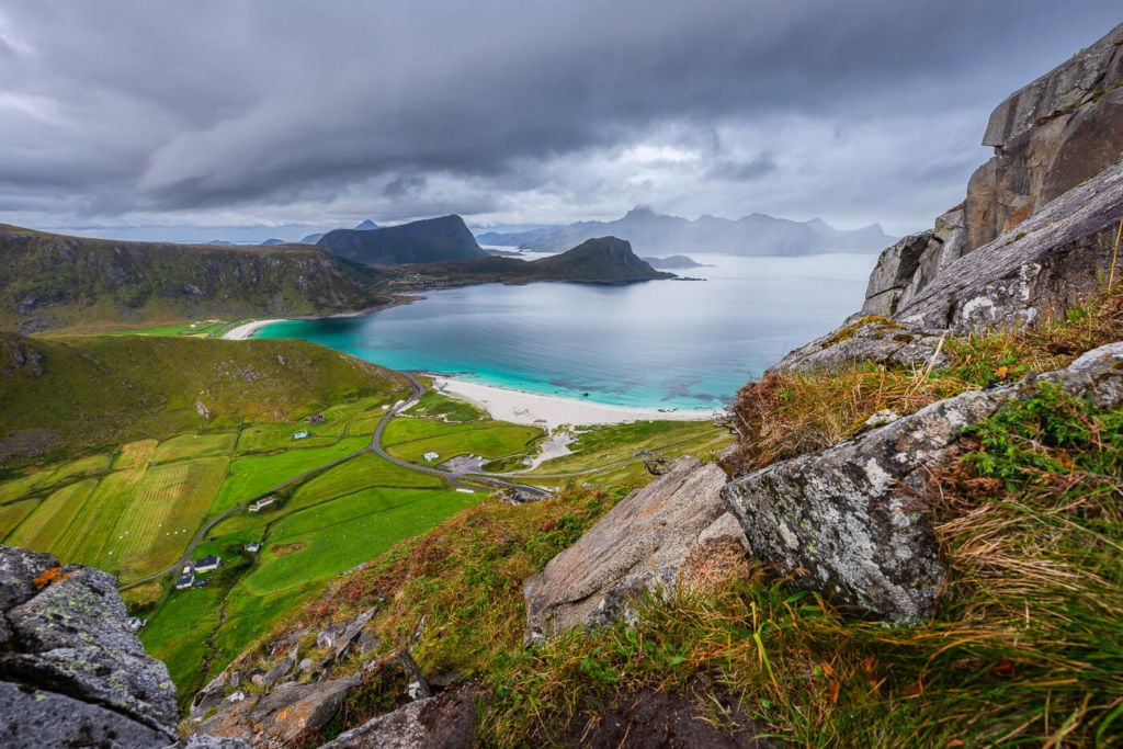
View from the top
Despite being an easy hike, I managed to get to the top on one attempt out of three due to bad weather. The first time heavy rains hit before I could make it to the top. The second time I actually made it to the top, despite some threatening rain. The third time a proper storm hit the Lofoten before I could make it to the top, so I had to turn back halfway. Yep, I can’t say I’ve had my best hikes here :)!
How to Get to Mannen and Overview of the Hike
- How to get to Mannen and Parking: to get to the trailhead, drive to Haukland beach and park the car there. Parking is paid, and it’s also possible to pay online here.
- Start of The Hike: From the Haukland parking area, head back to the road. You will notice another narrow paved road on the right, closed to motor traffic. You can start the hike there.
- Photography & Scenery value: depending on the weather, dramatic landscapes or sunny tropical-like seascapes.
- Hike Difficulty: Easy
- Tip: there are several other possible hikes in the area, like Veggen, Holandsmelen, Himmeltindan and Offersøykammen. So you may consider spending a night or two in the area – or camping at Haukland or Uttakleiv to go on a few more hikes.
The Mannen Trail
| Distance | Elevation gain | Hike Time |
|---|---|---|
| 3.90 KM. | 350 Mt | 1:30/2:00 Hrs |
As you reach the trailhead, you can continue on the paved road for the next 5/10 minutes. You will soon see various trails heading up the side of the mountain to your left. You can take any of these. Also, you may come across some sheep here.
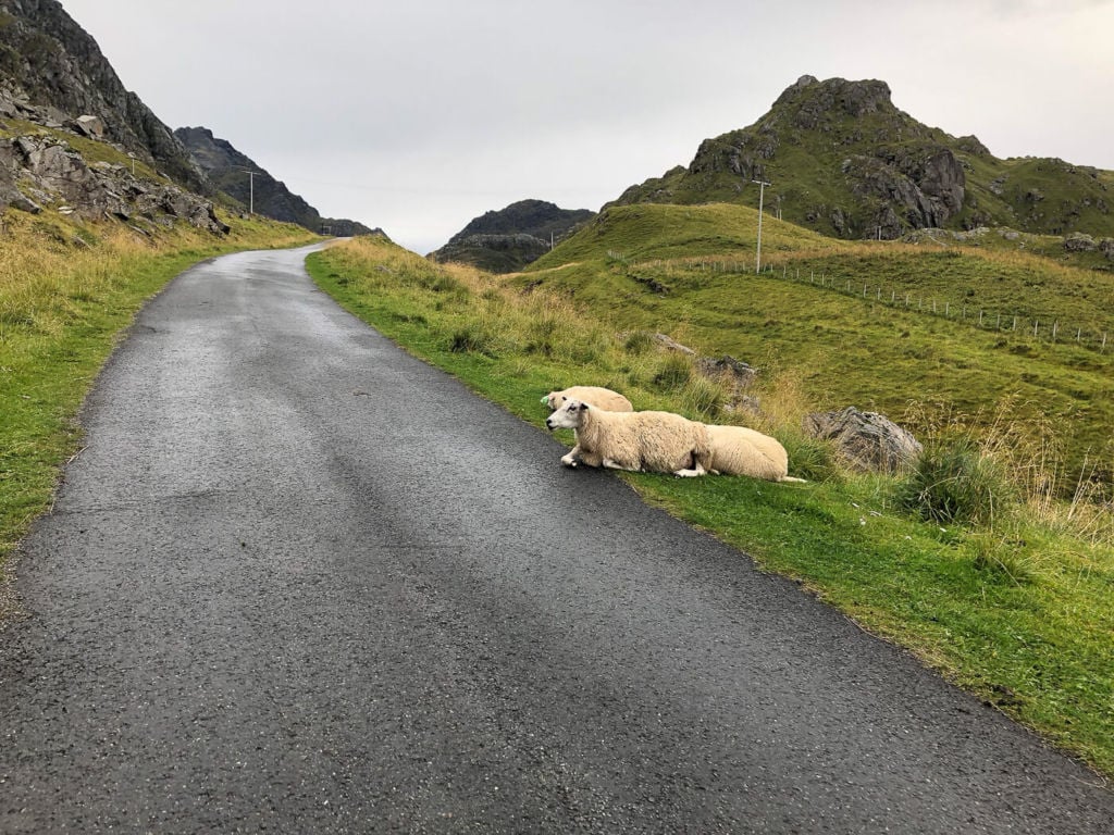
Sheep chilling on the side of the road.
Some of the sheep may also be chilling in the middle of the trail, completely unbothered by the human traffic around them. So you may need to negotiate your way up with them :).
But back to the trail. The trail can be very muddy if it’s been raining recently, especially in this first part. From here, the trail will start zig-zagging its way up the mountain until you reach the pass that connects Haukland to the other side, Uttakleiv. This means it is technically possible to start the Hike from Uttakleiv rather than Haukland. I have never hiked that way, but it should be easy to find the trailhead from that side too.
From the pass, keep following the trail up. The climb is never steep, and the trail is always visible. Ask you keep going up, you will see different tracks leading to various lookouts. Be careful, as some of these are exposed, especially toward Haukland. You will soon see the top and the cairn marking it. Once on top, enjoy the views!
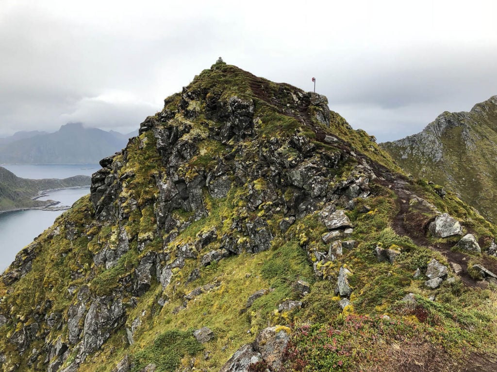
The top, viewed from the trail.
Photos and Photography Tips for the Hike to Mannen
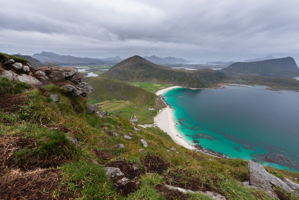
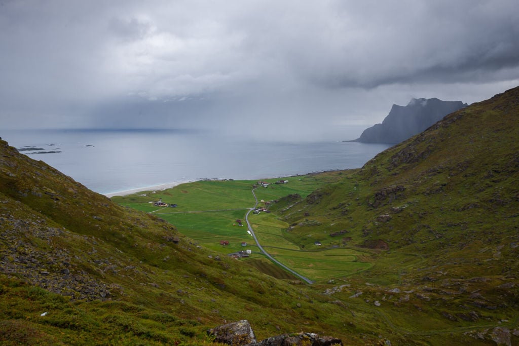
Photographically speaking, the main subject here will be the view over the Haukland and Vik beaches to the south of Mannen. However, there are also quite a few good views over Uttakleiv on the other side of the mountain.
View of Uttakleiv from the pass. Yes, that was some hefty rain!
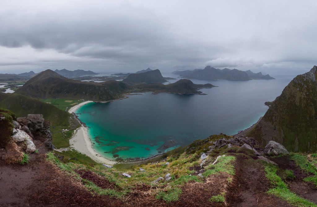
The Summit offers excellent 360-degree views, suitable for panoramas. I think some of the best views over Haukland can be found on the way up, mid-way through the hike. It’s easy to sport those lookouts as there will be trails leading to each one of them. You can also look them up on the Komoot map below.
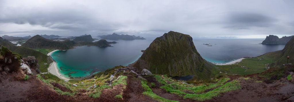
Panoramic view from the top of Mannen. The mountain in the middle is Veggen.
View from the top toward Haukland (the closed beach) and Vik.
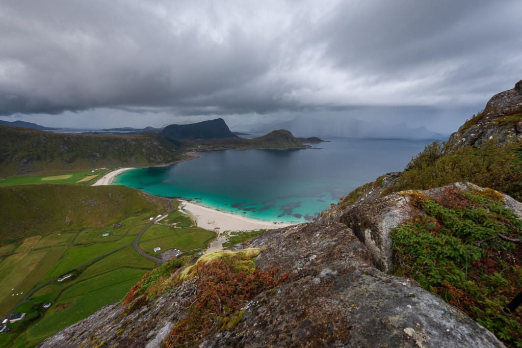
View from one of the vantage points on the way up.

Uttakleiv, viewed from the top of Mannen.
On the view over Uttakleiv: I think that may be a great location to shoot some northern lights. Unfortunately, I never managed to do that, but I plan to do so in the future unless a storm hits again – which usually happens when I attempt to hike this small mountain.
Map of the Hike to Mannen
The hike is easy, and the trail straightforward to follow, but If you need a GPS track, you can download the .GPX file from the Komoot activity.
Where to Stay
- The Haukland and Uttakleiv campings are pretty close.
- Several Rorbu and cabin accommodations are also available nearby. Leknes also offers a few Hotel accommodations.
Additional resources
- Check out the main page on Hiking in Norway for more Photo Hikes and inspiration.
- You can also check out the Offersøykammen hike if you are in the area.
- If you are looking for a more challenging hike with great views over some of the spectacular Lofoten beaches, check out the Hike to Helvetestinden.
If you have been on this hike and would like to share your experience or thoughts, let us know in the comments.


Thanks for this recommendation. Hope to get to nearby Lofotra museum before long and appreciate your review. It came up third on Google news feed on my phone so you will probably get lots of views and new followers.
Thanks Nic! Hope you’ll manage to visit, both the museum and the longhouse reconstruction are amazing, I can definitely recommend them.