Hike to Veggen – Vestvågøya, Lofoten Islands, Norway
Out of all the short hikes in the area, the hike to Veggen is my favorite, along with the hike to Offersøykammen. If you are in the Vestvågøy island area and have time for one hike only, I would recommend Veggen over Mannen. I think the views are better from Veggen on either side of the mountain, toward the Uttakleiv and Haukland/Vik Beaches.
View from the top of Veggen toward Uttakleiv.

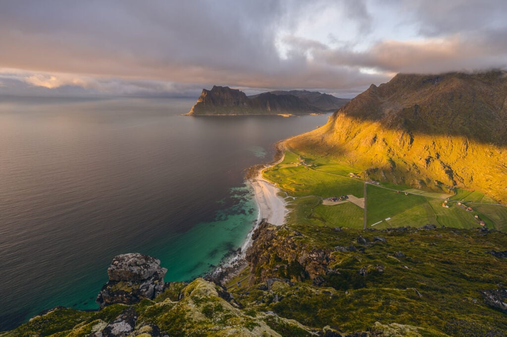
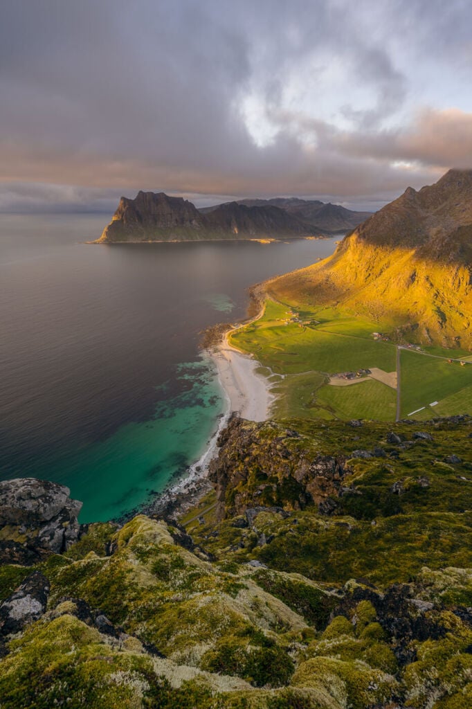
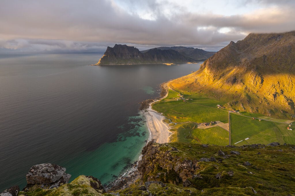
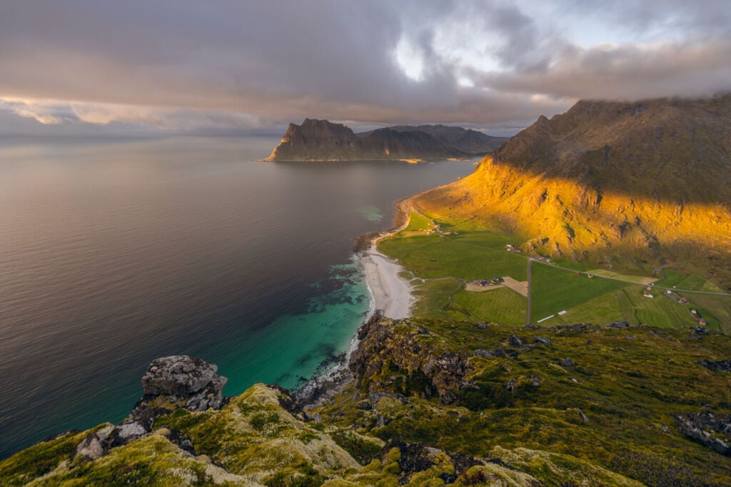
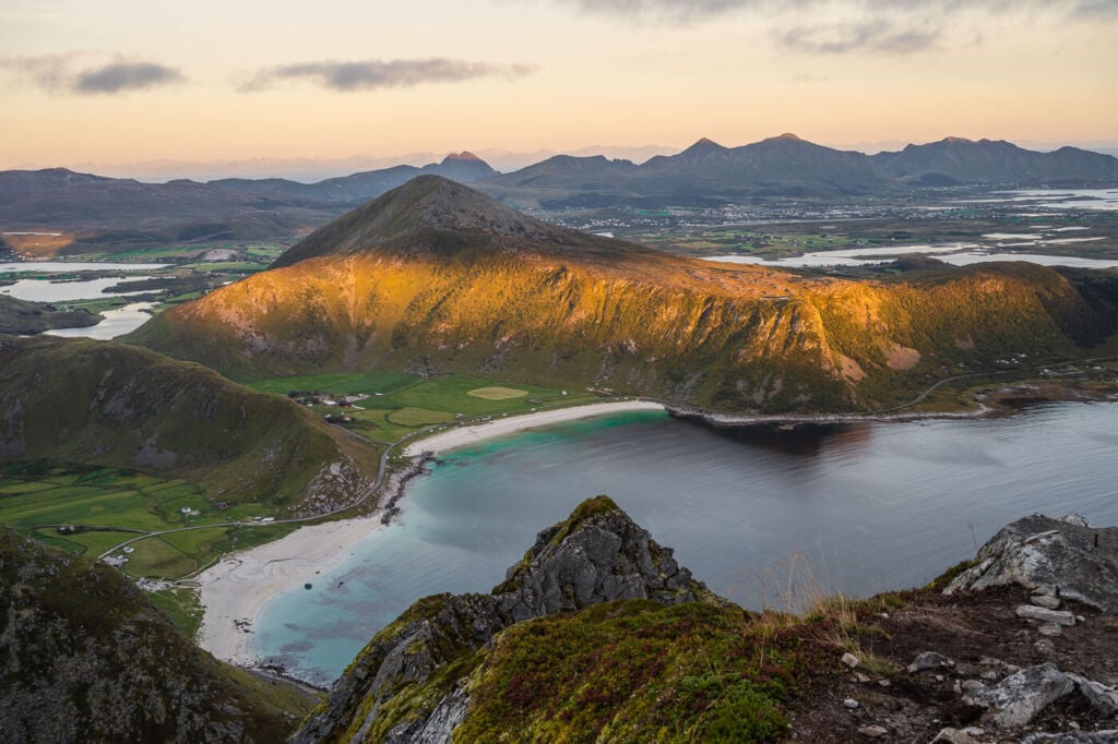
View from the top of Veggen toward the Haukland and Vik beaches
Furthermore, this is a relatively short hike. I hiked up Veggen twice on my last trip in 2022, the second time for sunset after another daytime hike. This is a great sunset or midnight sun hike. When the sun is low on the horizon, you get a nice warm light falling over the landscape beneath.
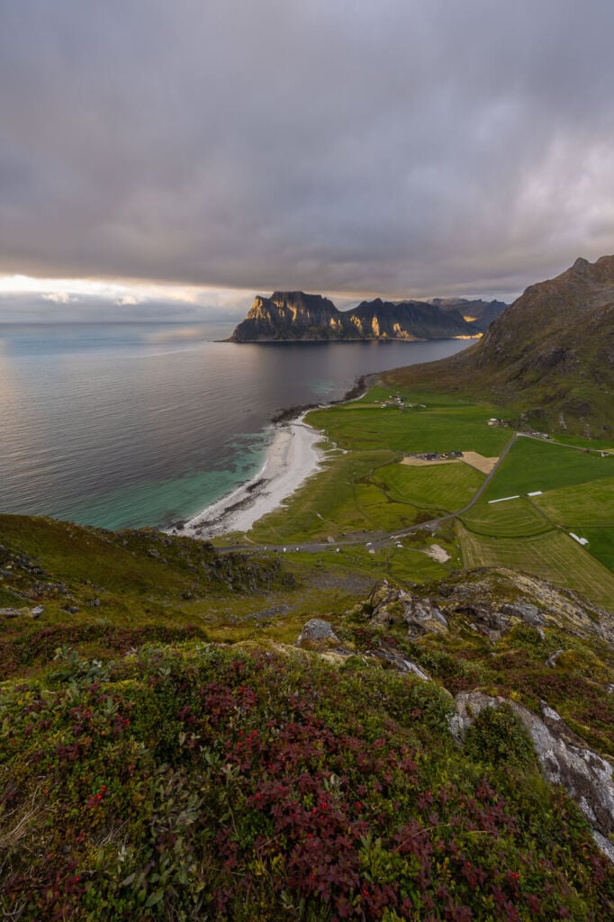
It’s also an excellent scenic hike with cloudy weather, as the crystal blue color of the water and white sand beaches will pop-up better. Just try to avoid hiking up there when there are clouds around the top…like I did on my first hike up there :)
How to get to Veggen & Overview of the Hike
- How to Get to Veggen: the trailhead is accessible from the Uttakleiv beach
- Start of The Hike: the paid parking by Uttakleiv beach
- Photography & Scenery value: birds-eye, scenic views of some of the best beaches in the Lofoten and the surrounding mountains.
- Hike Difficulty: Easy to Moderate, as some passages are pretty steep and can be slippery when wet.
- Tip: This is a great sunset hike. Also, considering how short it is, you can easily combine this hike with another one n the area on the same day. Mannen, Holandsmelen and Offersøykammen are all excellent options within a short driving distance.
The Veggen Trail
| Distance | Ascent | Hike Time |
|---|---|---|
| 3,18 Km. | 510 m. | 2:00 / 2:30 Hrs |
From the parking area, you can heat toward the small saddle between Mannen and Veggen. You will see a couple of trails heading leading there. Some of those will be sheep tracks. Regardless, they will all converge as the trail gets steeper.
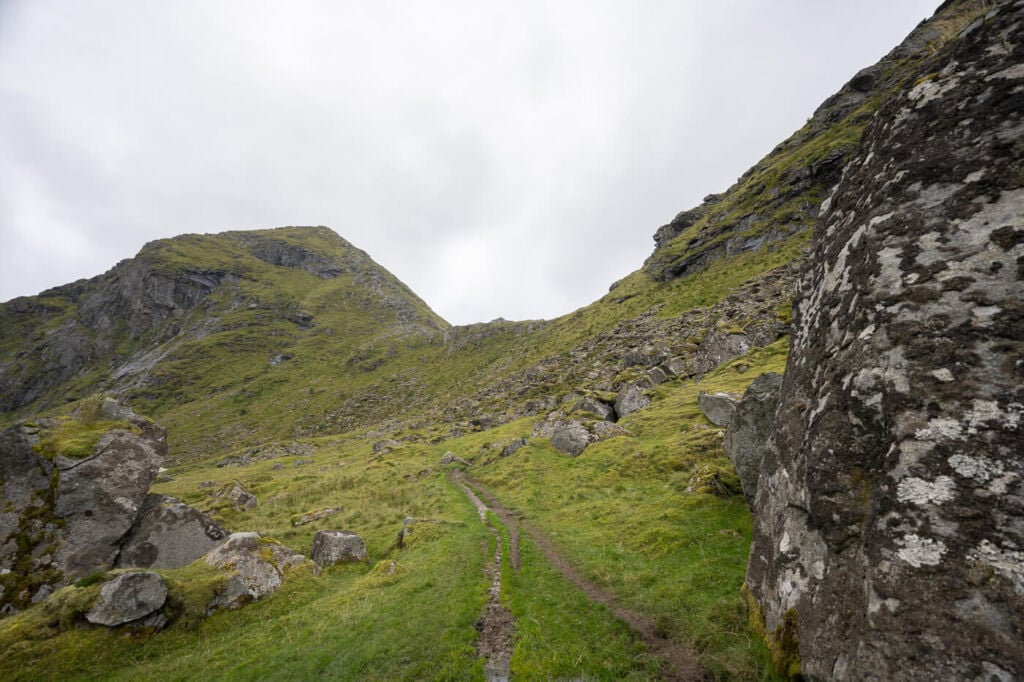
The first part of the trail leading up to the saddle, in the middle.
The first part of the ascent can be very muddy and slippery if it has rained recently. However, this first part of the climb is relatively short, and you will soon reach the Small saddle between Mannen and Veggen. There you will find a small lake (Vasskarvatnet).
Trail sheep trails here will diverge in a few different directions, possibly confusing you as to which trail to follow next. That will be the widest, steepest trail to your right when facing the small lake.
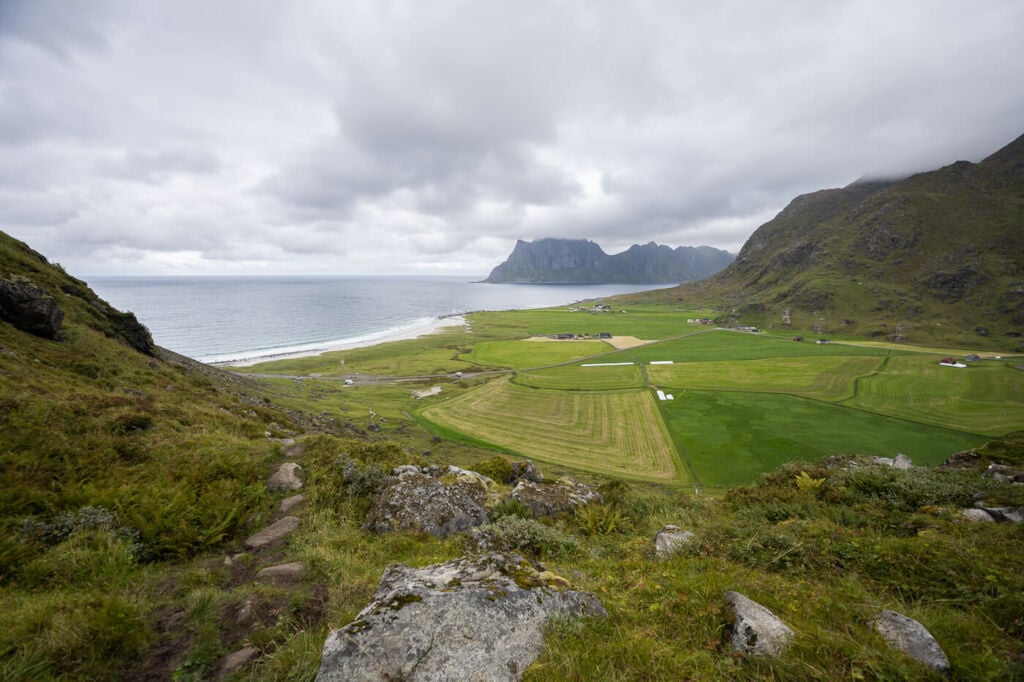
View from the saddle between Veggen and Mannen. here the steepest part of the trail begins.
This is the steepest part of the hike, and it gets steeper as you move higher up until you reach the relatively flat and wide top of the mountain. From the top, you will first pass by a great vantage point avocet Uttakleiv beach. To reach the actual summit, you would have to walk in the opposite direction toward Haukland beach. The summit is on that side, marked by a cairn.
The steep trail, taken just below the summit. the mountain on the right is Mannen.
Once on top, you can enjoy the well-deserved views after the steep climb!
Veggen Photos and Photography Tips
The views over Uttakleiv beach are great all the way to the top of the mountain. Essentially, you will get the same view over the beach from different angles until you reach the flattish top of the mountain. This means many opportunities to catch different foregrounds for the same view.

The saddle between Mannen and Veggen can be a good spot for a short night hike during the Northern Lights season. While the views are not as from the top, there still is a good, open view over the beach.
The side toward Uttakleiv, on top of the mountain, is very steep. So steep you can actually include the whole beach!
The other side offers equally fantastic views of the Haukland and Vik beaches. If you have a zoom lens up to 70mm, you will also be able to close in other compositions, isolating some of the farther away mountains, like Offersøykammen. I had two lenses with me; a 14-24 and a 24-70, so I’d recommend bringing anything in that range on this hike.

The Haukland and Vik beaches


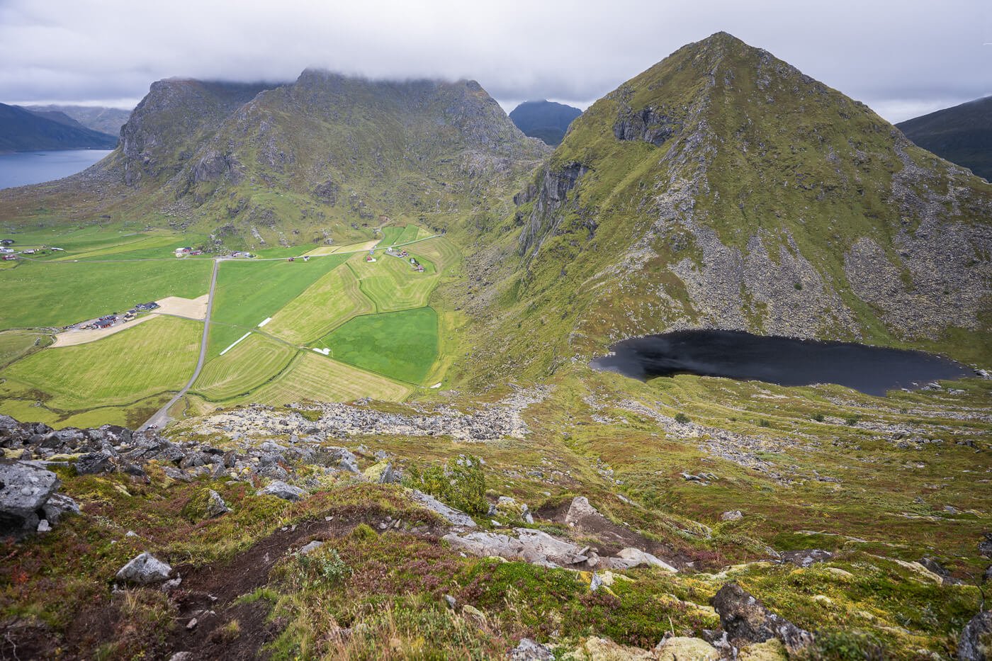
Offersøykammen, the mountain in the middle of the image, viewed from the top of Veggen.
In terms of scenery and landscape, this is one of the hikes that offer the best value for the effort. While the hike to Veggen is relatively short, it offers a great variety of views and compositions to choose from. Definitely, a location you will have fun at with your camera!
Video of the Hike to Veggen
Here is a short Video I took on this hike. Nothing too fancy, just the trial, the views and some music, but it gives a good feel for the trail.
Map of the Hike to Veggen
Here is the map of the hike to Veggen. The hike is easy, and the trail straightforward to follow, but If you need a GPS track, you can download the .GPX file from the Komoot activity.
Where to stay
There are a few spots suitable for camping around the top of the mountain, especially on the side overlooking Uttakleiv. Otherwise:
- The Haukland and Uttakleiv campsites are pretty close.
- Several Rorbu and cabin accommodations are also available nearby. Leknes also offers a few Hotel accommodations.
Additional Resources
- If you are looking for more hikes in the same area, check out the Hike to Mannen or the Hike to Offersøykammen.
- If you are looking for a more challenging hike with great views over some of the spectacular Lofoten beaches, check out the Hike to Helvetestinden.
- Check out the main page on Hiking in Norway for more Photo Hikes and inspiration.
If you have any questions or feedback, let me know in the comments below. Thanks for reading!


Leave A Comment