The Offersøykammen Hike and its amazing views – Lofoten Islands, Norway
The Offersøykammen Hike and its amazing views are easily accessible and a must-see for anyone on a hiking and photography trip in the Lofoten Islands.
This hike is one you should not miss on your itinerary. While this is not a high peak at 436mt, this hike is one I highly recommend for a variety of reasons:
- In terms of vistas and landscape, the views from the top are some of the best in the area. There is something primordial about them; you don’t get a clear view beyond the cliffs until you reach the very top, and once you get there, it’s almost like a new world is revealing itself.
- Also, you can hike to the top and back in less than two hours. If you are up for it, you can combine it with other short hikes nearby, like Mannen, Veggen or Holandsmelen.
- Last but not least, for first-timers visiting the Lofoten, this hike is an excellent introduction to what the Lofoten have to offer in terms of hiking and scenery.
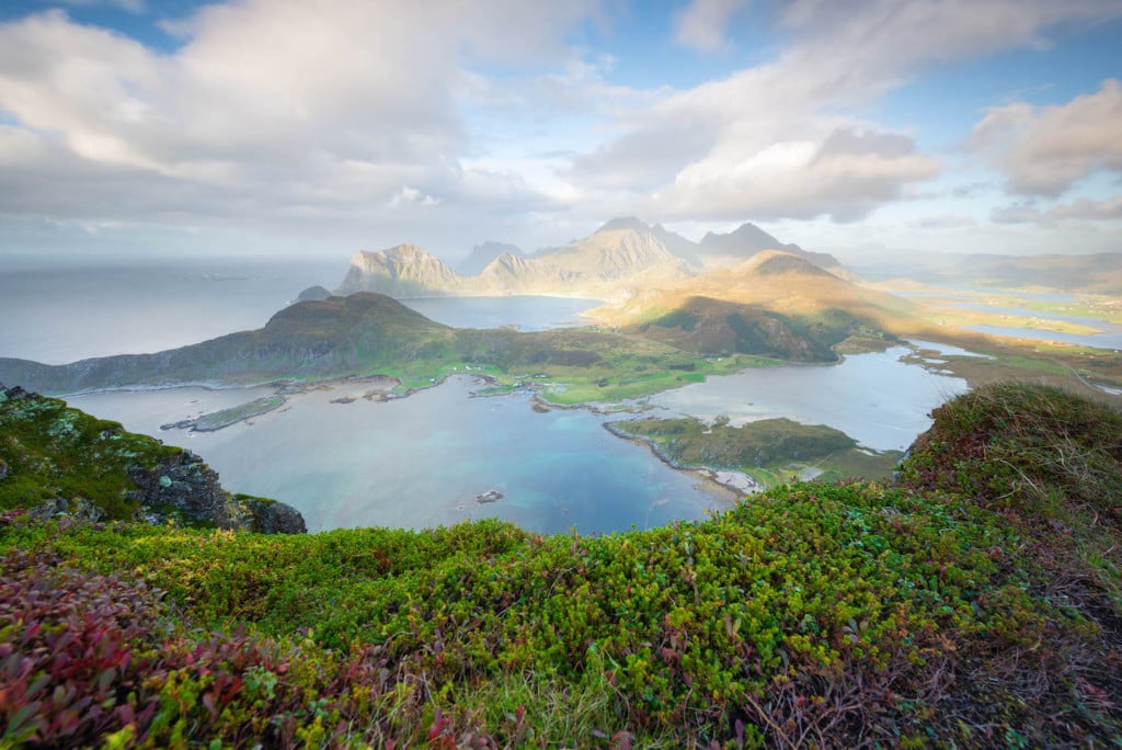
View from a vantage point close to the top of Offersøykammen
I have hiked it myself a few times, and it’s very popular with locals too. Furthermore, this small mountain was my very first hike on the Lofoten Islands. Therefore I don’t deny I may be biased, but I encourage you to go and see it yourself nonetheless :).
How to get to Offersøykammen and Overview of the Hike
- Getting there: You can access the trailhead directly from the E10 road. As you drive by the starting point, you can leave your vehicle in the resting area on the side of the E10 (GPS coordinates 68.14946614939161, 13.506340604208143).
- Start of the Hike: From the resting area, you can walk back towards Leknes. The well-worn trail will be visible on the side of the mountain. Moreover, the trailhead is also on google maps if you have trouble finding it.
- Photography & Scenery value: panoramic views all around since this small peak does not have other mountains around it.
- Difficulty: Easy, a bit steep in some places, and requires carefulness if wet as the trail is well-worn and there may be loose rocks.
- Tip: If you want to enjoy the hike a little longer, choose another starting point. There is a pullout by the side of the tunnel connecting the islands of Vestvågøya and Flakstadøya (GPS coordinates 68.148214237071, 13.483855211339593). If you are into seascape photography, you definitely want to check out all the beaches in the area (Haukland, Vik, Uttakleiv or Myrland).
The Offersøykammen trail
| Distance | Elevation Gain | Hike Time |
|---|---|---|
| 2.61 KM | 390 MT | 2:00 Hrs |
You will first have to go through a bushy and relatively steep section as you start your ascent. If it’s been raining, water may be trickling down the trail. Gradually, the bushes will disappear, and you will have to cross a less steep area. As you continue, the hike will again become increasingly steep. Finally, you can keep following the trail to the top, where it flattens out a bit. Be careful up there, as the cliff is a vertical drop all the way down to the other side of the mountain.
This location can be very windy. If it is already windy at the start of the hike by sea level, you can reasonably expect strong winds on top. Therefore, you may want to bring a beanie and windproof jacket.
The trail is visible all the way to the top, but make sure you take the same path you took on your way up when descending as there are other trailheads.
Photographing The Offersøykammen Hike and its amazing views
As soon as you get out of the bushy section of the trail, the views over the vast landscape will start to open up. Here you will have some fantastic views over the nearby islands and bays.
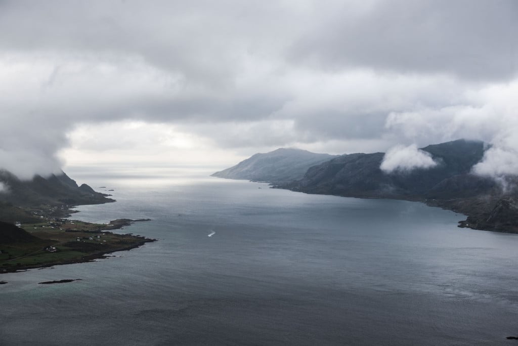
View over the surrounding islands on a stormy day.
View over the surrounding islands on a very windy day
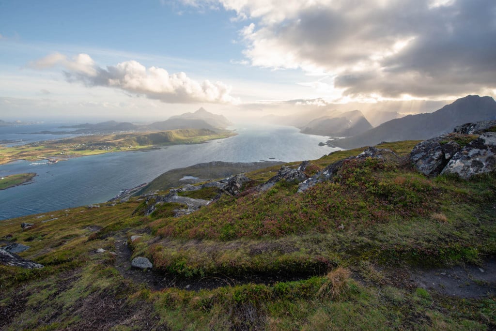
As you approach the top, you will start to get better views to the north-east, over the Vestvågøya island
View from the trail as you approach the summit
Another view from the trail close to the summit
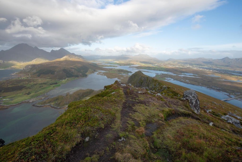
From here, the summit will already be in sight.

The summit
Once you reach the top, the view will open up in all its glory to the landscape below.
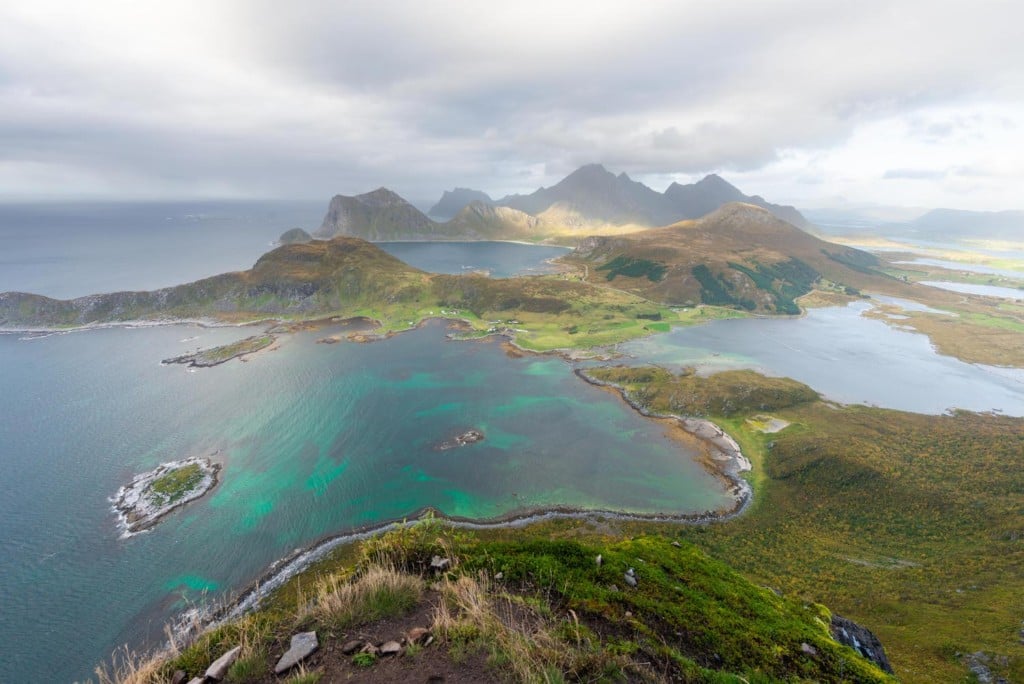
View from the top
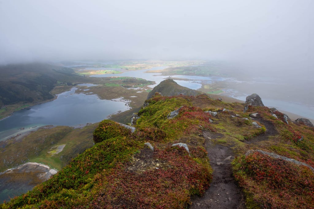
However, to me, the best scenic spot is just below the summit, right on the trail – see the photos below. From this spot, you can easily use the vegetation in the foreground to nicely frame the landscape.
Long exposure taken with a Lee Big Stopper. 61 seconds exposure.
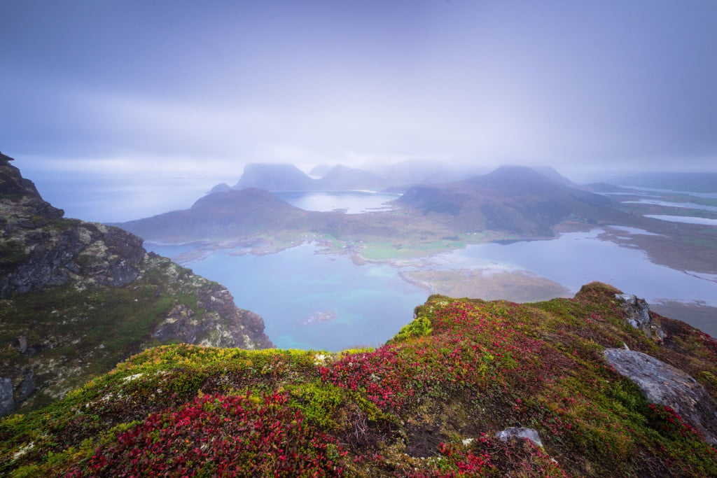
Same view as above, from a spot a little further down the trail.
In terms of lenses, I would definitely recommend bringing a wide-angle zoom and a tele lens if you enjoy composing and shooting the farther away mountains and landscapes. Also, bring a tripod if you plan to shoot long exposure as the view is suitable for that type of shooting.
You may also bring a drone if it’s not too crowded. It is, however, a popular spot, and you will likely meet other hikers on the trail. I did have my drone with me here, but I did not use it. It feels like being up in the air when you reach the summit.
Map of the Offersøykammen Hike
Here is the map of the hike. If you need a GPS track, you can download the .GPX file from the Komoot activity.
Where to stay
- The Haukland and Uttakleiv campings are quite close.
- Several Rorbu and cabin accommodations are also available nearby. Leknes also offers a few Hotel accommodations.
Additional Resources
- Check out the main page on Hiking in Norway for more Photo Hikes and inspiration.
- Check out this other cool hikes nearby, the hike to Mannen and the Hike to Veggen


Leave A Comment