Hike to Hustinden – Lofoten Islands, Norway
Hustinden is one of the most photographed mountains in all of the Lofoten; it is also possible to hike all the way to its top. Hustinden is an imposing mountain, seemingly stemming from the sea and out of nowhere.
Even if its name, Hustinden, does not sound familiar to you, chances are you have probably seen one or more pictures of this mountain:
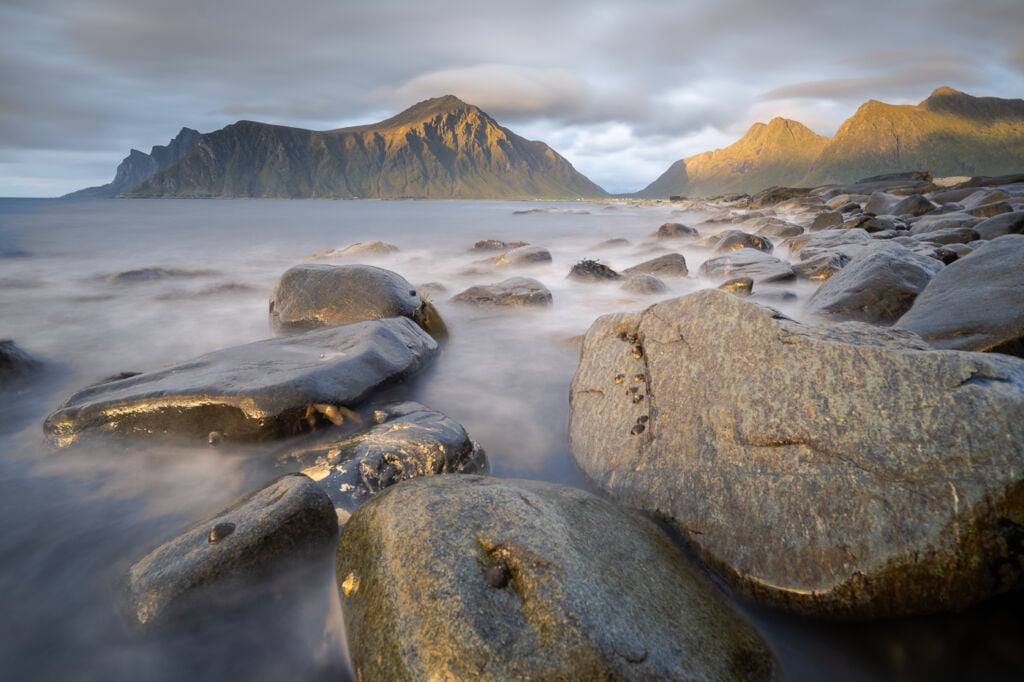
Hustinden from the shores around Skagsanden
The hike to the top is relatively easy, and the views from the broad Summit are fantastic, especially toward the southern Island, Moskenesøya. Jagged peaks, steep cliffs and white sand beaches are all included in the views from the summit.
Also, the top of the Mountain you see from Skagsanden beach is a false summit. The actual Summit is behind it the side and not visible from the beach. However, the broad and flattish summit will allow you to walk around and soak in the views from all sides of the mountain.
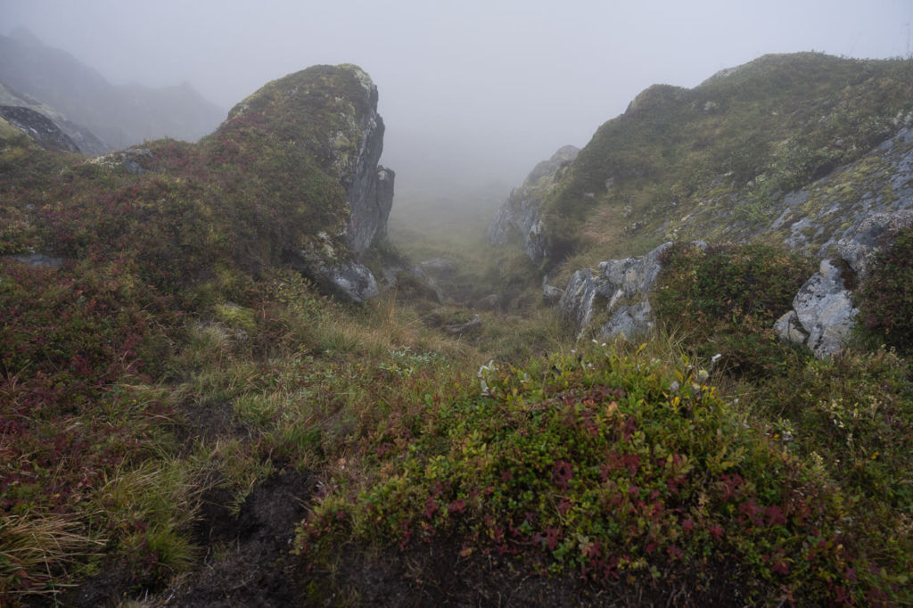
This is an excellent half-a-day hike, or longer if the weather is nice and you want to take your time and relax on the broad top of the Mountain. Unfortunately, I wasn’t that lucky with the weather when I hiked to the top of Hustinden. It was rather cloudy, and the top was engulfed in clouds, but I enjoyed this hike and its views.
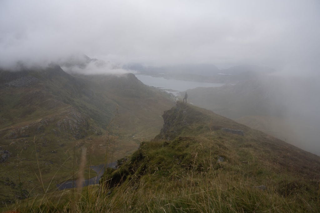
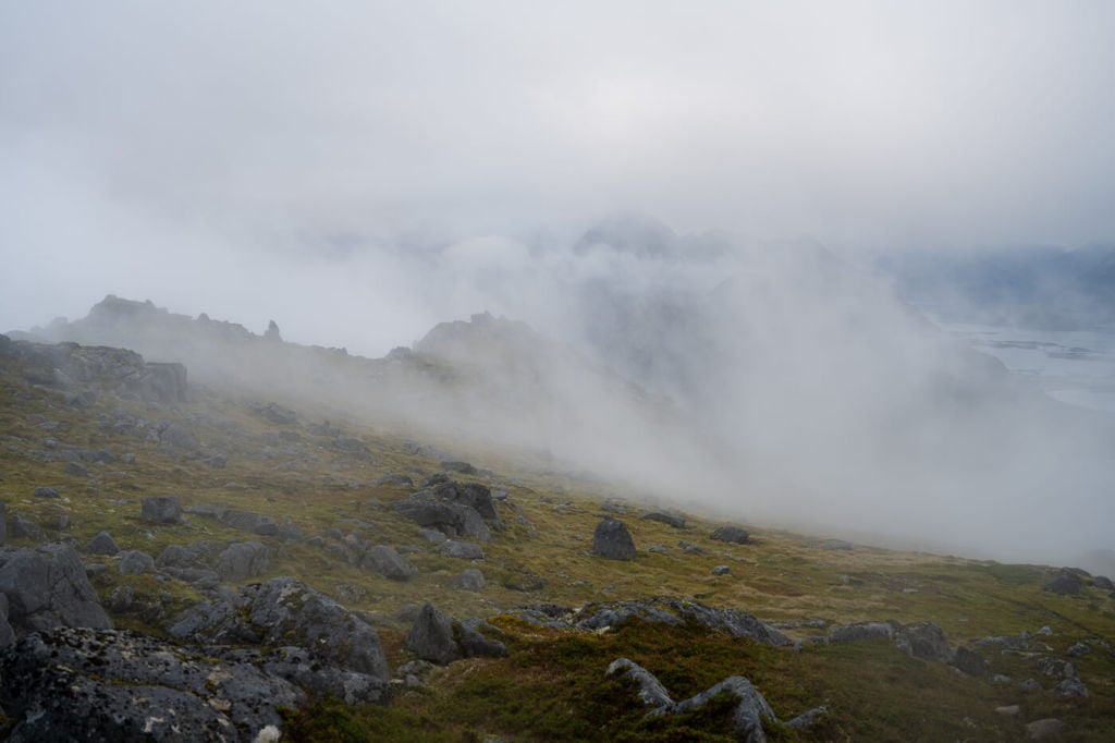
View from the trail halfway up the Mountain.
Outline of the Hike to Hustinden
- How to get to Hustinden and Parking: The start of the hike is easily reachable, and it’s directly on the E10 road. The parking area is also well-marked on Google maps, as it is the same as the Stornappstinden Trailhead (click for directions). As you approach this location by car, you will see a gravel road on the side of the E10. that gravel road will lead you to the parking area, where you can leave the car.
- Start of The Hike: the small parking area next to the red hut.
- Photography & Scenery value: Cliffs with Fjords view. Suitable for a Sunset hike.
- Hike Difficulty: medium. The trail presents no particular challenges, although its last stretch is quite steep.
- Tip: If you plan to spend a night on the Mountain, you can combine this hike with one up to Stornappstinden.
One of the steepest parts of the trail.
On the Trail
| Distance | Ascent | Hike Time |
|---|---|---|
| 6.60 Km. | 720 m | 3:00 / 3:30 Hrs |
You should head toward the iron gate by the little hut from the small parking area. Make sure you close the gate properly, as stray sheep may be trying to get out. You will see a couple of trails diverging in different directions here. Take the one on your left; the one on the right leads to Stornappstinden.
Be ready for the first flat part of the hike. It’s wet and boggy, and it’s easy to step into a pool of mud that could swallow half a shin. If that sounds oddly specific…yep, been there, done that.
Once past the first boggy part, the trail will slowly gain elevation. The trail here is rather fain, and there are multiple faint tracks crossing it. You can keep heading toward the lower ridge of the Mountain. From there, the trail is visible again all the way to the top.
This is also the steepest section, and you may need to use your hand to scramble up in a couple of passages. It is never exposed, though.
View from the trail toward the road E10 and Leknes.
Once you reach the Summit, you will have to follow the trail to your right to get to the actual Summit, marked by a post.
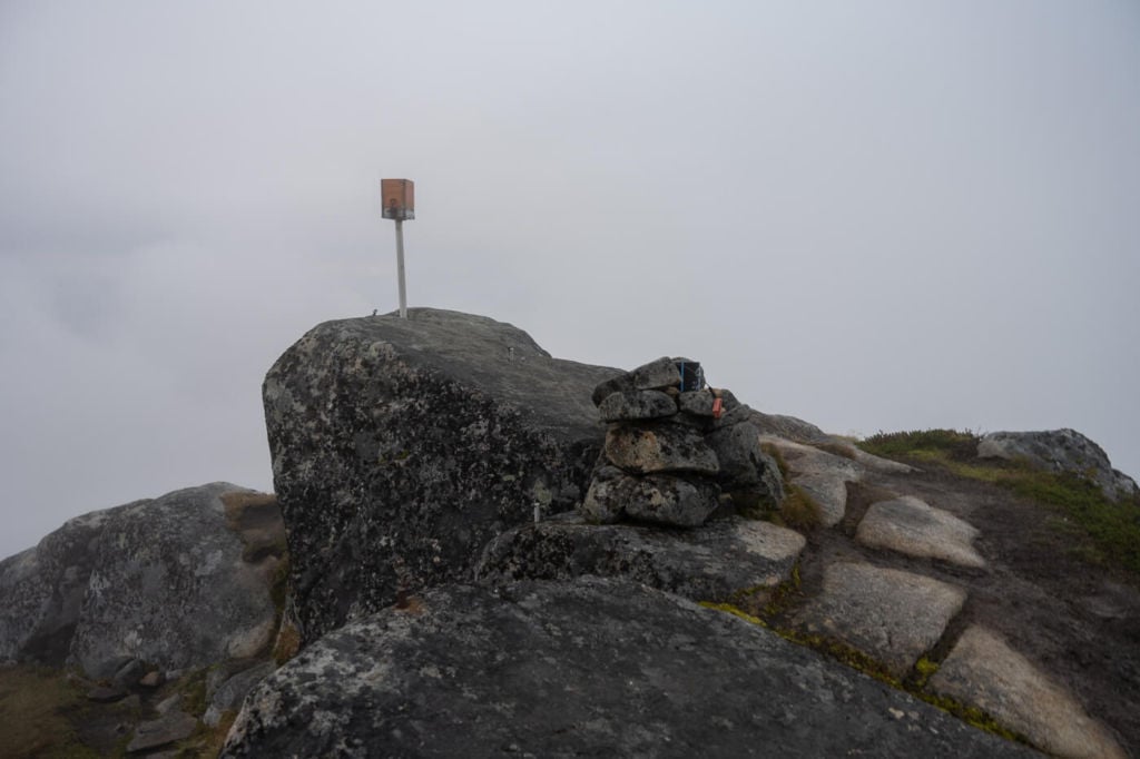
Flakstadtinden’s Summit
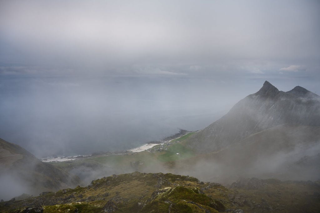
If you turn to your left, you will see Skagsanden beach and the Flakstadpollen Fjord. This is the “false” summit you see from Skagsanden beach.
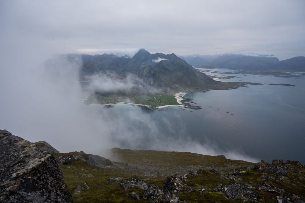
View from the top of Hustinden toward Skagsanden beach
Photos of the Hike to Hustinden
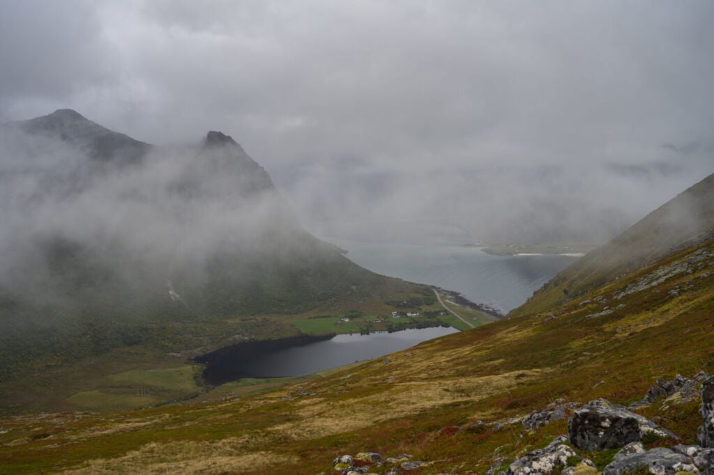
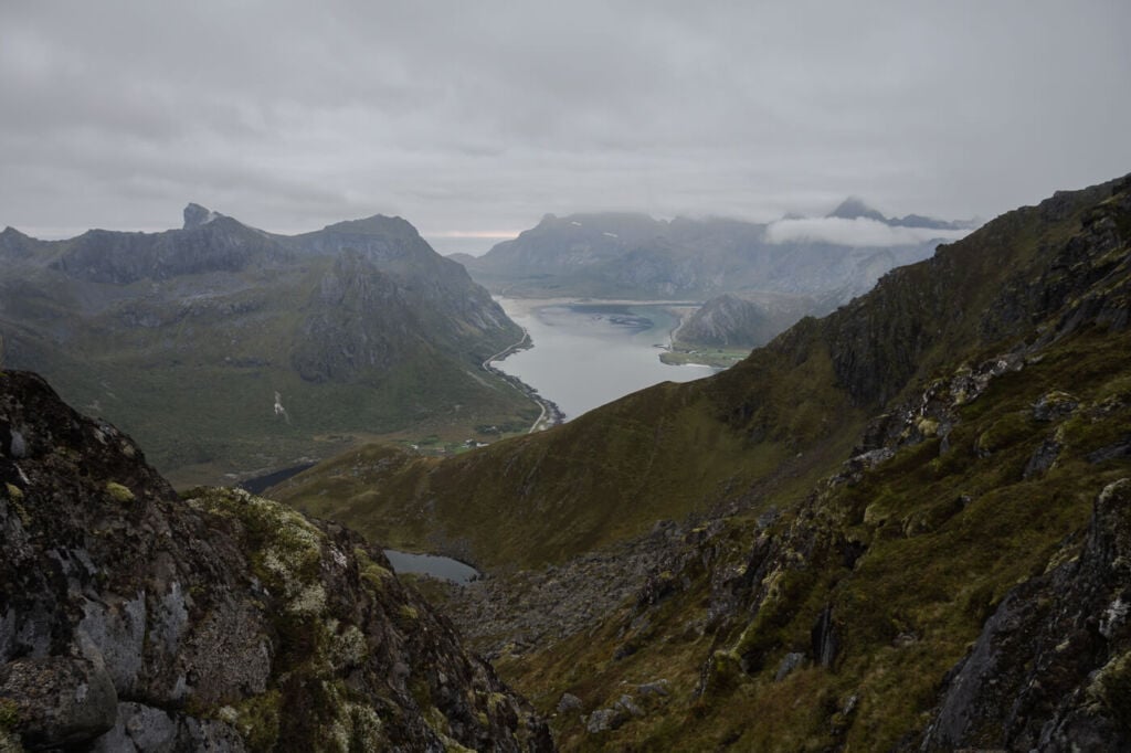
As soon as you start gaining elevation, the views will improve. First, they will open up in the small valley between Hustinden and Middagstinden (the Mountain between Hustinden and Stornappstinden). This will give you a good view of the small lake (Mørkdalsvatnet) in the middle of the valley:
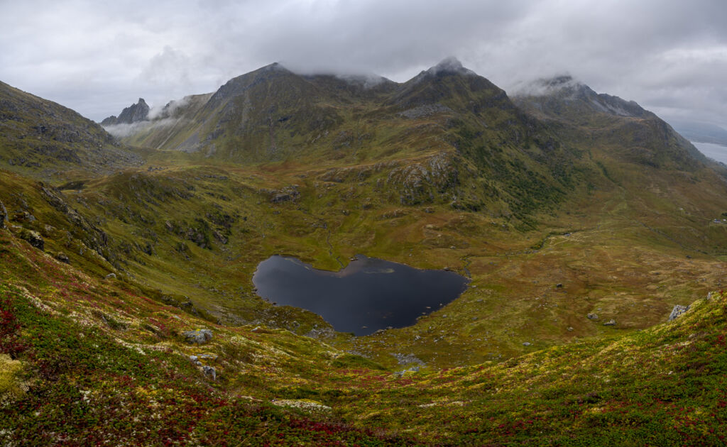
Mørkdalsvatnet
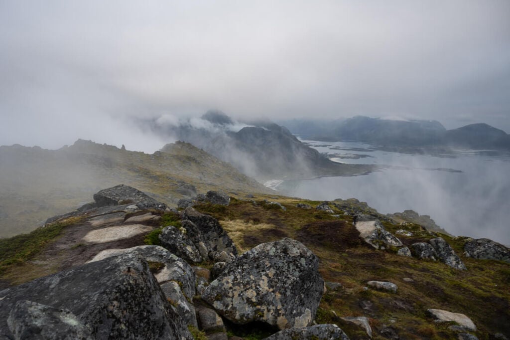
The trail offers excellent views on either side of the Mountain as you continue to hike up.
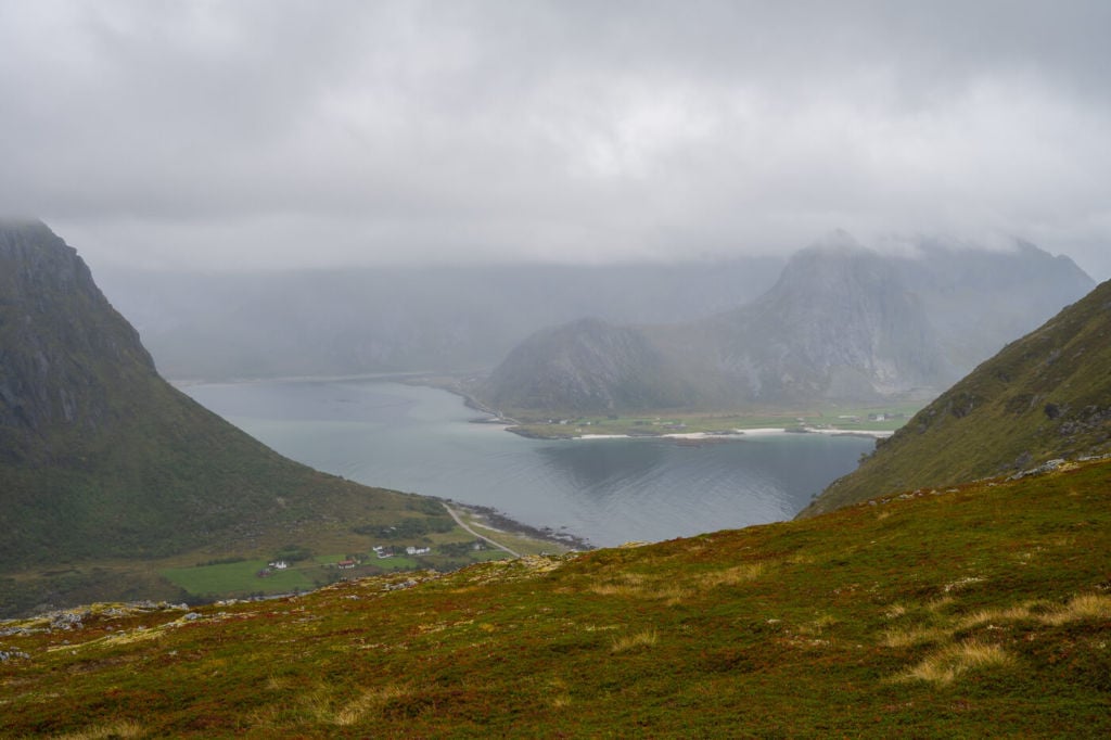
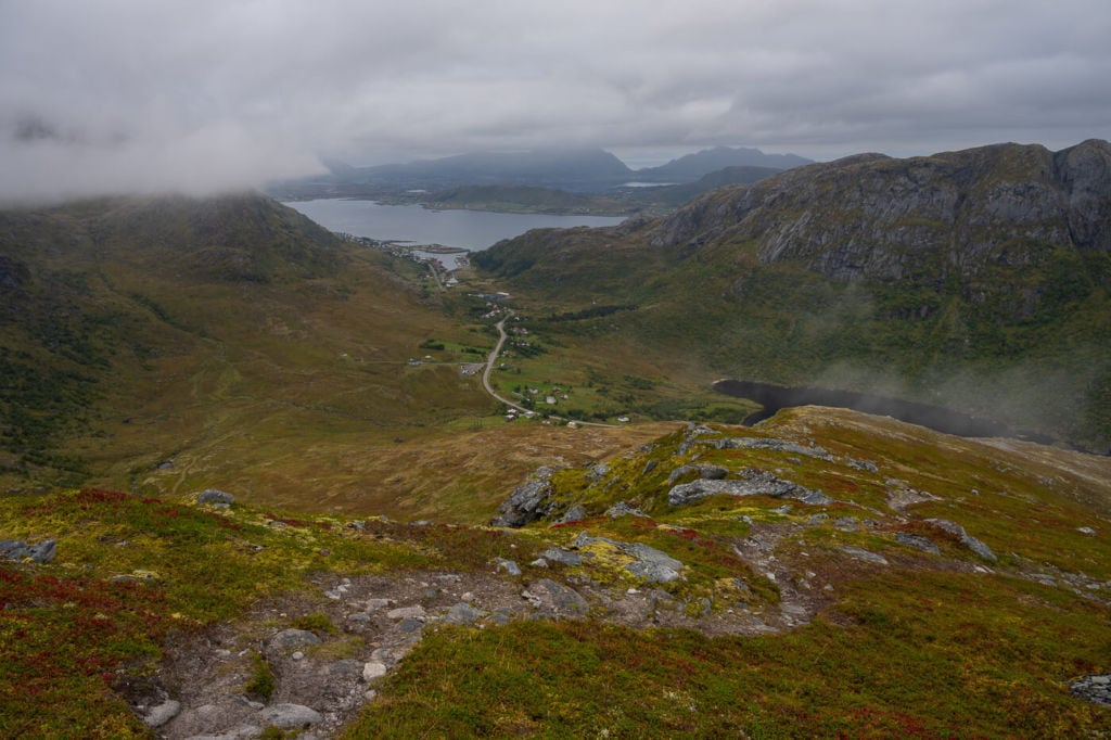
View from the trail toward Flakstadpollen to the South.
Looking at the landscape below.
Another view of Flakstadpollen.
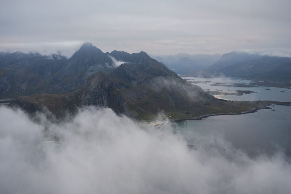
The Summit offers excellent views on all sides, especially toward Skagsanden beach, to the south and the west, and toward the Ocean.
Additionally, this would be a great sunset hike, and I can imagine the scene would be amazing with the luck of having some colors. I was hoping for that too on this hike, but the clouds did not break. Still, I did enjoy the excellent views from the summit.
View from the Summit to the west.
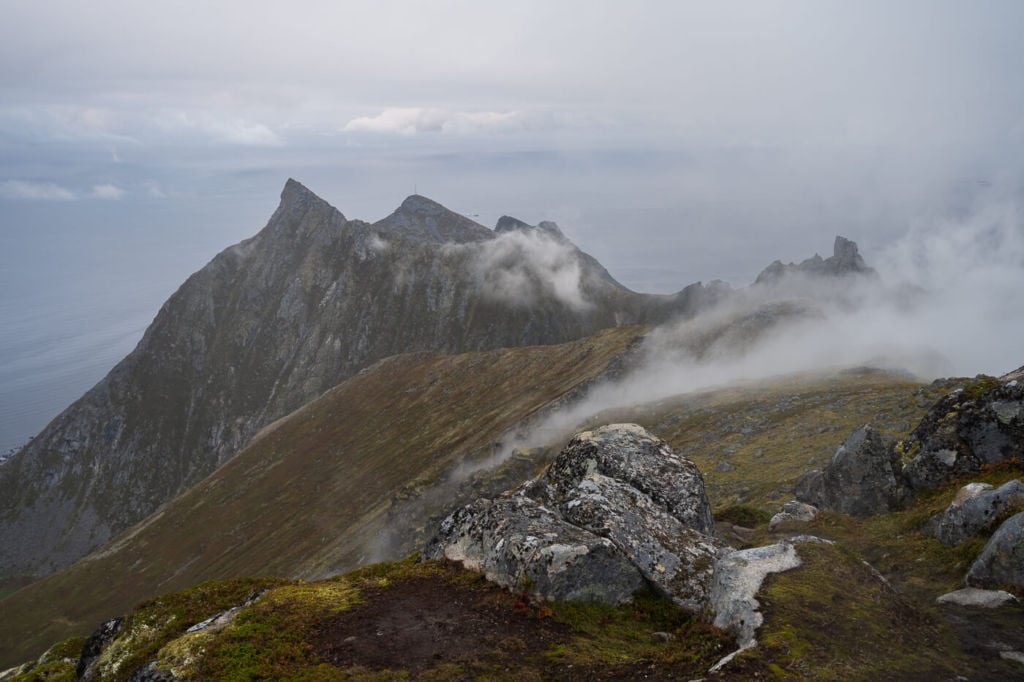
View to the south and the trail leading to the southern Summit.
Vikten viewed from the top of Hustinden.
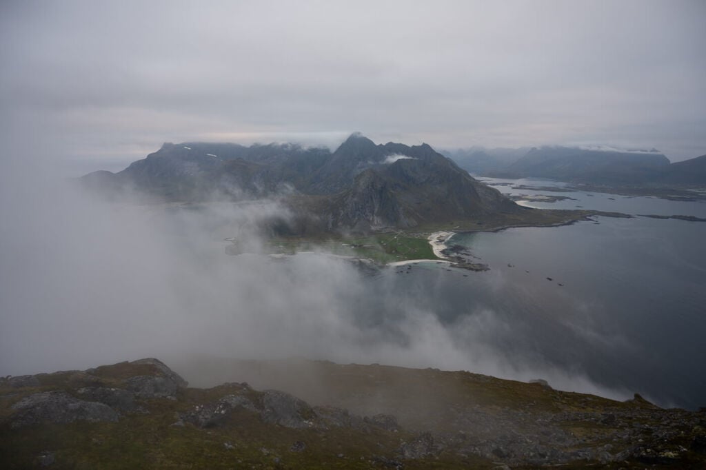
Skagsanden Beach, viewed from the top of Hustinden
Conclusion
This is a fun, half-day hike. I could see myself chilling on the top and enjoying a snack on a sunny summer day, or going back for sunset in late summer/early autumn.
Lastly, if you want to get a feel for the trail, here’s a short video of the Hike to Hustinden:
Map of the Hike to Hustinden
Here is the map of the Hike to Hustinden. If you need a GPS track, you can download the .GPX file from the Komoot activity.
Where to stay
There are a few spots suitable for camping around the top of the Mountain and on the lower slopes, otherwise:
- The Lofoten Beach Camp is the closes option. The Haukland and Uttakleiv campings are also relatively close.
- Also, Several Rorbu and cabin accommodations are also available nearby.
Additional Resources
There are several more great hikes nearby, such as:
Also, check out the main page on Hiking in Norway for more Photo Hikes and inspiration.


Leave A Comment