The Stornappstinden Hike on Flakstadøya – Lofoten Islands, Norway
The Stornappstinden Hike on Flakstadøya is an easily reachable hike that offers spectacular views over the Islands of Flakstadøya and Vestvagøya.
The hike up Stornappstinden on the Lofoten island of Flakstadøya is one of my favourites. I’ve done it three and a half times on different visits to the Lofoten Islands. The “half’ is because of a vantage point close to the middle of the hike. More on this later.
Back to the hike: why would this be one of my favourites? Easy. The hike is steep but not overly demanding, the views are fantastic, and it is easily accessible.
View from the top looking South
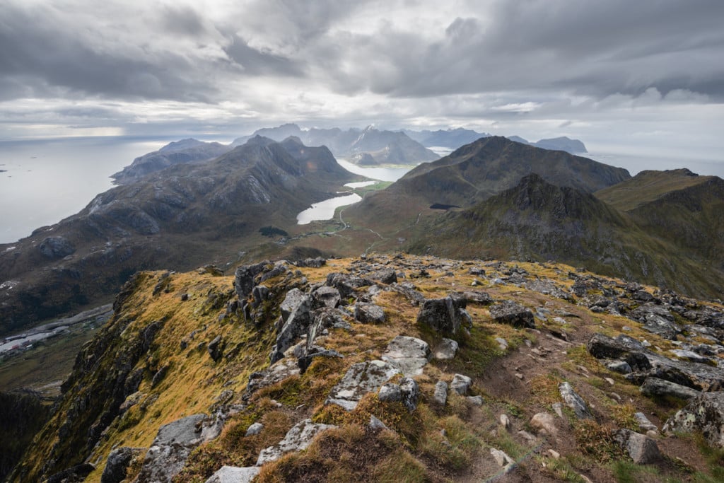
Stornappstinden towers all of the other surrounding mountains nearby, so you feel like being on top of the world. From here, you can also see several other likeable smaller peaks nearby.

Panoramic View from the top of Stornappstinden looking North
You can basically plan your next hike from the top without having to look at a map ;)
How to get to Stornappstinden and overview of the Hike
- Getting there and Parking: The start of the hike is easily reachable and directly on the E10 and is now also marked on Google maps. You will see a small parking area on your right when driving south. You can park there.
- Start of The Hike: the small parking area.
- Photography & Scenery value: from the top, scenic views all around.
- Difficulty: medium, but the last part of the climb is quite steep.
- Tip: If you want to hike to Hustinden, you can park the car in the same location.
The Stornappstinden Trail
| Distance | Ascent | Duration |
|---|---|---|
| 4.82 Km | 640 Mt | 3.30 / 4.00 Hrs |
The trail starts from the parking area. You can follow the ski lift lines on the first part of the trail. This part is not steep, but it can be boggy and wet.
The trail is unmarked but well worn. It is also quite popular with locals. It is also popular among the local sheep population, and you will likely come across some on your hike.
As you keep going up, the trail will increasingly become steeper. The trail is visible at all times and easy to follow.
Toward the middle of the hike, there is a small, easy creek crossing. After this point, pay attention to any trail forking to your left and avoid them. I got side-tracked on one of my hikes and had to cross boulders field, with was not particularly fun. You can see that in the GPS track below.
From here, it is a steep hike until you reach the top, where you will enjoy the scenic views all around the mountain.
Photos and Photography tips for the Stornappstinden Hike on Flakstadøya
For this hike, I would recommend bringing a wide-angle and a tele lens up to 200 to close and isolate different parts of the vast views you have from the top.
On the other hand, the wide-angle will work well when including some foreground elements to add to the perspective.
The views from the top are undoubtedly spectacular. You will see several smaller peaks from the top looking north, such as Veggen, Mannen and Offersøykammen.

View to the North. Offersøykammen is the closes mountain, with Mannen and Veggen in the background.
View to the South, with Hustinden on the right and Flakstadtind in the middle.


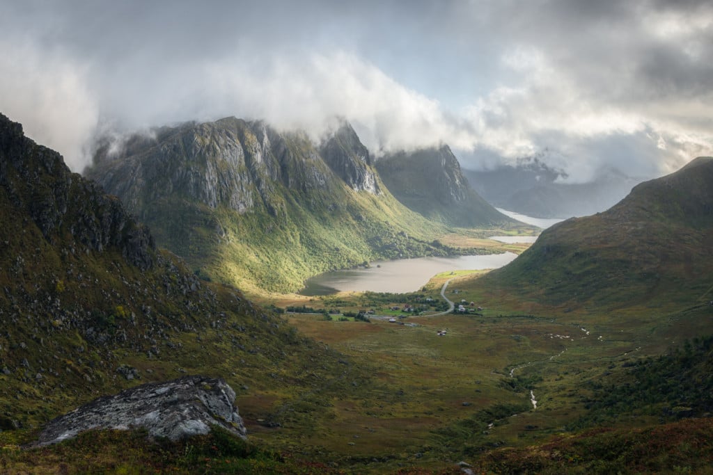
One of my favourite vantage points is close to the middle of the hike. This is the vantage point I mentioned in the introduction.
What I particularly like about this vantage point are the “layered” mountains, the lake in the middle and how it is naturally framed into an image.
In my opinion, the best time to shoot here is late afternoon in late Summer or early Autumn, when the sun goes down to your right (looking south). Or any other time of the year when the sun is in that particular position ;).
When these conditions are met and the sky is partially clear, the sun will shine directly on the mountains on your left, creating interesting lighting conditions behind the mountains on your right.
These are some examples of what I mean by this description. Still, I have not managed to get the shot I envisioned from here yet, but this should give you a good example of the potential of this particular vantage point. So I will definitely go back there on one of my next trips when the conditions are right.


Map of the Stornappstinden Hike
Here is the map of the hike. If you need a GPS track, you can download the .GPX file from the Komoot activity. However, please note the slight unintentional detour on the way up. The trail forks there, so keep to the right.
Where to Stay
- The Lofoten Beach Camp is the closes option. The Haukland and Uttakleiv campings are also quite close.
- Several Rorbu and cabin accommodations are also available nearby.
Additional Resources
Check out the main page on Hiking in Norway for more Photo Hikes and inspiration.


Leave A Comment