Háalda Hike in Landmannalaugar, Iceland
The Háalda hike in Landamannalaugar is perhaps the one that offers the most varied landscape of all. Yes, I know that’s quite a statement in a region like Landmannalaugar. However, this is going to be a long post with plenty of photos, so you’ll hopefully have enough material to judge by yourself. Regardless, the landscape is beyond amazing right from the start.
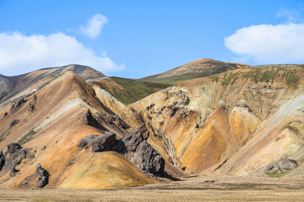
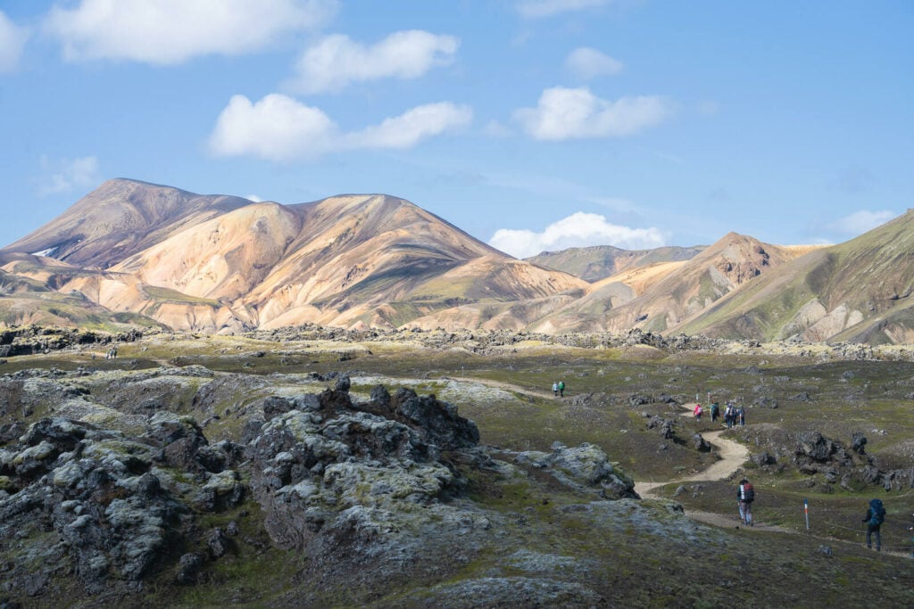
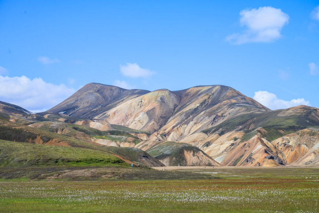
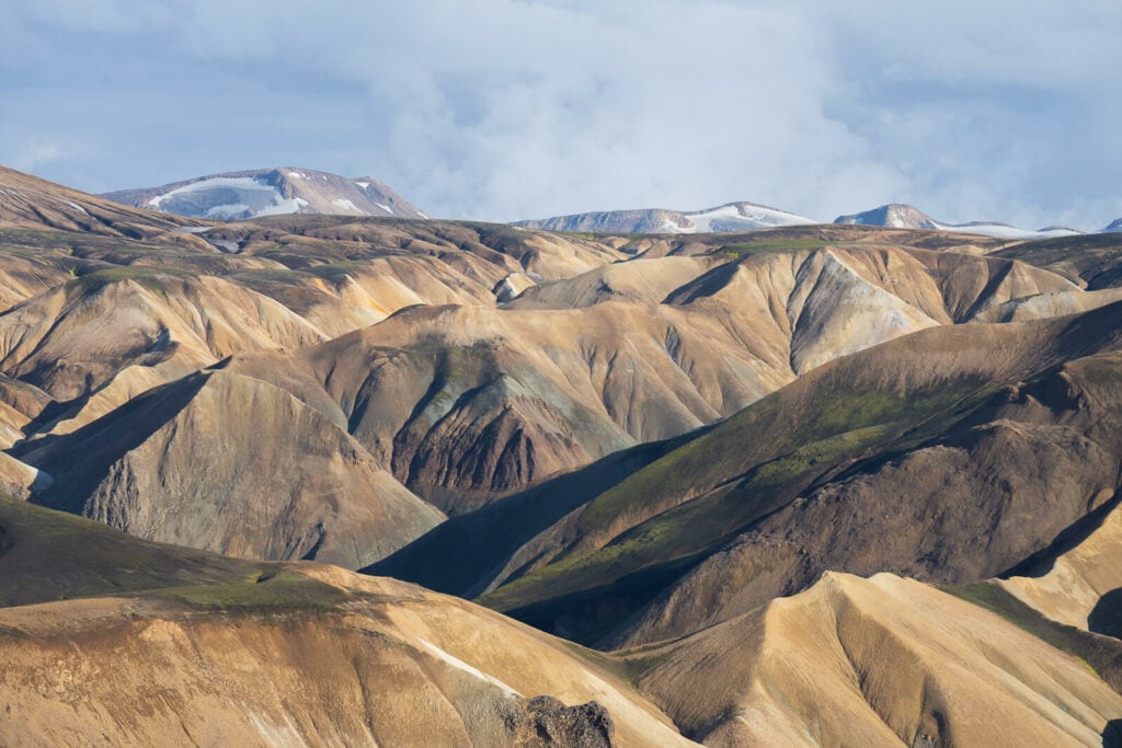
Haalda, the highest mountain in the background.
Also, the hike to Háalda is one of the hardest hikes in Landmannalaugar, together with the one to Grænihryggur. This is both because Háalda is the highest mountain in Landmannalaugar and because it is the longest day hike.
There are several trail variations you can make too, and we’ll go into the details of it later.
For now, if you are thinking about hiking to Haalda, I’m here to tell you that yes, it’s more than worth it. The landscape along this trail is not only extremely beautiful but also quite varied. Rhyolite mountains, Lunar landscapes, Steep trails, hidden gorges, fumaroles, and more.
Read on for the details, or scroll down for photos of this amazing place. There’s also the full full video of this hike at the bottom.
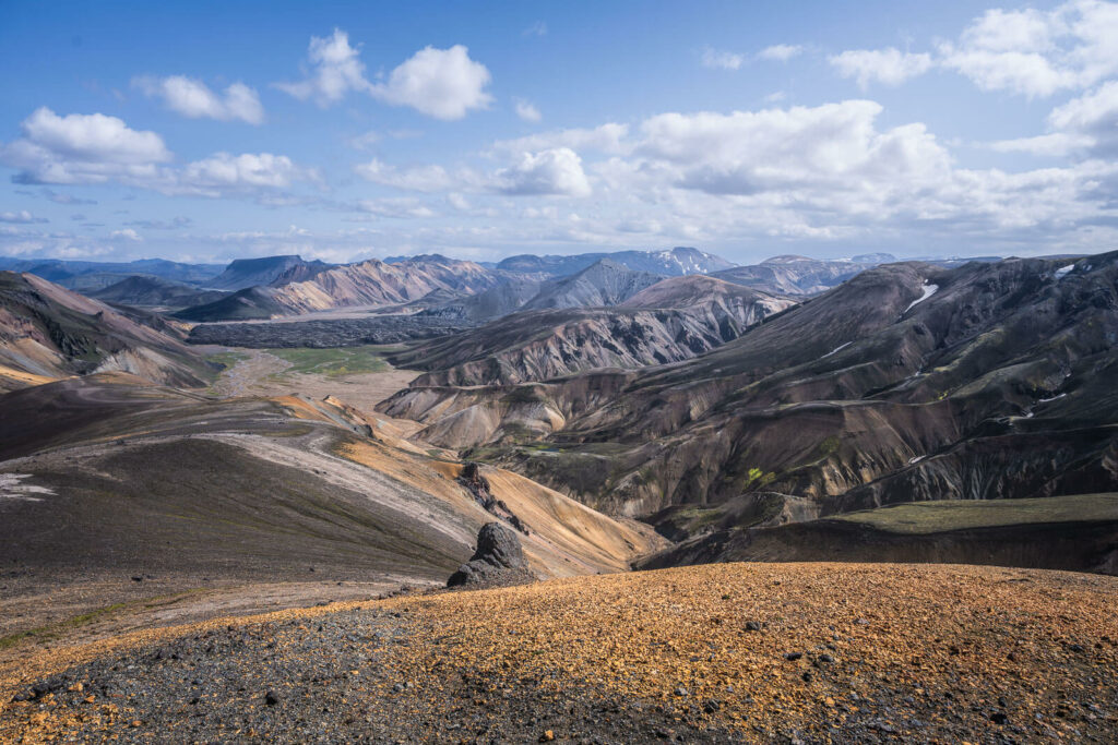
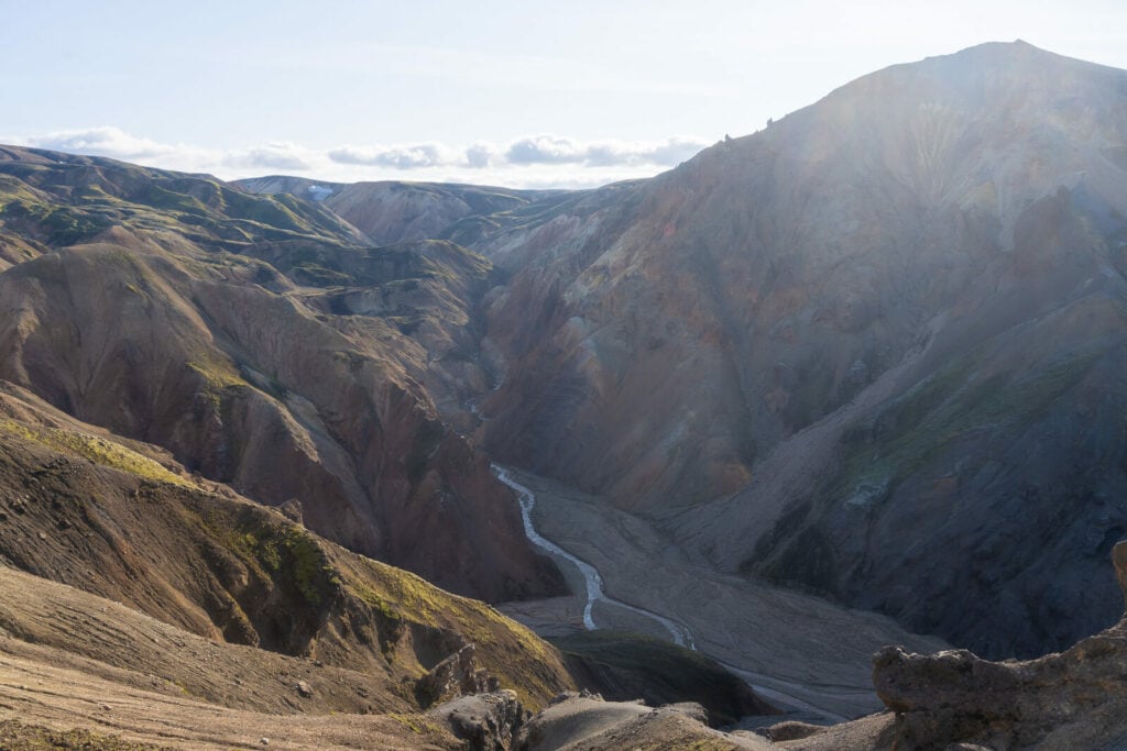
Háalda, view from the summit
Going to Iceland? Blue Car Rental Discount!
As a reader of The Photo Hikes, you get a 5% discount on your car rental when booking with Blue Car Rental through this website. The discount will be automatically applied to the booking through the following link
Table of Contents
Overview of the Haalda Hike & Map
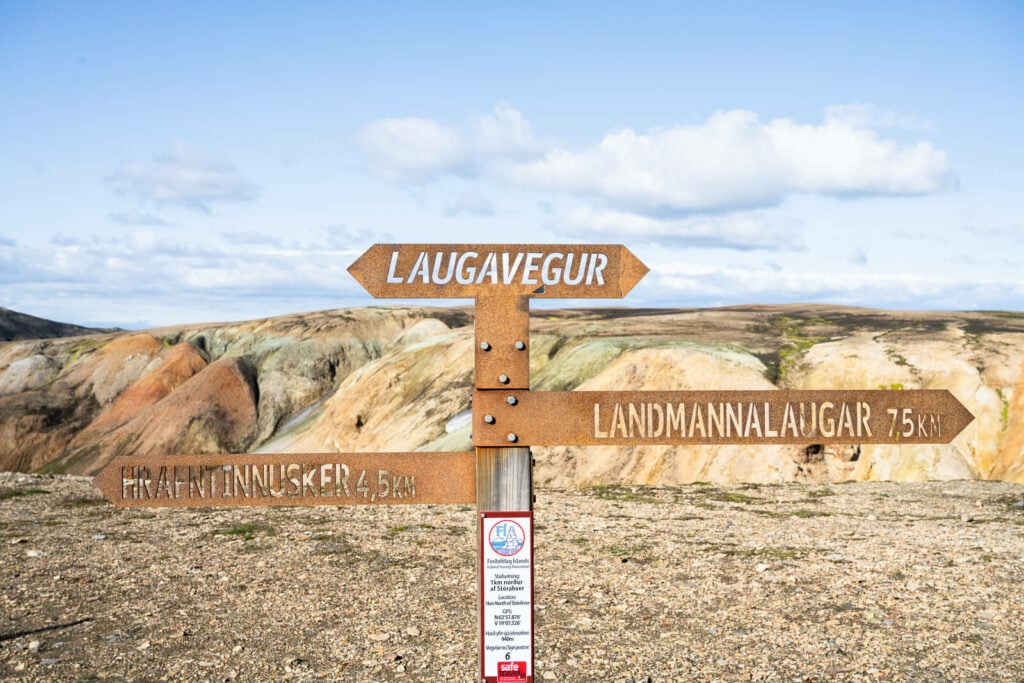
As mentioned in the intro, there are several ways you can hike to Haalda. First of all, it’s a loop hike, so you can do it either way. There also are two possible trails on each side, so you have a total of four variations of this hike.
If you have already hiked some trails in Landmannalaugar, this comes in handy. This means you can plan your itinerary to hike those trails you have not been to yet.
For instance, if you are doing the hike counterclockwise, as I did, you can hike up Haalda either via Sudurnamur (longer) or the Laugahraun lava field.
On the opposite side, you can either choose to hike back to camp via the Brennisteinsalda trail, or the Skalli trail (longer).
While I had already hiked all those trails, I chose to hike via Laugahraum and Brennisteinsalda since I never hiked those connecting trails. So this is the hike you see here:
| Max Altitude | 1,128 m |
|---|---|
| Distance | 22.3 KM |
| Elevation gain | 1,060 m ↑ / 1,060 m ↓ |
| Hike time | 06:00/ 07:00 Hours |
| Hike Difficulty | Difficult |
Here is also the map of this hike. You can download the Haalda hike GPS file for free from the activity linked below:
How to get to Landmannalaugar and Parking
Landmannalaugar is located in the highlands of Iceland; this means you can only get there in summer. Typically, from mid-June until mid-September, although the dates vary each year. Check Road.is to see if the road is open.
- Driving Directions: If you are driving, a 4WD is required. The best way to get there is via road 208 North to Landmannalaugar and then road F224, as there are no river crossings until you get to the camping ground.
- Parking: please note: as of June 20th, 2024, you will need to reserve parking in advance if you plan to visit Landmannalaugar between 9 AM and 4 PM (source). You can reserve your parking spot in Landmannalaugar here. The reservation system will be in place every year between June 20th and September 15th. Once in the Parking area, you can leave the car in the parking lot by the river. A small pedestrian bridge will allow you to cross the river from there. However, you should only attempt to get to Landmannalaugar via other F Roads (like the F208 south) with a larger 4WD as the river crossings are unsuitable for a small 4WD car. Please note: as of
- Public Transport: No public transport is available, but a few companies offer transport services like Trex – Travel Experiences or Reykjavik Excursions.
The Haalda Hiking Trail
As mentioned earlier, there are several possible ways to get to Haalda and back. In this post, I will describe the trail I hiked, from the campsite to Haalda via the Laugahraun lava field, and back via Brennisteinsalda. That is the same way everyone doing the Laugavegur trail takes too, at least the part through Laugahraun.
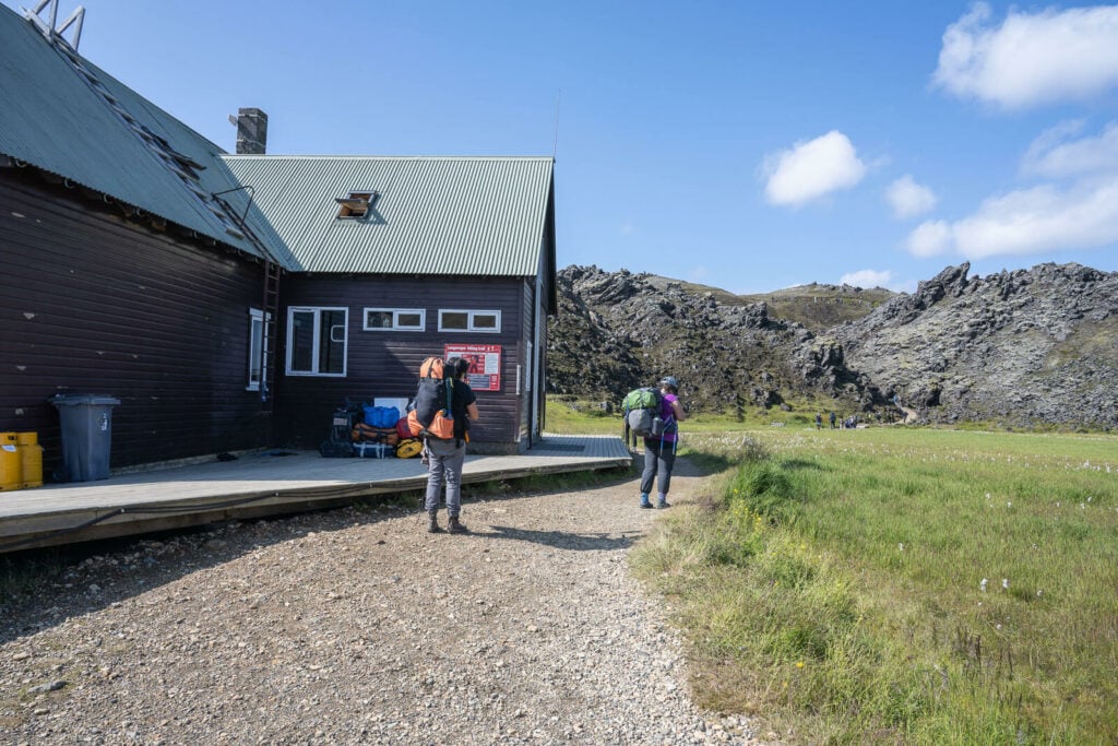
You can heat to the main hut and take the trail toward the Lava field.
The views immediately open up to the magnificent landscape around the trail.
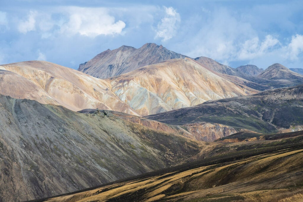
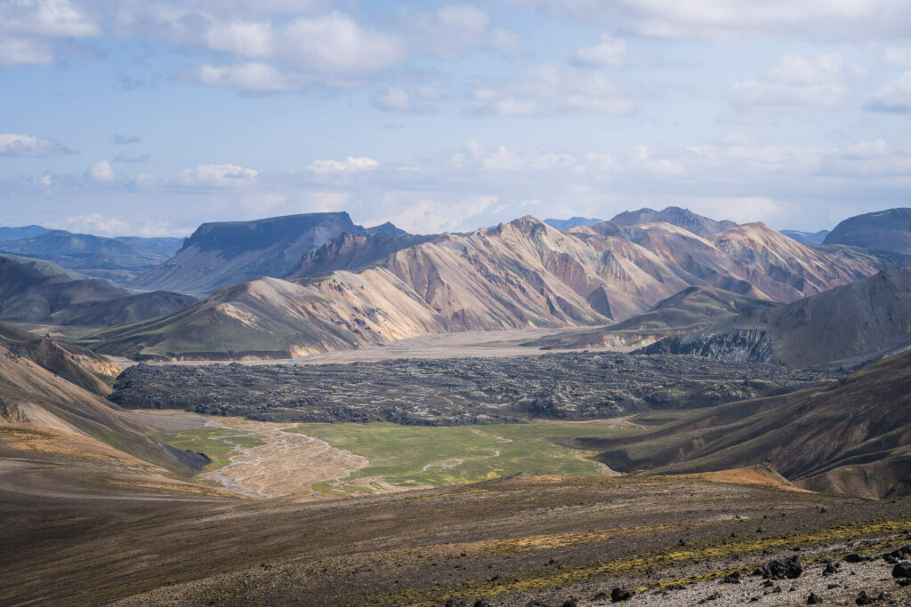
This first part is easy, and the landscape is already truly magnificent. While the hike through the Laugahraun lava field is easy, there’s no shortage of scenic landscape around it. You can get a good view of all the major attractions, such as Blahnúkúr, Brennisteinsalda, and Sudurnamur.
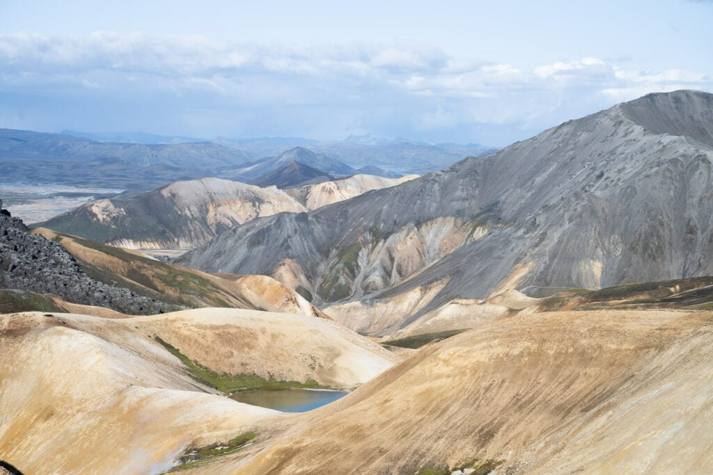
Once past that, you will have to cross the large alluvial plain between Brennisteinsalda and Sudurnamur, to hike up the mountain on the far side. There is where you will find the first yellow trail sign pointing to Haalda. From here you will need to keep following the yellow or yellow-blue trail marks.
the Laugahraun lava field. Haalda is the highest mountain on the left hand side.
The beautiful alluvial plains in between Sudurnamur and Brennisteinsalda.
Haalda, the mountain in the middle.
Not as close at it seems!
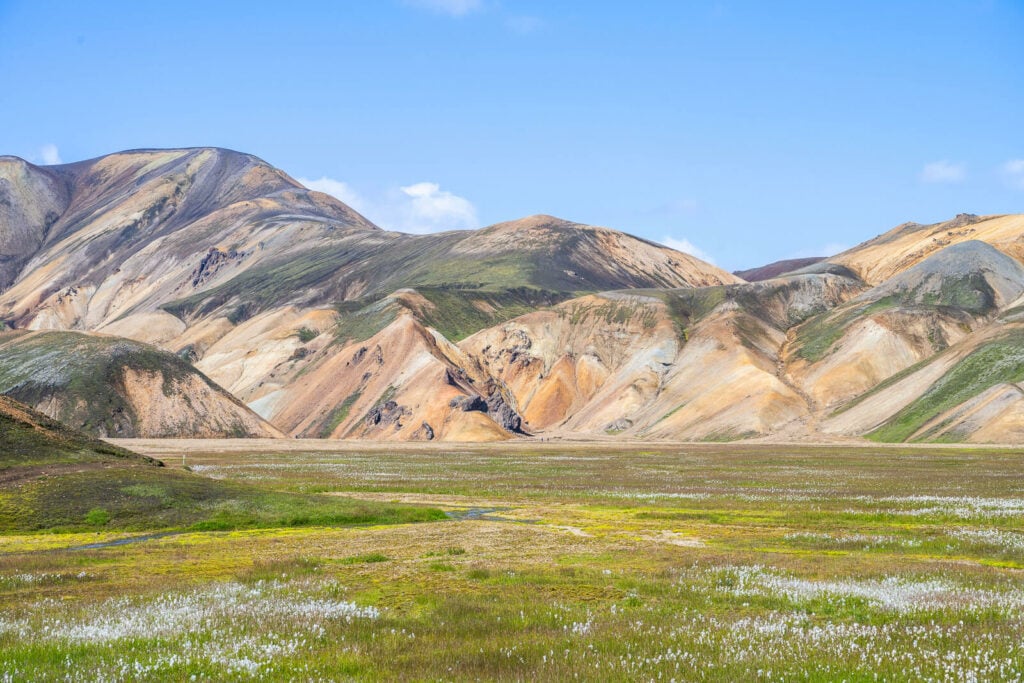
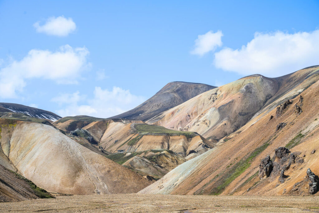
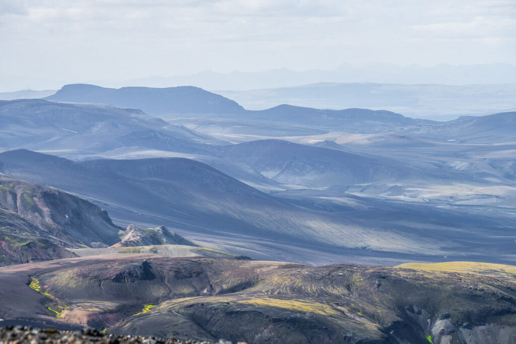
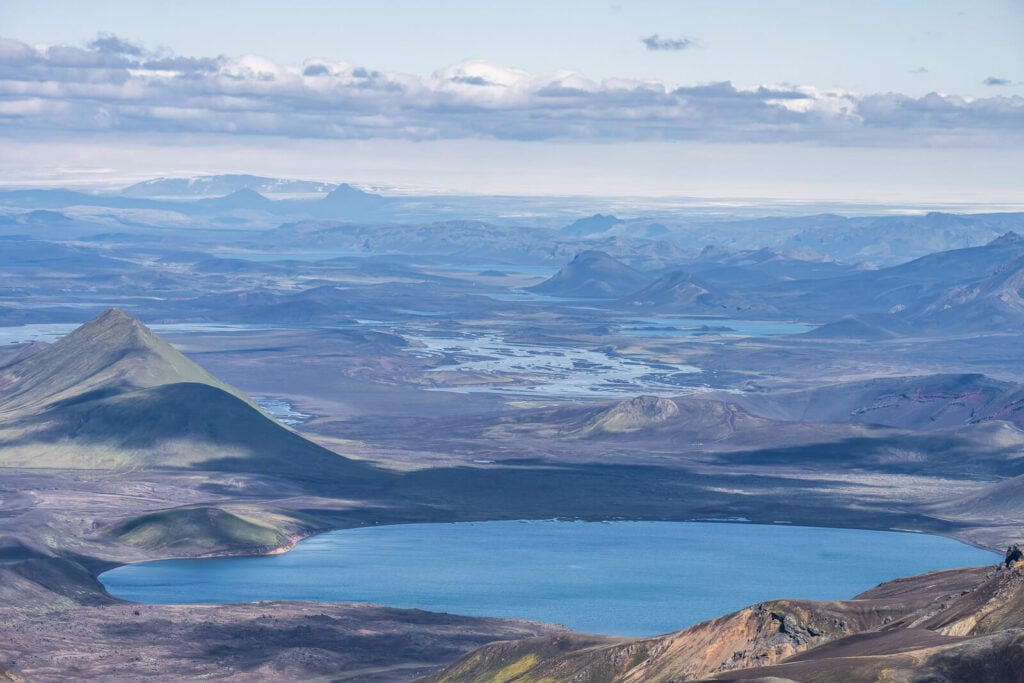
Haalda from here will look deceptively close; it’s the big rounded mountain to your left. This is also where most of the elevation gain happens until you reach the top of Háalda. On the wide and flat summit, there is a small cairn. Needless to say, you have spectacular views from the top. This includes all the views toward the Landmannalaugar campsite, as well as on the opposite side, toward Höfðavatn.
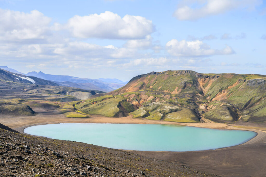
Höfðavatn.
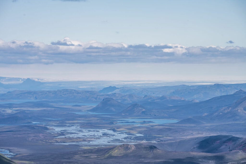
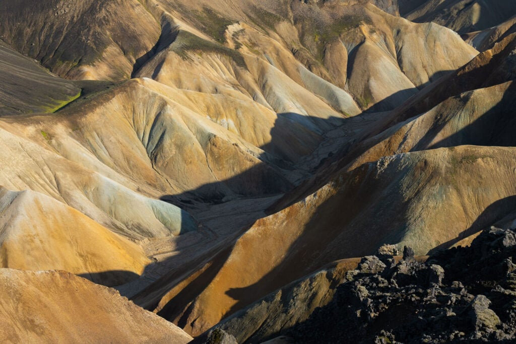
Some of the stunning landscapes from the summit.
Endless landscapes.
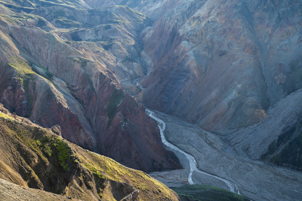
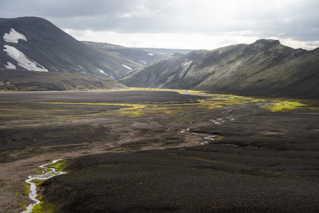
Also, once you’ve reached the summit, you’re only 1/3 of the way into the hike. So there’s plenty more to see along the trail. This is where the landscape changes from the classic colorful rhyolite mountains to lunar/martian landscapes, small gorges, fumaroles, and very active geothermal areas.
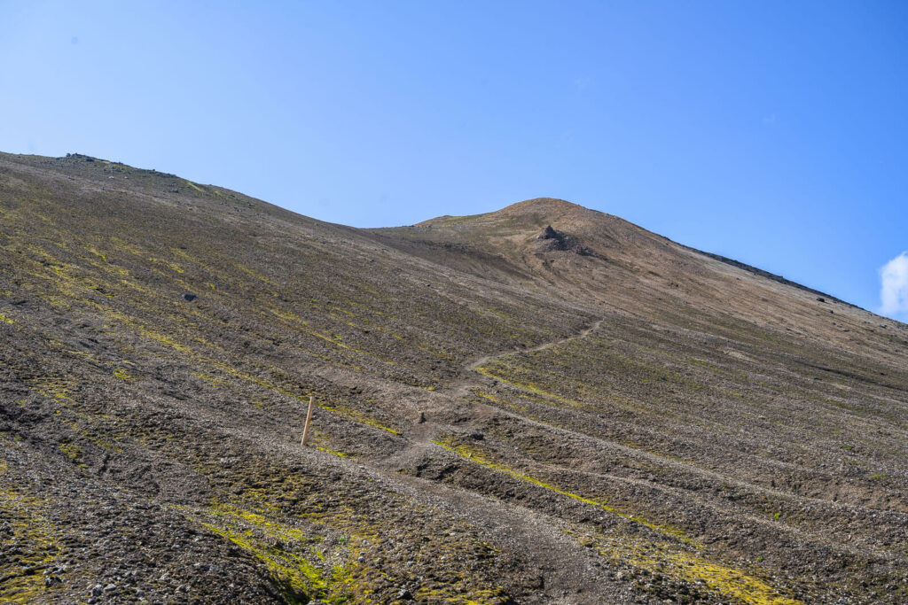
Anyway, first you will need to descend on the opposite slope. which is also quite steep. Here the trail is difficult to see, just follow the blue/yellow trail markers.
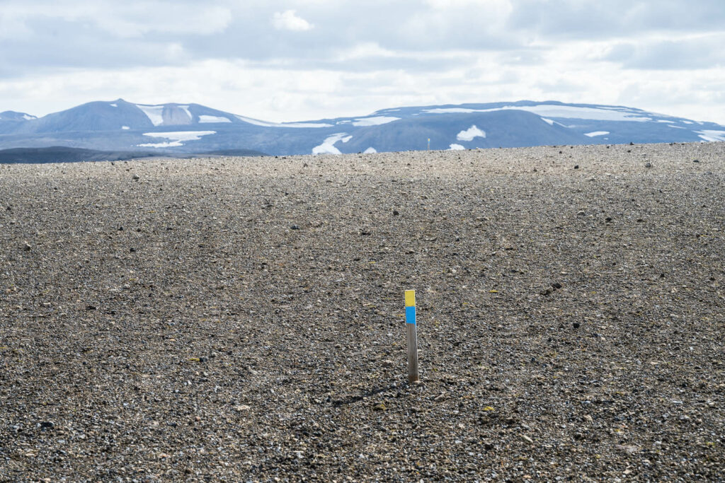
The Trail Markers
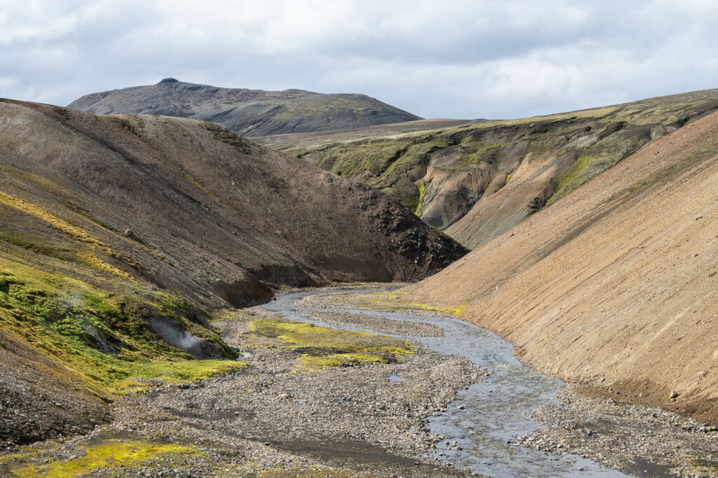
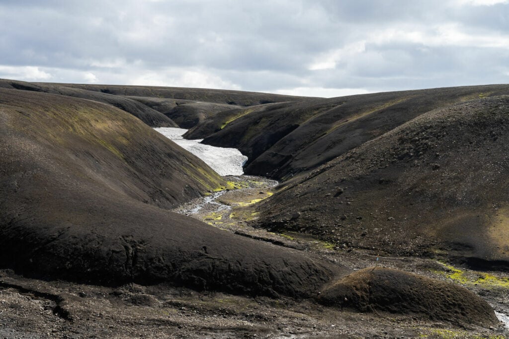
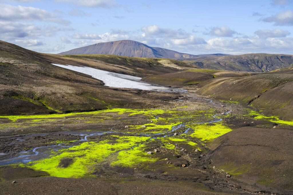
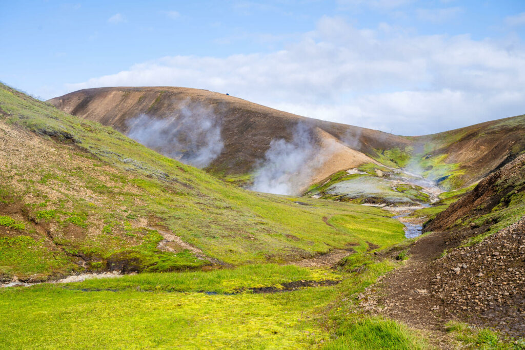
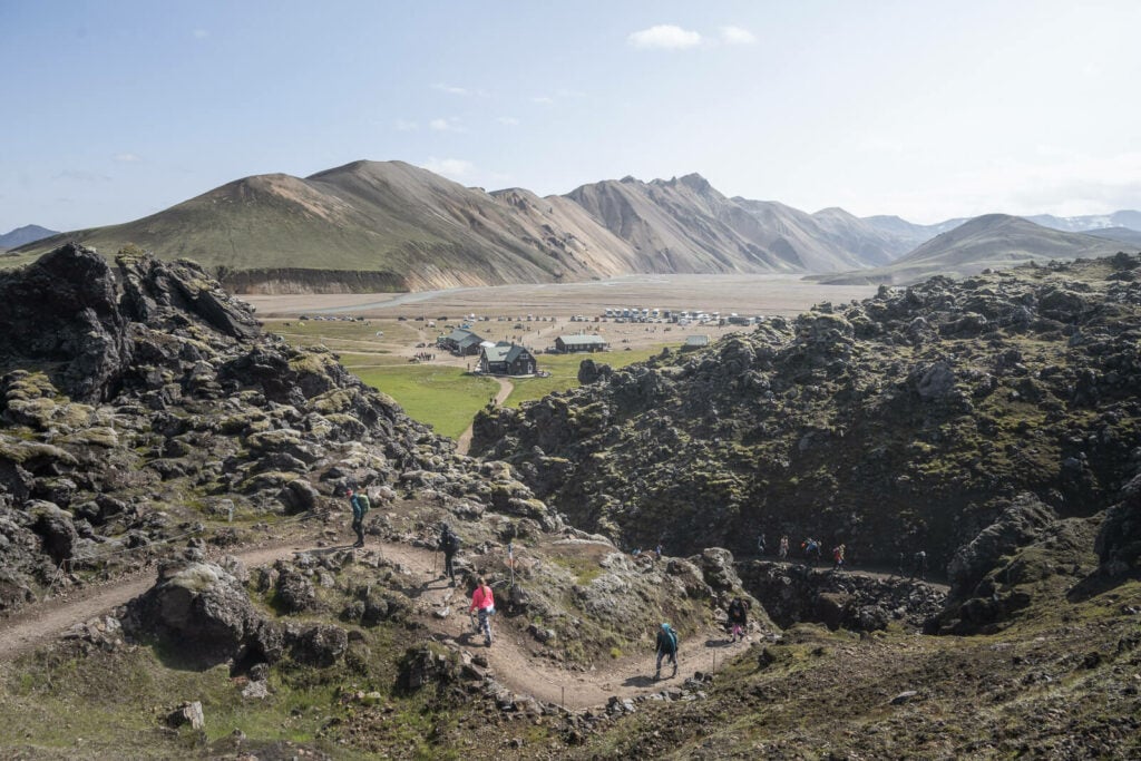
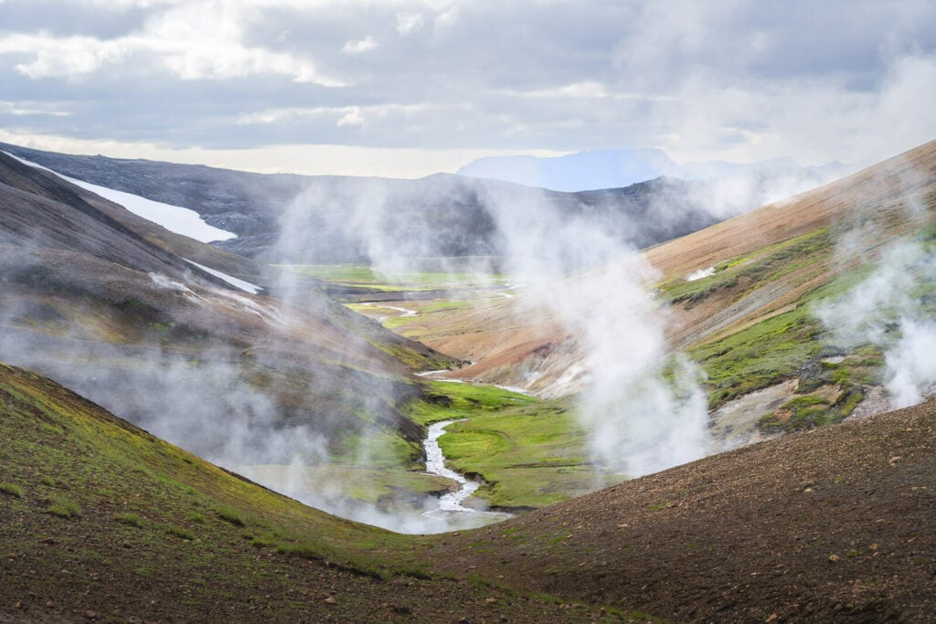
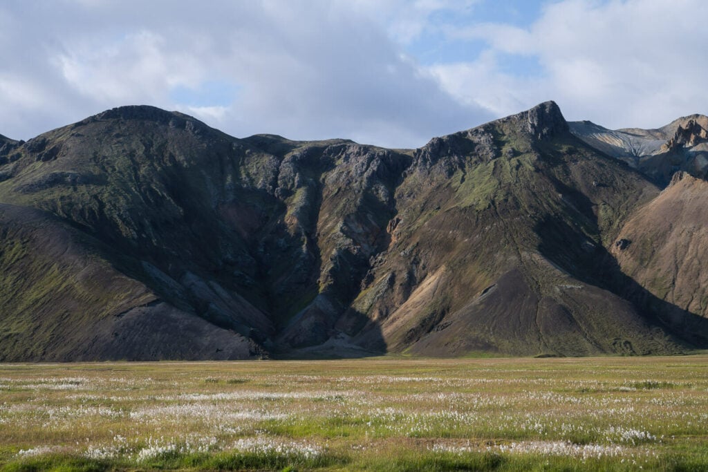
Once you’re on the other side of the mountain, the trail will be primarily flat. Here you will find some beautiful hidden gorges, black sand plains, and very active geothermal areas. All of this continues for a few kilometers until you reach the relatively crowded junction with the Laugavergur trail.
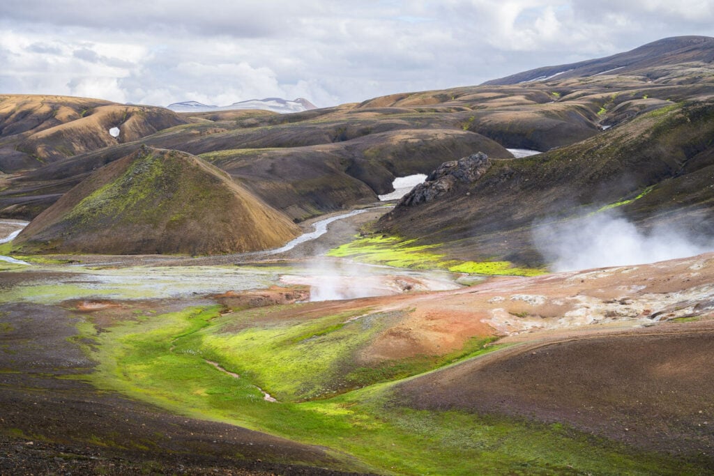
This is where you will the most geothermally active area of the whole hike. This area is a major attraction in itself, due to the geothermal features and colorful hills. It’s one of those places where you can feel the earth being alive. Take great care to not wander off-trail, it’s a very delicate area. Also, scorching hot in places!
From here, you will need to follow the Laugavergur trail back toward the Landmannalaugar basecamp, for the most part at least. On your way back, you will also have a choice to either go back to camp via Brennisteinsalda, it via the Skalli trail. if you want to do it via scally, you will need to add about 6-7 km to the trail, so it is not a trivial deviation; that would bring the total distance to 27-28km.
Anyway, I passed by Brennisteinsalda, since I already visited Skalli, but I had never been on the part of the trail connecting Haalda to Brennisteinsalda. So that was my choice. Again, needless to say, beautiful landscape all around it, plenty of mountain views, and hidden gorges along the way. Even some fierce and curious lambs!
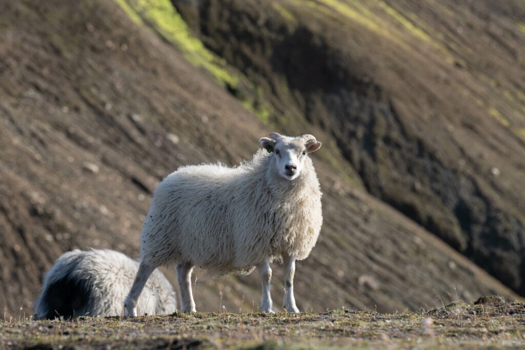
Fierce Lamb!
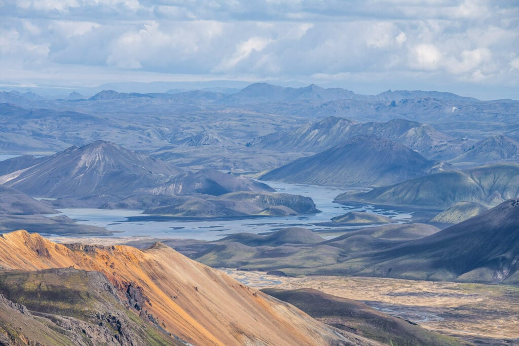
Passing by Brennisteinsalda provides the opportunity to catch more amazing landscapes.
Blahnukur, on the right hand side.
Once you’ve reached the top of Brennisteinsalda, you can either choose to go down through the Laugahraun lava fields or the Graenagil Canyon. The distance is more or less the same, so you can pick what makes the most sense to you. I choose to go back through the Laugahraub lava field.
Once back at camp, there was only one more thing left to do; take the swimsuit and go for a restoring dip in the geothermal waters of the hot pool!
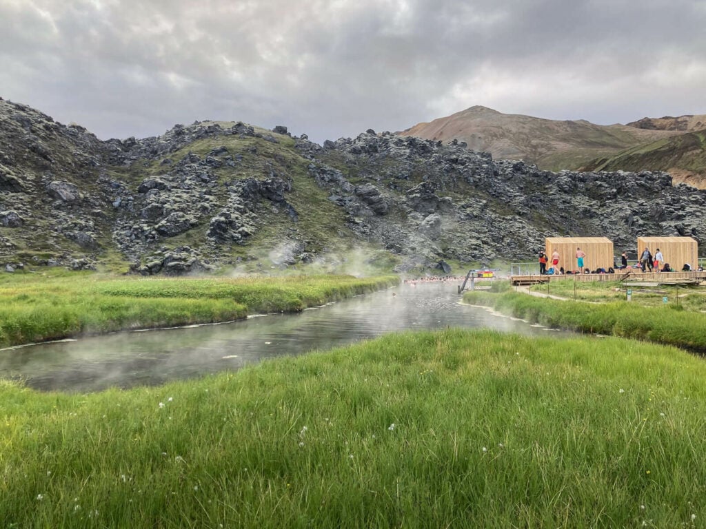
The hot pool in Landmannalaugar.
The Haalda Hike Photos and Photography Tips
Well, it’s no secret that Landmanalaugar is my favorite place in all of Iceland both to hike and to take photos. This is one of those rare hikes and locations where there is no single point of interest, rather, the whole trail is one major point of interest in one way or another.
What this means for landscape photography as well as for nature and landscape lovers, is there is no shortage of points of interest or photography subjects along the way.
Here is a gallery
Looking back toward the Laugahraun lava filed and the campsite
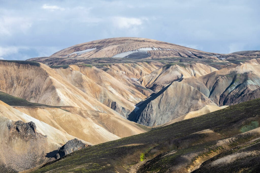
Rhyolite mountains
The Vast expanse of the highlands
In terms of lenses, I’ve never found ultra-wide lenses to be particularly useful in Landmannalaugar, and this trail is no exception. If you need to save some weight in your backpack, leave the ultra-wide.
However, a telephoto lens is a must here. You could spend hours taking photos of all the details in the vast landscape ahead of you while time flies. I sure did for me. I probably spent one hour only atop Haalda with my 70-200mm lens.
Please note; to fly a drone in Landmannalaugar you would need to apply for special permission from the Environment agency. This is a protected area so a permit is required if you want to fly. Application to the permit is paid.
Video of the Hike
if you still want to see more, here is a short YouTube video ho this hike.
Where to stay
The Landmannalaugar campsite would be the most obvious choice. You can camp in a tent (paid) or with a Van in the parking areas (free, but you still need to pay for the facilities). Alternatively, you could stay at the hut, but it needs to be booked well in advance.
However, if you do not want to cannot camp at Landmannalaugar, there are a few places you can stay at just outside the Fjallabak Nature Reserve. Like, for instance, the Highland Center.
Additional Resources
- For more info on Hiking and Camping in Landmannalaugar, check out my comprehensive Guide to hiking and camping in Landmannalaugar.
- Check out my Top 5 list of (other) hikes in Landamannalaugar.
- Check out even more Hikes in Iceland here.


Leave A Comment