Iceland Ring Road 8 Days Itinerary with a Campervan
If you are wondering whether you can do a campervan trip around Iceland on the ring road in 8 days, here’s your answer: yes, you totally can. I did it in May 2023 and also added a stop on the Westfjords and two on the Snaefelsness peninsula.
I managed to visit 23 locations in 8 days, between quick roadside stops and long hikes. That’s an average of three each day with some amazing highlights that only Iceland can provide.
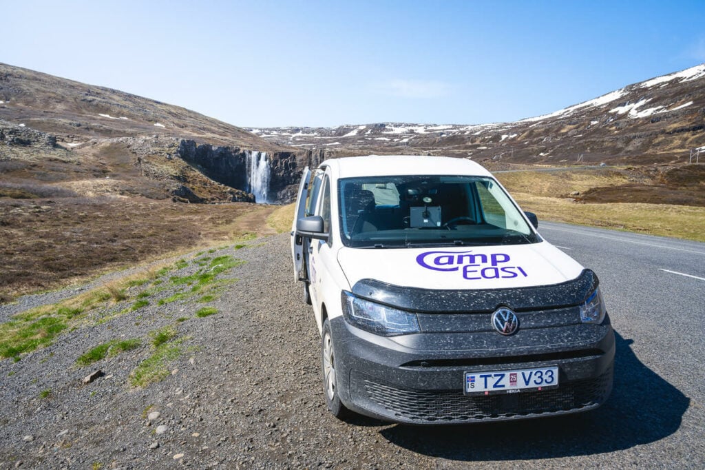
The CampEasy Campervan I used for my ring road trip around Iceland.
Seems like too much? It is, kind of, but also it isn’t. It really depends on what your expectations are. Such an itinerary requires a lot of driving and time on the road, but on the other hand, it allows you to see and experience many different regions of Iceland.
Anyway here is my full day-by-day itinerary and the location I visited:
So while you can definitely do it, there are two main things to consider:
- First, as you probably know already lots of driving is required, every day. And one thing you should know, it will take longer than you may anticipate to get anywhere in Iceland.
- Second, you may need to be picky about where you want to stop and what you are willing to skip. You’re not going to be able to see everything on the ring road, so you will need to make choices on what to see and what not.
In this post, I’ll show you how I planned and organized my trip, what I saw, and what I skipped along the way. You can use this information to plan your own trip if you are thinking about doing something similar, or if you have limited time on the Island.
My full trip was eight days, with a full seven days of travel. If you are coming from the US or Canada or landing in the early A.M., you may actually be able to do this in seven days instead of eight. Generally speaking, if your flight lands in the early AM you might be able to. I landed in the late afternoon so I pretty much lost one full day.
Anyway, if you are planning to drive that much, make sure you take enough breaks in between locations to rest before the drive to your next stop. Safety first always comes first.
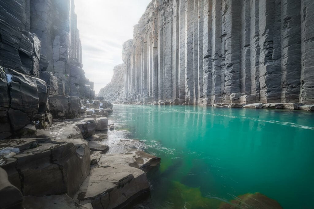
Stuðlagil, visited on my fourth day around the Ring Road.
Why choose a campervan for a Ring Road Trip in Iceland
If you have already booked a van or a car, you can skip this section. If you haven’t or are still considering which type of vehicle to book, read on to see why I preferred a Campervan vs. a car or even a car with a roof tent.
-
Campervan vs Car
For such an endeavor I’d absolutely recommend a campervan over a car, for two very simple reasons: time and flexibility. You want to save any time you can get and be flexible enough to change plans along the way.
A campervan allows you to do both. You are basically on the road all the time. You can eat and sleep in the Van and you have the flexibility of changing itinerary along the way. Why? The Weather, mostly. As we’ll see in the next section, this is one of the most important aspects to consider when planning a road trip to Iceland.
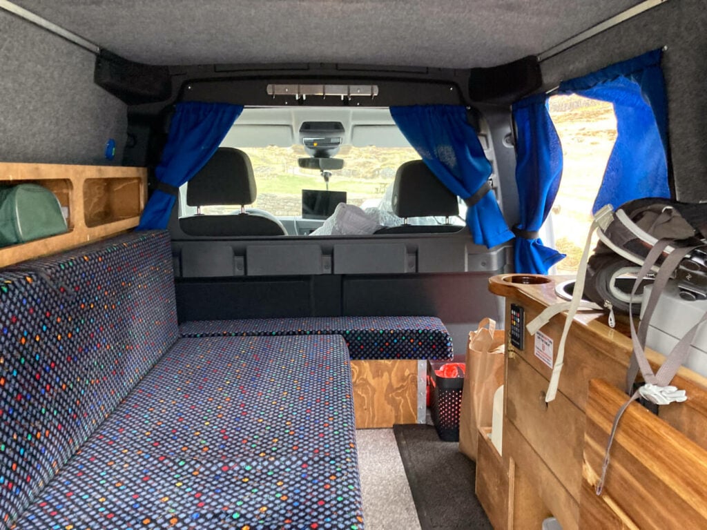
The inside of my camper van for this trip.
This is something I’ve learned from Icelanders. If the weather is bad, just go where the nice weather is. Don’t be stuck in a place waiting for the rain to stop. If the sun is shining 200 km from where you are, drive there and adjust your itinerary accordingly. A van easily allows you to do this.
If you had a car you would need to book the accommodation in advance for most of the nights, if not all. This type of travel would not allow for much flexibility.
Additionally, if you are planning to do this as a photography road trip around Iceland as I did, flexibility is key for you to be ready and out to catch the best light, sunrise, or sunset.
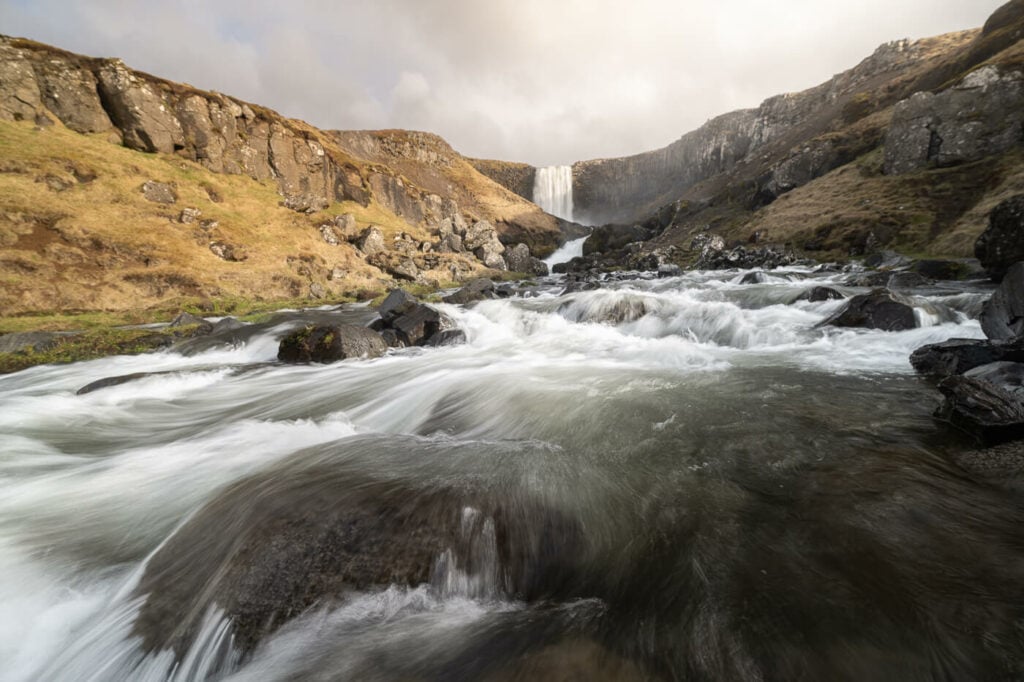
Sunset at Svöðufoss, on the Snæfellsnes peninsula.
-
Campervan vs Car with roof tent
Another option would be a roof tent, but this has more limitations for a not-so-much-cheaper price. First of all, it’s going to be cold. Vans have heathers, roof tents don’t.
Second, you have less space inside. If you are stuck due to bad weather, you can chill in a van, but you’d be stuck in a car with a roof tent. This brings us to the third point; you can sleep in a van in strong winds, while you cannot use a roof tent in the same conditions. Roof tents can only withstand so much wind before risking getting damaged.
I’d generally recommend thinking carefully about what kind of trip you want to go on and then considering which type of vehicle would be the most suitable for your own trip. If you are planning to visit that many locations and cover that much ground, a van is definitely the option that allows you the most flexibility.
My Choice – A 2WD Volkswagen Caddy Campervan. No need for a 4WD vehicle in May in Iceland
For this trip, I chose a VW Caddy Easy Small campervan from CampEasy. The Caddy is more than enough for one person and good for two. There is more than enough space for one person with a bag and camera equipment, it’s cheaper and does not consume as much as bigger vehicles. Also, plenty of charging ports.
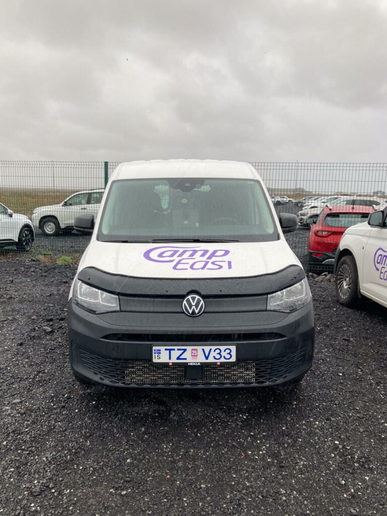
Volkswagen Caddy Camper at pick up.
It also was a 2WD vehicle. First of all, a 2WD vehicle is cheaper. Second of all, there is no point in having a 4WD vehicle at this time of the year, May. The highlands are closed, the weather should be mostly fair, and even in case of snow, most rental car companies still fit winter tiers on their fleet.
I had to drive through a sudden snowstorm with the ring road close behind and in from of me. No problem at all with the 2wd Caddy. Of course, you need to drive carefully, but we’ll get to it later during my day two trip report. If you still prefer the peace of mind of a 4WD, this model is also available as a 4WD.
Also, CampEasy offers a pickup service at the airport and they have a “leftovers” corned where you can pick up free stuff for free! It’s stuff left from other campers and should you have anything left at the end of your trip you can leave it there. This did save me a bunch of money too when I went to do my groceries.
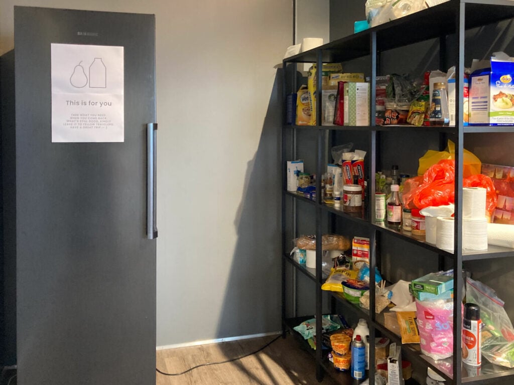
The “free goodies & groceries” corner at the Campeasy head office.
The camper also comes with pillows, a duvet, and everything you need to cook, including a stove with a gas canister, cutlery, and dishes. Plus it’s very well insulated and with the Webasto heather, you are sure to stay warm and toasty through the night.
The Van also has a very spacious fridge and a sink. Anyway, I’ll add my review of the Easy Small and more photos at the end of this post, for those who are interested.
What I planned and what I did during my trip – Iceland Self Drive Itinerary Tips
My plan was to do the ring road either clockwise or counterclockwise, depending on the weather at the time of arrival. For that, I had prepared a list of places I wanted to visit each day, so I could do it either way.
I had planned to arrive on a Saturday afternoon and leave on Sunday the week after. So seven full days, plus two half-days to spend. As mentioned earlier, flexibility is the key. Here you can see my original plans and the actual day-by-day Itinerary I followed to catch the best weather. You will notice it is only seven days. This is because I have not included day one in the table, since I arrived in the evening and did not do any sightseeing.
| Ring Road Counterlockwise | Ring Road Clockwise | Actual itinerary |
|---|---|---|
| Glymur, Svodufoss,Grundarfoss, Selvallafoss | Skogar Waterfall Way, Kvernufoss | Dynjandi, Selvallafoss, Grundarfoss |
| Dynjandi, Reykjafoss, Fosslaug | Hatta Hike in Vik | Kirkjufellsfoss, Kolufoss and Kolugljufur, Reykjafoss, Fosslaug. |
| Dettifos, Selfoss, Hafragilsfoss Stuðlagil |
Gufufoss, Klifbrekkufossar, Laugarfell Waterfall circle, Strutsfoss |
Godafoss, Dettifoss, Selfoss, Hafragilsfoss, Rjúkandi, Studlagil Canyon, Laugarfell Waterfall Circle |
| Gufufoss, Klifbrekkufossar, Laugarfell Waterfall circle, Strutsfoss |
Dettifos, Selfoss, Hafragilsfoss, Stuðlagil | Strutsfoss, Gufufoss, Fardagafoss, Klifubrekkarfossar, Flogufoss, Vestrahorn |
| Hatta Hike in Vik | Reykjafoss, Fosslaug, Dynjandi | Then Diamond Beach and Jokulsarlon, Stigafoss, Stjórnarfoss, Gluggafoss, Hjalparfoss and Gjáin |
| Skogar Waterfall Way, Kvernufoss | Svodufoss, Grundarfoss, Selvallafoss, Glymur | Skogafoss and the Skogafoss Waterfall Way, Svöðufoss |
| Bruarfoss, Gjian, Hjalpafoss | Bruarfoss, Gjian, Hjalpafoss | Bjarnafoss and Reykjavik |
As you can see, my schedule ended up being rather different and it turned out to be quite an adventure, which I thoroughly enjoyed despite the long days on the road. By the way, I do love driving too apart from hiking and with the landscape in Iceland being that epic, driving never gets boring.
Anyway, as you may have noticed, I have not included some of the major attractions. This is because I was on my 7th trip around the Island, so I only planned to visit locations I had not been to before.
Still, I will add all the major and alternative sights and stops I skipped for each day. This is so you can include them on your own Ring Road trip around Iceland if you want to use this post to plan your.s. I’ll also add links to the blog post of each location, if available.
Now without further ado, here is my 7-day Ring Road, Snaefelsness, and Westfjords trip report.
Iceland Ring Road Campervan Trip 8 Days Itinerary – Day by Day
Day one – Driving from Keflavik to the Westfjords
Start at: Keflavik
Stop at: Dynjandi
Distance Driven: 402 KM / 6:30 hours
Sights: Dynjandi, but not really much, it was rather dark.
Other potential stops: there is so much to see in between it would. be impossible to make a comprehensive list. However, a few alternative places you should consider for a more chilled itinerary could be Thingvellir and Oxarafoss, Hraunfossar and Barnafoss, Glymur, or the Snaefelsness peninsula. To be honest, if this is your first time in Iceland you should consider skipping the Westfjords altogether and plan a more relaxed itinerary.
To be fair, I did not do any sightseeing that day. First of all, it was past six p.m. when I picked up the van. I had to do some groceries for the trip as well, and there was heavy rain for the whole night except for the Westfjords. So I went to stock up on food at the Bonus supermarket nearby, which is where I usually do my groceries after picking up my rentals. Then I started driving all the way to the Westfjords from Keflavik. It’s a long drive, but if you plan it, you may be able to catch the ferry Baldur between Stykkishólmur and Brjánslækur. This would save you a few hours of driving. If instead, you prefer the scenic drive like I do, drive on!
Day Two – The beautiful Dynjandi and Snaefelsness peninsula
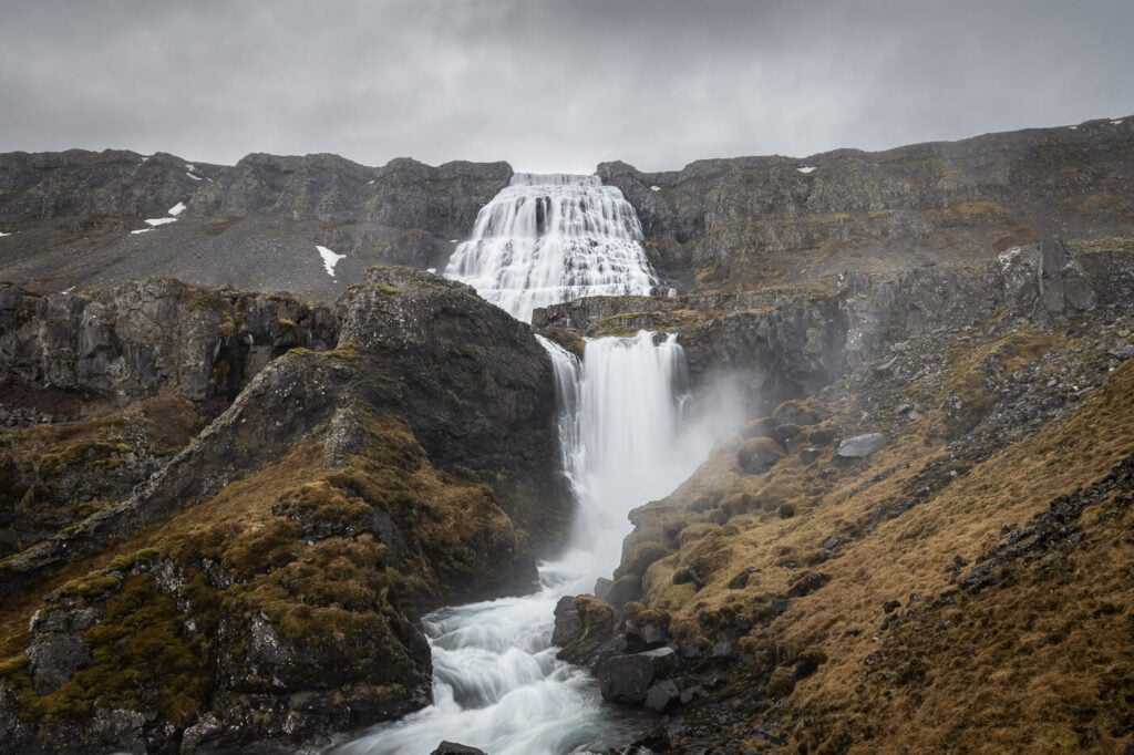
There actually are several waterfalls by Dynjandi, not just one.
Start at: Dynjandi
Stop at: Grundarfjordur
Distance Driven: 341 KM / 5:30 hours
Sights: Dynjandi, Selvallafoss, Grundarfoss.
Grundarfoss
Other potential stops: in their Westfjords you could consider adding Fossfjordur and this free hot pool close to Fossfjörður, where you can also visit the Fossfjörður Waterfall. Also the Hellalaugur Natural Hot Spring, on road 60. In the Snaefelsness peninsula, Arnarstapi and Búðir’s famous black church.
The first thing I did in the morning was the Dynjandi Waterfalls hike. There are several of them and it took about one hour (see also my post on the Dynjandi waterfalls hike). I had the place all to myself for the entire time. Magic!
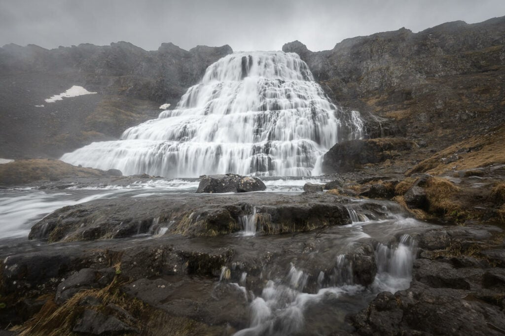
Dynjandi Waterfall.
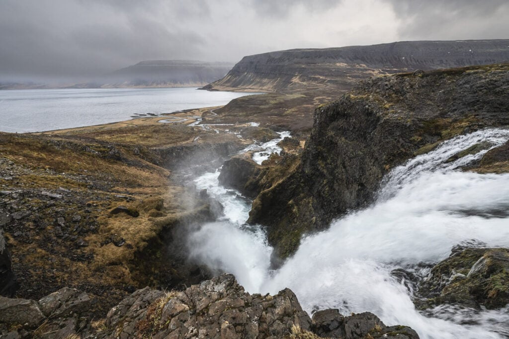
View of the Fjord
After the hike, I started driving back toward the Snaefelsness peninsula. The weather was going to get worse in the Westfjords and better over there. So I jumped in the van, and started driving, as some snow began to fall on the mountain passes of the Westfjords. I did not take the ferry because, again, I love driving, especially scenic roads like Road 60 in the Westfjords. Still, you should definitely consider that option if you want a more chilled trip.
After a few hours, I arrived at my first stop, a beautiful waterfall known as the Sheep’s waterfall, or Selvallafoss. It’s a beautiful, small waterfall s short walk from the parking/rest area Selvallavatn ViewPoint, on road 56. You can’t actually see the waterfall from the road, but you can follow one of the trails heading downhill from there. It’s a five-minute walk only. If you are passing by, this is a stop you won’t regret.
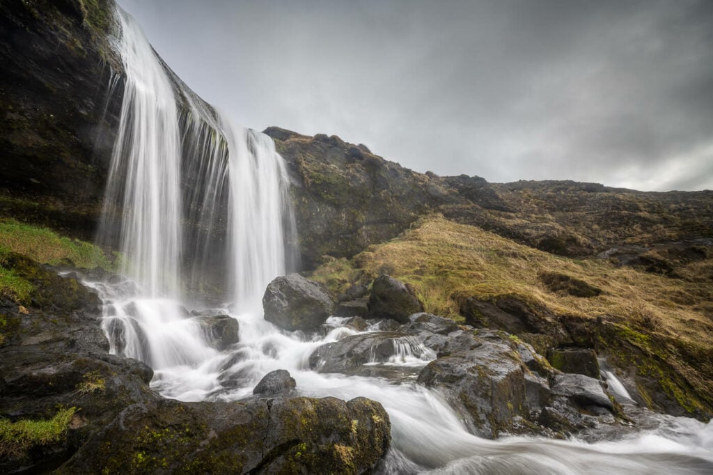
Sevallafoss, a beautiful little waterfall on the Snaefelsness peninsula
Tired, I then went looking for a campsite. I stayed at the Grundarfjordur campsite. It offers basic facilities and is perfect for a good night’s sleep. Here I had dinner, rested for a little bit, and then headed off to the next location, Grundarfoss. There’s a bit of a hike to get to the waterfall, the out-and-back walk will take about an hour.
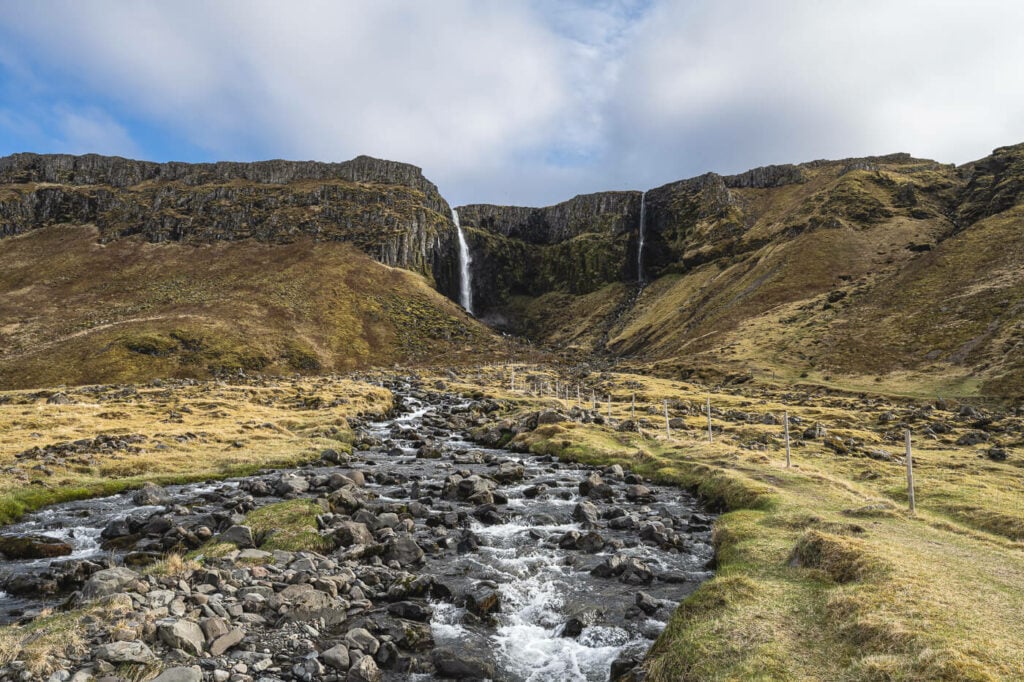
Part of the trail leading up to Grundarfoss.
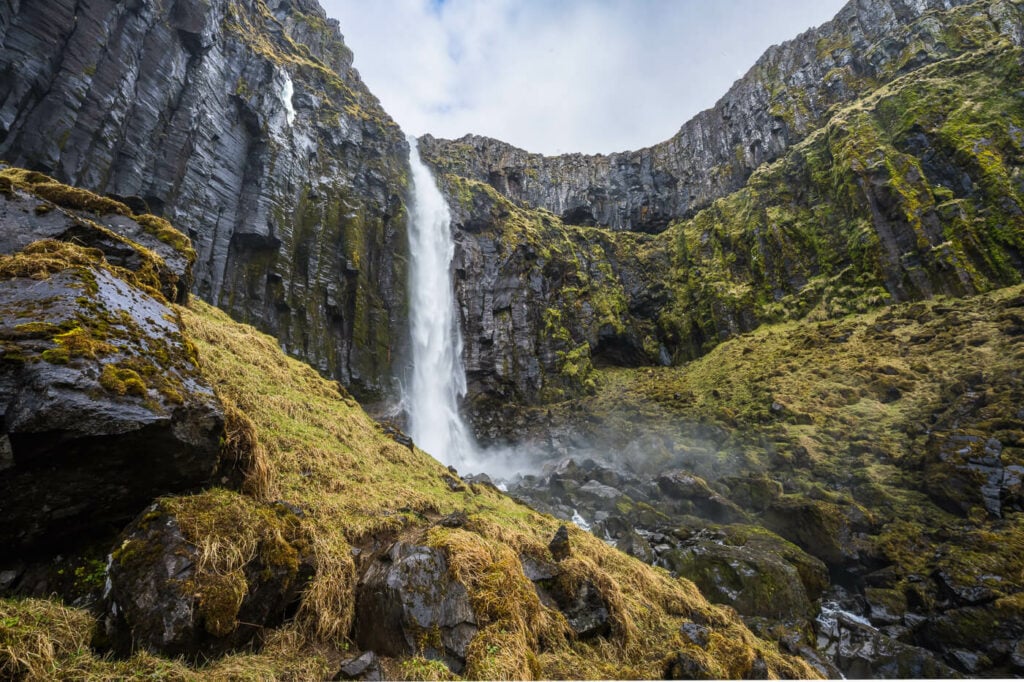
Grundarfoss.
Day Three – Caught in a Snowstorm and North Iceland
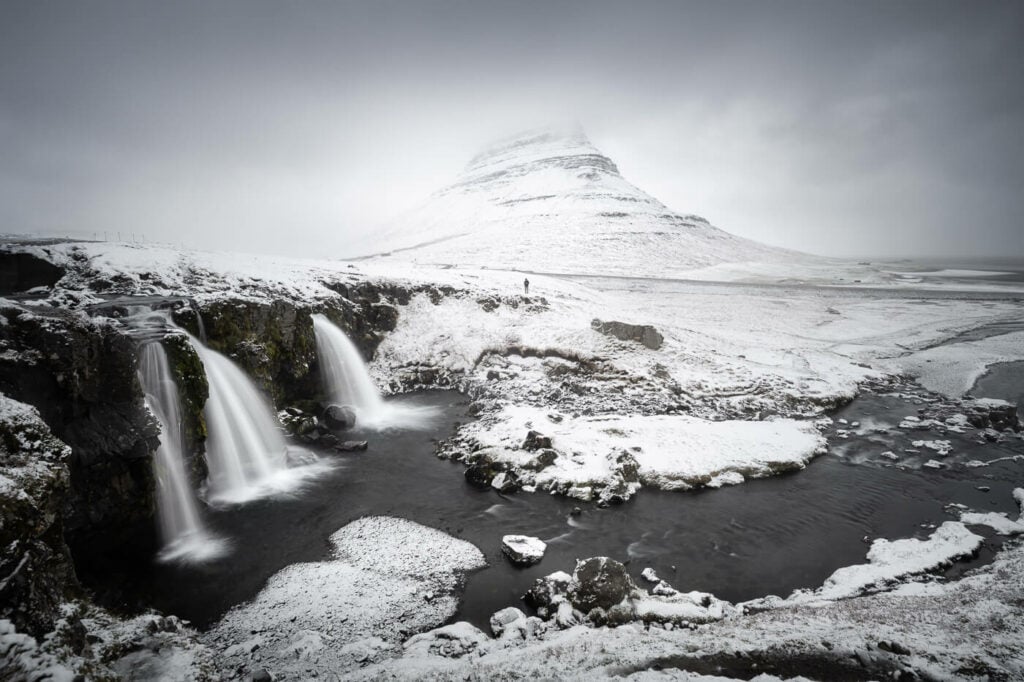
Kirkjufell and Kirkjufellsfoss under the snow in late May.
Start at: Grundarfjordur
Stop at: Akureyri
Distance Driven: 375km / 7:30 Hours (due to a snowstorm)
Sights: Kirkjufellsfoss under the snow! Kolufoss and Kolugljufur, Reykjafoss and Fosslaug.
Alternative attractions: as worthy detours from the Ring road up north on the Skagi peninsula, you can consider visiting Hvítserkur, the Kálfshamarsvík lighthouse, or the Ketubjörg cliffs and waterfalls.
A very amazing and unique day. To my total surprise, I woke up under a blanket of snow. About 2CM of snow fell during the night. The first thing I did was to go and shoot Kirkjufell and Kirkjufellsfoss. While I had been there several times already, I was quite excited at the possibility of taking photos of this location under the snow. So off I went after a quick breakfast.
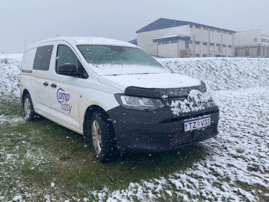
Woke up under a layer of snow, and it continued after that.
The snow adventure continued after that. The weather forecast looked good in the North, with a few sunny days ahead. So that’s where I decided to head next.
My plan was to reach Akureyri by the evening and stop at Kolufoss/Kolugljufur and Reykjafoss and Fosslaug on my way there. As I started driving north, a heavy, unforecasted snowstorm created almost whiteout conditions on the Ring Road. Queues started forming on the road. A couple of crashes and a few cars in the ditch.
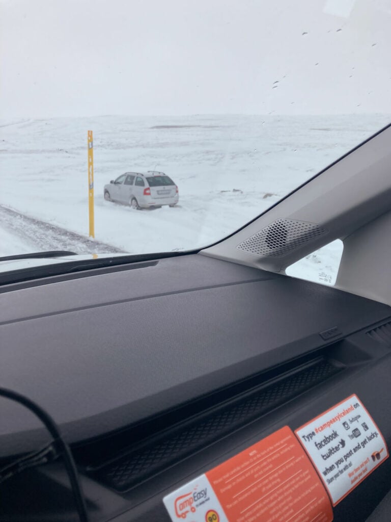
One of the several cars that went offroad. winter driving in Iceland is no joke, even in spring :).
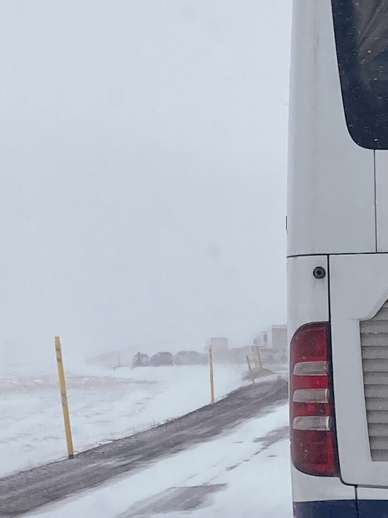
As you can see the conditions were pretty bad. A couple of minor crashes ahead.
I stopped in a small pull-out area to check the road conditions and to my surprise, the stretch of Ring Road I was on is now closed to all traffic. That was about 30/40 km and I was in the middle of it. I pondered what to do for a bit. Well, I had food, beer, and a heater in the van; I could have waited it out if needed.
However, after a bit, I decided to keep driving. Slowly, very slowly, 10-15 km/h slow. It took more than one hour, but near Blonduos the weather finally cleared. Sun! I was ready for the next stop, Kolufoss and Kolugljufur.
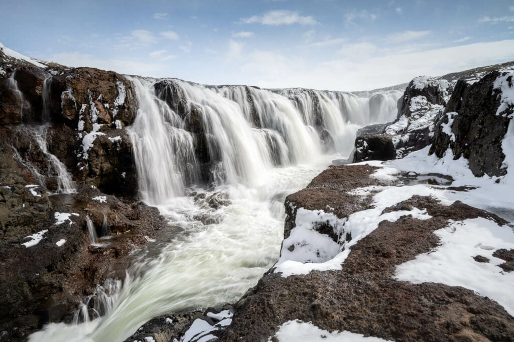
Kolufoss
I’ve spent a good hour there visiting the canyon and the waterfall. There isn’t a whole lot of space to walk around, it is a rather small location, but a beautiful one.
Next, I drove to my next stop, the Reykjafoss waterfall and the Fosslaug hot spring. There’s a bit of walking required here, about 20 minutes each way. The trail is essentially flat and very easy to walk on. The Reykjafoss waterfall is much better than I expected it to be, even if it is a relatively small one. The Fosslaug hot spring is also quite small. I did not have time to take a dip even if the pool was free – next time I guess!
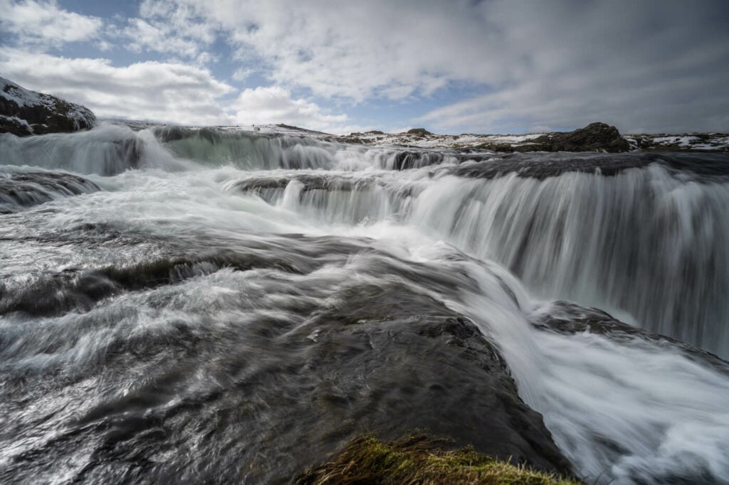
The upper part of the Reykjafoss Waterfall
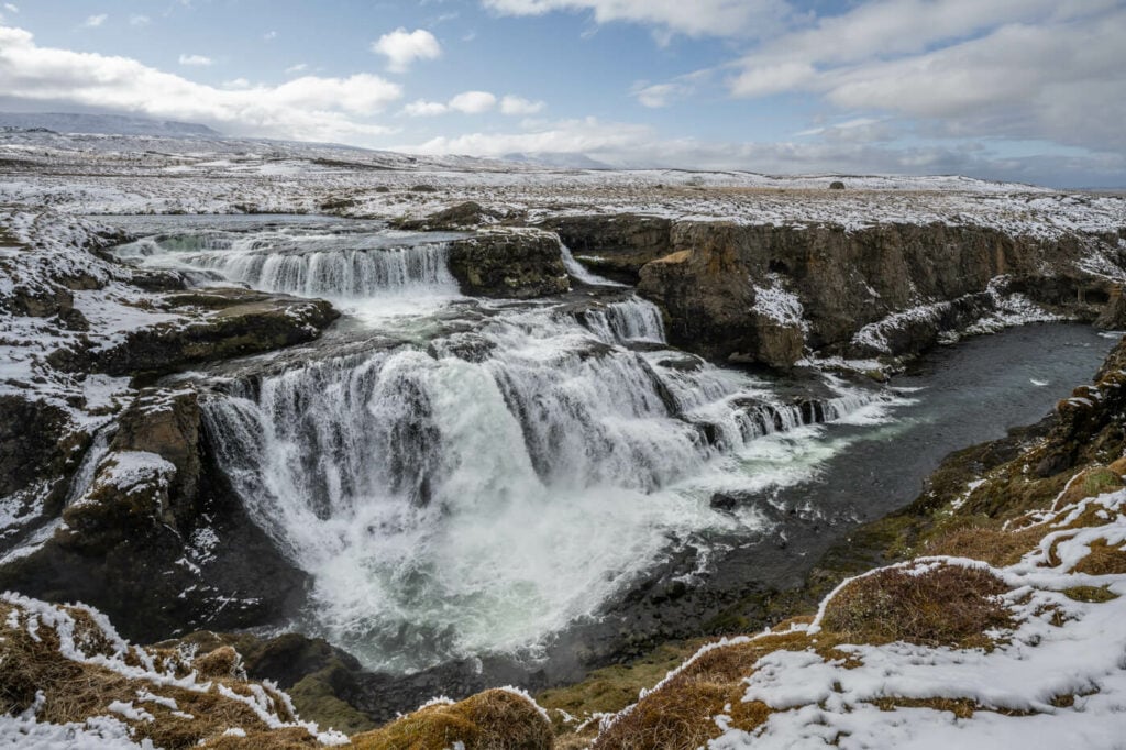
Reykjafoss, viewed from the opposite side.
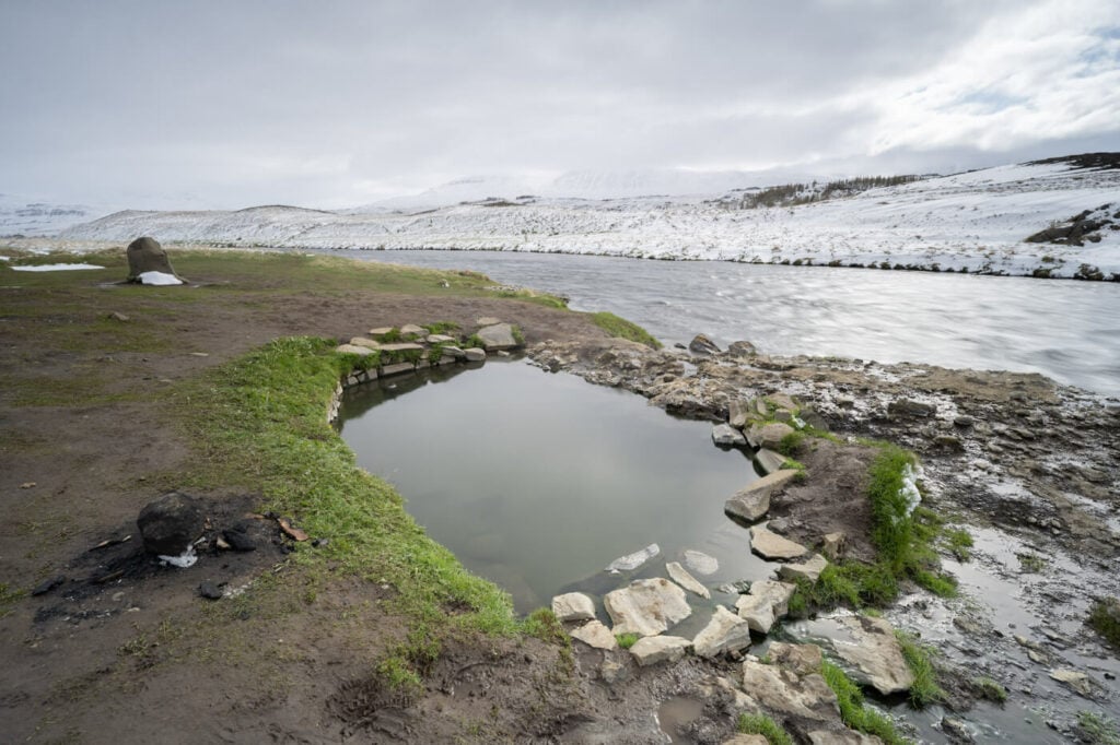
Fosslaug, the hot pools next to Reykjafoss.
This was my last stop for the day, before heading to Akureyri for the night. This was definitely a very tiring day due to driving and hiking. Still a very enjoyable one. I ended it with a short walk through the beautiful small town of Akureyri, something I do every time I visit Iceland.
I slept at the campsite in my van, a long and restoring sleep.
Day Four – From North to East Iceland
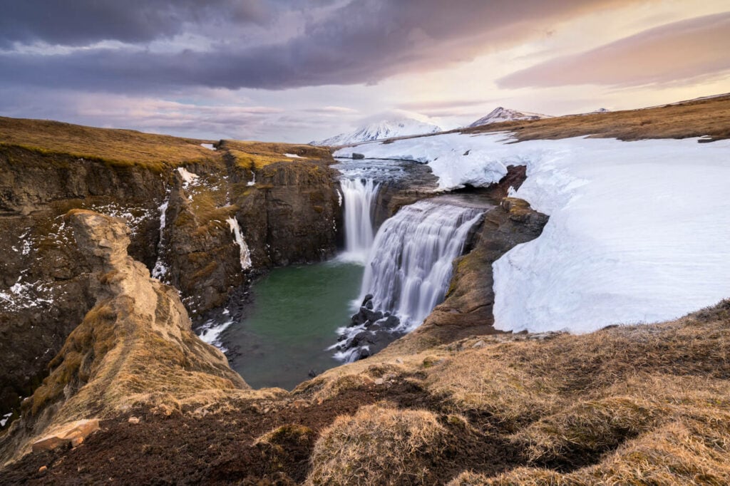
Sunset at the last Waterfall on the Waterfall Circle.
Start at: Akureyri
Stop at: Laugarfell
Distance Driven: 370 KM / 5:30 Hours
Sights: Godafoss, Dettifoss, Selfoss Hafragilsfoss (west), Rjúkandi, Studlagil Canyon, the Laugarfell Waterfall Circle Hike.
Other potential stops: there is so much to see in the north of Iceland. The Hverir Geothermal Area and Námafjall, Lake Mývatn, the Mývatn nature baths, the Dimmuborgir Lava filed, mývatn, Grjótagjá, Aldeyjarfoss (if the road is open), Ásbyrgi or you could visits Húsavík instead. These are just some of the major attractions but the list could go on.
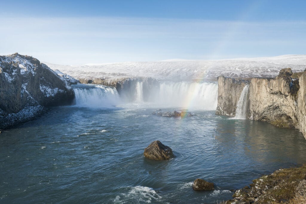
Godafoss with a rainbow
I woke up to another beautiful day, the “follow the weather” strategy definitely paid off as it kept raining in the south. My first stop in the morning was at Godafoss. I had been here several times before and originally did not plan to stop. However seeing it empty and with a rainbow by the waterfall, I decided to make an extra stop and enjoy it for a bit.
Then, off to Dettifoss East, where I also hiked to both Selfoss and Hafragilsfoss. The West side is closed at this time of the year (May) and so is the road to Hafragilsfoss, but hiking there and back just takes about 40 minutes.
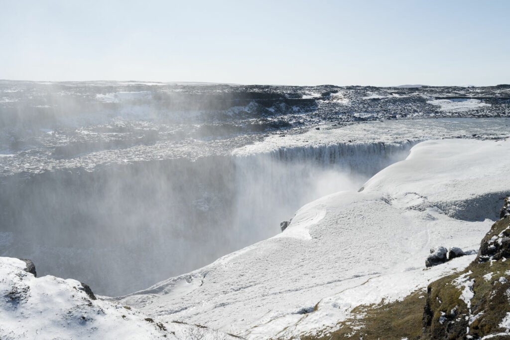
Dettifoss
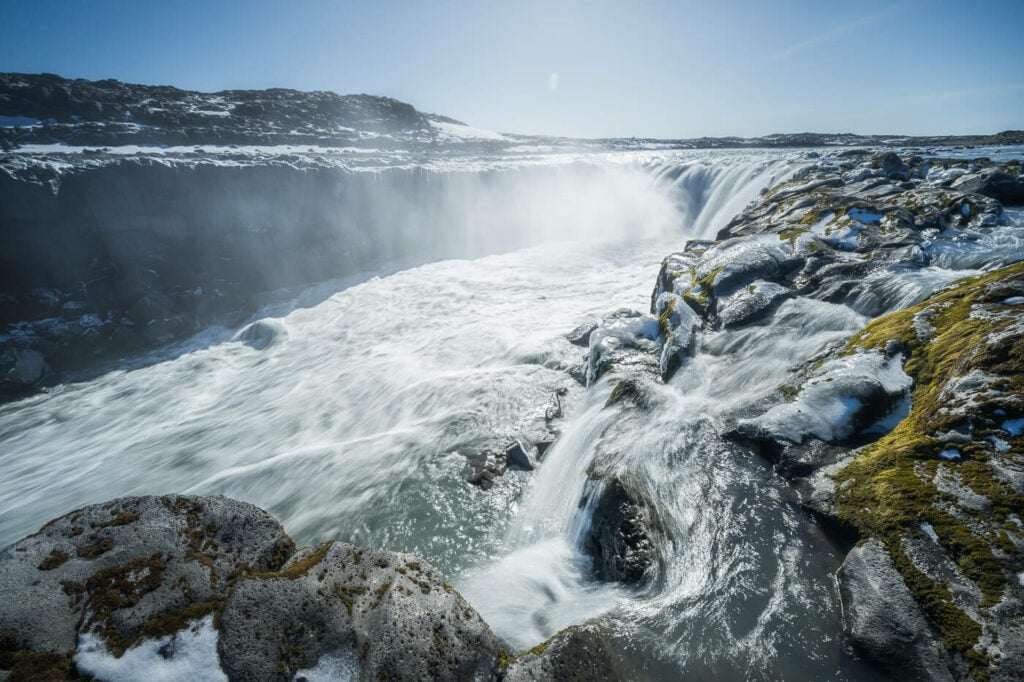
Selfoss
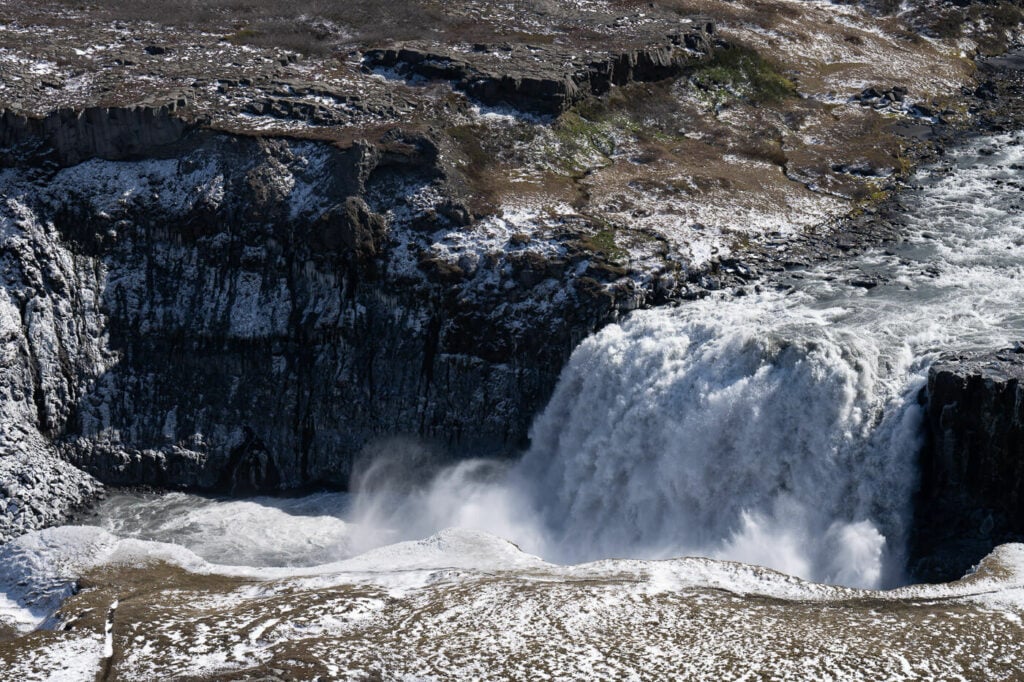
Hafragilsfoss.
Then I moved to my next planned stop, Rjúkandi. This is a beautiful waterfall on the side of Road 1, well worth a stop. A stop here requires about 10-20 minutes, depending on how close you want to get to the waterfall.
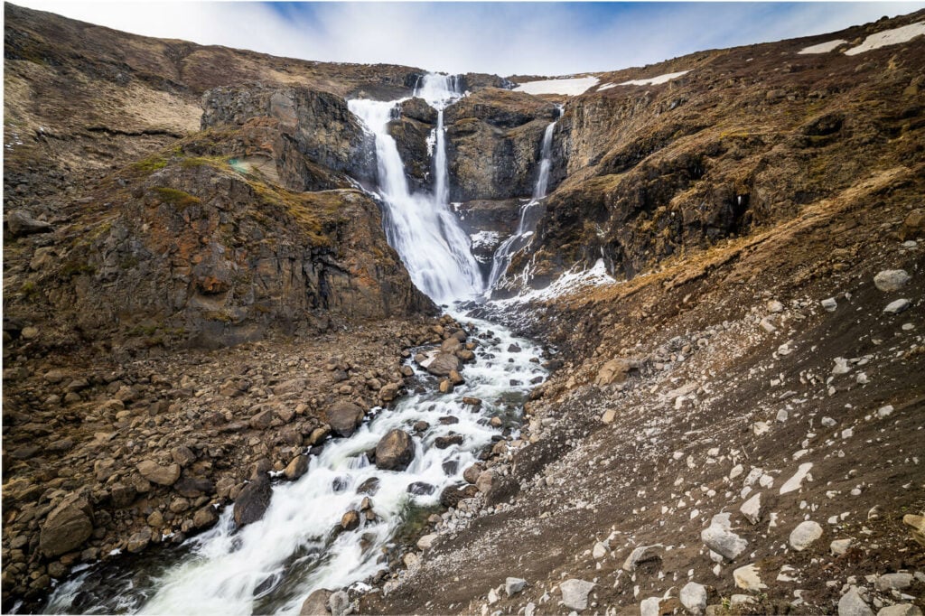
Rjukandi Waterfall
I took a few shots and then moved on to the Studlagil Canyon, where I visited both the West and East sides. To be honest, you can probably skip the west side unless you want to stop for the night with your van, as there are some paid facilities/restrooms.
On the east side, there are two parking areas. The first one before the bridge, and a second one a little further up a gravel road. It’s a rough road but doable in a 2Wd car if you drive carefully. I had no problem with my Caddy van, but several people preferred just to leave the car in the first parking area and walk from there. That adds about an hour to the hike.

The Studlagil Canyon
The visit to Studlagil Canyon took a couple of hours in total; it was a bit on the quick side too, as I had one more hike planned for the day – The waterfall Circle hike in Laugarfell. So I jumped in the Van and headed to my next stop and third hike of the day.
The Waterfall Circle hike was the best discovery of this trip. I had anticipated it was going to be a great one, but it ended up being much better than expected. Quite easy, and stunning waterfalls. Furthermore, there was no one around. For the whole evening, I wandered around this beautiful landscape alone. I was there for Sunset, so I was able to capture the last waterfalls on the trail under some good light.

Sunset at the last Waterfall on the Waterfall Circle (clockwise).
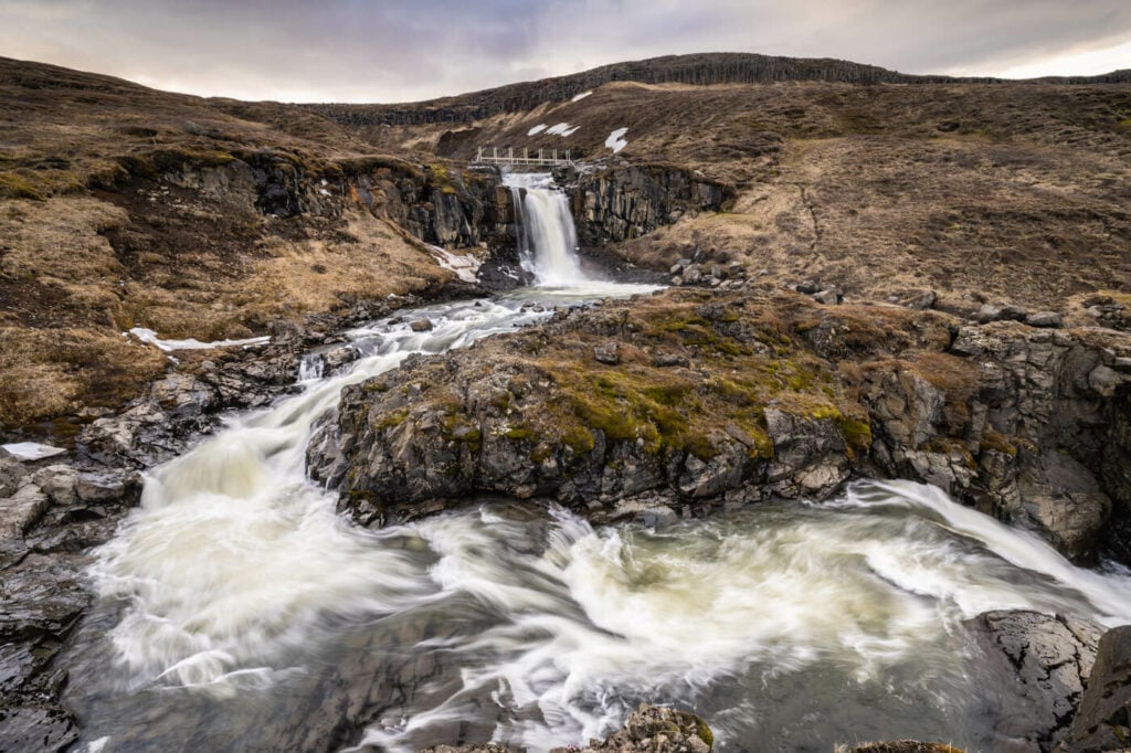
Unnamed waterfall on the Laugará River.
Time to get to a campsite after that. A good night of rest was what I really needed to recover some energy and prepare for the following day.
Day Five – Waterfalls of East Iceland
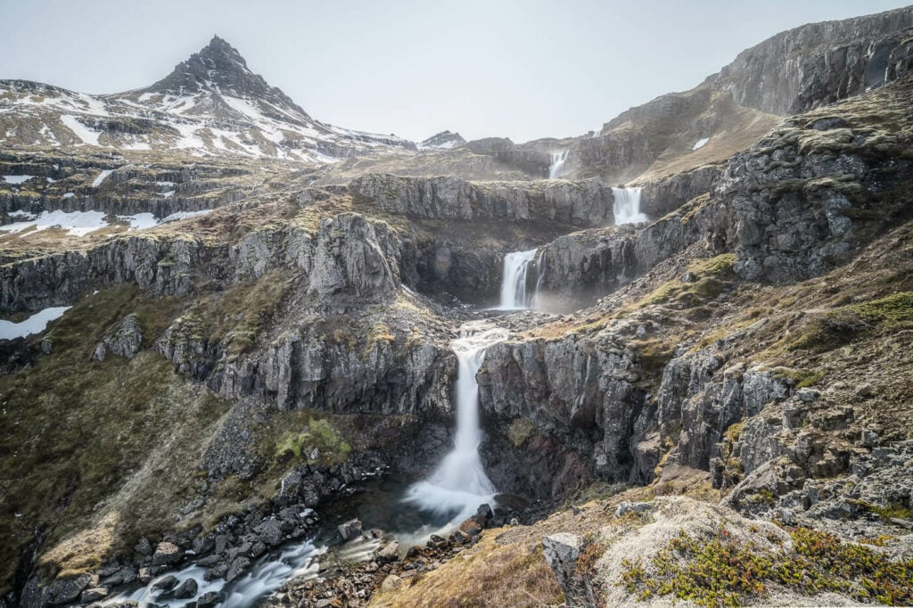
Klifbrekkufossar.
Start at: Laugarfell
Stop at: Vestrahorn
Distance Driven: 420Km / 6:30 Hours
Sights: Strutsfoss, Gufufoss, Fardagafoss, Klifbrekkufossar, Flogufoss, Vestrahorn.
Other potential stops: Hengifoss, the Dimmugljúfur, and Hafrahvammagljúfur (but they require a 4wd car), Eystrahorn and Krossanesfjall, Skutafoss.
I woke up relatively early in the morning, around 7 a.m., had breakfast, and then drove off to my first location of the day, the beautiful Strutsfoss waterfall. I also spotted a bunch of reindeer close to the trailhead, the first time I saw them in the wild.
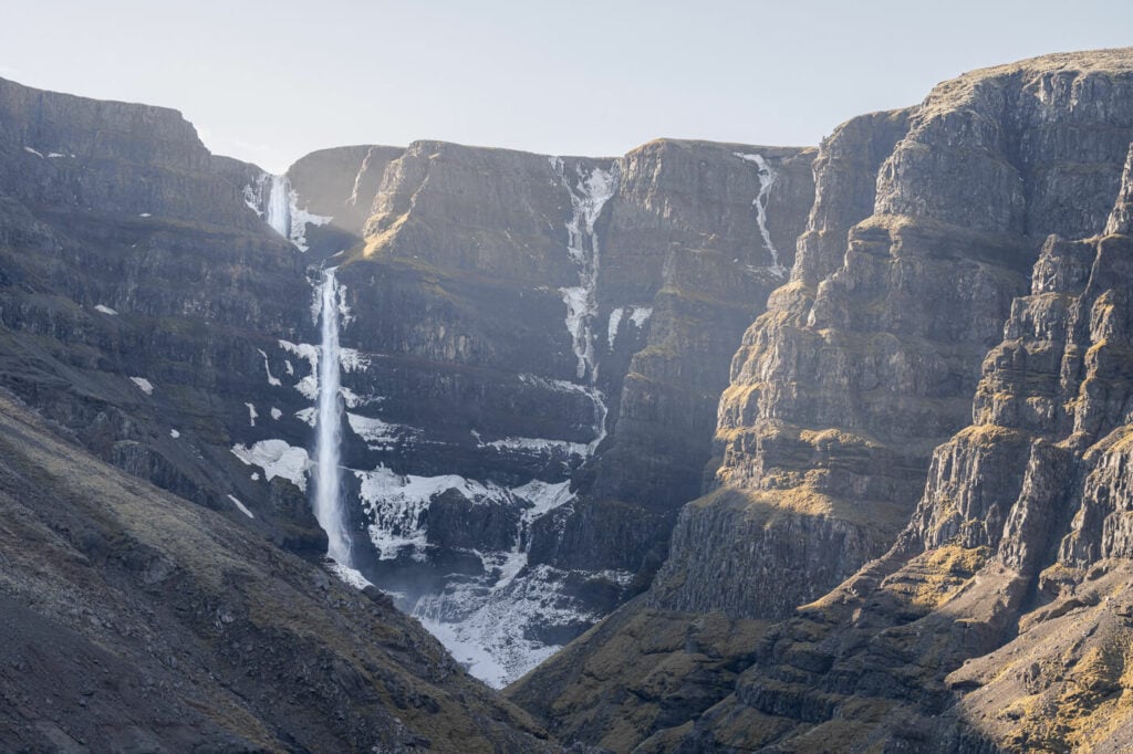
Strutsfoss in the morning.
The hike to Strutsfoss is also a relatively easy one and well worth the effort of getting there. The Waterfall is a very tall one and the canyon around it is also extremely scenic. Not the best to visit in the morning to be fair, as the waterfall is in the shadows until the afternoon, but that would not matter much on cloudy days. Anyway, I thoroughly enjoyed this hike too. I met no one on the trail and had the location all to myself, which allowed me to fully enjoy it in all of its quietness.
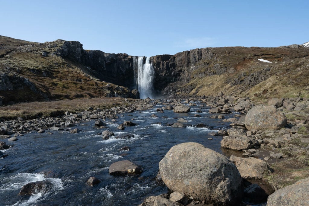
Gufufoss, my next stop.
I then started driving toward Gufufoss, or the Gufu waterfall. It’s a rather short drive from Egilsstaðir, across a mountain pass to the east. Gufufoss is a beautiful, scenic waterfall in the (name of the fjord). This one is good for a short roadside stop, and it’s also a short hike to get to its feet. You can also walk above the waterfall if you want to. I probably spent half an hour here taking photos and enjoying the surroundings.
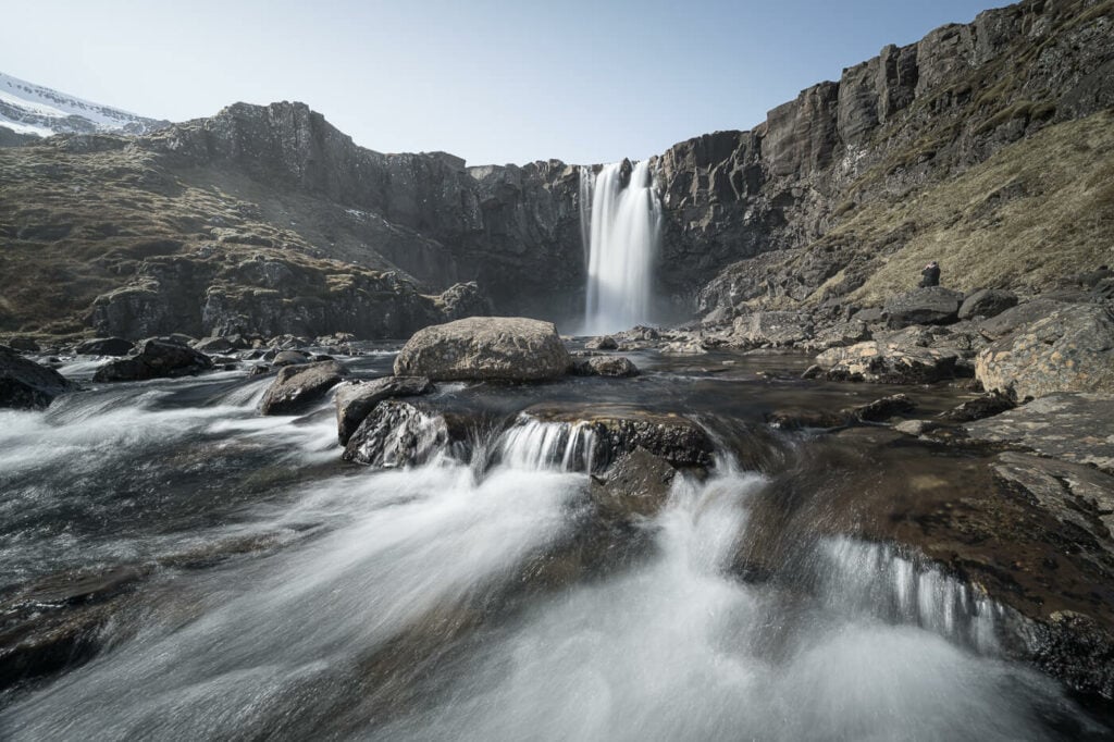
Gufufoss, or the Gufu Waterfall.
On the way back to Egilsstaðir I stopped by another waterfall, Fardagafoss. This is a waterfall you can’t actually see from the road and the out-and-back hike takes about 30-40 minutes. It’s another easy hike, but if you want to get close to it, there is a relatively steep section with some chains to help with the balance.
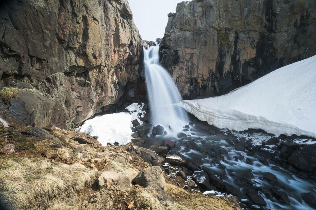
Fardagafoss
From there I then drove to Klifbrekkufossar, another beautiful multi-layer waterfall in the least of Iceland. Getting to Klifubrekkufossar, isn’t the easiest, especially with a 2WD car. The road is rather rough, especially early or late in the season. It’s quite a long drive too, but a scenic one at the same time. Still, it’s not an f-road and doable with any cars at slow speed and making sure to avoid the deepest potholes.
Anyway, I could have spent hours taking photos at Klifbrekkufossar. There are so many possible compositions and layers of waterfalls you could easily spend a whole morning or afternoon here.
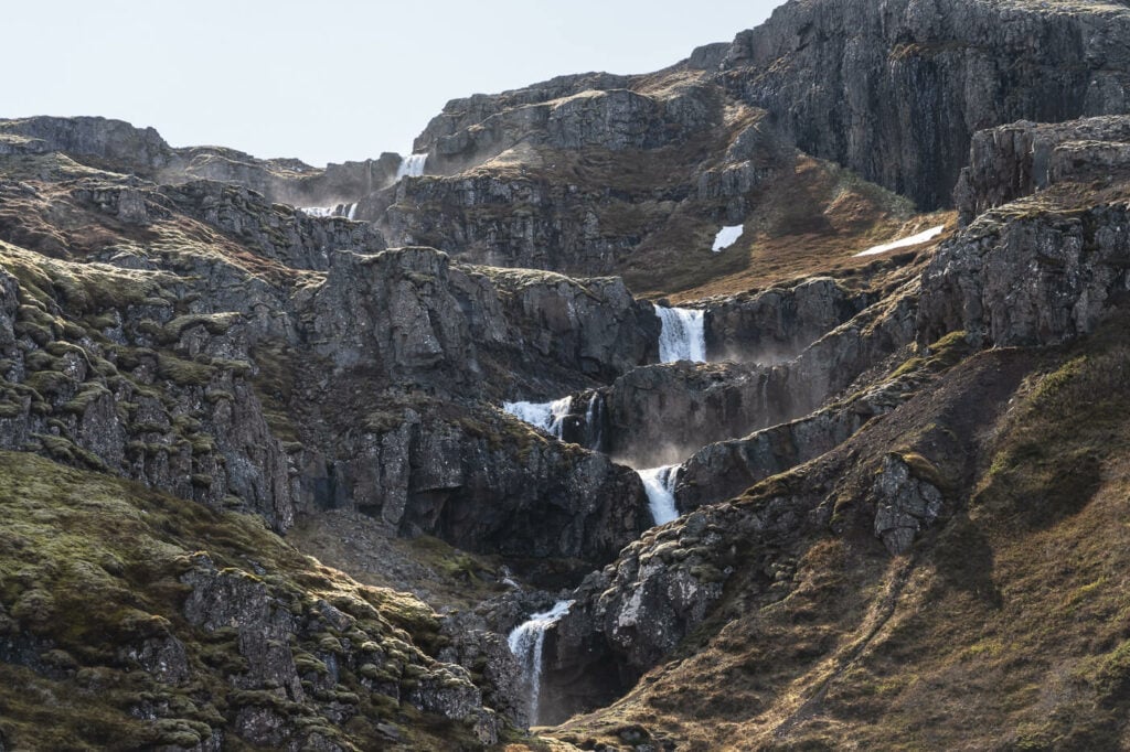
200mm photo of the multiple layers of Klifbrekkufossar.

14mm photo of the upper part of Klifbrekkufossar
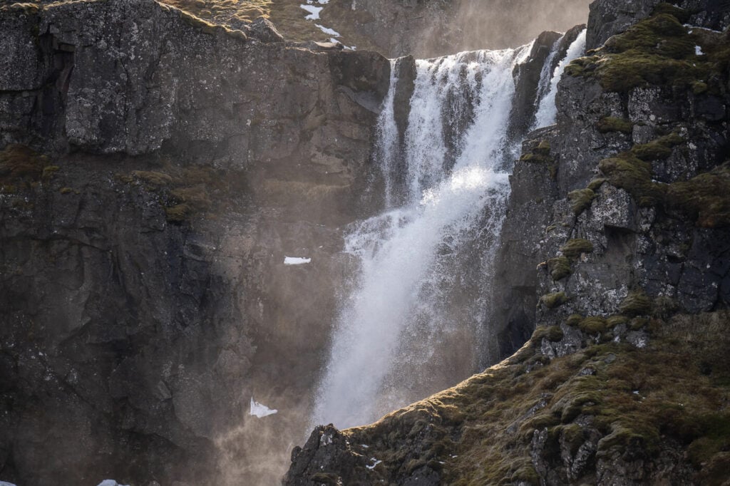
Detail of one of the Klifbrekkufossar waterfalls in the afternoon light
Onto my last stop of the day then; Flogufoss. It’s quite a long drive to get to Flogufoss too. Additionally, once you get there, it isn’t really clear where you have to go or where you can park the car. I ended up driving down a very rough gravel road, actually more of a stone road than gravel..but anyway I drove until I found a relatively large area, possibly the parking area. there are no signs here so hard to tell.
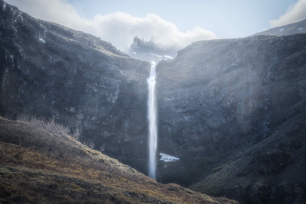
Flogufoss Waterfall
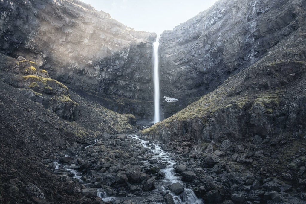
A closer look at Flogufoss
The hike to Flogufoss is quite a short and easy one, and there are a couple of good viewpoints along the way. I somehow expected the waterfall to be taller and bigger, but it was smaller than anticipated. However, it is once again a very beautiful waterfall.
That was the last stop of the day. Next, I headed to Vestrahorn where I camped for the night. The Viking Cafe there is also a campsite and they offer some basic facilities i.e. toilet and shower. You also have a ticket to Vestrahorn included in the price. The idea was to catch sunset or sunrise from here, but it turned out to be foggy the whole time. It’s rather common in this area and the Vestrahorn mountains are often in a layer of clouds.
Day Six – The south coast and a bit of Golden Circle
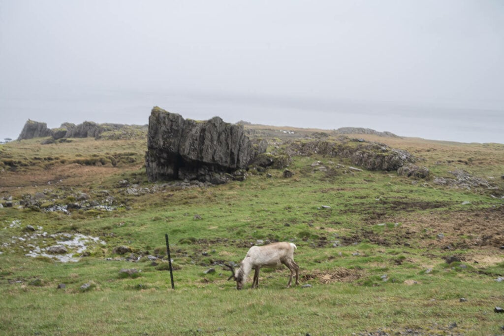
A lone Reindeer next to Vestrahorn in the east of Iceland
Start at: Vestrahorn
Stop at: Skogafoss Campsite
Distance Driven: 600km / 9:00 hours
Sights: A Reindeer! Then Diamond Beach and Jokulsarlon, Stigafoss, Stjórnarfoss, Gluggafoss, Hjalparfoss and Gjáin.
Other/Alternative attractions: Here we are talking about the south coast of Iceland and the Golden Circle, which are probably the regions of Iceland with the highest concentration of attractions. You could easily spend a week here alone. So I’ll just list some of the major attractions: Fjadragljufur Canyon hike, the Mulagljufur Canyon Hike, Stjornafoss, Lomagnupur, Svartifoss and the Skaftafell National Park, Snivafellsjokull, Fjallasarlon, Haifoss, Gullfoss, Bruarfoss, Geysir, Seljalandsfoss, Glufrabui, Nauthusagil and Nauthusafoss, Dyrholaey, Reynjsfjara and Reynisfjall and Vik.
A lot of driving again, mostly because of the weather. While I slept at the Skogafoss campsite, I initially drove past it to visit other locations where the weather was better. Sometimes, however, you are just going to get wet no matter where you go :)! Regardless of the rain, I still managed to visit several locations.
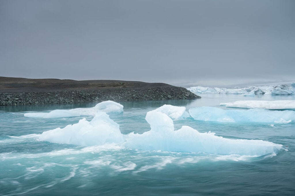
Jokulsarlon, the Icebergs Lagoon
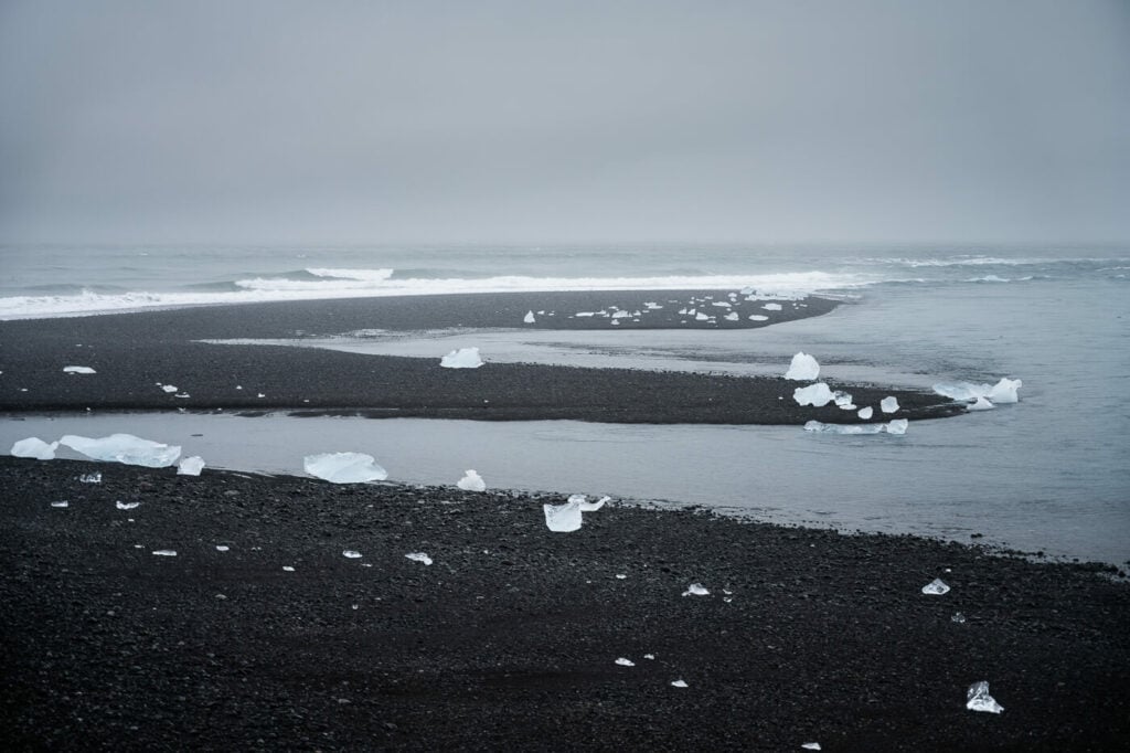
A view of the diamond beach
I woke up in a thick fog from the day before, and I started the long drive towards the south coast of Iceland. The first, unplanned stop was Jokulsarlon and the diamond beach. I had been there several times already, but I do enjoy stopping here especially if it is not mega crowded. I also liked to overcast conditions to take some photos. However, I did not spend much time here though, probably about 30-40 minutes.

Stigafoss
After that, I just took a quick roadside stop to admire the magnificent Stigafoss. This is one of Iceland’s tallest waterfalls but few stop here. You can walk on a dirt road closer to the waterfall, but honestly, the whole scene looks best from afar.
I then continued onto Stjórnarfoss for another quick stop in the rain and then drove on to Gluggafoss. I took a couple of photos at Stjórnarfoss under heavy rain and a few more at Gluggafoss where the rain had almost stopped. You can also actually hike around Gluggafoss, as it is a multi-step waterfall. the best one is the second where you can walk into the narrow gorge. Here there is a small pool and sometimes people also take a bath here, under the roaring sound of Gluggafoss. Anyway, one more beautiful waterfall added to the trip.
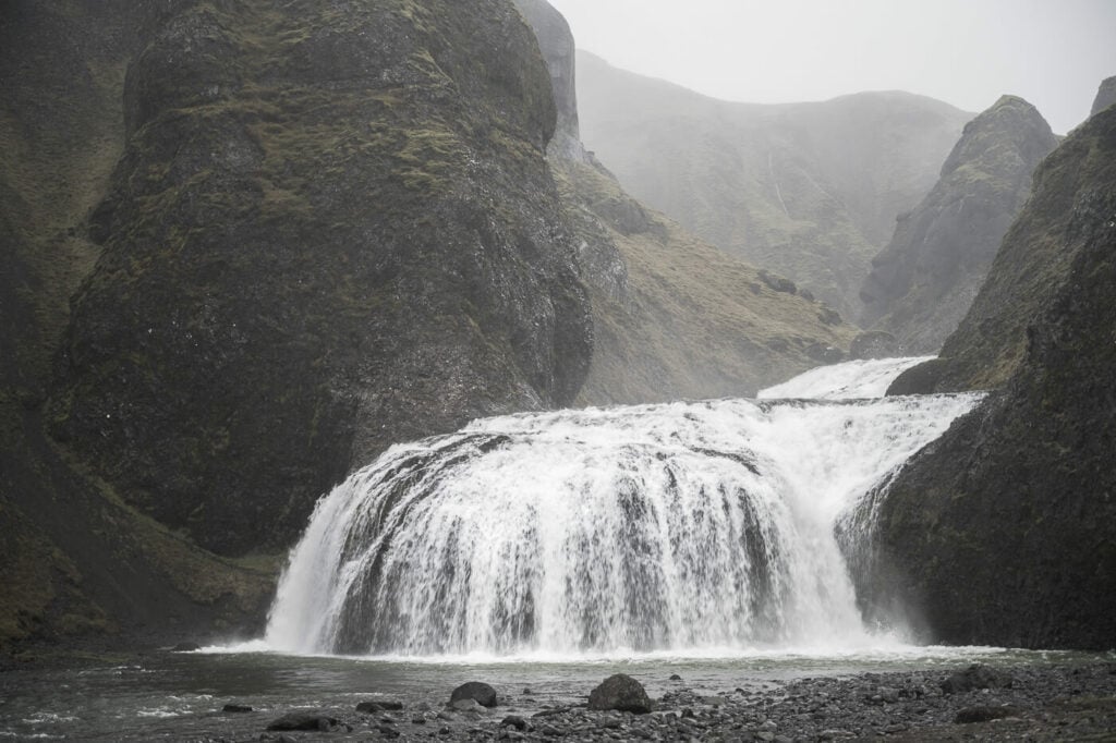
Stjórnarfoss
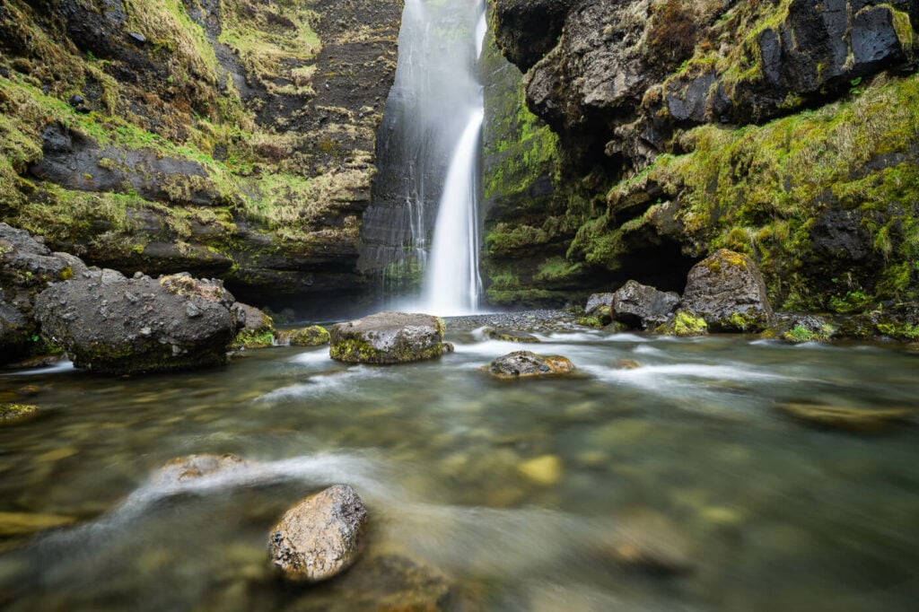
Gluggafoss
I visited two more places before driving back to Skogafoss. This is because I wanted to do the Skogafoss Waterfall Way hike, but since it was raining that afternoon and the water looked better the following morning, I decided to swap the activities, even if there was more driving involved.
Next up, Gjáin and Hjalparfoss.
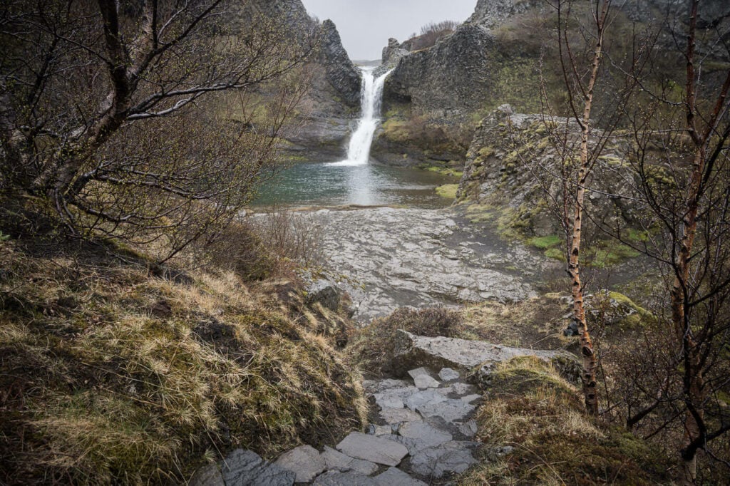
One of the many waterfalls at Gjáin.
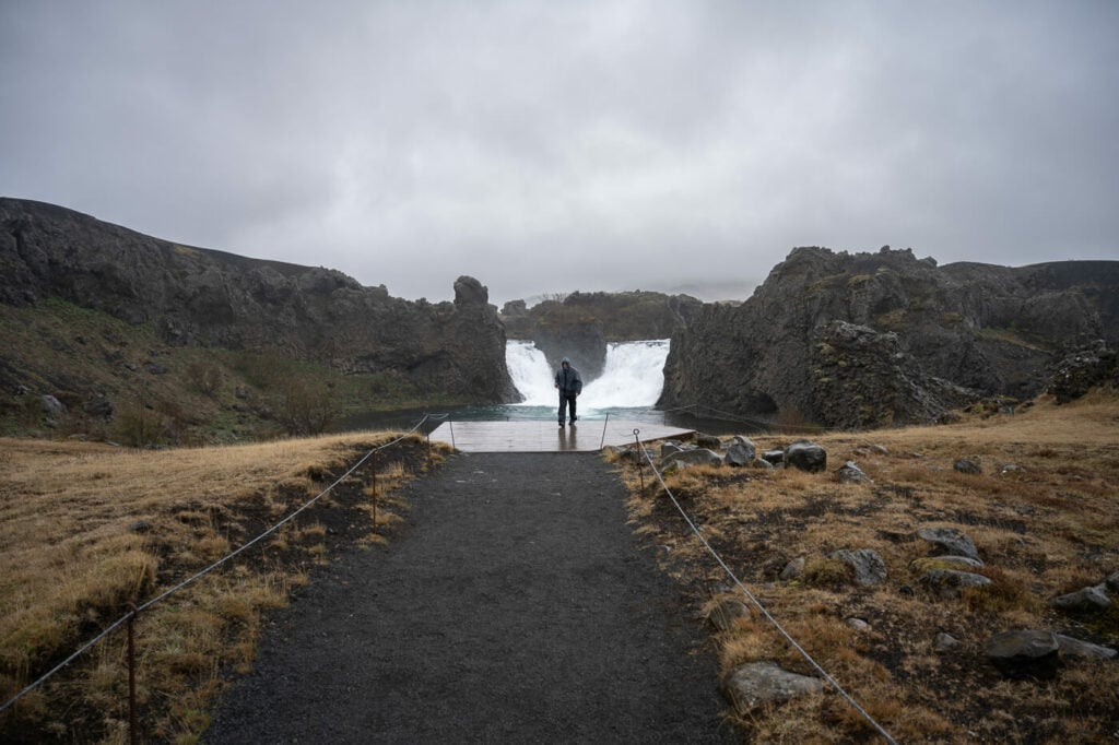
Hjalparfoss
Gjáin is a small valley with several beautiful waterfalls. Kind of a “waterfalls paradise”, actually. There actually are two trailheads to get to Gjáin, one on road 327, which uses the same access road as Haifoss but is suitable for 4WD vehicles. The one from Stöng requires a 20-minute hike. Hjalparfoss makes for a quick stop, although you can walk around it as well.
At that point, it was time to drive back to the Skogafoss campsite and settle for the night.
Day Seven – Skogafoss and the Waterfall Way and back to the Snaefellsness Peninsula
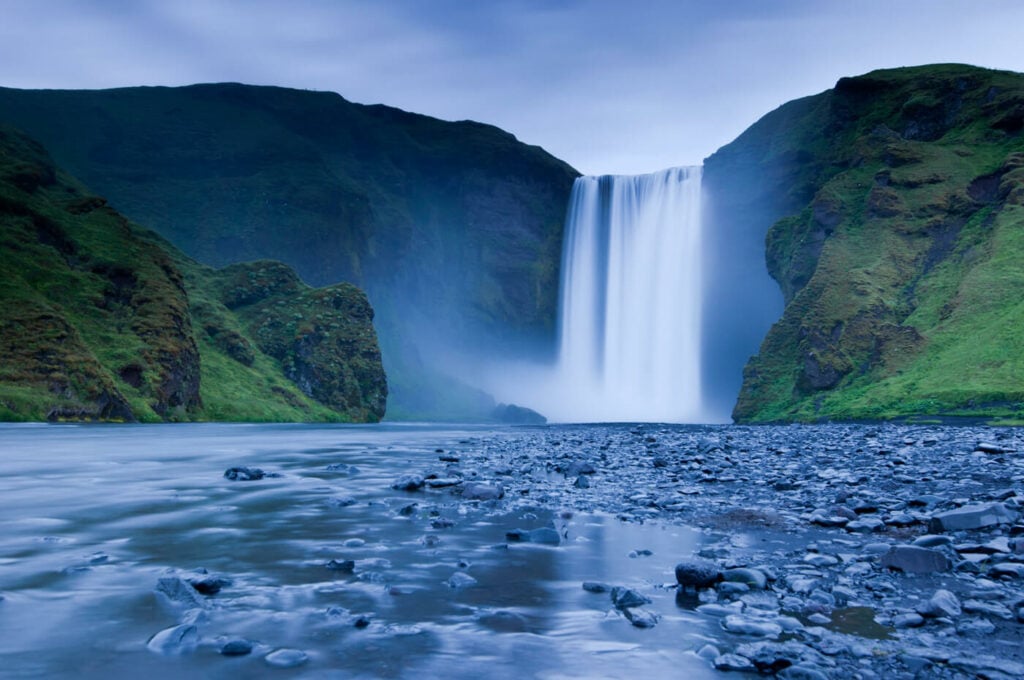
The majestic Skogafoss.
Start at: Skogafoss Campsite
Stop at: Olafsvik Campsite
Distance Driven: 335KM / 5:30 hours
Sights: Skogafoss and the Skogafoss Waterfall Way, Kvernufoss, Svöðufoss.
Other potential stops: here again you could consider visiting more of the South of Iceland or the Golden Circle. There are plenty of attractions without having to drive a long way.
This was a hike I had really been looking forward to, the Skogafoss waterfall way hike. It’s an out-and-back trail that starts at Skogafoss and ends at the bridge above the Skogar River. You can however stop and turn back anywhere on the trail – also because it is quite a long hike, even though it is not a particularly demanding one.
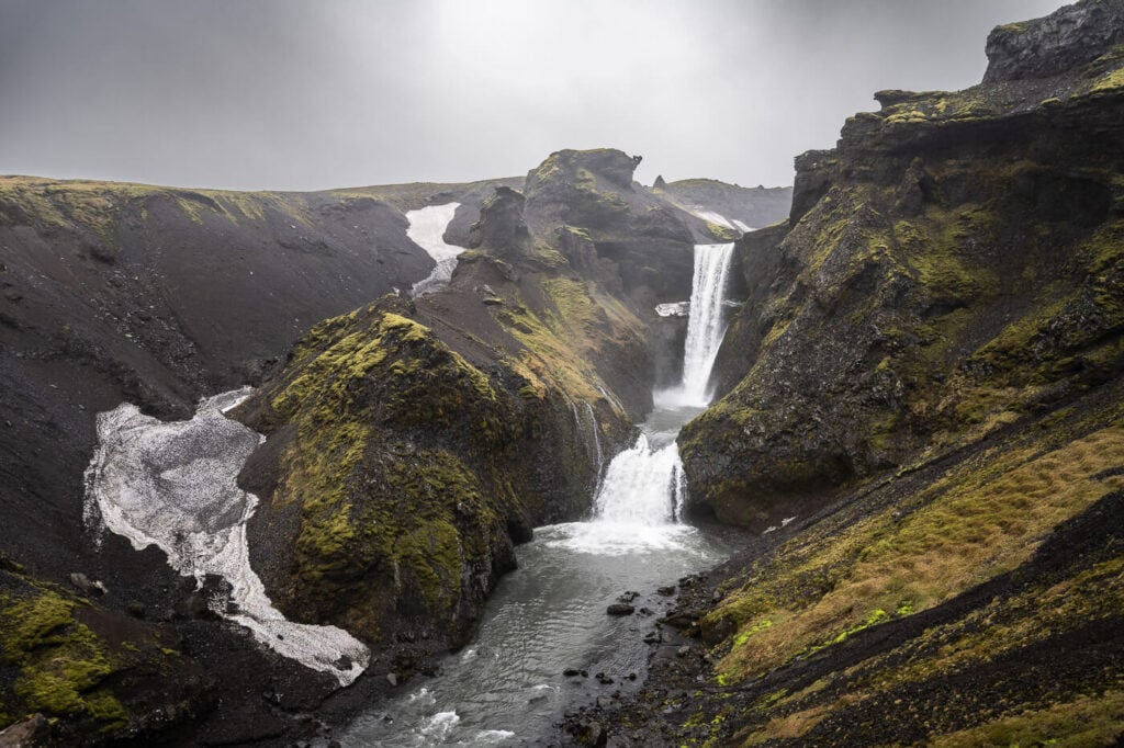
Miðfoss and Neðstifoss, close to the end of the Waterfall Way hike.
If you have time, I’d highly recommend it. some of the waterfalls are just stunning and there’s more than 25 of them along the way. I also have a video of the Skogafoss Waterfall Way hike on YouTube if you want to check it out.
The weather was looking better than the day before, so after a quick and nutritious breakfast and a good port of coffee, I set out with my backpack and my camera. The hike did not disappoint and it was actually even better than anticipated—one waterfall after another and some very beautiful ones like Miðfoss, Neðstifoss, or Króksfoss.
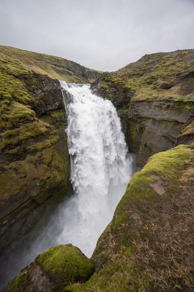
The Thunderous and impressive Króksfoss
The hike took about 4:30 hours, so I was back at camp by lunch, where I had to decide what to do next. Once more, I opted to drive where the best weather was, back to the Snaefelsness peninsula. Well, kind of like “best weather”. The forecast was sunny, but also 80-90 km/h wind gusts (yellow warning) for the morning after. Still, by that time I was planning to leave.
Other than going there because of the weather, I wanted to capture some waterfalls I did not manage to stop at on my first visit a few days earlier. So after the hike, I started the long drive to Olafsvik. I arrived in the late afternoon and immediately drove to my next stop, Svöðufoss, so that I could then settle in for the night.

Svöðufoss
Svöðufoss is another beautiful waterfall, and it’s an easy walk from the parking area. I probably spent 30-40 minutes in total there, before heading back to camp for a quick dinner and some much-needed sleep.
Day Eight – Reykjavik and departure
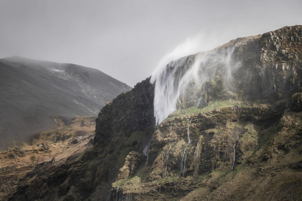
Bjarnafoss, going back upwards and sideways due to the wind.
Start at: Olafsvik
Stop at: Reykjavik – Campeasy’s office
Distance Driven: 248KM / 4:00 hours
Sights: Bjarnafoss, from afar.
Other potential stops: as previously mentioned on day one you could visit the other side of the Snaefelsness peninsula or some more waterfalls like Bugsfoss, Bæjarfoss, or Klukkufoss. If you are looking for something entirely different, you can consider visiting the Reykjanes peninsula instead. There you could visit the recent Fagradalsfjall eruption site or the Blue Lagoon for instance.
As the weather forecast announced the day before, strong winds had hit the Snaefelsness peninsula so it was time to get out of there. I drove off after a quick breakfast but briefly stopped at a viewpoint on the road to admire the fantastic landscape that was unfolding before my eyes. In between rain, snow, and hail, some light managed to peek through the clouds, creating an amazing contrast in the landscape below the pass I was on.
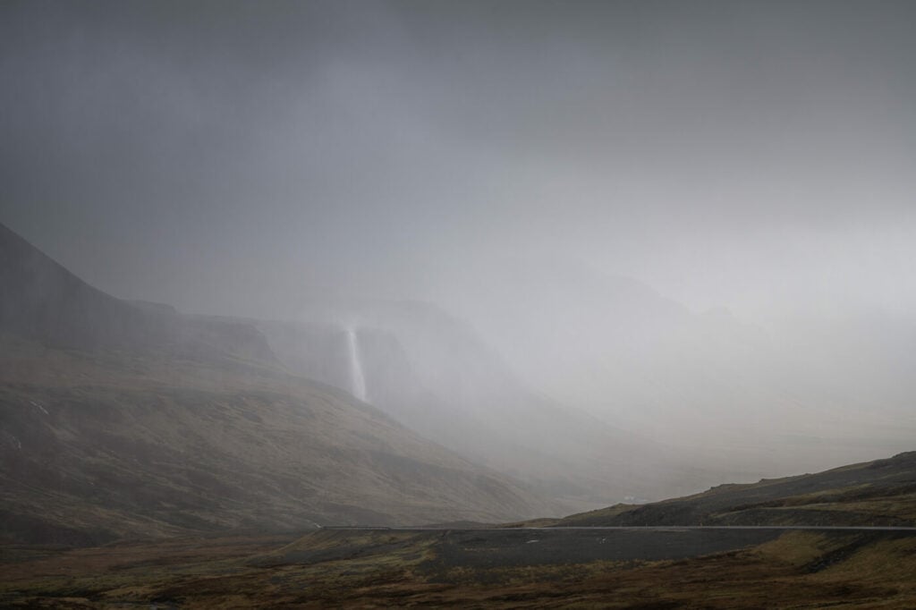
Bjarnafoss, barely visible through the rain, with some sidelight from a break in the clouds.

Bjarnafoss, going back upwards and sideways due to the wind.
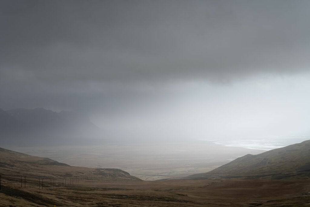
The Dark and Gloomy landscape ahead of me. Time to get out of there!
I grabbed my 70-200 lens and started shooting from inside the car. From there I also noticed Bjarnafoss was actually going upwards and sideways due to the wind, which was quite a scary-amazing thing to see. I then looked for a decent vantage point to take photos of this unusual sight, before running out of there.
Next, I stopped at the gas station in Borgardfjordur, to have lunch and ponder on where to go next. I had considered hiking to Gylmur, but after a bit of thinking I opted against it and decided instead to head to Reykjavik for the rest of the day. A chilled afternoon and evening, walking around town for some food and a couple of beers.
Off I want then, to spend the afternoon and the evening in Reykjavik. I stayed up until midnight and then drove to the CampEasy office by Keflavik airport, where I had arranged a taxi to pick me up for the airport at 4 AM.
Conclusion of the Seven Days Iceland Ring Road Campervan Trip – was it worth it?
As you can see this Campervan road trip around the ring road was quite intense in terms of distance to cover, driving time and number of places visited.
On the other hand, such an itinerary allowed me to see plenty of locations on all the corners of Iceland, except the highlands (which are inaccessible in May anyway).
Ultimately it comes down to how much time you are willing to spend on the road versus just chilling somewhere. For me, it was worth it. If you are planning a similar trip, just make sure you take enough breaks to rest on the road.
So, would I do it again? absolutely! I would change just one thing; I’d stop at different locations the next time :)
My Easy Small Caddy Van for this Trip
Lastly As mentioned in the intro, here are some additional photos of the Campeasy Campervan I used on this Iceland Campervan ring road trip. Definitely a well-furnished, well-thought-through layout and storage spaces.
Plenty of charging points for different devices (12v sockets, USB, and USC-C ports). One thing I’d recommend though is to bring a soft bag rather than a hard suitcase, so you can easily adapt it to the available space.
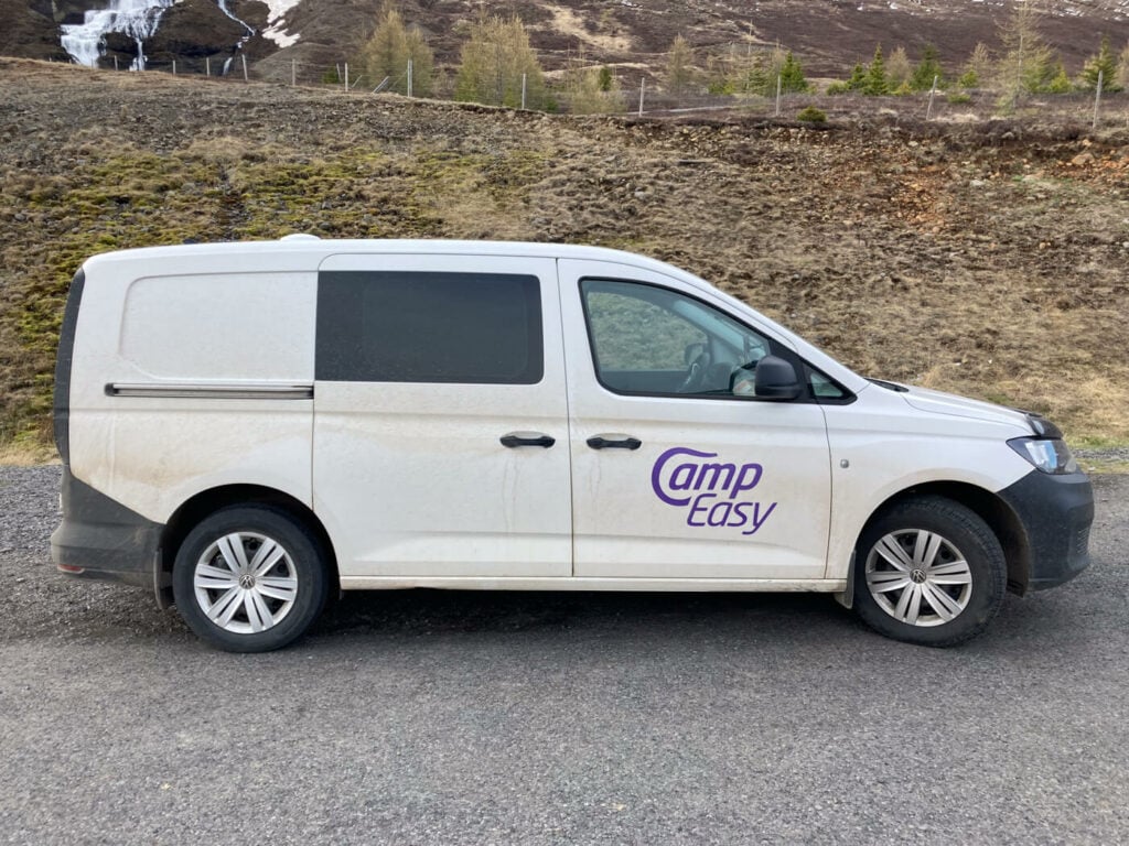
My Campeasy Van for this road trip adventure.
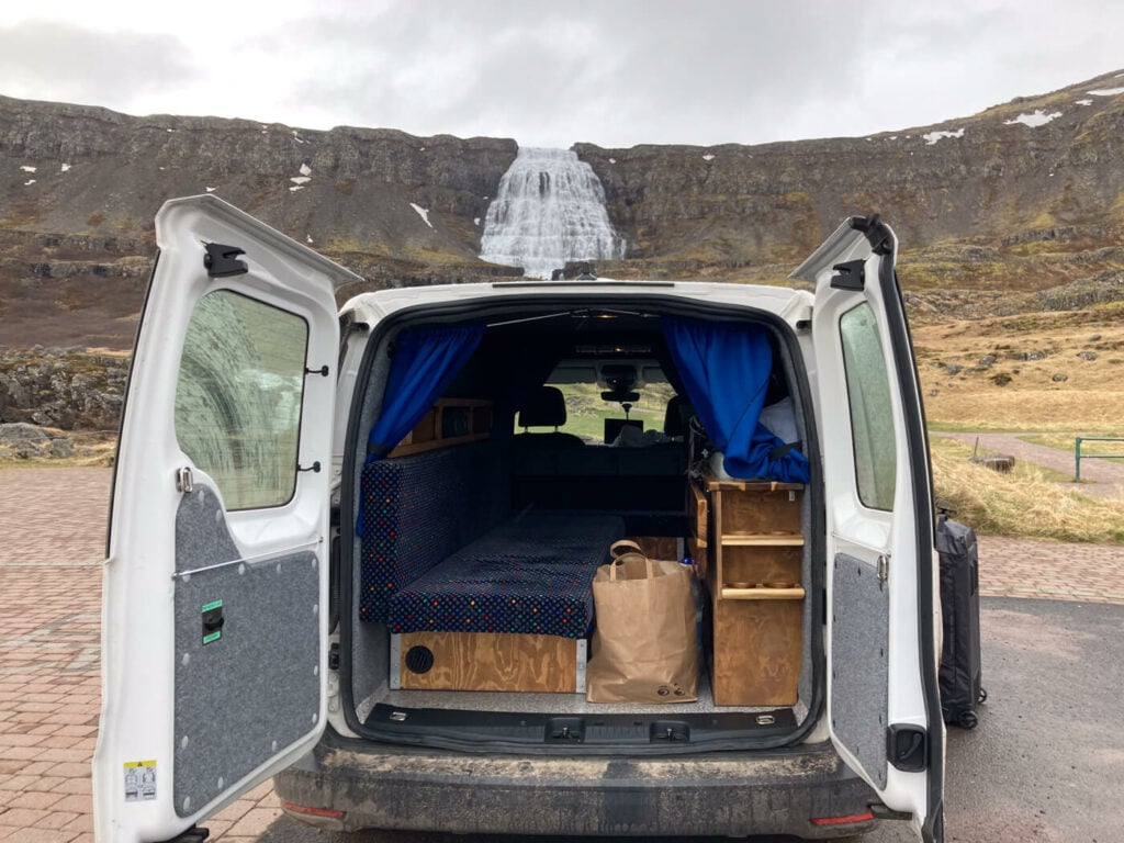
Dynjandi
As a photographer, It was critical for me to have plenty of charging points and the caddy had more than enough. Two USB-C ports, three USB ones, and two 12v sockets. More than I needed for my mobile, my camera, the drone, and my laptop too. I never once had to resort to my power bank or to charge my devices in public places such as bars or campsites.
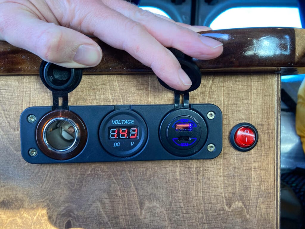
Two of the charging ports in the back, below the sink. Two more USB ports are on the other side of the van.
The layout of the camper is extremely functional and no space is wasted. While the Caddy Easy Small is the smallest in their rental van fleet, I had enough space to chill and read a book or a small foldable table to process some of the photos while having a drink.
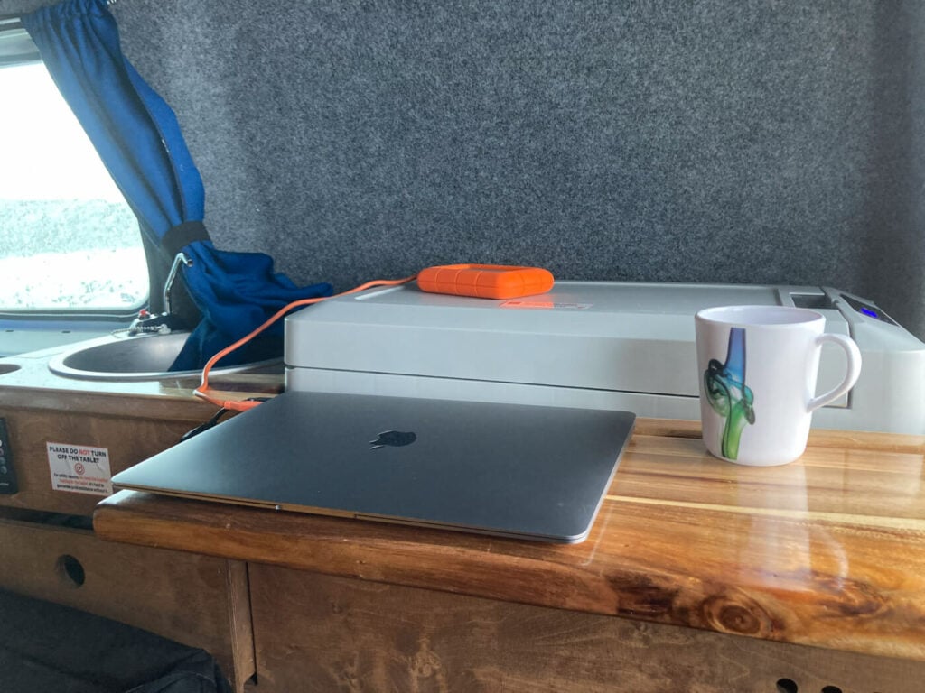
A small but very convenient foldable table you can use to prepare some food or work on a laptop.
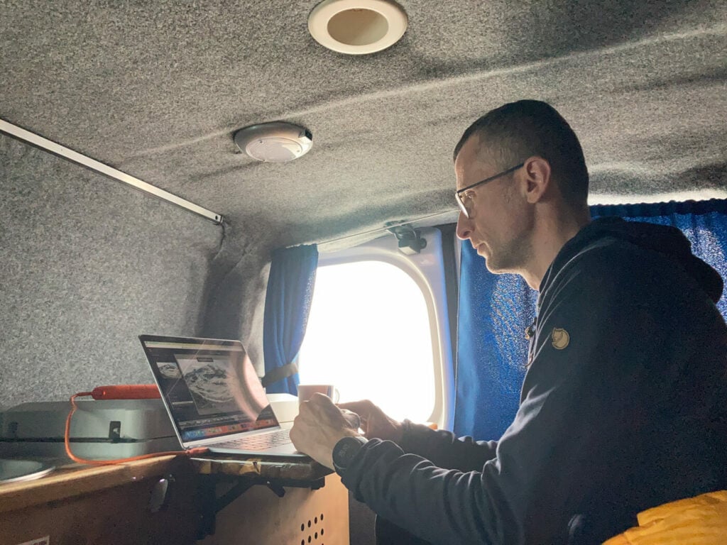
Working on some photos after a hike.
The insulation and the heating system are amazing and had no problem keeping a warm temperature through day or night. This with the reasonably comfy bed, ensured I could get enough rest at night.
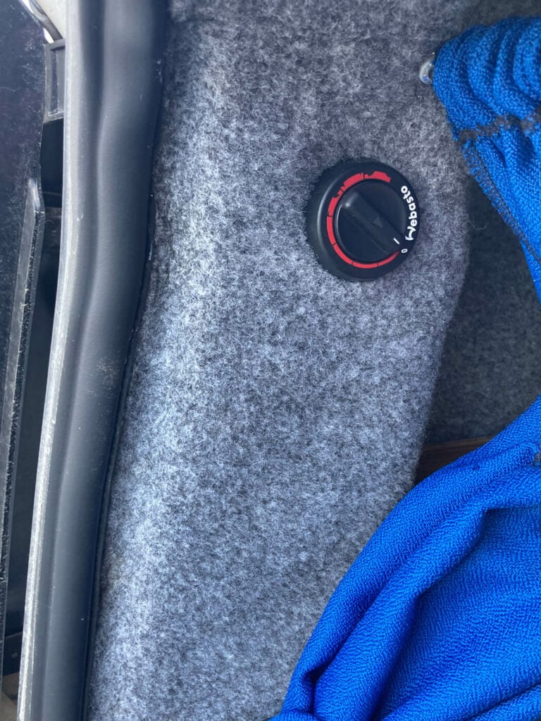
The Webasto heating system dial
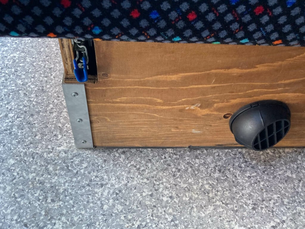
The heater, situated just below the bed.
Highly Recommended!
I hope you enjoyed this Iceland Ring Road Campervan Trip report – and hopefully found some useful information to plan your own.
Additional Resources
- Check out more Hikes in Iceland (with maps) here.
- More Itineraries – read about another itinerary in March for winter hikes and northern lights.

Leave A Comment