
Matmora and Delpsheia Hike, Panoramic Ridge Hike in the Lofoten, Norway
The Hike to Matmora via Delpsheia is perhaps the most scenic and popular hike on Austvågøya, the northernmost and biggest Island on the Lofoten. Also, probably the best ridge hike in the Lofoten islands.
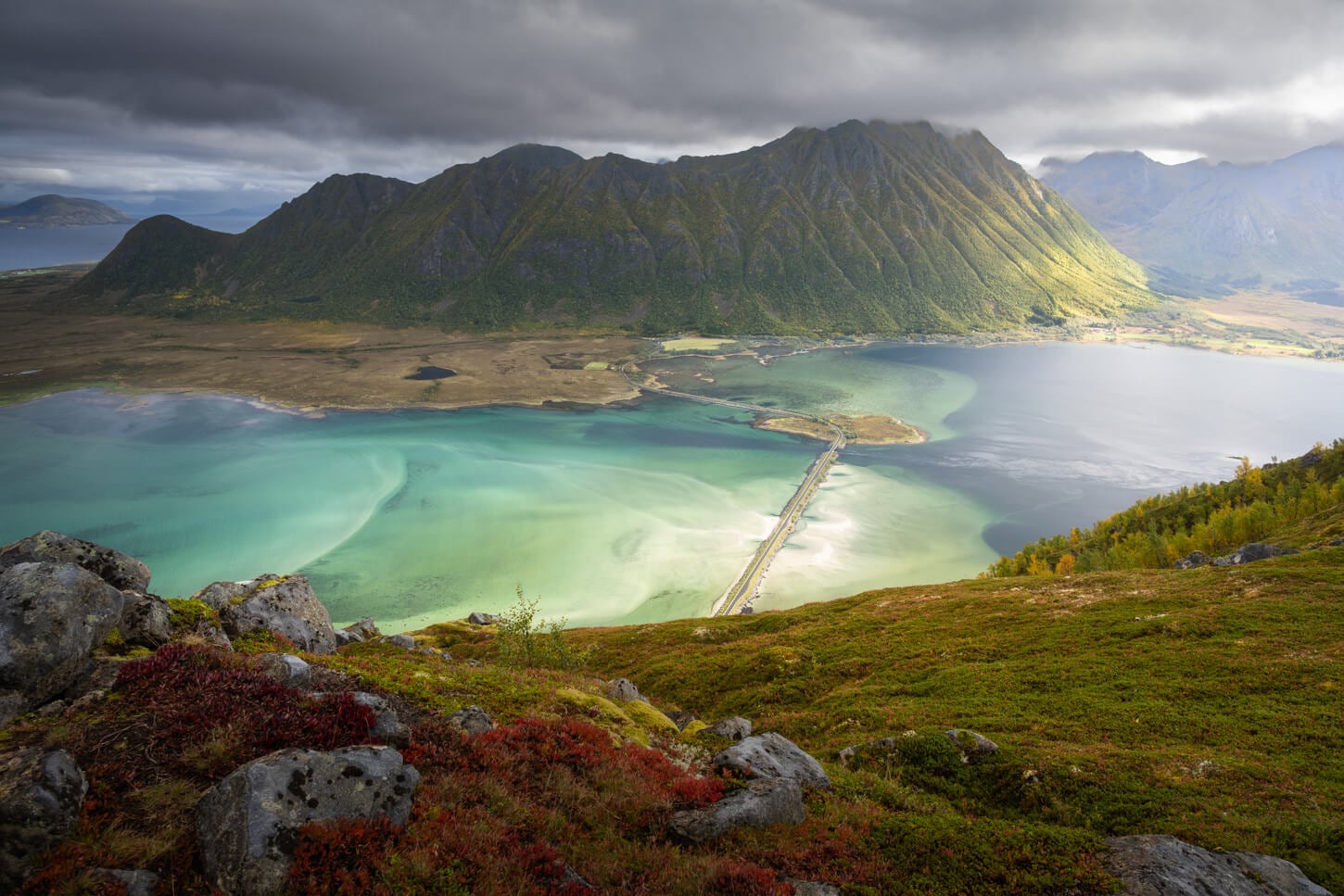
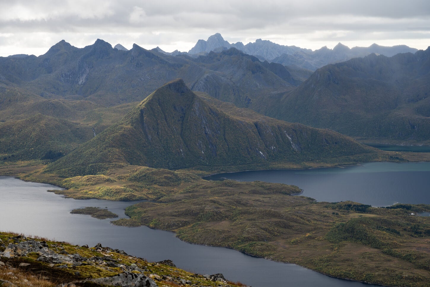
View from Delpsheia, or Delpen, on the hike to Matmora.
| Matmora and Delpsheia out-and-back Hike: Quick Overview |
| • Distance: 12.1 km / 7.5 mi (Out & Back) | Elevation: +970m / 3,182 ft | Time: 4–5h | Difficulty: Moderate | Trail: Unmarked, but visible all the way to the top. |
| • Start & Parking: Delpen-Matmora Trailhead near Laukvik/Straumnes |
| • Best Season & Light: Early summer to Early Autumn |
While Matmora is a bit off the main routes compared to the higher concentration of hikes in the southern parts, the drive there is well worth it for the spectacular views it offers.
Delpsheia, also called Delpen or Delpsheia, in particular, offers beautiful views of Grunnførfjorden and other mountains in the area.
Of moderate difficulty, there are also a couple of different ways to hike to the top of Matmora, but I would definitely recommend including Delpsheia and doing the whole ridge trail for the views it offers.
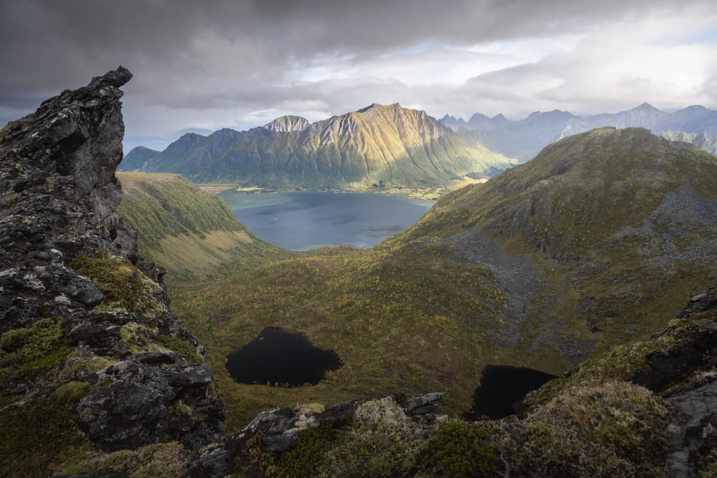
View from the ridge near Matmora's Summit.
Table of Contents
Overview of the Matmora and Delpsheia Hike, Map & GPX
There actually are a couple of different ways you can hike to Matmora. And there are also a couple of different hiking options.
First, there are two main trailheads. The Delpen-Matmora Trailhead, and the Matmora Trailhead. If you start from the former, you will hike to Delpsheia first, and then to Matmora. If you take the latter, you'll climb up Matmora first, taking almost all of the positive elevation gain on a shorter stretch, then hike back on toward Delpsheia.
Then you can close the loop back to the trail by walking along the main road, Midnattsolveien. The whole loop is about 17 km (10.6 miles).
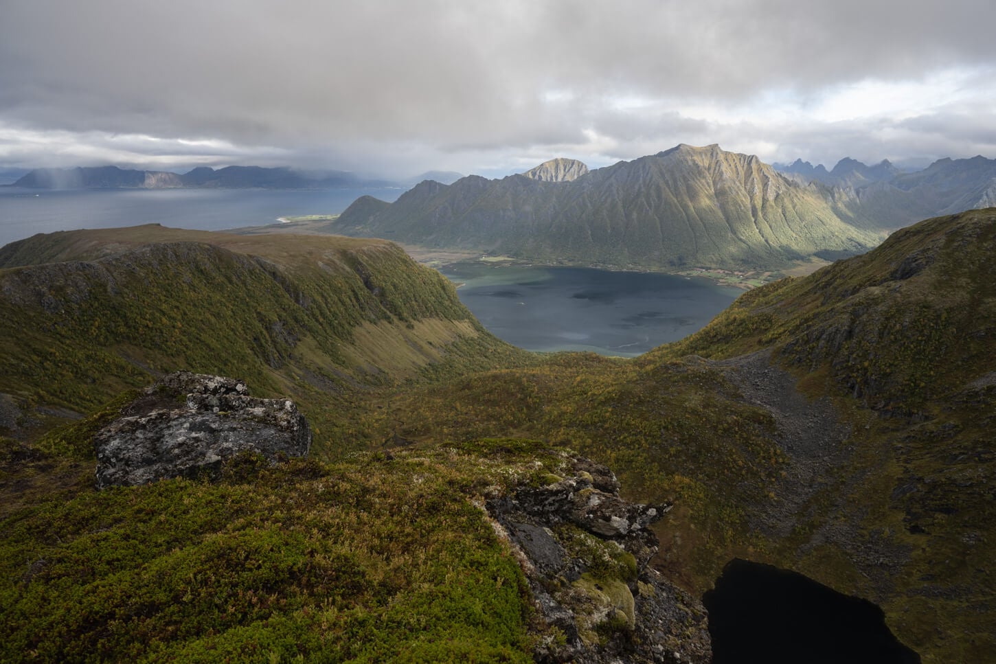
Walking from Matmora back towards Delpsheia.
I chose a third option, which was hiking up from the Delpen-Matmora Trailhead, and back the same way. I figured I'd rather do the same mountain trail twice rather than walk along a paved road, even if the paved road option is arguably easier.
There is no better or worse way to do it. It depends on what you want to do. However, if you are planning it for the midnight sun season, you may want to climb up to Matmora first and walk back down toward Delpsheia. In that direction of travel, you will have the midnight sun in front of you as you descend the mountain toward the sea.
Here is the map of the hike. You can download the GPX file for free from the activity linked below.
How to Get to the Matmora and Delpsheia Trailhead and Parking
Both trailheads mentioned above are on the same road, Midnattsolveien, or the Midnight Sun road. Quite a name. The trailhead is located on the west side of the Lofoten islands, in the northern part.
So if you are driving on the E10 from Narvik to the southern part of the Lofoten, it's best to include Matmora in your itinerary on the way south. Likewise, if you are arriving in the Lofoten via the Bodø ferry, it's best to include it in your itinerary while driving towards the north.
Still, while the drive from places like Reine takes almost three hours, it is doable in a day. Which is what I did too.
- Driving Directions: On the E10, whether driving from the north or from the south, take the road to Laukvik or Straumnes
- Parking: As there are two trailheads, there are also two parking areas. The first you'll come across is the one that leads directly to Matmora's summit. Then, there is a small parking area suitable for no more than 6-7 cars by the Delpen-Matmora trailhead.
- Public Transport: The road where the trailhead is, Fv888 or Midnattsolveien, is not serviced by public transportation.
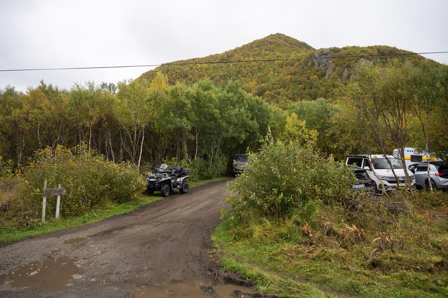
The Delpen-Matmora trailhead and its small parking, suitable for 6/7 cars.
The Matmora and Delpsheia Hiking Trail
The hike to Delpsheia is worth it on its own, whether to watch the midnight sun or a sunset. It's about 2.9 km or 1.8 miles out-and-back from the northern trailhead on Midnattsolveien, with almost 400m of total elevation gain. I think Delpsheia offers probably the best panoramic views on the trail, with the open, wide views of Grunnførfjorden.
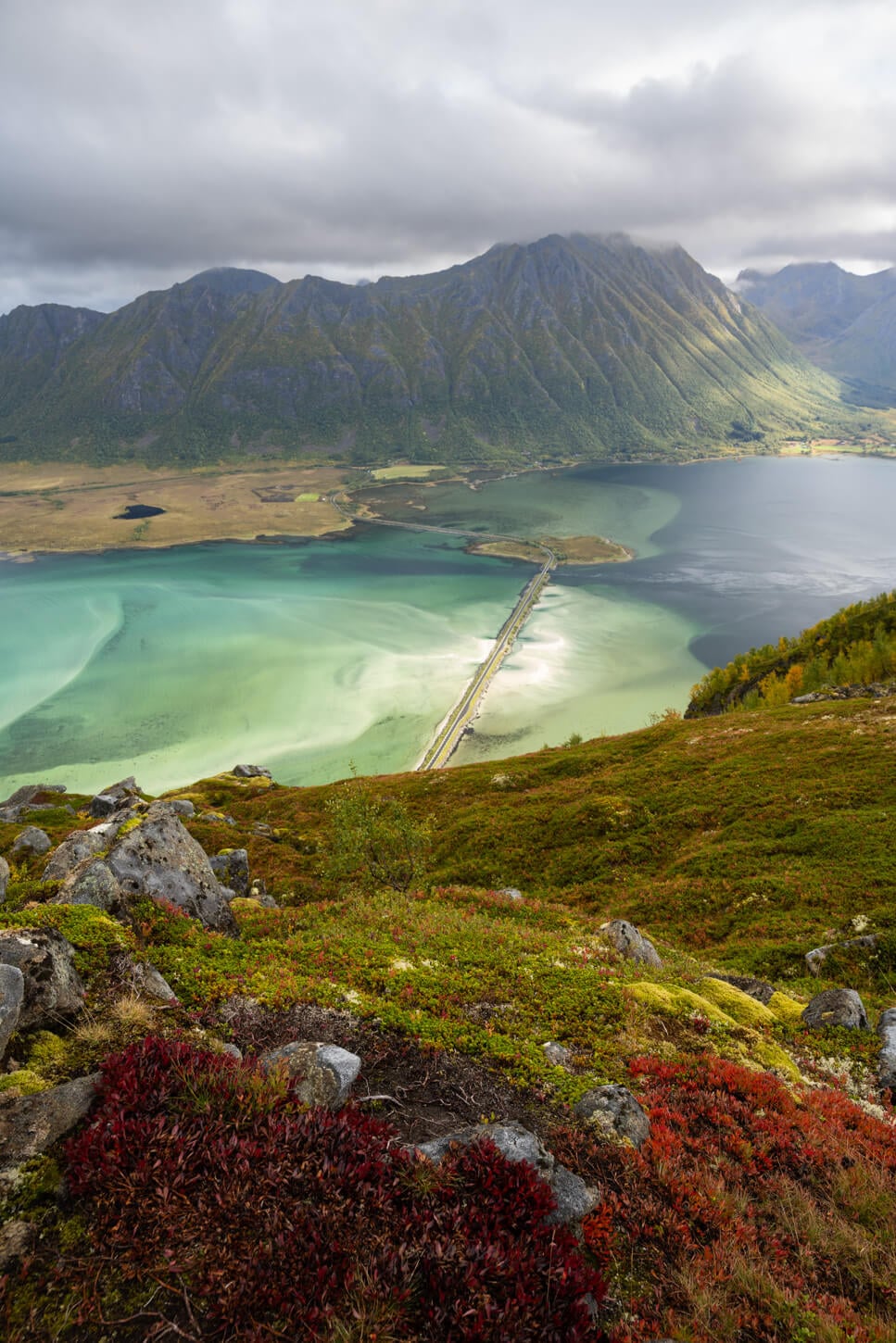
It would also be a short, rewarding sunset or midnight sun hike too. then of course you can also continue to Matmora for the rest of the trail.
Hiking to Delpsheia
From the Delpen Parking area, the trail immediately heads into the bushes, for a first, muddy climb towards Delpsheia. There is not much of a view in these sections, and it can be very muddy, so you'll likely be mostly focused on your footing. You'll likely need to use tree branches to balance yourself as you climb up, or to have an extra contact point while crossing the muddiest sections.
This first climb goes on for about 1.15km. It's quite slow going due to the thick birch woods and the mud. Do note the trail crosses sheep grazing grounds, so make sure to keep any gates you come across closed.
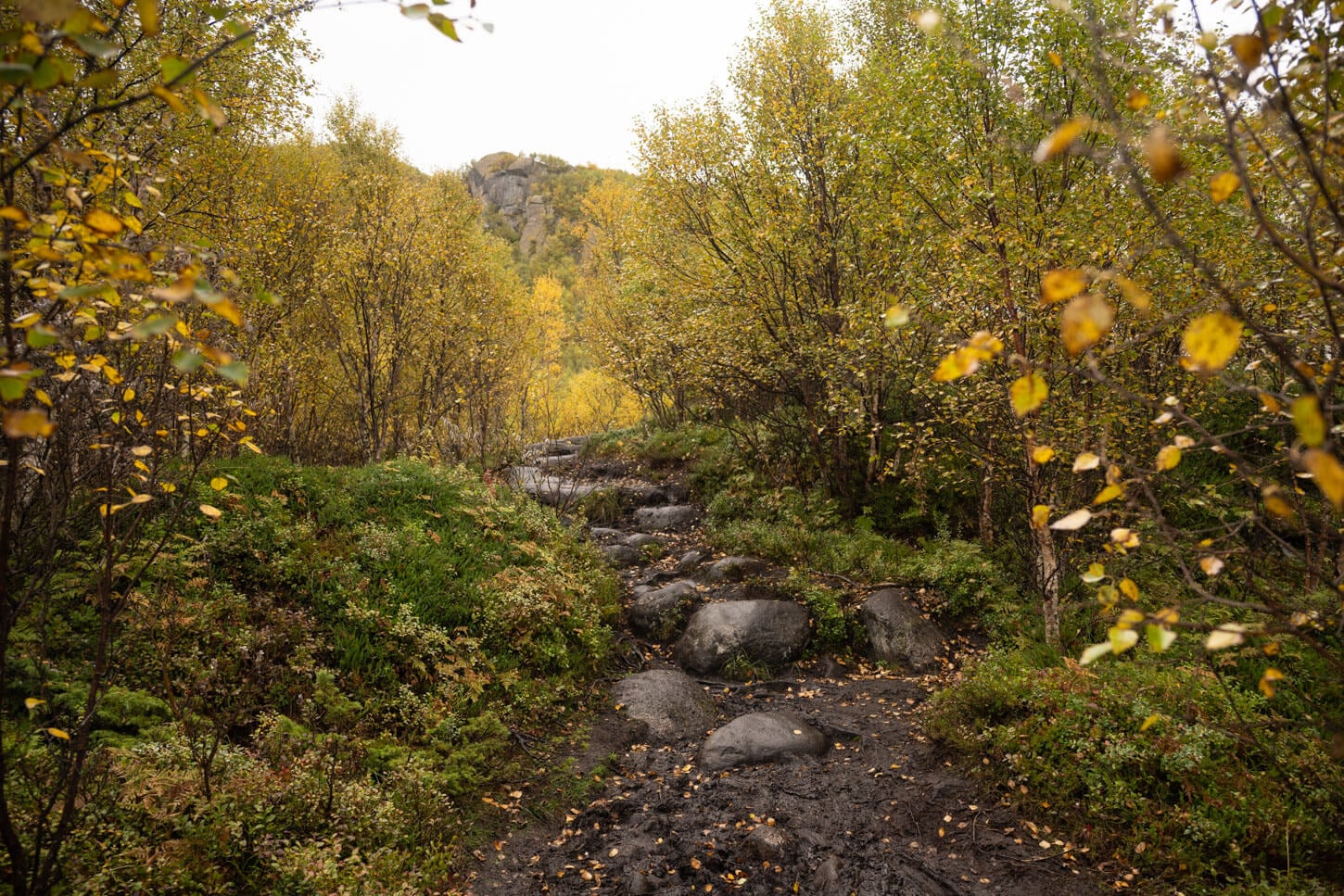
The initial section of the trail can be very muddy if it recently rained.
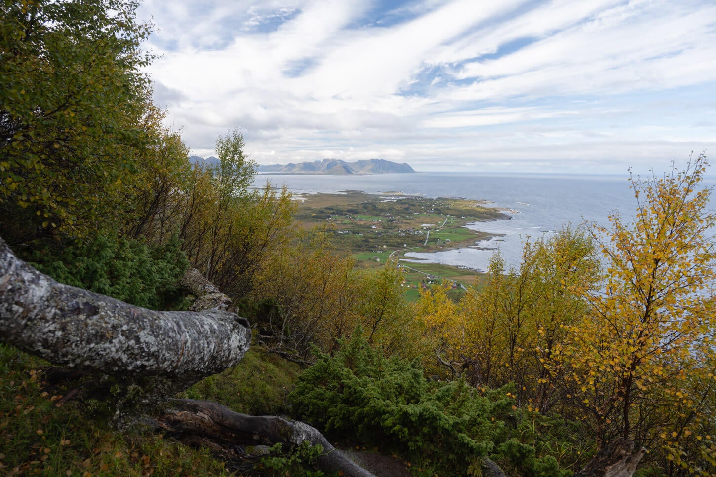
While for the first kilometer or so the trail is mostly in a thick birch forest, the views will occasionally open up.
While the trail is mostly in the woods, the views occasionally open up to the landscape around, mostly to the south. It's only as you approach Delpsheia that the view also opens up toward Grunnførfjorden.
At about 1.5km into the hike, you will reach the first summit on this trail, Delpsheia. There you have the best views of Grunnførfjorden, and the beautiful colors of its waters.
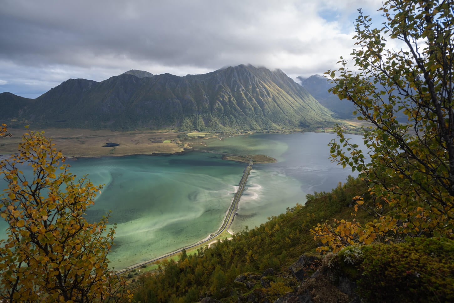
As you approache Delpsheia's summit, the views will also open up toward Grunnførfjorden
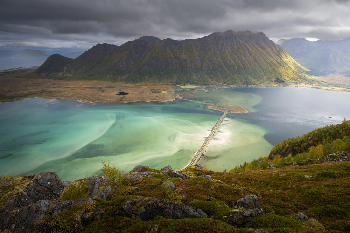
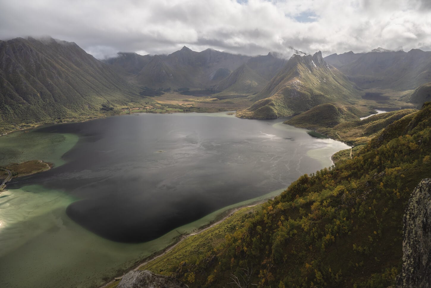
There are several viewpoints around the summit, and it's a good place for a short break to soak in the views before continuing toward Matmora.
From Delpsheia to Matmora
Past Delpsheia, it is essentially a ridge hike all the way up to the last, rocky climb to Matmora. You can already see the summit to the east, as the highest peak toward the far end of the fjord. So in that sense, the path to follow is quite clear. If anything, it looks closer than it actually is, also because of the few up and downhill sections along the ridge.
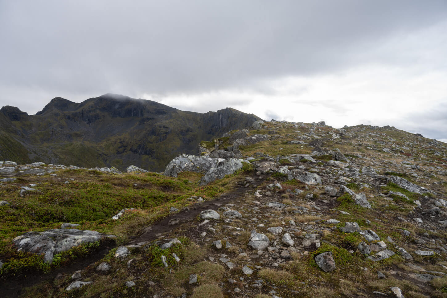
Past Delpsheia, the trail continues on the ridge that connects to Matmora's summit.
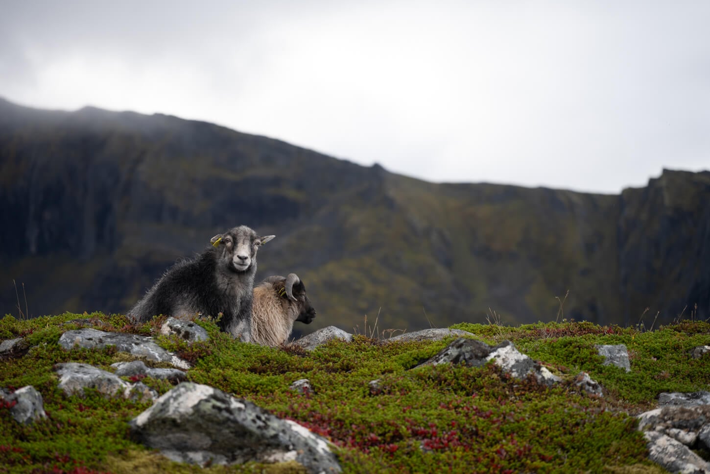
From Delpsheia, you will also probably notice a couple of trails leading there. One closer to the ridge and another one to the south, away from the ridge. I'd recommend taking the one closer to the ridge on the way up for the best panoramic views. Then take the other one on the way back, if you are doing the hike as out-and-back from the Delpen-Matmora trailhead, as I did. However, both will merge later on as the ridge narrows.
In this middle section, the trail assumes a much gentler elevation profile, and it widens considerably at first. It's much easier walking here, and quite pleasant with that landscape around. As you progress up the mountains, the trail will become rockier and will narrow as it crosses the narrowest part of the ridge.
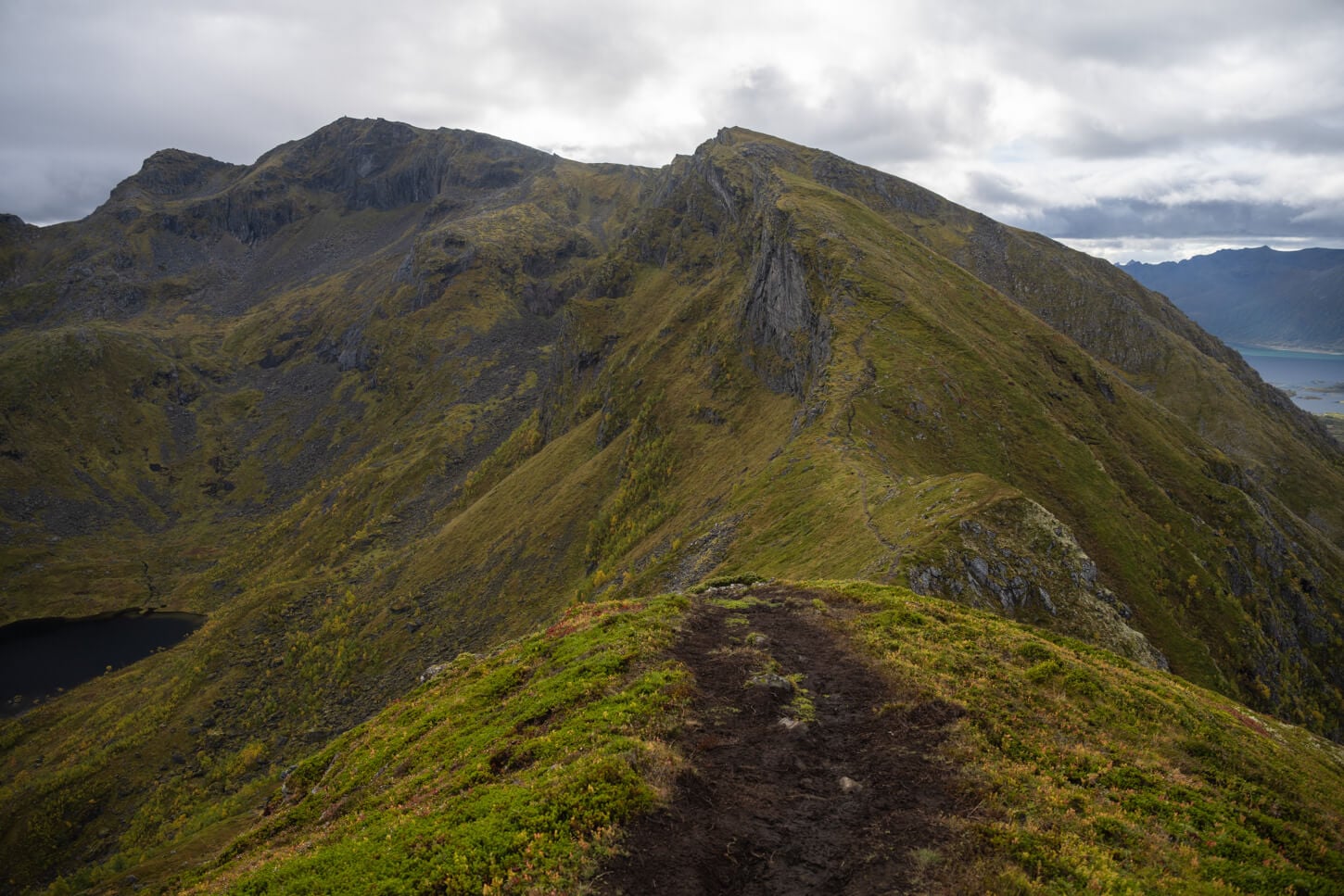
The ridge consists of a few different up and downhill sections.
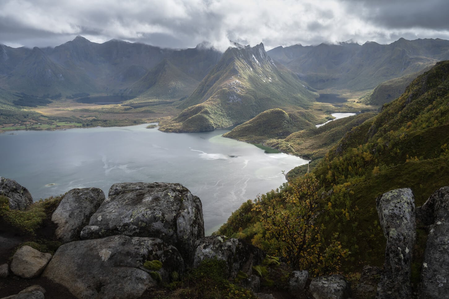
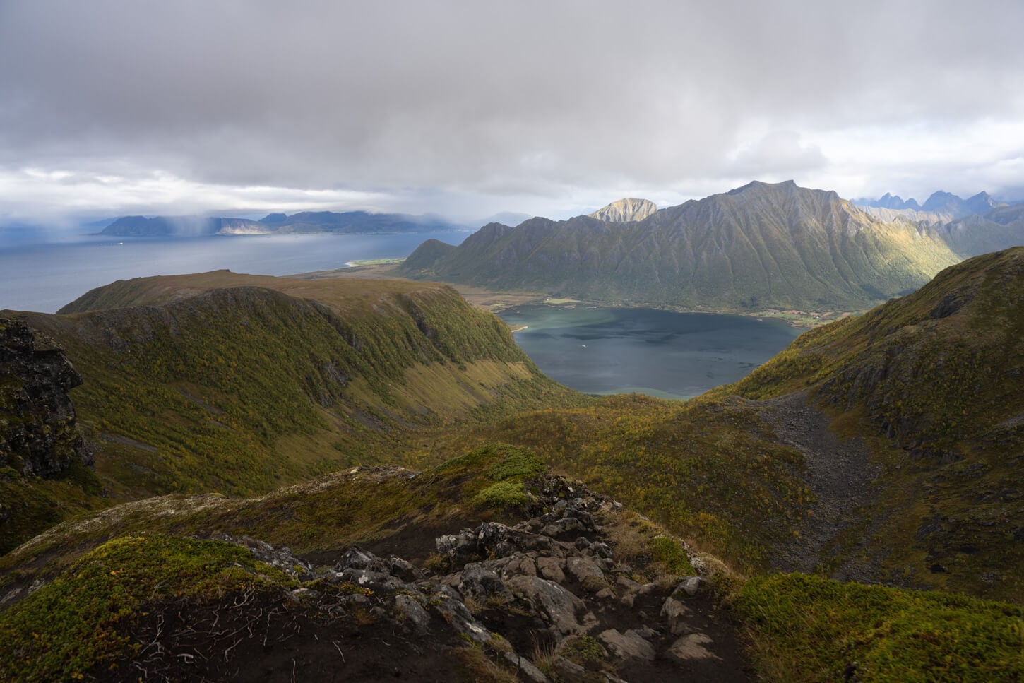
There are also several minor peaks on the trail to the summit, each one offering different views of the fjord. For this middle section, the trail continues to follow the ridge, alternating short uphill and downhill sections, until the last climb.
For the last stretch to Matmora, the trail widens again and crosses a boulder field. Soon, the large cairn that marks Matmora's summit. Once you reach the top, the views will open up on both sides of the mountains. I can't really say 360 degrees views because the large cairn will block them, but you get the idea.
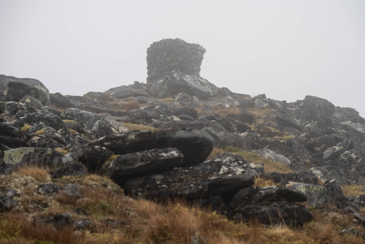
The big cairn marking Matmora's summit.
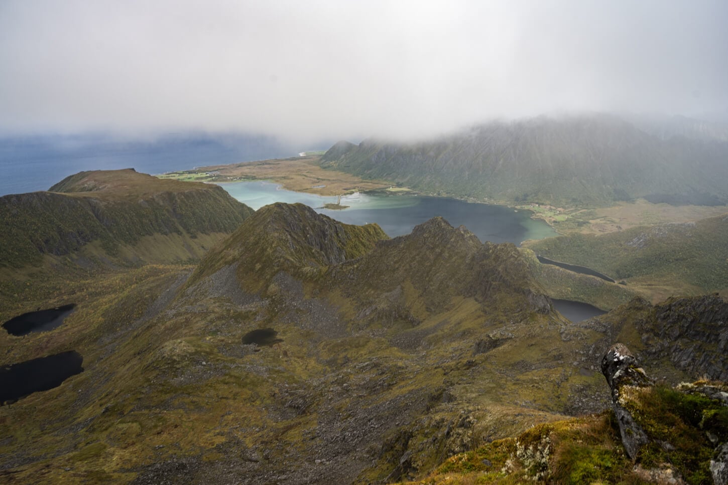
View from the summit toward the North-west.
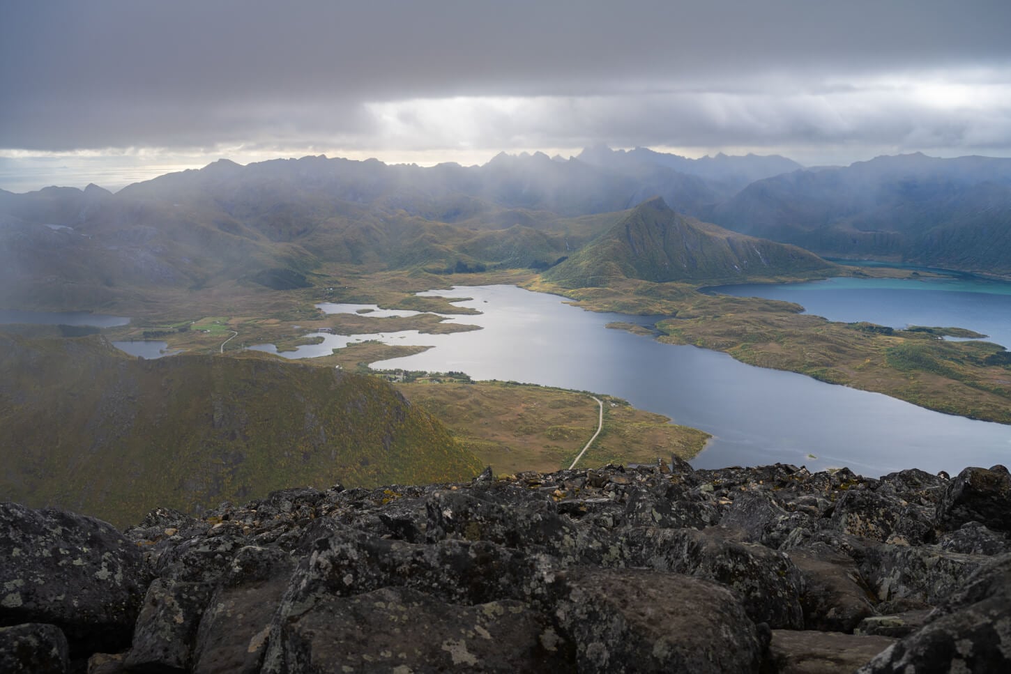
View from the summit in the opposite direction.
Matmora and Delpsheia Photos and Photography Tips
Purely from a landscape photography perspective, I think the main point of interest is Delpsheia, and the view of Grunnførfjorden. Even more than Matmora's summit. To be fair, there the view from there lacks a bit of foreground, but by moving around a bit you will find some rocks to work as anchors or some interesting vegetation.
it's a good place to catch some early morning light from the east, like in the photos below, take in early September in the morning. it would work equally well in the afternoon, with the light coming from the opposite direction. and of curse, during the midnight sun season.
View from Delpsheia, or Delpen, on the hike to Matmora.
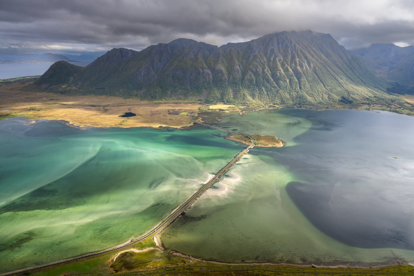
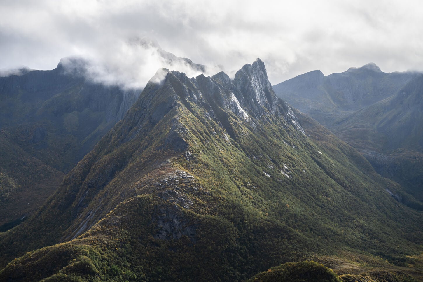
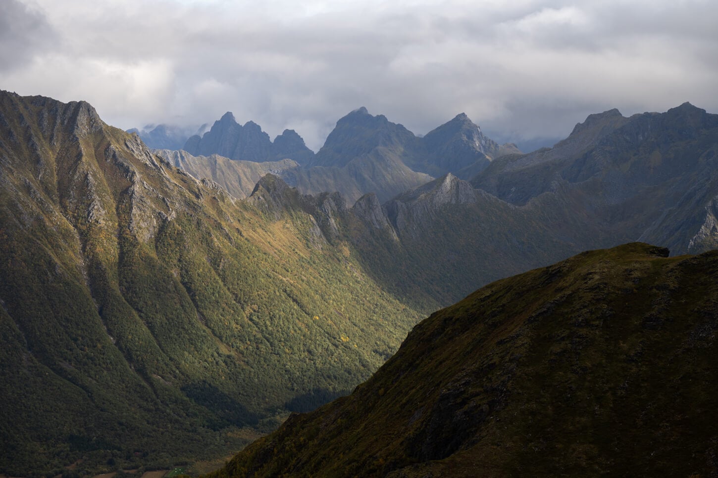
There are also quite a few interesting views along the ridge, and a few interesting mountains too. So it's a good place to bring a medium telephoto lens. I used only my 24-120 mm Nikkor Z lens, and I think it was more than adequate in terms of range, both on the wide and on the longer side. Though to be fair, on the wide side down to 18mm wide might have worked better, especially from Delpsheia. A 24mm lens was enough, but probably a little wider provides more compositional freedom.
On the longer range, there are plenty of interesting details and mountains in the landscape to zoom in on.
Where to Stay
There are some Guesthouses or Rorbuer in the area, in Lauvik or Straumnes, if you want to spend the night before or after the hike in the area.
Otherwise, the city of Svolvær is a short 30-minute drive from the trailhead, with plenty of accommodation types to choose from. And, easy access to another great hike, like Fløya and Djevelporten.
Additional Resources
- Planning a trip to the Lofoten? Here are my tips to plan a trip to the Lofoten Islands.
- Discover more Scenic spots and Hikes in Norway.


Leave A Comment