
Perito Moreno Glacier Walkways, Patagonia, Argentina.
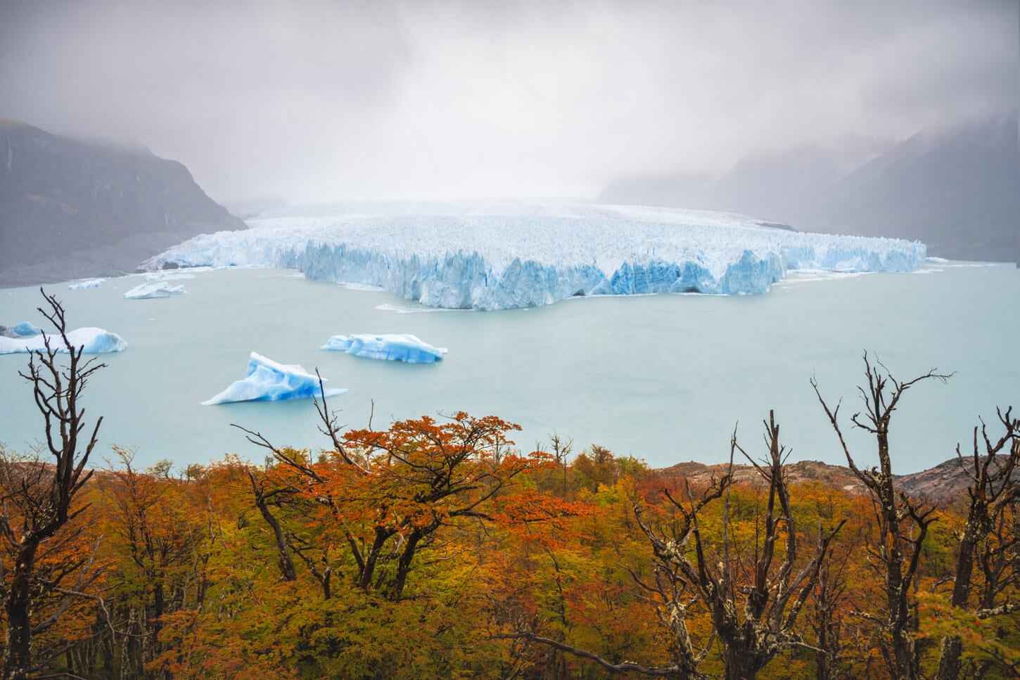
The Perito Moreno is possibly the most iconic glacier in the world, and one you can see up close through a series of walkways situated in front of the glacier. Located in Patagonia and part of the Southern Patagonian Ice Field, it’s hard to render its true size. It’s one of those things you really have to see for yourself.
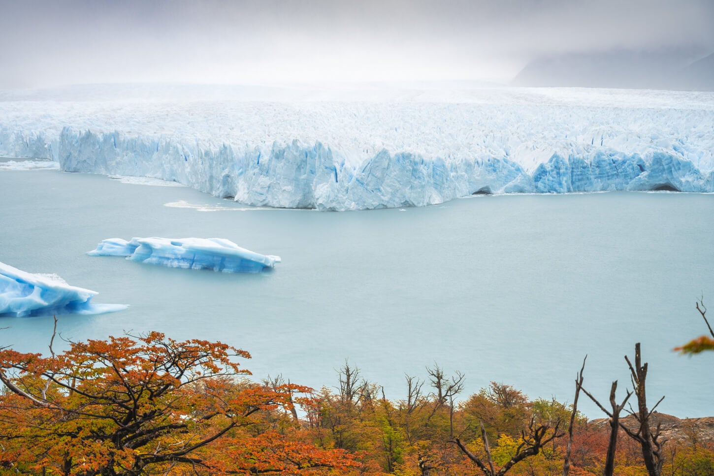
Perito Moreno’s Glacier front.
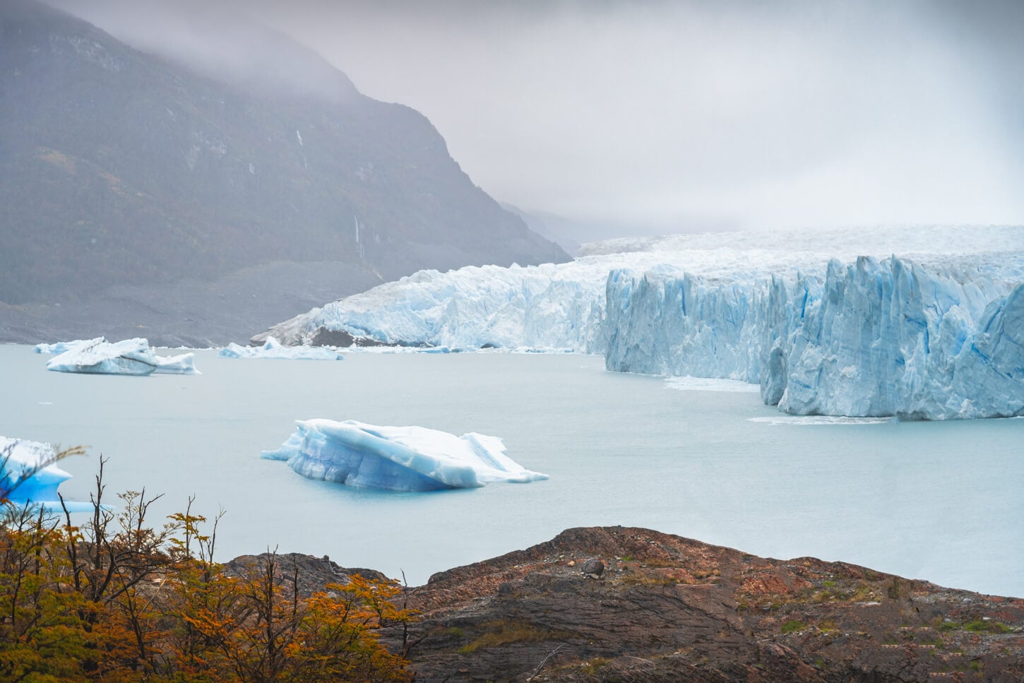
In numbers, it is currently about 5km wide and rising roughly 60-70 meters above the lake. While it is still a mighty sight, the glacier has recently started receding too. Up until a few years ago, it was still holding strong, but it is now receding fast.
Scientists warn that Glaciar Perito Moreno has entered a phase of fast recession (source, full paper linked at the bottom of this post). In fact, it has already retreated more than 800 meters in places since 2019. And it may soon detach from its subglacial ridge, which would mean a retreat of several kilometers. So better to plan a visit sooner rather than later if you want to see it, as it could look very different in a few years.
For the time being, it still is a beautiful sight, one of nature’s true wonders. The walkways are still a great way to experience it.
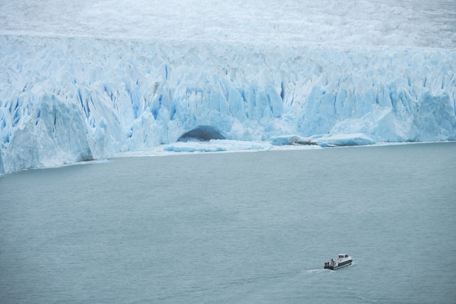
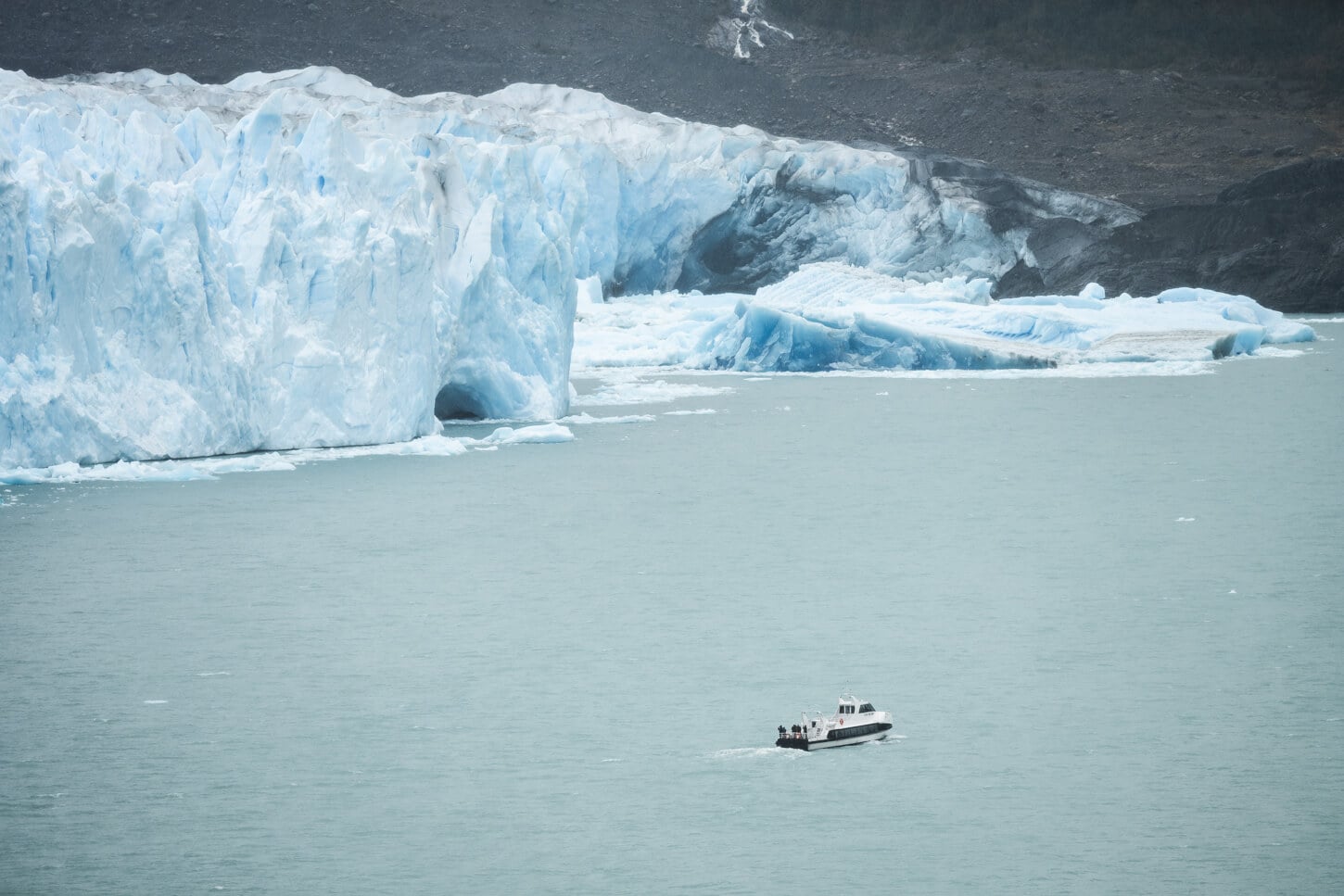
Perito Moreno’s Glacier Front, with a boat for scale.
Fun Fact: If you are wondering what the “Perito Moreno” name means, it’s nothing related to glaciers directly. “Perito” means “Expert”, and Moreno is the name of the Argentinian Naturalist the glacier is named after.
Table of Contents
Overview of the Perito Moreno Glacier Walkways & Map
The walkways are a network of paths on a small inlet that is right in front of the glacier. Each path is marked with a different color and rated for different difficulties. I would not really call any of them “difficult” if you are used to hiking in the mountains.
That is because the walkways are essentially metal footbridges. There is no walking on dirt or a proper hiking path on the walkways. So you have to read the “difficult” rating, keeping in mind this is a place that is frequently visited by both children and more senior visitors, for which the many steps/elevation gain may be an effort.
Other than that, it’s easy to walk across the walkways to several different viewpoints of the glacier.
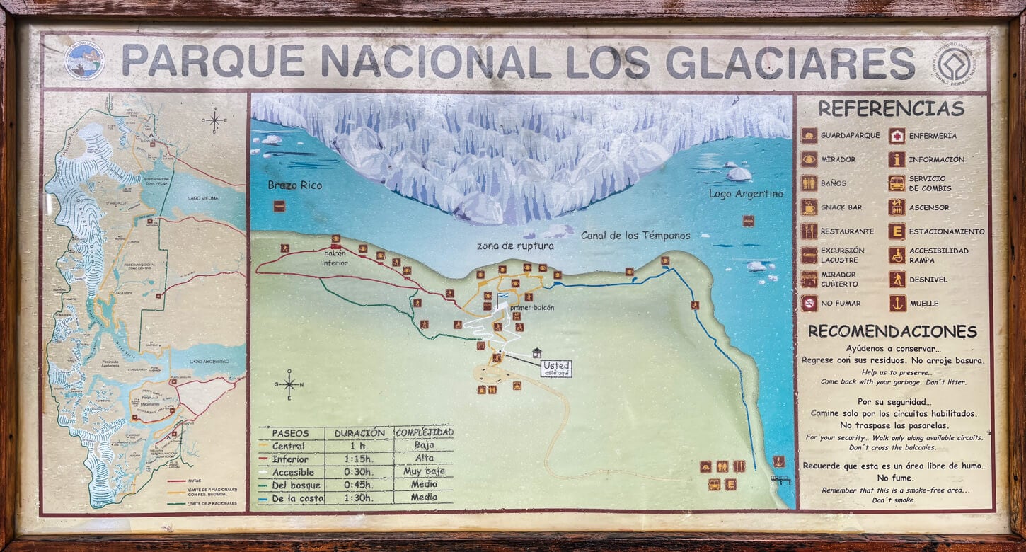
Map of the Perito Moreno Walkways from a local board.
Perito Moreno Walkways List
Here is an Overview of all the Perito Moreno Walkways:
- “Accessible” Path (White): This is the accessible path to the “Primer Balcon,” which is one of the best viewpoints, suitable for visitors with reduced mobility
- “Central” Path (Yellow): partly interconnected with the white/accessible path, it leads closer to the glacier’s front.
- “Balcon Inferior” Path: marked as the “hardest” path, it’s the one with more elevation gain, but again, negligible if you are used to mountain hiking. The lowest possible viewpoint, and closest to the glacier’s front, is on this path.
- “Del Bosque” Path: This is a path, as the name says, mostly in the forest, connected to the red path, “Balcon inferior”
- “De la Costa” Path: This is the shore path accessible from the other parking area near one of the boat tour departures. It’s probably one of the best paths to get a closer view of floating icebergs rather than the glacier’s front. Or if you just want to take a long walk.
Do note that you need to purchase an entrance ticket to Los Glaciares, either for one day or multiple days, if you plan to visit other places. You can pre-purchase tickets online on the official APN website.
The table below refers to my own tour of the walkways, which touches the main viewpoints along the walkways. However, the entire walkways are about 4.7km/2.9 miles long, in total.
| Max Altitude | 300m / 984 ft. |
|---|---|
| Distance | 2.11 KM / 1.3 miles |
| Elevation gain | 110 m ↑ / 110m ↓ (360 ft.) |
| Hike time | 30 Minutes / 1 Hour |
| Hike Difficulty | Easy |
Here is the map of this short walk. It’s the same walk I took on the walkways, starting from the “accessible”, to the “central” and “balcon inferior” and back. You can download the GPX file for free from the activity linked below. Not that you’d need one, and you can only walk on the metal walkways around the area, and they are all well-marked.
How to get to the Perito Moreno Glacier Walkways and Parking
The Perito Moreno walkways are easily accessible from El Calafate, but getting there requires a bit of time. It’s about 75km or 46.5 miles from town to the parking area, and by car it takes 1 hour and 15-30 minutes to get there. It’s an easy drive.
- Driving Directions: From El Calafate, keep driving on the main road through town, Road 11. Keep following past the lakes, shore, and until you reach the park’s entrance checkpoint, some 45km/30miles away from El Calafate. There, you will need to show the Park’s entrance ticket, or you can buy it on the spot. From the checkpoint, it’s another 30 or so km to the walkways parking area. The road is a little twistier and slower going, but it builds anticipation as you start to see the first few icebergs in Lago Argentino to your left.
- Parking: There is a small parking area by the visitors’ center. I was actually surprised to see how small it is, but I guess most of the visitors come here with Bus Tours or Private Transfers. Free at the time of writing. I arrived in the early afternoon at about 2 pm and had no issues finding a spot to park my rental car. However, it was a rainy day at the end of the season, so that may be different during peak season, on a bright summer day.
- Public Transport: While there are no real public transport options, there are several bus transfer options from El Calafate that you can choose from.
Note that you usually need to purchase the park’s entrance separately if you take a bus transfer, unless some companies include that in the package. But check before booking the tour.
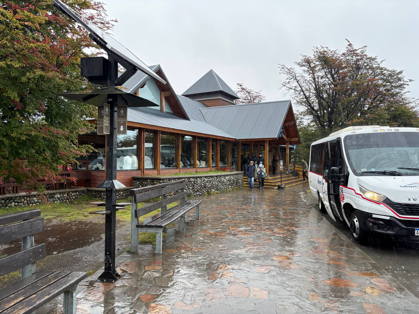
Perito Moreno’s Visitors Center
Perito Moreno Boardwalks Opening Hours and Access Rules
The Perito Moreno Park’s entrance is normally open year-round, but closed on December 25th and January 1st.
Other than that, there are different opening times depending on the season.
- Summer Season (September 1 to April 30): entry is possible between 8:00 AM and 6:00 PM. You must leave the walkways by 7:30 PM and exit the park completely by 8:00 PM
- Winter Season (May 1 to August 31):9:00 AM to 4:00 PM. You must leave the area by 6:00 PM
You can also check the hours for any possible change directly on the official Perito Moreno Website.
Trails of the Perito Moreno Walkways
There are several different trails on the walkways. It’s a sort of interconnected network of metal that offers different viewpoints in front of the glacier’s front. From the parking and drop-off area next to the visitors’ centers, you have a few different access points to different walkways. So there really is no predefined path you have to follow; you can just go and pick your path.
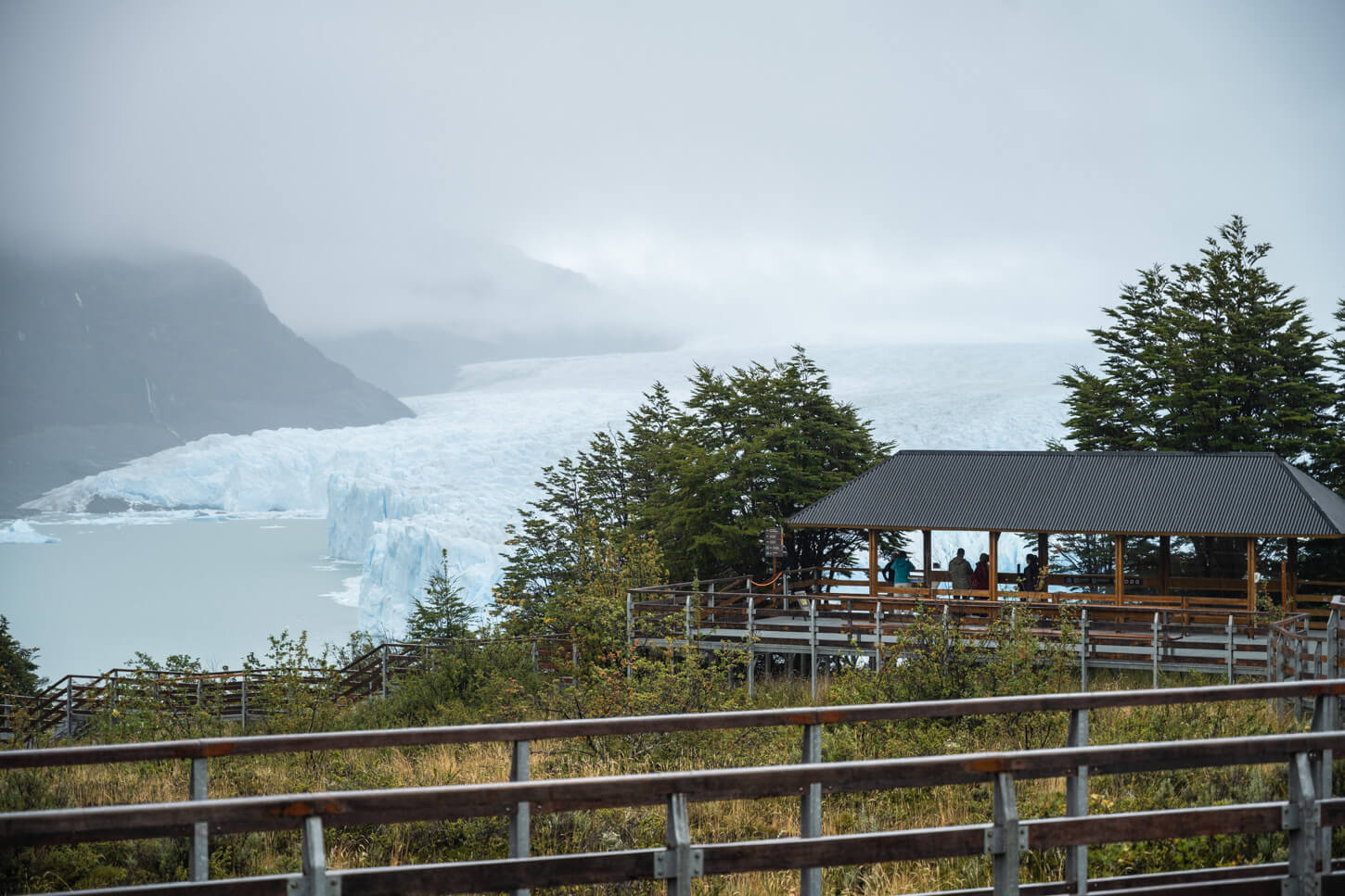
The Walkways and one of their Viewpoints – or Balconies
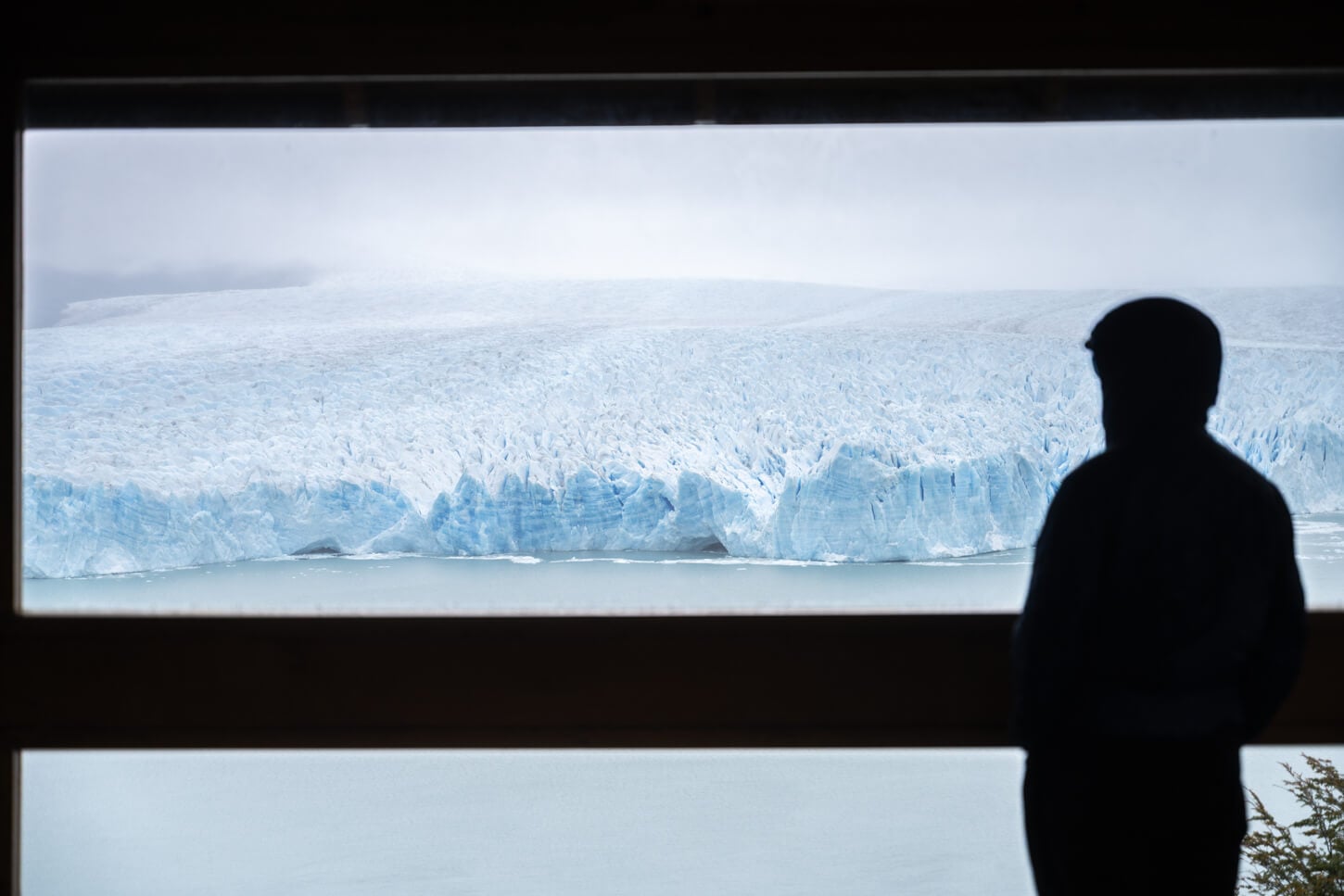
View of Perito Moreno from the Primer Balcón, the first viewpoint on the “accessible” path
I went straight t to the main viewing platform on the white, “accessible” path first. It’s the one that offers is one that offers the best panoramic views of the glaciers, the “primer balcón”. It’s also the one with a small covered area, good to hang out at in case of rain. While it is on the upper part of the walkways and the glacier looks a bit farther away compared to the lower walkways, you have the widest possible panoramic views from this point.
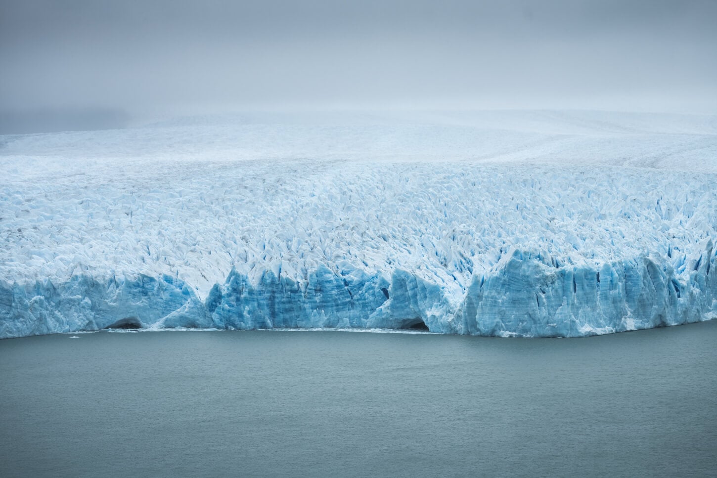
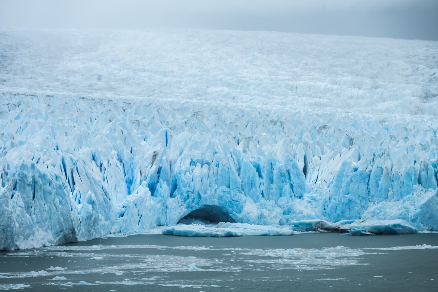
Detail of the Glacier’s front.
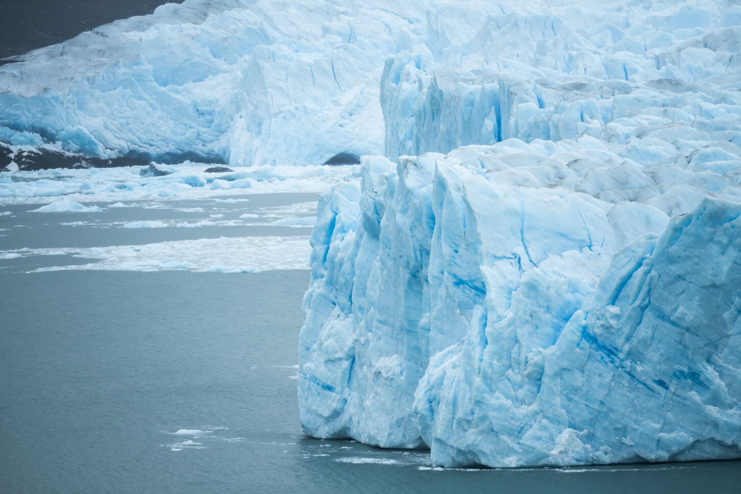
For scale, can you see the tiny lines of hikers on the glacier, on the top left-hand side? Yes, those “dots”.
The “accessible” path and the “Primer Balcón” are also the best ones if you wish to see a calving episode, or parts of the glacier’s front crashing into the lake.
From there, you can walk toward the shore on the “Central” path, that offerse several more, lower viewpoints. There are several great viewpoints along this path, too, as they bring you a little closer to the glacier’s front.
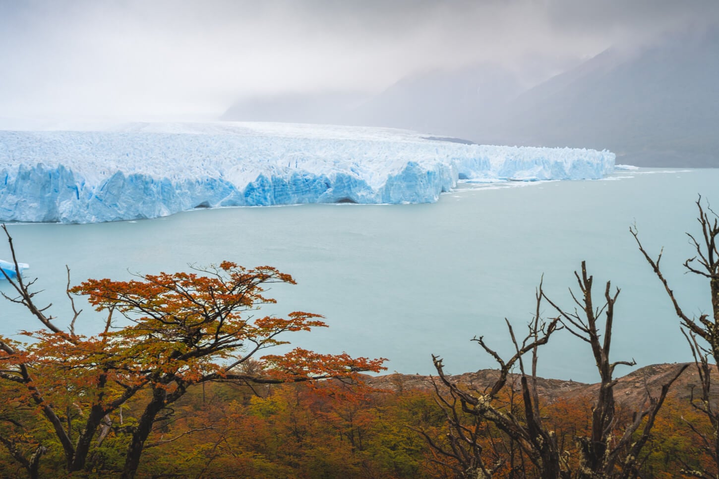
View of the Glacier from the “Central” path
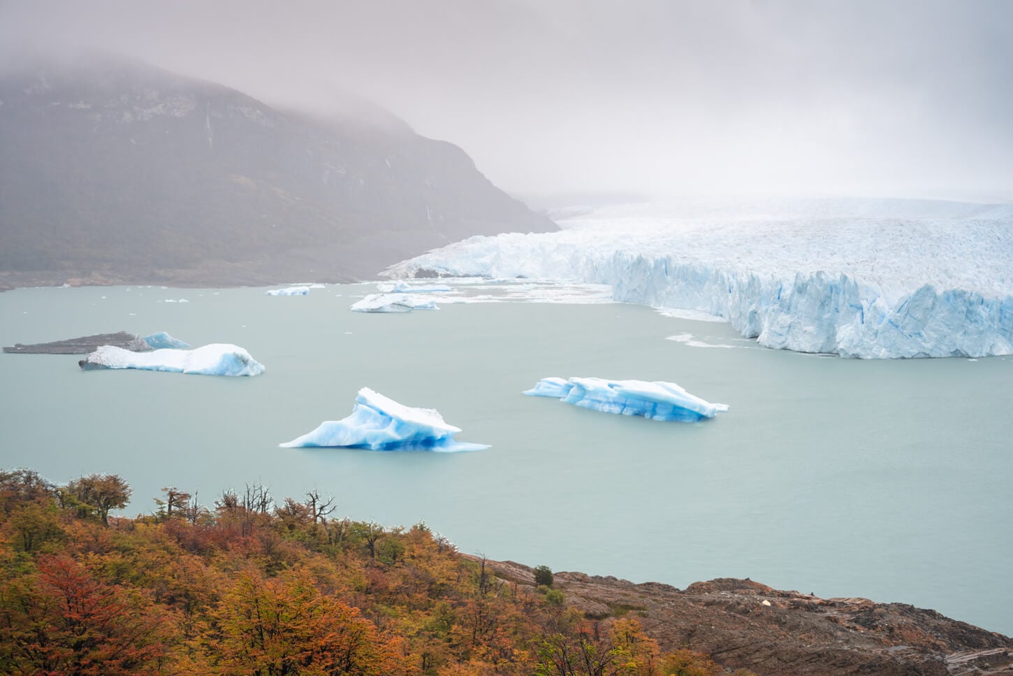
From there, you can continue to the “Balcon Inferior” path, which leads to the lowest possible viewpoint closer to the shore. It does provide better views of the closest sections of the glacier’s front. That also means it’s one of the best viewpoints to have a better sense of the scale of the glacier’s size.
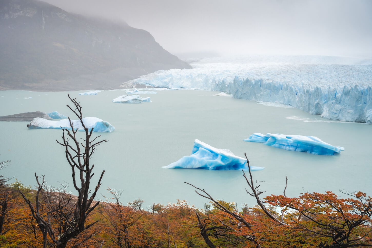
View from one of the observation points on the “”Balcon Inferior” path
The “Balcon Inferior” loops back on itself, but you can also take the path “del Bosque”, which leads back to the “primer balcón”. I took this path too, to spend some more time at the “primer balcón” viewpoint, before heading back.
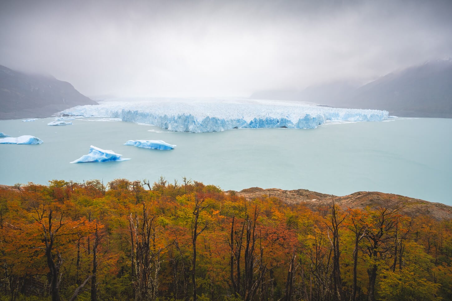
Perito Moreno Photos and Photography Tips
First, a note on the gear. I took these photos either with a 24-100mm lens or with a 100-400mm telephoto lens, full frame. I think that’s the ideal range to capture the glacier on the wide and longer side. On the telephoto lens, I’d recommend at least something in the range of 180-200mm.
For reference, this is how the glacier looks at 24mm and at 400mm:
Photo taken at 24mm
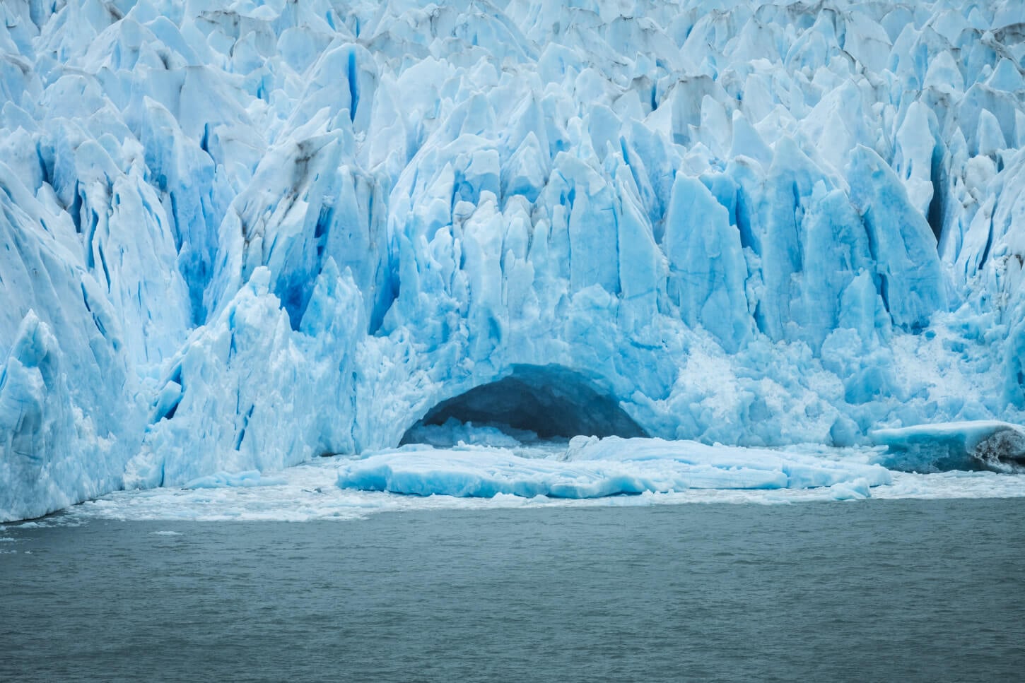
Photo taken at 400mm.
Now, with the glacier receding, gone are the days when you could photograph the impressive glacier fronts right next to the shore. If you look at old pictures online, that made it easy to render the size of the glacier, especially with people on the walkways.
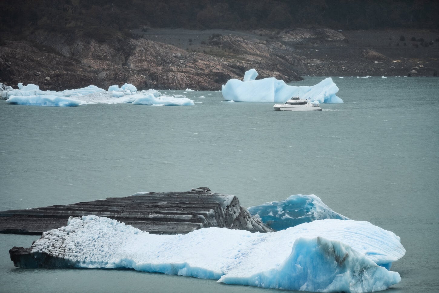
That’s entirely gone. To do that, you will need a long telephoto lens and wait for one of the tour boats to pass by the glacier’s front to have the option to render its true size. It’s mind-boggling to see how the glacier is, and waiting for a boat to approach is the only way to render some sort of scale properly.
Or you might even spot a glacier tour walking on the glacier. To be fair, I only realized there was a tour when I looked at the photo on a PC, but below you can see tiny line people on a glacier tour. It’s on the upper left part of the image.
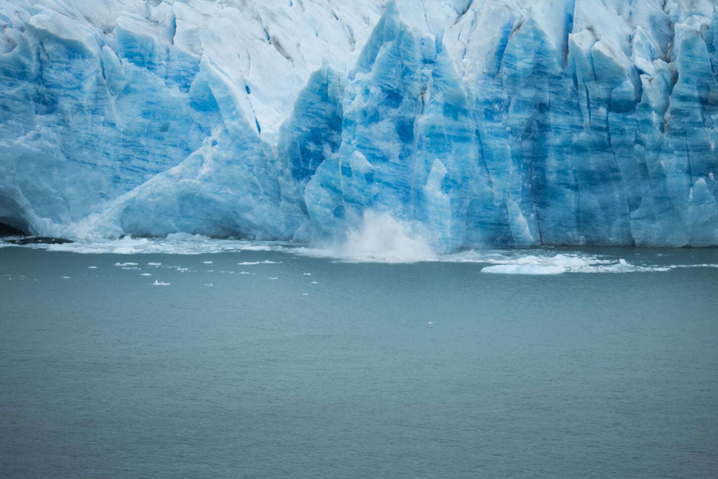
One of the things you may want to capture, smaller or bigger calving episodes, requires patience. And a telephoto lens, again above 200m if you don’t want to crop. I hung around for about a couple of hours in the rain, including the walking time, and I have seen three relatively small calving episodes, but not spectacular crashes.
That is to say, you may need to hang around for a while, unless you get lucky. And for reference, this tiny splash is all I managed to capture during that time.
Lastly, Sunset and sunrise here are not an option, due to the opening hours of the park.
Where to Stay
El Calafate is about 45 minutes drive and the only town nearby. Plenty of accommodation types from High-End Hotels to guesthouses or Hostels. Also, some guest houses in El Calafate’s outskirts, if you are looking for something a little more
If you are thinking about staying in El Calafate, personally, I think it’s fine for one night, max two. It’s a rather tourist-oriented town, and it does not have much of the character that El Chaltén or Puerto Natales have.
I stayed there one night too, as I drove from Torres del Paine to visit Perino Moreno in the afternoon and to check the town in the evening. Good place to shop for souvenirs or to have a good dinner, or look for organized/guided tours.
Additional Resources
- You may also want to read my full El Chaltén Hiking and Landscape photography guide, if you are planning a trip to the area.
- For a general overview of hiking and landscape Photography locations in Argentina, check out my main Argentina page.
- Here is the Perito Moreno official website.
- Link to the research paper on the state of Perito Moreno.

Leave A Comment