
Best Ring Road Hikes in Iceland: Hiking & Photography Itinerary
The Ring Road of Iceland is full of easy, quick stops, but for hikers, there are also plenty of trails that can fill an entire itinerary, and here are the best Ring Road hikes in Iceland. A list of 27 day hikes and several more photo locations you can reach directly from the Route, plus a few worthy detours worth considering if you want additional stops.
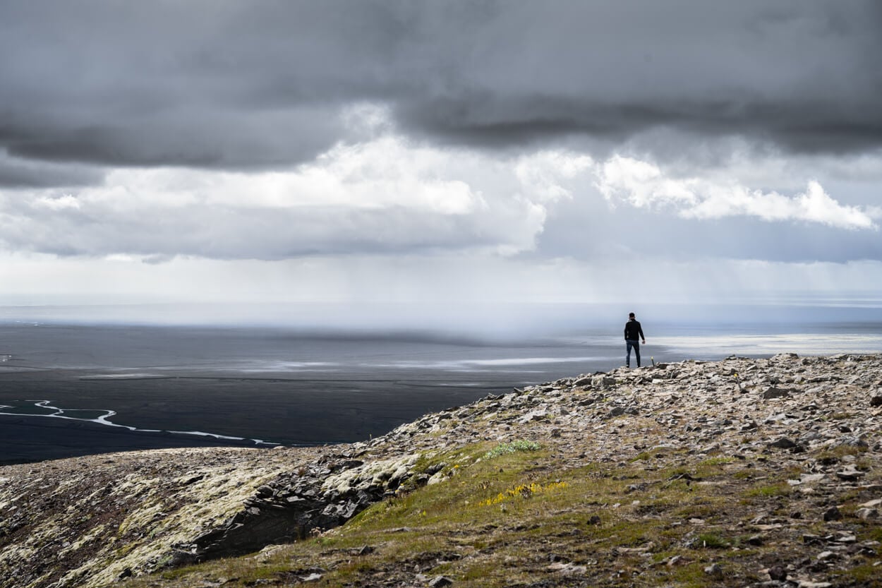
It’s a list that offers all the possible types of landscapes you can find in Iceland. From geothermal areas to glaciers and jagged peaks, through canyons and green mossy fields, waterfalls and volcanic landscapes, there’s a bit of everything. Some are easy, short walks, some are challenging, all-day hikes.
All the locations in this list are places that I visited one more time, and I would not hesitate recommending them to anyone planning a trip to Iceland.
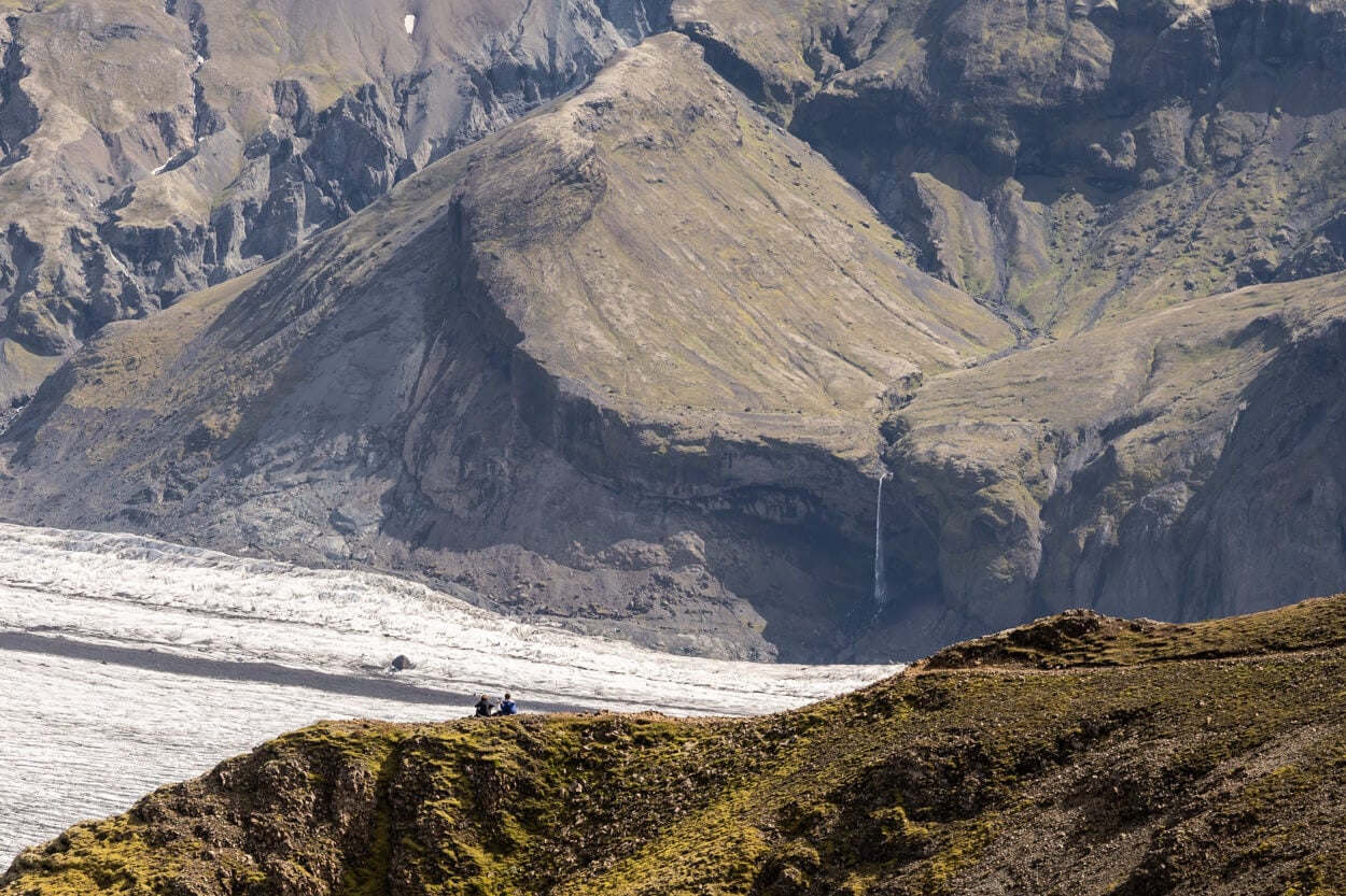
Skaftafell National Park
There’s going to be way more than what you could visit even in a 2-to 3-week trip, but the purpose of adding many locations is to give you a choice in planning your itinerary and alternative options if you are on the road and looking for alternatives.
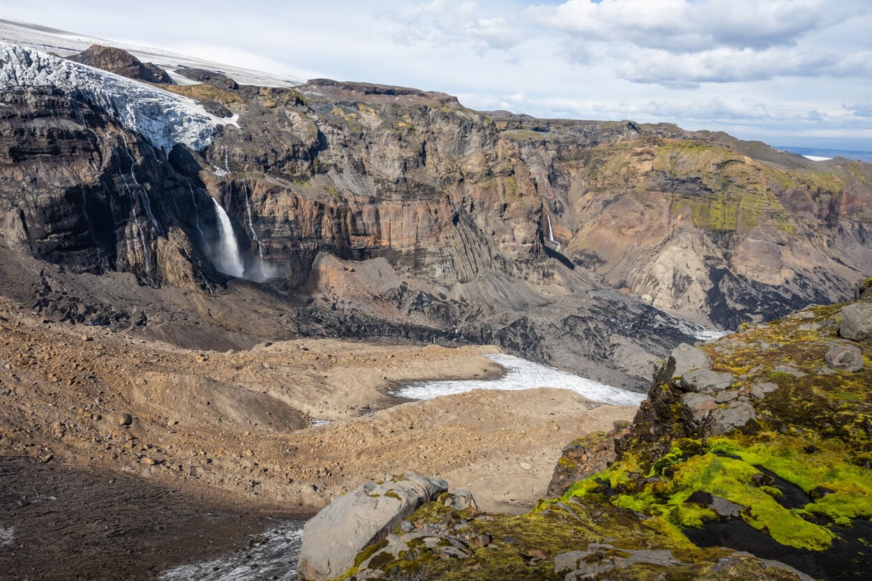
Þakgil, Huldujökull Viewpoint.
Table of Contents
How to use this Guide
First off, this list only includes day hikes. It’s an itinerary of hikes around Iceland, and as such, it is designed to be used as a ‘stop-and-go’ list day after day. And, in between, I have added the most scenic photo stops.
Second, the “best season” section in each hike description is to be intended as Astronomical or the Gregorian calendar seasons. Technically, and based on the old Norse Calendar, there are two seasons in Iceland, Winter and Summer. Summer starts on the 11th of April, and Winter starts on the first Saturday after the 26th week of summer, so around late October. A bit of a fun fact, but I thought it was worth mentioning.
Now onto the list:
- Direction of Travel: The list is organized along a counterclockwise itinerary along the ring road. That is usually the most common direction of travel. So if you are planning to drive the ring road clockwise instead, you can scroll from the bottom of this post up.
- Additional Photo Spots & Points of interest: In between Hikes, I have added major photo stops/points of interest. However, the list is by no means exhaustive. Still, if you are planning your itinerary, you can use it as a reference for the most interesting photo spots along the road.
- Detours & Alternatives: While most of these locations are directly accessible from the Ring Road, I have added some that require short detours, where I think it makes sense. I will also provide alternative routes through other regions for those who want to extend their trip beyond the ring road.
This itinerary can be done in any 2WD and does not require entering f-roads or the highlands. Though some trailheads may be on rough roads or may require walking a little extra to reach the trailhead, I’ll put a note for such cases.
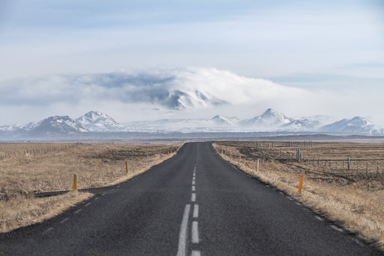
When to go and Planning Tips (& Car rental Discount)
The best time to hike around the Ring Road at these locations is from early June to mid-September. Outside that window, conditions are a bit of a mixed bag.
During the shoulder seasons, March to May and September to November, some trails are accessible, while others remain unsafe or closed.
For example, Glymur is typically closed until late May or early June. Þakgil is usually inaccessible until early June. On the other hand, Fjaðrárgljúfur and Jökulsárlón are usually accessible year-round, unless there is a severe storm.
In the middle of winter, even fewer hikes are possible, and you also have to account for very short daylight hours. For an idea of what is doable, check out my post on a Winter Eight-day hiking trip (in a van).
To sum it up:
- Early June to September: for the trails to be accessible and have the longest daylight.
- Shoulder Seasons (March/May or September/November): if you are ok with shorter daylight and reduced hiking options and possible freak snowstorms. Also, bring microspikes!
- Winter: not recommended, though some shorter hikes may still be possible.
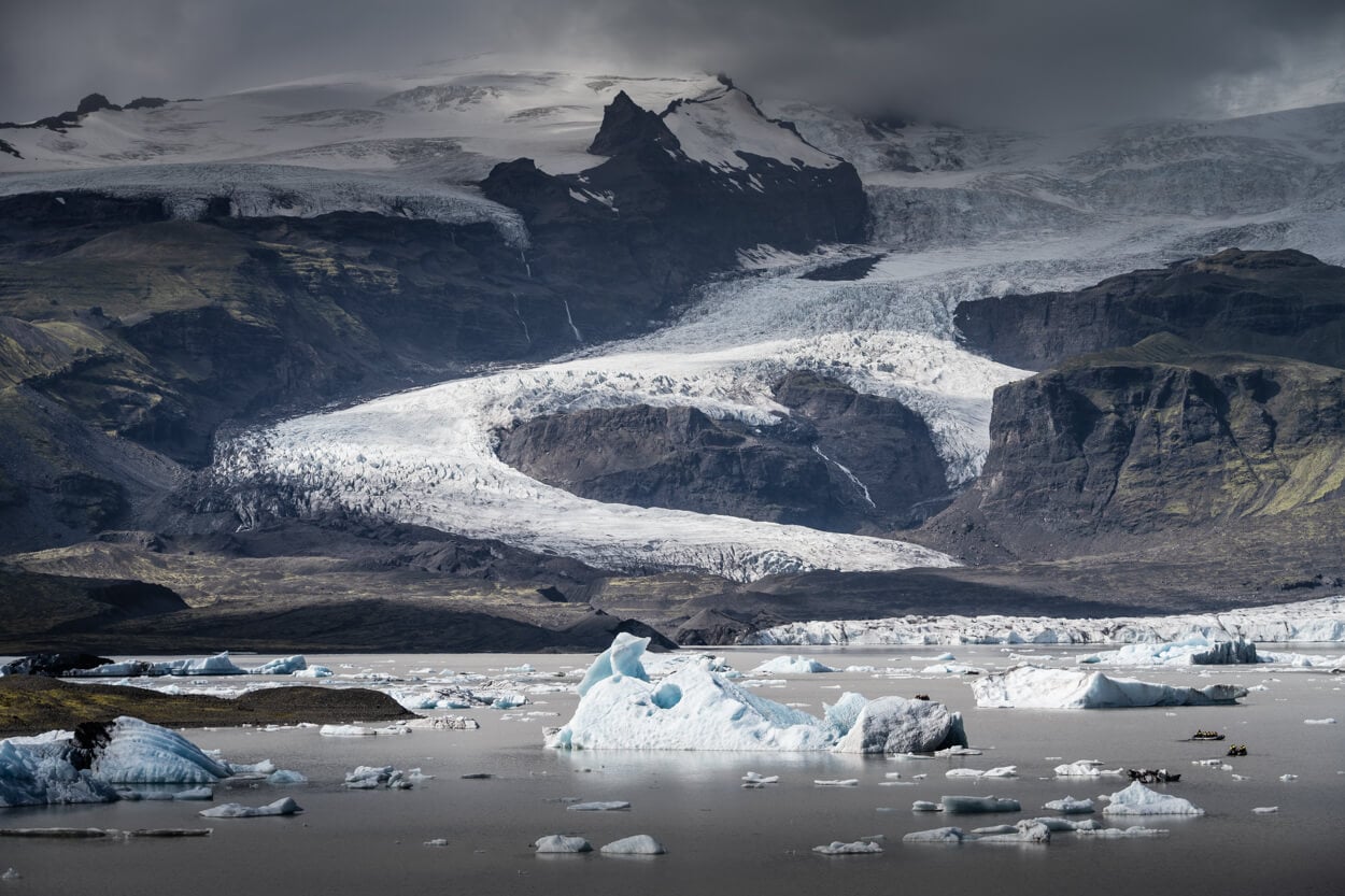
All around the Ring Road, many beautiful locations are accessible within short detours. Here is Fjallsárlón, a Glacial Lagoon.
Parking
It is safe to assume most of these locations have paid parking. Download and install the Parka App before setting off so you can pay quickly via your phone and hit the trail without hassle.
Car Rental Discount
If you haven’t booked a vehicle yet, you can get a 5% discount with Blue Car Rental, one of the leading car rental companies, located just outside the airport.
Hiking Etiquette & Safety
Before getting into the full guide and list of hikes, here are a few tips to hike safely and in respect of the local written and unwritten rules.
In terms of safety, there are three websites you’d want to check daily and before setting out on the trail or on the road:
- Safetravel.is: check for warnings, hazards, danger, or just to confirm if an area or trail is open. You can also log your itinerary for safety purposes
- Vedur.is: Iceland’s Meteo office weather forecast, as the weather can change suddenly.
- Road.is to check road conditions and possible closures.
In terms of Hiking:
- Stick to the marked and visible paths. A rope across a trail or a simple line of stones means the path is closed, and we, as visitors, are expected to respect that. For someone living in a big city, it may feel weird to not see a “barricade” that physically prevents people from accessing an area, but that’s how it works in Iceland.
- Do not walk on moss; it’s fragile, and even a step on it will damage its roots. Moss is slow-growing and may take years to recover from damage.
- No cairns. And don’t move stones to create cairns. Trolls live under those stones :)!
- Do not try to get close to or touch hot springs
- Closed gates: You can cross closed gates on a trail, but close them behind you. They are usually there to keep livestock within their grazing areas.
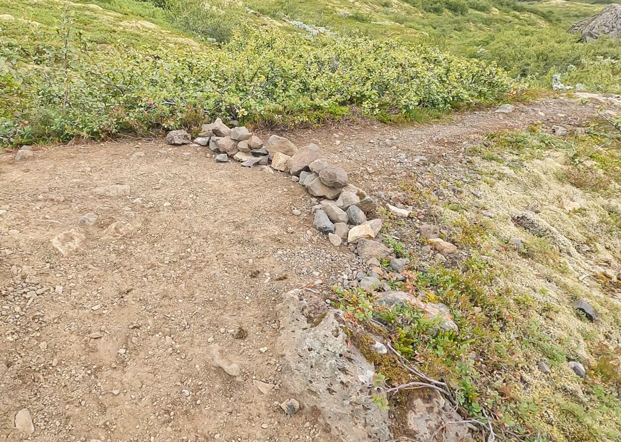
Stones laid across a path mean “Closed”.
Hiking & Landscape Photography Itinerary around the Ring Road, with Map
This itinerary is designed as a road trip around the Ring Road. I have not added directional arrows to the pins, so you can follow it counterclockwise, clockwise, or simply tackle it by region if you only wish to explore specific parts of the island.
Below, you can explore all the hikes on the interactive map, followed by a short overview of each trail and links to my full in-depth guides where available.
Each full guide includes an embedded route map and downloadable GPX file, and for trails I haven’t written a dedicated post about yet, I’ve included a direct link to my Komoot activity so you can grab the GPX track right away.
Table of Distances & Quick Overview
Overall, the main itinerary around the ring road includes 27 hikes, some short, some longer, some easy, some difficult. Some are popular locations, some others are lesser-known ones. I’ve tried to keep a balance between those opposites so that there is a good mix.
You can also find a quick overview of the distances between each one of the main hikes in the list. This is indicative because travel time depends heavily on weather, traffic, and on how many photo stops you make.
Many of the phot stops in the list still require some amount of walking or driving, and they easily add one, two, or even three hours to a full day on the road.
| Hike | From | To | Distance | Drive Time | Hike Distance |
|---|---|---|---|---|---|
| Reykjadalur | Keflavik | Reykjadalur | 90 km / 56 mi | 1 hr 30 min | Moderate |
| Stóra-Dímon | Reykjadalur | Stóra-Dímon | 90 km / 56 mi | 1 hr 30 min | Easy |
| Nauthúsagil | Stóra-Dímon | Nauthúsagil | 23 km / 14.3 mi | 40 min | Easy |
| Seljalandsfoss-Gljufrabui | Nauthúsagil | Seljalandsfoss | 10 km / 6.2 mi | 20 min | Easy |
| Skógafoss Waterfall Way | Seljalandsfoss | Skógafoss | 30 km / 18.6 mi | 30 min | Hard |
| Kvernufoss | Skógafoss | Kvernufoss | 2 km / 1.2 mi | 5 min | Easy |
| Reynisfjall / Hatta | Kvernufoss | Reynisfjall / Hatta | 35 km / 21.7 mi | 40 min | Easy /Moderate |
| Þakgil Yellow Trail | Reynisfjall / Hatta | Þakgil (Thakgil) | 20 km / 12.4 mi | 1 hr 00 min | Hard |
| Fjaðrárgljúfur | Þakgil (Thakgil) | Fjaðrárgljúfur | 80 km / 49.7 mi | 1 hr 30 min | Easy |
| Djúpá River and Canyon | Fjaðrárgljúfur | Djúpá River and Canyon | 35 km / 21.7 mi | 30 min | Easy |
| Lómagnúpur | Djúpá River and Canyon | Lómagnúpur | 10 km / 6.2 mi | 15 min | Hard |
| Kristínartindar / Svartifoss | Lómagnúpur | Skaftafell | 36 km / 22.4 mi | 40 min | Hard / Easy |
| Múlagljúfur | Skaftafell | Múlagljúfur | 45 km / 28 mi | 40 min | Moderate |
| Fossárdalur | Múlagljúfur | Fossárdalur | 19 km / 11.8 mi | 23 min | Moderate |
| Hengifoss | Fossárdalur | Hengifoss | 83 km / 51.6 mi | 1 hr 30 min | Moderate |
| Strútsfoss | Hengifoss | Strútsfoss | 21 km / 13 mi | 30 min | Easy |
| Stórurð | Strútsfoss | Stórurð | 114 km / 70.8 mi | 1 hr 40 min | Moderate |
| Stuðlagil West | Stórurð | Stuðlagil | 99 km / 61.5 mi | 1 hr 30 min | Easy |
| Dettifoss / Selfoss / Hafragilsfoss West | Stuðlagil | Dettifoss | 129 km / 80.2 mi | 2 hr 00 min | Moderate |
| Ásbyrgi | Dettifoss | Ásbyrgi | 37 km / 23 mi | 40 min | Moderate |
| Hverfjall | Ásbyrgi | Hverfjall | 87 km / 54.1 mi | 1 hr 20 min | Moderate |
| Bólugil | Hverfjall | Bólugil | 179 km / 111.2 mi | 2 hr 30 min | Easy |
| Reykjafoss (Closed) | Bólugil | Reykjafoss | 26 km / 16.2 mi | 20 min | Easy |
| Benefoss, Attifoss, and Ankafoss | Reykjafoss | Benefoss, Attifoss, and Ankafoss | 138 km / 85.7 mi | 1 hr 40 min | Easy |
| Rauðsgil | Benefoss, Attifoss, and Ankafoss | Rauðsgil | 96 km / 59.7 mi | 1 hr 20 min | Easy |
| Glymur | Rauðsgil | Glymur | 98 km / 60.9 mi | 1 hr 20 min | Moderate |
| Esja | Glymur | Esja | 50 km / 31.1 mi | 45 min | Moderate/Hard |
SOUTH ICELAND
South Iceland is the most popular region in Iceland, outside of the Reykjavik area at least. For good reason, as it probably has the highest concentration of easily reachable points of interest and some of the most beautiful landscapes on the island.
And, of course, great hikes from short and scenic to all-day epic hikes.
Reykjadalur – Hike, Bathe, and Relax in a Geothermal River
Reykjadalur is a geothermal valley where you can bathe in the naturally warm waters of a geothermal river. And a relaxing dip in a hot geothermal pool after a hike is hard to beat. So after the hike up, you can relax and take a bath in warm geothermal waters before heading back down.
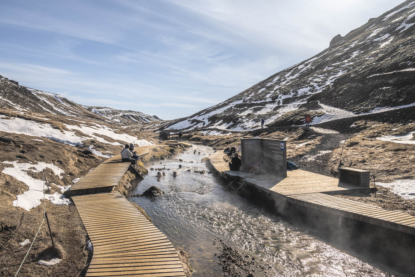
Reykjadalur.
| Reykjadalur Hike Quick Overview |
| • Distance: 12.6 km / 7.8 (Out & Back) | Elevation: +820 m / 2,690 ft | Time: 3-4 h | Difficulty: Moderate |
| • Start & Parking: Reykjadalur Car Park in Hveragerði |
| • Best Season: Early June to Early September |
| • GPX File Download |
Depending on your direction of travel, this can be either the first or last hike on each trip around the ring road. The hike is relatively long and typically possible year-round, depending on snow and ice, but you may need microspikes or crampons in winter.
The trail also passes through a beautiful geothermal area, where you can see gargling fumaroles and colorful geothermal pools. However, the highlight is the geothermal river where you can bathe.
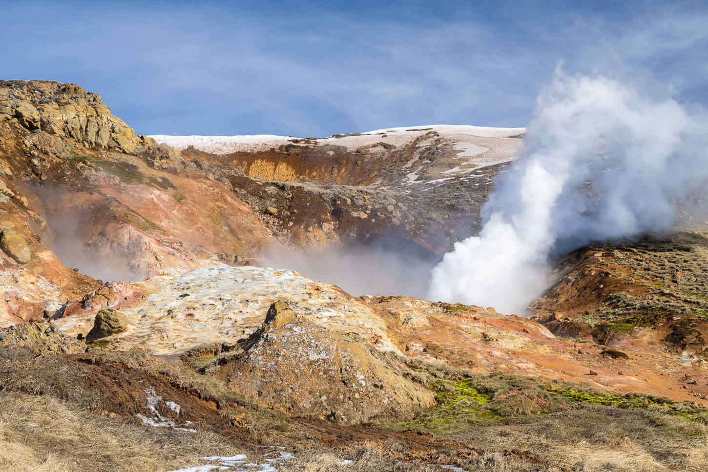
On the Reykjadalur trail, it’s also possible to see several fumaroles.
Stóra-Dímon – A Preview of the Highlands
Stóra-Dímon is a small haystack-like hill rising out of the flat glacial outwash plains of the Markarfljót river. A very prominent feature in the landscape, it’s actually a remnant of a subglacial eruption, and it makes for a scenic, short hike.
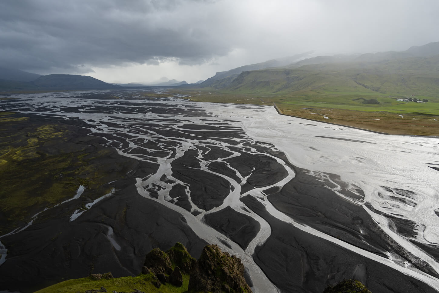
View of the Markarfljót river from Stóra-Dímon.
| Stora-Dimon Hike Quick Overview |
| • Distance: 0.9 km / 0.55 mi (Out & Back) | Elevation: +190 m / 623 ft | Time: 30-45 minutes | Difficulty: Easy |
| • Start & Parking: Stora-Dimon Trailhead on Road 250 |
| • Best Season: Spring to Early Autumn |
| • GPX File Download |
This is a short out-and-back hike that won’t take more than one hour. Often overlooked and easy to miss, this is a short stop you can easily integrate into any itinerary, especially if you are looking for a place away from the crowds that can still offer nice views. Or, if you are looking for a short hike to do in the winter season in the south of Iceland. Either way, it’s a short hike that rewards with scenic views.
Photo Spot
Before heading to the next sport, consider a drive to Gluggafoss, farther down the same gravel road. It’s a beautiful, multi-step waterfall. You can either do it as a quick stop or as a short hike to view the upper steps of the waterfall.

The second step of the Gluggafoss Waterfall.
Nauthúsagil and Nauthúsafoss – Adventure in a Small Canyon
This is another short hike into a small but rather canyon. It’s a bit of an adventure on a trail that follows a small river upstream into a narrow ravine where you will find a small and a bigger waterfall, Nauthúsafoss.

Nauthúsagil.
| Nauthúsagil and Nauthúsafoss Quick Overview |
| • Distance: 1.62 km / 1.0 mi (Out & Back) | Elevation: +20m / 65 ft | Time: 20-40 minutes | Difficulty: Easy |
| • Start & Parking: Nauthúsafoss Parking |
| • Best Season: Late Spring to Early Autumn |
| • Full Post & GPX File Download |
It’s probably one of the most “fun” short hikes in the south of Iceland. It’s quite easy to follow the river upstream into the canyon initially, but the last bit is a little more challenging. You will essentially have to climb with the help of a fixed rope the rock face next to the first small waterfall. From there, you can access the second waterfall, Nauthúsafoss.
That, however, requires pulling yourself up with a fixed rope on the wet walls of the cave, which is the “adventure” part. Nothing too difficult, but it does require hiking shoes with a good grip to have stability on the wet rocks.
Seljajandsfoss and Gjufrabui
Seljandfoss and Gjufrabui (with Glufrafoss) are two waterfalls that can be visited on the same path. And while Seljalandsfoss has a cave behind it, Gljufrabui is inside a cave. So if you don’t know it’s there, it’s easy to miss.

Seljalandsfoss
| Seljajandsfoss and Gjufrabui Quick Overview |
| • Distance: 2.2 km / 1.4 mi (Out & Back) | Elevation: +20m / 60 ft | Time: 40 min – 1 h | Difficulty: Easy |
| • Start & Parking: Seljalandsfoss Parking area |
| • Best Season: Spring to Autumn |
| • Full Post & GPX File Download |
It’s a location best visited early in the morning or late in the evening, especially in summer, to avoid the bulk of the crowds. Gljufrabiu only has a narrow entrance, and the viewpoint in the cave is suitable for a handful of people only, so in peak season, queues will form to enter the cave.
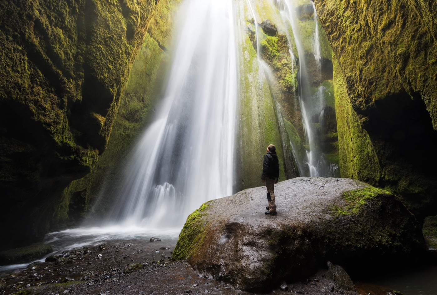
Gljufrabui.
Skógafoss Waterfall Way – Best Waterfall Hike in Iceland
This is one of the most awesome hikes in Iceland. With more than 25 waterfalls along the way, this may well be the best waterfall hike in Iceland. The trail is rather demanding, but you can stop and turn around at any time.

The Majestic Skogafoss, the start of the hike.
| Skógafoss Waterfall Way Hike Quick Overview |
| • Distance: 17.2 km / 10.6 mi (Out & Back) | Elevation: +800m / 2,624 ft | Time: 4.5–5h | Difficulty: Hard |
| • Start & Parking: Skógafoss Parking Area |
| • Best Season & Light: Early June to Early September |
| • Full Post & GPX File Download |
Many of the waterfalls along this trail would be major attractions in their own right. Seeing so many beautiful falls on the same trail is a rather unique experience, and the name “Waterfall Way” couldn’t be more spot-on.
Still, that’s somewhat reductive, because the trail also offers views of beautiful canyons and the pristine landscape of Iceland’s interior.
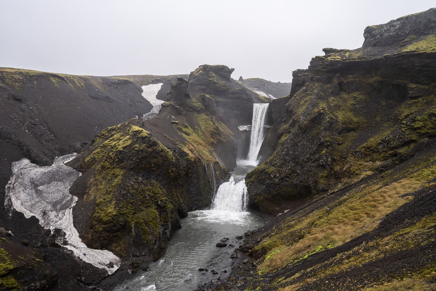
Kvernufoss
Kvernufoss is another beautiful Waterfall just a short drive from Skógafoss. While in a way Skógafoss overshadows it a bit, it is well worth the short hike. it still feels a bit like a hidden gem, and there will be far fewer visitors around compared to Skógafoss.

Kvernufoss
| Kvernufoss Hike Quick Overview |
| • Distance: 2.09 km / 5.59 mi (Out & Back) | Elevation: +40m / 131 ft | Time: 20-30 minutes | Difficulty: Easy |
| • Start & Parking: Kvernufoss parking area |
| • Best Season: Spring to Autumn |
| • Full Post & GPX File Download |
The hike is quite short, too, as it takes about 10-15 minutes to reach Kvernufoss from the parking area. It’s an easy, well-maintained path, and you can also walk behind the waterfall. No difficulties of sorts to visit this waterfall, which makes for a great photo spot, too.
Photo Spots
Before heading to the next stop, you could stop at the Sólheimajökull glacier, but do not miss Dyrhólaey and Reynisfjara, or the black sand beach, and its sea stacks, Reynisdrangar. Also, the Reynisfjara viewpoint near Dyrhólaey before visiting the black sand beach on the opposite side of the bay. Take particular care when visiting Reynisfjara and pay attention to the warning system. The sneaker waves can be extremely dangerous.
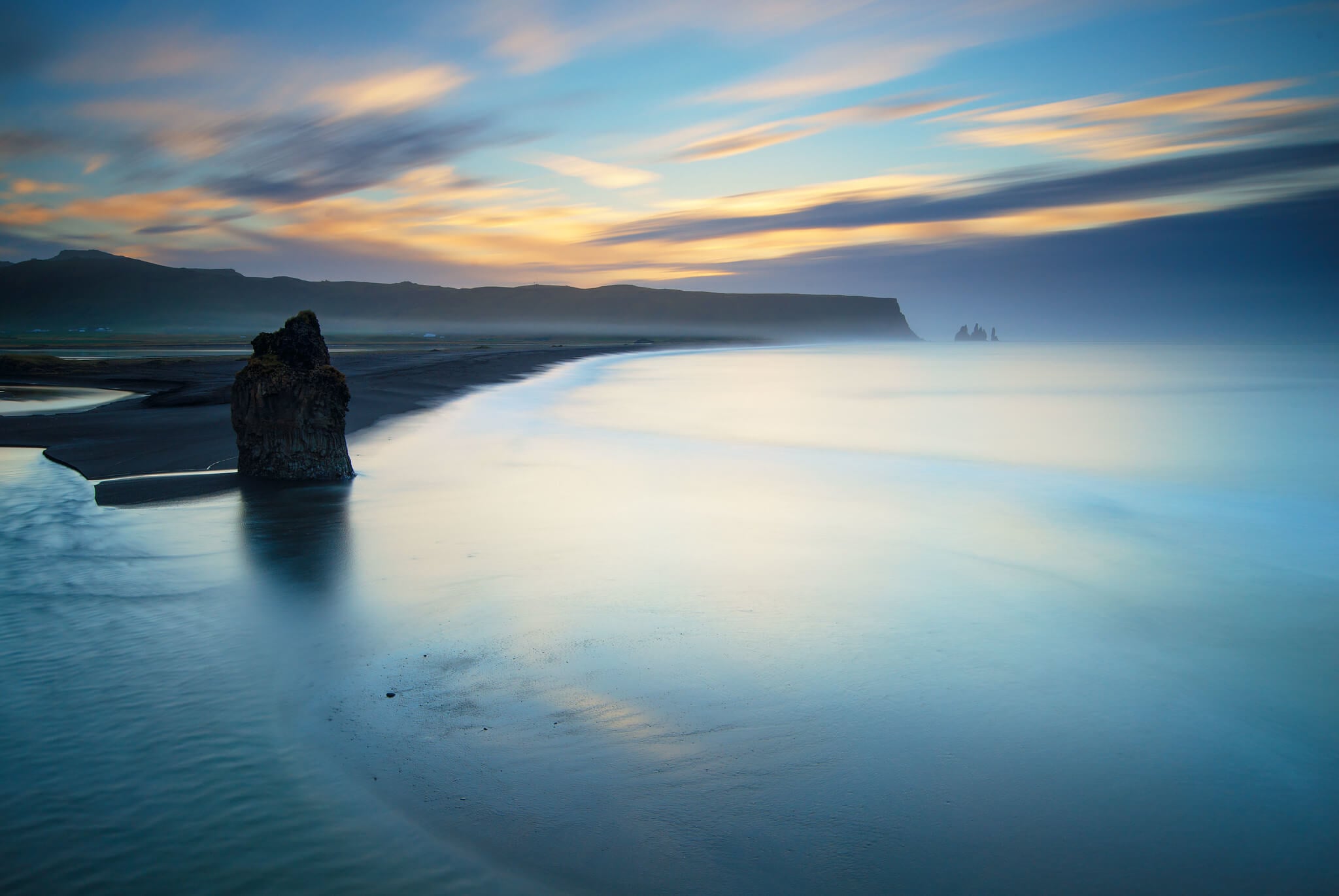
Reynisfjara Viewpoint near Dyrhólaey.
Then, if you feel like it, hike up Reynisfjall from Vik to view the beach and the sea stacks from above, away from the crowds. It’s the next hike on this list.
Reynisfjall – See The Black Beach from Above
Reynisfjall is the mountain that towers above the Reynisfjara beach and sea stacks. Despite its popularity, few people hike there. The views are stunning in both directions, and you also have a great bird’s-eye view of the sea stacks.

The Reynisfjall Sea Cliffs Hike – View toward Dyrhólaey.
| Reynisfjall Sea Cliffs Quick Overview |
| • Distance: 8 km / 5 mi (Out & Back) | Elevation: +270m / 885 ft | Time: 3-3.5 h | Difficulty: Moderate |
| • Start & Parking: Vik or the small parking by the trailhead |
| • Best Season: Early June to Early September |
| • Full Post & GPX File Download |
The out-and-back hike takes about three hours and is easily doable directly from Vik. It’s a great place to enjoy the views of all the surrounding landmarks away from the crowds, especially at Sunset. The top of Reynisfjall is actually a relatively large plateau, and the trail follows the cliffs along its perimeter.
Hatta – Views of Vik and its Church without the Crowds
Another hike in Vik that offers a different perspective on the town, Vik’s church, and the black-sand beach. And, better views, with fewer people around. Overall, Hatta is a moderately challenging trail that not only offers great views of Vik and the Reynisdrangar sea stacks, but also of Dyrhólaey and long stretches of the southern coast.

View of Vik from the Hiking trail to Hatta, a 2-2.5-hour out-and-back hike.
| Hatta Hike Quick Overview |
| • Distance: 7.15 KM km / 4.44 mi (Out & Back) | Elevation: +470m / 1,541 ft | Time: 2./2.5 h | Difficulty: Moderate |
| • Start & Parking: Vik’s Church Parking area |
| • Best Season: Late Spring to Late Autumn |
| • Full Post & GPX File Download |
Definitely an underrated trail in Vik, just like Reynisfjall. In most cases, it would take a couple of hours or less for the out-and-back hike to Hatta’s summit, so it’s a relatively quick one that you can easily combine with other points of interest in the area or along the south coast.
Þakgil Yellow Trail – Epic Glacier Views
Þakgil is one of Iceland’s best hiking spots. It requires a relatively long detour from the ring road onto a 20 km rough dirt road that is also accessible with a 2WD car. The road is rough, but well worth the trip. For the best views, I recommend taking the yellow trail to the Huldujökull glacier viewpoint for an impressive yet still underrated vista.
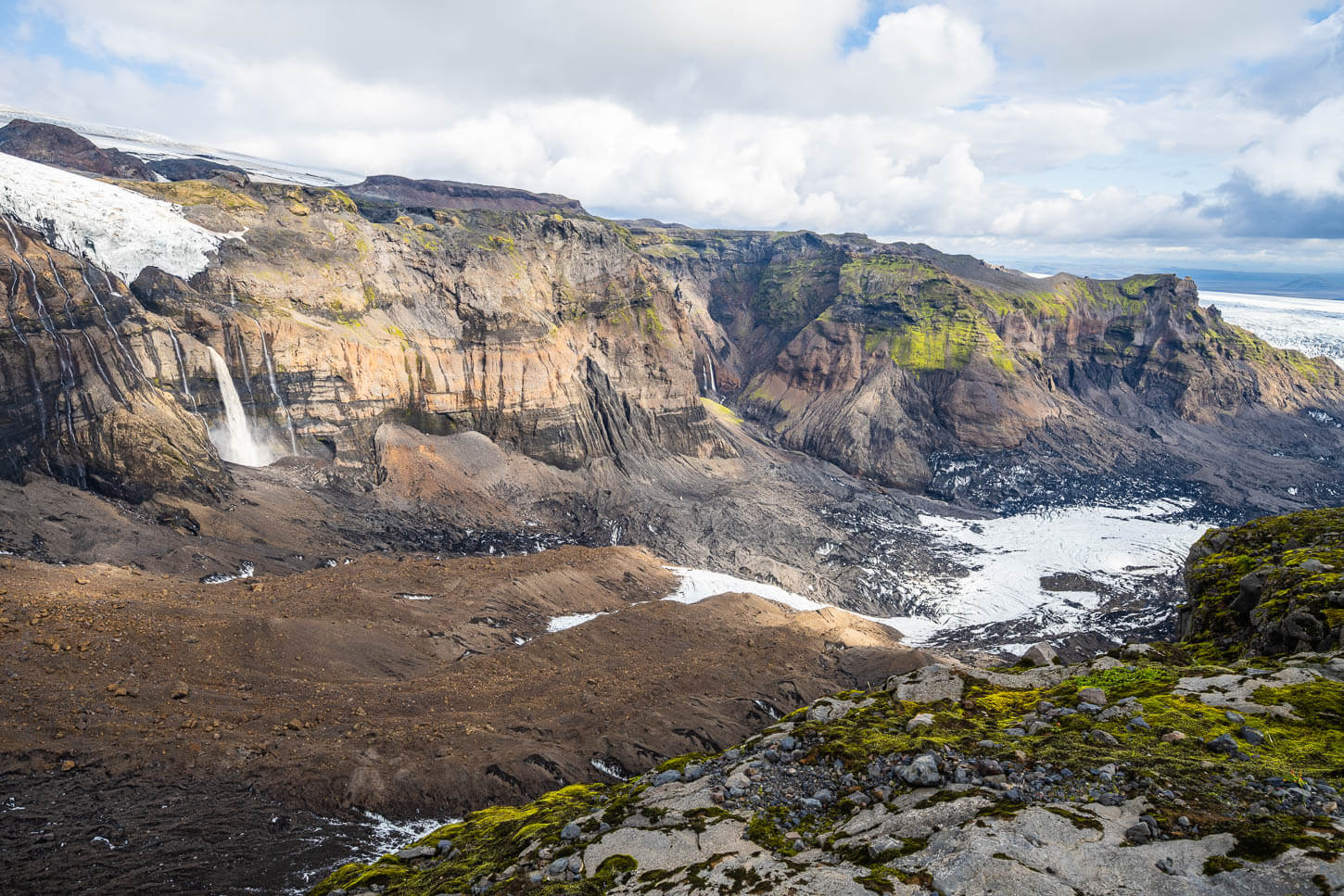
Huldujökull viewpoin in Thakgil
| Þakgil Yellow Trail Quick Overview |
| • Distance: 18 km / 11.18 mi (Loop) | Elevation: +700m / 2,296 ft | Time: 5.5-6 h | Difficulty: Hard |
| • Start & Parking: Þakgil Campsite |
| • Best Season: Early June to Early September |
| • Full Post & GPX File Download |
However, there are several more trails to explore in Þakgil, and if you prefer more remote locations, this is a great place to spend a couple of days hiking and relaxing at the beautiful Þakgil campsite. Here are my Þakgil Yellow Trail guide as well as my Þakgil Hiking and camping guide.
Fjaðrárgljúfur – Easy hike into a fairy-tale Canyon
As one of the most popular attractions in southern Iceland, Fjaðrárgljúfur can get crowded. However, that does not take away from the unique beauty of this canyon.

The Fjaðrárgljúfur Canyon.
| Fjaðrárgljúfur Canyon Hike Quick Overview |
| • Distance: 2.12 km / 1.31 mi (Out & Back) | Elevation: +70m / 229 ft | Time: 40 mins – 1 h | Difficulty: Easy |
| • Start & Parking: Fjaðrárgljúfur Parking |
| • Best Season: Early June to Early September |
| • Full Post & GPX File Download |
The trail follows the Canyon and the Fjaðrá river upstream for about 1km to the main viewpoint at the far end of the canyon. So it’s a relatively short hike, easy to integrate. It’s best to visit early in the morning or later in the afternoon to both avoid the bulk of the crowds and to get the best light.
Photo Spot
There are quite a few photo spots in the area. The main ones, in order: Stjórnarfoss, Foss-a-Sidu, and Fossálar. They are all waterfalls that can be visited as quick stops. However, access to Foss-a-Sidu is restricted, but its view can be enjoyed from a nearby pull-out area.
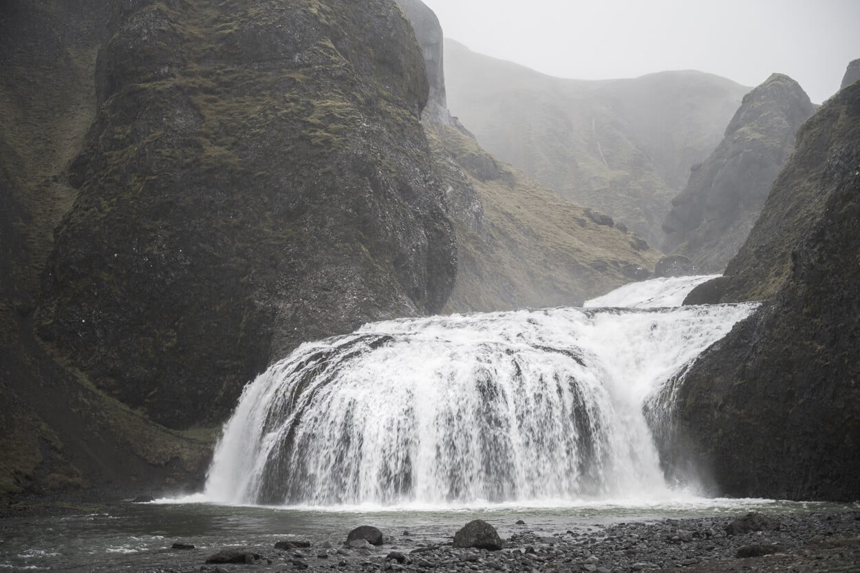
Stjórnarfoss.
Djúpá River and Canyon – a lesser-known Canyon with Waterfalls
This is a hidden gem that receives few visits each year. It’s one of those places where you are unlikely to see any other people around. The trail is unmarked and barely visible in places. Seldom visited by anyone, it’s one of those beauties hidden in plain sight. This small canyon also has two waterfalls: Bassi and Gufufoss (the latter not to be confused with Gufufoss in the East).
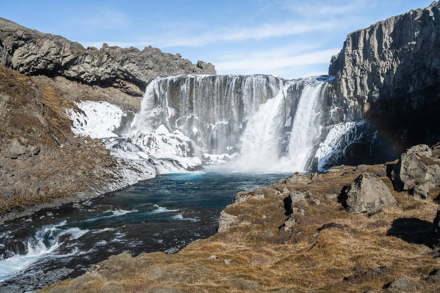
Gufufoss
| Djúpá River and Canyon Hike Quick Overview |
| • Distance: 3.92 km / 2.42 mi (Out & Back) | Elevation: +100 m / 328 ft | Time: 1-1.5 h | Difficulty: Easy |
| • Start & Parking: Kálfafell Rest area |
| • Best Season: Early June to late September |
| • Full Post & GPX File Download |
This small canyon is easily accessible from the Kálfafell rest area on the ring road. While it is a common area for people to stop and gaze at the beautiful landscape, few venture much farther than the immediate vicinity. However, the stop is worth it if you are looking for a spot with none of the crowds of the main ring road stops.
Lómagnúpur – Challenging Hike to the Top of the Rock
Lómagnúpur is one of the most recognizable landmarks on Iceland’s southeast coast. How could anyone miss this striking, imposing 700+ rockface? While it may seem inaccessible, it’s actually possible to hike to the top of the cliffs. The summit isn’t even the top of the cliff; it’s a way back, but walking atop Lómagnúpur is a bit like walking on another planet.

| Lómagnúpur Hike Quick Overview |
| • Distance: 18-20 km / 11-12 mi (Out & Back) | Elevation: +1,200m / 3,937 ft | Time: 9h–11h | Difficulty: Hard |
| • Start & Parking: Lómagnúpur Viewpoint or Trailhead down the dirt track |
| • Best Season & Light: Early June to Early September |
| • Full Post & GPX File Download |
Do note that while you can do this hike directly from the parking area, you need an F-Road-approved car to drive down the dead-end dirt track that leads close to the trailhead. That’s why it’s 18-20km, as the drive down the dirt track is about 2km.
As you can imagine, the hike is long and demanding, and not free of a few sketchy sections. Also, the trail is largely unmarked, and the terrain is quite difficult, with many large rocks for long stretches. Overall, it’s an all-day adventure for experienced hikers.
Kristinartindar and Svartifoss
Technically, two separate hikes. However, you can easily include Svartifoss on your way to Kristinartindar. The short hike to Svartifoss is easy, but Kristinartindar is a challenging, long route at almost 20 km round-trip. The section of the trail leading to the summit is steep, rocky, and moderately exposed, which requires some scrambling.
The last part makes it one of the most technical hikes along the ring road. So if you are looking for a long, all-day hike, definitely put this on your list.

View from Kristinartindar’s Summit.
| Kristinartindar & Svartifoss Hike Quick Overview |
| • Distance: 19.2 km / 11.93 mi (Loop) | Elevation: +1,120m / 3,674 ft | Time: 7-8 h | Difficulty: Hard/Exposed |
| • Start & Parking: Skaftafell Visitors Center |
| • Best Season & Light: Early June to Early September |
| • Full Post & GPX File Download |
However, they are second to none. Two Glacier tongues from the vast ice Vatnajökull’s Ice cap, plus jagged, colorful mountains, and a view of the tallest waterfall in Iceland, Morsafoss.
Mentioning only the view from the summit is a bit reductive, though, as there are many beautiful views along the trail. And of course, the detour to Svartifoss if you want to include it. If you only want to hike to Svartifoss, the out-and-back hike is about 4.2km long, or 2.6 miles, and it usually takes about an hour.

Svartifoss, with a Rainbow.
Photo Stop
Svínafellsjökull is another relatively quick stop in the Skaftafell national park, where you can see a glacier from up close. Svínafellsjökull is rather impressive, with its crevassed glacier tongue that extends to the steep rock faces far beyond.
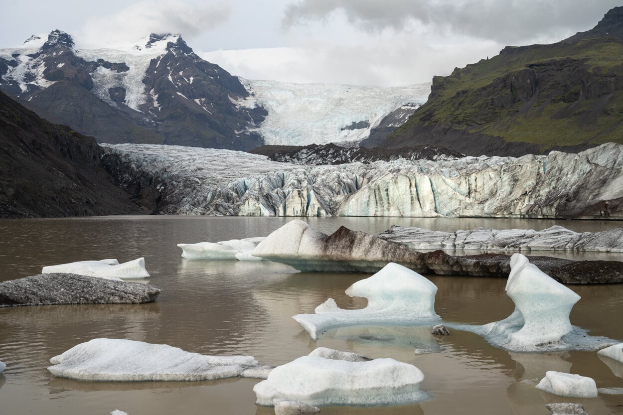
Svínafellsjökull.
Múlagljúfur – A hike not to miss
Múlagljúfur of the most epic canyons in Iceland – and arguably the most scenic, along with Fjaðrárgljúfur. It used to be a hidden gem, but nowadays it’s a popular attraction, with paid parking at the trailhead.

Múlagljúfur Canyon, view of the canyon from the main viewpoint.
| Múlagljúfur Canyon Hike Quick Overview |
| • Distance: 5.77 km / 3.6 mi (Out & Back) | Elevation: +410m / 1,345 ft | Time: 2-2.5 h | Difficulty: Moderate |
| • Start & Parking: Múlagljúfur Parking Area |
| • Best Season & Light: Early June to Early September |
| • Full Post & GPX File Download |
Yet, despite its growing popularity, it still feels as if venturing into a remote, hidden area. It is one of the spots I visited the most in Iceland, and I returned several times. This is a hike I would not miss. As a hike, you can either hike to the main viewpoint only, which is also the main photo spot, or you can also hike all the way up to the top of the canyon.
The hiking time mentioned above refers to the whole hike, but if you just want to hike to the main viewpoint, it’s about 3,86 km / 2.4miles, which roughly takes 1-1.5 hours out and back.
Photo Stops
Past Múlagljúfur, it’s a land of glaciers. Two stops I’d recommend are Fjallsárlón and, especially, Jökulsárlón with its Diamond beach. Both are beautiful Glacial lagoons with floating Icebergs. And while Fjallasarlon offers better views of the Ice front, Jokulsarlon is the place you want to visit to see the bigger icebergs, and the so-called “Diamond beach” where you can see bigger and smaller ice chunks left on the black sand beach by the tides.
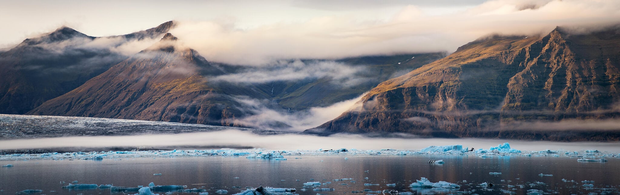
Jokulsarlon, the glacier lagoon.
Recommended Detour
As an alternative to Reykjavik at the beginning of this itinerary, you can consider driving through the so-called “Golden Circle” instead, with some additional extensions. However, it’s quite a long detour. You can visit the waterfall Öxarárfoss, the Þingvellir National Park, Geysir, the mighty Gullfoss, Brúarfoss, and also Háifoss. It’s an area filled with points of interest and worth exploring on its own. To include all of these stops, I’d recommend allocating a couple of days.
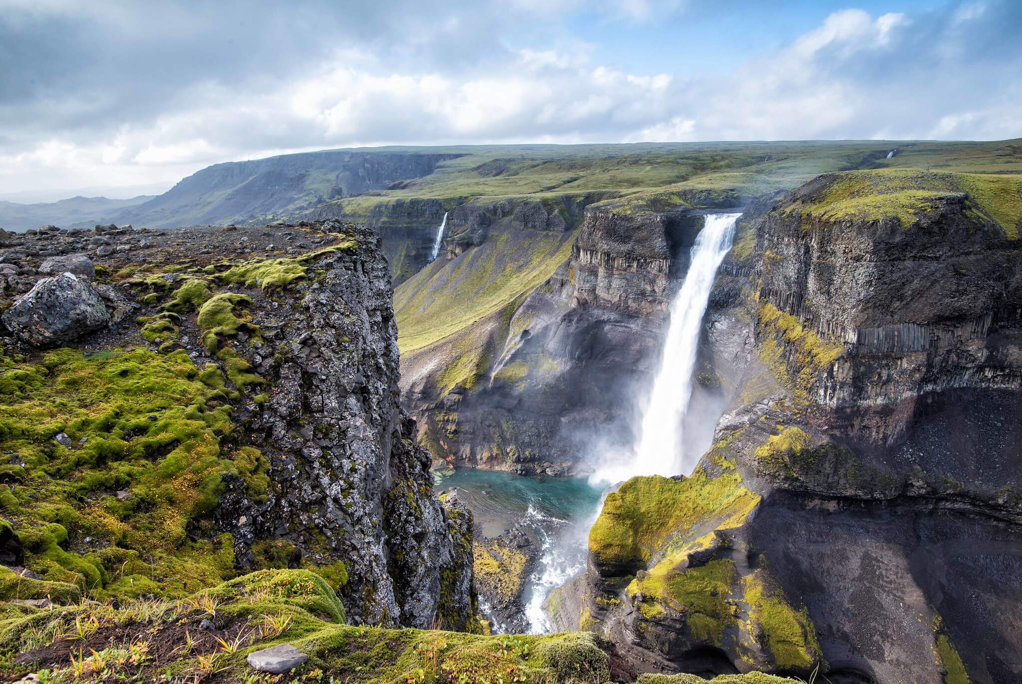
Háifoss.
EAST ICELAND
East Iceland is one of my favorite regions. It has the same “flavor” as the South, but it’s less crowded and offers some extremely beautiful locations that are not as crowded as some of the locations in the South. That applies to both Hikes and Photo Spots.
Specifically coming from the south, there are a few photo spots that you may want to stop at first.
Photo Spots
The first and most popular photo spot is Stokkness, where you can enjoy the views of Vestrahorn, one of the most photographed mountains and landmarks in Iceland. It’s a short detour from the ring road. Then Skútafoss, a small but beautiful waterfall. Lastly, the Hvalnes lighthouse for some photos at another mountain, Eystrahorn. Then onto the next hike, a bit off the Ring Road, and into the Fossardalur valley.
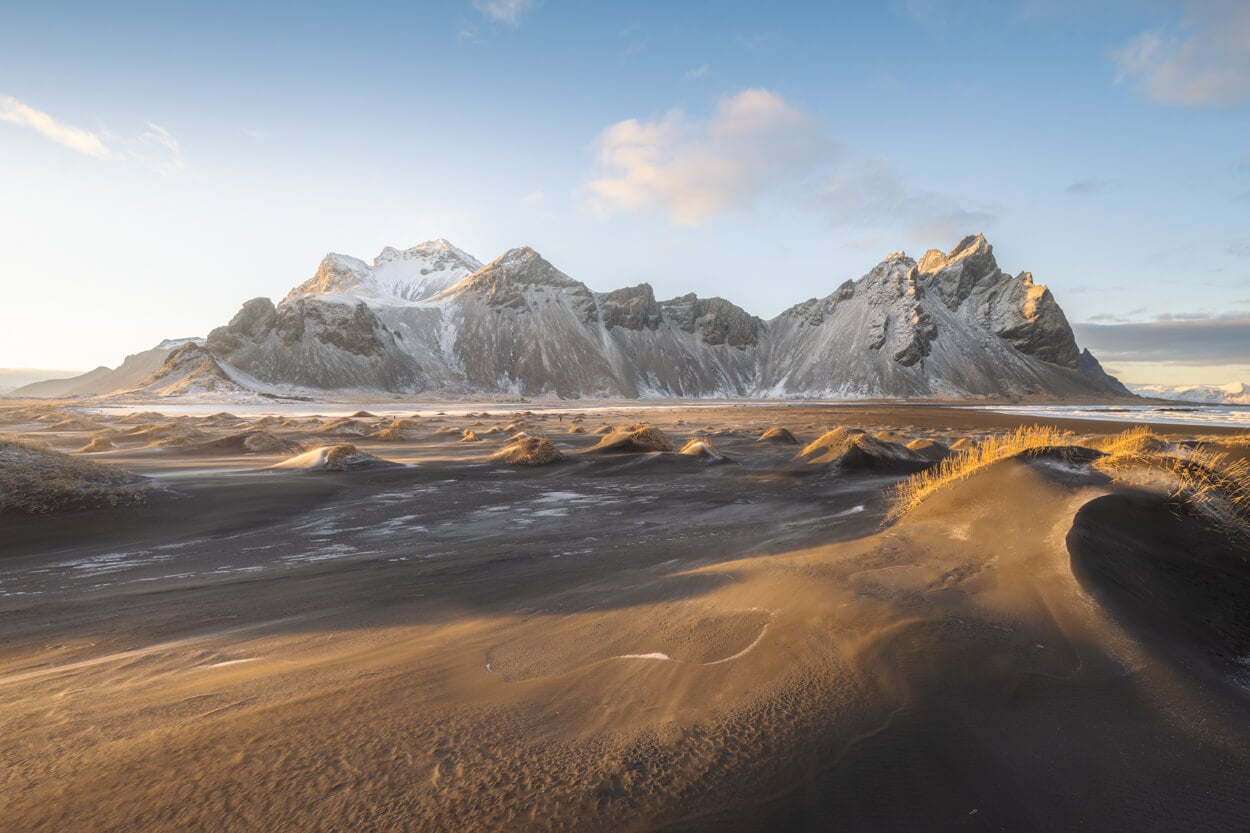
Vestrahorn.
Fossardalur – Waterfall Hike off the beaten path
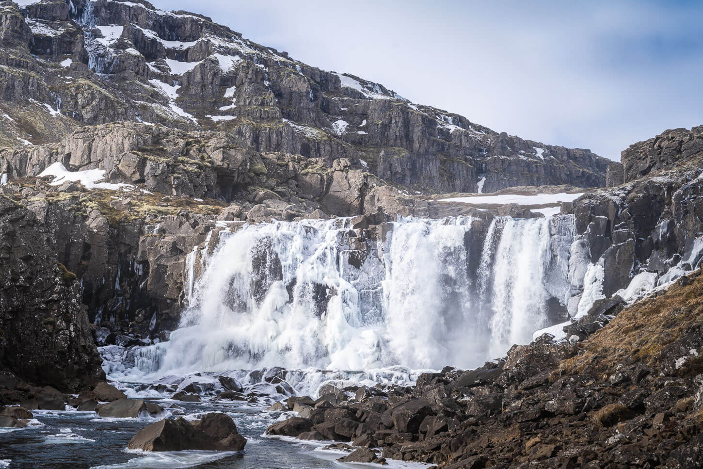
Mulafoss Waterfall.
| Fossardalur Hike Quick Overview |
| • Distance: 9.38 km / 5.82 mi (Out & Back) | Elevation: +360m / 1,181 ft | Time: 2.5–3h | Difficulty: Moderate |
| • Start & Parking: Fossardalur Campsite/Parking |
| • Best Season: Early Spring to Early Autumn |
| • Full Post & GPX File Download |
This is a rather easy waterfall hike into the beautiful Fossardalur Valley. While easily accessible, it is a bit off the beaten path and offers a more rural experience than other major attractions on the ring road.
There are three distinct waterfalls on this trail, the last of which is the most spectacular, Mulafoss.
Hengifoss – a unique geological beauty
As the third-highest waterfall in Iceland, Hengifoss is an impressive sight. not only purely for its height, but also for the environment around it.
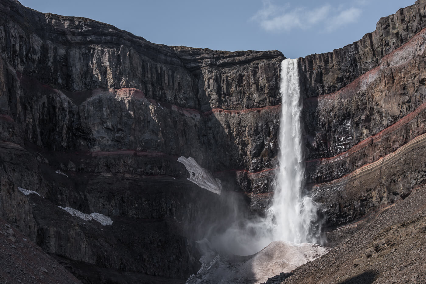
| Hengifoss Hike Overview |
| • Distance: 4.71 km / 2.92 mi (Out & Back) | Elevation: +230m / 754 ft | Time: 1.5-2h | Difficulty: Easy |
| • Start & Parking: Hengifoss Car Park |
| • Best Season: Early June to Early September |
| • Full Post & GPX File Download |
This is a relatively long deviation from the ring road, but absolutely worth it for one of the tallest and most beautiful waterfalls in Iceland. Hengifoss is one of Iceland’s most spectacular waterfalls, with a drop of 128 meters (420 feet) from cliffs that alternate basaltic rocks and red clay layers.
Strútsfoss
Here we are getting quite a bit off the ring road. However, I have decided to include Strútsfoss in the list as an alternative or addition to Hengifoss, for those who want to explore more of the area.

Strútsfoss.
| Strútsfoss Hike Quick Overview |
| • Distance: 7.53 km / 4.47 mi (Out & Back) | Elevation: +270m / 885 ft | Time: 1.5-2h | Difficulty: Easy |
| • Start & Parking: Strútsfoss Car Park |
| • Best Season: Early June to Early September |
| • Full Post & GPX File Download |
The whole area feels quite remote, and yet it is easily accessible. Strútsfoss is a two-step, 120-meter-tall (393 feet) waterfall, which shows the same basaltic and red clay layers as Hengifoss. The hike is quite easy too.
Stórurð – A lagoon filled with giant boulders
A relatively long detour from the ring road, Stórurð makes for a great, moderately challenging hike to a lagoon filled with giant boulders. That is actually what Stórurð means, Giant Boulders.
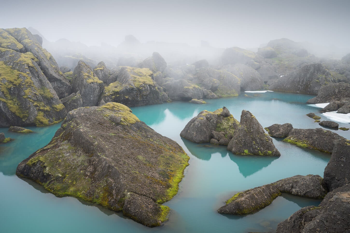
| Stórurð Hike Quick Overview |
| • Distance: 13.4 km / 8.32 mi (Out & Back) | Elevation: +680m / 2,230 ft | Time: 3.5-4.5h | Difficulty: Moderate |
| • Start & Parking: Stórurð Trailhead |
| • Best Season: Early June to Early September |
| • Full Post & GPX File Download |
And they really are giant. One of those things you have to see for yourself to understand its size. It’s well worth the effort and definitely one of the best and most scenic Hikes in East Iceland.
Stuðlagil Canyon Hike, East Side – Biggest Basalt Canyon in Iceland
While Stuðlagilan can be accessed from both sides, if you have only time for one hike, that should be the East Side. That’s where you get the views from inside the Canyon.

Inside the Canyon, West side.
| Stuðlagil Canyon Hike Quick Overview |
| • Distance: 5.69 km / 3.5 mi (Out & Back) | Elevation: +130m / 426 ft | Time: 1.5-2 h | Difficulty: Easy |
| • Start & Parking: Stuðlagil Parking East |
| • Best Season: Early June to Early September |
| • Full Post & GPX File Download |
The hike is relatively easy, mostly flat, and takes about 1 to 2 hours to complete. However, approaching the inside of the Canyon requires particular care, as it is slippery and there isn’t much room for error near the river.
Photo Spot
In between the Eat and the North, a good stop to stretch your legs is the Rjúkandi waterfall. Located directly along the ring road, it’s an easy and quick stop at a very scenic waterfall.
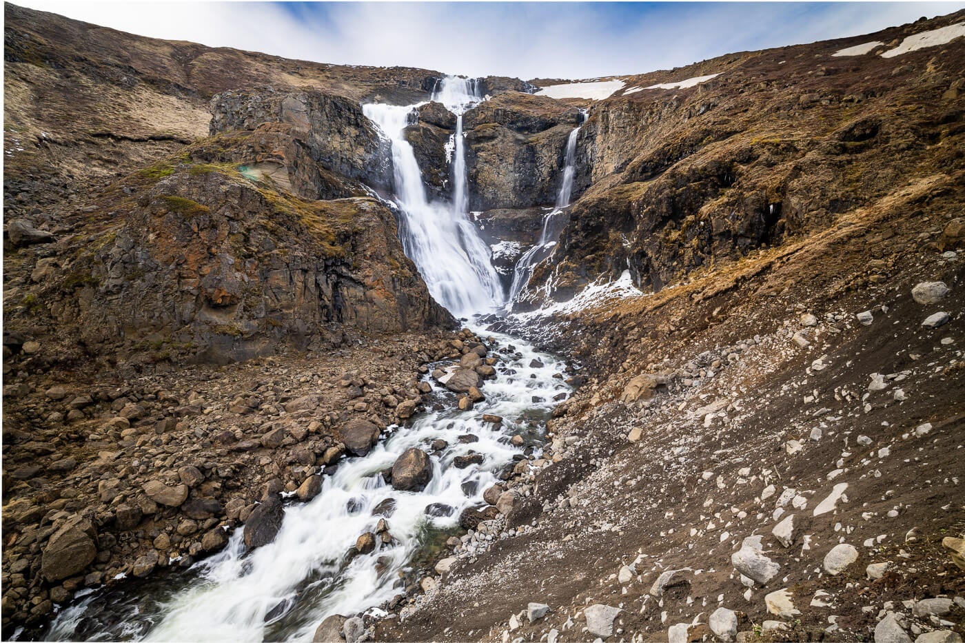
Rjukandi Waterfall.
Recommended Detours
If you want to get a taste for the Highlands with one of the driving hassles, you can explore the Waterfall Circle Hike in Laugarfell and continue further to the Kárahnjúkar Dam. While the drive is very long, both are accessible with 2WD cars when the road is not closed for the winter.

Waterfalls in Laugarfell.
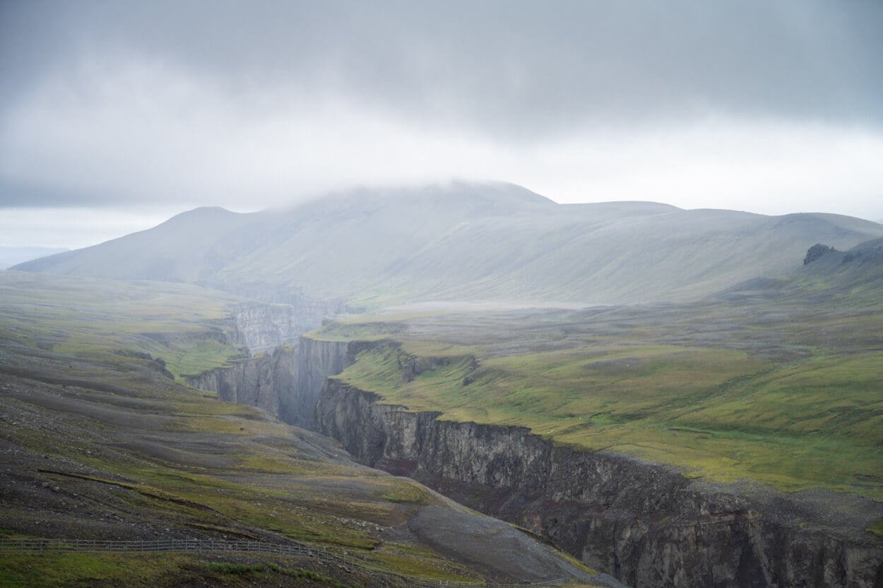
Hafrahvammagljúfur, view from the Kárahnjúkar Dam.
Also consider visiting Seyðisfjörður; on the way there, you can stop for the short hike to Fardagafoss and, once in Seyðisfjörður, visit Gufufoss and take the Vestdalsfossar Waterfall trail. Or, you can also visit another waterfall, Búðareyrarfoss.
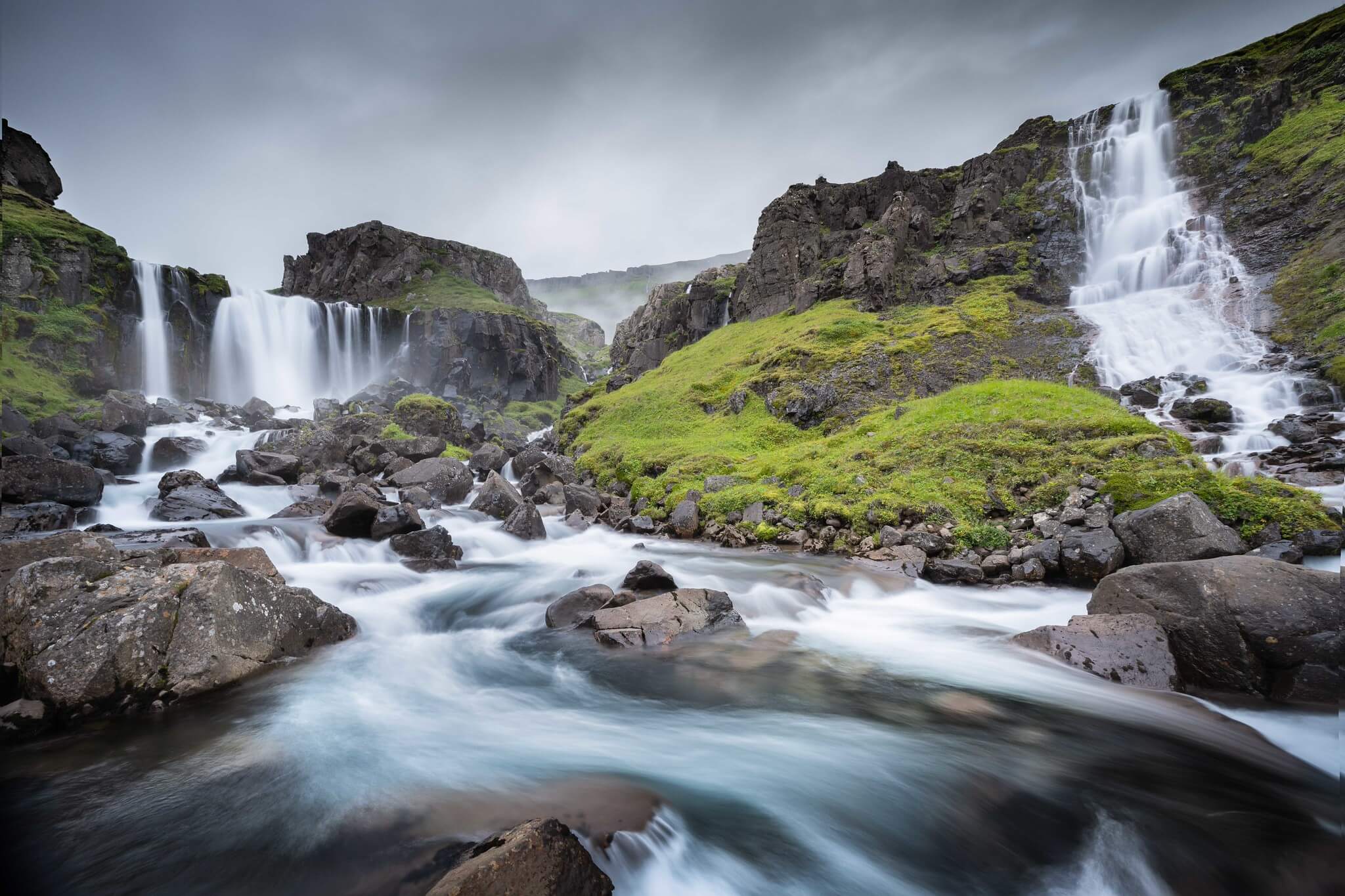
Vestadalsfossar Waterfalls in Seyðisfjörður.
NORTH ICELAND
North of Iceland is perhaps the most “rugged” region on the Ring Road. Compared to the south, it’s a less green and less rainy region, too, on average. The landscape can be lunar or martian-like at times, but it is a region also filled with waterfalls, canyons, and geothermal areas.
Dettifoss, Selfoss, and Hafragilsfoss West – Most Epic Waterfall Hike in North Iceland
Dettifoss is one of the most powerful waterfalls in Europe, and the most powerful in Iceland. A mighty sight, even more special when you combine it with other waterfalls on the same river, Selfoss, upstream, and Hafragislfoss downstream.
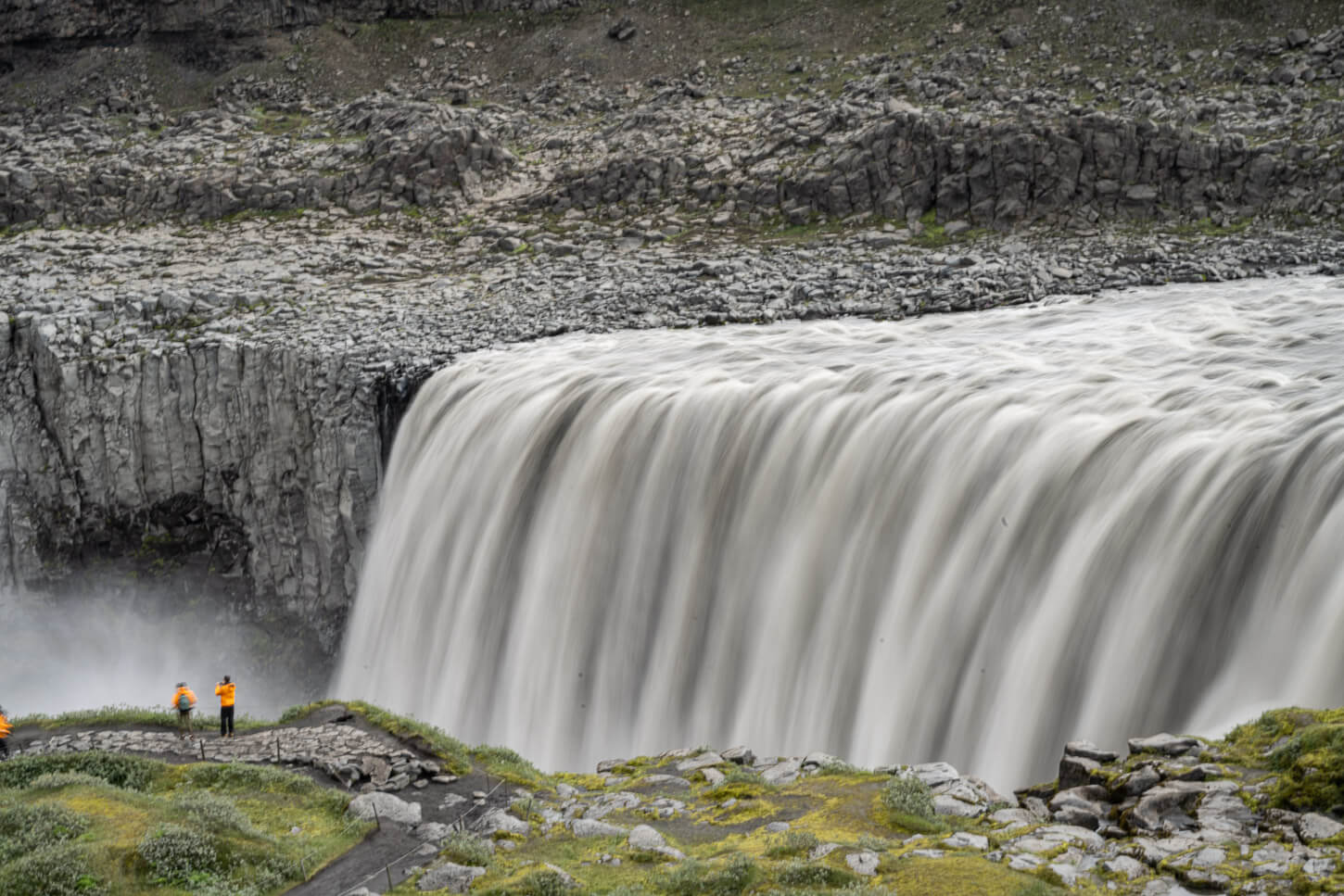
Dettifoss West.
| Dettifoss, Selfoss, and Hafragilsfoss Hike Quick Overview |
| • Distance: 10.1 km / 6.2 mi (Out & Back) | Elevation: +120m / 393 ft | Time: 2-2.5h | Difficulty: Easy |
| • Start & Parking: Dettifoss West Car Park |
| • Best Season: Late Spring to early Autumn |
| • Full Post & GPX File Download |
The west side is the most easily accessible, as the road is entirely paved. Most visit Dettifoss and Selfoss only, but I’d highly recommend not missing Hafragilsfoss. It’s another absolutely impressive waterfall that offers equally impressive views of the Jokulsargljufur canyon.
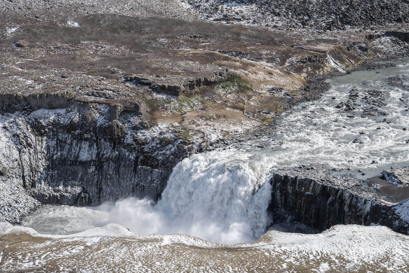
Hafragilsfoss.
Ásbyrgi – an Epic Horseshoe-shaped Canyon
From Dettifoss, you could continue north for another 40 minutes or so by car to reach Ásbyrgi. A canyon of epic proportions and another mighty sight.
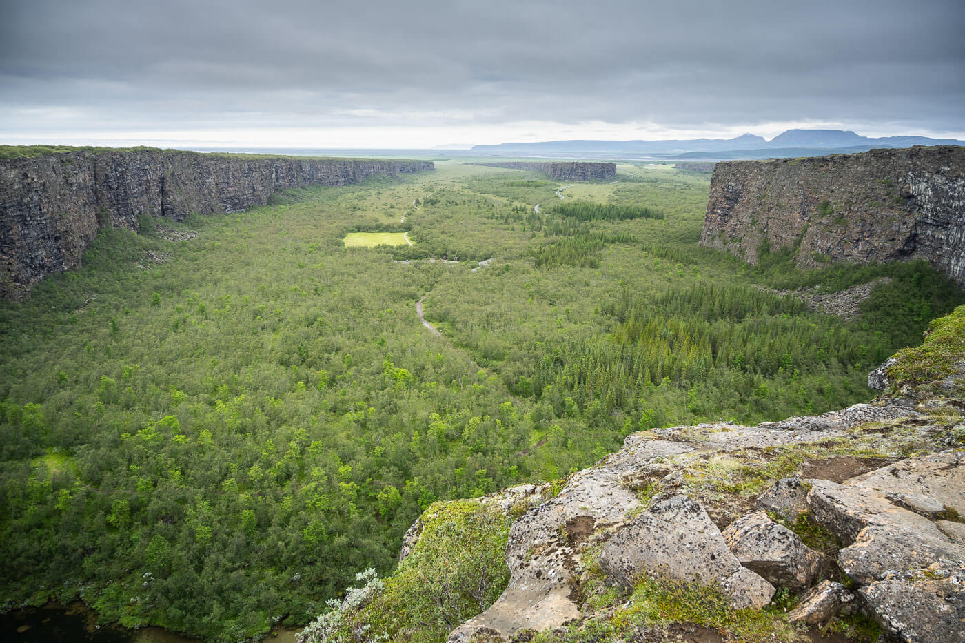
Ásbyrgi – view from the top of the Canyon
| Ásbyrgi Canyon Hike Overview |
| • Distance: 13.6 km / 8.45 mi (Loop) | Elevation: +190m / 623 ft | Time: 3-4 h | Difficulty: Moderate |
| • Start & Parking: Ásbyrgi Visitor Centre |
| • Best Season: Early June to Early September |
| • Full Post & GPX File Download |
There are several Hiking options at Ásbyrgi. However, to catch the best views and a variety of landscapes, I’d recommend the longer loop trail, which also includes the northern part of the Jokulsargljufur canyon. Also, there is a campsite at the entrance of the Canyon, a very nice spot to stay at.
Photo Spot
Back on the ring road and continuing the itinerary, Námafjall, or Hverir, is the next stop. It’s a geothermal area where the Earth feels alive with several fumaroles and boiling mud pools. It’s quite an otherworldly environment you can visit on a short stop.
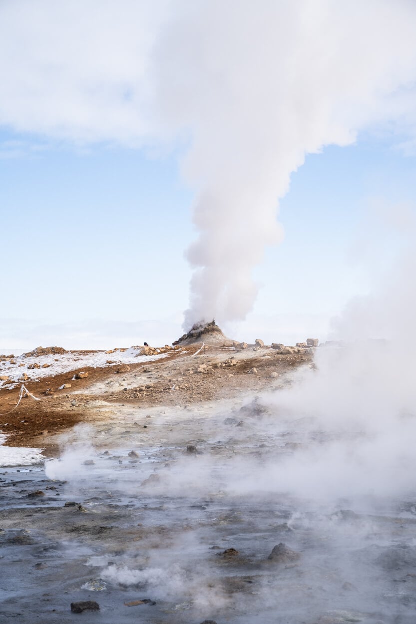
Fumarole in the Námafjall, or Hverir geothermal area.
Hverfjall – Hike the Rim of an Explosive Crater
Hverfjall is a large volcanic crater near Myvatn. You can’t miss it; it’s highly recognizable from a distance. It’s possible to hike to the top of the rim and around it. Watching down the crater and thinking about the eruptions that created it is mind-boggling.
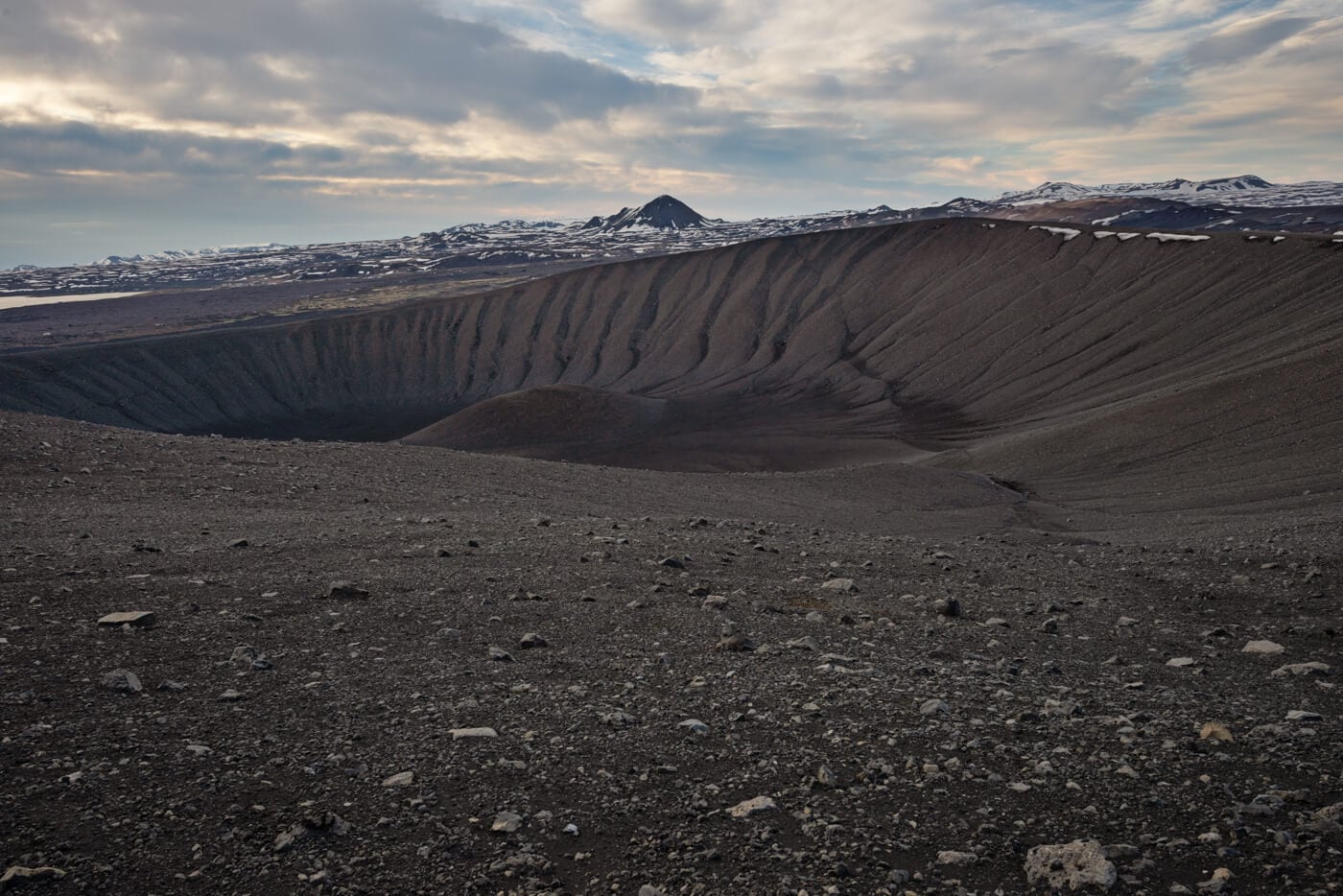
The Hverfjall Crater.
| Hverfjall Crater Hike Quick Overview |
| • Distance: 4.33 km / 2.69 mi (Loop) | Elevation: +280m / 918 ft | Time: 1.5-2h | Difficulty: Moderate |
| • Start & Parking: Hverfjall Parking |
| • Best Season: Early June to Early September |
| • Full Post & GPX File Download |
On a clear day, the view of the landscape around the crater is fantastic. Both to the north and to the south, where the view extends far into the highlands.
Photo Spot
The must-stop photo spot here is Goðafoss. One of the most photographed in Iceland, as well as one of the most scenic. You can visit both sides of the waterfall. While it is a short walk, you may end up spending a decent amount of time here taking pictures from the different vantage points around the waterfall.
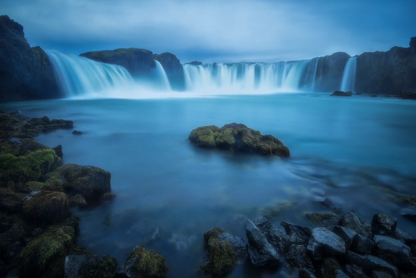
Goðafoss, or Godafoss, the “Waterfall of the Gods”.
Bólugil – A Hidden Ravine with Several Waterfalls
Bólugil is a ravine that can be reached with a short hike directly from the ring road. There’s a series of waterfalls inside the ravine, and the main viewpoint can be reached with a short hike directly from a small pullout area on the side of the ring road.
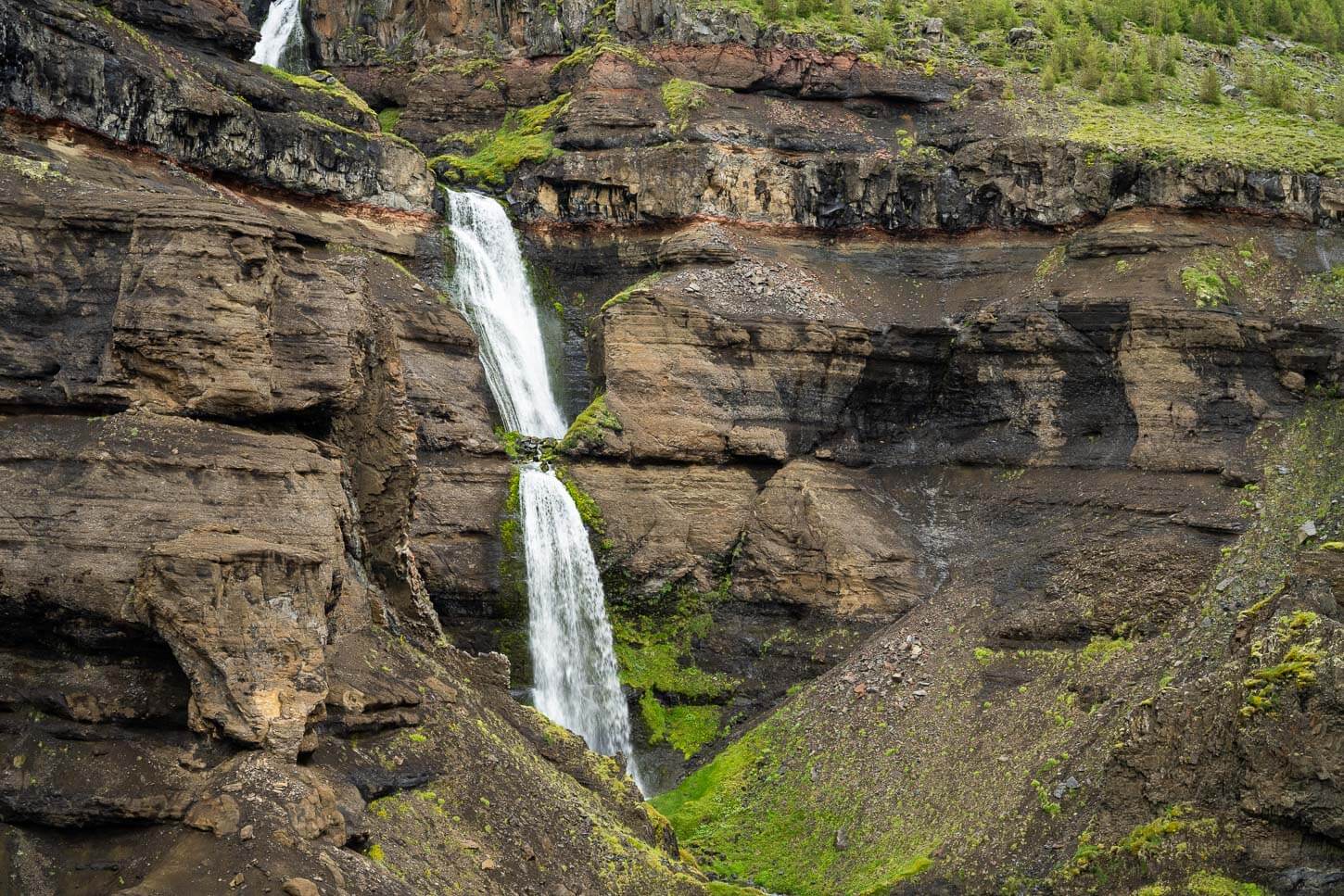
Bolugil Waterfalls
| Bólugil Hike Quick Overview |
| • Distance: 2.51 km / 1.55 mi (Out & Back) | Elevation: +130m / 426 ft | Time: 0.5-1h | Difficulty: Easy |
| • Start & Parking: Roadside Parking Area |
| • Best Season: Early June to Early September |
| • GPX File Download |
Seldom visited, Bólugil is a beautiful, hidden canyon with a series of waterfalls cascading down from the cliffs into a narrow gorge. It’s a nice, short hike that makes for a nice stop to stretch your legs while driving across northern Iceland.
Reykjafoss and Fossaslaug – Easy Waterfall Hike with a Geothermal Pool (CLOSED)
This used to be a great short hike, with the beautiful Reykjafoss Waterfall and the small geothermal pool of Fossaslaug. However, it has been closed to the public due to landowners’ disputes. I am keeping it on this list both for general awareness (many sites still report it as open) and in case it will reopen one day.

Reykjafoss.
| Reykjafoss and Fossaslaug Overview |
| • Distance: 1.92 km / 1.19 mi (Out & Back) | Elevation: +60 m / 196 ft | Time: 0.5-1 h | Difficulty: Easy |
| • Start & Parking: N/A (Curretly Closed) |
| • Best Season: Early June to Early September |
| • Full Post & GPX File Download |
Photo Spot
Not too far from the previous spots, lies Kolugljúfur, a small Canyon with a rather nice waterfall, Kolufoss. It’s a short drive off the ring road and a worthy photo spot. it’s possible to walk around the canyon on either side, so it’s also a good spot to stretch your legs.
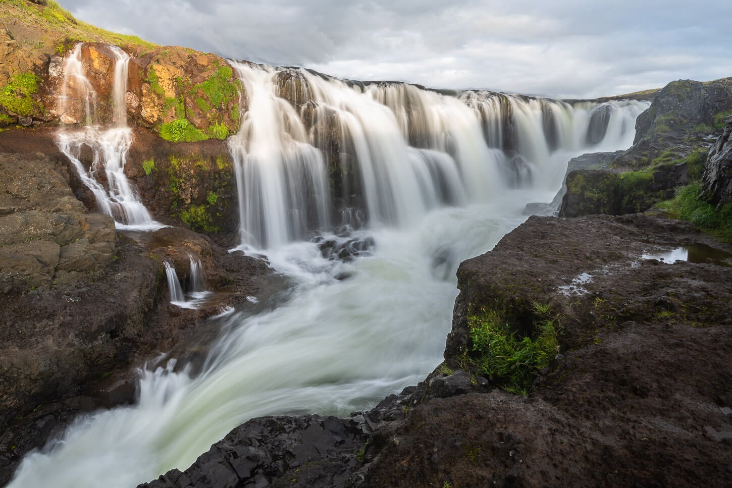
Kolufoss catching the late evening light.
Benefoss, Attifoss, and Ankafoss – a short hike to three waterfalls in a small canyon
A short hike in a rural area in North Iceland. The waterfalls are on private land, and landowners have not restricted access, but follow any on-site signs you will find and respect the land; it is private property.
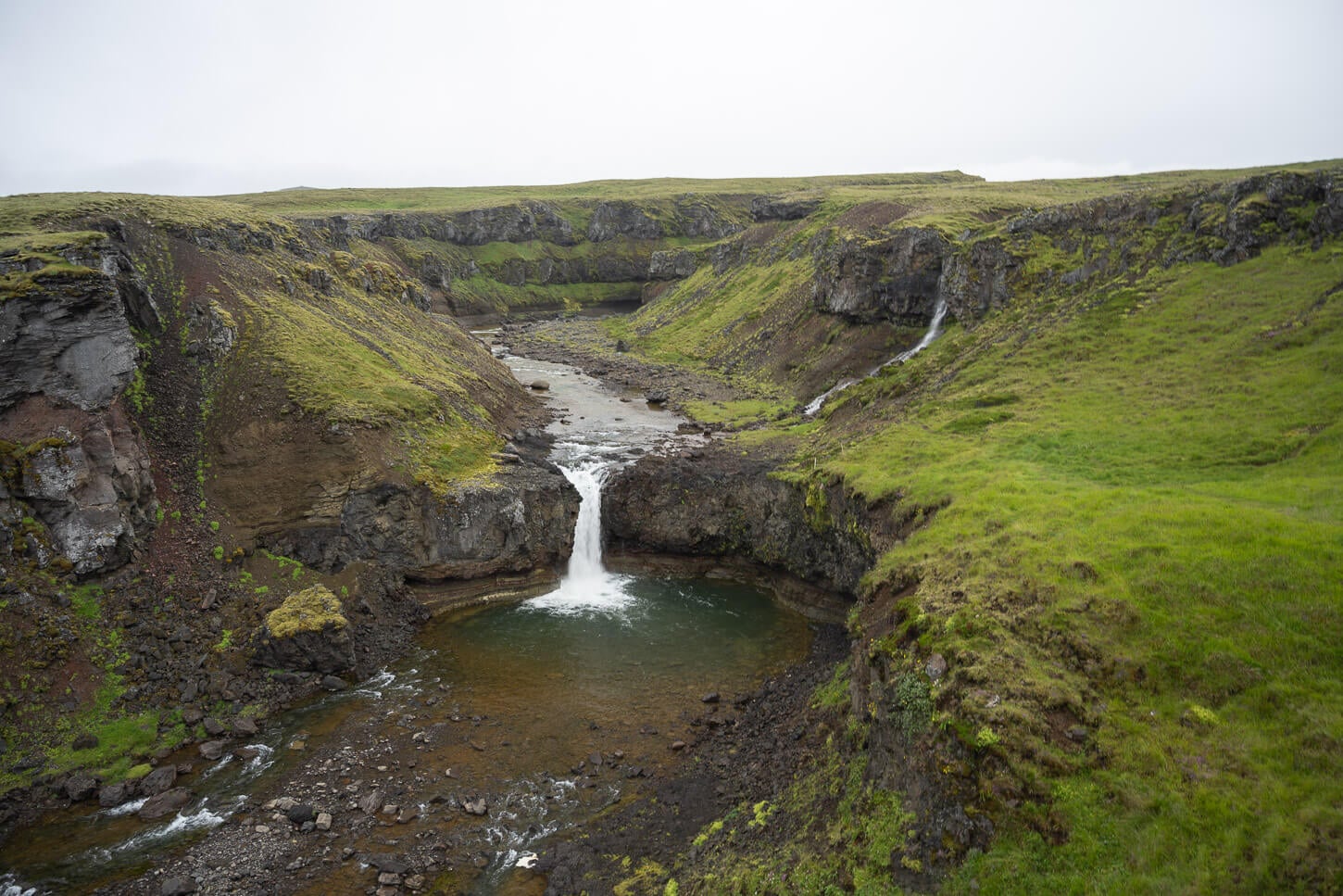
Benefoss.
| Benefoss, Attifoss, and Ankafoss Hike Quick Overview |
| • Distance: 3.91 km / 2.42 mi (Out & Back) | Elevation: +100m / 328 ft | Time: 1-1.5 h | Difficulty: Easy |
| • Start & Parking: Fagrabrekka Farm Access Road |
| • Best Season: Early June to Early September |
| • GPX File Download |
A bit of a hidden gem in the “Waterfall Hikes” Category, you can find three different waterfalls on this trail, all nestled in a small canyon. However, you can walk into the ravine. The hike is quite easy and follows the river and the canyon upstream, where you can enjoy the views of the three waterfalls.
Recommended Detours
Before moving back toward the south and through West Iceland, there are a couple of detours worth considering, especially for those planning a longer trip or looking for more rural areas.
- If you are looking for some more rural detours, look into the Skagi Peninsula. This could be easily done in a day. The main attractions are the Ketubjörg Cliffs and waterfalls, and the Kálfshamarsvík lighthouse/cove. And, on the opposite side of the Fjord, Hvítserkur, a basalt sea stack known as the Troll of the North.

Hvítserkur.
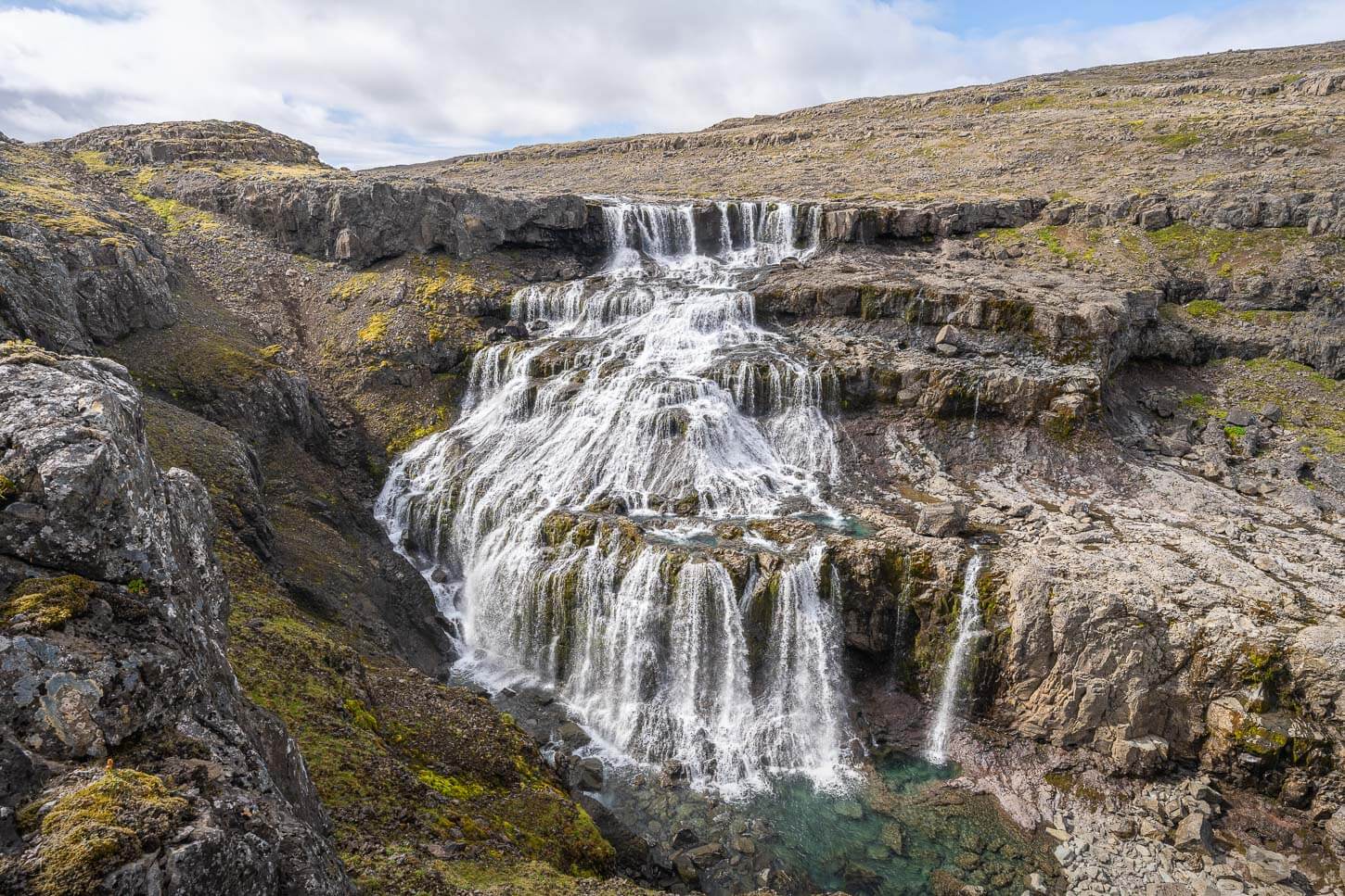
- For a detour that requires a more extended time, 3-4 or more days, consider exploring the Westfjords. They feel even more remote and are less crowded than the ring road. Some Key highlights to see are the beautiful Dynjandi, the Valagil Waterfalls, and the Látrabjarg Cliffs, especially in June/July, during the Puffin nesting season. Prime spot to see them.
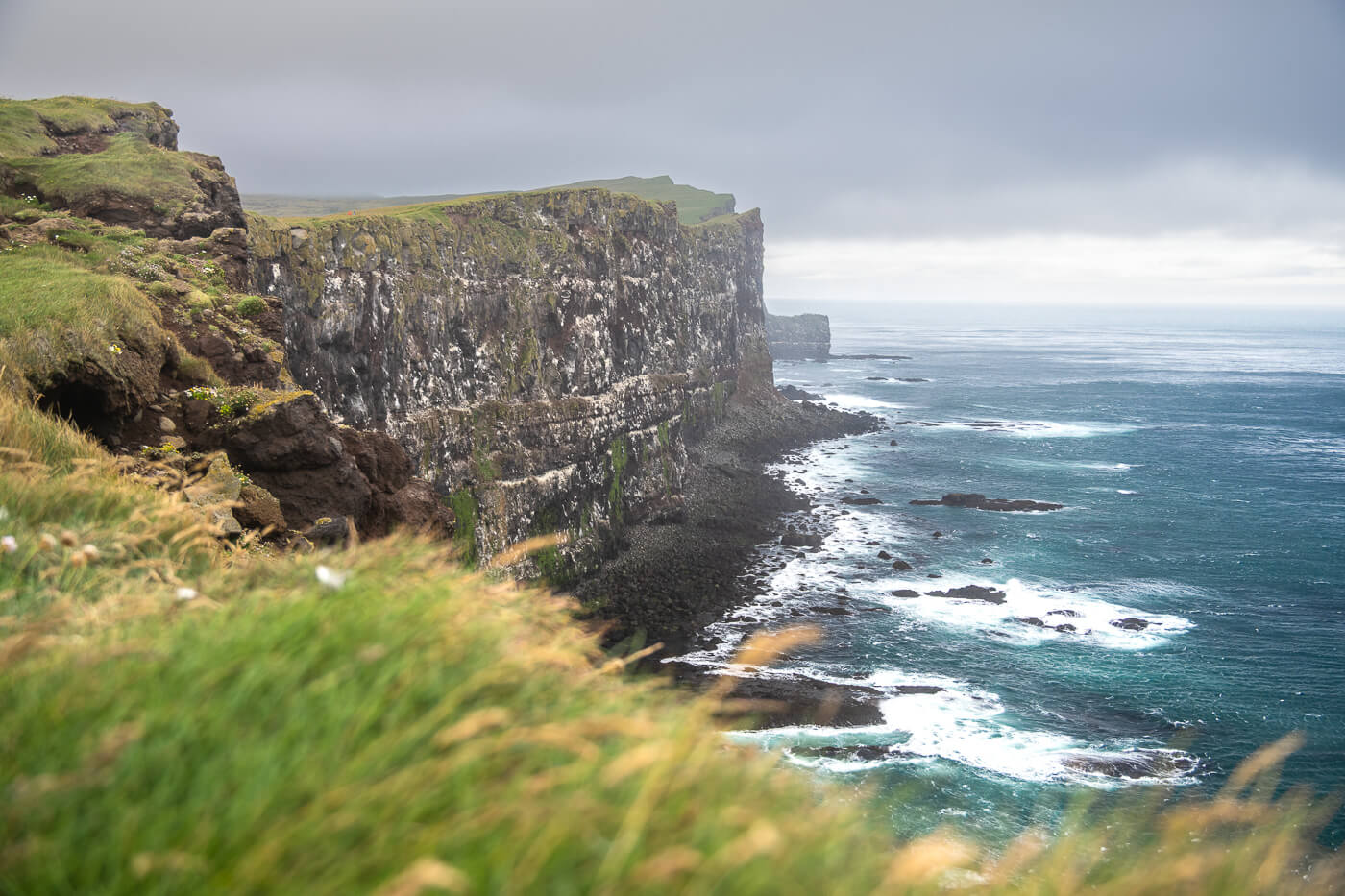
Látrabjarg Cliffs.
- Alternatively, a more popular detour is the Snæfellsnes peninsula. Kirkjufell and Kirkjufellsfoss are the most popular photo stops, but there are several other major and lesser-known spots. For example, Budir’s church and Arnarstapi’s coastline, and lesser-known short hikes and waterfalls like Selvallafoss, Grundarfoss, Svodufoss, or Bjarnafoss.
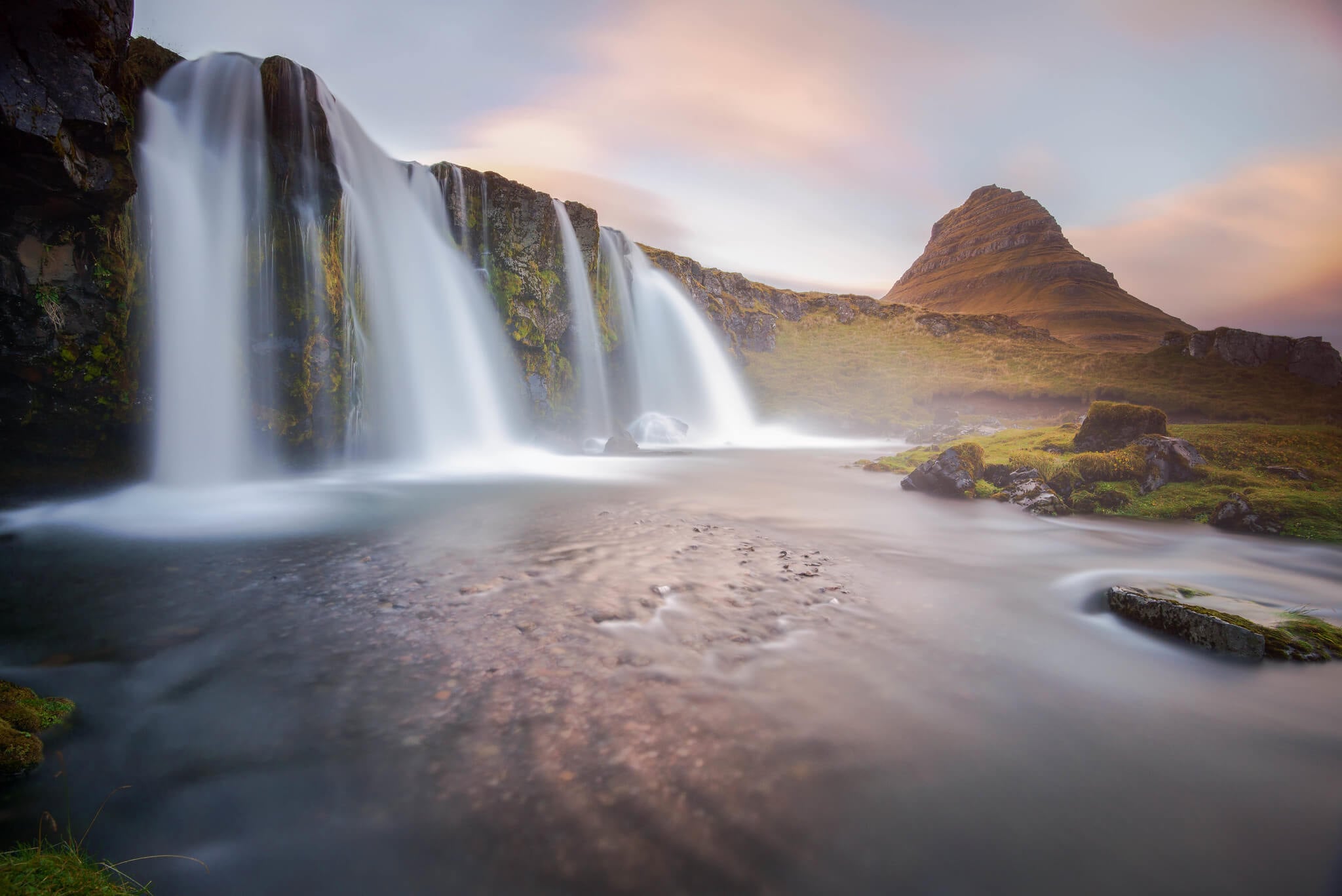
Kirkjufellsfoss.
WEST ICELAND
Rauðsgil Gorge – a hidden gorge with waterfalls in the countryside
A bit of a hidden gem in West Iceland, Rauðsgil is a little-known but beautiful gorge with three waterfalls in it. It’s located in a relatively remote area of West Iceland, and it’s also a hike you could easily do as a day trip from Reykjavik, if you have your own car.
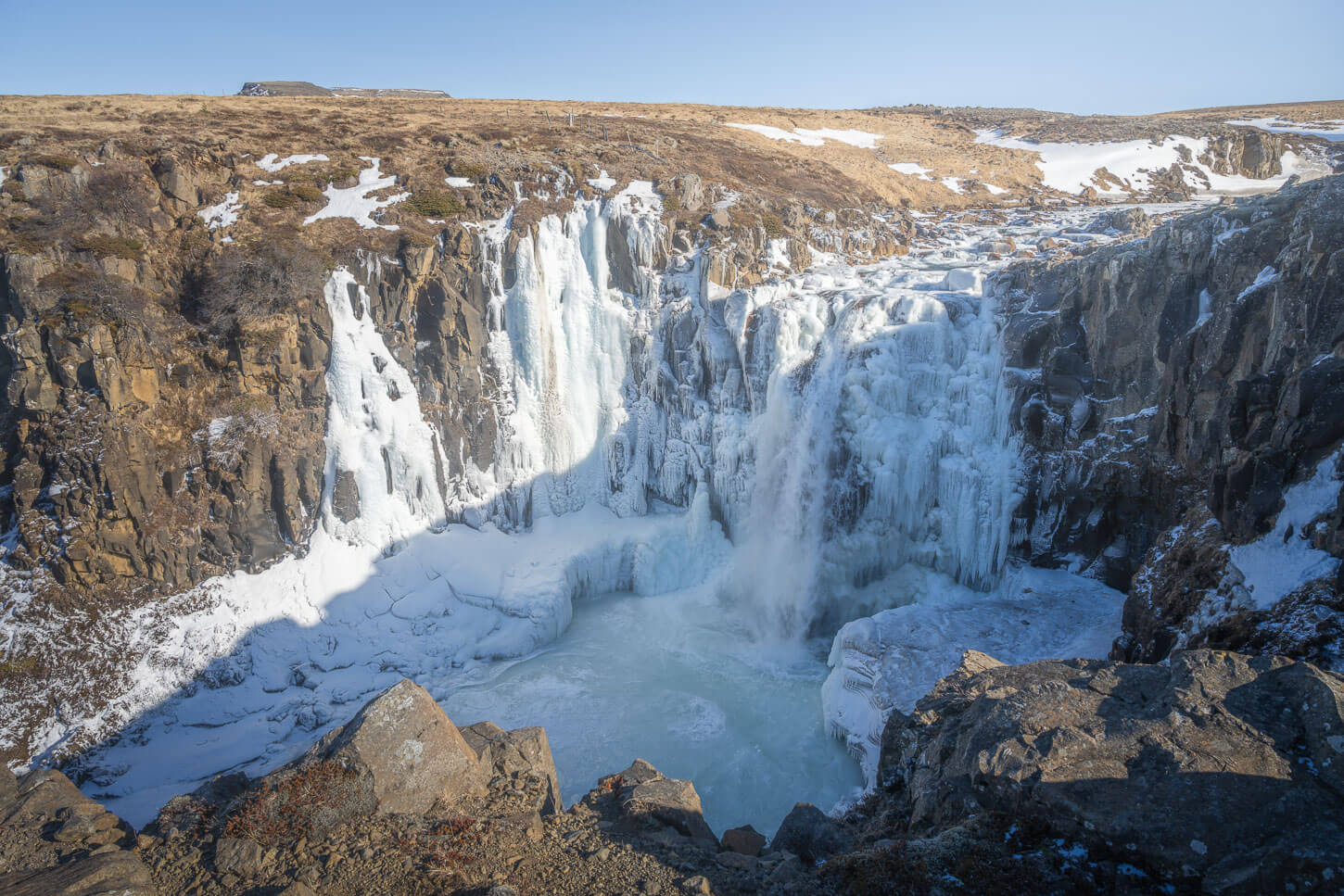
The third and biggest waterfall in the Rauðsgil Gorge, on a late Winter day.
| Rauðsgil Gorge Hike Quick Overview |
| • Distance: 4.87 km / 3.02 mi (Out & Back) | Elevation: +310m / 1,017 ft | Time: 1.5-2.5 h | Difficulty: Easy |
| • Start & Parking: No Official Parking – Small Pullout Areas along the road. |
| • Best Season: Early June to Early September |
| • GPX File Download |
The trail follows the river upstream for the most part, providing views of the waterfall in the small gorge. It’s one of those posts you won’t find many people around, and a great, relatively short hike if you are in the area.
Photo Spot
Hraunfossar is a rather unique waterfall, and a great photo spot too. The water seems to drop off out of nowhere from the rocky ground around the Hvítá River. In reality, it’s an underground river that flows under the Hallmundarhraun lava field and drops out at this exact spot.
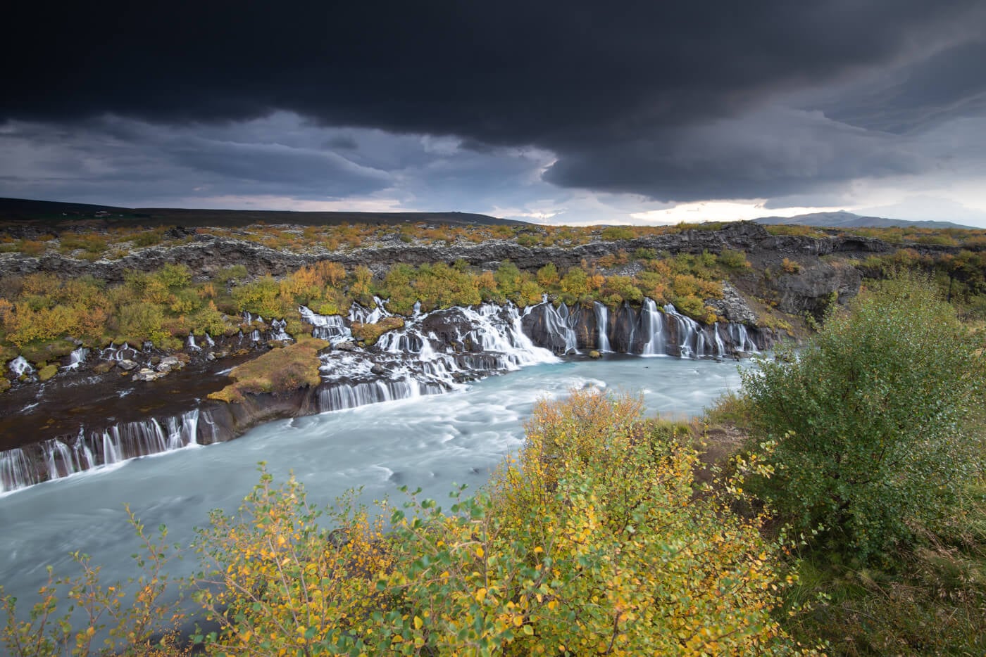
Hraunfossar.
Glymur – a fun day hike to Iceland’s second-tallest waterfall
The once-tallest waterfall in Iceland, and currently the second-tallest, makes for a great day hike. Easily doable as a day hike from Reykjavik, too. It’s a moderately challenging hike that requires a couple of river crossings. One on a log, and one on foot, so it’s a bit of an adventure too.

| Glymur Hike Quick Overview |
| • Distance: 7.56 km / 4.7 mi (Loop) | Elevation: +358m / 1,175 ft | Time: 3-4h | Difficulty: Moderate |
| • Start & Parking: Glymur Parking |
| • Best Season: Early June to Early September |
| • Full Post & GPX File Download |
Interesting fact: Glyumr used to be the tallest waterfall in Iceland, until glacial melt allowed for a much higher waterfall to form in the Skaftafell National Park (Morsafoss).
Esja – A classic Hike & locals’ favorite in the Reykjavik Area
A very busy mountain, frequented by locals and tourists alike, Esja is a popular choice for day hikes from Reykjavik, too. There are several trails on Mount Esja, ranging from easy to difficult. The most common hike, the easiest option, is a trail that leads to a lookout. From there, the terrain is slightly more challenging and moderately exposed at times, but enjoyable for experienced hikers.
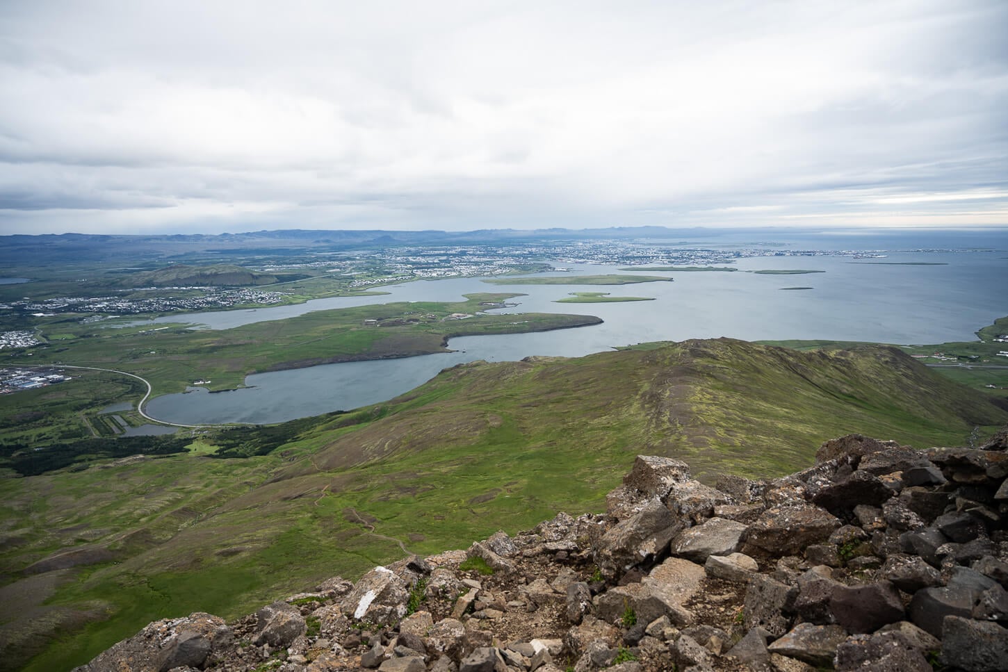
View from Mount Esja
| Mount Esja Hike Quick Overview |
| • Distance: 8.4 km / 5.2 mi (Out & Back/Loop) | Elevation: +810m / 2,657 ft | Time: 2.5h–3.5h | Difficulty: Moderate/Hard |
| • Start & Parking: Esjurætur – Hiking Center |
| • Best Season: Early June to Early September |
| • GPX File Download |
Overall, while not as scenic as a hike in the highlands or on the south coast, it’s a great hike with different levels of difficulty, and it’s easily doable as a day hike from Reykjavik, with public transport too.
Recommended Detours
To conclude the tour and before going back to the airport, the Reykjanes peninsula offers some great points of interest and hikes. You can hike to the recent eruption side around the Fagradalsfjall volcano, or hike the Krýsuvíkurberg cliffs, or the short trail at the Seltún Geothermal Area, if you did not visit any other geothermal areas on your itinerary.

The very last stops
Personally, I like to spend the last afternoon at the Blue Lagoon or at a geothermal pool to just relax. It feels like paradise after a long road and hiking trip in Iceland. Then, usually spend the last evening in Reykjavik too, for a good meal and a couple of beers. It’s always a great town for a chilled stroll.
And, as I say to anyone about to visit Iceland for the first time, you might find yourself planning your next trip even before you leave the island. Don’t worry. It’s normal. Happens a lot.
Additional Resources
- If you are into Waterfalls, you can discover more beautiful and unique Waterfalls in my eBook guide, “Iceland – The Best Waterfall Hikes and Walks“.
- Or, discover more Hikes in Iceland here.





Leave A Comment