
The Best Hikes in the Highlands of Iceland & Planning Tips
The Highlands of Iceland are home to some of the most spectacular landscapes in the country, and their hikes are among the best ways to experience that raw nature up close. Hiking is arguably the best way to feel the beauty and remoteness of this place, which is accessible only for a handful of months each year.
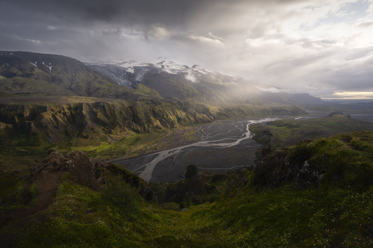
Valahnúkur, Þórsmörk.
The highlands are where you can experience the rawness of Iceland’s nature in its purest form. It’s a world of natural richness and desolation at the same time. Glaciers, meandering rivers, and volcanic landscapes. It’s one of the few places in Europe where the landscape feels just as it’s supposed to be, as it formed and as it still is. In many ways, it’s also where the brutal force of nature becomes tangible.
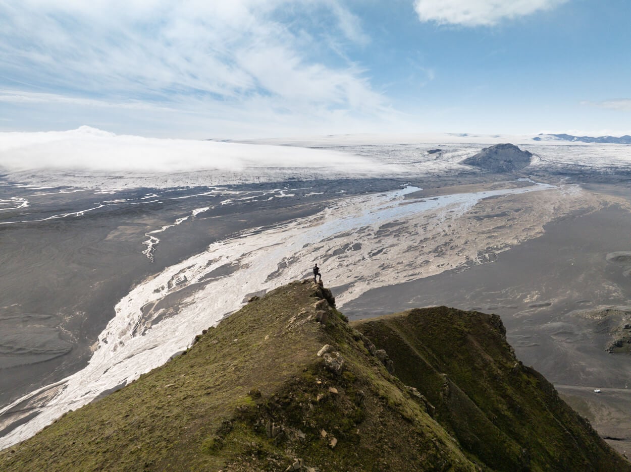
Mælifell
I know this may sound like hyper-excited rambling. If you’ve been there, you’ll likely feel the same. If you haven’t, you probably will after your first visit. Still, a trip to the Highlands demands careful planning, thorough preparation, and deep respect for the environment, including a strict leave-no-trace approach. As beautiful as they are, the Highlands remain an inhospitable place.
So below you’ll find my tips for planning your hikes, followed by what I consider the best and most scenic trails in the Highlands.
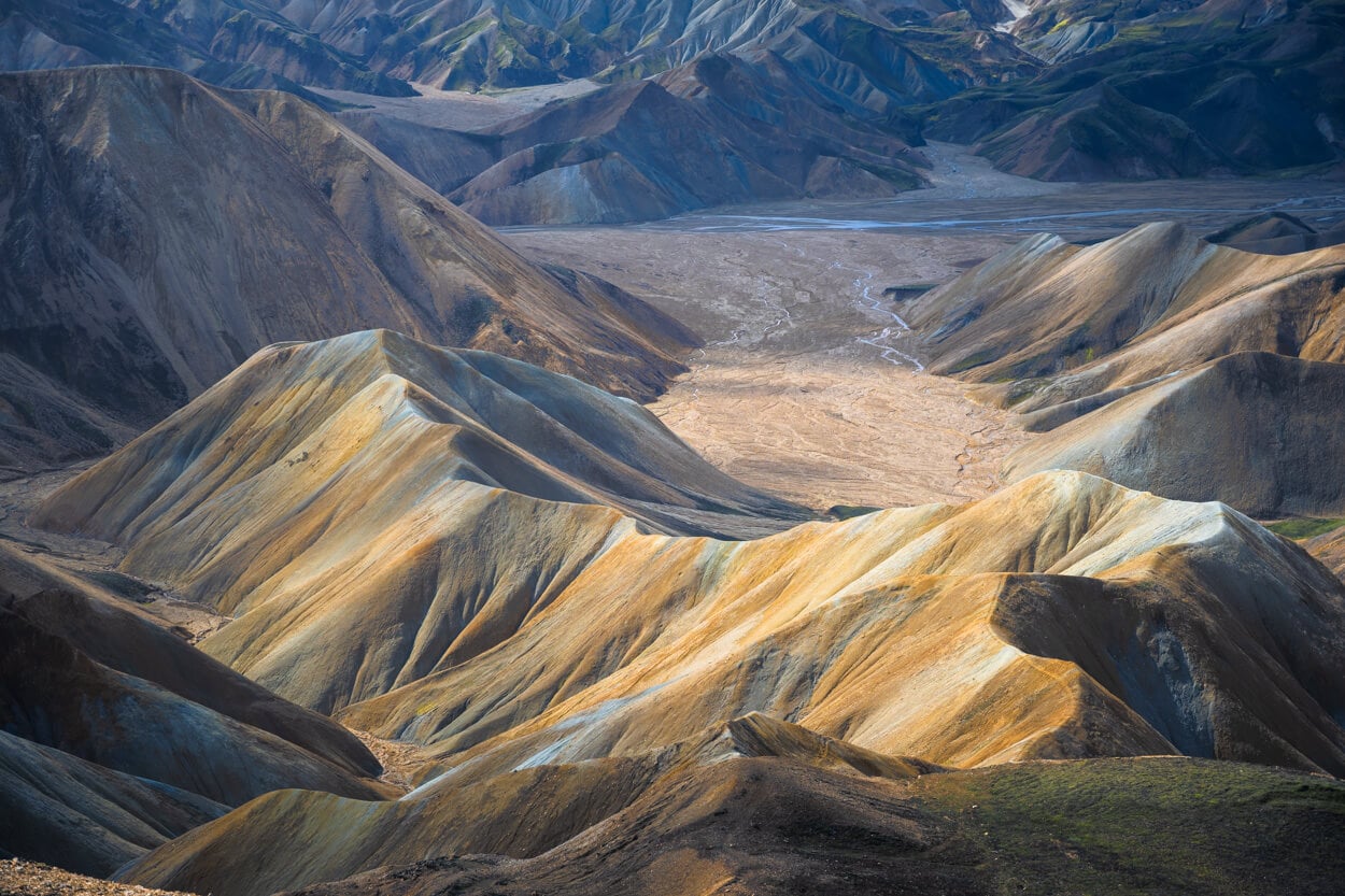
Uppgönguhryggur, Landmannalaugar.
Table of Contents
When to Visit the Highlands of Iceland & Planning Tips
The Highlands are generally accessible only from early summer to early autumn, but exactly when the mountain roads open varies from year to year. You can check the average opening dates for the mountain roads to get an idea of what to expect.
On paper, that leaves a short season. In practice, it can be even shorter: even when the Highlands are open, roads can suddenly become impassable, even in summer, because of heavy rain, swollen rivers, glacial floods, erosion, or whatever else nature decides to throw at you. And of course, you also need a good weather window.
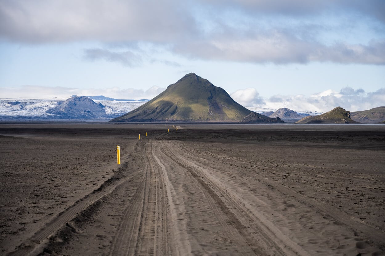
Road F-210, with Mælifell in the distance.
For this reason, my main tip is not to plan a fixed hiking itinerary, but to build a list of places you’d like to visit, ideally more than you’ll actually have time for. Then decide where to go on the spot, based on the forecast. It’s basically a “follow the weather” approach.
It’s also worth researching each F-road (the unpaved mountain roads that cross the Highlands) in detail: which river crossings it has, and how deep and difficult they are. Choose your rental car accordingly, and before booking, check whether the rental company restricts which F-roads you can drive on, since many do.
Lastly, be prepared for any kind of weather. In the Highlands, it can be freezing even in July or August. So pack accordingly.
Safety Tips and Best Practices for Iceland’s Highland
Before running out to the trails list, I thought I’d share a few safety tips for both driving and hiking. As visitors of the highlands, where there is little to no infrastructure, we are often on our own. As such, it’s best to be particularly on the alert and well prepared to visit these remote areas.
Renting the Right Vehicle
For the highlands, you will need to rent an AWD or 4×4 vehicle approved for that purpose. On top of that, make sure you’re allowed to drive your rental vehicle on the roads you want to take. Many rental companies put restrictions on which roads you can drive. For instance, F249 is prohibited, and F26 or F88/F910 are often prohibited or restricted to special vehicles.
Most rental cars do not provide any insurance coverage for water damage. Some do: Blue Car Rental, for instance, now offers additional coverage for water damage.
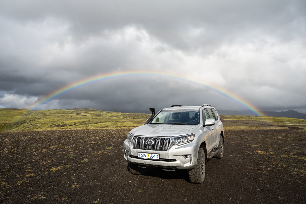
Driving deep into the highlands often requires capable vehicles, also for safety reasons.
Driving on F-Roads
- Road conditions: Always check road conditions on road.is and the weather forecast on vedur.is before driving into the highlands. Weather and road conditions can change quickly.
- No off-road driving: Drive only on marked F-roads or tracks. This includes not driving on the shoulder, turning around along a road, or parking on the side of the road.
- Fuel: Fill up the tank before driving into the highlands. There are no refueling options anywhere in the highlands.
- Tires and spare: F-roads are rough, so check the spare and the tire-change kit before you leave your rental location.
- Offline maps: While in most areas of the highlands mobile coverage is surprisingly good, have offline or paper maps.
Crossing Rivers
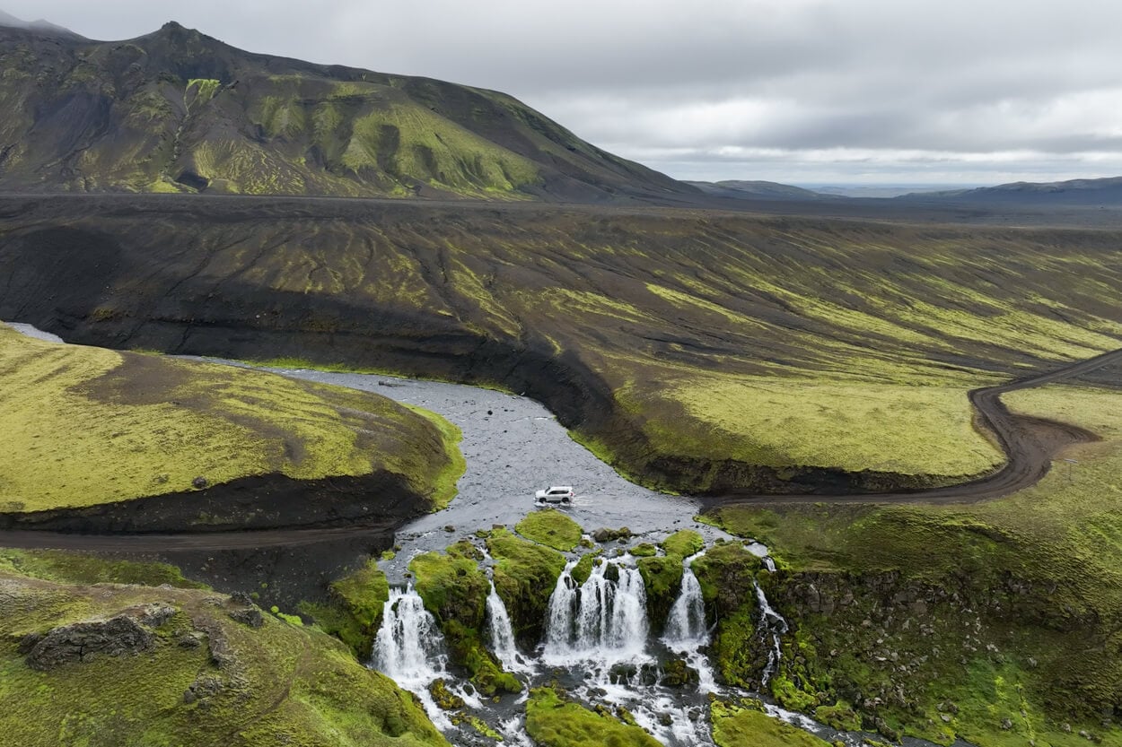
River crossings could be a full article in itself. If you have never crossed a river in a car and are planning to drive roads that have even shallow rivers, make sure to research the topic thoroughly. There are plenty of good resources to learn from online or on YouTube. However, here is a non-exhaustive list of tips:
- First and foremost, understand the wading depth of your car. If you flood the engine, you’ll end up having to pay for the car anew.
- Wait for someone to cross first and see how and where they cross.
- If in doubt, cross the river on foot first to understand the depth and the river bottom (e.g., sand, big rocks…).
- To cross, use low gear and rear diff lock if your car has them. Enter very slowly, then accelerate slightly to 5-6 km/h to form a bow wave in front of your hood. This lowers the water level around the hood, as water is pushed forward.
- Drive across the shallower parts of the river, and with the current, never against it.
- If another car is crossing in front of you, wait a few seconds after it completes the crossing. You do not want the recoil wave from the opposite riverbank to hit your car and flood the engine.
- Cross in the morning when possible. Glacier-fed rivers rise through the day as the ice melts.
And, of course, do not be afraid to turn around if needed. You do not want to ruin your vacation, and there’s plenty to explore in the highlands of Iceland even without crossing rivers.
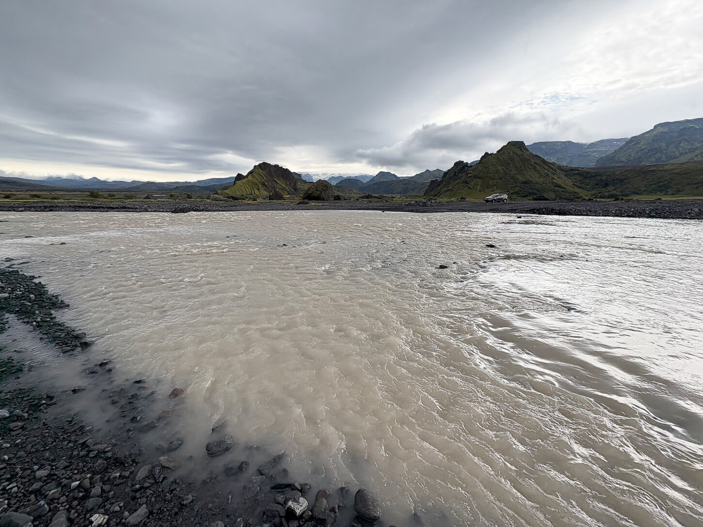
Steinholtsá River crossing in Þórsmörk, with a “no longer usable” car on the opposite side.
No 4×4? Consider the Highland Bus
If you are planning to visit only specific places, like Landmannalaugar or Þórsmörk, you can also consider getting a 2WD car and purchasing a Highland Bus ticket. I’ve done both several times.
Hiking Safety
With the highlands being far from civilization, it could take several hours to reach help, or for help to reach you, should anything go wrong.
- Have more water and food than you’ll need at all times.
- Stick to the marked and visible paths. A rope across a trail or a simple line of stones means the path is closed, and we, as visitors, are expected to respect that.
- Many areas have rangers and ranger huts, and it’s always worth stopping by for a chat to understand conditions and possible hazards before heading out.
- If you are solo, it is a good idea to leave your itinerary on Safetravel.is. Also, save 112 as the emergency number, and consider the 112 Iceland app.
- Carry an offline map or GPS, since fog can drop in quickly.

Protecting the Landscape
- Do not walk on moss. It’s fragile, and even a step on it will damage its roots. Moss is slow-growing and may take years to recover.
- Do not build any cairns or move stones to add them to existing cairns. Those stones might be trolls’ houses :)! Likewise, do not destroy existing cairns. Some are quite old, and some were built in the past to mark land ownership borders or long-distance tracks.
- Pack out everything, including toilet paper, and trash it once back to “civilization”.
How to use this guide
The guide includes a list of 21 of the best day hikes in the highlands of Iceland. In order to make it easy to build itineraries around those hikes, I have grouped them by Region. I will also specify which F-road they are on, so if you are planning to drive a specific F-road and want to add some hikes on the way, you can just search for the road number.
Each Hike section has a table with the essential information to understand the type of hike and how to get there. For the full details, you can view the dedicated post, which will also be linked in the quick overview table.
You can also download individual GPX files for free from the same table, via Komoot. I, of course, hike all these trails myself, so you get my own recorded GPX files.
Map of the Best Hikes in the Highlands of Iceland
Here is a map that offers an overview of what I think are the best and most scenic hikes in the Highlands of Iceland. Some are easy, some are very tough. However, there’s a bit of everything for every skill level. Right off the bat, I’ll tell you my top five picks from the extended list below. In no particular order:
- Blahnukur-Brennisteinsalda Loop (Landmannalaugar)
- Sveinstindur (Vatnajökull)
- Rauðibotn (Fjallabak)
- Hveradalir (Kerlingarfjoll)
- Grænihryggur (Landmannalaugar)
These are my five top picks, but I’d give an “honorable mention” to Valahnúkur in Þórsmörk. Now here’s the maps:
Þórsmörk Valley (F249)
You can reach Básar/Langidalur in a capable 4×4 up to the Krossá River, which I’d recommend never crossing in a rental. I never did, even with a modified Land Cruiser. Can park before Krossá and take the footbridge. However, that still requires crossing the Steinholtsá river, which can be challenging. For the best overall experience, it’s best to use one of the Highland Buses.
Valahnúkur
Valahnúkur is perhaps the most popular hike and viewpoint in Þórsmörk. For good reasons, the views from Valahnúkur’s summit beat anywhere in Þórsmörk, and the hike is quite easy. The summit offers 360 panoramic views of glaciers, rivers, and mountains like few other places.
Valahnúkur, Þórsmörk.
| Valahnúkur Hike Quick Overview |
| • Distance: 3.26 km / 2.02 mi (Out & Back) | Elevation: + 260 m / 853 ft | Time: 1.5 – 2 h | Difficulty: Easy |
| • Road: F-249, but don’t drive there; take a bus. |
| • Start & Parking: Húsadalur or Langidalur |
| • GPX File Download & Valahnúkur Hike Full Post |
On a clear day, even the view of the mountain in the highlands further north is breathtaking. You can easily hike up Valahnúkur from either Husadalur (Volcano Huts) or Langidalur. The distance is more or less the same from both. Don’t attempt to drive there. Most car rental companies forbid driving on Road F249 entirely, as there are a couple of deep and difficult river crossings.
Hvannargil Canyon Þórsmörk
If Valahnukur is the easiest and provides fantastic panoramic views, the Hike into the Hvannargil Canyon is perhaps one of the most difficult and sketchy day hikes in Þórsmörk. The trail initially follows the same trail as for the Fimmvörðuháls, but it then turns into the Hvannargil canyon.
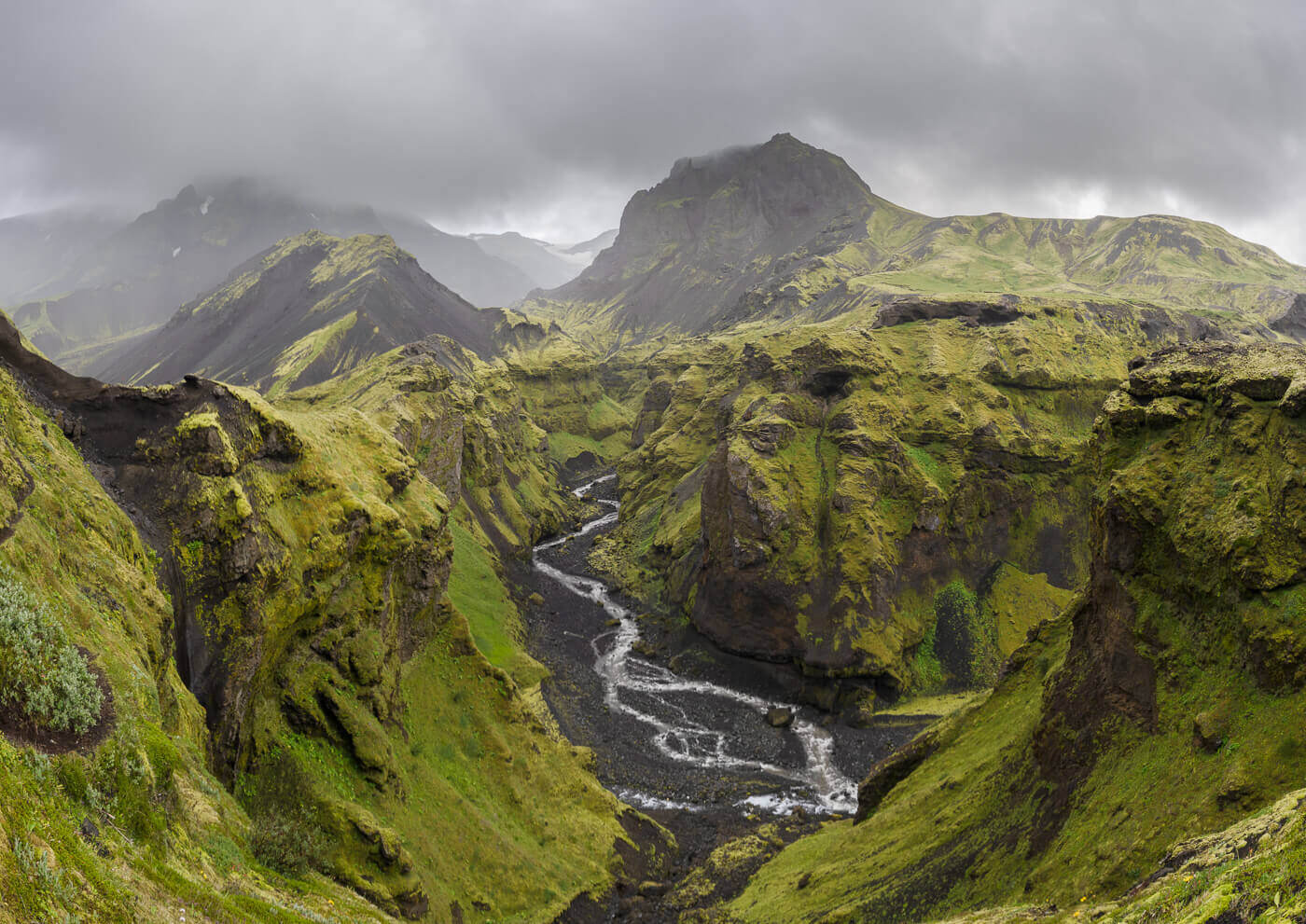
Hvannárgil Canyon.
| Hvannargil Canyon Hike Quick Overview |
| • Distance: 21.4 km / 13.29 mi (Out & Back) | Elevation: + 730 m / 2,395 ft | Time: 8-9 h | Difficulty: Hard/Exposed |
| • Road: F-249, but don’t drive there; take a bus. |
| • Start & Parking: Any of the Þórsmörk campsites, in my case, Húsadalur |
| • GPX File Download & Hvannargil Canyon Hike Full Post |
Here you have fantastic views of the pristine mountain in that Valley. However, the terrain here is rather soft and steep, so it’s slow going. Hiking poles are recommended. As you continue further down into the valley, you’ll reach the Hvannargil canyon. Here, the trails become as narrow as your two feet, and in places, it is completely exposed to the canyon below, leaving no room for mistakes.
Stigafoss Waterfall Hike
Stigafoss is a bit of a hidden gem along road F-249 to Þórsmörk. While you do not have to drive all the way to Þórsmörk, there are still a few rivers to cross to get to the trailhead. The hike itself is quite short
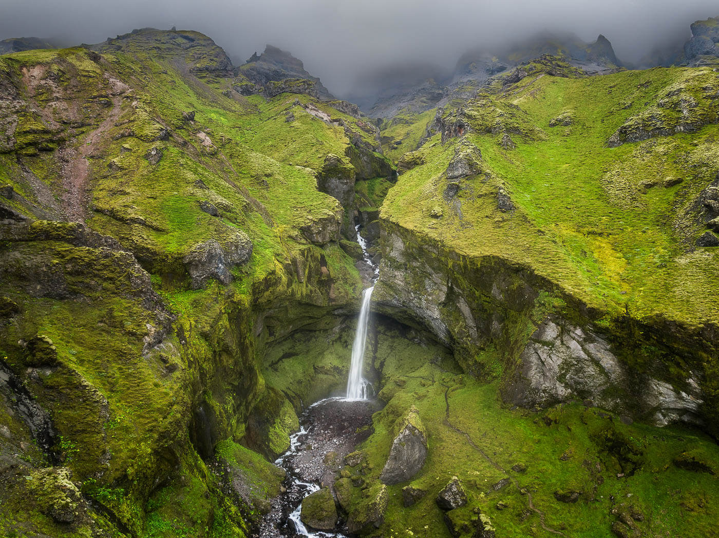
Stigafoss Waterfall (Drone Photo).
| Stigafoss Waterfall Hike Quick Overview |
| • Distance: 1.75 km / 1.08 mi (Out & Back) | Elevation: 278 m / 912 ft | Time: 30-45 minutes | Difficulty: Easy |
| • Road: F249, with river crossings |
| • Start & Parking: F249 side track |
| • GPX File Download & Stigafoss Waterfall Hike Full Post |
Landmannalaugar, Northern Fjallabak & Þjórsárdalur (208, F208 North, F224, F225)
F208 North has no river crossings up to the parking lot just before the Landmannalaugar campsite. Manageable in a standard small/medium 4×4. Remember, you need to book your parking spot in advance for Landmannalaugar.
Bláhnúkur-Brennisteinsalda Loop
If you only had one day in Landmannalaugar and wanted to experience some of the best panoramic views, the Bláhnúkur-Brennisteinsalda Loop is your best choice. You don’t have to do either one of the two. While doing both does add some elevation gain, it does not add that much distance, and you get the views from both summits at once.

View over the colorful Rhyolite Mountains of Landmannalaugar from Bláhnúkur
| Bláhnúkur-Brennisteinsalda Loop Hike Quick Overview |
| • Distance: 9.21 km / 5.72 mi (Out & Back) | Elevation: +450 m / 1,476 ft | Time: 3-4 h | Difficulty: Moderate |
| • Road: 208 North, F224. One river crossing, but you can park before, too. |
| • Start & Parking: Landmannalaugar Campsite |
| • GPX File Download & Bláhnúkur and Brennisteinsalda full posts |
If you want to do only one of the two, however, I’d recommend Bláhnúkur. Better panoramic views, in my opinion. Hiking poles are highly recommended as some sections can be quite to very slippery, depending on conditions. However, if you are looking for a more challenging, scenic hike in Landmannalaugar, here’s the Grænihryggur next.
Grænihryggur / Green Ridge Hike
The “green ridge” is one of the most unique rock formations in Landmannalaugar. This says a lot considering how the area is known for its beautiful and colorful Rhyolite mountains. There are two main trails, only one is marked, and the other one is even more challenging, as it requires river crossings and hiking up steep ravines filled with scree.

The Grænihryggur, or Green Ridge, in Landmannalaugar.
| Grænihryggur / Green Ridge Hike Quick Overview |
| • Distance: 16.8 km / 10.43 mi (Out & Back) | Elevation: +820 m / 2,960 ft | Time: 5.5 – 6.5 h | Difficulty: Hard |
| • Road: F208 North, no river crossings. |
| • Start & Parking: Grænihryggur Trailhead on Road f208 |
| • GPX File Download & Grænihryggur Hike Full Post |
For this reason, I’ll recommend the main trail. It’s fully marked, not freezing river crossings on foot, and a little shorter. Of course, with spectacular landscapes. The trailhead can easily be accessed from Road F208, past the Landmannalaugar campsite, when arriving from Road 208 North. No river crossings are involved, and reaching the trailhead can be done in any car approved for F-Roads.
Skalli & Uppgönguhryggur
Another trail in Landmannalaugar. A less travelled one, but no less spectacular, especially when including the detour to Uppgönguhryggur, which I highly recommend. It is also the highest mountain in Landmannalaugar, at 1,027 m (3,280 ft). Do note that the GPX below already includes the out-and-back detour to Uppgönguhryggur.
| Skalli Hike Quick Overview |
| • Distance: 22.2 km / 13.79 mi (Out & Back) | Elevation: +1,090 m / 3,576 ft | Time: 7-8 h | Difficulty: Hard |
| •Road: 208 North, F224. One river crossing, but you can park before, too. |
| •Start & Parking: Landmannalaugar Campsite |
| • GPX File Download & Skalli Hike Full Post |
It’s a far less traveled trail that brings you to some of the most colorful landscapes in Landmannalaugar. And panoramic views of some of the most remote areas too.
Dynkur
One of the most epic waterfalls in Iceland, and one of the most difficult to get to. While the hike in itself isn’t difficult at all, getting there is. It’s a long drive on a very rough dirt track that’s not even an F-road. A high clearance vehicle is required.
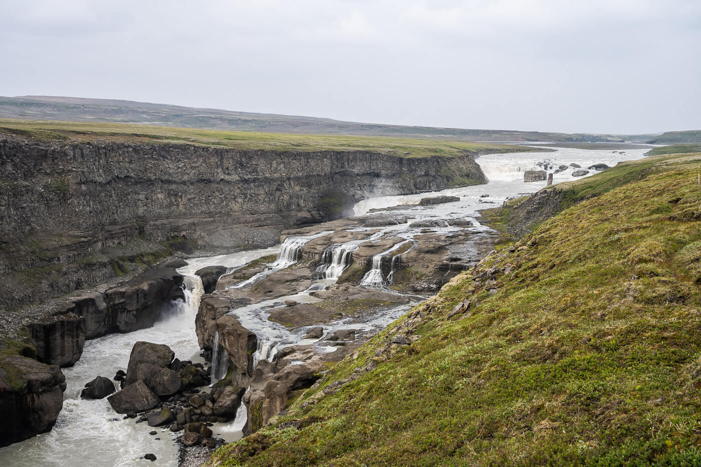
Dynkur.
| Dynkur Waterfall Hike Quick Overview |
| • Distance: 3.62 km / 2.24 mi (Out & Back) | Elevation: + 90 m / 295 ft | Time: 1-1.5 h | Difficulty: Easy |
| • Road: Unmarked track, no river crossings. High clearance required. |
| • Start & Parking: Dynkur Trailhead |
| • GPX File Download & Dynkur Waterfall Hike Full Post |
Not only the waterfall but the whole landscape is of epic proportions. Especially the deep canyon Dynkur falls in is quite a sight in itself. Plus it is a very remote location, where you are unlikely to meet anyone else. After all, it’s a hard-to-get-to place.
Rauðfoss and Rauðauga Hike
There are two major points of interest on this hike. First Rauðfoss, or the “red” waterfall, because of its “rusty red” color. What gives the waterfall its color is the iron-rich water that comes from its source, a few kilometers upstream. It’s also about 60 meters tall, so definitely an impressive sight.

Rauðfoss and its typical “rusty red” color.
| Rauðfoss and Rauðauga Hike Quick Overview |
| • Distance: 9.95 km / 6.18 mi (Out & Back) | Elevation: + 490 m / 1,607 ft | Time: 4-5 h | Difficulty: Moderate |
| • Road: F225, no river crossings from the Road 26 Junction |
| • Start & Parking: Rauðfoss Parking/Trailhead |
| • GPX File Download & Rauðfoss and Rauðauga Full Post |
Second, Rauðauga; it’s the above-mentioned source. It’s a spring that comes out straight from the earth, forming a colorful pool and giving birth to a river that is also rusty red. Quite a sight as the trail follows the river upstream all the way to the spring.
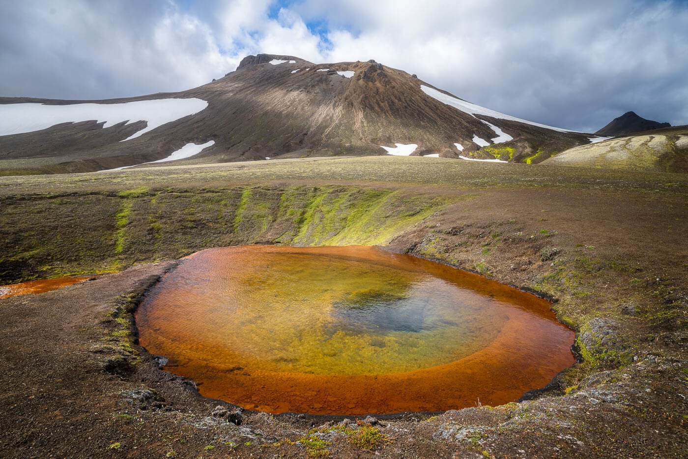
Rauðauga, the source of Rauðfoss.
Sigöldugljúfur
Also known as the “Valley of Tears,” Sigöldugljúfur is a popular stop on the way to Landmannalaugar. Also, one that can be reached with regular 2WD cars, although it’s a rough drive. The hike to the main viewpoint is short and easy. The trail is fully marked, and the visit usually takes a little over an hour.
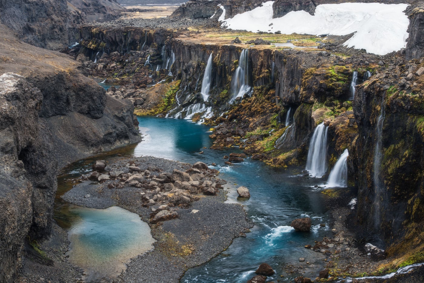
Sigöldugljúfur
| Sigöldugljúfur Hike Quick Overview |
| • Distance: 1.94 km / 1.20 mi (Out & Back) | Elevation: + 20 m / 65 ft | Time: 30-45 minutes | Difficulty: Easy |
| • Road: 208 North |
| • Start & Parking: Sigöldugljúfur Parking |
| • GPX File Download & Sigöldugljúfur Canyon Full Post |
Second, Rauðauga; it’s the above-mentioned source. It’s a spring that comes out straight from the earth, forming a colorful pool and giving birth to a river that is also rusty red. Quite a sight as the trail follows the river upstream all the way to the spring.
Southern Fjallabak & Eldgjá (F208 South / F235 / F210 / F261)
Medium to rugged 4×4 terrain. Involves multiple unbridged glacial/mountain rivers (especially F208 South, F210, and Bláfjallakvísl on F261). Requires a higher-clearance 4×4 and river-crossing experience.
Ófærufoss
Ófærufoss is a waterfall located in the Eldgjá fissure, and it’s possible to visit it with a short hike from the Eldgjá visitors center. Actually, you can easily combine it with a visit to the next hike on this list, too, Sveinstindur. It’s a two-step waterfall, and walking through the Eldgjá fissure to reach the waterfall is an experience in itself.

| Ófærufoss hike Quick Overview |
| • Distance: 4.46 km / 2.77 mi (Out & Back) | Elevation: +80 m / 262 ft | Time: 1.5-2 h | Difficulty: Easy |
| • Road: F208 South, River Crossings |
| • Start & Parking: Eldgjá Visitors Center |
| • GPX File Download & Ófærufoss Hike Full Post |
If you want to visit Ófærufoss but do not want to risk the river crossing in a rental car, you can park the car by the Ranger’s cabin and continue on foot. It will be 3.5 km longer, in total.
Sveinstidur
It’s hard to explain the pull Sveinstindur has on me. You’d have to experience it for yourself. On a clear day, the views from the top are unmatched. Views as far as the eyes can see, and no traces of humans apart from a couple of huts and tracks. Otherwise, it’s mountains, lakes, rivers, glaciers, and the classic moss green/lava black landscape of Iceland all the way to the horizon.
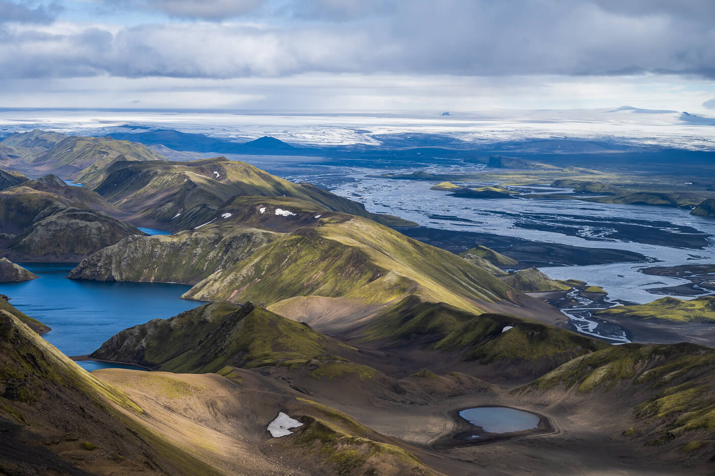
View from the top of Sveinstindur toward the Vatnajökull ice cap.
| Sveinstidur Hike Quick Overview |
| • Distance: 4.39 km / 2.72 mi (Out & Back) | Elevation: + 530 m / 1,738 ft | Time: 2.5 – 3 h | Difficulty: Moderate |
| • Road: F208 South, F235, river crossings |
| • Start & Parking: Sveinstindur Trailhead Parking |
| • GPX File Download & Sveinstindur Hike Full Post |
And, although it’s not a particularly challenging hike, getting to Sveinstindur is a trip in itself. Getting to the trailhead requires driving the entirety of road F235, a road with several river crossings. Best accessed from F208 south. Usually, the first river crossing on F208 from the south is the deepest too, so if you can safely pass that, you should be able to get to the trailhead too.
Rauðibotn
Rauðibotn is another extinct volcanic crater that formed during the Eldgja eruption. It’s also a very colorful location, and you can hike almost entirely around the crater, from where you can enjoy the view of the beautiful landscape of the southern highlands. You can even see Mælifell from the trail.
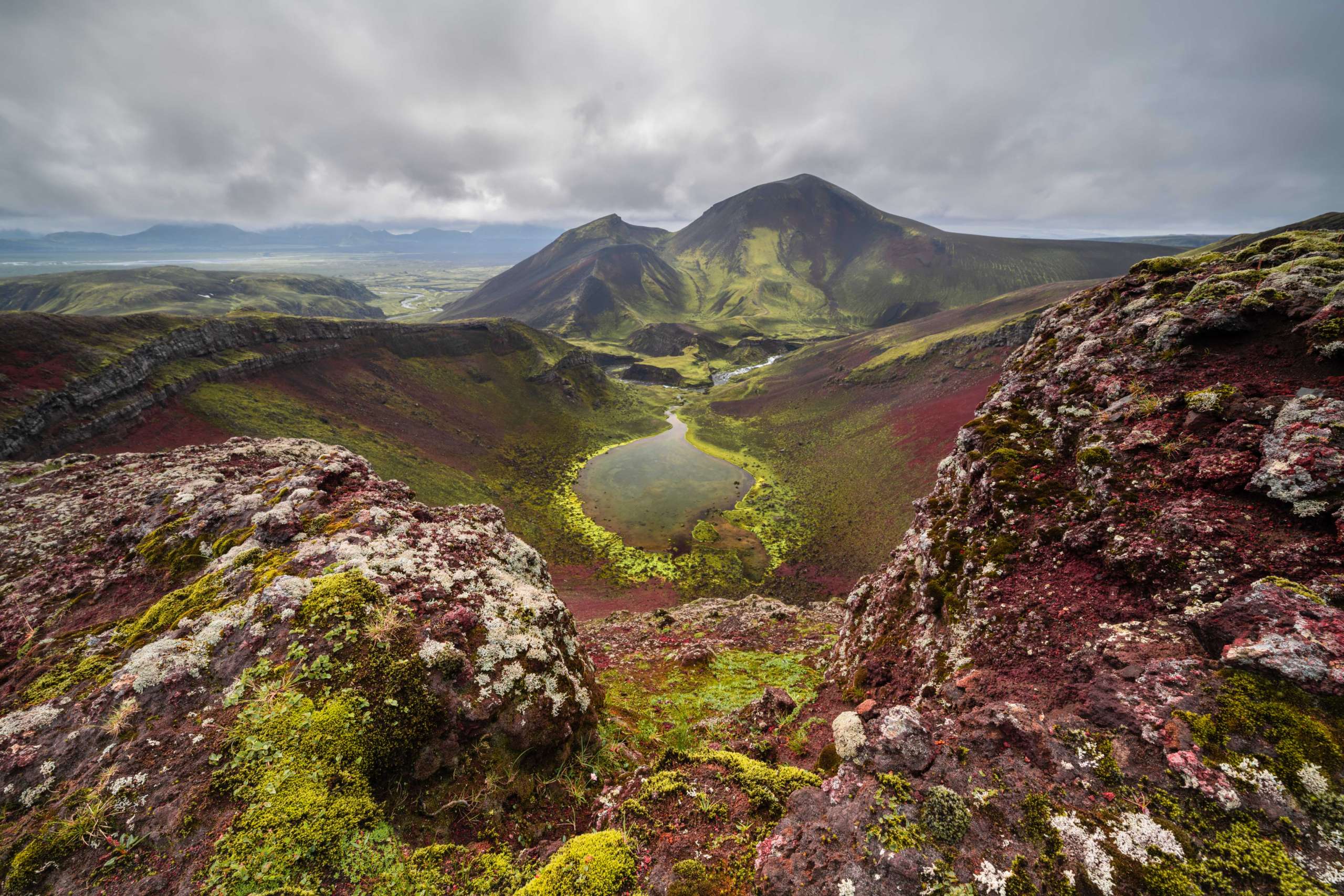
Rauðibotn.
| Rauðibotn Hike Quick Overview |
| • Distance: 7.31 km / 4.54 mi (Out & Back) | Elevation: +230 m / 754 ft | Time: 3-3.5 h | Difficulty: Moderate |
| • Road: F208 South / F210. Avoid F233 if coming from F208 north. |
| • Start & Parking: Before the Hólmsá River crossing, or Rauðibotn trailhead. |
| • GPX File Download & Rauðibotn Hike Full Post |
It’s quite a long drive to get there, which involves 2-3 river crossings. Usually doable in any car approved for the F-Roads, but check conditions before driving off.
Mælifell Volcano Hike
Probably the most photographed and recognizable stand-alone mountains in Iceland. Getting there is quite difficult and requires the weather conditions and water level to be just right. Accessible from Road F210, the best way to get there is via Road F232 instead, as Road F210 has much deeper and more difficult rivers to cross.
Mælifell
| Mælifell Hike Quick Overview |
| • Distance: 1.42 km / 0.88 mi (Out & Back) | Elevation: + 270 m / 885 ft | Time: 1 h | Difficulty: Moderate, but exposed in sections |
| • Road: Easiest (but still challenging) F232 and F210. |
| • Start & Parking: Small pull-out area on the side of the road |
| • GPX File Download & Mælifell Hike Full Post |
The hike to the top of Mælifell is unmarked; it’s not particularly difficult, but it is steep, and it does have some exposed sections. Probably not suitable if you suffer from vertigo or have agoraphobia, though. Other than that, it’s a fun hike, and the views of the surrounding landscape are fantastic. Glaciers, Mountains, rivers, and black sand outwash plains.
Markarfljótsgljúfur West Canyon Hike
Of all the canyons in Iceland, Markarfljótsgljúfu is perhaps the most impressive in terms of size and depth. And some absolutely stunning landscapes. There technically are two trails, one on the east side and one on the west side. While both require a car suitable for F-roads, the west side can be accessed by almost any 4WD car, while the east side is more commonly visited as a detour of the Laugavegur Trek. You can get there by car too, but you’d need a bigger 4X4 car, like a Land Cruiser.

Markarfljótsgljúfur West Side Viewpoint
| Markarfljótsgljúfur Canyon Hike Quick Overview |
| • Distance: 2.97 km / 1.84 mi (Out & Back) | Elevation: +190 m / 295 ft | Time: 1-1.5 h | Difficulty: Easy |
| • Road: F261, no river crossings |
| • Start & Parking: Dead-End side track of F261 (high clearance required) or Markarfljótsgljúfur Parking area |
| • GPX File Download & Markarfljotgljufur Canyon Hike Full Post |
If you have a suitable vehicle to attempt the hike on the east side, too, here’s the GPX file too. It’s a little longer at 4.5 km in total. I did both on the same day. It’s doable as an all-day effort. But again, you’d need a proper 4X4 to reach Emstrur-Botnar, where the East Side trailhead is.
Kjölur Route (Route 35 / F347)
Route 35 is an unpaved washboard gravel road that crosses Iceland from North to South. Worth the drive in itself, however, accessing the main hikes in this area, however, does require a 4X4.
Hveradalir Hike in Kerlingarfjoll
The Hveradalir trail is perhaps the one with the most colorful landscape outside of Landmannalaugar. It is also a rather otherworldly place, where the Earth feels alive, with several steaming mud pots and fumaroles.

| Hveradalir Hike in Kerlingarfjoll Quick Overview |
| • Distance: 7.24 km / 4.49 mi (Loop) | Elevation: +560 m / 1,837 ft | Time: 3 – 3.5 h | Difficulty: Moderate |
| • Road: 35 and F347, no river crossings |
| • Start & Parking: Kerlingarfjoll trailhead on road F347 |
| • GPX File Download & Hveradalir Hike full Post |
The hike isn’t that difficult, but it tends to be rather muddy. And the area is often covered in clouds even when the weather is nice in nearby areas. So best to bring hiking poles and attempt it in the best possible weather.
Nýifoss Waterfall Hike
One of the “newest” waterfalls in Iceland. It was formed in 1939 after a catastrophic event. It’s a rather unique waterfall in the sense that you have the impression as if it’s emptying the vast glacial lake behind, Hagavatn.
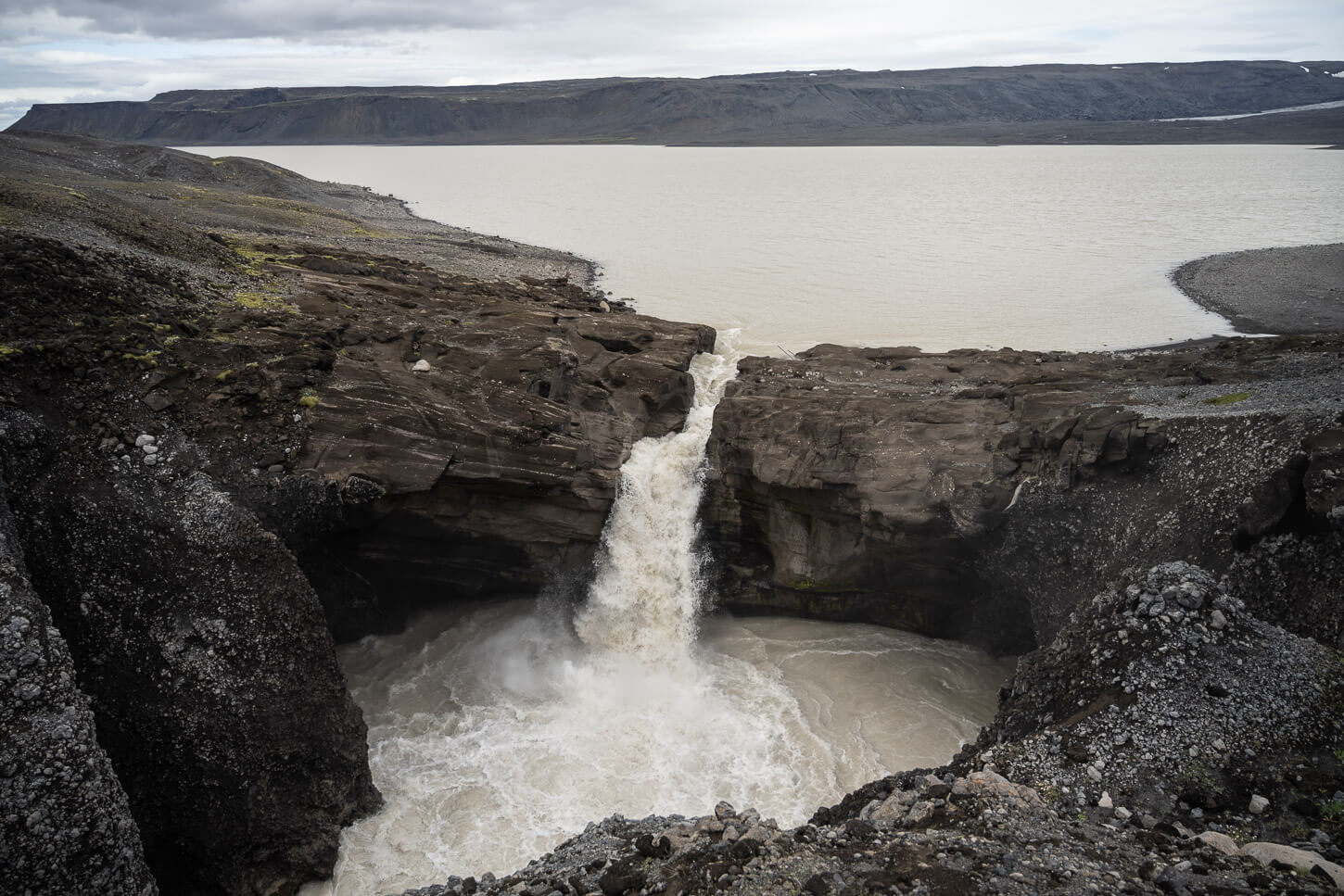
| Nýifoss Waterfall Hike Quick Overview |
| • Distance: 2 km / 1.2 mi (Out & Back) | Elevation: 90 m / 295 ft | Time: 1 h | Difficulty: Easy |
| • Road: 35 and F335, river crossings, high clearance required. |
| •Start & Parking: Road F335 pull-out area. |
| • GPX File Download & Nýifoss Waterfall Hike Full Post |
It’s an easy, short hike, but getting there does require a proper 4X4 vehicle, and there are river crossings.
Northern & Eastern Interior (F88 / F905 / F910 & Route 910)
Remote interior vs. easy east access. Askja via F88 has the deep Lindaá crossing (F905/F910 is an easier alternative with shallower water), while Laugarfell sits on the eastern edge without demanding F-road crossings.
Waterfall Circle Hike Laugarfell
Of all the hikes in the Highlands, this one is perhaps the most accessible, as you can do it in any regular 2WD car. Also, one of the very best waterfalls hikes in Iceland. Five waterfall worth viewing in themselves, and a trail through a pristine landscape.

| Waterfall Circle Hike Laugarfell Hike Quick Overview |
| • Distance: 8.30 km / 5.15 mi (Loop) | Elevation: +260 m / 853 ft | Time: 2 – 2.5 h | Difficulty: Moderate |
| • Road: 910, no river crossings. |
| • Start & Parking: Laugarfell Hut |
| • GPX File Download & Waterfall Circle Hike Full Post |
The whole area is quite pristine, and you can also see a rather deep canyon. It is also usually accessible earlier compared to other locations in the highlands. I did this hike as early as late May.
Hafrahvammagljúfur Canyon Hike
A remote, spectacular 200 m deep canyon located farther inland compared to Laugarfell. The Kárahnjúkar power plant upstream limits the water flow in the canyon, but at the same time reveals its real depth, which is impressive.
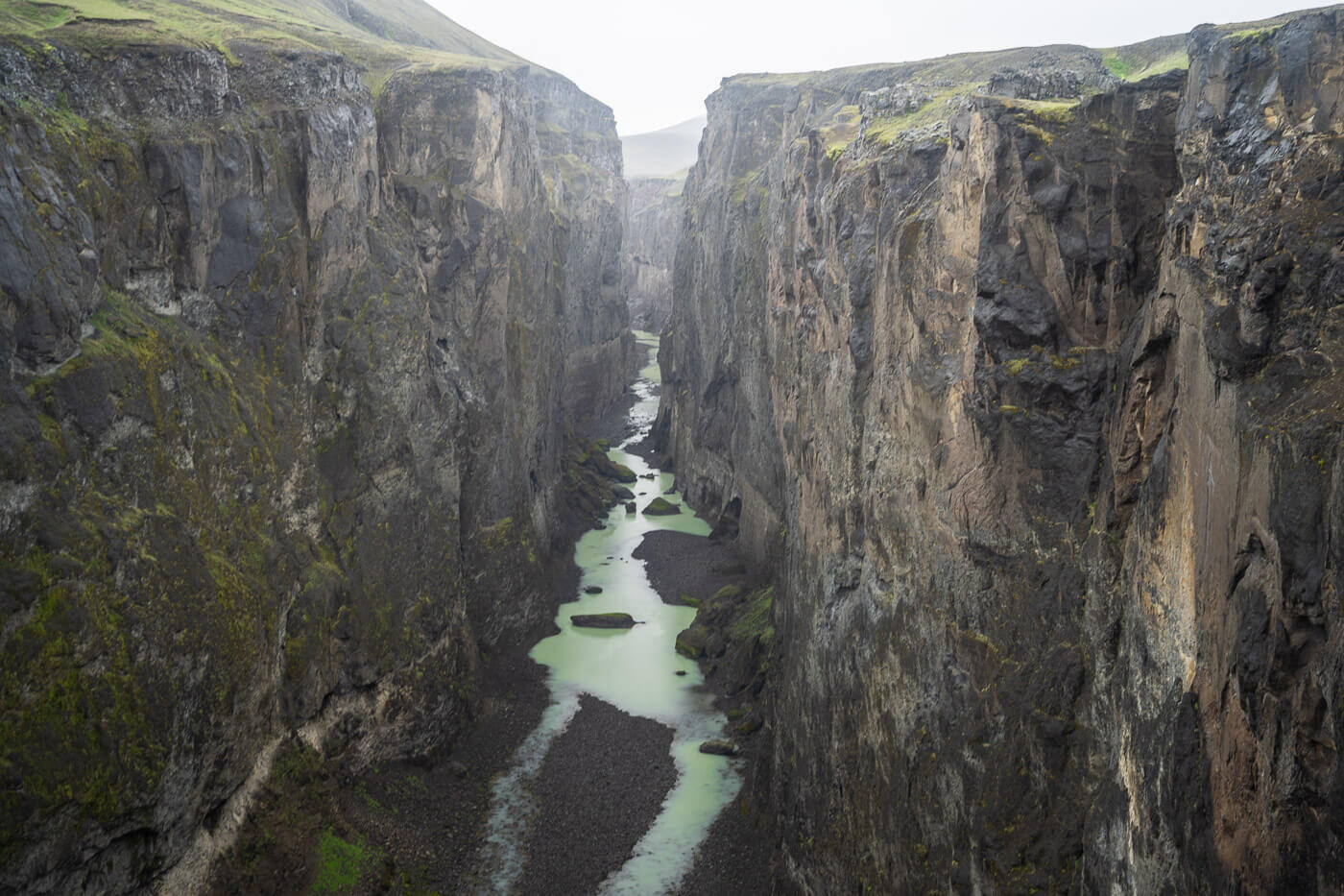
| Hafrahvammagljúfur Canyon Hike Quick Overview |
| • Distance: 2.73 km / 1.69 mi (Out & Back) | Elevation: 160 m / 524 ft | Time: 1 h | Difficulty: Easy |
| • Road: 910 and F910, no river crossings, but changing without high clearance. |
| • Start & Parking: Hafrahvammagljúfur Canyon Parking |
| • GPX File Download & Hafrahvammagljúfur Canyon Hike Full Post |
It’s another easy hike too, and it’s paved until the Kárahnjúkar dam. From there it’s a regular F Road, but the last bit down to the parking are is steep with big, loose rocks. Drive carfully.
Viti Crater Hike
The hike to Viti is a rather short and very easy one. It is mostly a walk on a flat trail through a volcanic wasteland, but the whole landscape is rather unique. Viti is a small crater with a geothermal lake, part of the much bigger Askjuvatn crater, which is also part of the much, much bigger Askja caldera.

| Viti Crater Hike Quick Overview |
| • Distance: 6.35 km / 3.94 mi (Out & Back) | Elevation: + 150 m / 492 ft | Time: 1.5-2 h | Difficulty: Easy |
| • Road: Easiest route F88/F910/F894, River Crossings |
| • Start & Parking: Viti Crater Trailhead |
| • GPX File Download & Viti Crater Hike Full Post |
It’s a rather unique, volcanic, desolate, but colorful landscape. Apart from the Viti Crater, you have a few viewpoints of the Askja Lake. Getting there requires a long drive on rough roads, which also involves river crossings.
Aldeyjarfoss Waterfall Hike
A very short hike, but very well worth the long drive to get to the trailhead. Located in a volcanic landscape made of basaltic rocks, Aldeyjarfoss is 20 m (66 ft) in height, and its waters powerfully cascade into a pool of water surrounded by basalt columns.

Aldeyjarfoss.
| Aldeyjarfoss Waterfall Hike Quick Overview |
| • Distance: 0.7 km / 0.5 mi (Out & Back) | Elevation: + 40 m / 131 ft | Time: 0.5 h | Difficulty: Easy |
| • Road: F26 North, No river crossings. |
| • Start & Parking: Aldeyjarfoss Parking Area/Trailhead |
| • GPX File Download & Aldeyjarfoss Waterfall Hike Full Post |
It’s quite a long drive from the ring road, but well worth it. Definitely one of the most beautiful waterfalls in the North of Iceland.
Laki Craters (F206 / F207)
Rough loop with medium to challenging river crossing. F206 includes the unbridged Geirlandsá river crossing and rocky sections; it requires a proper medium-to-large 4×4.
Laki and Lakagigar
Mount Laki is an 818 m (2,684 ft) high mountain, part of the volcanic fissure that formed during one of the most devastating eruptions in Iceland in recent centuries. The eruption occurred in 1783-84, and what’s left now are vast fields of moss-covered solidified lava. Mount Laki offers the best Panoramic views of the area, and beyond.
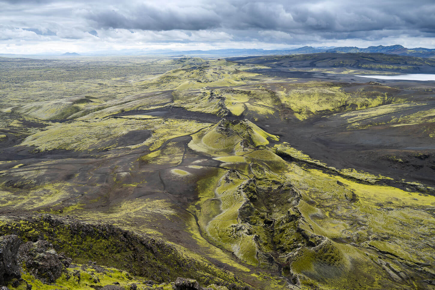
Laki Craters.
| Laki and Lakagigar Hike Quick Overview |
| • Distance: 4.5 km / 2.8 mi (Loop) | Elevation: +300 m / 984 ft | Time: 1.5-2 h | Difficulty: Easy |
| • Road: F206, several river crossings, two of which are challenging. |
| • Start & Parking: Laki Visitors Center |
| • GPX File Download & Laki and Lakagigar Hike Full Post |
It’s a long drive to get there, which involves two medium/big river crossings, depending on water levels. Also, make sure to stop at Fragrifoss along the way. It’s also worth doing another short hike nearby, Tjarnagigur (details in the full post).
Additional Resources
- To pair the highlands with some hikes on the Ring Road, check out my guide to the Best Ring Road Hikes and Photo spots.
- If you are into Waterfalls, you can discover more beautiful and unique Waterfalls in my eBook guide, “Iceland – The Best Waterfall Hikes and Walks“.
- Or, discover more Hikes in Iceland here.





Leave A Comment